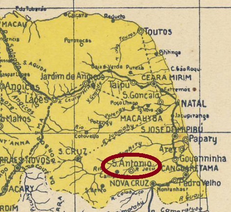
Santo Antonio was from June 1886 on a district of the municipality of Goianinha, situated round 80 km southwest of the provincial capital Natal. In July 1890 it ascended to a villa and received an own municipality in January 1892.
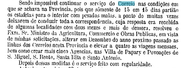
According to the Imperial Mail Register (Tabella das Agencias do Correio do Imperio) of 1885, a local post office was created as early as 1836. This is probably a misprint, given that neither postal records nor cancels exist from a time up to fifty years before the village became a district. Instead, in May 1875 the creation of a postal agency in Santo Antonio in December 1874 was reported by the province president:

No postmark from the Empire could be safely identified until now.
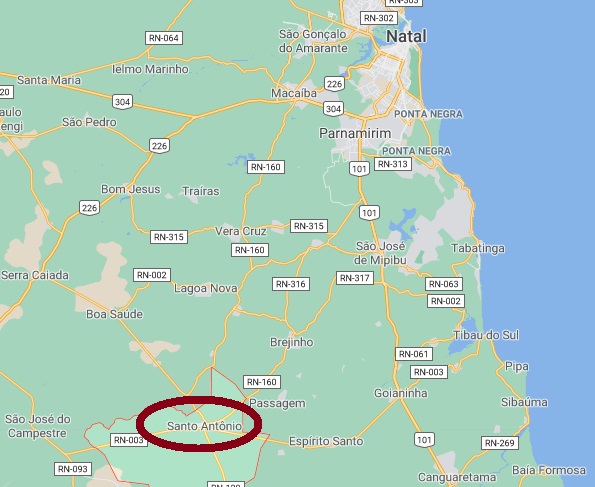
Santo Antonio war ab Juni 1886 ein Distrikt im Municipio von Goianinha und lag rund 80 km südwestlich der Provinzhauptstadt Natal entfernt. Im Juli 1890 stieg er zur Villa auf, im Januar 1892, zum eigenen Município.
Laut Verzeichnis der kaiserlichen Postämter (Tabella das Agencias do Correio do Imperio) von 1885 gab es dort bereits ab 1836 ein Postamt. Das dürfte ein Druckfehler sein (oder die Postagentur war von kurzer Dauer), da es keine weiteren Spuren von Postbetrieb dort aus der Zeit gab, 50 Jahre bevor Santo Antonio zum Distrikt erklärt wurde. Stattdessen meldete der Provinzpräsident in seinem Bericht vom Mai 1875 die Gründung eines Postamts in Santo Antonio im Dezember 1874:
Keine Poststempel der Kaiserzeit konnten bisher mit Sicherheit ermittelt werden.
