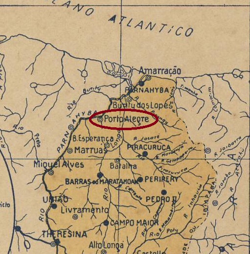
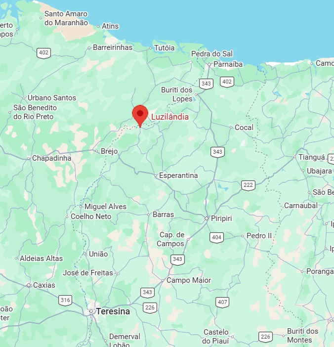
Other names: Fazenda do Estreito, Port’alegre/Porto Alegre, Joaquim Távora, Luzilândia (1943)
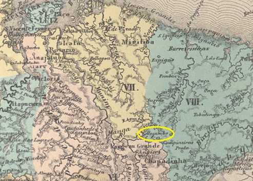
Around 1870, the Fazenda do Estreito was established on the south bank of a narrow stretch of the Parnaíba River, 240 kilometres north of the provincial capital, Teresina. The settlement grew and, in March 1890, became the Vila de Nossa Senhora da Conceição de Port’alegre (sometimes spelled Porto Alegre). The name of the town subsequently changed three times: in April 1931 to Joaquim Távora, in October 1935 to Porto Alegre, and finally, in December 1943, to Município de Luzilândia.
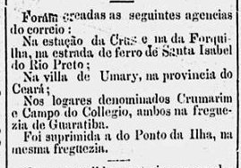
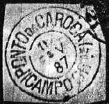
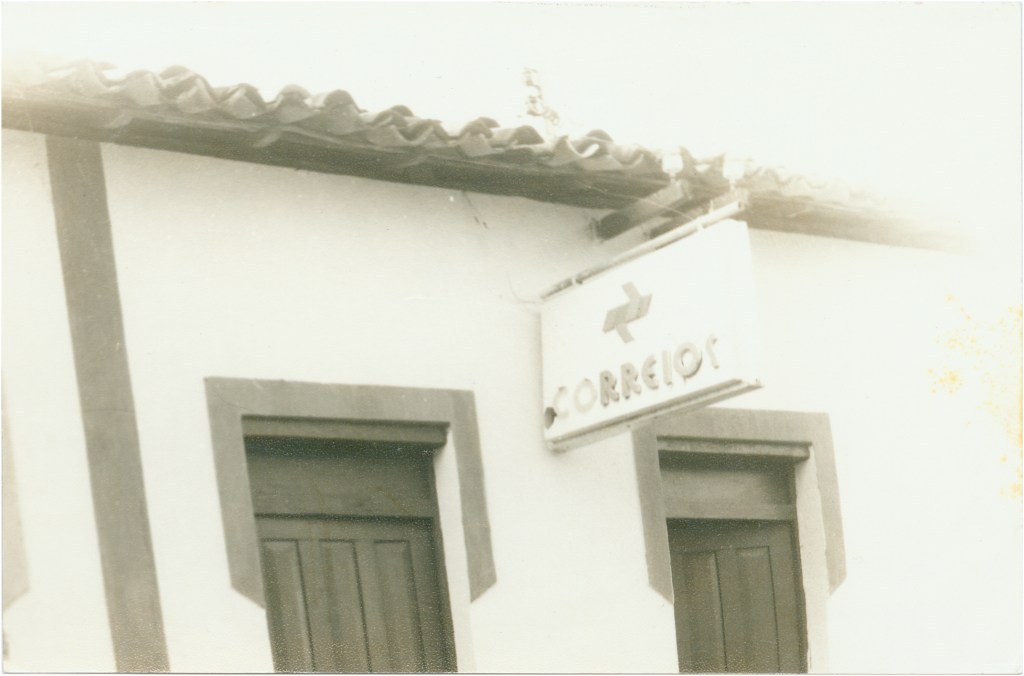
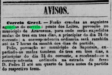
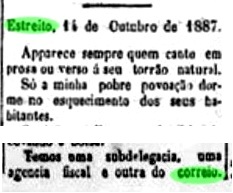
As Estreito is not listed in the directory of imperial post offices (Tabella das Agências do Correio do Império, Rio de Janeiro, 1885), we know from a note in the regional press that a postal agency was established there shortly afterwards:

To date, no imperial postmark from Estreito has been found. From 1890 onwards, the place name Port’alegre (or Porto Alegre) came into use.
Outros nomes: Fazenda do Estreito, Port’alegre/Porto Alegre, Joaquim Távora, Luzilândia (1943)
Por volta de 1870, surgiu a Fazenda do Estreito na margem sul de um trecho estreito do rio Parnaíba, 240 quilômetros ao norte de Teresina, capital da província. O povoado cresceu e, em março de 1890, tornou-se a Vila de Nossa Senhora da Conceição de Port’alegre. Posteriormente, o nome do local mudou três vezes: em abril de 1931 para Joaquim Távora, em outubro de 1935 para Porto Alegre e, finalmente, em dezembro de 1943 para Município de Luzilândia.
Como Estreito não consta da Tabela das Agências do Correio do Império (Rio de Janeiro, 1885), sabemos, por meio de uma nota na imprensa regional, que logo em seguida criou-se ali uma agência dos Correios:

Até o momento, não foi encontrado nenhum carimbo postal imperial de Estreito. A partir de 1890, passou a ser utilizado o nome de Port’alegre (também escrito Porto Alegre).
Andere Namen: Fazenda do Estreito, Port’alegre/Porto Alegre, Joaquim Távora, Luzilândia (1943)
Um 1870 entstand am Südufer einer engen Stelle des Parnaíba-Flusses, 240 Kilometer nördlich der Provinzhauptstadt Teresina, die Fazenda do Estreito. Die Siedlung wuchs und wurde im März 1890 zur Vila de Nossa Senhora da Conceição de Port’alegre. Danach änderte sich der Ortsname dreimal: im April 1931 zu Joaquim Távora, im Oktober 1935 zu Porto Alegre und schließlich im Dezember 1943 zu Município de Luzilândia.
Da Estreito nicht im Verzeichnis der kaiserlichen Postämter (Tabella das Agencias do Correio do Imperio, Rio de Janeiro, 1885) aufgeführt ist, wissen wir durch eine Notiz in der regionalen Presse, dass es dort kurz darauf eine Postagentur gab:
Bisher wurde kein kaiserlicher Poststempel aus Estreito gefunden. Ab dem Jahr 1890 galt dann der Ortsname Port’alegre (auch Porto Alegre geschrieben).