Print edition update of November 12, 2020
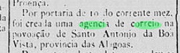
According to the Imperial Mail Register ( / Verzeichnis der kaiserlichen Postämter /Tabella das Agencias do Correio do Imperio, Rio de Janeiro, ) of 1885, the local post office was created in July 1884, which can be confirmed by the Rio press:
However, Aldo Cardoso (Contribuição para a História dos Correios de Alagoas, Maceió, 1969) states this agency was closed as soon as 1894. No cancel of the Empire has been found until now.
Buchtext-Aktualisierung von 12. November 2020
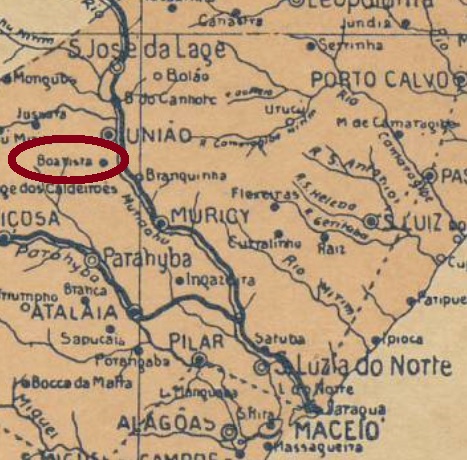
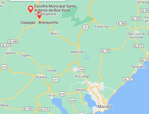
Santo Antonio da Boa Vista war ab März 1872 ein Distrikt im Município von Muricy, der an Ostufer des Flusses Mundaú, rund 90 km nordwestlich der Provinzhauptstadt Maceió entfernt lag. Im Mai 1962 wurde daraus ein Stadtteil des neulich gegründeten Município von Branquinha.
Laut Verzeichnis der kaiserlichen Postämter (Tabella das Agencias do Correio do Imperio) von 1885 gab es dort ab Juli 1884 ein Postamt, wie die Presse aus Rio bestätigen kann:

Allerdings wurde die Agentur bereits 1894 geschlossen, wie Aldo Cardoso (Contribuição para a História dos Correios de Alagoas, Maceió, 1969) berichtet. Kein Poststempel des Kaiserreichs konnte bisher gefunden werden.
