Other names: Tapera, Santo Antonio do Norte (1938)
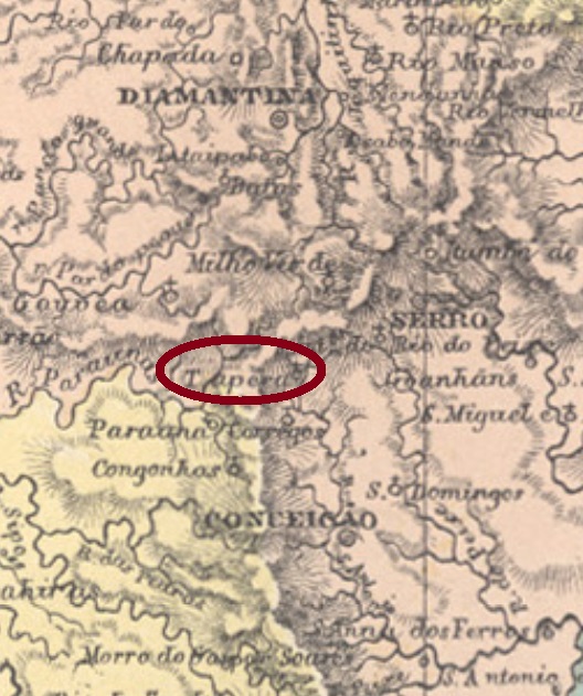
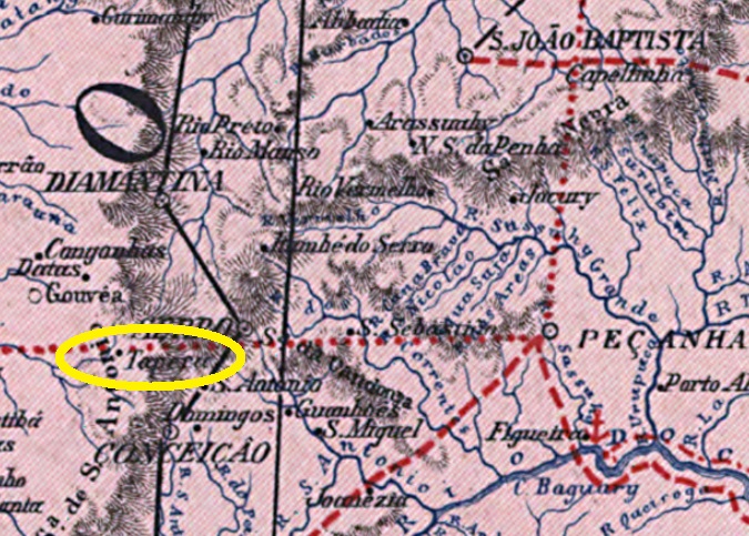
Santo Antonio da Tapera (= of the Mud Hut) was a district of the municipality of Conceição do Serro, established in June 1858 and situated ca. 250 km north of the provincial capital Ouro Preto. It kept this administrative status until today, but is called Santo Antonio do Norte since December 1938, while the municipality’s name today is Conceição do Mato Dentro. The local population has also considerably shrunk in the meantime: from over 3.3 thousand in 1880 to 662 souls in 2010.
Paula Sobrinho (História Postal de Minas Gerais, Belo Horizonte, 1997) tells us that the local post office was created in June 1884. One single cancel of the Empire has been found: SMG-2990a (Coll. Márcio Protzner) has a double circle with the inscription S. ANTONIO DA TAPERA above and an x-form ornament below, dated 1886 at the centre.
Andere Namen: Tapera, Santo Antonio do Norte (1938)
Santo Antonio da Tapera (= der Lehmhütte) war ab Juni 1858 ein Distrikt im Município von Conceição do Serro, der ca. 250 km nördlich der Provinzhauptstadt Ouro Preto entfernt lag. Dieser Verwaltungsstatus gilt bis heute, aber die Ortschaft heißt seit Dezember 1938 Santo Antonio do Norte, und der Município nennt sich heute Conceição do Mato Dentro. Auch die Ortsbevölkerung ist seitdem merklich geschrumpft: von über 3.300 (1880) zu 662 Einwohnern im Jahr 2010.
Paula Sobrinho (História Postal de Minas Gerais, Belo Horizonte, 1997) schreibt den Juni 1884 als Entstehungsdatum fürs örtliche Postamt. Nur ein Stempel aus der Kaiserzeit wurde bisher gefunden: SMG-2990a (Samml. Márcio Protzner) hat einen Doppelkreis mit der Inschrift S. ANTONIO DA TAPERA oben und einem X-förmigen Ornament unten, datiert 1886 in der Mitte.
