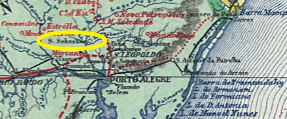
This locality was, from about 1850, a settlement called Porto do Guimarães, located on the east bank of the Caí River, about 70 km north of the provincial capital Porto Alegre. In 1873, the settlement became part of the Freguesia of São José do Hortêncio, which at that time belonged to São Leopoldo. Two years later, it became a villa.
The Imperial Mail Register (Tabella das Agencias do Correio do Imperio, Rio de Janeiro, 1885) lists this post office with foundation date 1879. Two postmarks as double circles were found for the 19th century. SRS-0370a (Coll. José A. Junges) also exists in blue, it has the inscription SAO SEBASTIAO DO CAHY at the top and the dates inside are from the period 1883-1889. SRS-0370b (Coll. José A. Junges) now has the inscription S. SEBASTIĀO DO CAHY at the top and there is an ornament in X at the bottom. Dates at the centre 1889 to 1890.
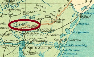
Diese Ortschaft war ab ca. 1850 eine Siedlung namens Porto do Guimarães, die am Ostufer des Flusses Caí lag, rund 70 km nördlich der Provinzhauptstadt Porto Alegre entfernt. 1873 ging die Ortschaft zur Freguesia von São José do Hortêncio, die damals noch São Leopoldo angehörte. Zwei Jahre später wurde daraus eine Villa.
Das Verzeichnis der kaiserlichen Postämter (Tabella das Agencias do Correio do Imperio, Rio de Janeiro, 1885) listet dieses Postamt mit Gründungsdatum 1879 auf. Zwei Stempel als Doppelkreise waren für den 19. Jahrhundert zu finden. SRS-0370a (Samml. José A. Junges) gibt es auch in blau, er hat oben die Inschrift SAO SEBASTIAO DO CAHY, und die Daten im Inneren kommen vom Zeitraum 1883-1889. SRS-0370b (Samml. José A. Junges) hat nun die Inschrift S. SEBASTIĀO DO CAHY oben, unten ist ein Ornament in X zu sehen. Daten in der Mitte 1889 bis 1890.
