Other names: Maripá, Maripá de Minas (1962).
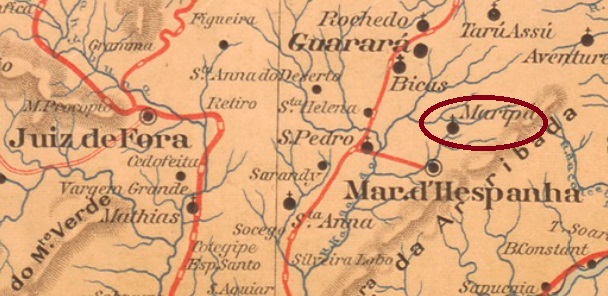
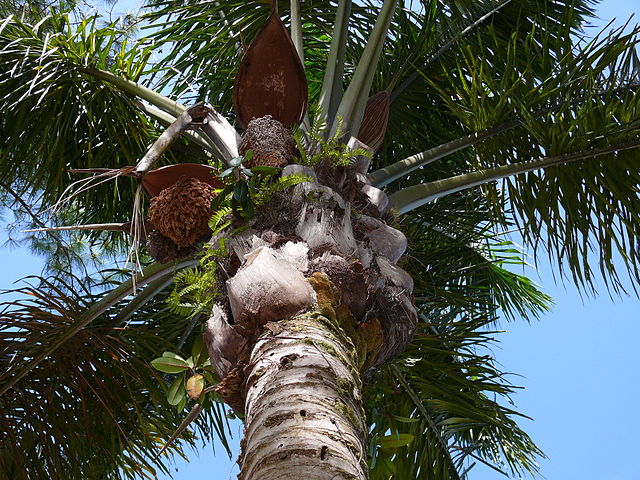
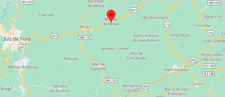
This settlement was first called Córrego do Meio (Middle Stream) and was located close to the provincial border with Rio de Janeiro, a good 270 km south of the capital Ouro Preto. In April 1890, it became a district of Mar d’Hespanha, which changed to the newly founded Município of Guarará the following year. Since December 1962, the municipality has been independent, under the name Maripá de Minas. The name refers to Attalea maripa (Martius), a palm tree of the Arecaceae family:
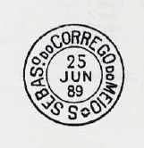
Paula Sobrinho writes in Historia Postal de Minas Gerais (Belo Horizonte, 1997) that there was a post office there from April 1881. The imperial postmark SMG-2625a has already been made known by Paulo Ayres in Catálogo de Carimbos Brasil-Império (S. Paulo, 1937, 1942):
Andere Namen: Maripá, Maripá de Minas (1962)
Diese Siedlung hieß zunächst Córrego do Meio (Mittlerer Bach) und lag nah an der Provinzgrenze zu Rio de Janeiro, gut 270 km südlich der Hauptstadt Ouro Preto entfernt. Im April 1890 wurde daraus ein Distrikt von Mar d’Hespanha, der im darauffolgenden Jahr zum neu gegründeten Município von Guarará wechselte. Seit Dezember 1962 ist die Gemeinde eigenständig, unter dem Namen Maripá de Minas. Der Name bezeichnet Attalea maripa (Martius), eine Palme der Familie Arecaceae:

Paula Sobrinho schreibt in Historia Postal de Minas Gerais (Belo Horizonte, 1997), dass es dort seit April 1881 ein Postamt gab. Der kaiserliche Ortstempel SMG-2625a wurde bereits durch Paulo Ayres in Catálogo de Carimbos Brasil-Império, (S. Paulo, 1937, 1942) bekannt gemacht:

