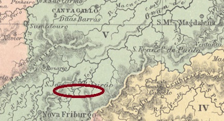
With Campo Bello do Cantagallo we have another village that has practically disappeared from the map today. It was a settlement of the Freguesia de S. José do Ribeirão in the Vila de Cantagallo around 1850, which has belonged to the Município Bom Jardim since July 1891 and lies on the north bank of the Rio Grande 160 km northeast of the capital Rio de Janeiro.
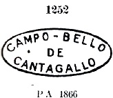
As Nova Monteiro writes in Administrações e Agencias Postaes do Brasil Imperio (Brasil Filatelico/RJ, 1934-5; Reprint SPP 1994-1999), there had been a post office there since September 1868, which was closed until 1879, as it is no longer mentioned in the Imperial Postal Guide (Guia Postal do Imperio, 1880). The only postmark so far is CRJ-0260a, listed in Paulo Ayres’ Catálogo de Carimbos Brasil-Império (S. Paulo, 1937, 1942) under No. 1252:
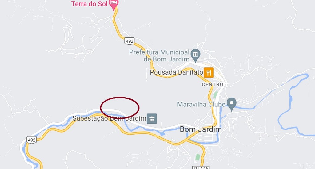
Mit Campo Bello do Cantagallo haben wir eine weitere Ortschaft, die heute praktisch von der Landkarte verschwunden ist. Es war um 1850 eine Siedlung der Freguesia de S. José do Ribeirão in der Vila de Cantagallo, die seit Juli 1891 zum Município Bom Jardim gehört und am Nordufer des Rio Grande 160 km nordöstlich der Hauptstadt Rio de Janeiro liegt.
Wie Nova Monteiro in Administrações e Agencias Postaes do Brasil Imperio (Brasil Filatelico/RJ, 1934-5; Reprint SPP 1994-1999) schreibt, gab es dort seit September 1868 ein Postamt, das aber erst 1879 geschlossen wurde, da es im Kaiserlichen Postführer (Guia Postal do Imperio, 1880) nicht mehr erwähnt wird. Der bisher einzige Poststempel ist CRJ-0260a, der in Paulo Ayres‘ Catálogo de Carimbos Brasil-Império (S. Paulo, 1937, 1942) unter Nr. 1252 verzeichnet ist:

