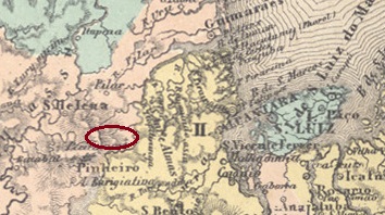
Gama is another place in the Empire of Brazil that has now disappeared from the map. From July 1866, S. Joaquim do Gama was a settlement in the Distrito de Pericuman, which at the time belonged to Vila de Pinheiro and was located on the west bank of the Pericumã, around 150 kilometres west of the provincial capital of São Luís do Maranhão. Around 1890, Gama itself became a district, but lost this status again in 1919 at the latest. Gama was probably once a fazenda that was unable to keep pace with the changing times.
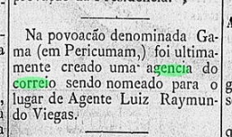
Even if there is no explanation for this today, there was a post office in the village around 1881, as reported in the regional press.
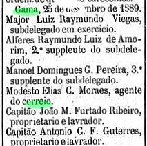
The agency was active at least by the end of the empire:

After that, every trace of postal activity is lost. No postmark from this town has been found to date, and it is probably very rare.
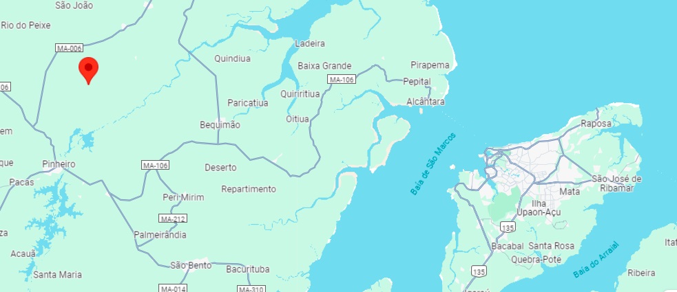
Gama ist ein weiterer Ort im Kaiserreich Brasilien, der heute von der Landkarte verschwunden ist. Seit Juli 1866 war S. Joaquim do Gama eine Siedlung im Distrito de Pericuman, die damals zur Vila de Pinheiro gehörte und am Westufer des Pericumã lag, etwa 150 km westlich der Provinzhauptstadt São Luís do Maranhão. Um 1890 wurde Gama selbst zum Distrikt, verlor diesen Status aber spätestens 1919 wieder. Vermutlich war Gama früher eine Fazenda, die mit dem Wandel der Zeit nicht Schritt halten konnte.
Auch wenn es heute keine Erklärung mehr dafür gibt, gab es um 1881 ein Postamt am Ort, wie die regionale Presse berichtete.

Die Agentur war bis zum Ende des Kaiserreichs aktiv:
Danach verliert sich jede Spur einer postalischen Tätigkeit. Bis heute wurde kein kaiserlicher Poststempel aus diesem Ort gefunden, er dürfte sehr selten sein.
