Other names: Santa Clara do Mucury, Santa Clara, Aymorés, Indiana, Nanuque (1943)
See also Santa Clara (SBA-0645)
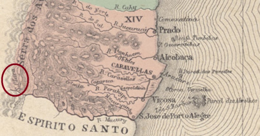
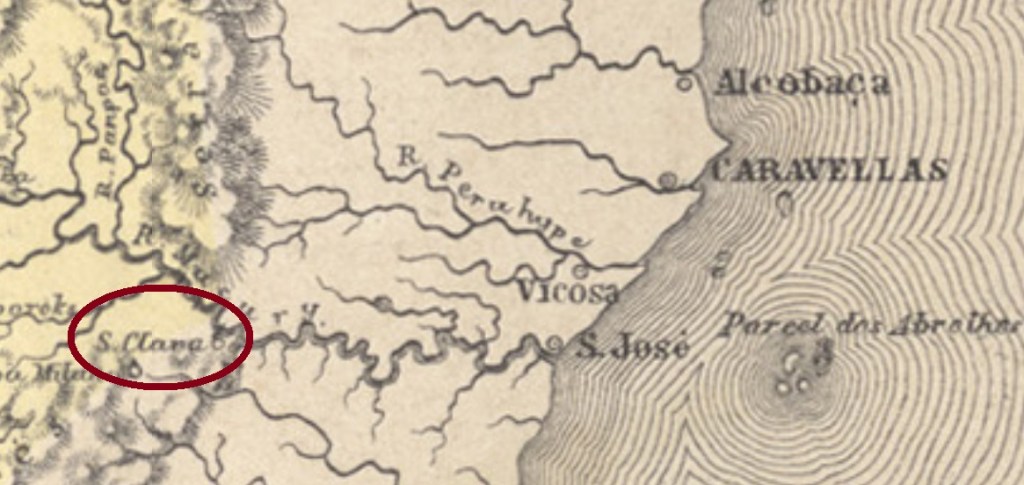
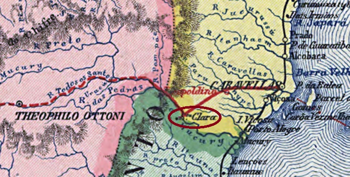
Here we have once more a fascinating story about a post office in a locality with a turbulent history. Santa Clara began as a colony of the municipality of São José de Porto Alegre (now the town of Mucuri) in the Bahia province, situated on the Mucuri River, over a thousand km south of the province capital Salvador. Since it was located near the border to two other provinces (Minas Gerais and Espírito Santo), for some strategic reason it must have been disputed among them, for it not only has caused often changes in the border lines, but also appears in different provinces on maps from the same year and author (see above).
Apparently, the origin of Santa Clara’s attractiveness was related with plans about separating the Minas Gerais province in two halves during the empire. Considering that the capital of the northern province would be Philadelphia (now: Teófilo Otoni), it is quite probable that Teophilo B. Ottoni (1807-1869) initiated and followed this goal. The influent journalist, entrepreneur and politician started many traffic projects in the region: the road between Philadelphia and Santa Clara, inaugurated in August 1857 as the first one in the Brazilian Empire, the Bahia-Minas Railway, which would link both provinces from 1881 on, and the Mucury River Navigation Company in the fifties, which intended to facilitate European immigration.
Ottoni’s premature death stopped most of those projects, but Santa Clara went to Minas Gerais as a district to the municipality of Minas Novas in November 1877, and changed in October 1881 as the freguesia of Santa Clara do Mucury to the municipality of Teophilo Ottoni. In December 1902 it became the district of Aymorés, which changed the toponym to Indiana in September 1923. In December 1938 it passed as a district to the new municipality of Carlos Chagas, and changed in December 1943 the toponym again, to Nanuque. Finally, in December 1948 Nanuque was given an own municipality.
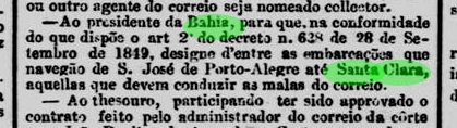
According to the Imperial Mail Register (Tabella das Agencias do Correio do Imperio) of 1885, the local post office was created in 1867, still in the Bahia province. Indeed, there were even before that time postal services along the Mucury River, as the Rio press reports:

Some time later, this agency must have passed to the control of Minas Gerais, because by May 1872 it returned to Bahia, as noticed by the Minas Gerais press:
It is still uncertain when it returned definitively to Minas Gerais, but since it is mentioned in the Bahia press until ca. 1880, one can assume that Santa Clara changed the province for good from then on.
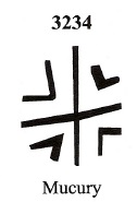
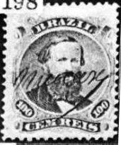
The earliest cancels were already presented by R. Koester under Mucury (Carimbologia XXVII). Initially, the stamps were cancelled by hand:

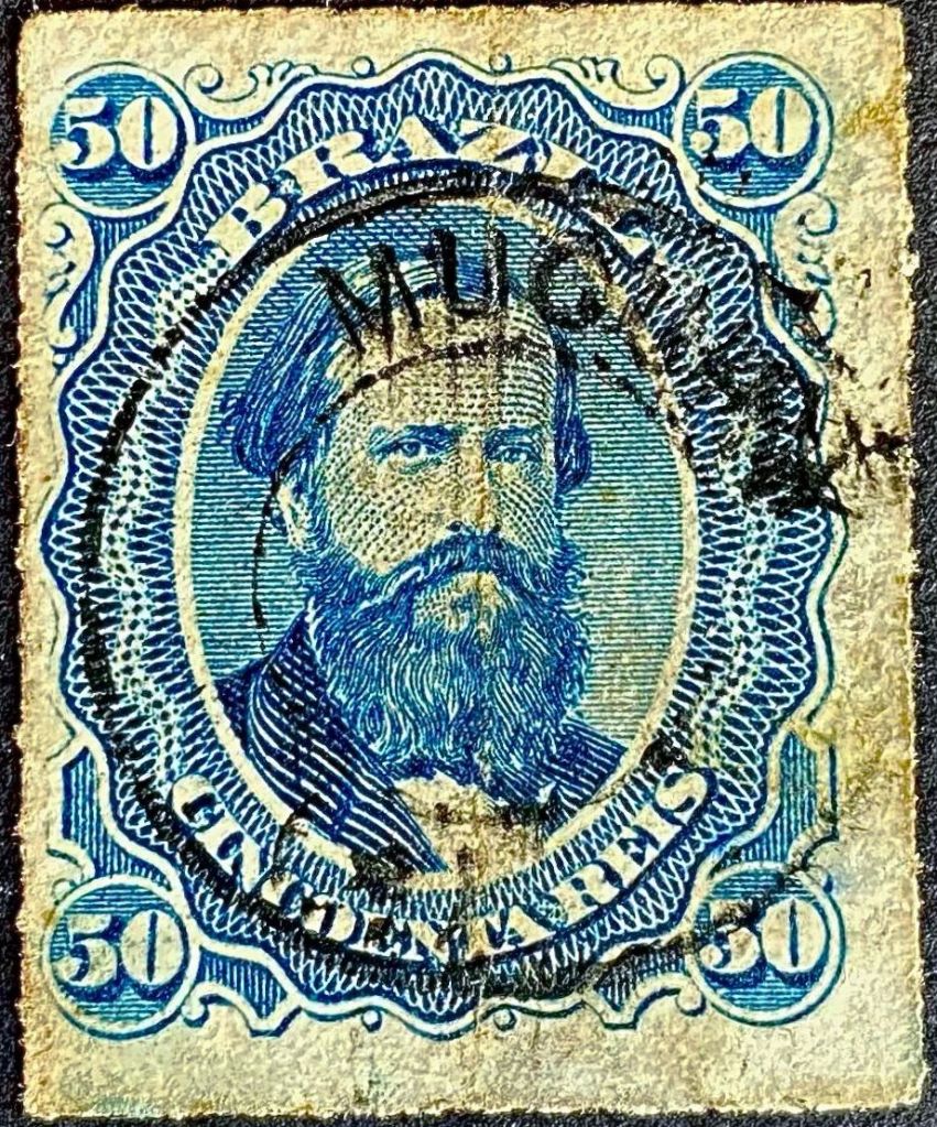
Around this time, a mute cancel was also used, which was given the number 3824 by James Dingler and Klerman W. Lopes in Mute Cancellations of the Brazil Empire / Carimbos Mudos do Brasil Império, (Brazil Philatelic Association, Rio de Janeiro, 2000):
Later, the French type MMG-3875a (illustration by Claudio Coelho) also appeared:

For later cancels (with Santa Clara) see SBA-0645.
Outros nomes: Santa Clara do Mucury, Santa Clara, Aymorés, Indiana, Nanuque (1943)
Veja também Santa Clara (SBA-0645)
Aqui temos outra históra fascinante sobre uma agência postal numa localidade de história agitada. Santa Clara era originalmente uma colônia do município baiano de São José de Porto Alegre (hoje cidade e município de Mucuri), às margens do Rio Mucuri, a mais de mil km ao sul de Salvador. Estando localizada próxima à fronteira com outras duas províncias (Minas Gerais e Espírito Santo), por alguma razão estratégica foi ela cobiçada por ambas. E por isso, trocou de província algumas vezes, conseguindo mesmo aparecer, no mesmo mapa, como pertencente a províncias diversas (veja imagens acima).
Possivelmente seria a atratividade de Santa Clara relacionada a planos de separar a provínicia mineira em duas partes, durante o Segundo Império. Considerando que a capital duma eventual província do norte mineiro deveria ser Filadélfia (hoje Teófilo Otoni), é bem possível que o jornalista, empresário e político Teophilo B. Ottoni (1807-1869) estivesse por trás desses planos. Pois este empreendeu diversos projetos de transporte na região: a estrada de Philadelphia a Santa Clara, inaugurada em agosto de 1857 e considerada a primeira estrada de rodagem interurbana do Império; a ferrovia Bahia-Minas, que ligaria ambas províncias a partir de 1881; ou ainda a Companhia de Navegação do Rio Mucury, que facilitaria a introdução de imigrantes europeus na região.
A morte de Teophilo Ottoni freou ou abortou esses projetos, mas Santa Clara passou para Minas Gerais como distrito do município de Minas Novas em novembro de 1877, e mudou-se para o município de Teophilo Ottoni em outubro de 1881, como a freguesia de Santa Clara do Mucury. Em dezembro de 1902 tornou-se o distrito de Aymorés, que trocaria de topônimo para Indiana em setembro de 1923. Em dezembro de 1938 passaria a ser distrito do novo município de Carlos Chagas, e trocou de nome novamente em dezembro de 1943, para Nanuque, que finalmente virou município em dezembro de 1948.
Segundo a Tabella das Agencias do Correio do Imperio de 1885, a agência postal local foi criada em 1867, ainda na província baiana. Mas segundo a imprensa fluminense informa, já havia transporte de malas postais ao longo do rio Mucuri antes dessa data:

Algum tempo depois, esta agência deve ter passado ao controle de Minas Gerais, porque até maio de 1872 já tinha retornado à Bahia, como informa a imprensa mineira:

Não sabemos quando Santa Clara veio em definitivo para Minas, mas como ela foi regularmente mencionada na imprensa baiana até ca. 1880, é possível que a mudança final tenha ocorrido por essa época.
Os carimbos mais antigos já foram apresentados por R. Koester sob o topônimo Mucury (Carimbologia XXVII). Inicialmente, os selos eram obliterados manualmente:

Nessa época, também era utilizado um carimbo mudo, que recebeu o número 3824 de James Dingler e Klerman W. Lopes em Mute Cancellations of the Brazil Empire / Carimbos Mudos do Brasil Império (Clube Filatélico do Brasil, Rio de Janeiro, 2000):

Mais tarde, surgiu também o tipo francês MMG-3875a (fig. Claudio Coelho):

Para carimbos posteriores (com Santa Clara), ver SBA-0645.
Andere Namen: Santa Clara do Mucury, Santa Clara, Aymorés, Indiana, Nanuque (1943)
Siehe auch Santa Clara (SBA-0645)
Hier haben wir wieder mit einem faszinierenden Fall eines Postamtes zu tun, dessen turbulente Geschichte viele Kapriolen schlug. Santa Clara war ursprünglich eine Kolonie im Município von São José de Porto Alegre (heute: Mucuri), die am Ufer des Mucuri über tausend km südlich der Provinzhauptstadt Salvador da Bahia entfernt lag. Da sie direkt an der Grenze zu zwei weiteren Provinzen (Minas Gerais und Espirito Santo) strategisch lag, wurde sie jahrzehntelang ein begehrtes Objekt. Santa Clara sollte mehrmals die Seite wechseln und schaffte es sogar , auf der gleichen Karte zwei unterschiedlichen Provinzen zugeordnet zu sein (siehe Abb. ganz oben).
Scheinbar hatte der Reiz Santa Claras mit alten Plänen zu tun, die kaiserliche Provinz Minas Gerais zu teilen. Da die geplante Hauptstadt der daraus entstehenden nördlichen Provinz Philadelphia (heute: Teófilo Otoni) sein sollte, ist es gut möglich, dass die Spaltungsidee aus dem Umkreis von Teophilo B. Ottoni (1807-1869) entsprang. Dieser einflussreiche Journalist, Unternehmer und Politiker initiierte mehrere Verkehrsprojekte in der Region: eine im August 1857 eingeweihte Strasse zwischen Philadelphia und Santa Clara (die erste Fernstrasse des brasilianischen Kaiserreichs), die Bahia-Minas Eisenbahngesellschaft, die die gleichnamigen Provinzen miteinander verbinden sollte, oder die Flussschifffahrtsgesellschaft Rio Mucury, die die europäische Einwanderung erleichtern sollte.
Ottonis früher Tod brachte einige der Projekte zum Erliegen, aber Santa Clara ging im November 1877 nach Minas Gerais als ein Distrikt des Município von Minas Novas und wechselte im Oktober 1881 als die Freguesia von Santa Clara do Mucury zum Município von Teophilo Ottoni. Im Dezember 1902 hieß der Distrikt Aymorés und ab September 1923 wurde er Indiana genannt. Im Dezember 1938 gehörte er zum neu gegründeten Município von Carlos Chagas und im Dezember 1943 wechselte der Ortsname abermals, zu Nanuque. Seit Dezember 1948 ist Nanuque ein eigener Município.
Laut Verzeichnis der kaiserlichen Postämter (Tabella das Agencias do Correio do Imperio) von 1885 entstand das örtliche Postamt in 1867, also noch in der Provinz Bahia. Allerdings gab es schon vorher Postverkehr entlang des Mucury, wie die Presse aus Rio berichtet:
Irgendwann später musste dieses Postamt Minas Geraes zugeordnet gewesen sein, denn im Mai 1872 wurde die Rückkehr in die Provinz Bahia bekannt gemacht:

Es ist auch nicht bekannt, wann genau Santa Clara nach Minas Gerais definitiv zurückkehrte. Da sie in der Presse Bahias bis ca. 1880 erwähnt wird, können wir davon ausgehen, dass dieser letzte Wechsel um diese Zeit stattgefunden hat.
Die frühesten Stempel dieser Ortschaft wurden bereits durch R. Koester unter Mucury vorgestellt (Carimbologia XXVII). Zunächst wurden die Briefmarken per Hand entwertet:
Um diese Zeit wurde auch ein stummer Stempel verwendet, der von James Dingler und Klerman W. Lopes in Mute Cancellations of the Brazil Empire / Carimbos Mudos do Brasil Império (Brazil Philatelic Association, Rio de Janeiro, 2000) die Nr. 3824 erhielt:

Später erschein auch der französischer Typ MMG-3875a (Abb. Claudio Coelho):
Für spätere Stempel (mit Santa Clara) siehe SBA-0645.
