Categories
Carimbologia T-Z

Villa de Guaratinguitá, São Paulo (VSP-1775)

Villiers de l’Ile Adam: Carta (…) da Provincia de São Paulo, 1847

See also Guaratinguetá (R. Koester: Carimbologia XXI)

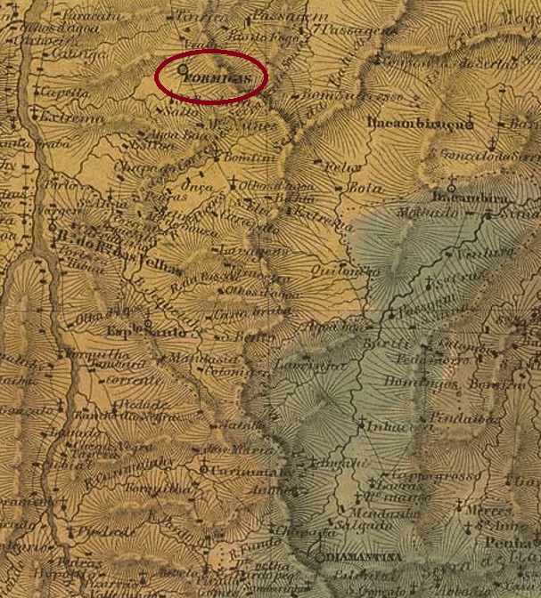
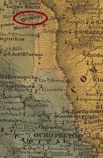
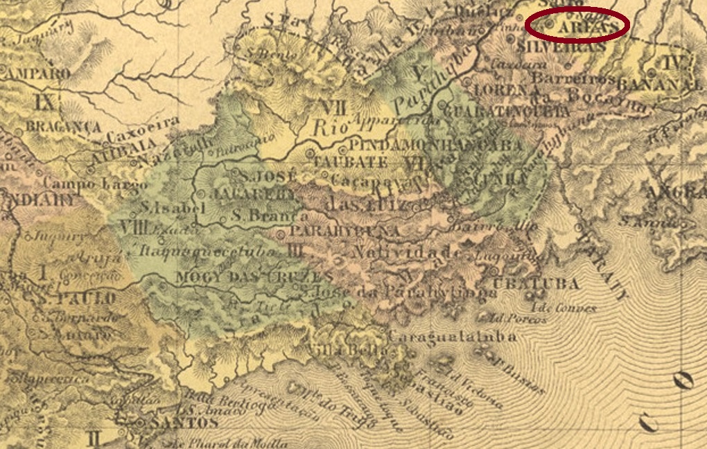
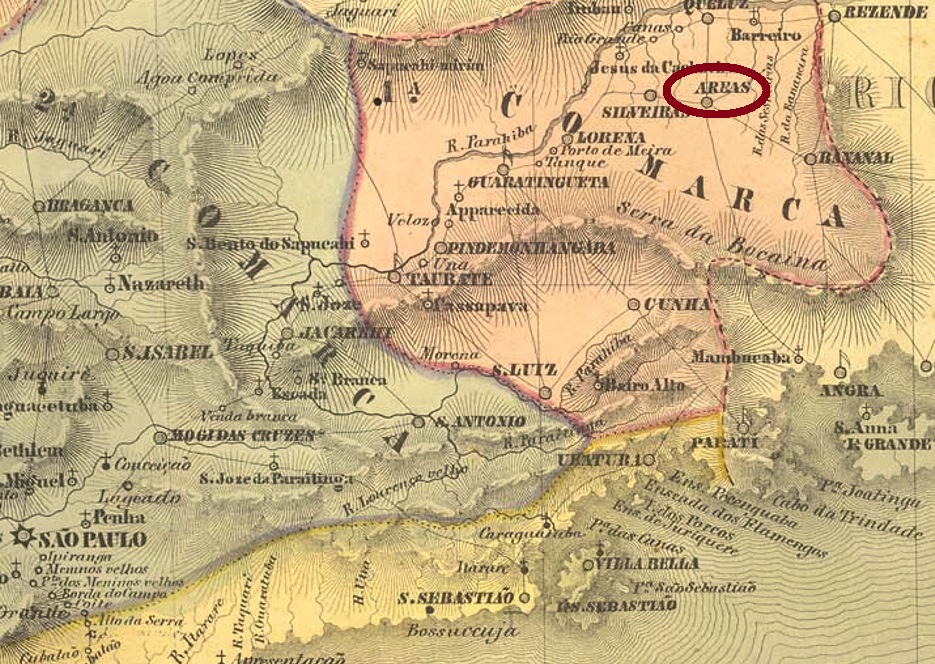
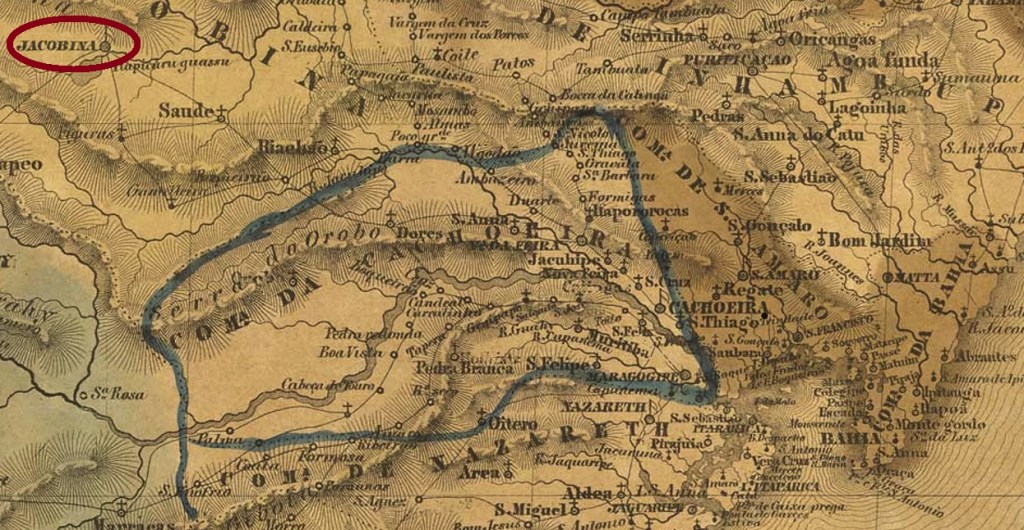
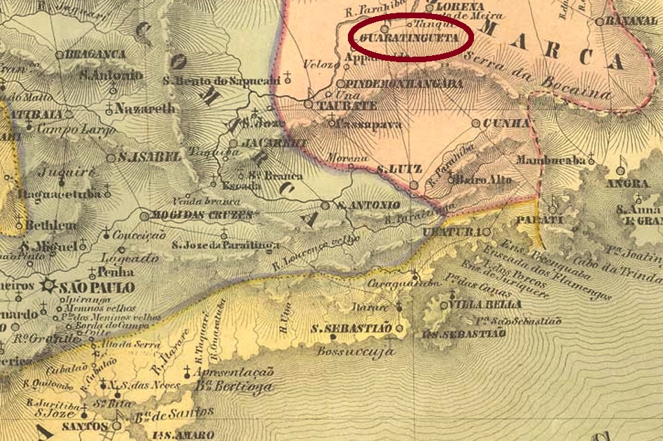
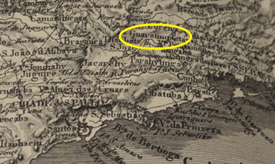
The freguesia of Santo Antonio de Guaratinguitá was mentioned in documents as early as 1630, belonged to the Vila of Taubaté and was situated on the south bank of the river Paraíba do Sul, 180 km northeast of the later provincial capital São Paulo. As early as 1657, the place was elevated to the status of a vila, but it was not until January 1844 that Guaratinguetá (as it is written today) was granted the status of a city. The name from the Tupi-guarani language means many white herons.

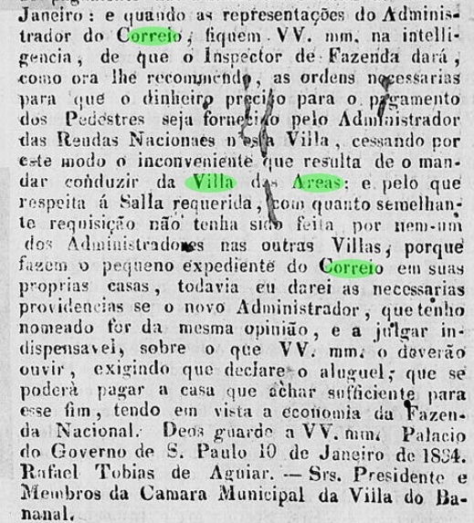
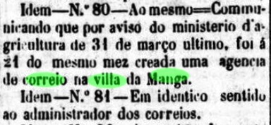
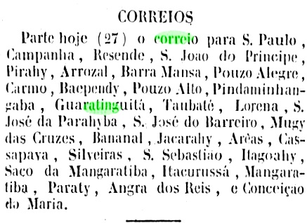
In the Directory of Imperial Post Offices (Tabella das Agencias do Correio do Imperio, Rio de Janeiro, 1885) we read that there had been a post office there since 1847. This cannot be the beginning of the first period of operation, because there are many cancelled letters from earlier years. As was the case in larger municipalities along the Paraíba-do-Sul valley, there was probably a postal system here before the establishment of the imperial post office, which was probably organised by the provincial government. Whatever, regular postal connections between Rio de Janeiro and Guaratinguetá already existed in January 1842:

Diario do Rio de Janeiro, 27.01.1842

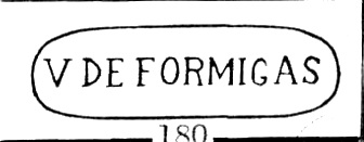
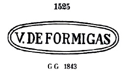
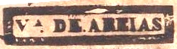
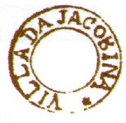
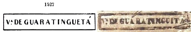
The first postmarks were already presented by Paulo Ayres in Catálogo de Carimbos Brasil-Império (S. Paulo, 1937, 1942). However, they have the same spelling mistake, which is why they are shown here with the corrected version. VSP-1775a also occurs in red-brown, was in use from 1837 to at least 1844 and corresponds to Paulo Ayres’ No. 1527:

VSP-1775a (P.A.1527, RHM P-SP-12) – recte

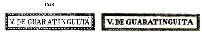
The following VSP-1775b also exists in red, it was in use from about 1843 to at least 1852 and corresponds to P. Ayres’ No. 1528:

VSP-1775b (P.A. 1528-recte RHM)

For later postmarks with the inscription GUARATINGUETÁ see R. Koester, Carimbologia XXI.

Spix & Martius, 1823/1831

Siehe auch Guaratinguetá (R. Koester: Carimbologia XXI)

Die Freguesia von Santo Antonio de Guaratinguitá wurde bereits 1630 urkundlich erwähnt, gehörte der Vila von Taubaté und lag am Südufer des Flusses Paraíba do Sul, 180 km nordöstlich der späteren Provinzhauptstadt São Paulo entfernt. Bereits 1657 wurde der Ort zur Vila erhoben, aber erst im Januar 1844 erhielt Guaratinguetá (wie es heute geschrieben wird) den Status einer Stadt. Der Name aus der Tupi-guarani-Sprache bedeutet viele weiße Reiher.

Im Verzeichnis der kaiserlichen Postämter (Tabella das Agencias do Correio do Imperio, Rio de Janeiro, 1885) liest man, dass es dort seit 1847 ein Postamt gab. Das kann nicht der Anfang der ersten Betriebsperiode sein, denn es gibt viele gestempelten Postsendungen aus früheren Jahren. Wie es in größeren Gemeinden entlang des Paraíba-do-Sul-Tals der Fall war, gab es wohl auch hier ein Postwesen vor der Einrichtung des kaiserlichen Postamts, das vermutlich von der Provinzregierung organisiert wurde. Wie es dem auch sei, reguläre Postverbindungen zwischen Rio de Janeiro und Guaratinguetá gab es bereits im Januar 1842:

Diario do Rio de Janeiro, 27.01.1842

Die ersten Poststempel wurden bereits durch Paulo Ayres in Catálogo de Carimbos Brasil-Império (S. Paulo, 1937, 1942) vorgestellt. Allerdings haben sie den gleichen Schreibfehler, weswegen sie hier mit der jeweils korrigierten Version gezeigt werden. VSP-1775a kommt auch in Rotbraun vor, war von 1837 bis mindestens 1844 in Gebrauch und entspricht Paulo Ayres’ Nr. 1527:

VSP-1775a (P.A.1527, RHM P-SP-12) – recte

Den Nachfolgestempel VSP-1775b gibt es auch in Rot, er wurde von ca. 1843 bis mindestens 1852 verwendet und entspricht P. Ayres’ Nr. 1528:

VSP-1775b (P.A. 1528-recte RHM)

Für spätere Poststempel mit Inschrift GUARATINGUETÁ siehe R. Koester, Carimbologia XXI.

Categories
Carimbologia T-Z

Villa de Formigas, Minas Gerais (VMG-3870)

Villiers de l’Ile Adam: Carta (…) da Provincia de Minas Geraes, 1849

Other names: Montes Claros de Formigas, Montes Claros (1857)

See also Montes Claros (R. Koester: Carimbologia XXVII)

The chapel of N. Sra. da Conceição e São José de Montes Claros de Formigas was founded in June 1769 on the east bank of the Rio do Vieira, a tributary of the left bank of the Verde Grande in the district of Vila do Principe (now Serro), more than 500 km north of the future provincial capital Ouro Preto. The village grew rapidly and was elevated to vila status in October 1831 and to town status in July 1857. Montes Claros de Formigas means light anthills and refers to the calcareous hilltops without vegetation in the region.

The Brazilian statistical agency IBGE wrote in 1959 about the existence of “postal services” (Serviço de Correios) in the locality from December 1832. These must have taken the form of postal relay work, as the local post office did not come into existence until October 1833, as can be read both by Nova Monteiro in Administrações e Agencias Postaes do Brasil Imperio (Brasil Filatelico/RJ, 1934-5; Reprint SPP 1994-1999) and in the postal report (Relatorio Postal) for 1887. Paula Sobrinho reports in his História Postal de Minas Gerais (Belo Horizonte, 1997) an agency creation in June 1853; however, this may be a reopening.

The earliest postmarks bear the simple inscription V. DE FORMIGAS. VMG-3870a also occurs in red, yellow and brown between 1836 and at least 1850 and has already been presented by Paulo Ayres in Catálogo de Carimbos Brasil-Império (S. Paulo, 1937, 1942) under No. 1525 and also by the RHM catalogue:

VMG-3870a (P.A. 1525, RHM P-MG-27)

Parallel to it, the much rarer cancel variant VMG-3870b appeared, which was in circulation between 1841 and at least 1850 and was presented by Reinhold Koester in Carimbologia XXVII:

VMG-3870b (RK)

Later postmarks of this place bear the inscriptions MONTES CLAROS or M. CLAROS DE F. and have already been made known by R. Koester (op. cit.).

Atlas do Imperio do Brasil, 1868

Andere Namen: Montes Claros de Formigas, Montes Claros (1857)

Siehe auch Montes Claros (R. Koester: Carimbologia XXVII)

Die Kapelle von N. Sra. da Conceição e São José de Montes Claros de Formigas wurde im Juni 1769 am Ostufer vom Rio do Vieira, einem Zufluss der linken Seite des Verde Grande in der Gemarkung der Vila do Principe (heute Serro), über 500 km nördlich der späteren Provinzhauptstadt Ouro Preto entfernt. Der Ort wuchs schnell und wurde im Oktober 1831 zur Vila und im Juli 1857 zur Stadt erhoben. Montes Claros de Formigas bedeutet helle Ameisenhaufen und weist auf die kalkhaltigen Bergkuppen ohne Vegetation in der Region hin.

Die brasilianische Statistikbehörde IBGE schrieb 1959 über das Vorhandensein von „Postdiensten“ (Serviço de Corrreios) vor Ort ab Dezember 1832. Diese dürfen in Form von Poststafettenarbeit stattgefunden haben, denn das örtliche Postamt entstand erst im Oktober 1833, was sowohl bei Nova Monteiro in Administrações e Agencias Postaes do Brasil Imperio (Brasil Filatelico/RJ, 1934-5; Reprint SPP 1994-1999) als auch im Postbericht (Relatorio Postal) für 1887 zu lesen ist. Paula Sobrinho berichtet in seiner História Postal de Minas Gerais (Belo Horizonte, 1997) über eine Agenturentstehung im Juni 1853; dies mag aber eine Wiedereröffnung sein.

Die frühesten Poststempel tragen die einfache Inschrift V. DE FORMIGAS. VMG-3870a kommt auch in Rot, Gelb und Braun zwischen 1836 und mindestens 1850 vor und wurde bereits durch Paulo Ayres in Catálogo de Carimbos Brasil-Império (S. Paulo, 1937, 1942) unter der Nr. 1525 und auch durch den RHM-Katalog vorgestellt:

VMG-3870a (P.A. 1525, RHM P-MG-27)

Parallel dazu erschien auch die viel seltene Stempelvariante VMG-3870b, die zwischen 1841 und mindestens 1850 im Umlauf war und durch Reinhold Koester in Carimbologia XXVII präsentiert wurde:

VMG-3870b (RK)

Spätere Poststempel dieses Orts tragen die Inschriften MONTES CLAROS bzw. M. CLAROS DE F. und wurden bereits durch R. Koester (op. cit.) bekannt gemacht.

Categories
Carimbologia T-Z

Villa de Corumbá, Goiás (VGO-0051)

Atlas do Imperio do Brasil, 1868

Another name: Corumbá de Goiás (1943)

See also Corumbá/GO (R. Koester: Carimbologia XIV)

The district of Nossa Senhora da Penha de França de Corumbá was created in December 1840 in the Município of Meia Ponte (now Pirenópolis) and was located on the west bank of the Corumbá River, less than 200 km east of the former provincial capital of Goyaz (now Goiás Velho). In July 1849, the village was promoted to Vila, but lost its political independence in August 1863 and returned to Meia Ponte as a district. It was promoted again to Vila in June 1875, and since July 1902 it has had the status of a town, called Corumbá de Goiás since December 1943, probably to avoid confusion with the town of the same name in Mato Grosso.

Two dates of origin for the local post office were found. Firstly in August 1853, as Nova Monteiro writes in Administrações e Agencias Postaes do Brasil Imperio (Brasil Filatelico/RJ, 1934-5; Reprint SPP 1994-1999), which is confirmed by the report of the Imperial Ministry of that year:

Relatorio do Ministerio do Imperio, 1853

The second opening of the post office is said to have taken place in September 1854, as reported by Nova Monteiro (op. cit.) and R. Koester (Carimbologia XIV). The earliest postmark so far is VGO-0051a, used at least from about 1877 and already presented by Paulo Ayres in Catálogo de Carimbos Brasil-Império (S. Paulo, 1937, 1942) under no. 1599:

VGO-0051a (P.A. 1599)

Later postmarks of the locality probably bear the place name Corumbá, without mentioning the Vila.

Villiers de l’Ile Adam: Carta (…) da Provincia de Goyaz, 1849

Anderer Name: Corumbá de Goiás (1943)

Siehe auch Corumbá/GO (R. Koester: Carimbologia XIV)

Der Distrikt von Nossa Senhora da Penha de França de Corumbá entstand im Dezember 1840 im Município von Meia Ponte (heute Pirenópolis) und lag am Westufer des Corumbá-Flusses, unter 200 km östlich der ehemaligen Provinzhauptstadt Goyaz (heute Goiás Velho) entfernt. Im Juli 1849 wurde die Ortschaft zur Vila befördert, verlor aber im August 1863 ihre politische Selbständigkeit und kehrte als Distrikt zu Meia Ponte zurück. Der Wiederaufstieg zur Vila erfolgte im Juni 1875, und seit Juli 1902 hat der Ort den Status einer Stadt, die seit Dezember 1943 Corumbá de Goiás heißt, wohl um Verwechslungen mit der gleichnamigen Stadt in Mato Grosso zu vermeiden.

Zwei Entstehungsdaten fürs örtliche Postamt wurden gefunden. Erstmals im August 1853, wie Nova Monteiro in Administrações e Agencias Postaes do Brasil Imperio (Brasil Filatelico/RJ, 1934-5; Reprint SPP 1994-1999) schreibt und vom Bericht des Imperialministeriums d. J. bestätigt wird:

Relatorio do Ministerio do Imperio, 1853

Die zweite Postamteröffnung soll im September 1854 stattgefunden haben, wie Nova Monteiro (op. cit.) und R. Koester (Carimbologia XIV) berichten. Der bisher früheste Poststempel ist VGO-0051a, der zumindest ab ca. 1877 verwendet und bereits durch Paulo Ayres in Catálogo de Carimbos Brasil-Império (S. Paulo, 1937, 1942) unter Nr. 1599 vorgestellt wurde:

VGO-0051a (P.A. 1599)

Spätere Poststempel der Ortschaft tragen wohl die Ortsbezeichnung Corumbá, ohne eine Vila zu erwähnen.

Categories
Carimbologia T-Z

Villa de Carinhanha, Bahia (VBA-0261, CBA-0260)

Atlas do Imperio do Brasil, 1868

Text updated on June 17, 2022

Other names: Carunhanha, Carinhenha
Also Carinhanha (R. Koester: Carimbologia IX)

Three dates of foundation of the Freguesia of São José de Carinhanha have come to us: first in April 1779, in connection with the Archbishopric of Salvador; then in August 1806, as recorded in the archives of the Bishopric of Recife; finally in 1813, when the place was subordinated to the Municipality of Barra do Rio Grande. It is certain that at that time Carinhanha still belonged to the Capitania of Pernambuco and was located on the left bank of the Rio São Francisco north of the mouth of the Carinhanha River and the border with Minas Gerais, almost 800 km west of the later provincial capital Salvador da Bahia. In April 1832 – thus already assigned to the province of Bahia – the place rose to the status of a villa, and since August 1909 Carinhanha has been a town. The name from the Indian language means many toothed acaris. Acari is the general name for fish of the armoured catfish family Loricaridae:

Pterogoplichthys pardalis/Cascudo-abacaxi (Photo: Derek Ramsey, CC-BA-SA 3.0)

As Nova Monteiro writes in Administrações e Agencias Postaes do Brasil Imperio (Brasil Filatelico/RJ, 1934-5; Reprint SPP 1994-1999), there was a post office there since December 1836. The first postmark is probably CBA-0260a, used at least from 1843 and already made known by the RHM catalogue:

CBA-0260a (RHM)

The puzzling letters S.I. should mean Serviço Imperial (Imperial Service), as Paulo Novaes in http://agenciaspostais.com.br/?p=29268 makes credible. The following postmark VBA-0261a was found from about 1866 and was already presented by Paulo Ayres in Catálogo de Carimbos Brasil-Império (S. Paulo, 1937, 1942) under no. 1598:

VBA-0261a (P.A. 1598)

Later postmarks probably bear the local name Carinhanha.

Villiers de l’Ile Adam: Carta: (…) da Provincia da Bahia, 1848

Textaktualisierung am 17. Juni 2022

Andere Namen: Carunhanha, Carinhenha
Siehe auch Carinhanha (R. Koester: Carimbologia IX)

Von der Freguesia von São José de Carinhanha sind drei Gründungsdaten überliefert: erstmals im April 1779, in Verbindung mit dem Erzbistum von Salvador; dann im August 1806, wie in den Archiven des Bistums Recife registriert; schließlich 1813, als der Ort der Gemeinde von Barra do Rio Grande untergeordnet wurde. Sicher ist, dass Carinhanha damals noch der Capitania von Pernambuco angehörte und am linken Ufer des Rio São Francisco nördlich der Mündung des Carinhanha und der Grenze zu Minas Gerais lag, fast 800 km westlich der späteren Provinzhauptstadt Salvador da Bahia entfernt. Im April 1832 – also bereits der Provinz Bahia zugeordnet – stieg der Ort zur Villa auf, und seit August 1909 ist Carinhanha eine Stadt. Der Name aus der Indianersprache bedeutet viele gezähnte Acaris. Acari ist die allgemeine Bezeichnung für Fische der Panzerwels-Familie Loricaridae:

Pterogoplichthys pardalis/Cascudo-abacaxi (Foto: Derek Ramsey, CC-BA-SA 3.0)

Wie Nova Monteiro in Administrações e Agencias Postaes do Brasil Imperio (Brasil Filatelico/RJ, 1934-5; Reprint SPP 1994-1999) schreibt, gab es dort ein Postamt seit Dezember 1836. Der erste Poststempel ist wohl CBA-0260a, der zumindest ab 1843 verwendet und bereits durch den RHM-Katalog bekannt gemacht wurde:

CBA-0260a (RHM) 1843ff

Die rätselhaften Buchstaben S.I. sollen Serviço Imperial (kaiserlicher Dienst) bedeuten, wie Paulo Novaes in http://agenciaspostais.com.br/?p=29268 glaubhaft macht. Der folgende Poststempel VBA-0261a war ab ca. 1866 zu finden und wurde bereits durch Paulo Ayres in Catálogo de Carimbos Brasil-Império (S. Paulo, 1937, 1942) unter Nr. 1598 vorgestellt:

VBA-0261a (P.A. 1598)

Spätere Poststempel tragen vermutlich die Bezeichnung Carinhanha.

Categories
Carimbologia T-Z

Villa de Caethe, Minas Gerais (VMG-0451)

Province of Minas Geraes, 1835

Other name: Villa Nova da Rainha

See also Caeté (R. Koester: Carimbologia VII)

This old settlement was already mentioned in a document in January 1714 and was located near Sabará, 120 km north of the later provincial capital Ouro Preto. After Brazil’s independence in 1822, the place name had to be changed. Thus, the Freguesia of N. Sra. do Bom Successo do Caethe came into being in June 1833 and was made a town in November 1865.

Two dates for the creation of the local post office have been found. First in March 1829, as Nova Monteiro writes in Administrações e Agencias Postaes do Brasil Imperio (Brasil Filatelico/RJ, 1934-5; reprint SPP 1994-1999). On the other hand, Paula Sobrinho in História Postal de Minas Gerais (Belo Horizonte, 1997) records October 1833. Should Nova Monteiro be right with his earlier date, postmarks with Villa Nova da Rainha would be quite possible. However, none of them have appeared so far. On the other hand, the presence of VMG-0451a in documents and letters between 1840 and 1843 is well documented, as its illustration in the RHM catalogue also shows:

VMG-0451a (RHM P-MG-10)

Later postmarks bear the abbreviated place name Caeté and can be seen in R. Koester’s Carimbologia VII.

Villiers de l’Ile Adam: Carta (…) da Provincia de Minas Geraes, 1849

Anderer Name: Villa Nova da Rainha

Siehe auch Caeté (R. Koester: Carimbologia VII)

Diese alte Siedlung wurde bereits im Januar 1714 urkundlich erwähnt und lag bei Sabará, 120 km nördlich der späteren Provinzhauptstadt Ouro Preto entfernt. Nach der Unabhängigkeit Brasiliens 1822 musste der Ortsname geändert werden. So entstand im Juni 1833 die Freguesia von Na. Sra. do Bom Successo do Caethe, die im November 1865 zur Stadt ernannt wurde.

Zwei Daten für die Entstehung des lokalen Postamts wurden gefunden. Erstmals im März 1829, wie Nova Monteiro in Administrações e Agencias Postaes do Brasil Imperio (Brasil Filatelico/RJ, 1934-5; Reprint SPP 1994-1999) schreibt. Dagegen registriert Paula Sobrinho in História Postal de Minas Gerais (Belo Horizonte, 1997) den Oktober 1833. Sollte Nova Monteiro mit seinem früheren Termin Recht haben, wären Poststempel mit Villa Nova da Rainha gut möglich. Allerdings ist bisher keiner davon aufgetaucht. Dagegen ist das Vorhandensein von VMG-0451a in Dokumenten und Briefen zwischen 1840 und 1843 gut belegt, wie auch seine Abbildung im RHM-Katalog zeigt:

VMG-0451a (RHM P-MG-10)

Spätere Poststempel tragen den gekürzten Ortsnamen Caeté bzw Caethe und sind in R. Koesters Carimbologia VII zu sehen.

Categories
Carimbologia T-Z

Villa de Caeteté (VBA-0880) – Villa Nova do Principe, Bahia (VBA-0960)

Atlas do Imperio do Brasil, 1868

Other names: Caetité, Caitité

See also: Caeteté; Vila Nova do Principe (R. Koester: Carimbologia VII and XXXII)

The freguesia called “Villa” Nova do Principe was mentioned in documents as early as 1754 and was located on the west bank of the São João River, 630 km southwest of the provincial capital Salvador da Bahia. A royal decree (Decreto Real) from February 1810 declared the place a vila, which rose to the town of Sant’Anna de Caeteté in October 1867. The Tupi language word means forest with large stones.

Two creation dates for the local post office were found. In Administrações e Agencias Postaes do Brasil Imperio (Brasil Filatelico/RJ, 1934-5; Reprint SPP 1994-1999), Nova Monteiro writes August 1841, while Reinhold Koester notes May 1865 in his Carimbologia. If Nova Monteiro’s information is correct, there was probably a pre-philatelic postmark from Villa Nova do Principe. However, the agency was already officially called Caeteté in November 1846:

Gazeta Official/RJ, 25.11.1846

So far, no postmark with Villa Nova do Principe has been seen. The first postmark with the new place name is VBA-0880a. It can be seen in the RHM catalogue and was in circulation from about 1843 to 1847:

VBA-0880a (RHM)

Later postmarks bear the abbreviated place name CAETETÉ and were already shown in Koester’s Carimbologia VII.

Villiers de l’Ile Adam: Carta (…) da Provincia da Bahia, 1848

Andere Namen: Caetité, Caitité

Siehe auch: Caetete; Vila Nova do Principe (R. Koester: Carimbologia VII und XXXII)

Die Freguesia namens “Villa” Nova do Principe wurde bereits 1754 urkundlich erwähnt und lag am Westufer des Flusses São João, 630 km südwestlich der Provinzhauptstadt Salvador da Bahia entfernt. Ein königliches Dekret (Decreto Real) aus Februar 1810 erklärte den Ort zu einer Vila, die im Oktober 1867 zur Stadt Sant’Anna de Caeteté aufstieg. Das Wort der Tupi-Sprache bedeutet Wald mit großen Steinen.

Zwei Gründungsdaten fürs örtliche Postamt wurden gefunden. Nova Monteiro schreibt dafür in Administrações e Agencias Postaes do Brasil Imperio (Brasil Filatelico/RJ, 1934-5; Reprint SPP 1994-1999) den August 1841, während Reinhold Koester den Mai 1865 notiert. Wenn Nova Monteiros Angabe stimmt, gab es vermutlich einen Prephila-Poststempel aus Villa Nova do Principe. Allerdings wurde die Agentur bereits im November 1846 Caeteté offiziell genannt:

Gazeta Official/RJ, 25.11.1846

Bisher war kein Poststempel mit Villa Nova do Principe zu sehen. Der erste Stempel mit dem neuen Ortsnamen ist VBA-0880a. Er ist im RHM-Katalog zu sehen und war im Umlauf von ca. 1843 bis 1847:

VBA-0880a (RHM)

Spätere Poststempel tragen den gekürzten Ortsnamen CAETETÉ und wurden bereits in Koesters Carimbologia VII gezeigt.

Categories
Carimbologia T-Z

Villa de Areias, São Paulo (VSP-1765)

Atlas do Imperio do Brasil, 1868

Other names: Sant’Anna da Parahyba Nova, Arêas

See also Areias (R. Koester: Carimbologia II)

The freguesia of Sant’Anna da Parahyba Nova was created in January 1784 and was on the south bank of the river Parahyba do Sul, barely 250 km northeast of the future provincial capital of São Paulo. In 1801, the village became a freguesia of the Vila of Lorena, and in November 1816, it became a vila with the name São Miguel das Areias. Areias has been a town since March 1857.

The local post office was created in December 1847, according to Nova Monteiro (Administrações e Agencias Postaes do Brasil Imperio, in Brasil Filatelico/RJ, 1934-5; Reprint SPP 1994-1999). Nevertheless, both letters with earlier dates and press releases of the 1830s suggest that a postal service, however organised, was active there before then:

O Novo Farol Paulistano, 07.02.1834

The first postal cancellation was VSP-1765a. This also came in blue, brown and green from, was used between 1836 and at least 1843 and has been made known by Paulo Ayres (Catálogo de Carimbos Brasil-Império, S. Paulo, 1937, 1942) under No. 1523:

VSP-1765a (P.A.1523)

The successor cancel VSP-1765b was also found in red, blue and green, in use 1845-1860 and was also presented by Paulo Ayres (op. cit.) this time with no. 1597:

VSP-1765b (P.A.1597)

There was also a handwritten cancellation around 1835:

1835 (image: Mário Celso Orsi Jr.)

J. A. Dingler and Klerman W. Lopes have also shown in Mute Cancellations of the Brazil Empire / Carimbos Mudos do Brasil Império (Brazil Philatelic Association, Rio de Janeiro, 2000) a mute postmark under no. 158:

BPA 158

Later local postmarks bear the designation AREIAS or AREAS and were presented by R. Koester (Carimbologia II).

Villiers de l’Ile Adam: Carta (…) da Provincia de São Paulo, 1847

Andere Namen: Sant’Anna da Parahyba Nova, Arêas

Siehe auch Areias (R. Koester: Carimbologia II)

Die Freguesia von Sant’Anna da Parahyba Nova entstand im Januar 1784 und lag am Südufer des Flusses Parahyba do Sul, knapp 250 km nordöstlich der späteren Provinzhauptstadt São Paulo entfernt. 1801 ging die Ortschaft als Freguesia zur Vila von Lorena und wurde selber im November 1816 eine Vila mit Namen São Miguel das Areias. Seit März 1857 ist Areias eine Stadt.

Das örtliche Postamt entstand laut Nova Monteiro (Administrações e Agencias Postaes do Brasil Imperio, in Brasil Filatelico/RJ, 1934-5; Reprint SPP 1994-1999) im Dezember 1847. Dennoch, sowohl Briefe mit früheren Daten als auch Pressenachrichten der 1830er Jahre legen nahe, dass es dort ein wie auch immer organisierten Postbetrieb bereits vorher aktiv war:

O Novo Farol Paulistano, 07.02.1834

Die erste postalische Entwertung war VSP-1765a. Diese kam auch in Blau, Braun und Grün von, wurde zwischen 1836 und zumindest 1843 gebraucht und ist durch Paulo Ayres (Catálogo de Carimbos Brasil-Império, S. Paulo, 1937, 1942) unter Nr. 1523 bekannt gemacht worden:

VSP-1765a (P.A.1523)

Der Nachfolgestempel VSP-1765b war auch in Rot, Blau und Grün anzutreffen, 1845-1860 in Verwendung und wurde ebenfalls durch Paulo Ayres (op. cit.) diesmal mit Nr. 1597 vorgestellt:

VSP-1765b (P.A.1597)

Aus 1835 kam auch eine handschriftliche Entwertung:

1835 (Abb. Mário Celso Orsi Jr.)

J. A. Dingler und Klerman W. Lopes haben in Mute Cancellations of the Brazil Empire / Carimbos Mudos do Brasil Império (Brazil Philatelic Association, Rio de Janeiro, 2000) auch einen stummen Poststempel unter Nr. 158 gezeigt:

BPA 158

Spätere Ortsstempel tragen die Bezeichnung AREIAS oder AREAS und wurden durch R. Koester (Carimbologia II) gezeigt.

Categories
Carimbologia T-Z

Villa das Barras, Piauí (VPI-0220, BPI-0030)

Atlas do Imperio do Brasil, 1868

Text update on June 17. 2022

Other names: Barras de Maratahoan, Maratahoan 

See also Barras (R. Koester: Carimbologia III)

The freguesia of N. Sa. da Conceição das Barras was established as early as October 1823 and was located on the north bank of the Maratauã River, where six waterways come together, barely 130 km north of the later provincial capital of Teresina. The village was elevated to a district in the Município of Campo Maior in September 1836 and to a vila in September 1841. It has been the town of Barras since December 1889.

Two creation years for the local post office have been found. First in May 1856, as Nova Monteiro writes in Administrações e Agencias Postaes do Brasil Imperio (Brasil Filatelico/RJ, 1934-5; Reprint SPP 1994-1999). Then 1882, as listed in the Directory of Imperial Post Offices (Tabella das Agencias do Correio do Imperio, Rio de Janeiro, 1885). The earliest postmark is BPI-0030a, already presented by Paulo Ayres in Catálogo de Carimbos Brasil-Império (S. Paulo, 1937, 1942) under no. 1229:

BPI-0030a (P.A. 1229)

Its successor VPI-0220b probably dates from the second period of operation of the post office. This postmark was used by Cicero A. Almeida in Carimbos Postais – século XIX, (Rio de Janeiro, 1989) under No. 788:

VPI-0220b (MPT-788)
Villiers de l’Ile Adam: Carta (…) da Provincia do Piauhy, 1850

Textaktualisierung am 17. Juni 2022

Andere Namen: Barras de Maratahoan, Maratahoan 

Siehe auch Barras (R. Koester: Carimbologia III)

Die Freguesia von N. Sa. da Conceição das Barras entstand bereits im Oktober 1823 und lag am Nordufer des Maratauã-Flusses, wo sechs Wasserwege zusammen kommen, knapp 130 km nördlich der späteren Provinzhauptstadt Teresina entfernt. Der Ort wurde im September 1836 zum Distrikt im Município von Campo Maior und im September 1841 zur Vila erhoben. Seit Dezember 1889 ist er die Stadt von Barras.

Zwei Gründungsjahre fürs örtliche Postamt wurden gefunden. Erstmals im Mai 1856, wie Nova Monteiro in Administrações e Agencias Postaes do Brasil Imperio (Brasil Filatelico/RJ, 1934-5; Reprint SPP 1994-1999) schreibt. Dann 1882, wie im Verzeichnis der kaiserlichen Postämter (Tabella das Agencias do Correio do Imperio, Rio de Janeiro, 1885) aufgelistet. Der früheste Poststempel ist BPI-0030a, der bereits durch Paulo Ayres in Catálogo de Carimbos Brasil-Império (S. Paulo, 1937, 1942) unter Nr. 1229 vorgestellt wurde:

BPI-0030a (P.A. 1229)

Sein Nachfolger VPI-0220b entstammt wohl der zweiten Betriebsperiode des Postamts. Dieser Poststempel wurde durch Cicero A. Almeida in Carimbos Postais – século XIX, (Rio de Janeiro, 1989) unter Nr. 788 bekannt gemacht:

VPI-0220b (MPT-788)

Categories
Carimbologia T-Z

Villa da Manga, Piauí (VPI-0250)

Atlas do Imperio do Brasil, 1868

Other names: S. Pedro de Alcantara, Colonia, Floriano (1897)

See also Manga (R. Koester: Carimbologia XXVII)

The villa of N. Sa. de Uhyca da Manga was established after the detachment of Jerumenha in July 1864 and was located on the south bank of the Parnaiba River, 250 km south of the provincial capital Teresina. As early as 1873, the agricultural enterprise (Estabelecimento Rural) called São Pedro de Alcantara was established there as a prestigious colonisation project of the Empire. This settlement grew rapidly and became the headquarters of the Município in June 1890, albeit under the shortened name of Colonia, as the Republicans wanted the traces of the monarchy to disappear. Between September 1895 and June 1896, the place was briefly demoted as a district of Jerumenha. Since July 1897, the Município has been called Floriano, in memory of Marshal Floriano Peixoto, the 2nd President of Brazil, who died in 1895.

The local post office was established in March 1879, as reported in the regional press:

A Imprensa, 12.07.1879

A second opening is said to have taken place in 1882, as noted in the Directory of Imperial Post Offices (Tabella das Agencias do Correio do Imperio, Rio de Janeiro, 1885). The imperial postmark is VPI-0250a, as illustrated by R. Koester in Carimbologia XXVII. The only specimen seen so far is dated 1894.

VPI-0250a (RK)
Arthur D. Ribeiro: Estado do Piauhy, 1924

Andere Namen: S. Pedro de Alcantara, Colonia, Floriano (1897)

Siehe auch Manga (R. Koester: Carimbologia XXVII)

Die Villa von N. Sa. de Uhyca da Manga wurde nach der Loslösung von Jerumenha im Juli 1864 ins Leben gerufen und lag am Südufer des Parnaiba-Flusses, 250 km südlich der Provinzhauptstadt Teresina entfernt. Bereits 1873 entstand dort das Landwirtschaftsunternehmen (Estabelecimento Rural) namens São Pedro de Alcantara als prestigeträchtiges Kolonisationsprojekt des Kaiserreichs. Diese Siedlung wuchs schnell und wurde Hauptsitz des Município im Juni 1890, allerdings unter dem gekürzten Namen Colonia, da die Republikaner die Spuren der Monarchie verschwinden lassen wollten. Zwischen September 1895 und Juni 1896 war der Ort kurzzeitig als Distrikt von Jerumenha degradiert. Seit Juli 1897 heißt der Município Floriano, in Erinnerung an Marschall Floriano Peixoto, den 2. Präsidenten Brasiliens, der 1895 verstarb.

Das örtliche Postamt entstand im März 1879, wie die Regionalpresse berichtet:

A Imprensa, 12.07.1879

Eine zweite Eröffnung soll 1882 stattgefunden haben, wie im Verzeichnis der kaiserlichen Postämter (Tabella das Agencias do Correio do Imperio, Rio de Janeiro, 1885) vermerkt. Der kaiserliche Poststempel ist VPI-0250a, wie von R. Koester in Carimbologia XXVII abgebildet. Das bisher einzig gesehene Exemplar ist 1894 datiert.

VPI-0250a (RK)

Categories
Carimbologia T-Z

Villa da Jacobina, Bahia (VBA-0885, JBA-0420)

Atlas do Imperio do Brasil, 1868

Text updated on June 17, 2022

See also Jacobina (R. Koester: Carimbologia XXV)

The freguesia of Santo Antonio da Jacobina was already mentioned in documents in 1677 and was located about 340 km southwest of the future provincial capital Salvador da Bahia. It became a vila in August 1720 and a town in July 1880.

Two years of origin were found for the local post office. First in May 1832, as Nova Monteiro writes in Administrações e Agencias Postaes do Brasil Imperio (Brasil Filatelico/RJ, 1934-5; Reprint SPP 1994-1999). Then again in 1868, as listed in the Directory of Imperial Post Offices (Tabella das Agencias do Correio do Imperio, Rio de Janeiro, 1885). The first two postmarks are from the first period of operation. JBA-0420a also exists in brown, was used from 1832 to at least 1843 and is known through Paulo Ayres’s Catálogo de Carimbos Brasil-Império (S. Paulo, 1937, 1942) under No. 1147:

JBA-0420a (P.A. 1147, RHM P-BA-08)

Its successor VBA-0885a was used at least until 1850 and already shown by the RHM catalogue:

VBA-0885a (RHM)

Later postmarks in the Empire bear the place name JACOBINA and have already been presented by R. Koester in Carimbologia XXV.

Villiers de l’Ile Adam: Carta (…) da Provincia da Bahia, 1848

Textaktualisierung vom 17. Juni 2022

Siehe auch Jacobina (R. Koester: Carimbologia XXV)

Die Freguesia von Santo Antonio da Jacobina war bereits 1677 urkundlich erwähnt und lag ca. 340 km südwestlich der künftigen Provinzhauptstadt Salvador da Bahia entfernt. Sie wurde im August 1720 eine Vila und im Juli 1880 eine Stadt.

Zwei Entstehungsjahre wurden fürs örtliche Postamt gefunden. Erstmals im Mai 1832, wie Nova Monteiro in Administrações e Agencias Postaes do Brasil Imperio (Brasil Filatelico/RJ, 1934-5; Reprint SPP 1994-1999). Danach 1868, wie im Verzeichnis der kaiserlichen Postämter (Tabella das Agencias do Correio do Imperio, Rio de Janeiro, 1885) aufgelistet. Die beiden ersten Poststempel entstammen der ersten Betriebsperiode. JBA-0420a existiert auch in Braun, wurde von 1832 bis mindestens 1843 verwendet und ist durch Paulo Ayres (Catálogo de Carimbos Brasil-Império, S. Paulo, 1937, 1942) unter der Nr. 1147 bekannt:

JBA-0420a (P.A. 1147, RHM P-BA-08)

Sein Nachfolger VBA-0885a wurde zumindest bis 1850 gebraucht und bereits durch den RHM-Katalog abgebildet:

VBA-0885a (RHM)

Spätere Poststempel im Kaiserreich tragen die Ortsbezeichnung JACOBINA und wurden bereits durch R. Koester in Carimbologia XXV vorgestellt.