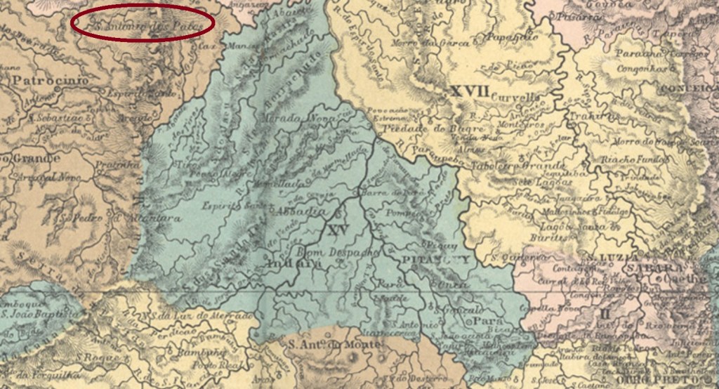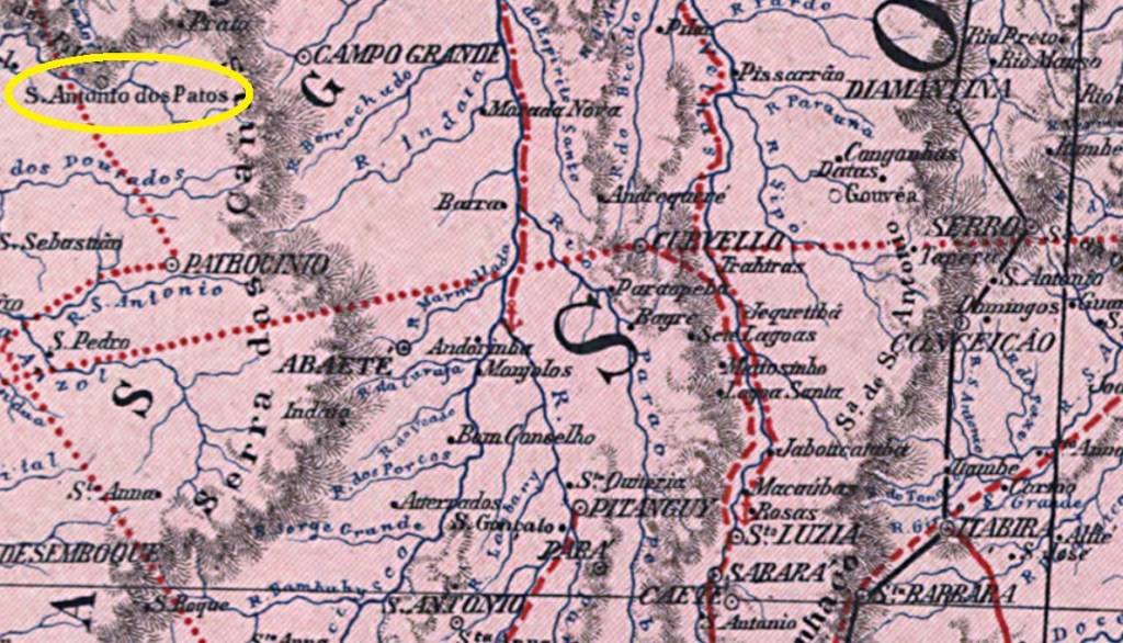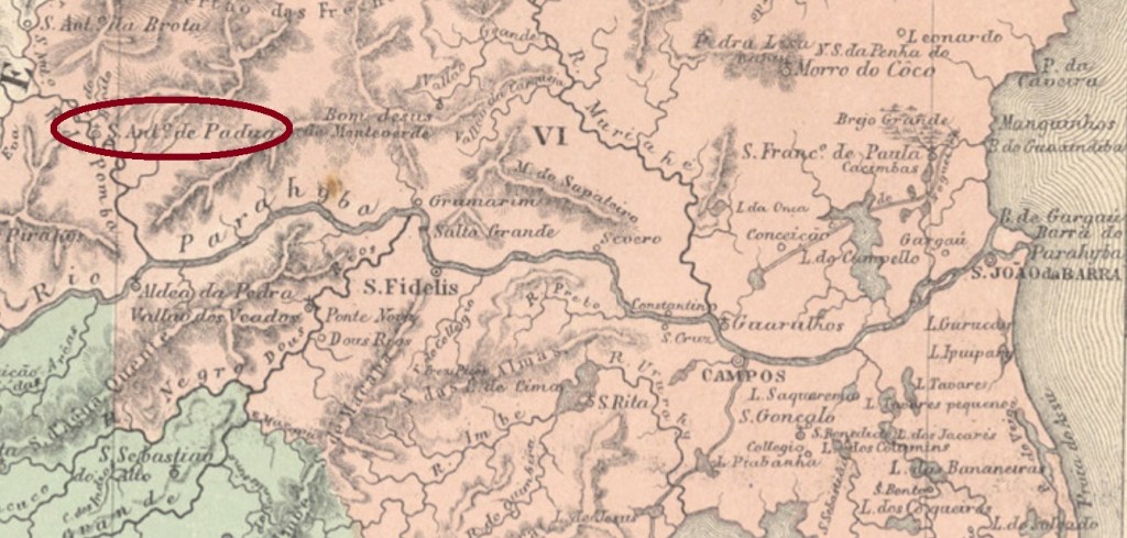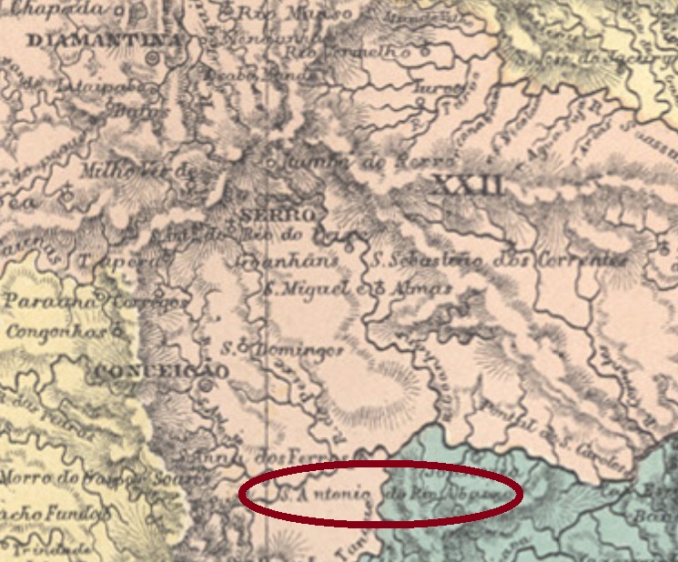
Santo Antonio do Rio Abaixo (= of the Lower Course) was since January 1875 a district in the municipality of Conceição do Serro, situated ca. 200 km north of the province capital Ouro Preto. It has kept the administrative status through the name changes of the municipality (in 1923 to Conceição and in 1943 to the actual Conceição do Mato Dentro) until the political emancipation in December 1962. Now the locals are used to call it S.A.R.A. (Wikipedia). The river here meant is the Santo Antonio, an affluent to the Rio Doce that springs up between the Serra do Espinhaço mountains and flows almost 300 km towards east.
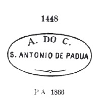
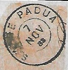
According to Paula Sobrinho (História Postal de Minas Gerais, Belo Horizonte, 1997), the local post office was created in October 1882. One imperial cancel is recorded: SMG-3045a (Coll. José A. Junges) has a double circle with the inscription S. ANTONIO DO RIO ABAIXO above and a diamond ornament below, whose four sides are open. Dates at the centre from 1884 until at least 1890.
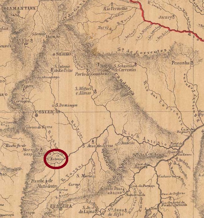
Santo Antonio do Rio Abaixo (= am Unterlauf) war ab Januar 1875 ein Distrikt im Município von Conceição do Serro, der ca. 200 km nördlich der Provinzhauptstadt Ouro Preto entfernt lag. Er erhielt diesen Verwaltungsstatus bis zur politischen Selbständigkeit im Dezember 1962, wenngleich zwischendurch Conceição do Serro zwei neue Namen verpasst bekam: Conceição (1923) und Conceição do Mato Dentro (ab 1943). Heute wird die Stadt Santo Antonio do Rio Abaixo von den Einwohnern S.A.R.A. genannt (Wikipedia). Der Fluss, der hier gemeint ist, heißt ebenfalls Santo Antonio. Er entspringt im Gebirge der Serra do Espinhaço und fließt ostwärts fast 300 km bis zur Mündung in den Rio Doce.
Wie Paula Sobrinho in seiner História Postal de Minas Gerais (Belo Horizonte, 1997) berichtet, gibt es dort ein Postamt seit Oktober 1882. Ein Stempel der Kaiserzeit ist überliefert: SMG-3045a (Samml. José A. Junges) hat einen Doppelkreis mit der Inschrift S. ANTONIO DO RIO ABAIXO oben und einem Rautenornament unten, dessen vier Seiten offen sind. Die Daten in der Mitte gehen von 1884 bis zumindest 1890.