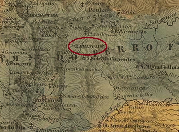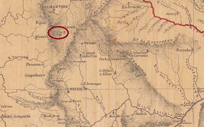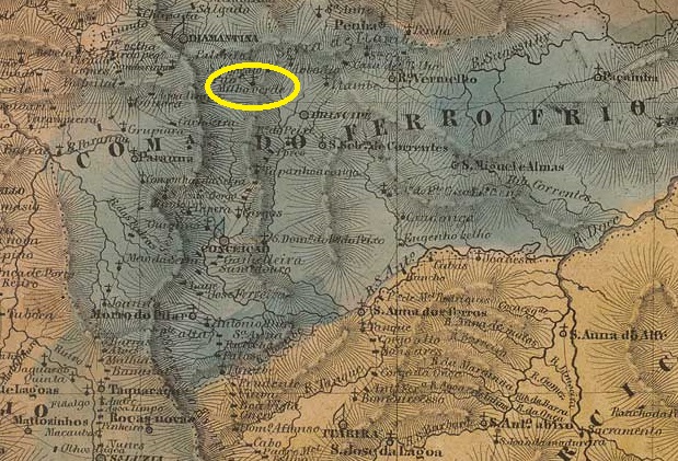
Other names: São Pedro do Fanado
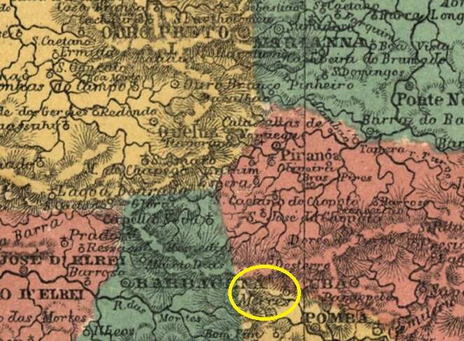
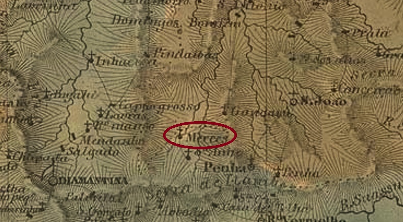
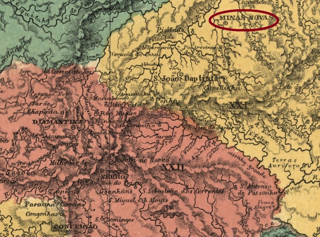
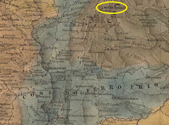
The Arraial de São Pedro do Fanado has been documented since 1727. The settlement was located on the eastern bank of the Fanado River, 550 kilometres north of what would later become the provincial capital, Ouro Preto. In 1728, it became the Freguesia de Nossa Senhora do Bom Successo das Minas do Fanado, which in October 1730 became the Vila de Nossa Senhora do Bom Successo das Minas Novas and finally, in March 1840, the town of Minas Novas.
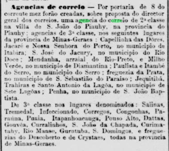
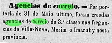
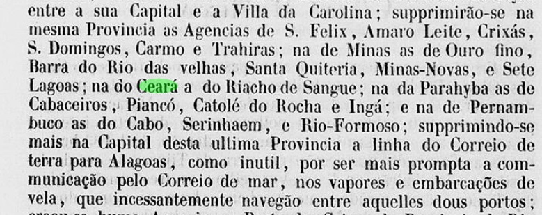
Three periods of operation of the local post office have been identified. The first began in October 1833, as both Paula Sobrinho in ‘História Postal de Minas Gerais’ (Belo Horizonte, 1997) and R. Koester in ‘Carimbologia XXVII’ write. We do not know when the agency was first closed, but Nova Monteiro writes in Administrações e Agencias Postaes do Brasil Imperio (Brasil Filatelico/RJ, 1934–1935; reprinted by SPP 1994–1999) that it reopened in April 1845. According to a report by the Imperial Ministry, this second period ended around 1850.
The date of the third opening is also unknown, but it must have taken place before 1853.
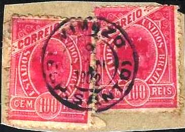
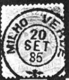
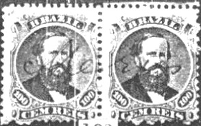
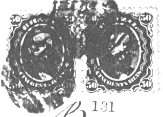
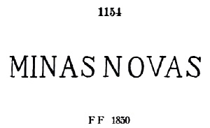
The oldest postmark to date is the pre-philatelic MMG-1610a, which occurs both with and without a margin. It was given the number 1154 by P. Ayres in Catálogo de Carimbos Brasil-Império (S. Paulo, 1937, 1942) and is listed in the RHM catalogue under P-MG-38.
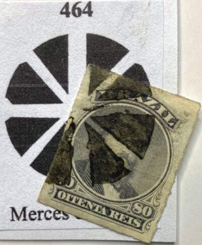
This was followed by the rare MMG-1610b (Fig. José Renato C. de Souza), which has not yet been definitively confirmed:
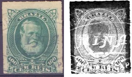
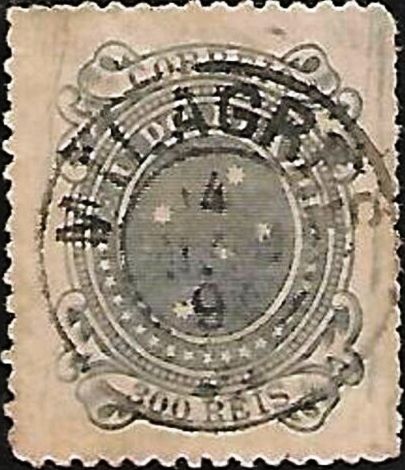
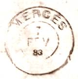
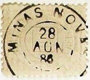
Towards the end of the Empire, the double circle MMG-1610c (Fig. Felipe Piccinini) also appeared:
Andere Namen: São Pedro do Fanado
Der Arraial de São Pedro do Fanado ist seit 1727 überliefert. Die Siedlung lag am Ostufer des Fanado, 550 Kilometer nördlich der späteren Provinzhauptstadt Ouro Preto. Im Jahr 1728 wurde sie zur Freguesia de Nossa Senhora do Bom Successo das Minas do Fanado, die im Oktober 1730 zur Vila de Nossa Senhora do Bom Successo das Minas Novas und im März 1840 schließlich zur Stadt Minas Novas wurde.
Es wurden drei Betriebsperioden des örtlichen Postamts festgestellt. Die erste begann im Oktober 1833, wie sowohl Paula Sobrinho in „História Postal de Minas Gerais” (Belo Horizonte, 1997) als auch R. Koester in „Carimbologia XXVII” schreiben. Wir wissen nicht, wann die Agentur erstmals geschlossen wurde, aber Nova Monteiro schreibt in Administrações e Agencias Postaes do Brasil Imperio (Brasil Filatelico/RJ, 1934–1935; Nachdruck SPP 1994–1999), dass sie im April 1845 wieder öffnete. Diese zweite Periode endete laut Bericht des Imperialministeriums um 1850.

Das Datum der dritten Eröffnung ist ebenfalls noch unbekannt, diese muss jedoch vor 1853 stattgefunden haben.
Der bisher älteste Poststempel ist der vorphilatelistische MMG-1610a , der sowohl mit als auch ohne Rand vorkommt. Er bekam von P. Ayres die Nr. 1154 in Catálogo de Carimbos Brasil-Império (S. Paulo, 1937, 1942) und wird im RHM-Katalog unter P–MG-38 aufgeführt.

Es folgte der seltene MMG-1610b (Abb. José Renato C. de Souza), der noch nicht endgültig bestätigt werden konnte:

Gegen Ende des Kaiserreichs erschein auch der Doppelkreis MMG-1610c (Abb. Felipe Piccinini):