Categories
Carimbologia C-D

Conchas (train station/Bahnhof), São Paulo (CSP-0365)

Cia. Sorocabana e Ytuana, 1898 (IBGE)

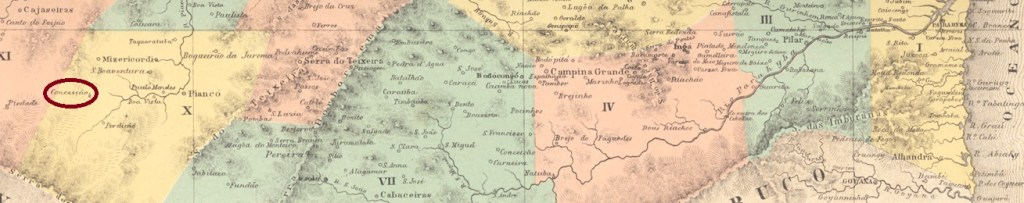
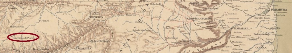
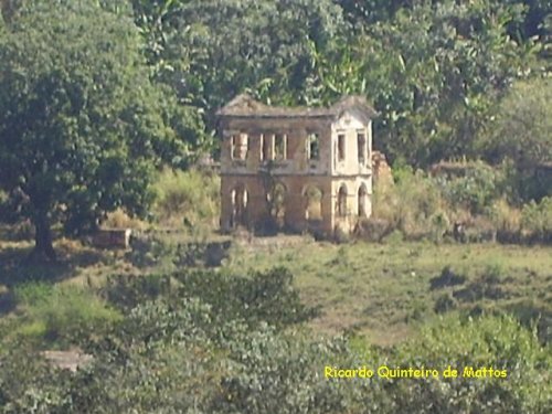
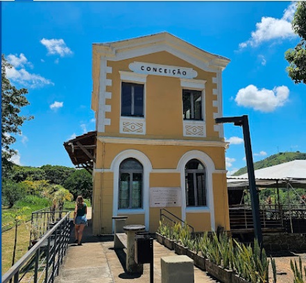
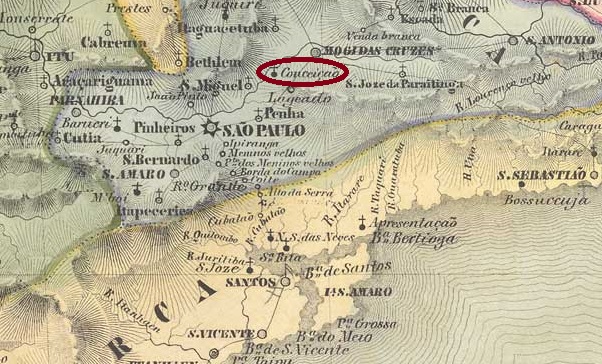
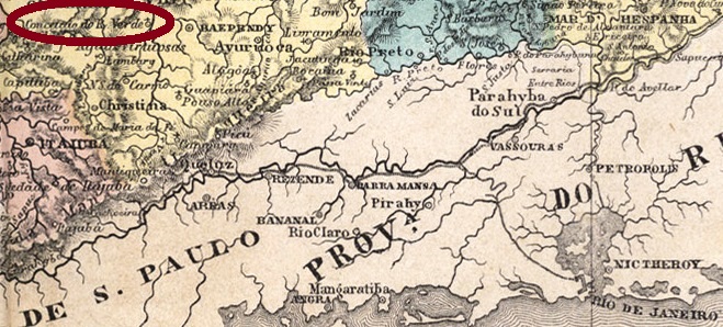
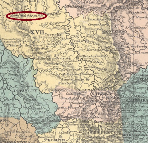
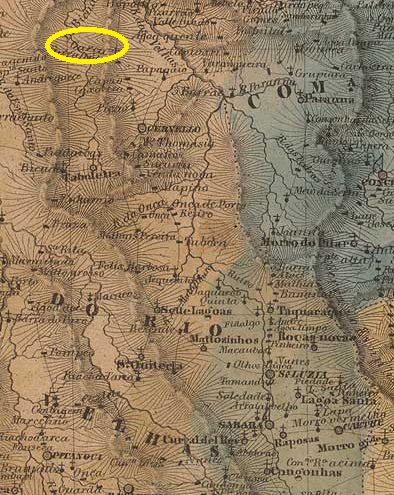
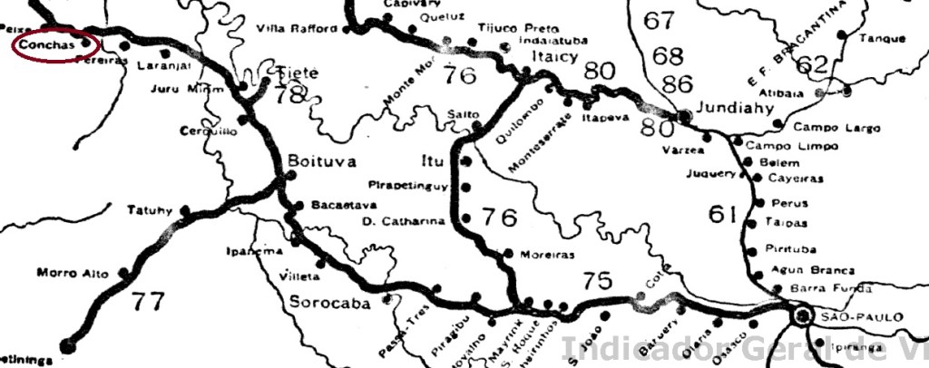
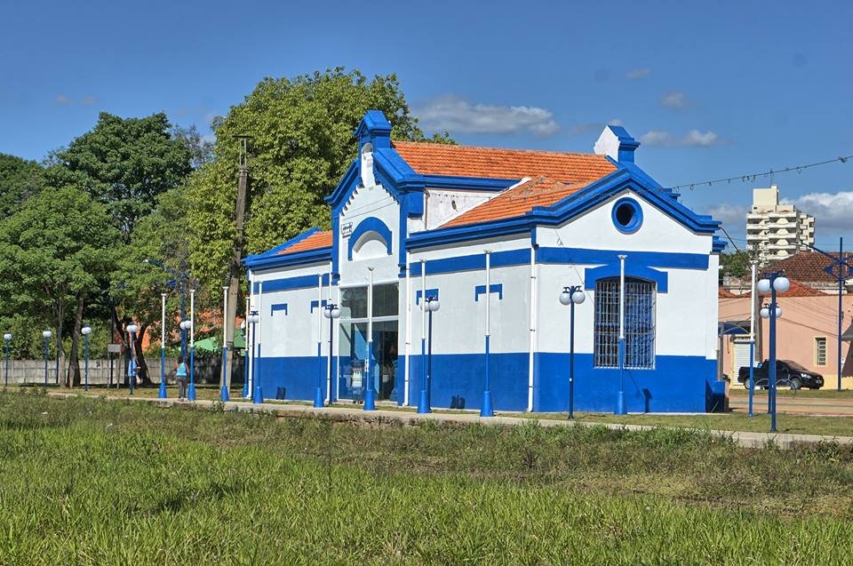
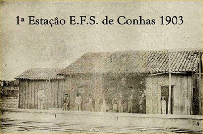
Conchas station was opened in July 1887 by the E.F. Sorocabana railway company (main line) and was located on the west bank of the Ribeirão das Conchas in the Município de Tietê, 180 km west of the provincial capital of São Paulo. The line passed to the Cia. União Sorocabana e Ytuana in 1892, to the Sorocabana Railway in 1907, to the E.F. Sorocabana in 1919 and finally belonged to FEPASA from 1971 until its closure in 1998 (estacoesferroviarias.com.br).

In 1903 (Photo: NN, on estacoesferroviarias.com.br)
In 2016 (Photo: Julio Cesar de Paiva, on estacoesferroviarias.com.br)

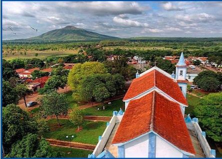
The area around the railway station became a district in December 1896 and twenty years later it became the Município de Conchas.

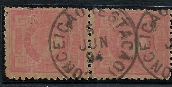
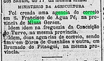
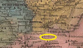
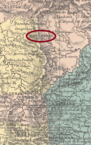
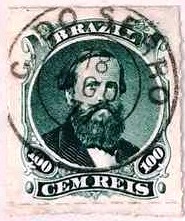
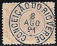
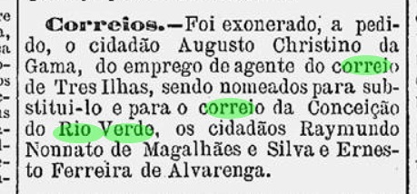
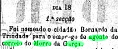
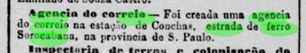
There had been a post office at the station since October 1888, as the Rio press reported:

Jornal do Commercio/RJ, 03/10/1888

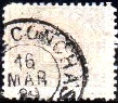
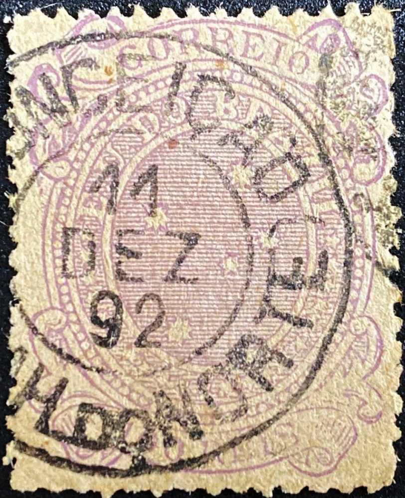
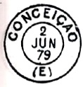
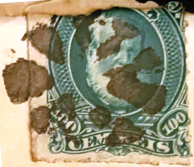
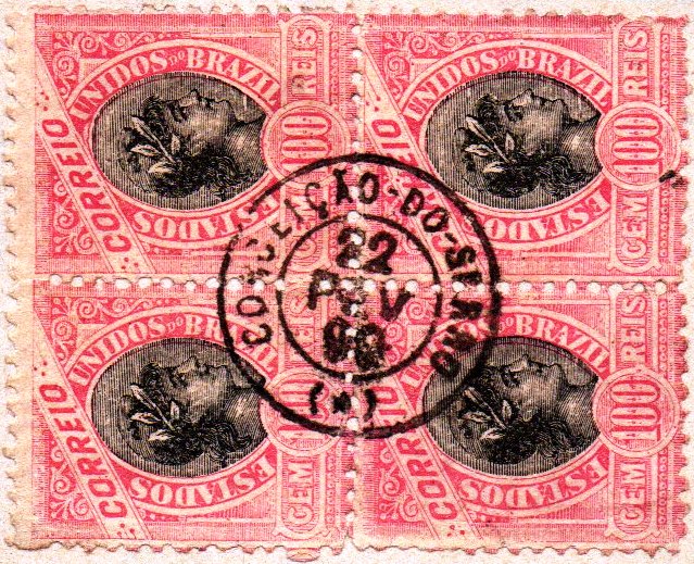
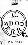
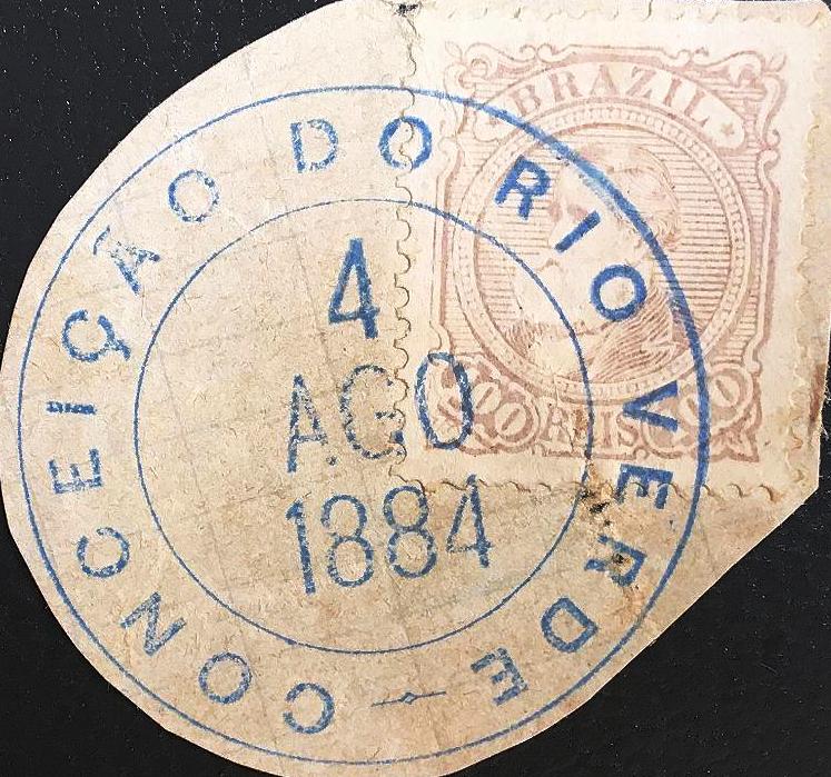
The imperial postmark is CSP-0365a (illus. Mário Celso Orsi Jr.):

CSP-0365a (MO) 1889-1897
Mappa Geral do Brasil, 1911

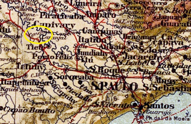
Der Bahnhof Conchas wurde im Juli 1887 von der Eisenbahngesellschaft E.F. Sorocabana (Hauptlinie) eröffnet und lag am Westufer des Ribeirão das Conchas im Município de Tietê, 180 km westlich der Provinzhauptstadt São Paulo. Die Strecke ging 1892 an die Cia. União Sorocabana e Ytuana, 1907 an die Sorocabana Railway, 1919 an die E.F. Sorocabana und gehörte zuletzt von 1971 bis zur Stilllegung 1998 der FEPASA (estacoesferroviarias.com.br). Heute sind die Gleise noch vorhanden, das Bahnhofsgebäude dient als Museum.

1903 (Foto: NN, auf estacoesferroviarias.com.br)
2016 (Foto: Julio Cesar de Paiva, auf estacoesferroviarias.com.br)

Das Gebiet um den Bahnhof wurde im Dezember 1896 zum Distrikt und zwanzig Jahre später zum Município de Conchas.

Seit Oktober 1888 gab es am Bahnhof ein Postamt, wie die Presse von Rio berichtete:

Jornal do Commercio/RJ, 03.10.1888

Der kaiserliche Poststempel ist CSP-0365a (Abb. Mário Celso Orsi Jr.):

CSP-0365a (MO) 1889-1897
Categories
Carimbologia C-D

Conceição, Paraíba (CPB-0110)

Atlas do Imperio do Brasil, 1868

Text update of March 2, 2024

Other names: Conceição da Misericordia, Conceição do Piancó

The settlement called Vila Federal de Conceição was founded in October 1866 and was located on the west bank of the Piancó near the Vila de Misericórdia, 470 kilometres west of the provincial capital Paraíba do Norte (today João Pessoa). It was declared a freguesia in December 1871 and received the status of a vila in October 1881.

As R. Koester writes in Carimbologia XIII, there had been a post office there since March 1888. The oldest postmark from this town so far is CPB-0110a (fig. Luiz C. Fritzen):

CPB-0110a (LCF) 1892
Sociedade Geologica e Mineralógica, 1910

Textaktualisierung am 2. März 2024

Andere Namen: Conceição da Misericordia, Conceição do Piancó

Die Siedlung mit dem Namen Vila Federal de Conceição wurde im Oktober 1866 gegründet und lag am Westufer des Piancó in der Nähe der Vila de Misericórdia, 470 km westlich der Provinzhauptstadt Paraíba do Norte (heute João Pessoa). Es wurde im Dezember 1871 zur Freguesia erklärt und erhielt im Oktober 1881 den Status einer Vila.

Wie R. Koester in Carimbologia XIII schreibt, gab es dort seit März 1888 ein Postamt. Der bisher älteste Poststempel aus diesem Ort ist CPB-0110a (Abb. Luiz C. Fritzen):

CPB-0110a (LCF) 1892
Categories
Carimbologia C-D

Conceição, Goiás (CGO-0045)

Atlas do Imperio do Brasil, 1868

Other names: Conceição do Norte, Conceição do Tocantins (1988)

This Freguesia de N. Sra. da Conceição was founded in June 1835 and was located 660 kilometres north-east of the provincial capital of Goyaz (now Goiás Velho). It was elevated to a vila in October 1854, but lost this status in August 1884 when it was downgraded to the district of Conceição do Norte around the Vila de S. José do Duro. In June 1938, this district was incorporated into the newly founded Município de Dianópolis and only became an independent Município again in August 1963, which has been called Conceição do Tocantins since 1988.

Main church N. Sra. da Conceição (Google Maps)

Two dates have been found for the creation of the local post office. Once in March 1829, as Nova Monteiro writes in Administrações e Agencias Postaes do Brasil Imperio (Brasil Filatelico/RJ, 1934-5; reprint SPP 1994-1999). Then again in 1832, as can be seen from the Directory of Imperial Post Offices (Tabella das Agencias do Correio do Imperio, Rio de Janeiro, 1885). Reinhold Koester writes in Carimbologia XIII that the two dates belong together and that 1832 is the year in which this postal agency went into operation.

No imperial postmark has yet been seen for Conceição/GO.

Teixeira Neto (apud Silva e Souza): Capitania de Goiás, 1809

Andere Namen: Conceição do Norte, Conceição do Tocantins (1988)

Diese Freguesia de N. Sra. da Conceição wurde im Juni 1835 gegründet und lag 660 km nordöstlich der Provinzhauptstadt Goyaz (heute Goiás Velho). Sie wurde im Oktober 1854 zur Vila erhoben, verlor diesen Status jedoch im August 1884, als sie zum Distrikt Conceição do Norte im Gebiet der Vila de S. José do Duro herabgestuft wurde. Im Juni 1938 wurde dieser Distrikt in das neu gegründete Município de Dianópolis eingegliedert und erst im August 1963 wieder zu einem eigenständigen Município erhoben, das seit 1988 Conceição do Tocantins heißt.

Hauptkirche N. Sra. da Conceição (Google Maps)

Für die Gründung des örtlichen Postamtes wurden zwei Daten gefunden. Einmal im März 1829, wie Nova Monteiro in Administrações e Agencias Postaes do Brasil Imperio (Brasil Filatelico/RJ, 1934-5; Nachdruck SPP 1994-1999) schreibt. Dann wieder 1832, wie aus dem Verzeichnis der kaiserlichen Postämter (Tabella das Agencias do Correio do Imperio, Rio de Janeiro, 1885) hervorgeht. Reinhold Koester meint in Carimbologia XIII, dass beide Daten zusammengehören und 1832 das Jahr der Inbetriebnahme dieser Postagentur sei.

Von Conceição/GO wurde bisher kein kaiserlicher Poststempel gesehen.

Categories
Carimbologia C-D

Conceição (train station/Bahnhof), Minas Gerais (CMG-0780)

Estações (…) do Rio de Janeiro, São Paulo e Minas Gerais, 1880

Text update of March 1, 2024

Other names: Simplício

Conceição station was opened in August 1871 by the railway company E.F. D. Pedro II (Porto Novo – Branch) on the north bank of the Paraíba do Sul around Vila de S. José d’Além Paraíba, 320 km south of the provincial capital Ouro Preto. The railway line went to E.F. Central do Brasil in 1890, to E.F. Leopoldina in 1965 and belonged to Rede Ferroviária Federal S.A. from 1975 to 1997 (estacoesferroviarias.com.br). Today, the tracks are still there and the station building serves as a restaurant.

2007, before the restoration of the building (Photo: Ricardo Q. de Matos, on estacoesferroviarias.com.br)
Around 2020 (Photo: Fabio Pereira, Google Maps)

After the turn of the century, the station was named Simplício, after Simplicio José Ferreira da Fonseca, a landowner in the region. The station post office was opened in July 1871, according to Paula Sobrinho (História Postal de Minas Gerais, Belo Horizonte, 1997). The oldest postmark here to date is CMG-0780a, which was already illustrated by Paulo Ayres (Catálogo de Carimbos Brasil-Império, S. Paulo, 1937, 1942):

CMG-0780a (P.A. p. 121) 1879-1880

It was followed by CMG-0780b (ill. Luiz Claudio Fritzen)

CMG-0780b (LCF) 1881-1894

In the meantime, a mute postmark (fig. Alexandre Andrade) from this station post office has also been found:

1880 (AA)
E. F. Central do Brasil, 1890

Textaktualisierung am 1. März 2024

Andere Namen: Simplício

Der Bahnhof Conceição wurde im August 1871 von der Eisenbahngesellschaft E.F. D. Pedro II (Porto Novo – Abzweig) eröffnet und lag am Nordufer des Paraíba do Sul im Gebiet der Vila de S. José d’Além Paraíba, 320 km südlich der Provinzhauptstadt Ouro Preto. Die Bahnlinie ging 1890 an die E.F. Central do Brasil, 1965 an die E.F. Leopoldina und gehörte von 1975 bis 1997 der Rede Ferroviária Federal S.A. (estacoesferroviarias.com.br). Heute sind die Gleise noch vorhanden, das Bahnhofsgebäude dient als Restaurant.

2007, vor der Restaurierung des Gebäudes (Foto: Ricardo Q. de Matos, auf estacoesferroviarias.com.br)
Um 2020 (Foto: Fabio Pereira, Google Maps)

Nach der Jahrhundertwende erhielt der Bahnhof den Namen Simplício, nach Simplicio José Ferreira da Fonseca, einem Großgrundbesitzer der Region. Das Bahnhofspostamt wurde im Juli 1871 eröffnet, wie Paula Sobrinho (História Postal de Minas Gerais, Belo Horizonte, 1997) schreibt. Der bisher älteste Poststempel hier ist CMG-0780a, der bereits von Paulo Ayres (Catálogo de Carimbos Brasil-Império, S. Paulo, 1937, 1942) abgebildet wurde:

CMG-0780a (P.A. S. 121) 1879-1880

Er wurde von CMG-0780b gefolgt ((Abb. Luiz Claudio Fritzen):

CMG-0780b (LCF) 1881-1894

Inzwischen wurde auch ein stummer Stempel (Abb. Alexandre Andrade) von diesem Bahnhofspostamt gefunden:

1880 (AA)
Categories
Carimbologia C-D

Conceição dos Guarulhos, São Paulo (CSP-0360)

Villiers de l’Ile Adam: Carta (…) da Provincia de São Paulo, 1847

Text update of March 8, 2024

Other names: Guarulhos (1906)

The settlement of N. Sra. da Conceição dos Guarulhos was founded in December 1560 on the west bank of the Córrego das Cubas, 20 kilometres north-east of the later provincial capital of São Paulo. In May 1865 it was made a freguesia of the Vila de São Paulo and in March 1880 it became a Vila itself. Since November 1906, the Município has only been called Guarulhos. The Tupi word means paunchy and was supposed to describe the indigenous people…

As the regional press reported, there had been a post office there since June 1880:

A Constituinte, 18/06/1880

The oldest postmark from Conceição de Guarulhos so far is the French type CSP-0360a (collect. Fuad Ferreira Fo.):

CSP-0360a (FF) 1893-1904
Atlas do Imperio do Brasil, 1868

Textaktualisierung am 8. März 2024

Andere Namen: Guarulhos (1906)

Die Siedlung N. Sra. da Conceição dos Guarulhos entstand im Dezember 1560 am Westufer des Córrego das Cubas, 20 km nordöstlich der späteren Provinzhauptstadt São Paulo. Im Mai 1865 wurde sie zur Freguesia der Vila de São Paulo ernannt und im März 1880 selbst zur Vila. Seit November 1906 heißt der Município nur noch Guarulhos. Das indianische Wort bedeutet bauchig und sollte die Ureinwohner beschreiben…

Wie die regionale Presse berichtete, gab es dort seit Juni 1880 ein Postamt:

A Constituinte, 18.06.1880

Der bisher älteste Poststempel aus Conceição de Guarulhos ist der französische Typ CSP-0360a (Samml. Fuad Ferreira Fo.):

CSP-0360a (FF) 1893-1904
Categories
Carimbologia C-D

Conceição do Turvo, Minas Gerais (CMG-0830)

Provincia de Minas Geraes, 1873

Other names: Senador Firmino

The chapel of N. Sra. da Conceição do Turvo, built in 1753, was located on the west bank of the Turvo River, 120 kilometres south-east of the later provincial capital Ouro Preto. In December 1865, the village was declared a freguesia of the Vila de Piranga and has been Município Senador Firmino since December 1938. The name commemorates the jurist Firmino Rodrigues da Silva (1816-1879), who was a judge in Piranga before becoming a senator of the empire.

Senator Firmino (culturaniteroi.com.br)

Two foundation dates have been found for the local post office. The first in February 1829, as Nova Monteiro writes in Administrações e Agencias Postaes do Brasil Imperio (Brasil Filatelico/RJ, 1934-5; reprint SPP 1994-1999). As this date seems very early and is not confirmed anywhere, it could be a printing error. Then again in February 1881, according to several sources and as announced in the Rio press as well:

Gazeta de Noticias/RJ, 21/02/1881

Reinhold Koester describes – unfortunately without illustration – the imperial postmark CMG-0830a as a double circle without ornament.

Villiers de l’Ile Adam: Carta (…) da Provincia de Minas Geraes, 1849

Andere Namen: Senador Firmino

Die 1753 erbaute Kapelle N. Sra. da Conceição do Turvo lag am Westufer des Turvo, 120 km südöstlich der späteren Provinzhauptstadt Ouro Preto. Im Dezember 1865 wurde der Ort zur Freguesia der Vila de Piranga ernannt und ist seit Dezember 1938 Município Senador Firmino. Der Name erinnert an den Juristen Firmino Rodrigues da Silva (1816-1879), der Richter in Piranga war, bevor er Senator des Kaiserreichs wurde.

Senator Firmino (culturaniteroi.com.br)

Für das örtliche Postamt wurden zwei Gründungsdaten gefunden. Das erste im Februar 1829, wie Nova Monteiro in Administrações e Agencias Postaes do Brasil Imperio (Brasil Filatelico/RJ, 1934-5; Nachdruck SPP 1994-1999) schreibt. Da dieses Datum sehr früh erscheint und nirgends bestätigt ist, könnte es sich hier um einen Druckfehler handeln. Dann wieder im Februar 1881, nach mehreren Quellen und auch durch die Presse von Rio angekündigt:

Gazeta de Noticias/RJ, 21.02.1881

Reinhold Koester beschreibt – leider ohne Abbildung – den kaiserlichen Poststempel CMG-0830a als Doppelkreis ohne Ornament.

Categories
Carimbologia C-D

Conceição do Serro, Minas Gerais (CMG-0825)

Atlas do Imperio do Brasil, 1868

Other names: Conceição do Mato Dentro (1724-1840, 1943)

The Freguesia de N. Sra. da Conceição do Mato Dentro, founded in February 1724, belonged to the Vila do Príncipe (later: Serro) and was located on the east bank of the Rio Santo Antonio, 270 kilometres north of the later provincial capital Ouro Preto. In March 1840 it was elevated to Vila de N. Sra. da Conceição and in October 1851 to the town of Conceição do Serro. This was followed by two renamings: in September 1923 to Município de Conceição and in December 1943 to the current Município de Conceição do Mato Dentro.

Three creation dates have been found for the local post office. First in February 1829, as Nova Monteiro writes in Administrações e Agencias Postaes do Brasil Imperio (Brasil Filatelico/RJ, 1934-5; reprint SPP 1994-1999). Then in 1839, as can be seen from the Directory of Imperial Post Offices (Tabella das Agencias do Correio do Imperio, Rio de Janeiro, 1885). And most recently in October 1860, as can be seen from the postal report (Relatorio Postal) for 1887.

The oldest postmark to date is the double circle CMG-0825c (Fig. Rölli Auctions):

CMG-0825c (Rölli) 1877-1889

The French type CMG-0825d (fig. Felipe Piccinini) appeared at the end of the Empire:

CMG-0825d (FP) 1889-1904

Please note: the following cancel comes from Cidade do Serro (see SMG-3100):

Serro (SMG-3100a)
Villiers de l’Ile Adam: Carta (…) da Provincia de Minas Geraes, 1849

Andere Namen: Conceição do Mato Dentro (1724-1840, 1943)

Die im Februar 1724 gegründete Freguesia de N. Sra. da Conceição do Mato Dentro gehörte zur Vila do Príncipe (später: Serro) und lag am Ostufer des Rio Santo Antonio, 270 km nördlich der späteren Provinzhauptstadt Ouro Preto. Im März 1840 wurde es zur Vila de N. Sra. da Conceição und im Oktober 1851 zur Stadt Conceição do Serro erhoben. Es folgten zwei Umbenennungen: im September 1923 in Município de Conceição und im Dezember 1943 in das heutige Município de Conceição do Mato Dentro.

Für das örtliche Postamt wurden drei Gründungsdaten gefunden. Zuerst im Februar 1829, wie Nova Monteiro in Administrações e Agencias Postaes do Brasil Imperio (Brasil Filatelico/RJ, 1934-5; Nachdruck SPP 1994-1999) schreibt. Dann 1839, wie aus dem Verzeichnis der kaiserlichen Postämter (Tabella das Agencias do Correio do Imperio, Rio de Janeiro, 1885) hervorgeht. Und zuletzt im Oktober 1860, wie im Postbericht (Relatorio Postal) für 1887 zu lesen ist.

Der bisher älteste Poststempel ist der Doppelkreis CMG-0825c (Abb. Rölli-Auktionen):

CMG-0825c (Rölli) 1877-1889

Zum Ende des Kaiserreichs erschien auch der französische Typ CMG-0825d (Abb. Felipe Piccinini):

CMG-0825d (FP) 1889-1904

Bitte beachten: dieser Stempel kommt aus der Cidade do Serro (siehe SMG-3100):

Serro (SMG-3100a)
Categories
Carimbologia C-D

Conceição do Rio Verde, Minas Gerais (CMG-0820)

Atlas do Imperio do Brasil, 1868

See also Rio Verde (RMG-2165)

The District of Nossa Senhora da Conceição do Rio Verde was founded in March 1839 in the municipality of Baependy, over 400 km southwest of the ancient provincial capital Ouro Preto. In September 1901 it changed to the municipality of Aguas Virtuosas, and 10 years later it acquired the political autonomy as an own municipality.

According to R. Koester (Carimbologia XIII) and Paula Sobrinho (História Postal de Minas Gerais, Belo Horizonte, 1997), the post office was created in November 1878. The first officer was announced in the regional press one month later:

 A Actualidade, December 10, 1878

The second creation of the post office was decided in February 1882, as can be seen from the postal report (Relatorio Postal) from the end of 1886. As the former post office is not listed in the Imperial Postal Guide (Guia Postal do Imperio, Rio de Janeiro, 1880), it was probably closed by the end of 1879.

The oldest postmark to date is CMG-0820a (image from the Internet), of which only one example in blue colour is known:

CMG-0820a (EB) 1884

It was followed by the better-known CMG-0820b (illustration from the Internet), which also appears in blue and whose centre part shows some variants:

CMG-0820b (EB) 1886-1896
Villiers de l’Ile Adam: Carta (…) da Provincia de Minas Geraes, 1849

Siehe auch Rio Verde (RMG-2165)

Der Distrikt von Nossa Senhora da Conceição do Rio Verde wurde im März 1839 im Município von Baependy gegründet, über 400 km südwestlich der ehemaligen Provinzhauptstadt Ouro Preto entfernt. Im September 1901 wechselte er zum Município von Aguas Virtuosas, und 10 Jahre später erhielt er die Verwaltungsautonomie als eigenständiger Município.

Laut R. Koester (Carimbologia XIII) und Paula Sobrinho (História Postal de Minas Gerais, Belo Horizonte, 1997) entstand das Postamt im November 1878. Der erste Postangestellte wurde in der Regionalpresse im folgenden Monat angekündigt:

A Actualidade, 10. Dezember 1878

Die Eröffnung eines zweiten Postamtes wurde im Februar 1882 beschlossen, wie aus dem Postbericht (Relatorio Postal) von Ende 1886 hervorgeht. Da das frühere Postamt nicht im Kaiserlichen Postführer (Guia Postal do Imperio, Rio de Janeiro, 1880) aufgeführt ist, wurde es wahrscheinlich vor Ende 1879 geschlossen.

Der bisher älteste Poststempel ist CMG-0820a (Abbildung aus dem Internet), von dem nur ein Exemplar in blauer Farbe bekannt ist:

CMG-0820a (EB) 1884

Ihm folgte der bekanntere CMG-0820b (Abb. aus dem Internet), der ebenfalls in Blau erscheint und dessen Mittelteil einige Abweichungen aufweist:

CMG-0820b (EB) 1886-1896
Categories
Carimbologia C-D

Conceição do Muqui, Espirito Santo (CES-0065)

Briguiet: Estado do Espirito Santo, 1923

N. Sra. da Conceição do Muqui was a settlement of the Freguesia de S. Pedro do Itabapoana, which in turn belonged to the Vila de Cachoeiro do Itapemirim. The settlement was located on the west bank of the Muqui do Sul River, 200 kilometres southwest of the provincial capital Vitória, and became a freguesia in July 1887 when S. Pedro do Itabapoana was elevated to a vila. In June 1890 it became a distrito of the Município de Monjardin and since December 1943 has belonged to the Município de Mimoso do Sul.

As R. Koester writes in Carimbologia XIII, there has been a post office there since March 1885. The oldest postmark to date is CES-0065a and was also illustrated by R. Koester (Carimbologia XXVII):

CES-0065a (RK) 1894
Google Maps

N. Sra. da Conceição do Muqui war eine Siedlung der Freguesia de S. Pedro do Itabapoana, die wiederum zur Vila de Cachoeiro do Itapemirim gehörte. Die Siedlung lag am Westufer des Flusses Muqui do Sul, 200 km südwestlich der Provinzhauptstadt Vitória, und wurde im Juli 1887 zur Freguesia, als S. Pedro do Itabapoana zur Vila erhoben wurde. Im Juni 1890 kam es als Distrito zum Município de Monjardin und gehört seit Dezember 1943 zum Município de Mimoso do Sul.

Wie R. Koester in Carimbologia XIII schreibt, gab es dort seit März 1885 ein Postamt. Der bisher älteste Poststempel ist CES-0065a und wurde ebenfalls von R. Koester (Carimbologia XXVII) abgebildet:

CES-0065a (RK) 1894
Categories
Carimbologia C-D

Conceição do Morro da Garça, Minas Gerais (CMG-0815)

Atlas do Imperio do Brasil, 1868

Other names: Imaculada Conceição do Morro da Garça

The chapel N. Sra. das Maravilhas do Morro da Garça was built as early as 1720. It belonged to the Vila de Curvelo and was located 300 kilometres north of the later provincial capital Ouro Preto. In January 1866 it became the Freguesia de Imaculada Conceição do Morro da Garça, and in December 1962 it was declared an autonomous município, now with the shortened place name Morro da Garça. The Morro da Garça (Heron Mountain) is a striking landmark of the city:

Photo: Thiago Lopes (Google Maps)

Two dates were found for the founding of the local post office that are so close to each other that they may belong together. Firstly in November 1883, as both Paula Sobrinho (História Postal de Minas Gerais, Belo Horizonte, 1997) and R. Koester (Carimbologia XIII) write. Then in April 1884, as can be seen from the postal report (Relatorio dos Correios) for 1887. As the agency is not listed in the Directory of Imperial Post Offices (Tabella das Agencias do Correio do Imperio, Rio de Janeiro, 1885), it can be assumed that it was not put into operation until later. In fact, a first postal agent was mentioned in the regional press in August 1885:

Liberal Mineiro, 28/08/1885

No imperial postmark from Conceição do Morro da Garça has yet been found.

Villiers de l’Ile Adam: Carta (…) da Provincia de Minas Gerais, 1849

Andere Namen: Imaculada Conceição do Morro da Garça

Die Kapelle N. Sra. das Maravilhas do Morro da Garça wurde bereits 1720 erbaut. Sie gehörte zur Vila de Curvelo und lag 300 km nördlich der späteren Provinzhauptstadt Ouro Preto. Im Januar 1866 wurde es zur Freguesia de Imaculada Conceição do Morro da Garça, und im Dezember 1962 wurde es zum autonomen Município ernannt, nun unter dem verkürzten Ortsnamen Morro da Garça. Der Morro da Garça (Reiherberg) ist ein markantes Wahrzeichen der Stadt:

Foto: Thiago Lopes (Google Maps)

Für die Gründung des örtlichen Postamtes wurden zwei Daten gefunden, die so nahe beieinander liegen, dass sie möglicherweise zusammengehören. Zuerst im November 1883, wie sowohl Paula Sobrinho (História Postal de Minas Gerais, Belo Horizonte, 1997) als auch R. Koester (Carimbologia XIII) schreiben. Dann im April 1884, wie aus dem Postbericht (Relatorio dos Correios) für 1887 hervorgeht. Da die Agentur nicht im Verzeichnis der kaiserlichen Postämter (Tabella das Agencias do Correio do Imperio, Rio de Janeiro, 1885) aufgeführt ist, kann davon ausgegangen werden, dass sie erst später in Betrieb genommen wurde. Tatsächlich wurde ein erster Postagent im August 1885 in der regionalen Presse erwähnt:

Liberal Mineiro, 28.08.1885

Bisher wurde kein kaiserlicher Poststempel aus Conceição do Morro da Garça gefunden.