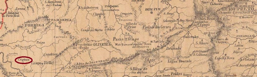
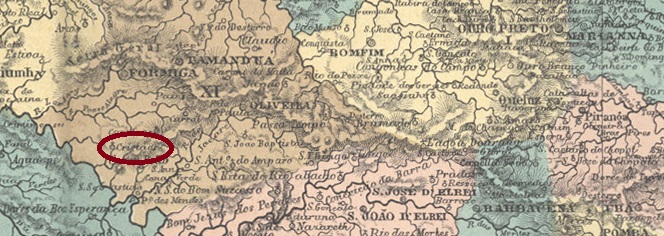
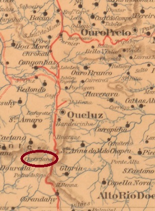
The Freguesia de N. Sra. da Ajuda de Crystáes was founded in January 1880 and belonged to the Vila de Itapecirica on the east bank of the Rio Grande, 300 kilometres west of the provincial capital Ouro Preto. In October of the following year, it was transferred to the Vila de Campo Belo and since December 1948 it has been the Município de Cristais, as it is written today.
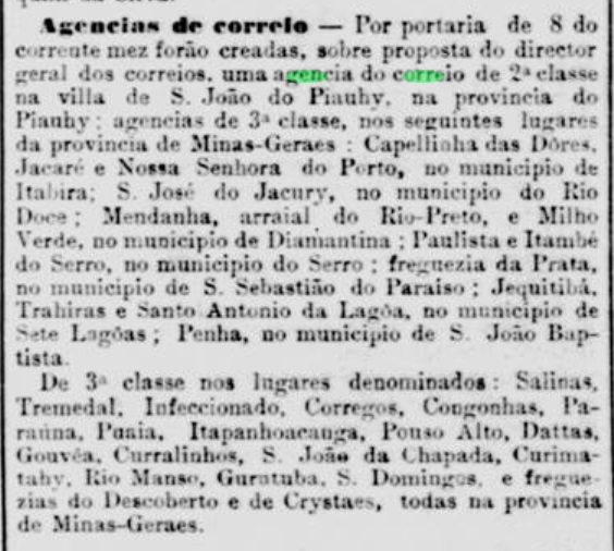
Paula Sobrinho writes in História Postal de Minas Gerais (Belo Horizonte, 1997) that there has been a post office there since November 1881. This is confirmed by the press from Rio:
Jornal do Commercio/RJ, 12/11/1881
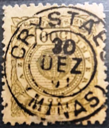
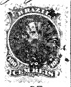
The only postmark of Crystaes in the 19th century so far is CMG-0915a (fig. José Renato C. de Souza):
CMG-0915a (JR) 1891-1894ffAtlas do Imperio do Brasil, 1868
Textaktualisierung am 14. Januar 2024
Die Freguesia de N. Sra. da Ajuda de Crystáes wurde im Januar 1880 gegründet und gehörte zur Vila de Itapecirica am Ostufer des Rio Grande, 300 km westlich der Provinzhauptstadt Ouro Preto. Im Oktober des darauffolgenden Jahres wechselte es zur Vila de Campo Belo und seit Dezember 1948 ist es das Município de Cristais, wie es heute geschrieben wird.
Paula Sobrinho schreibt in História Postal de Minas Gerais (Belo Horizonte, 1997), dass es dort seit November 1881 ein Postamt gab. Dies wird durch die Presse aus Rio bestätigt:
Jornal do Commercio/RJ, 12.11.1881
Der bisher einziger Poststempel von Crystaes im 19. Jahrhundert ist CMG-0915a (Abb. José Renato C. de Souza):
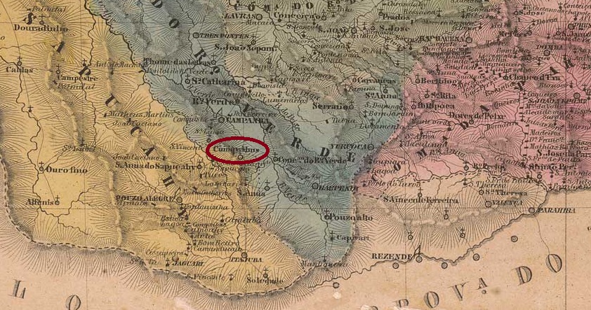
Villiers de l’Ile Adam: Carta (…) da Provincia de Minas Geraes, 1849
Updated on January 21, 2024
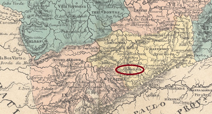
This village was the Curato do Espirito Santo de Cumquibus (sic) from 1824 and belonged to the Freguesia de Carmo do Rio Verde, which in turn belonged to the Vila de Baependy, and was located on the east bank of the Lambari, 370 kilometres southwest of the provincial capital Ouro Preto. In April 1841, it became a freguesia, which was incorporated into the Vila de Boa Vista de Itajubá in September 1848. In June 1850 it was elevated to Villa Christina, in honour of Empress Teresa Cristina, and since July 1872 Cristina (as it is spelled today) has been a town.
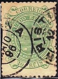
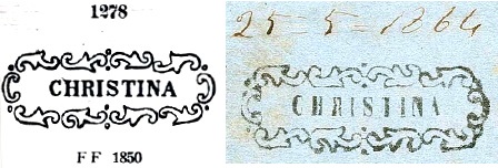
There has been a post office since August 1856, as several sources agree. The first postmark is CMG-0745a, which was used until 1870 and also exists in red. Since the illustration in P. Ayres’ Catálogo de Carimbos Brasil-Império (P.A. 1278, S. Paulo, 1937, 1942) does not exactly reproduce the shape of the letters, here is an additional illustration from the Corinphila auction catalogue:
CMG-0745a (P.A. 1278/recte CO) 1860-1873
Sometime around 1868 a mute cancel was also used (fig. R. Koester, in Carimbologia XI):
1868 (RK)
It was not until the 1880s that the double circle CMG-0745b (illustration from the Internet) has arrived:
CMG-0745b (EB) 1885-1896Atlas do Imperio do Brasil, 1868
Textaktualisierung am 21. Januar 2024
Der Ort war ab 1824 Curato do Espirito Santo de Cumquibus (sic) und gehörte zur Freguesia de Carmo do Rio Verde, die wiederum zur Vila de Baependy gehörte, und lag am Ostufer des Lambari, 370 km südwestlich der Provinzhauptstadt Ouro Preto. Im April 1841 wurde es zu einer Freguesia, die im September 1848 in die Vila de Boa Vista de Itajubá eingegliedert wurde. Im Juni 1850 erfolgte die Erhebung zur Villa Christina, zu Ehren der Kaiserin Teresa Cristina, und seit Juli 1872 ist Cristina (wie es heute geschrieben wird) eine Stadt.
Seit August 1856 gibt es ein Postamt, wie mehrere Quellen übereinstimmend berichten. Der erste Poststempel ist CMG-0745a, der bis 1870 verwendet wurde und auch in Rot existiert. Da die Abbildung in P. Ayres‘ Catálogo de Carimbos Brasil-Império (P.A. 1278, S. Paulo, 1937, 1942) die Form der Buchstaben nicht genau wiedergibt, hier zusätzlich eine Abbildung aus dem Auktionskatalog Corinphila:
CMG-0745a (P.A. 1278/recte CO) 1860-1870
Irgendwann um 1868
Irgendwann um 1868 wurde auch ein stummer Stempel verwendet (Abb. R. Koester, in Carimbologia XII):
1868 (RK)
Erst in den 80er Jahren wurde der Doppelkreis CMG-0745b (Abb. aus dem Internet) hinzugefügt:
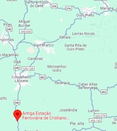
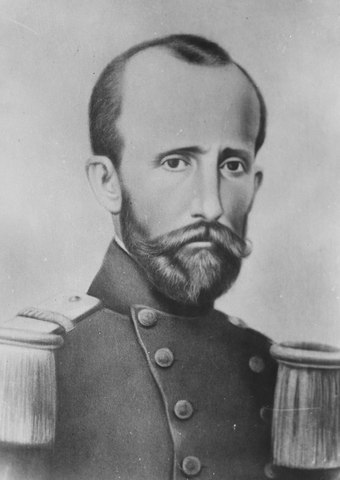
Christiano Ottoni station was opened in December 1883 by the railway company E.F. D. Pedro II (Central Line) and was located on the west bank of the Paraopeba near the Vila de Queluz, 70 km south-west of the provincial capital Ouro Preto. The name commemorates Christiano Benedito Ottoni (1811-1896), a military engineer who headed the E.F. D. Pedro II. He was also a professor of mathematics and a senator in the Empire and the early Republic. The current Christiano Ottoni Foundation supports the School of Engineering at the University of Minas Gerais in Belo Horizonte.
Christiano B. Ottoni (Fundo Agência Nacional)
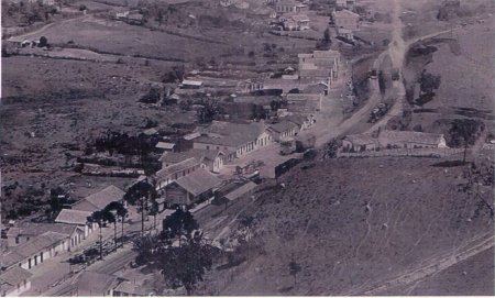
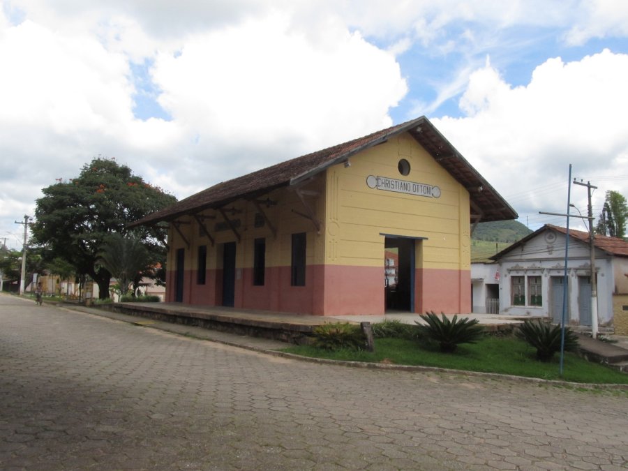
The railway line was transferred to the E.F. Central do Brasil in 1894 and remained there until it was closed in 1972. Today, the tracks have disappeared, and the station building is a listed building as a museum of the municipal cultural office.
Around 1950 (Photo: Roberto Nomiya on estacoesferroviarias.com.br)April 2021 (Photo: Julio Alves on estacoesferroviarias.com.br)
The area around the railway station became a district of the municipality of Queluz in September 1891 and the Município Cristiano Otoni, as it is written today, in December 1962.
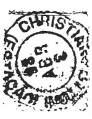
All sources agree that there has been a post office since June 1884. The only imperial postmark to date is CMG-0740a and has already been shown by R. Koester in Carimbologia XI:
CMG-0740a (RK) 1886Google Maps
Der Bahnhof Christiano Ottoni wurde im Dezember 1883 von der Eisenbahngesellschaft E.F. D. Pedro II (Hauptlinie) eröffnet und lag am Westufer des Paraopeba im Gebiet von Vila de Queluz, 70 km südwestlich der Provinzhauptstadt Ouro Preto. Der Name erinnert an Christiano Benedito Ottoni (1811-1896), der als Militäringenieur die E.F. D. Pedro II. leitete. Er war auch Mathematikprofessor und Senator im Kaiserreich und in der frühen Republik. Die heutige Christiano-Ottoni-Stiftung unterstützt die Ingenieurschule der Universität von Minas Gerais in Belo Horizonte.
Christiano B. Ottoni (Fundo Agência Nacional)
Die Bahnlinie ging 1894 an die E.F. Central do Brasil über und blieb dort bis zur Stilllegung 1972. Heute sind die Gleise verschwunden, das Bahnhofsgebäude steht unter Denkmalschutz als Museum des städtischen Kulturamtes.
Um 1950 (Foto: Roberto Nomiya auf estacoesferroviarias.com.br)Im April 2021 (Foto: Julio Alves auf estacoesferroviarias.com.br)
Das Gebiet um den Bahnhof wurde im September 1891 zur Distrikt der Gemeinde Queluz und im Dezember 1962 zum Município Cristiano Otoni, wie es heute geschrieben wird.
Alle Quellen stimmen darin überein, dass es seit Juni 1884 ein Postamt gab. Der bisher einzige kaiserliche Poststempel ist CMG-0740a und wurde bereits von R. Koester in Carimbologia XI gezeigt:
Carta da Republica dos Estados Unidos do Brazil, 1892
Text update of January 7, 2024
Other names: Santiago Dantas, Chopinzinho (1951)
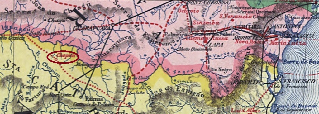
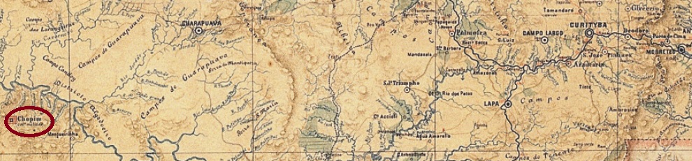
Similarly to Chapecó (see CPR-0045), Chopim was also founded in November 1859 as a military colony in the province of Paraná, allegedly to counteract the territorial desires of neighbouring Argentina. Like Chapecó, this colony was not founded until December 1882. It was located 400 kilometres west of the provincial capital of Curitiba. In April 1909, it became a district of the Município Palmas. It then changed its location twice: in December 1943 to Iguaçu and in May 1944 to Mangueirinha. In November 1951, Chopim was renamed Chopinzinho and in this diminutive form was elevated to an independent município in December 1954.
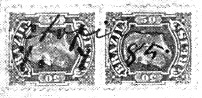
As R. Koester writes in Carimbologia XI, there had been a post office there since September 1883; Koester also shows a handwritten cancellation from 1885:
1885 (RK)
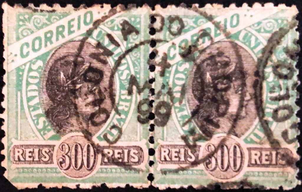
The regular postmark CPR-0050a (image by Felipe Piccinini) came shortly later:
CPR-0050a (FP) 1886-1899Estado do Paraná, 1896
Textaktualisierung am 7. Januar 2024
Andere Namen: Santiago Dantas, Chopinzinho (1951)
Ähnlich wie Chapecó (siehe CPR-0045) wurde auch Chopim im November 1859 als Militärkolonie in der Provinz Paraná gegründet, angeblich um den territorialen Begehrlichkeiten des Nachbarlandes Argentinien entgegenzuwirken. Wie Chapecó wurde auch diese Kolonie erst im Dezember 1882 installiert. Sie lag 400 km westlich der Provinzhauptstadt Curitiba. Im April 1909 wurde sie ein Distrikt des Município Palmas. Danach wechselte sie zweimal ihren Standort: im Dezember 1943 nach Iguaçu und im Mai 1944 nach Mangueirinha. Im November 1951 wurde Chopim in Chopinzinho umbenannt und in dieser verkleinerten Form im Dezember 1954 zum eigenständigen Município erhoben.
Wie R. Koester in Carimbologia XI schreibt, gab es dort seit September 1883 ein Postamt, davon Koester auch eine handschriftliche Entwertung von 1885 zeigt:
1885 (RK)
Der richtige Poststempel CPR-0050a (Abb. Felipe Piccinini) kam erst etwas später:
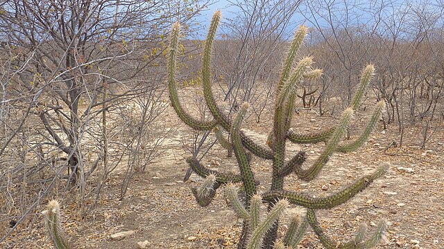
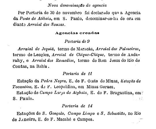
The name Chique-Chique, strange even to Brazilian ears, is said to come from a species of cactus (Pilosocereus polygonus) that is common in the region:
Pilosocereus polygonus (Photo: Diogo Sergio, CC BY-SA 3.0)
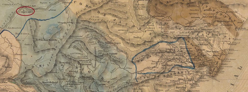
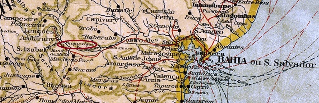
The Freguesia de Senhor do Bomfim e Bom Jesus do Chique-Chique was founded in 1714, belonged to the Vila de Sento Sé and was located on the south bank of the São Francisco, 590 kilometres west of the later provincial capital Salvador da Bahia. In July 1832 it became a Vila and in June 1928 a town, which has been spelt Xique-xique since December 1943.
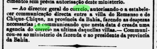
As Nova Monteiro writes in Administrações e Agencias Postaes do Brasil Imperio (Brasil Filatelico/RJ, 1934-5; reprint SPP 1994-1999), there had been a post office there since June 1859. This is confirmed by the press in Rio:
Jornal do Commercio/RJ, 08/07/1859
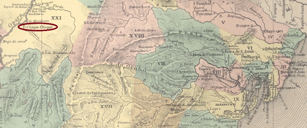
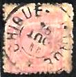
The only postmark from the 19th century so far is CBA-0275b (illustration from the Internet), which was seen with a date from the Republic:
CBA-0275b (EB) 1894Villiers de l’Ile Adam: Carta (…) da Provincia da Bahia, 1848
Der selbst für brasilianische Ohren merkwürdige Name Chique-Chique soll von einer in der Region häufig vorkommenden Kakteenart (Pilosocereus polygonus) stammen:
Pilosocereus polygonus (Foto: Diogo Sergio, CC BY-SA 3.0)
Die Freguesia de Senhor do Bomfim e Bom Jesus do Chique-Chique wurde 1714 gegründet, gehörte zur Vila de Sento Sé und lag am Südufer des São Francisco, 590 km westlich der späteren Provinzhauptstadt Salvador da Bahia. Im Juli 1832 wurde es zur Vila und im Juni 1928 zur Stadt erhoben, die seit Dezember 1943 Xique-xique geschrieben wird.
Wie Nova Monteiro in Administrações e Agencias Postaes do Brasil Imperio (Brasil Filatelico/RJ, 1934-5; Nachdruck SPP 1994-1999) schreibt, gab es dort seit Juni 1859 ein Postamt. Dies wird von der Presse in Rio bestätigt:
Jornal do Commercio/RJ, 08.07.1859
Der bisher einzige Poststempel aus dem 19. Jahrhundert ist CBA-0275b (Abb. aus dem Internet), der mit einem Datum aus der Republik gesehen wurde:
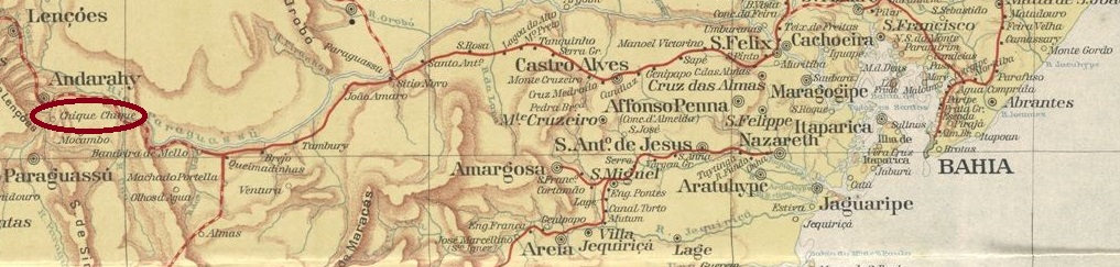
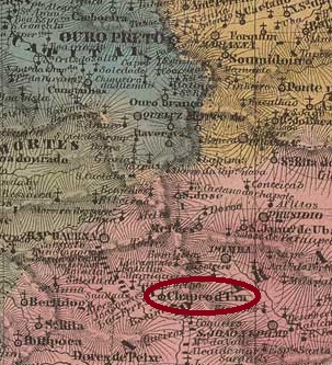
A forgotten village in the middle of the Chapada Diamantina, 440 kilometres west of the then provincial capital Salvador da Bahia. It was an arraial of the Vila de Sta. Izabel do Paraguaçu, which became a freguesia of the then newly founded Vila de Andarahy in May 1884. In the 20th century, it was renamed Igatu, presumably to avoid confusion with the larger Vila de Chique-Chique on the Rio S. Francisco.
Diamonds were found there in the late 18th century, the town grew rapidly and is said to have had around 9,000 inhabitants. In 2011, there were still 382, living mainly from tourism. Igatu means “good river” – although no water can be seen on the map – and is considered the “Macchu-Picchu” of the state of Bahia.
The local post office was created in November 1889, one week before the end of the Brazilian Empire, as can be seen from the postal report (Boletim Postal) of the following month:
Boletim Postal No. 8, December 1889
To date, no imperial postmark of this Chique-Chique has been found. It would be a miracle if one did exist.
Estado da Bahia, 1913
Andere Namen: Xique-Xique de Igatu, Igatu
Ein vergessenes Dorf inmitten der Chapada Diamantina, 440 km westlich der damaligen Provinzhauptstadt Salvador da Bahia. Es war ein Arraial der Vila de Sta. Izabel do Paraguaçu, das im Mai 1884 als Freguesia zur damals neu gegründeten Vila de Andarahy kam. Im 20. Jahrhundert erfolgte die Umbenennung in Igatu, vermutlich um Verwechslungen mit der größeren Vila de Chique-Chique am Rio S. Francisco zu vermeiden.
Im späten 18. Jahrhundert wurden dort Diamanten gefunden, der Ort wuchs schnell und soll etwa 9.000 Einwohner gehabt haben. Im Jahr 2011 waren es noch 382, die hauptsächlich vom Tourismus lebten. Igatu bedeutet “Guter Fluss” – obwohl auf der Karte kein Wasser zu sehen ist – und gilt als “Macchu-Picchu” des Bundesstaates Bahia.
Das örtliche Postamt wurde im November 1889 ins Leben gerufen, eine Woche vor dem Ende des brasilianischen Kaiserreichs, wie aus dem Postbericht (Boletim Postal) des folgenden Monats hervorgeht:
Boletim Postal Nr. 8, Dezember 1889
Bis heute wurde kein kaiserlicher Poststempel von diesem Chique-Chique gefunden. Es wäre ein Wunder, wenn es einen gäbe.
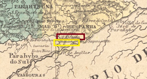
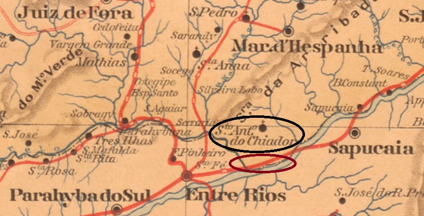
The Arraial de Sto. Antonio do Chiador was established around 1841 near the north bank of the Paraíba do Sul, about 300 kilometres south of the provincial capital Ouro Preto. It became a freguesia of the Vila de Mar d’Hespanha in January 1880, a district in December 1938 and an independent município in December 1953.
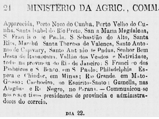
As Nova Monteiro writes in Administrações e Agencias Postaes do Brasil Imperio (Brasil Filatelico/RJ, 1934-5; Reprint SPP 1994-1999), there was already a post office there in July 1859, but it was closed again in June 1861, as reported by the Ministry of Agriculture (Ministerio da Agricultura):
Expediente do Ministerio da Agricultura, 21/06/1861
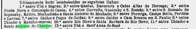
Apparently the agency then remained closed until May 1880, when it was reopened as Sto. Antonio do Chiador, as Paula Sobrinho reports in História Postal de Minas Gerais (Belo Horizonte, 1997). A postal route between Chiador and Chiador station (see below) was also in operation from 1880, and postmarks with Santo Antonio do Chiador have so far been found with dates from 1885 onwards (see SMG-3020).
A Actualidade, 02.10.1880
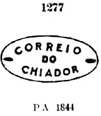
The postmark CMG-0735a could date from the first period of operation in Chiador. It was assigned no. 1277 by Paulo Ayres in the Catálogo de Carimbos Brasil-Império (S. Paulo, 1937, 1942) and is said to have been used on Inclinados stamps of 1844:
CMG-0735a (P.A. 1277) 1859-1885ff
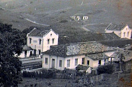
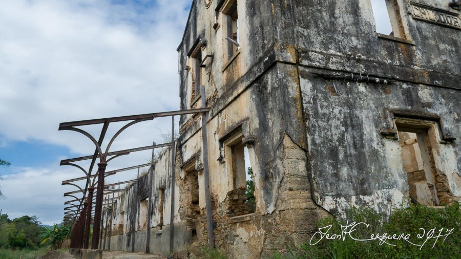
In June or July 1869, 5 km further south, practically directly on the banks of the Paraíba, a railway station of the E.F.D. Pedro II railway company (Porto Novo Branch) was inaugurated. The railway line passed to E.F. Central do Brasil in 1890, to E.F. Leopoldina in 1965 and belonged to Rede Ferroviaria Federal S.A. (estacoesferroviarias.com.br) from 1975 until its closure in 1997. Today the tracks are still there, the station building is an abandoned ruin:
In 1948 (Photo: Edson de Lima Lucas on estacoesferroviarias.com.br)In 2017 (Photo: Jean Cerqueira on estacoesferroviarias.com.br)
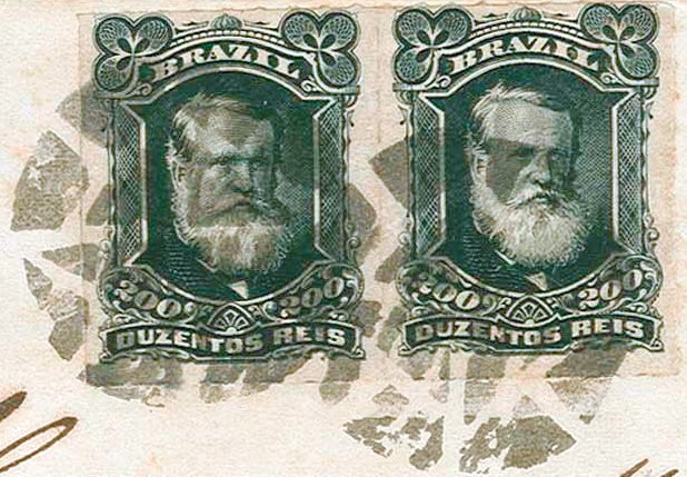
As Paulo Novaes writes on agenciaspostais.com.br, a post office was opened at the railway station in July 1869. It was managed by the Rio General Direction until December 1908, when it was transferred to the Minas Gerais Postal Bureau. It is not certain whether CMG-0735b (fig. Corinphila auctions) is the first postmark of this railway station post office. However, since it has already been seen with dates from 1877 – also in blue (when apparently no post office was in operation in the Freguesia de Chiador), it is very likely that it is a railway station postmark.
CMG-0735b (CO) 1877-1888
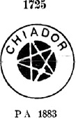
The same applies to its successors CMG-0735c (In Paulo Ayres with no. 1275) and CMG-0735d (fig. R. Koester, in Carimbologia XI).
CMG-0735c (P.A. 1725) 1883ffCMG-0735d (RK)
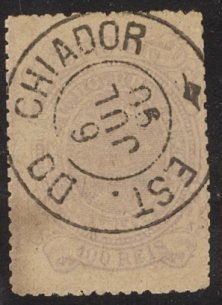
The cancel CMG-0736a (Coll. Marcio Protzner) is certainly from the Chiador station post office:
CMG-0736a (MP) 1888-1896
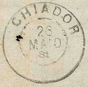
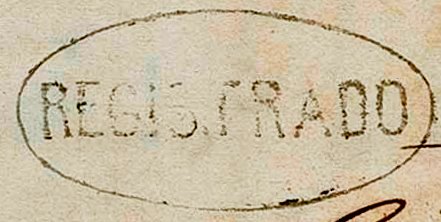
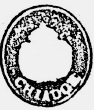
The mute postmark and the registered postmark from 1881 probably also belong to the Chiador railway station post office (illus. Corinphila auctions):
1881 (CO)1881 (CO)Estado de Minas Geraes, 1910
Siehe auch Sto. Antonio do Chiador (SMG-3020)
Die Arraial de Sto. Antonio do Chiador entstand um 1841 nahe dem Nordufer des Paraíba do Sul, etwa 300 km südlich der Provinzhauptstadt Ouro Preto. Es wurde im Januar 1880 eine Freguesia der Vila de Mar d’Hespanha, im Dezember 1938 ein Distrikt und im Dezember 1953 ein eigenständiges Município.
Wie Nova Monteiro in Administrações e Agencias Postaes do Brasil Imperio (Brasil Filatelico/RJ, 1934-5; Reprint SPP 1994-1999) schreibt, gab es dort bereits im Juli 1859 ein Postamt, das aber im Juni 1861 wieder geschlossen wurde, wie das Landwirtschaftsministerium (Ministerio da Agricultura) berichtete:
Expediente do Ministerio da Agricultura, 21.06.1861
Anscheinend blieb die Agentur dann bis Mai 1880 geschlossen, als sie als Sto. Antonio do Chiador wiedereröffnet wurde, wie Paula Sobrinho in História Postal de Minas Gerais (Belo Horizonte, 1997) berichtet. Ab 1880 war auch eine Postroute zwischen Chiador und dem Bahnhof Chiador (s.u.) in Betrieb, und Poststempel mit Santo Antonio do Chiador wurden bisher mit Daten ab 1885 gefunden (s. SMG-3020).
A Actualidade, 02.10.1880
Aus der ersten Betriebsperiode in Chiador könnte der Poststempel CMG-0735a stammen. Er wurde von Paulo Ayres mit der Nr. 1277 im Catálogo de Carimbos Brasil-Império (S. Paulo, 1937, 1942) versehen und soll auf Inclinados-Marken von 1844 verwendet worden sein:
CMG-0735a (P.A. 1277) 1859-1885ff
Im Juni oder Juli 1869 wurde 5 km weiter südlich, praktisch direkt am Ufer des Paraíba, ein Bahnhof der Eisenbahngesellschaft E.F.D. Pedro II (Abzweigung Porto Novo) eingeweiht. Die Bahnlinie ging 1890 an die E.F. Central do Brasil, 1965 an die E.F. Leopoldina und gehörte von 1975 bis zu ihrer Schließung 1997 der Rede Ferroviaria Federal S.A. (estacoesferroviarias.com.br). Heute sind die Gleise noch vorhanden, das Bahnhofsgebäude ist eine verlassene Ruine:
1948 (Foto: Edson de Lima Lucas auf estacoesferroviarias.com.br)2017 (Foto: Jean Cerqueira auf estacoesferroviarias.com.br)
Wie Paulo Novaes auf agenciaspostais.com.br schreibt, wurde im Juli 1869 am Bahnhof ein Postamt eröffnet. Dieses wurde bis Dezember 1908 von der Postdirektion von Rio verwaltet und dann an die Postdirektion von Minas Gerais übergeben. Es ist nicht sicher, ob CMG-0735b (Abb. Corinphila-Auktionen) der erste Stempel dieses Bahnhofspostamtes ist. Da er aber bereits mit Daten von 1877 – und auch in Blau – gesehen wurde (als in der Freguesia de Chiador anscheinend kein Postamt in Betrieb war), ist es sehr wahrscheinlich, dass es sich um einen Bahnhofsstempel handelt.
CMG-0735b (CO) 1877-1888
Dasselbe gilt für seine Nachfolger CMG-0735c (In Paulo Ayres mit Nr. 1275) und CMG-0735d (Abb. R. Koester, in Carimbologia XI).
CMG-0735c (P.A. 1725) 1883ffCMG-0735d (RK)
Mit Sicherheit vom Bahnhofspostamt Chiador stammt der Stempel CMG-0736a (Abb. Márcio Protzner):
CMG-0736a (MP) 1888-1896
Ebenfalls zum Bahnhofspostamt Chiador gehören wohl der stumme Stempel und der Einschreibestempel von 1881 (Abb. Corinphila-Auktionen):
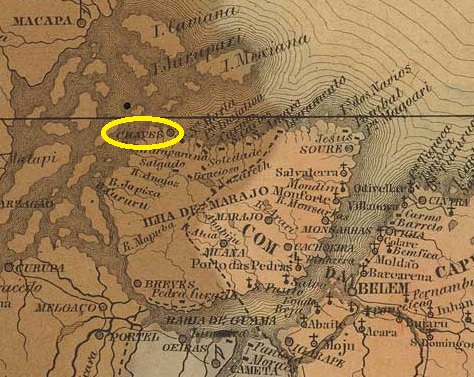
Villiers de l’Ile Adam: Carta (…) das Provincias dp Grão-Pará e Alto Amazonas, 1850
Other names: Equador, Sto. Antonio de Aruãs
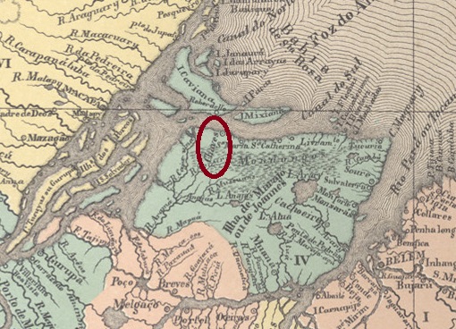
According to tradition, this place was also named after a Portuguese community. Although Santo Antonio de Chaves is in the province of Pará just 220 km north-west of the provincial capital Belém, the journey there today still takes 2 days and 10 hours for 500 km. Chaves was already a Vila in July 1755, which was renamed Equador in August 1834. This name was probably not well received, as the old name returned just ten years later. In January 1891, the locality was elevated to town status. In June 1932, titwas renamed Sto. Antonio de Aruãs, which was also not well received. The name Chaves returned definitively in October 1938.
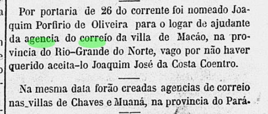
As the Rio press reported, there had been a post office in the town since April 1865:
Correio Mercantil/RJ, 28/04/1865
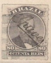
The first postmark has not yet been seen and will probably have been broken soon, as the stamps were cancelled by hand there from around 1876 (illustration from the Internet):
1876ff (EB)
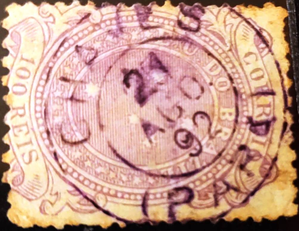
The oldest cancel is the double circle CPA-0075b (illustration from the Internet), which was found with a date of 1892:
CPA-0075b (EB) 1892
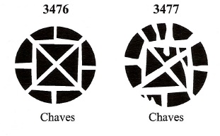
James Dingler and Klerman W. Lopes have recorded two mute cancels from Chaves in Mute Cancellations of the Brazil Empire / Carimbos Mudos do Brasil Império (Brazil Philatelic Association, Rio de Janeiro, 2000):
BPA 3476 (1876ff) – 3477Atlas do Imperio do Brasil, 1868
Andere Namen: Equador, Sto. Antonio de Aruãs
Der Überlieferung nach wurde auch dieser Ort nach einer portugiesischen Gemeinde benannt. Obwohl Santo Antonio de Chaves in der Provinz Pará 220 km nordwestlich der Provinzhauptstadt Belém liegt, dauert die Fahrt dorthin heute noch 2 Tage und 10 Stunden für 500 km. Chaves war bereits im Juli 1755 eine Vila, die im August 1834 in Equador umbenannt wurde. Dieser Name kam wohl nicht gut an, denn schon zehn Jahre später kehrte der alte Name zurück. Im Januar 1891 folgte die Erhebung zur Stadt. Im Juni 1932 wurde die Stadt in Sto. Antonio de Aruãs, der ebenfalls nicht gut ankam. Der Name Chaves kehrte im Oktober 1938 zurück.
Wie die Presse in Rio berichtete, gab es seit April 1865 ein Postamt am Ort:
Correio Mercantil/RJ, 28.04.1865
Der erste Poststempel ist noch nicht gesehen worden und wird wohl bald zerbrochen sein, denn ab etwa 1876 wurden die Marken dort von Hand entwertet (Abb. aus dem Internet):
1876ff (EB)
Der bisher älteste Stempel ist der Doppelkreis CPA-0075b (Abb. aus dem Internet), der mit einem Datum von 1892 gefunden wurde:
CPA-0075b (EB) 1892
Aus Chaves haben James Dingler und Klerman W. Lopes in Mute Cancellations of the Brazil Empire / Carimbos Mudos do Brasil Império (Brazil Philatelic Association, Rio de Janeiro, 2000) zwei stumme Stempel registriert:
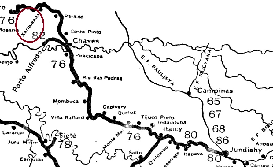
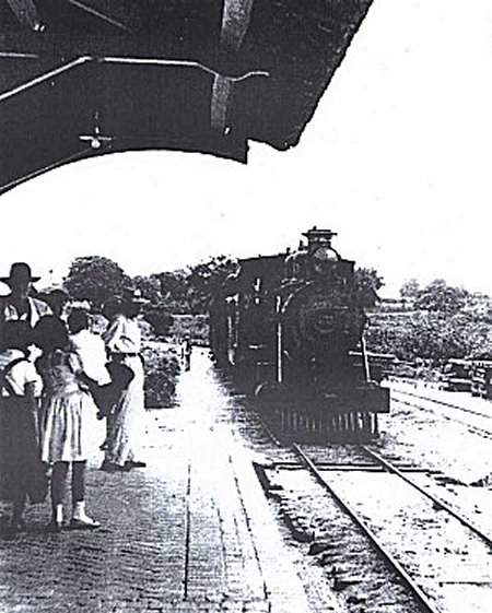
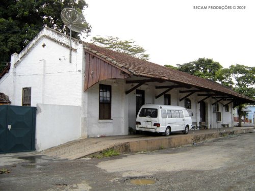
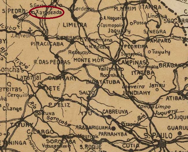
Charqueada station was opened in October 1887 by the E.F. Ytuana (Piracicaba branch) on the east bank of the Ribeirão Fregadoli in the Município Piracicaba, 180 km northwest of the provincial capital of São Paulo. The line went to the Cia. União Sorocabana e Ytuana in 1892, to the Sorocabana Railway in 1907 and belonged to E.F. Sorocabana from 1919 until it was closed in 1966 (estacoesferroviarias.com.br). Today, the tracks have disappeared and the station building serves as a warehouse for Charqueada, which has been an independent município since December 1953.
Charqueada station in the 1960s (Photo: Paulo Roberto Szabad, on estacoesferroviarias.com.br)In January 2009 (Photo: Adriano Martins, on estacoesferroviarias.com.br)
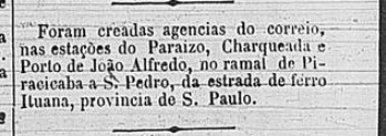
According to the Rio press, there had been a post office at the railway station since March 1888:
Cidade do Rio, 09/03/1888
No imperial postmark has yet been seen from this station.
Arthur D. Ribeiro: Estado de São Paulo, 1924
Der Bahnhof Charqueada wurde im Oktober 1887 von der E.F. Ytuana (Piracicaba-Abzweigung) eröffnet und lag am Ostufer des Ribeirão Fregadoli im Município Piracicaba, 180 km nordwestlich der Provinzhauptstadt São Paulo. Die Strecke ging 1892 an die Cia. União Sorocabana e Ytuana, 1907 an die Sorocabana Railway und gehörte von 1919 bis zur Stilllegung der Strecke 1966 der E.F. Sorocabana (estacoesferroviarias.com.br). Heute sind die Gleise verschwunden und das Bahnhofsgebäude dient als Lager der Gemeinde Charqueada, die seit Dezember 1953 ein eigenständiges Município ist.
Der Bahnhof in den 60er Jahren (Foto: Paulo Roberto Szabad, auf estacoesferroviarias.com.br)Im Januar 2009 (Foto: Adriano Martins, auf estacoesferroviarias.com.br)
Wie die Presse von Rio berichtet, gab es seit März 1888 ein Postamt am Bahnhof:
Cidade do Rio, 09.03.1888
Bisher wurde kein kaiserlicher Poststempel von diesem Bahnhof gesehen.
Villiers de l’Ile Adam: Carta (…) da Provincia de Minas Geraes, 1849
Other names: Paula Lima (1891)
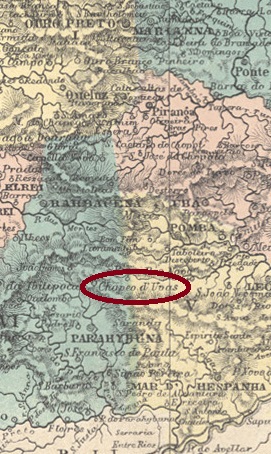
The Freguesia de N. Sra. da Assumpção do Chapeo d’Uvas was founded in 1810, belonged to the Vila de Barbacena, and lay 180 kilometres south of the later provincial capital of Ouro Preto. It was an important station on the Caminho Velho (Old Road) to Rio de Janeiro. In May 1850, the freguesia was incorporated into the newly founded Vila de Sto. Antonio do Paraibuna, which was given the name Juiz de Fora in December 1865. The name Chapeo d’Uvas is said to come from the indigenous name Chapetuva, “path through the swamp”. So, it is no wonder that the town was renamed Paula Lima in March. Paula Lima has been a rural suburb of the city of Juiz de Fora since May 1976. The name commemorates Count Francisco de Paula Lima (1812-1865), a wealthy landowner in the region.
Francisco de Paula Lima ca 1865
The local post office was opened at least three times. The first date could not be determined, but the postmark CMG-0730a (Fig. RHM catalogue) is said to have been used in 1835.
CMG-0730a (RHM) 1835
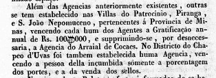
The second creation was commissioned at the end of October 1843, according to concurring information from R. Koester (Carimbologia XI), Nova Monteiro (Administrações e Agencias Postaes do Brasil Imperio, in Brasil Filatelico/RJ, 1934-5; reprint SPP 1994-1999) and a ministerial report from Rio:
Relatorio do Ministerio do Imperio, 1843
The agency was still in operation in 1859, but must have been closed shortly afterwards, as it was reopened in May 1864, as can be seen from the postal report (Relatorio dos Correios) for 1886.
In the 70s, the next postmark was not yet available, as the stamps were cancelled by hand:
1876ff (fig. R. Koester, op. cit.)
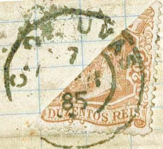
It was not until the 80s that CMG-0730b appeared (fig. Corinphila Auctions):
CMG-0730b (CO) 1883-1885
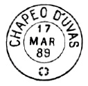
CMG-0730c also appeared in the late imperial period, as illustrated in Paulo Ayres’ Catálogo de Carimbos Brasil-Império, (S. Paulo, 1937, 1942) on p. 121:
CMG-0730c (P.A. p. 121) 1888-1889
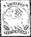
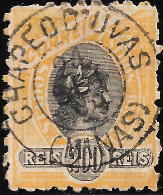
In the early Republic, the old place name was still used on postmarks:
CMG-0730d (EB) 1895-1899
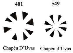
Two mute cancellations of Chapeo d’Uvas are also registered by James Dingler and Klerman W. Lopes in Mute Cancellations of the Brazil Empire / Carimbos Mudos do Brasil Império (Brazil Philatelic Association, Rio de Janeiro, 2000):
BPA 481 (1883) – 549Atlas do Imperio do Brasil, 1868
Andere Namen: Paula Lima (1891)
Die Freguesia de N. Sra. da Assumpção do Chapeo d’Uvas wurde 1810 gegründet und gehörte zur Vila de Barbacena, sie lag 180 km südlich der späteren Provinzhauptstadt Ouro Preto und war eine wichtige Station am Caminho Velho (Alter Weg) nach Rio de Janeiro. Im Mai 1850 wurde die Freguesia in die neu gegründete Vila de Sto. Antonio do Paraibuna, die im Dezember 1865 den Namen Juiz de Fora erhielt. Der Name Chapeo d’Uvas soll von der indigenen Bezeichnung Chapetuva, „Weg durch den Sumpf“, stammen. Kein Wunder also, dass der Ort im März in Paula Lima umbenannt wurde. Seit Mai 1976 ist Paula Lima ein ländlicher Vorort der Stadt Juiz de Fora. Der Name erinnert an den Komtur Francisco de Paula Lima (1812-1865), einen reichen Großgrundbesitzer der Region.
Francisco de Paula Lima ca 1865
Das örtliche Postamt wurde mindestens dreimal eröffnet. Das erste Datum konnte nicht ermittelt werden, aber der Poststempel CMG-0730a (Abb. RHM-Katalog) soll 1835 verwendet worden sein.
CMG-0730a (RHM) 1835
Die zweite Entstehung wurde Ende Oktober 1843 in Auftrag gegeben, nach übereinstimmenden Angaben von R. Koester (Carimbologia XI), Nova Monteiro (Administrações e Agencias Postaes do Brasil Imperio, in Brasil Filatelico/RJ, 1934-5; Reprint SPP 1994-1999) und einem Ministerialbericht aus Rio:
Relatorio do Ministerio do Imperio, 1843
Die Agentur war 1859 noch in Betrieb, muss aber kurz danach geschlossen worden sein, da sie im Mai 1864 wieder eröffnet wurde, wie aus dem Postbericht (Relatorio dos Correios) für 1886 hervorgeht.
In den 7oer Jahren ist der nächste Poststempel noch nicht vorhanden, da die Marken von Hand entwertet wurden:
1876ff (Abb. R. Koester, op.cit.)
Erst in den 80er Jahren erschien CMG-0730b (Abb. Corinphila Auktionen):
CMG-0730b (CO) 1883-1885
In der späten Kaiserzeit wurde auch CMG-0730c verwendet, wie in Paulo Ayres‘ Catálogo de Carimbos Brasil-Império (S. Paulo, 1937, 1942) auf S. 121 abgebildet:
CMG-0730c (P.A. S. 121) 1888-1889
In der frühen Republik wurde noch der alte Ortsname auf Poststempeln verwendet:
CMG-0730d (EB) 1895-1899
Von Chapeo d’Uvas sind auch zwei stumme Entwertungen von James Dingler und Klerman W. Lopes in Mute Cancellations of the Brazil Empire / Carimbos Mudos do Brasil Império (Brazil Philatelic Association, Rio de Janeiro, 2000) registriert: