Categories
Carimbologia C-D

CCMRSF, Bahia (CBA-0175)

Atlas do Imperio do Brasil, 1868

Other names: Commissão de Melhoramentos do Rio de S. Francisco

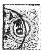
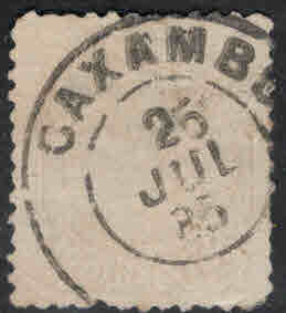
This postal agency of the Brazilian Empire presented a double enigma. On the one hand, R. Koester in Carimbologia XII (Brasil Filatélico 161, June 1970) did not know what a post office with the name Comipão meant. On the other hand, the postmark CBA-0175a (all examples: Lélio Cimini Collection) could not be categorised until recently.

CBA-0175a (Lélio Cimini) 1894ff

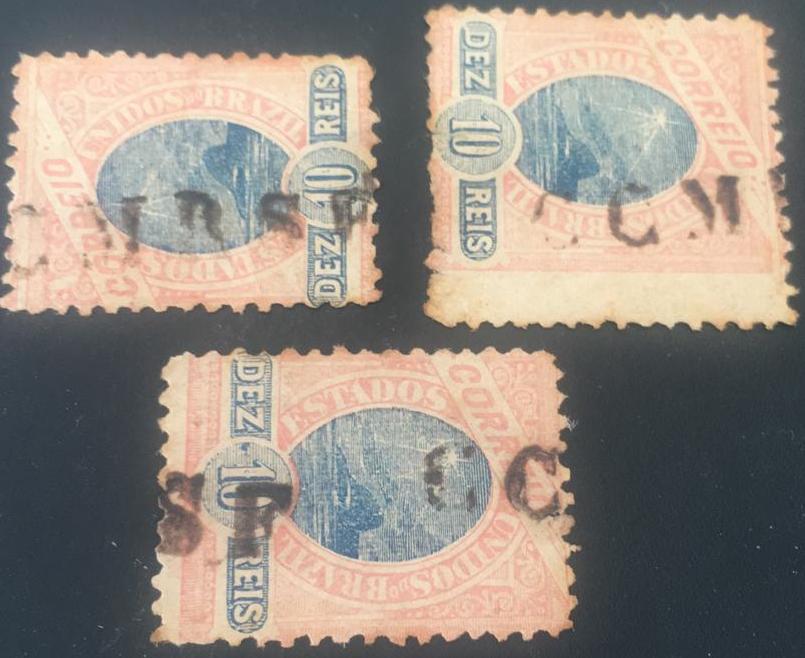
We can now say with good certainty that Koester was misreading a printing error at the time: it should be Commissão (not Comipão), and the abbreviation CCMRSF would mean Correio da Commissão de Melhoramentos do Rio de São Francisco: Post Office of the Commission for the Improvement of Navigation on the São Francisco.

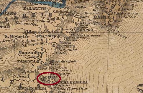
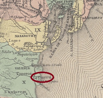
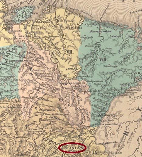
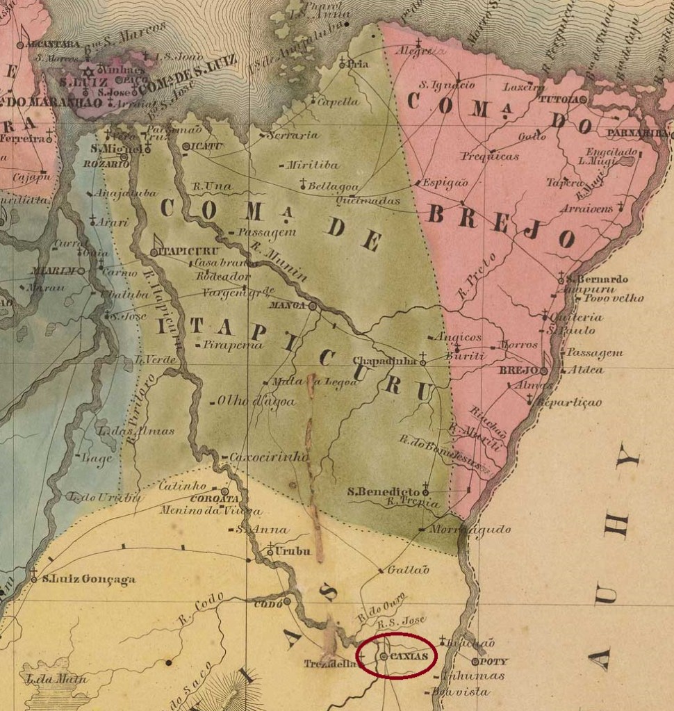
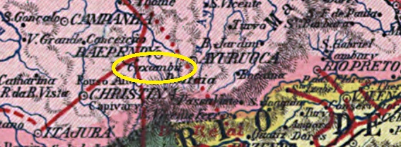
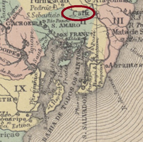
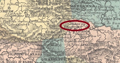
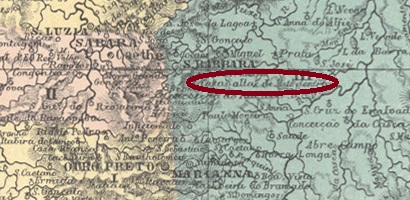
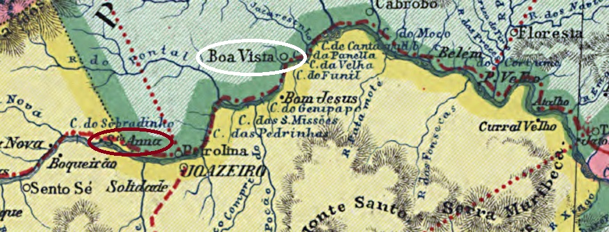
Such commissions were set up in the empire when a long and costly project was undertaken. In the south, there was the Commissão de Melhoramentos da Barra do Rio Grande, which was intended to make shipping to Porto Alegre considerably easier by clearing the Rio Grande Canal. There was also a commission for the improvement of the army, which was to better equip the imperial forces, and so on. The CMRSF intended to make the São Francisco below Juazeiro more navigable, which was a long, arduous and expensive task due to the numerous waterfalls (see maps).

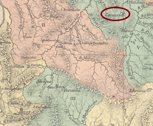
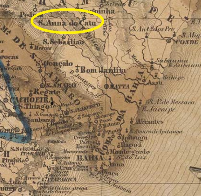
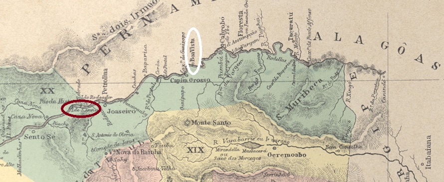
The CMRSF began operations in May 1883 in the settlement of Sant’Anna, 560 kilometres northwest of the provincial capital of Salvador, now submerged by the Sobradinho dam. The main office functioned there until August 1888, when the entire Commission moved further downstream to Boa Vista, on the left bank of the S. Francisco River, in the province of Pernambuco.

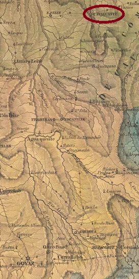
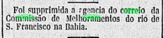
R. Koester (op. cit.) writes that the Commission had its own post office from September 1888. As the postal route there was administered by the province of Bahia, the agency was assigned to this province. The post office was only closed in March 1898, as reported by the Rio press.

Gazeta de Noticias/RJ, 03/03/1898
Carta da Republica dos Estados Unidos do Brazil, 1892

Andere Namen: Commissão de Melhoramentos do Rio de S. Francisco

Diese Postagentur des brasilianischen Kaiserreichs stellte ein doppelter Rätsel dar. Einerseits wusste R. Koester in Carimbologia XII (Brasil Filatélico 161, Juni 1970) nicht, was ein Postamt mit Namen Comipão bedeuten sollte. Andererseits konnte man bis vor Kurzem den Poststempel CBA-0175a (Alle Abb.: Samml. Lélio Cimini) nicht einordnen.

CBA-0175a (Lélio Cimini) 1894ff

Inzwischen können wir mit guter Sicherheit behaupten, dass Koester damals einem Druckfehler aufgesessen war: es hieß Commissão (nicht Comipão), und die Kürzel CCMRSF würde bedeuten Correio da Commissão de Melhoramentos do Rio de São Francisco, auf Deutsch etwa: Poststelle der Kommission zur Verbesserung der Schifffahrt am São Francisco.

Solche Kommissionen wurden im Kaiserreich dann ins Leben gerufen, wenn ein langes und kostspieliges Projekt in Angriff genommen wurde. Es gab im Süden die Commissão de Melhoramentos da Barra do Rio Grande, die durch die Räumung des Rio Grande-Kanals die Schifffahrt nach Porto Alegre erheblich erleichtern sollte. Es gab auch eine Kommission für die Verbesserung der Armee, die die kaiserlichen Streitkräfte besser ausrüsten sollte, und so weiter. Die CMRSF beabsichtigte, den São Francisco unterhalb von Juazeiro schiffbarer zu machen, was aufgrund der zahlreichen Wasserfälle eine langwierige, anstrengende und teure Aufgabe war (s. Karten).

Die CMRSF-Kommission nahm den Betrieb im Mai 1883 in der Siedlung Sant’Anna auf, 560 km nordwestlich der Provinzhauptstadt Salvador. Dort funktionierte das Hauptbüro bis August 1888, als die gesamte Kommission weiter flussabwärts nach Boa Vista am linken Ufer des S. Francisco – also in der Provinz Pernambuco – umzog.

R. Koester (op. cit.) schreibt, dass die Kommission über eine eigene Poststelle ab September 1888 verfügte. Da die Postroute dorthin von der Provinz Bahia verwaltet war, wird die Agentur dieser Provinz zugeordnet. Das Postamt wurde erst im März 1898 geschlossen, wie die Presse aus Rio meldete.

Gazeta de Noticias/RJ, 03.03.1898
Categories
Carimbologia C-D

Cayru, Bahia (CBA-0270)

Villiers de l’Ile Adam: Carta (…) da Provincia da Bahia, 1848

Cayru was already a parish in 1606, located 170 kilometres southwest of the then colonial capital Salvador da Bahia and belonging to the Vila de Ilhéus. In 1608, it became the Vila de N. Sra. do Rosário de Cayru, which was declared a freguesia two years later. Since March 1938, Cairu – as it is spelt today – has been a town. The name is of indigenous origin and means “abode of the sun”.

As R. Koester writes in Carimbologia X, there has been a post office there since August 1876. This was confirmed the following year by the report of the Provincial Council:

Relatorio do Conselho do Governo, 1877

The only postmark from the imperial era to date is CBA-0270a. Here is the illustration by R. Koester (op. cit.):

CBA-0270a (RK) 1888
Atlas do Imperio do Brasil, 1868

Cayru war bereits 1606 eine Pfarrei, die 170 km südwestlich der damaligen Kolonialhauptstadt Salvador da Bahia lag und zur Vila de Ilhéus gehörte. 1608 wurde daraus die Vila de N. Sra. do Rosário de Cayru, die zwei Jahre später zur Freguesia erklärt wurde. Seit März 1938 ist Cairu – wie es heute geschrieben wird – eine Stadt. Der Name ist indigenen Ursprungs und bedeutet “Wohnort der Sonne”.

Wie R. Koester in Carimbologia X schreibt, gab es dort seit August 1876 ein Postamt. Dies wurde im folgenden Jahr durch den Bericht des Provinzialrates bestätigt:

Relatorio do Conselho do Governo, 1877

Der bisher einzige Poststempel aus der Kaiserzeit ist CBA-0270a. Hier die Abbildung von R. Koester (op. cit.):

CBA-0270a (RK) 1888
Categories
Carimbologia C-D

Caxias, Maranhão (CMA-0080)

Atlas do Imperio do Brasil, 1868

The Freguesia de Caxias das Aldeias Altas was founded around 1730 and was located on the east bank of the Itapecuru, 360 kilometres south of the later provincial capital S. Luís do Maranhão. In October 1811, it became the Vila de N. Sra. da Conceição e S. José de Caxias das Aldeias Altas, which was elevated to the status of the town of Caxias in July 1836.

Caxias post office, ca. 1975 (IBGE)

Two foundation dates were found for the local post office. First in February 1820, as Nova Monteiro writes in Administrações e Agencias Postaes do Brasil Imperio (Brasil Filatelico/RJ, 1934-5; reprint SPP 1994-1999). Then in February 1826 according to R. Koester (Carimbologia X) and confirmed by the Directory of Imperial Post Offices (Tabella das Agencias do Correio do Imperio, Rio de Janeiro, 1885).

The oldest postmark to date is CMA-0080a, which was found in red on a letter from 1825 and is listed in the RHM catalogue under the number P-MA-01:

CMA-0080a (RHM P-MA 01) 1825

It was followed by CMA-0080b, which also exists in red and was previously seen with dates from 1842 to 1846:

CMA-0080b (RHM P-MA-02) 1842-1846

Then came the well-known CMA-0080c. This one also occurs in blue and was assigned the No. 1269 by P. Ayres in the Catálogo de Carimbos Brasil-Império (S. Paulo, 1937, 1942):

CMA-0080c (P.A. 1269, MPT 369) 1850ff-1876ff

The French type CMA-0080d (illustration from the Internet) also occurs without a date. There is eventually a risk of confusion with a postmark from the town of the same name in the province of Rio Grande do Sul.

CMA-0080d (WA) 1880-1886

CMA-0080e (Claudio Coelho collection) was also used at the end of the Empire. This enigmatic cancel bears the abbreviation E (for Estação), which at the time was a sure indication of a railway station. In the province of Maranhão, however, the term Estação was also used for post offices at the time:

CMA-0080e (CC) 1888-1894

Caxias also has a mute cancellation from the Empire, which was assigned the no. 3645 by James Dingler and Klerman W. Lopes in Mute Cancellations of the Brazil Empire / Carimbos Mudos do Brasil Império (Brazil Philatelic Association, Rio de Janeiro, 2000):

BPA 3645 (1883)
Villiers de l’Ile Adam: Carta (…) da Provincia do Maranhão, 1850

Die Freguesia de Caxias das Aldeias Altas entstand um 1730 und lag am Ostufer des Itapecuru, 360 km südlich der späteren Provinzhauptstadt S. Luís do Maranhão. Im Oktober 1811 wurde daraus die Vila de N. Sra. da Conceição e S. José de Caxias das Aldeias Altas, die im Juli 1836 zur Stadt Caxias erhoben wurde.

Postamt Caxias, ca. 1975 (IBGE)

Für das örtliche Postamt wurden zwei Gründungsdaten gefunden. Zuerst im Februar 1820, wie Nova Monteiro in Administrações e Agencias Postaes do Brasil Imperio (Brasil Filatelico/RJ, 1934-5; Nachdruck SPP 1994-1999) schreibt. Dann im Februar 1826 nach R. Koester (Carimbologia X) und bestätigt durch das Verzeichnis der kaiserlichen Postämter (Tabella das Agencias do Correio do Imperio, Rio de Janeiro, 1885).

Der bisher älteste Stempel ist CMA-0080a, der in roter Farbe auf einem Brief von 1825 gefunden wurde und im RHM-Katalog unter der Nummer P-MA 01 geführt wird:

CMA-0080a (RHM P-MA-01) 1825

Ihm folgte CMA-0080b, der ebenfalls in Rot existiert und bisher mit Daten von 1842 bis 1846 gesehen wurde:

CMA-0080b (RHM P-MA-02) 1842-1846

Dann kam der bekannte CMA-0080c. Dieser kommt auch in blau vor und wurde von P. Ayres im Catálogo de Carimbos Brasil-Império (S. Paulo, 1937, 1942) mit der Nr. 1269 versehen:

CMA-0080c (P.A. 1269, MPT 369) 1850ff-1876ff

Der französische Typ CMA-0080d (Abbildung aus dem Internet) kommt auch ohne Datum vor. Hier besteht Verwechslungsgefahr mit einem Poststempel aus dem gleichnamigen Ort in der Provinz Rio Grande do Sul.

CMA-0080d (WA) 1880-1886

Am Ende des Kaiserreichs wurde auch CMA-0080e (Samml. Claudio Coelho) verwendet. Dieser rätselhafte Stempel trägt die Abkürzung E (für Estação), was damals ein sicherer Hinweis auf einen Bahnhof war. In der Provinz Maranhão wurde die Bezeichnung Estação damals aber auch für Postämter verwendet:

CMA-0080e (CC) 1888-1894

Caxias hat auch einen stummen Stempel aus dem Kaiserreich, der von James Dingler und Klerman W. Lopes in Mute Cancellations of the Brazil Empire / Carimbos Mudos do Brasil Império (Brazil Philatelic Association, Rio de Janeiro, 2000) mit der Nr. 3645 versehen wurde:

BPA 3645 (1883)
Categories
Carimbologia C-D

Caxias, Rio Grande do Sul (CRS-0090)

Carta da Republica dos Estados Unidos do Brazil, 1892

Other names: Campo dos Bugres, Caxias do Sul (1944)

The Italian colony located 150 kilometres north of the provincial capital Porto Alegre was initially given the unflattering name Campo dos Bugres (Indian field) in 1875. Two years later, it was renamed Caxias in honour of Luiz Alves de Lima e Silva, Duke of Caxias (1803-1880), who became a national hero of Brazil as a officer and provincial administrator. In April 1884, the town became the Freguesia de Sta. Thereza de Caxias, in June 1890 a Vila and twenty years later a city, which has been called Caxias do Sul since December 1944 to avoid confusion with the city of the same name in Maranhão.

As can be seen from the list of imperial post offices (Tabella das Agencias do Correio do Imperio, Rio de Janeiro, 1885), there had been a post office there since 1881. The oldest postmark is CRS-0090a (Fig. Rölli Auctions), which has so far been found with dates from 1885 to 1893:

CRS-0090a (Rölli) 1885-1893

The Catalogo Enciclopedico RHM (S. Paulo, 1999) also mentions a postmark (French type) from Caxias in the province of Rio Grande do Sul, but this has not yet been definitively confirmed.

Estado do Rio Grande do Sul, 1891

Andere Namen: Campo dos Bugres, Caxias do Sul (1944)

Die 150 km nördlich der Provinzhauptstadt Porto Alegre gelegene italienische Kolonie erhielt 1875 zunächst den wenig schmeichelhaften Namen Campo dos Bugres (Indianerfeld). Zwei Jahre später wurde sie in Caxias umbenannt, zu Ehren von Luiz Alves de Lima e Silva, Herzog von Caxias (1803-1880), der als Feldherr und Provinzverwalter zu einem Nationalhelden Brasiliens wurde. Im April 1884 wurde der Ort zur Freguesia de Sta. Thereza de Caxias, im Juni 1890 zur Vila und zwanzig Jahre später zur Stadt, die seit Dezember 1944 Caxias do Sul heißt, um Verwechslungen mit der gleichnamigen Stadt in Maranhão zu vermeiden.

Wie aus dem Verzeichnis der kaiserlichen Postämter (Tabella das Agencias do Correio do Imperio, Rio de Janeiro, 1885) hervorgeht, gab es dort seit 1881 ein Postamt. Der älteste Poststempel ist CRS-0090a (Abb. Rölli-Auktionen), der bisher mit Daten von 1885 bis 1893 gefunden wurde:

CRS-0090a (Rölli) 1885-1893

Im Catalogo Enciclopedico RHM (S. Paulo, 1999) wird auch ein Poststempel (französischer Typ) aus Caxias in der Provinz Rio Grande do Sul erwähnt, der aber noch nicht endgültig bestätigt werden konnte.

Categories
Carimbologia C-D

Caxangá, Pernambuco (CPE-0185)

Carta Corographica da Provincia de Pernambuco, 1880

To date, it has not been possible to determine when the Arraial de S. Francisco de Paula de Caxangá was founded. All that is known is that it was on the north bank of the Capibaribe, 10 kilometres west of the provincial capital Recife. Around 1920, Caxangá became a district, but lost this status again and is now a district of Recife.

As Reinhold Koester writes in Carimbologia X, the establishment of a local post office was decided in 1875. However, it took until October 1889 for it to be put into operation, as reported in the regional press:

Diário de Pernambuco, 13/10/1889

No imperial postmark from Caxangá is known to date; it must be extremely rare.

Google Maps

Bis heute konnte nicht geklärt werden, wann der Arraial de S. Francisco de Paula de Caxangá gegründet wurde. Man weiß nur, dass er am Nordufer des Capibaribe, 10 km westlich der Provinzhauptstadt Recife, gegründet wurde. Um 1920 wurde Caxangá ein Distrikt, verlor diesen Status aber wieder und ist heute ein Stadtteil von Recife.

Wie Reinhold Koester in Carimbologia X schreibt, wurde 1875 die Einrichtung eines örtlichen Postamtes beschlossen. Es dauerte jedoch bis Oktober 1889, bis es in Betrieb genommen wurde, wie die regionale Presse berichtete:

Diário de Pernambuco, 13.10.1889

Bisher ist kein kaiserlicher Poststempel aus Caxangá bekannt, er muss äußerst selten sein.

Categories
Carimbologia C-D

Caxambu, Minas Gerais (CMG-0715)

Provincia de Minas Geraes, 1873

See also Aguas do Caxambu (AMG-0040)

The beautiful word Caxambu comes from the Tupi-Guarani and is said to mean forest sounds. The freguesia of N. Sra. dos Remédios de Caxambu was founded in November 1844 in the Município of Baependy, 300 km southwest of the provincial capital Ouro Preto. In November 1875, the town’s name changed to Santa Maria das Águas de Caxambu. Since September 1901, Caxambu has been an independent município.

As Paula Sobrinho writes in História Postal de Minas Gerais (Belo Horizonte, 1997), there was a post office there since December 1871. The only imperial postmark with Caxambu so far is CMG-0715a (illustration from the Internet), it was seen with dates between 1879 and 1887. Thus it fits exactly between the postmarks AMG-0040a and AMG-0040b, both with the place name Águas do Caxambu (see AMG-0040):

CMG-0715a (HS) 1879-1887
Carta da Republica dos Estados Unidos do Brazil, 1892

Siehe auch Aguas do Caxambu (AMG-0040)

Das schöne Wort Caxambu kommt aus dem Tupi-Guarani und soll Waldgeräusch bedeuten. Die Freguesia von N. Sra. dos Remédios de Caxambu wurde im November 1844 im Município von Baependy gegründet und lag 300 km sürwestlich der Provinzhauptstadt Ouro Preto entfernt. Im November 1875 änderte sich der Ortsname zu Santa Maria das Águas Virtuosas de Caxambu. Seit September 1901 ist Caxambu ein eigenständiger Município.

Wie Paula Sobrinho in História Postal de Minas Gerais (Belo Horizonte, 1997) schreibt, gab es dort ein Postamt seit Dezember 1871. Der bisher einzige kaiserliche Poststempel mit Caxambu ist CMG-0715a (Abb. aus dem Internet), er wurde mit Daten zwischen 1879 und 1887 gesehen. Damit passt er zeitlich genau zwischen die Poststempel AMG-0040a und AMG-0040b, beide mit der Ortsangabe Águas do Caxambu (siehe AMG-0040):

CMG-0715a (HS) 1879-1887
Categories
Carimbologia C-D

Cavalcante, Goiás (CGO-0040)

Atlas do Imperio do Brasil, 1868

Little is known about this place. The settlement is said to have originated 580 kilometres north-east of the later provincial capital of Goyaz (today Goiás Velho) in 1740, became the Freguesia Sant’Anna de Cavalcante in 1759 and a Vila in November 1831. However, the Brazilian statistics authority IBGE records another appointment as a freguesia in July 1835, so there is still a need for research here.

Two foundation dates were found for the local post office. One is 1832, as can be read in the directory of imperial post offices (Tabella das Agencias do Correio do Imperio, Rio de Janeiro, 1885). Then again in January 1851, as Nova Monteiro writes in Administrações e Agencias Postaes do Brasil Imperio (Brasil Filatelico/RJ, 1934-5; reprint SPP 1994-1999). The only imperial postmark to date is CGO-0040a, which according to the RHM catalogue (no. P-GO-02) was used from around 1832.

CGO-0040a (RHM P-GO-02) 1832ff
Villiers de l’Ile Adam: Carta (…) da Provincia de Goyaz, 1849

Über diesen Ort ist wenig bekannt. Die Siedlung soll 1740 580 km nordöstlich der späteren Provinzhauptstadt Goyaz (heute Goiás Velho) entstanden sein, wurde bereits 1759 zur Freguesia Sant’Anna de Cavalcante und im November 1831 zur Vila. Die brasilianische Statistikbehörde IBGE verzeichnet jedoch eine weitere Ernennung zur Freguesia im Juli 1835, so dass hier noch Klärungsbedarf besteht.

Für das örtliche Postamt wurden zwei Gründungsdaten gefunden. Einmal 1832, wie im Verzeichnis der kaiserlichen Postämter (Tabella das Agencias do Correio do Imperio, Rio de Janeiro, 1885) zu lesen ist. Dann wieder im Januar 1851, wie Nova Monteiro in Administrações e Agencias Postaes do Brasil Imperio (Brasil Filatelico/RJ, 1934-5; Reprint SPP 1994-1999) schreibt. Der bisher einzige kaiserliche Poststempel ist CGO-0040a, der laut RHM-Katalog (Nr. P-GO-02) ab ca. 1832 verwendet wurde.

CGO-0040a (RHM P-GO-02) 1832ff
Categories
Carimbologia C-D

Catú, Bahia (CBA-0265)

Atlas do Imperio do Brasil, 1868

See also Sant’Anna do Catú (SBA-0825)

Sant’Anna do Catú was since 1796 a settlement of the Villa of São Francisco do Conde, situated almost 90 km north of the province capital Salvador da Bahia. In June 1868 it was elevated to a villa, which became a town in July 1913. From March 1931 on the municipality has the simplified name of Catu.

According to Nova Monteiro (Administrações e Agencias Postaes do Brasil Imperio, in Brasil Filatelico/RJ, 1934-5; Reprint SPP 1994-1999), the local post office was created in March 1863. One postal cancel of the Brazilian Empire was found, whose identity is not yet confirmed definitively. SBA-0825b (Coll. José A. Junges) has a double circle with the inscription S.A. DE CA(TU) above. The only known example has a date of 1884 at the centre.

Villiers de l’Ile Adam: Carta (…) da Provincia da Bahia, 1848

Siehe auch Sant’Anna do Catú (SBA-0825)

Sant’Anna do Catú war ab 1796 eine Siedlung in der Villa von São Francisco do Conde und lag fast 90 km nördlich der Provinzhauptstadt Salvador da Bahia entfernt. Im Juni 1868 stieg sie zur Villa auf und wurde eine Stadt im Juli 1913. Seit März 1931 trägt der Município den vereinfachten Namen Catu.

Laut Nova Monteiro (Administrações e Agencias Postaes do Brasil Imperio, in Brasil Filatelico/RJ, 1934-5; Reprint SPP 1994-1999) entstand das örtliche Postamt im März 1863. Ein Poststempel des Kaiserreichs ist vorhanden, dessen Zuordnung noch nicht endgültig gesichert ist. SBA-0825b (Samml. José A. Junges) hat einen Doppelkreis mit der Inschrift S.A. DE CA(TU) oben. Das einzig bekannte Exemplar hat ein Datum aus 1884 in der Mitte.

Categories
Carimbologia C-D

Cattas Altas de Noroega, Minas Gerais (CMG-0710)

Estado de Minas Geraes, 1910

Around 1700, Cattas Altas de Noroega was an arraial of the municipality of Vila Rica and was located around 50 kilometres south of the later provincial capital. In April 1840, the village was transferred to Vila de Queluz (now Conselheiro Lafaiete) as Freguesia de S. Gonçalo de Cattas Altas de Noroega and has been Município de Catas Altas da Noruega, as it is spelt today, since December 1962. The reference to Norway (Noruega) in the place name has not yet been explained.

As Paula Sobrinho (História Postal de Minas Gerais, Belo Horizonte, 1997) and R. Koester (Carimbologia X) write, there has been a post office there since August 1879. The only imperial postmark to date is CMG-0710a, which also exists in blue and is illustrated in Paulo Ayres’ Catálogo de Carimbos Brasil-Império (S. Paulo, 1937, 1942):

CMG-0710a (P.A. p. 120) 1885-1898
Atlas do Imperio do Brasil, 1868

Cattas Altas de Noroega war um 1700 ein Arraial der Gemeinde Vila Rica und lag etwa 50 km südlich der späteren Provinzhauptstadt. Im April 1840 ging der Ort als Freguesia de S. Gonçalo de Cattas Altas de Noroega an die Vila de Queluz (heute Conselheiro Lafaiete) über und ist seit Dezember 1962 Município de Catas Altas da Noruega, wie es heute geschrieben wird. Der Bezug zu Norwegen (Noruega) im Ortsnamen konnte bisher nicht erklärt werden.

Wie Paula Sobrinho (História Postal de Minas Gerais, Belo Horizonte, 1997) und R. Koester (Carimbologia X) schreiben, gab es dort ein Postamt seit August 1879. Der bisher einzige kaiserliche Poststempel ist CMG-0710a, der auch in blau existiert und in Paulo Ayres‘ Catálogo de Carimbos Brasil-Império (S. Paulo, 1937, 1942) abgebildet ist:

CMG-0710a (P.A. S. 120) 1885-1898
Categories
Carimbologia C-D

Cattas Altas, Minas Gerais (CMG-0705)

Atlas do Imperio do Brasil, 1868

Other names: Cattas Altas do Matto Dentro

The chapel N. Sra. da Conceição das Cattas Altas do Matto Dentro was built in February 1712 70 kilometres north of the capital Vila Rica, later called Ouro Preto. In March 1839, the settlement became a freguesia of Vila de Santa Bárbara. It remained so until December 1995, when Catas Altas (as it is now spelt) became an independent município.

Paula Sobrinho (História Postal de Minas Gerais, Belo Horizonte, 1997) and R. Koester (Carimbologia X) agree that the local post office was founded in September 1863. However, the earliest postal cancellation dates from 1871, and since it is also handwritten, this could be an indication of a yet undiscovered postmark. Handwritten cancellations have been found with dates up to 1874 (here: fig. José Renato C. de Souza), also in carmine.

1871-1874 (JR)

Local postmarks as double circles only appeared in the 80s of the 19th century. CMG-0705b (fig. R.Koester, op. cit.) was seen with dates from 1883 to 1888:

CMG-0705b (RK)

The French type CMG-0705c (coll. José A. Junges) also occurs in red:

CMG-0705c (JJ) 1881-1903

James Dingler and Klerman W. Lopes have also included two mute cancellations from the imperial Cattas Altas in Mute Cancellations of the Brazil Empire / Carimbos Mudos do Brasil Império (Brazil Philatelic Association, Rio de Janeiro, 2000):

BPA 3803-3804 (P.A. 647, 1866ff-1876)

Another mute cancellation was found by the philatelist Fuad Ferreira Fo:

1874 (FF)
Provincia de Minas Geraes, 1873

Andere Namen: Cattas Altas do Matto Dentro

Die Kapelle N. Sra. da Conceição das Cattas Altas do Matto Dentro wurde bereits im Februar 1712 70 km nördlich der Hauptstadt Vila Rica, später Ouro Preto genannt, errichtet. Im März 1839 wurde die Siedlung zur Freguesia der Vila de Santa Bárbara. So blieb es bis Dezember 1995, als Catas Altas (wie es heute geschrieben wird) ein eigenständiges Município wurde.

Für die Gründung des örtlichen Postamtes geben Paula Sobrinho (História Postal de Minas Gerais, Belo Horizonte, 1997) und R. Koester (Carimbologia X) übereinstimmend den September 1863 an. Die früheste postalische Entwertung stammt jedoch aus dem Jahr 1871. Da diese handschriftlich ist, könnte dies ein Hinweis auf einen noch unentdeckten Poststempel sein. Handschriftliche Entwertungen wurden mit Daten bis 1874 gefunden (hier: Abb. José Renato C. de Souza), auch in Karmin.

1871-1874 (JR)

Poststempel als Doppelkreise kamen erst in den 80er Jahren des 19. Jahrhunderts auf. CMG-0705b (Abb. R.Koester, op. cit.) wurde mit Daten von 1883 bis 1888 gesehen:

CMG-0705b (RK)

Der französische Typ CMG-0705c (Slg. José A. Junges) kommt auch in rot vor:

CMG-0705c (JJ) 1881-1903

James Dingler und Klerman W. Lopes haben in Mute Cancellations of the Brazil Empire / Carimbos Mudos do Brasil Império (Brazil Philatelic Association, Rio de Janeiro, 2000) auch zwei stumme Entwertungen aus dem kaiserlichen Cattas Altas aufgenommen:

BPA 3803-3804 (P.A. 647, 1866ff-1876)

Eine weitere stumme Abstempelung fand der Philatelist Fuad Ferreira Fo:

1874 (FF)