Categories
Carimbologia C-D

Catolé (do Rocha), Paraíba (CPB-0105)

Atlas do Imperio do Brasil, 1868

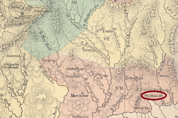
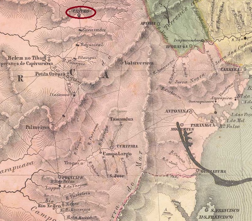
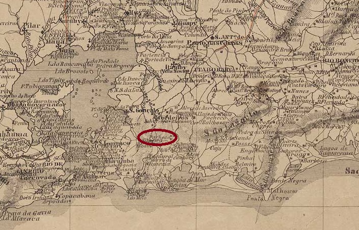
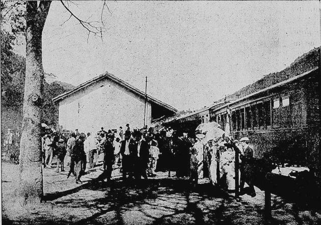
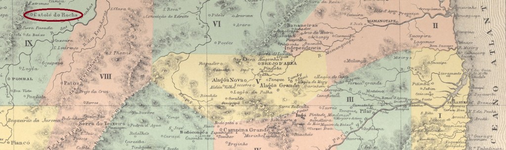
Catolé was the name of an old fazenda belonging to Lieutenant Francisco de Oliveira Rocha on the north bank of the Riacho Escuro, 400 kilometres west of the later provincial capital Parahyba do Norte (today: João Pessoa). From around 1780, a settlement was established there under the aegis of N. Sra. do Rosário, which was declared a Freguesia and Vila Federal de Catolé do Rocha in May 1835. And so it has remained to this day, apart from the fact that in 1873 N. Sra. dos Remédios became the new patron saint of the city.

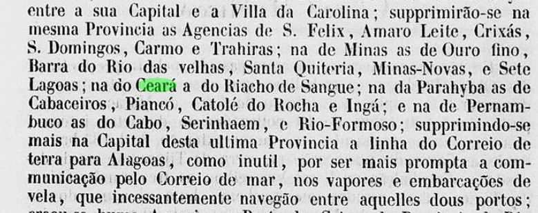
Three periods of operation of the local post office have been identified for the period of the Empire. The first began in May 1829, as can be seen from the Relatorio Postal of 1886. The second began in July 1836, as Nova Monteiro writes in Administrações e Agencias Postaes do Brasil Imperio (Brasil Filatelico/RJ, 1934-5; reprint SPP 1994-1999), and ended around 1850, as can be seen from the report of the Imperial Ministry (Relatorio do Ministerio do Imperio):

Relatorio do Ministerio do Imperio, 1850

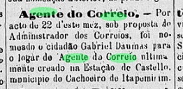
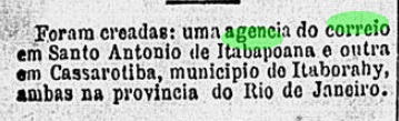
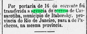
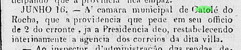
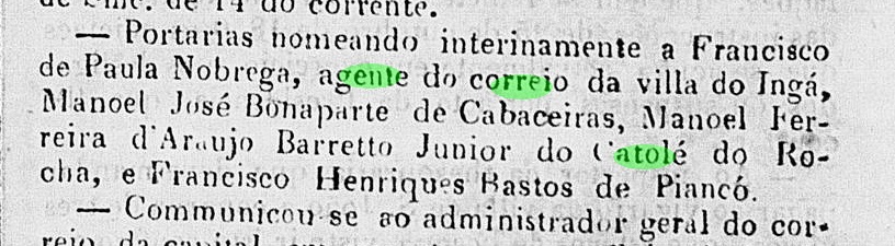
As early as June 1851, the third post office creation in Catolé was reported in the regional press:

O Governista Parahybano, 18/06/1851

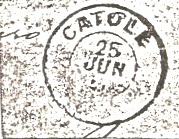
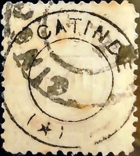
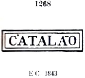
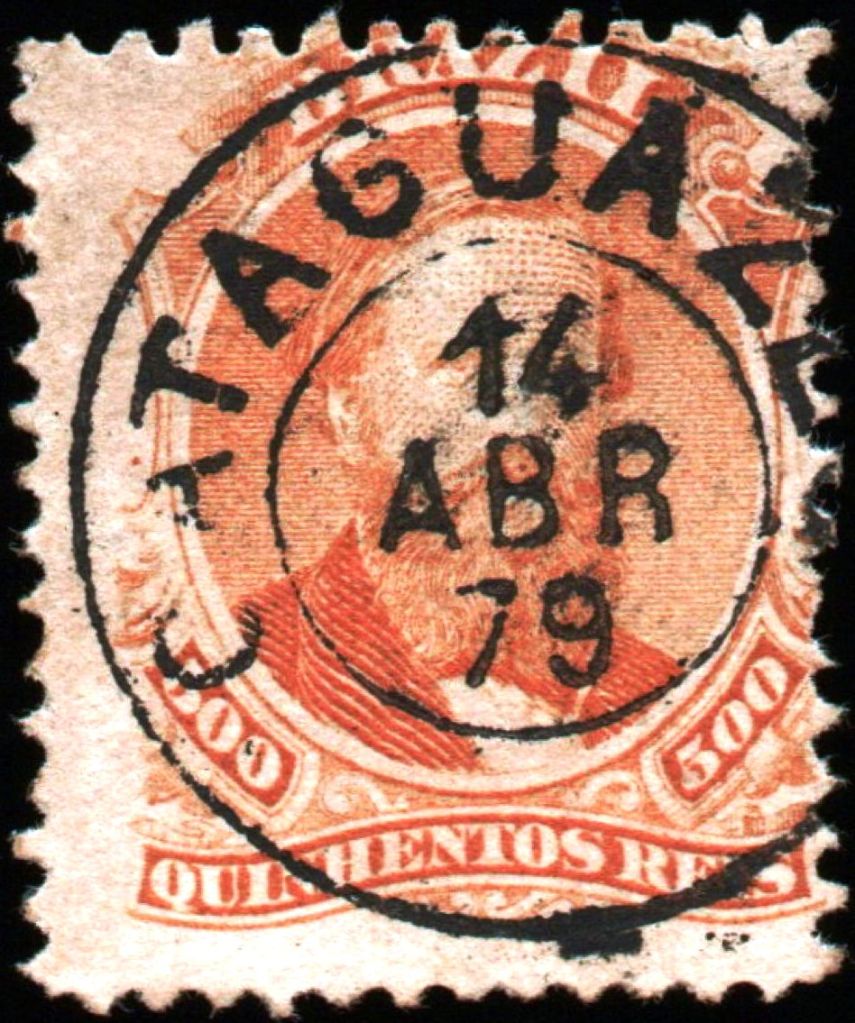
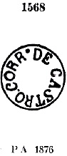
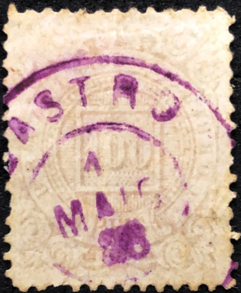
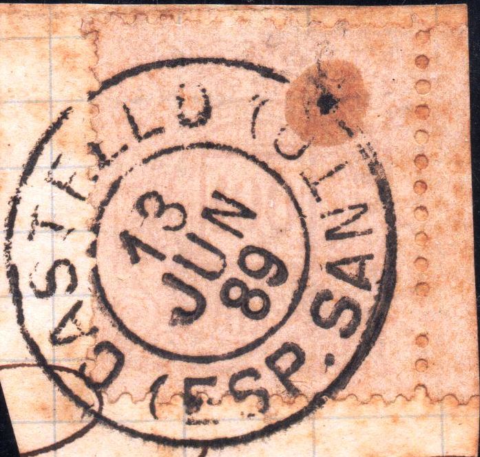
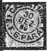
So far, only one imperial postmark has been found. CPB-0105b (fig. Jorge L. Pedreira) has dates from 1882ff to 1893:

CPB-0105b (JLP) 1882ff-1893
Villiers de l’Ile Adam: Carta (…) das Provincias do Rio Grande do Norte e Parahiba, 1848

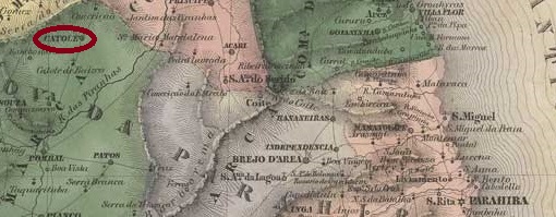
Catolé war der Name einer alten Fazenda des Leutnants Francisco de Oliveira Rocha am Nordufer des Riacho Escuro, 400 km westlich der späteren Provinzhauptstadt Parahyba do Norte (heute: João Pessoa). Ab etwa 1780 entstand dort unter der Ägide von N. Sra. do Rosário eine Siedlung, die im Mai 1835 zur Freguesia und Vila Federal de Catolé do Rocha ernannt wurde. Und so ist es bis heute geblieben, abgesehen davon, dass 1873 N. Sra. dos Remédios die neue Schutzpatronin der Stadt wurde.

Für die Zeit des Kaiserreichs wurden drei Betriebsperioden des örtlichen Postamts festgestellt. Die erste begann im Mai 1829, wie aus dem Relatorio Postal von 1886 hervorgeht. Die zweite begann im Juli 1836, wie Nova Monteiro in Administrações e Agencias Postaes do Brasil Imperio (Brasil Filatelico/RJ, 1934-5; Reprint SPP 1994-1999) schreibt, und endete um 1850, wie aus dem Bericht des kaiserl. Ministeriums (Relatorio do Ministerio do Imperio) nachzulesen ist:

Relatorio do Ministerio do Imperio, 1850

Bereits im Juni 1851 wurde zum dritten Mal das Postamt in Catolé eröffnet, wie die regionale Presse berichtete:

O Governista Parahybano, 18.06.1851

Bisher wurde nur ein einziger Poststempel des Kaiserreichs gefunden, CPB-0105b (Abb. Jorge L. Pedreira) hat Daten von 1882ff bis 1893:

CPB-0105b (JLP) 1882ff-1893
Categories
Carimbologia C-D

Catinde, Pernambuco (CPE-0180)

Atlas do Imperio do Brasil, 1868

The settlement of Sant’Anna de Catende originally belonged to the Vila de Bonito and was located 140 kilometres southwest of the provincial capital Recife. It was only in November 1892, in the days of the Republic, that it was assigned to the Município de Palmares as a district. Catende became a vila in July 1909 and a town in September 1928.

As can be seen from the list of imperial post offices (Tabella das Agencias do Correio do Imperio, Rio de Janeiro, 1885), there had been a post office there since 1876. The only imperial postmark found to date is the French type CPE-0180a (fig. Jorge L. Pedreira), with dates from around 1883 to at least 1888. Strangely enough, the place name is misspelled here:

CPE-0180a (JLP) 1883ff-1888ff
Carta Corographica da Provincia de Pernambuco, 1880

Die Siedlung Sant’Anna de Catende gehörte ursprünglich zur Vila de Bonito und lag 140 km südwestlich der Provinzhauptstadt Recife. Erst im November 1892, bereits zu Zeiten der Republik, wurde sie als Distrikt dem Município de Palmares zugeordnet. Catende wurde im Juli 1909 eine Vila und im September 1928 eine Stadt.

Wie aus dem Verzeichnis der kaiserlichen Postämter (Tabella das Agencias do Correio do Imperio, Rio de Janeiro, 1885) hervorgeht, gab es dort ein Postamt seit 1876. Der bisher einzige kaiserliche Poststempel ist der französische Typ CPE-0180a (Abb. Jorge L. Pedreira), der mit Daten von ca. 1883 bis mindestens 1888 gefunden wurde. Merkwürdigerweise ist hier der Ortsname falsch geschrieben:

CPE-0180a (JLP) 1883ff-1888ff
Categories
Carimbologia C-D

Catalão, Goiás (CGO-0035)

Atlas do Imperio do Brasil, 1868

The Vila de N. Sra. Madre de Deus do Catalão was founded in April 1833 and is located on the north bank of the Paranaíba, 400 kilometres south-east of the ancient provincial capital of Goyaz (now Goiás Velho). It was only declared a freguesia in July 1835 and was elevated to a town in August 1859.

Two dates have been found for the founding of the local post office. Nova Monteiro mentions March 1829 in Administrações e Agencias Postaes do Brasil Imperio (Brasil Filatelico/RJ, 1934-5; reprint SPP 1994-1999), while the agency is mentioned in the Directory of Imperial Post Offices (Tabella das Agencias do Correio do Imperio, Rio de Janeiro, 1885) from 1832 on. The oldest postmark to date is CGO-0035a, which can be seen on Bull’s-Eye issues from 1843 and was already shown by Paulo Ayres in Catálogo de Carimbos Brasil-Império (S. Paulo, 1937, 1942) with no. 1268:

CGO-0035a (P.A. 1268) 1843ff

This cancel broke at some point and there was no replacement. Therefore, the stamps were cancelled by hand, as also noted by P. Ayres (op. cit.):

P.A. p. 146 (1866ff-1876ff)

CGO-0035b (fig. R. Koester, in Carimbologia X) was introduced about 1881 and remained in use until at least 1899:

CGO-0035b (RK) 1881-1899
Carta da Provinica de Goyaz, 1875

Die Vila de N. Sra. Madre de Deus do Catalão wurde im April 1833 gegründet und liegt am Nordufer des Paranaíba, 400 km südöstlich der damaligen Provinzhauptstadt Goyaz (heute Goiás Velho). Es wurde erst im Juli 1835 zur Freguesia erklärt und im August 1859 zur Stadt erhoben.

Für die Gründung des örtlichen Postamtes wurden zwei Daten gefunden. Nova Monteiro nennt dafür den März 1829 in Administrações e Agencias Postaes do Brasil Imperio (Brasil Filatelico/RJ, 1934-5; Reprint SPP 1994-1999), während die Agentur im Verzeichnis der kaiserlichen Postämter (Tabella das Agencias do Correio do Imperio, Rio de Janeiro, 1885) ab 1832 erwähnt wird. Der bisher älteste Poststempel ist CGO-0035a, der auf Ochsenaugen-Ausgaben von 1843 zu sehen ist und bereits von Paulo Ayres in Catálogo de Carimbos Brasil-Império (S. Paulo, 1937, 1942) mit Nr. 1268 gezeigt wurde:

CGO-0035a (P.A. 1268) 1843ff

Dieser Stempel ging irgendwann kaputt und es gab keinen Ersatz. Daher wurden die Marken von Hand entwertet, wie auch bei P. Ayres (op. cit.) vermerkt:

P.A. S. 146 (1866ff-1876ff)

Erst ab etwa 1881 wurde CGO-0035b (Abb. R. Koester, in Carimbologia X) eingeführt und bis mindestens 1899 verwendet:

CGO-0035b (RK) 1881-1899
Categories
Carimbologia C-D

Cataguazes, Minas Gerais (CMG-0700)

Atlas do Imperio do Brasil, 1868

Text update of July 27, 2025

Other names: Meia Pataca

The Curato de Sta. Rita de Cássia de Meia Pataca was created in April 1841 on the north bank of the Pomba River, 240 kilometres south-east of the provincial capital Ouro Preto. In October 1851 it became a freguesia of the municipality of Ubá and in November 1875 it became the Vila de Cataguazes, which was elevated to the status of a town in September 1881.

Paula Sobrinho in História Postal de Minas Gerais (Belo Horizonte, 1997) and R. Koester (Carimbologia X) agree that there was a post office there from July 1872.

The oldest postmark here is the double circle CMG-0700a (Fig. Claudio Coelho), which was found with dates from 1879 to 1887:

CMG-0700a (CC) 1879-1887

It was followed by the rare CMG-0700b (fig. R. Koester, op.cit.):

CMG-0700b (RK) 1888-1889

CMG-0700c also appeared in the early Republic (illustration from the Internet):

CMG-0700c (EB) 1888-1897

Many mute cancellations from the Imperial period are also known from Cataguazes. Here are the examples presented by James Dingler and Klerman W. Lopes in Mute Cancellations of the Brazil Empire / Carimbos Mudos do Brasil Império (Brazil Philatelic Association, Rio de Janeiro, 2000):

BPA 198 – 861 (P.A. 502, 1878ff-1879) – 1182 (P.A. 249) 1878ff
BPA 1566 – 1567
BPA 1569 – 1570 (1883) – 1571

For postmarks with the place name Meia Pataca, see MMG-3595.

Mappa Geral do Brazil, 1911

Textaktualisierung am 27. Juli 2025

Andere Namen: Meia Pataca

Das Curato de Sta. Rita de Cássia de Meia Pataca wurde im April 1841 am Nordufer des Flusses Pomba, 240 km südöstlich der Provinzhauptstadt Ouro Preto, errichtet. Im Oktober 1851 wurde sie zur Freguesia der Gemeinde Ubá und im November 1875 zur Vila de Cataguazes, die im September 1881 zur Stadt erhoben wurde.

Paula Sobrinho in História Postal de Minas Gerais (Belo Horizonte, 1997) und R. Koester (Carimbologia X) schreiben übereinstimmend, dass es dort seit Juli 1872 ein Postamt gab.

Der älteste Poststempel ist hier der Doppelkreis CMG-0700a (Abb. Claudio Coelho), der mit Daten von 1879 bis 1887 gefunden wurde:

CMG-0700a (CC) 1879-1887

Ihm folgte der seltene CMG-0700b (Abb. R. Koester, op.cit.):

CMG-0700b (RK) 1888-1889

In der frühen Republik erschien auch CMG-0700c (Abb. aus dem Internet):

CMG-0700c (EB) 1888-1897

Aus Cataguazes sind auch viele stumme Stempel aus der Kaiserzeit bekannt. Hier sind die von James Dingler und Klerman W. Lopes in Mute Cancellations of the Brazil Empire / Carimbos Mudos do Brasil Império (Brazil Philatelic Association, Rio de Janeiro, 2000) vorgestellten Beispiele:

BPA 198 – 861 (P.A. 502, 1878ff-1879) – 1182 (P.A. 249, 1878ff)
BPA 1566 – 1567
BPA 1569 – 1570 (1883) – 1571

Für Poststempel mit der Ortsbezeichnung Meia Pataca siehe MMG-3595.

Categories
Carimbologia C-D

Castro, São Paulo-Paraná (CPR-0040)

Atlas do Imperio do Brasil, 1868

Other names: Sant’Anna de Iapó

The Freguesia de Sant’Anna de Iapó was founded in March 1774, belonged to the Vila de Curitiba (then still in the Capitania de São Paulo) and was located on the south bank of the Iapó, 150 kilometres northwest of the later provincial capital of Curitiba. In September 1788, it was elevated to Vila Nova de Castro, which became a city in January 1857, this time in the new province of Paraná. Castro is considered the oldest city in this province. The name commemorates Martinho de Melo e Castro (1716-1795), a Portuguese diplomat and politician.

Nova Monteiro writes in Administrações e Agencias Postaes do Brasil Imperio (Brasil Filatelico/RJ, 1934-5; reprint SPP 1994-1999) that there had been a post office there since April 1828. According to the philatelist Mário Celso Orsi Jr., the first postmark was CPR-0040a, which was used from the beginning until around 1843:

CPR-0040a (MO) 1828-1843

It was followed by its similar colleague CPR-0040b, which was used from 1836 to 1870 and was already made known by Paulo Ayres (Catálogo de Carimbos Brasil-Império, S. Paulo, 1937, 1942) with the no. 1267 and in the RHM catalogue (under P-SP-07):

CPR-0040b (P.A. 1267, RHM P-SP-07)

From around 1867, the archaic-looking CPR-0040c, also known through Paulo Ayres, appeared, this time under no. 1568:

CPR-0040c (P.A. 1568) 1867-1876ff

Towards the end of the Empire, CPR-0040d (illustrated by Roberto Assef Jr.) appeared, which also exists in dark violet:

CPR-0040d (RA) 1877-1892

Two mute cancellations of the imperial Castro are known. First, James Dingler and Klerman W. Lopes in Mute Cancellations of the Brazil Empire / Carimbos Mudos do Brasil Império (Brazil Philatelic Association, Rio de Janeiro, 2000) show no. 210, which is identical to P. Ayres no. 453 (op. cit.):

BPA 210 (P.A. 453) 1866ff

Then Mario Celso Orsi Jr. has shown another mute cancel from Castro:

1866ff (MO)
Villiers de l’Ile Adam: Carta (…) da Provincia de São Paulo, 1847

Andere Namen: Sant’Anna de Iapó

Die Freguesia de Sant‘Anna de Iapó wurde bereits im März 1774 gegründet, gehörte zur Vila de Curitiba (damals noch in der Capitania de São Paulo) und lag am Südufer des Iapó, 150 km nordwestlich der späteren Provinzhauptstadt Curitiba. Im September 1788 erfolgte die Ernennung zur Vila Nova de Castro, die im Januar 1857 zur Stadt erklärt wurde, diesmal in der neuen Provinz Paraná. Castro gilt als die älteste Stadt dieser Provinz. Der Name erinnert an Martinho de Melo e Castro (1716-1795), einen portugiesischen Diplomaten und Politiker.

Nova Monteiro schreibt in Administrações e Agencias Postaes do Brasil Imperio (Brasil Filatelico/RJ, 1934-5; Reprint SPP 1994-1999), dass es dort seit April 1828 ein Postamt gab. Nach Angaben des Philatelisten Mário Celso Orsi Jr. war der erste Poststempel CPR-0040a, der von der Eröffnung bis etwa 1843 verwendet wurde:

CPR-0040a (MO) 1828-1843

Ihm folgte sein ähnlicher Kollege CPR-0040b, der von 1836 bis 1870 verwendet wurde und bereits von Paulo Ayres (Catálogo de Carimbos Brasil-Império, S. Paulo, 1937, 1942) mit der Nr. 1267 und im RHM-Katalog (unter P-SP-07) bekannt gemacht wurde:

CPR-0040b (P.A. 1267, RHM P-SP-07)

Ab ca. 1867 erschien der archaisch anmutende CPR-0040c, ebenfalls bekannt durch Paulo Ayres, diesmal mit der Nr. 1568:

CPR-0040c (P.A. 1568) 1867-1876ff

Gegen Ende des Kaiserreichs erschien CPR-0040d (Abb. Roberto Assef Jr.), die es auch in dunkelviolett gibt:

CPR-0040d (RA) 1877-1892

Vom kaiserlichen Castro sind zwei stumme Entwertungen bekannt. Zunächst zeigen James Dingler und Klerman W. Lopes in Mute Cancellations of the Brazil Empire / Carimbos Mudos do Brasil Império (Brazil Philatelic Association, Rio de Janeiro, 2000) die Nr. 210, die mit P. Ayres Nr. 453 (op. cit.) identisch ist:

BPA 210 (P.A. 453) 1866ff

Dann hat Mario Celso Orsi Jr. einen anderen stummen Poststempel von Castro gezeigt:

1866ff (MO)
Categories
Carimbologia C-D

Castello (train station/Bahnhof), Espirito Santo (CES-0055)

Carta da Republica dos Estados Unidos do Brazil, 1892

Castello station was opened in September 1887 by the railway company Cia. Lloyd Brasileiro and was located on the west bank of the Castello in the Município Cachoeiro do Itapemirim, 140 km west of the provincial capital Vitória. The railway line was taken over by Espirito Santo e Caravellas Railway Co. Ltd. in 1898 and belonged to E.F. Leopoldina (estacoesferroviarias.com.br) from 1907 until its closure in 1963. Today, the station building has already been demolished and the tracks have been removed. The settlement around the railway station became a district in July 1891 and a Município de Castelo in December 1928.

Around 1940 (estacoesferroviarias.com.br)
Around 1970 (Photo: Lauriano G. Fim, on estacoesferroviarias.com.br)

Reinhold Koester in Carimbologia X and Paulo Novaes on agenciaspostais.com.br write that there has been a post office at the railway station since February 1888. However, the first postal agent was introduced in the regional press only in August of that year:

O Espirito Santense, 25/08/1888

The imperial postmark here is CES-0055a (image from the Internet):

CES-0055a (EB) 1889-1910
Instituto Brasileiro de Geografia e Estatística, 1958

Der Bahnhof Castello wurde im September 1887 von der Eisenbahngesellschaft Cia. Lloyd Brasileiro eröffnet und lag am Westufer des Castello im Município Cachoeiro do Itapemirim, 140 km westlich der Provinzhauptstadt Vitória. Die Bahnlinie wurde 1898 von der Espirito Santo e Caravellas Railway Co. Ltd. übernommen und gehörte von 1907 bis zu ihrer Stilllegung 1963 der E.F. Leopoldina (estacoesferroviarias.com.br). Heute ist das Bahnhofsgebäude bereits abgerissen, die Gleise wurden entfernt. Die Siedlung um den Bahnhof wurde im Juli 1891 zum Distrikt und im Dezember 1928 zum Município de Castelo.

Um 1940 (estacoesferroviarias.com.br)
Um 1970 (Foto: Lauriano G. Fim, auf estacoesferroviarias.com.br)

Reinhold Koester in Carimbologia X und Paulo Novaes auf agenciaspostais.com.br schreiben, dass es seit Februar 1888 ein Postamt am Bahnhof gab. Der erste Postagent wurde jedoch erst im August des Jahres in der regionalen Presse vorgestellt:

O Espirito Santense, 25.08.1888

Der kaiserliche Poststempel hier ist CES-0055a (Abbildung aus dem Internet):

CES-0055a (EB) 1889-1910
Categories
Carimbologia C-D

Cassarotiba, Rio de Janeiro (CRJ-0330)

Bellegard-Niemeyer: Carta Corographica da Provincia do Rio de Janeiro, 1867

Cassarotiba (also spelt Cassorotiba) is the name of a small mountain range that today lies in the Município Maricá, 50 kilometres east of the capital Rio de Janeiro. There is still a fazenda there today, which may have been the origin of a small settlement.

R. Koester writes in Carimbologia X that a post office was established there in January 1885. This is confirmed by the press in Rio:

Gazeta de Noticias, 24/01/1885

The post office was so insignificant that in the same year it was moved further north to Pachecos, now near the Vila of Itaboraí, as the press also reported:

O Paiz, 18/10/1885

No imperial postmark of Cassarotiba has yet been seen. It must be very rare.

agenciaspostais.com.br

Cassarotiba (heute Cassorotiba geschrieben) ist der Name eines kleinen Gebirges, das im Município Maricá, 50 km östlich der Hauptstadt Rio de Janeiro liegt. Dort befindet sich noch heute eine Fazenda, die möglicherweise der Ursprung einer kleinen Siedlung war.

R. Koester schreibt in Carimbologia X, dass dort im Januar 1885 ein Postamt eingerichtet wurde. Dies wird von der Presse in Rio bestätigt:

Gazeta de Noticias, 24.01.1885

Das Postamt war so unbedeutend, dass es noch im selben Jahr weiter nördlich nach Pachecos, jetzt in der Nähe der Vila von Itaboraí, verlegt wurde, wie die Presse ebenfalls berichtete:

O Paiz, 18.10.1885

Bisher wurde noch kein kaiserlicher Poststempel von Cassarotiba gesehen. Er muss sehr selten sein.

Categories
Carimbologia C-D

Cascavel (train station/Bahnhof), São Paulo (CSP-0335)

Companhia Mogyana , 1898 (IBGE)

Cascavel station was opened in January 1887 by the railway company Cia. Mogyana (Main Line) and was in the municipality of Vila de S. João da Boa Vista, 190 km north of the provincial capital of São Paulo. Since November 1944, the railway station and the municipality have been called Aguaí. The line was transferred to FEPASA in 1971 and has been operated by Ferrovia Centro-Atlantica (FCA) since 1999. The station building has been a listed building since 2022.

Ca. 1915 (on estacoesferroviarias.com.br)
In 2016 (Photo: Ralph Giesbrecht, on estacoesferroviarias.com.br)

Reinhold Koester writes in Carimbologia X that there has been a post office there since August 1888. This is confirmed by the regional press:

A Provincia de São Paulo, 14/08/1888

No imperial postmarks are known to date from Cascavel railway station.

Mappa Geral do Brasil, 1911

Der Bahnhof Cascavel wurde im Januar 1887 von der Eisenbahngesellschaft Cia. Mogyana (Hauptstrecke) eröffnet und lag in der Gemeinde Vila de S. João da Boa Vista, 190 km nördlich der Provinzhauptstadt São Paulo. Seit November 1944 tragen der Bahnhof und die Gemeinde den Namen Aguaí. Die Strecke ging 1971 an die FEPASA über und wird seit 1999 von der Ferrovia Centro-Atlantica (FCA) betrieben. Seit 2022 steht das Bahnhofsgebäude unter Denkmalschutz.

Ca. 1915 (auf estacoesferroviarias.com.br)
2016 (Foto: Ralph Giesbrecht, auf estacoesferroviarias.com.br)

Reinhold Koester schreibt in Carimbologia X, dass es dort seit August 1888 ein Postamt gab. Dies wird von der regionalen Presse bestätigt:

A Provincia de São Paulo, 14.08.1888

Vom Bahnhof Cascavel sind bisher keine kaiserlichen Poststempel bekannt.

Categories
Carimbologia C-D

Cascavel, Ceará (CCE-0100)

Villiers de l’Ile Adam: Carta (…) da Provincia do Ceara, 1849

The Freguesia de N. Sra. da Conceição de Cascavel was founded in September 1832 and belonged to the Vila de Aquiraz, near the mouth of the Chorós into the Atlantic Ocean, 65 kilometres south-east of the provincial capital Fortaleza. It was elevated to a vila in May 1833 and to a town in November 1883.

The local post office was established at least three times during the imperial era. The first must have been before 1849, as a regular postal route was already in operation there in January of that year:

O Cearense, 04/01/1849

However, this agency was closed in 1851 as it was “of less importance”:

Relatorio do Ministerio do Imperio, 1851, p.27

The second opening was decided in April 1864, as reported in the Rio press:

Constitucional/RJ, 09/04/1864

Finally, Nova Monteiro registered in Administrações e Agencias Postaes do Brasil Imperio (Brasil Filatelico/RJ, 1934-5; reprint SPP 1994-1999) a new establishment in March 1865. The only imperial postmark so far is CCE-0100b, as shown by R. Koester in Carimbologia X:

CCE-0100b (RK)
Atlas do Imperio do Brasil, 1868

Die Freguesia de N. Sra. da Conceição de Cascavel wurde im September 1832 gegründet und gehörte zur Vila de Aquiraz, nahe der Mündung des Chorós in den Atlantik, 65 km südöstlich der Provinzhauptstadt Fortaleza. Es wurde im Mai 1833 zur Vila und im November 1883 zur Stadt erhoben.

Das örtliche Postamt wurde während der Kaiserzeit mindestens dreimal eingerichtet. Das erste muss vor 1849 gewesen sein, da bereits im Januar dieses Jahres eine regelmäßige Postroute dorthin in Betrieb war:

O Cearense, 04.01.1849

Diese Agentur wurde jedoch 1851 geschlossen, da sie „von geringer Bedeutung“ war:

Relatorio do Ministerio do Imperio, 1851, S.27

Die zweite Eröffnung wurde im April 1864 beschlossen, wie die Presse von Rio berichtete:

Constitucional/RJ, 09.04.1864

Schließlich registrierte Nova Monteiro in Administrações e Agencias Postaes do Brasil Imperio (Brasil Filatelico/RJ, 1934-5; Reprint SPP 1994-1999) eine Neugründung im März 1865. Der bisher einzige kaiserliche Poststempel ist CCE-0100b, wie von R. Koester in Carimbologia X gezeigt:

CCE-0100b (RK)

Categories
Carimbologia C-D

Cascatinha (train station/Bahnhof), Rio de Janeiro (CRJ-0325)

Almanak Laemmert, 1892

Cascatinha (Little Waterfall) station was opened in February 1886 by the E.F. Príncipe do Grão-Pará railway company and was located on the east bank of the Piabanha in the Vila de Petrópolis region, over 70 km north of the capital Rio de Janeiro. The line belonged to E.F. Leopoldina from 1890 until it was closed. Today, the tracks have disappeared and the station building serves as a museum (estacoesferroviarias.com.br).

In 1905 (Photo: Revista da Semana, on estacoesferroviarias.com.br)
In June 2023 (Photo: Renato Ramos, on estacoesferroviarias.com.br)

As R. Koester writes in Carimbologia X, there had been a post office at the railway station since 1886. Three postmarks were found for the 19th century. CRJ-0325a (agenciaspostais.com.br) is the oldest one and bears internal dates from 1887 to 1889:

CRJ-0325a (PN) 1887-1889

R. Koester showed the successor postmark CRJ-0325b in Carimbologia X:

CRJ-0325b (RK) 1889

CRJ-0325c also appeared at the beginning of the Republic (picture: Luiz C. Fritzen):

CRJ-0325c (LCF) 1893-1901
agenciaspostais.com.br

Der Bahnhof Cascatinha (Kleiner Wasserfall) wurde im Februar 1886 von der Eisenbahngesellschaft E.F. Príncipe do Grão-Pará eröffnet und lag am Ostufer des Piabanha in der Region Vila de Petrópolis, über 70 km nördlich der Hauptstadt Rio de Janeiro. Die Strecke gehörte von 1890 bis zu ihrer Stilllegung der E.F. Leopoldina. Heute sind die Gleise verschwunden, das Bahnhofsgebäude dient als Museum (estacoesferroviarias.com.br).

1905 (Foto: Revista da Semana, auf estacoesferroviarias.com.br)
Im Juni 2023 (Foto: Renato Ramos, auf estacoesferroviarias.com.br)

Wie R. Koester in Carimbologia X schreibt, gab es seit 1886 ein Postamt am Bahnhof. Für das 19. Jahrhundert wurden drei Poststempel gefunden. CRJ-0325a (agenciaspostais.com.br) ist der älteste und trägt interne Daten von 1887 bis 1889:

CRJ-0325a (PN) 1887-1889

R. Koester zeigte in Carimbologia X den Nachfolgestempel CRJ-0325b:

CRJ-0325b (RK) 1889

Zu Beginn der Republik erschien auch CRJ-0325c (Abb. Luiz C. Fritzen):

CRJ-0325c (LCF) 1893-1901