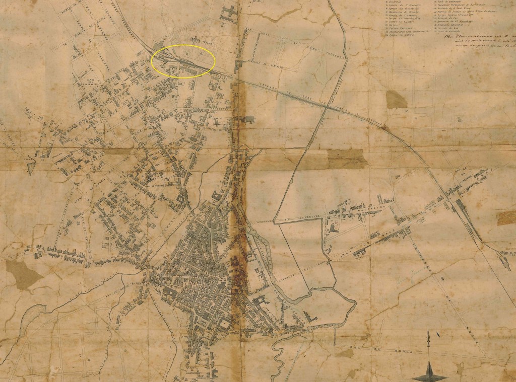
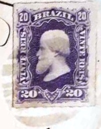
Luz (Light) station was opened in February 1867 by the São Paulo Railway company in the city of São Paulo, three kilometres north of the main church. The name is derived from the neighbouring Convento da Imaculada Conceição da Luz, which today houses the most important museum of sacred art in São Paulo. The railway line changed hands in 1946 to the E. F. Santos a Jundiaí in 1946, Rede Ferroviária Federal S. A. in 1975 and has been operated by Companhia Paulista de Trens Metropolitanos (CPTM) since 1992. The main building has been built at least three times and today also serves as a museum of the Portuguese language.
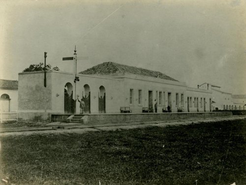
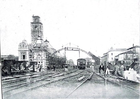
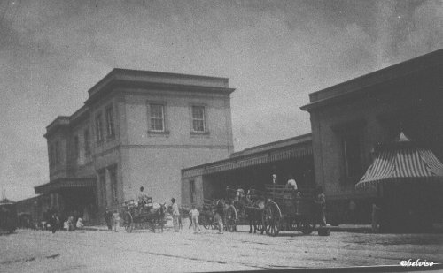
Around 1867 (Photo: A.C. Belviso, on estacoesferroviarias.com.br)Around 1880 (Photo: A.C. Belviso, on estacoesferroviarias.com.br)Around 1900 (Photo: estacoesferroviarias.com.br)
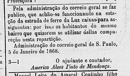
The directory of imperial post offices (Tabella das Agencias do Correio do Imperio, Rio de Janeiro, 1885) shows that in 1879 it was decided to establish a railway station post office. This began operations in January 1880, as reported in the regional press.
Correio Paulistano, 10.01.1880
However, there had been post boxes at the railway station since 1868:
Diario de São Paulo, 09.01.1868
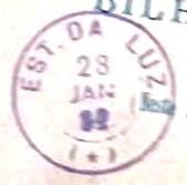
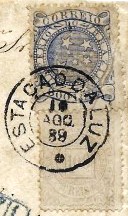
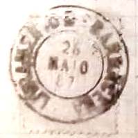
The first postmark here is the French type LSP-0502a (collect. Fuad Ferreira Fo.):
LSP-0502a (FF) 1880-1890
This was followed by the circle cancellation LSP-0502b (ill. Luiz C. Fritzen):
LSP-0502b (LCF) 1887-1898
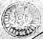
Three mute postmarks from the imperial Luz railway station post office are also known:
1882ff (illus. from the Internet)1880ff (illustration: Rölli auctions)1881 (Fuad Ferreira Fo. collection)Estações (…) de São Paulo, Rio de Janeiro e Minas, 1880
Der Bahnhof Luz (Licht) wurde im Februar 1867 von der Eisenbahngesellschaft São Paulo Railway im Stadtgebiet von São Paulo, drei Kilometer nördlich der Hauptkirche, eröffnet. Der Name leitet sich vom benachbarten Kloster Convento da Imaculada Conceição da Luz ab, in dem sich heute das wichtigste Museum für sakrale Kunst in São Paulo befindet. Die Bahnlinie wechselte 1946 zur E. F. Santos a Jundiaí, 1975 zur Rede Ferroviária Federal S. A. und wird seit 1992 von der Companhia Paulista de Trens Metropolitanos (CPTM) betrieben. Das Hauptgebäude wurde mindestens dreimal errichtet und dient heute auch als Museum der portugiesischen Sprache.
Um 1867 (Foto: A.C. Belviso, auf estacoesferroviarias.com.br)Um 1880 (Foto: A.C. Belviso, auf estacoesferroviarias.com.br)Um 1900 (Foto: estacoesferroviarias.com.br)
Aus dem Verzeichnis der kaiserlichen Postämter (Tabella das Agencias do Correio do Imperio, Rio de Janeiro, 1885) geht hervor, dass im Jahr 1879 die Errichtung eines Bahnhofspostamts beschlossen wurde. Dieses nahm im Januar 1880 den Betrieb auf, wie die regionale Presse mitteilte.
Correio Paulistano, 10.01.1880
Es gab jedoch Postfächer am Bahnhof bereits seit 1868:
Diario de São Paulo, 09.01.1868
Der erste Poststempel ist hier der französische Typ LSP-0502a (Samml. Fuad Ferreira Fo.):
LSP-0502a (FF) 1880-1890
Es folgte der Kreisstempel LSP-0502b (Abb. Luiz C. Fritzen):
LSP-0502b (LCF) 1887-1898
Aus dem Bahnhofspostamt Luz sind auch drei stumme Poststempel aus dem Kaiserreich bekannt:
1882ff (Abb. aus dem Internet)1880ff (Abb.: Rölli-Auktionen)1881 (Samml. Fuad Ferreira Fo.)
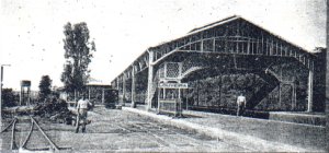
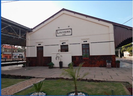
This station, originally called Capivary, was opened in March 1872 by the railway company Cia. Paulista (main line). It was in the Município de Jundiahy, 70 kilometres northwest of the provincial capital of São Paulo. From 1971 until its closure in 1998, the railway line belonged to the FEPASA consortium. Today, the tracks still exist and the station building serves as a railway museum.
In 1918 (Photo: Filemon Peres, estacoesferroviarias.com.br)In May 2023 (photo: Kevin Nilo, Google Maps)
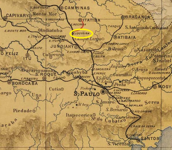
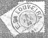
The area around the railway station became part of the Município de Vinhedo in December 1948 and was declared a distrito five years later. Louveira has been an independent município since January 1964.
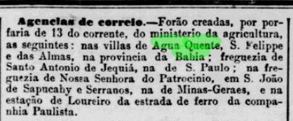
According to the Rio press, there had been a post office at the railway station (here misspelled) since August 1881.
Jornal do Commercio/RJ, 15/08/1881
A handwritten cancellation around 1885 was found on the Internet:
1885ff (EB)
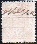
The oldest postmark to date is LSP-0780a (fig. R. Koester, in Carimbologia XXVI):
LSP-0780a (RK) 1886
LSP-0780b also appeared at the end of the 19th century (illustration from the Internet):
LSP-0780b (EB) 1896-1897J.M. Ribeiro Lisboa: Provincia de São Paulo, 1884
Andere Namen: Capivary
Dieser Bahnhof hieß ursprünglich Capivary und wurde im März 1872 von der Eisenbahngesellschaft Cia. Paulista (Hauptlinie) eröffnet. Er lag im Município de Jundiahy, 70 km nordwestlich der Provinzhauptstadt São Paulo. Von 1971 bis zur Stilllegung im Jahr 1998 gehörte die Bahnlinie dem FEPASA-Konsortium. Heute sind die Gleise noch vorhanden und das Bahnhofsgebäude dient als Bahnmuseum.
Im Jahr 1918 (Foto: Filemon Peres, estacoesferroviarias.com.br)Im Mai 2023 (Foto: Kevin Nilo, Google Maps).
Das Areal um den Bahnhof ging im Dezember 1948 zum Município de Vinhedo über und wurde fünf Jahre später zum Distrito erklärt. Seit Januar 1964 ist Louveira ein eigenständiger Município.
Wie die Presse aus Rio bekannt gab, gab es seit August 1881 ein Postamt am Bahnhof (hier falsch geschrieben).
Jornal do Commercio/RJ, 15.08.1881
Eine handschriftliche Entwertung aus 1885 wurde im Internet gefunden:
1885ff (EB)
Der bisher älteste Poststempel ist LSP-0780a (Abb. R. Koester, in Carimbologia XXVI):
LSP-0780a (RK) 1886
Am Ende des 19. Jahrhunderts erschien auch LSP-0780b (Abb. aus dem Internet):
Carta da Republica dos Estados Unidos do Brazil, 1892
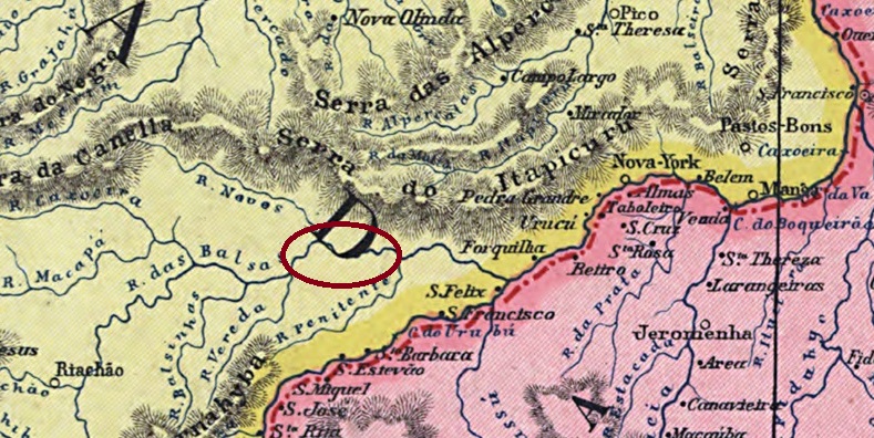
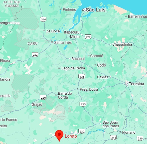
The Freguesia de São Félix de Balsas had existed since November 1851 and belonged to the Vila de Pastos Bons. It was located on the west bank of the Rio das Balsas, 700 kilometres south of the provincial capital of São Luís do Maranhão. In July 1873 it was elevated to Vila de Loreto and in March 1938 to a town.
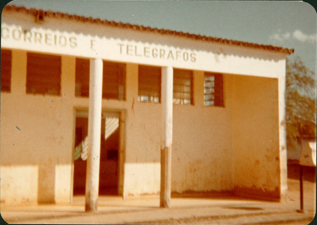
Loreto post office, around 1975 (IBGE)
According to the postal report for 1886, there had been a post office there since October 1877. However, no imperial postmark for Loreto in Maranhão has yet been found.
Google Maps
Die Freguesia de São Félix de Balsas bestand seit November 1851 und gehörte zur Vila de Pastos Bons. Sie lag am Westufer des Rio das Balsas, 700 Kilometer südlich der Provinzhauptstadt São Luís do Maranhão. Im Juli 1873 wurde sie zur Vila de Loreto und im März 1938 zur Stadt erhoben.
Postamt Loreto, ca. 1975 (IBGE)
Wie aus dem Postbericht für das Jahr 1886 hervorgeht, gab es dort seit Oktober 1877 ein Postamt. Bisher konnte jedoch kein kaiserlicher Poststempel für Loreto in Maranhão gefunden werden.
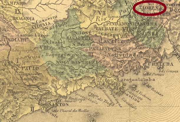
The original settlement of Guaiapacaré became the freguesia of N. Sra. da Piedade de Lorena in 1718, it belonged to the Vila de Guaratinguetá and was situated on the south bank of the river Paraíba do Sul, 180 km northeast of the later provincial capital São Paulo. In September 1788, it was elevated to the status of vila, and in April 1856, it became a town. The name comes from Bernardo José Maria de Lorena e Silveira (1756-1818), the Count of Sarzedas, who was Capitão-Mor of São Paulo from 1788 to 1797.
Both Nova Monteiro (Administrações e Agencias Postaes do Brasil Imperio, in Brasil Filatelico/RJ, 1934-5; Reprint SPP 1994-1999) and the Directory of Imperial Post Offices (Tabella das Agencias do Correio do Imperio, Rio de Janeiro, 1885) agree that there was a post office there from June 1842. However, there are postmarked letters from Lorena that show earlier dates. Apparently, Lorena was one of the towns in the Paraíba do Sul valley that had a functioning postal system before 1842 which was not subordinate to the central government in Rio. The first two postmarks are from this period of operation. LSP-0775a and LSP-0775b are very similar; the first postmark is chestnut in colour and was in circulation between 1831 and 1841, while the second – which probably also occurs in green – was found on letters and documents between 1829 and at least 1843. Both cancels were presented in the RHM catalogue under P-SP-18a and P-SP-19 respectively.
LSP-0775a (RHM P-SP-18a)LSP-0775b (RHM P-SP-19)
Then came VSP-1780a, which appeared from 1841 to 1856 and was already shown by Paulo Ayres in Catálogo de Carimbos Brasil-Império (S. Paulo, 1937, 1942) under no. 1578:
VSP-1780a (P.A. 1578, RHM P-SP-20), also in red and green
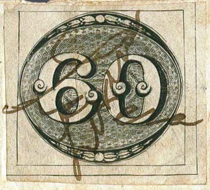
This was followed by LSP-0775c, which can also be seen in Ayres’ work (op. cit.), this time under no. 1579:
LSP-0775c (P.A. 1579, EB) 1864-1868
A short time later, the French type LSP-0775d also appeared, also in blue, also presented by P. Ayres. The circumflex accent on the E in the image is actually an acute accent, as can be seen on the right, in Felipe Piccinini’s image:
LSP-0775d (P.A. p.117 recte FP) 1867-1876, also in blue
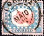
In the 1880s, the French cancel returned, this time without any accent, as seen in LSP-0775e (image C. A. Balata):
LSP-0775e (CB) 1877-1888, also in blue
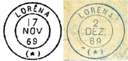
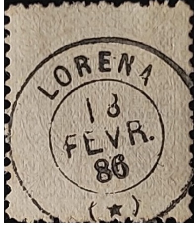
At the end of the empire finally came LSP-0775f (ill. Mário Celso Orsi Jr.):
LSP-0775f (MO) 1889-1898
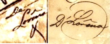
These handwritten cancellations also date from the first period of operation (Coll. José L. Fevereiro/Mario Celso Orsi JR.):
1830 (JLF/MO)
Another handwritten cancellation (fig. Corinphila) dates from the second period of operation:
1845 (CO)
Two mute cancellations are known from Lorena. Firstly by Mário Celso Orsi Jr:
1867 (MO)
Then by Nikolas Moura:
1868-1869 (NiM)Villiers de l’Ile Adam: Carta (…) da Provincia de São Paulo, 1847
Textaktualisierung vom 30. Juni 2025
Siehe auch Villa de Lorena (VSP-1780)
Die ursprüngliche Siedlung von Guaiapacaré wurde 1718 die Freguesia von N. Sra. da Piedade de Lorena, sie gehörte der Vila de Guaratinguetá und lag am Südufer des Flusses Paraíba do Sul,, 180 km nordöstlich der späteren Provinzhauptstadt São Paulo entfernt. Im September 1788 wurde der Ort zur Vila erhoben und im April 1856 zur Stadt. Der Name kommt von Bernardo José Maria de Lorena e Silveira (1756-1818), dem Graf von Sarzedas, der von 1788 bis 1797 Capitão-Mor von São Paulo war.
Sowohl Nova Monteiro (Administrações e Agencias Postaes do Brasil Imperio, in Brasil Filatelico/RJ, 1934-5; Reprint SPP 1994-1999) als auch das Verzeichnis der kaiserlichen Postämter (Tabella das Agencias do Correio do Imperio, Rio de Janeiro, 1885) sind sich darüber einig, dass es dort ab Juni 1842 ein Postamt gab. Allerdings kennt man gestempelte Briefe aus Lorena, die frühere Daten aufweisen. Offenbar gehörte Lorena zu den Ortschaften im Paraíba do Sul-Tal, die vor 1842 ein funktionierendes Postwesen unterhielten, das nicht der Zentralregierung in Rio unterstellt war. Die ersten beiden Poststempel entstammen dieser Betriebsperiode. LSP-0775a und LSP-0775b sind sich sehr ähnlich; der erste Poststempel ist kastanienfarbig und war zwischen 1831 und 1841 im Umlauf, während der zweite – der wohl auch in grün vorkommt – auf Briefen und Dokumenten zwischen 1829 und zumindest 1843 gefunden wurde. Beide Stempel wurden im RHM-Katalog unter P-SP-18a bzw. P-SP-19 vorgestellt.
LSP-0775a (RHM P-SP-18a)LSP-0775b (RHM P-SP-19)
Danach kam VSP-1780a, der von 1841 bis 1856 erschien und bereits durch Paulo Ayres in Catálogo de Carimbos Brasil-Império (S. Paulo, 1937, 1942) unter Nr. 1578 gezeigt wurde:
VSP-1780a (P.A. 1578, RHM P-SP-20), auch in Rot und Grün
Es folgte LSP-0775c, der ebenfalls im Ayres‘ Werk (op. cit.) zu sehen ist, diesmal unter Nr. 1579:
LSP-0775c (P.A. 1579, EB) 1864-1868
Kurze Zeit später erschien auch der französische Typ LSP-0775d, auch in Blau, und auch von P. Ayres vorgestellt. Der Zirkumflex auf dem E im Bild ist in Wirklichkeit ein accent aigu, wie rechts im Bild von Felipe Piccinini zu sehen ist:
LSP-0775d (P.A. S.117 recte FP) 1867-1876, auch in blau
In den 80er Jahren kehrte der französische Stempel zurück, diesmal ohne jeglichen Akzent, wie in LSP-0775e (Bild C. A. Balata) zu sehen ist:
LSP-0775e (CB) 1877-1888, auch in Blau
Am Ende des Kaiserreichs kam schließlich LSP-0775f (Abb. Mário Celso Orsi Jr.):
LSP-0775f (MO) 1889-1898
Aus der ersten Betriebsperiode stammen auch diese handschriftlichen Entwertungen (Samml. José L. Fevereiro/Mário Celso Orsi Jr.):
1830 (JLF/MO)
Eine weitere handschriftliche Entwertung (Abb. Corinphila) kommt aus der zweiten Betriebsperiode:
1845 (CO)
Zwei stumme Abstempelungen sind aus Lorena bekannt. Erstens durch Mário Celso Orsi Jr:
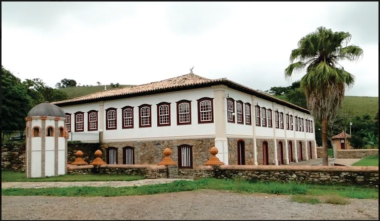
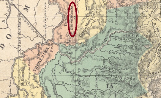
Here we are again dealing with a post office of the Brazilian empire, which apparently originated from a private initiative. The Fazenda Loanda was the seat of a large estate in the area of Vila de Bananal, 330 kilometres north-east of the provincial capital of São Paulo. The owner was Pedro Ramos Nogueira (1823-1885), also known as Baron de Joatinga.
The main building of the fazenda is still an impressive tourist attraction in the region today.
fazendaloanda.com
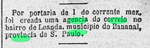
R. Koester writes in Carimbologia XXVI that there has been a post office there since January 1885. However, it was not until August of that year that the Rio press reported the decision to establish an agency on site:
Gazeta de Noticias/RJ, 05/08/1885
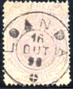
The imperial postmark is LSP-0770a (illus. Mário Celso Orsi Jr.):
LSP-0770a (MO) 1885-1890Google Maps
Hier haben wir es wieder mit einem Postamt des brasilianischen Kaiserreichs zu tun, das offenbar aus einer Privatinitiative entstanden ist. Die Fazenda Loanda war der Sitz eines Großgrundbesitzes im Gebiet der Vila de Bananal, 330 Kilometer nordöstlich der Provinzhauptstadt São Paulo. Inhaber war Pedro Ramos Nogueira (1823–1885), auch bekannt als Baron de Joatinga.
Das Hauptgebäude der Fazenda ist heute noch ein imposanter Touristenmagnet der Region.
fazendaloanda.com
R. Koester schreibt in Carimbologia XXVI, dass es dort seit Januar 1885 ein Postamt gab. Die Presse aus Rio meldete jedoch erst im August des Jahres den Beschluss, eine Agentur vor Ort zu errichten:
Gazeta de Noticias/RJ, 05.08.1885
Der kaiserliche Poststempel ist LSP-0770a (Abb. Mário Celso Orsi Jr.):
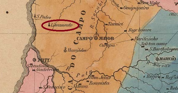
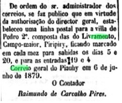
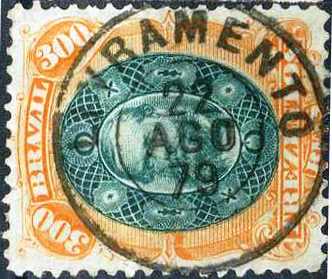
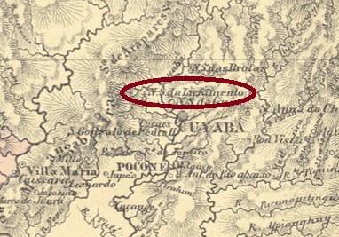
The Freguesia de Nossa Senhora do Livramento had existed since July 1874 and belonged to the Vila de União. It was located 55 kilometres north-east of the provincial capital Teresina. In May 1877, it became a Vila and was finally elevated to a city in July 1924. Since March 1931, the town has borne the name José de Freitas, in honour of a large landowner in the region from the late 19th century.
According to the list of imperial post offices (Tabella das Agencias do Correio do Imperio, Rio de Janeiro, 1885), there had been a post office there since 1879 and in June of the same year a postal route was established from Teresina, as reported in the regional press.
A Imprensa, 14 June 1879
The only imperial postmark to date, LPI-0090a (illustration from the Internet), has yet to be definitively confirmed:
LPI-0090a (EB) 1879Villiers de l’Ile Adam: Carta (…) da Provincia do Piauhy, 1850
Andere Namen: José de Freitas (1931)
Die Freguesia de Nossa Senhora do Livramento bestand seit Juli 1874 und gehörte zur Vila de União. Sie lag 55 Kilometer nordöstlich der Provinzhauptstadt Teresina. Im Mai 1877 wurde sie zur Vila und im Juli 1924 schließlich zur Stadt erhoben. Seit März 1931 trägt die Stadt den Namen José de Freitas, zu Ehren eines Großgrundbesitzers der Region aus dem späten 19. Jahrhundert.
Wie aus dem Verzeichnis der kaiserlichen Postämter (Tabella das Agencias do Correio do Imperio, Rio de Janeiro, 1885) hervorgeht, gab es dort seit 1879 ein Postamt und im Juni desselben Jahres wurde eine Postroute von Teresina dorthin eingerichtet, wie die regionale Presse bekannt gab.
A Imprensa, 14.06.1879
Der bisher einzige kaiserlicher Poststempel LPI-0090a (Abb. aus dem Internet) muss noch endgültig bestätigt werden:
Villiers de l’Ile Adam: Carta (…) da Provincia do Matto Grosso, 1850
Other names: S. José dos Cocais
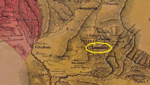
The Freguesia de Nossa Senhora do Livramento had existed since August 1835 and belonged to the Vila de Cuiabá, which was located 40 kilometres to the north-east. In May 1883 it was elevated to the status of a Vila. In December 1943, the município changed its name to São José dos Cocais, but in October 1948 the name N. Sra. do Livramento returned.
As reported in the Rio de Janeiro press, it was decided in November 1882 to set up a local post office.
Jornal do Commercio/RJ, 17.11.1882
So far, no imperial postmark could be assigned to this locality with certainty.
Atlas do Imperio do Brasil, 1868
Andere Namen: S. José dos Cocais
Die Freguesia de Nossa Senhora do Livramento bestand seit August 1835 und gehörte zur Vila de Cuiabá, die 40 Kilometer weiter nordöstlich lag. Im Mai 1883 wurde sie zur Vila erhoben. Im Dezember 1943 änderte der Município seinen Namen zu São José dos Cocais, doch im Oktober 1948 kehrte der Name N. Sra. do Livramento zurück.
Wie die Presse aus Rio de Janeiro berichtete, wurde im November 1882 beschlossen, vor Ort ein Postamt einzurichten.
Jornal do Commercio/RJ, 17.11.1882
Bisher konnte kein kaiserlicher Poststempel mit Sicherheit dieser Ortschaft zugeordnet werden.
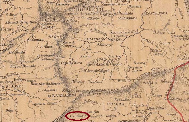
From 1836, Livramento was a district of Vila de Barbacena, 180 kilometres south of the provincial capital Ouro Preto. In May 1854, the town changed its name to Sant’Anna do Livramento and became a freguesia in November 1880. The place name Livramento returned in December 1938. Five years later, the district was renamed Oliveira Fortes. Oliveira Fortes has been an independent município since December 1953. The name commemorates one of the first large landowners in the region.
Paula Sobrinho (História Postal de Minas Gerais, Belo Horizonte, 1997) and R. Koester (Carimbologia XXVI) agree that there has been a post office there since April 1877. However, the directory of imperial post offices (Tabella das Agencias do Correio do Imperio, Rio de Janeiro, 1885) lists the agency as having been established in 1881. As the post office is not listed in the postal guide (Guia Postal do Império, Rio de Janeiro, 1880), it can be assumed that it was closed in the meantime.
The oldest postmark to date is LMG-1515a (collect. Fuad Ferreira Fo.)
LMG-1515a (FF) 1887
Koester (op. cit.) also shows the postmark with the imperial seal LMG-1515b:
LMG-1515b (RK)Villiers de l’Ile Adam: Carta (…) da Provincia de Minas Geraes, 1849
Andere Namen: Oliveira Fortes (1943)
Seit 1836 war Livramento ein Distrikt der 180 km südlich der Provinzhauptstadt Ouro Preto gelegenen Vila de Barbacena. Im Mai 1854 änderte der Ort seinen Namen in Sant’Anna do Livramento und wurde im November 1880 zu einer Freguesia. Im Dezember 1938 kehrte der Ortsname Livramento zurück. Fünf Jahre später wurde der Distrikt zu Oliveira Fortes umbenannt. Seit Dezember 1953 ist Oliveira Fortes ein eigenständiger Município. Der Name erinnert an einen der ersten Großgrundbesitzer der Region.
Paula Sobrinho (História Postal de Minas Gerais, Belo Horizonte, 1997) und R. Koester (Carimbologia XXVI) sind sich einig, dass es dort seit April 1877 ein Postamt gab. Allerdings listet das Verzeichnis der kaiserlichen Postämter (Tabella das Agencias do Correio do Imperio, Rio de Janeiro, 1885) die Agentur mit dem Entstehungsjahr 1881 auf. Da das Postamt im Postführer (Guia Postal do Império, Rio de Janeiro, 1880) nicht aufgeführt wird, kann davon ausgegangen werden, dass es zwischendurch geschlossen war.
Der bisher älteste Poststempel ist LMG-1515a (Samml. Fuad Ferreira Fo.)
LMG-1515a (FF) 1887
Koester (op. cit.) zeigt auch den Stempel mit dem kaiserlichen Siegel LMG-1515b:
Villiers de l’Ile Adam: Carta (…) da Provincia de Minas Geraes, 1849
Other names: Liberdade (1923)
From 1836, Livramento was a district of Ayuruoca, located on the north bank of the Rio Grande, 300 kilometres south of the provincial capital Ouro Preto. In May 1855, the town was elevated to the Freguesia de Senhor Bom Jesus do Livramento and changed its name to Liberdade (Liberty) in September 1923. Liberdade has been an independent município since December 1938.
Paula Sobrinho (História Postal de Minas Gerais, Belo Horizonte, 1997) and R. Koester (Carimbologia XXVI) agree that there has been a post office there since August 1872. The only imperial postmark to date is LMG-1510a (collect. Fuad Ferreira Fo.), which also occurs in red:
LMG-1510a (FF) 1886-1887Atlas do Imperio do Brasil, 1868
Andere Namen: Liberdade (1923)
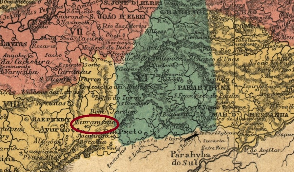
Seit 1836 war Livramento ein Distrikt von Ayuruoca, der am Nordufer des Rio Grande lag, 300 Kilometer südlich der Provinzhauptstadt Ouro Preto. Im Mai 1855 wurde der Ort zur Freguesia de Senhor Bom Jesus do Livramento erhoben und änderte im September 1923 seinen Namen in Liberdade (Freiheit). Seit Dezember 1938 ist Liberdade ein eigenständiger Município.
Paula Sobrinho (História Postal de Minas Gerais, Belo Horizonte, 1997) und R. Koester (Carimbologia XXVI) sind sich einig, dass es dort seit August 1872 ein Postamt gab. Der bisher einzige kaiserliche Poststempel ist LMG-1510a (Samml. Fuad Ferreira Fo.), der auch in Rot vorkommt:
Villiers de l’Ile Adam: Carta (…) da Provincia do Espirito Santo, 1850
Other names: Aldeia dos Coutins
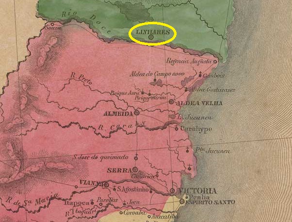
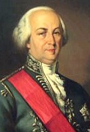
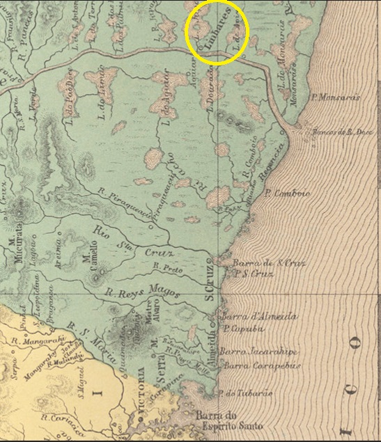
The settlement on the north bank of the Rio Doce, 140 kilometres north of the later provincial capital Vitória, had existed since 1809 and was named after the Count of Linhares, the Portuguese Rodrigo de Sousa Coutinho (1755-1812), who organised the flight of the Lisbon court to Brazil (1807-1808).
The Count of Linhares (Wikipedia)
In August 1818, the village became the Freguesia de N. Sra. da Conceição de Linhares do Rio Doce and in April 1833 the Vila de Linhares. In December 1921, Linhares was downgraded to a district of the municipality of Colatina, but regained its municipality status in December 1943.
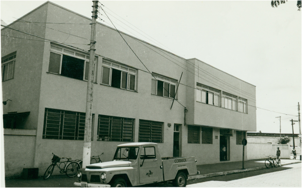
Linhares post office, 1975 (IBGE)
Nova Monteiro writes in Administrações e Agencias Postaes do Brasil Imperio (Brasil Filatelico/RJ, 1934-1935; reprint SPP 1994-1999) that there had been a post office there since October 1831. On agenciaspostais.com.br, however, P. Novaes writes December 1831, which could be a transcription error.
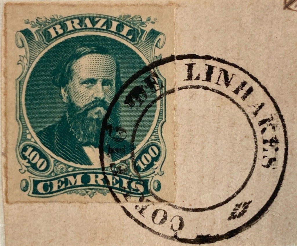
The oldest postmark to date is probably not the first: LES-0105b (fig. Roberto Assef Jr.) does not appear until the 1860s:
LES-0105b (RA) 1866ff-1876ff
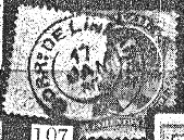
This was followed by LES-0105c (ill. R. Koester, in Carimbologia XXVI):
LES-0105c (RK) 1885Atlas do Imperio do Brasil, 1868
Andere Namen: Aldeia dos Coutins
Die Siedlung am Nordufer des Rio Doce, 140 Kilometer nördlich der späteren Provinzhauptstadt Vitória, bestand seit 1809. Benannt wurde sie nach dem Grafen von Linhares, dem Portugiesen Rodrigo de Sousa Coutinho (1755–1812), der die Flucht des Lissaboner Hofs nach Brasilien (1807–1808) organisierte.
Der Graf von Linhares (Wikipedia)
Im August 1818 wurde der Ort zur Freguesia de N. Sra. da Conceição de Linhares do Rio Doce und im April 1833 zur Vila de Linhares. Im Dezember 1921 wurde Linhares zum Distrikt des Munizips Colatina herabgestuft, erlangte jedoch im Dezember 1943 den Munizip-Status wieder.
Postamt Linhares, 1975 (IBGE)
Nova Monteiro schreibt in Administrações e Agencias Postaes do Brasil Imperio (Brasil Filatelico/RJ, 1934–1935; Nachdruck SPP 1994–1999), dass es dort seit Oktober 1831 ein Postamt gab. Auf agenciaspostais.com.br schreibt P. Novaes hingegen Dezember 1831, was ein Übertragungsfehler sein könnte.
Der bisher älteste Poststempel ist wohl nicht der erste: LES-0105b (Abb. Roberto Assef Jr.) kommt erst ab den 1860er Jahren vor:
LES-0105b (RA) 1866ff-1876ff
Es folgte LES-0105c (Abb. R. Koester, in Carimbologia XXVI):