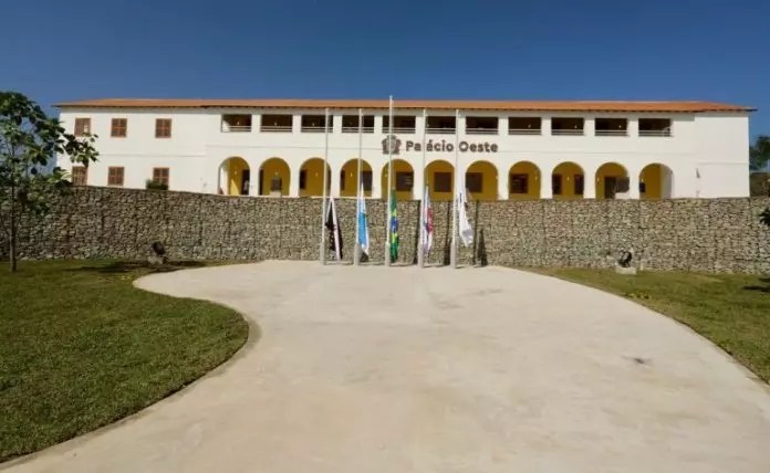
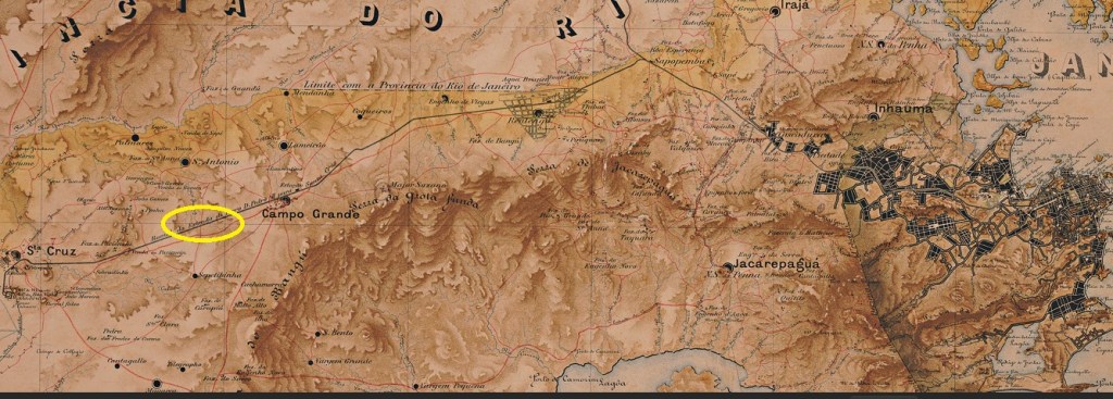
The locality developed from the Fazenda Inhoahyba, which belonged to the Gonzaga family and was located on the Royal Road (Estrada Real) 60 kilometres west of the capital Rio de Janeiro. A settlement developed there, which is now part of the administrative district of Campo Grande. The now modernised Fazenda Inhoahyba has been the administrative centre of the Rio West district since July 2024.
The “Palácio Oeste”
As R. Koester writes in Carimbologia XXII, there had been a post office there since April 1884, which was closed around 1940 according to Paulo Novaes (agenciaspostais.com.br). The imperial postmark is the rare IMN-0110a (fig. R. Koester, op.cit.):
IMN-0110a (RK) 1884Mappa do Municipio Neutro, ca. 1880
Der Ort entstand aus der Fazenda Inhoahyba, die der Familie Gonzaga gehörte und an der Königsstraße (Estrada Real) 60 km westlich der Hauptstadt Rio de Janeiro lag. Dort entwickelte sich eine Siedlung, die heute ein Stadtteil des Verwaltungsbezirks Campo Grande ist. Die heute modernisierte Fazenda Inhoahyba ist seit Juli 2024 Verwaltungssitz des Stadtteils Rio-West.
Der “Palácio Oeste”
Wie R. Koester in Carimbologia XXII schreibt, gab es dort seit April 1884 ein Postamt, das nach Paulo Novaes (agenciaspostais.com.br) um 1940 geschlossen wurde. Der kaiserliche Poststempel ist der seltene IMN-0110a (Abb. R. Koester, op.cit.):
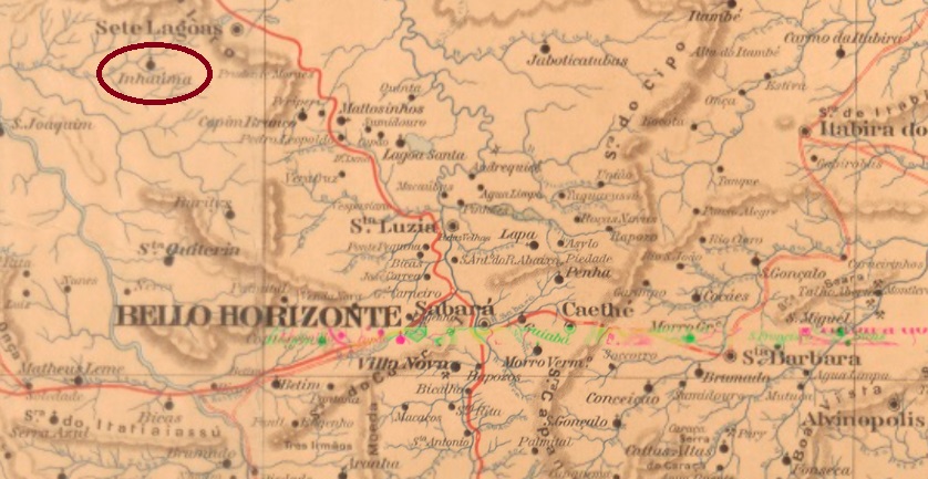
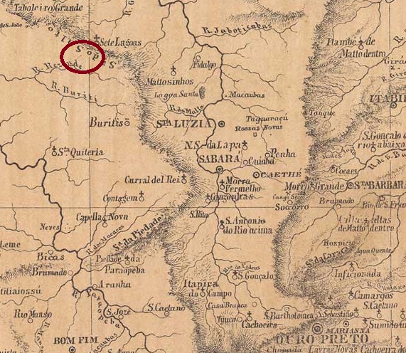
From January 1875, Inhaúma was a district of the Vila de Sete Lagoas, 180 kilometres northwest of the provincial capital of Ouro Preto. In November 1880, it became the Freguesia de S. Sebastião de Inhaúma, which has been an independent município since December 1948.
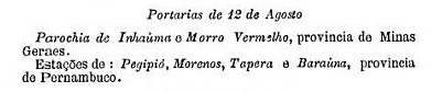
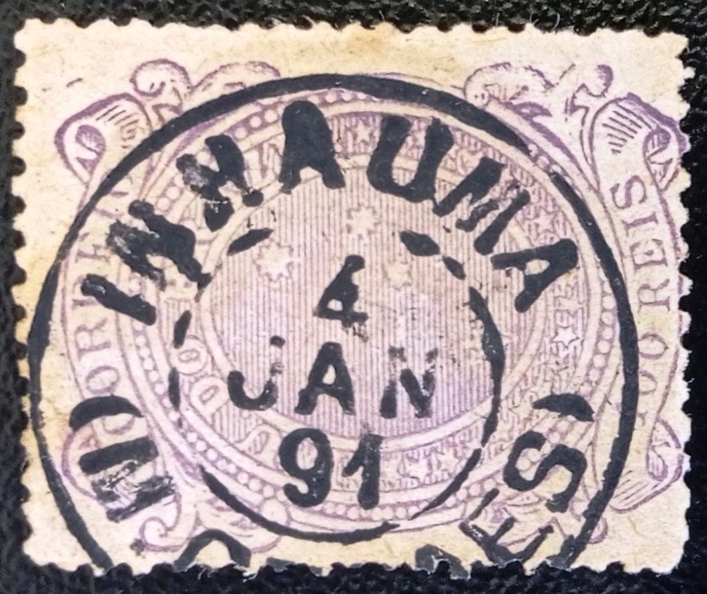
Reinhold Koester writes in Carimbologia XXII that there has been a post office there since August 1889. This is confirmed by the postal bulletin of the following month:
Boletim Postal No. 5, September 1889
The oldest postmark to date is the double circle IMG-1340a (Fig. Felipe Piccinini):
IMG-1340a (FP) 1889ff-1891Provincia de Minas Geraes, 1873
Siehe auch Santo Antonio do Monte (SMG-3490)
Seit Januar 1875 war Inhaúma ein Distrito der Vila de Sete Lagoas, 180 km nordwestlich der Provinzhauptstadt Ouro Preto gelegen. Im November 1880 wurde daraus die Freguesia de S. Sebastião de Inhaúma, die seit Dezember 1948 ein eigenständiges Município ist.
Reinhold Koester schreibt in Carimbologia XXII, dass es dort seit August 1889 ein Postamt gab. Dies wird durch das Postbulletin des folgenden Monats bestätigt:
Boletim Postal Nr. 5, September 1889
Der bisher älteste Poststempel ist der Doppelkreis IMG-1340a (Abb. Felipe Piccinini):
Villiers de l’Ile Adam: Carta (…) da Provincia da Bahia, 1848
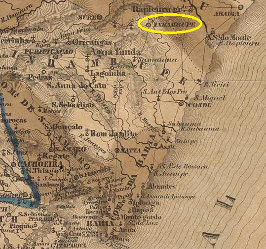
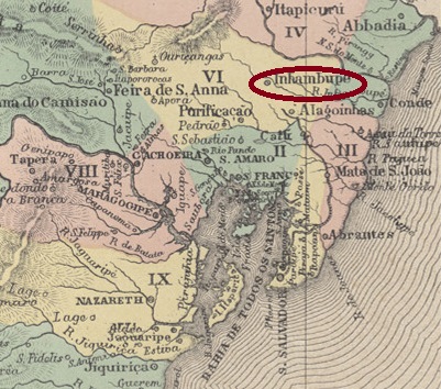
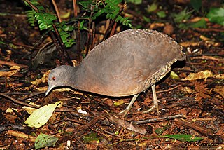
The village on the south bank of the Inhambupe, 170 kilometres north of the colonial capital Salvador da Bahia, first became a Vila (in April 1728) and only later (in November 1816) the Freguesia do Divino Espírito Santo de Inhambupe, a rather unusual development. Inhambupe has been a town since August 1896. The name comes from the Tupi-Guarani and means river of the Inhambus. The latter is a bird from the Tinamidae family:
Crypturellus obsoletus (Photo: José Carlos A. Rodrigues/Wikipedia)
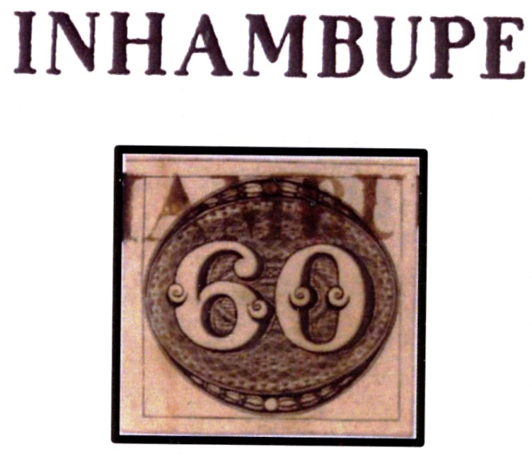
Nova Monteiro writes in Administrações e Agencias Postaes do Brasil Imperio (Brasil Filatelico/RJ, 1934-5; reprint SPP 1994-1999) that there had been a post office there since May 1832, while the directory of imperial post offices (Tabella das Agencias do Correio do Imperio, Rio de Janeiro, 1885) gives the year 1861. It is not known when the agency was closed in the meantime, but it was in operation at the end of 1856.
The oldest postmark is IBA-0400a, which also exists in brown and was given the number 1142 by P. Ayres in the Catálogo de Carimbos Brasil-Império (S. Paulo, 1937, 1942). Here also an illustration by Henrique B. Ferreira (Catálogo ilustrado dos carimbos sobre os olhos-de-boi, 4a. ed, Porto Alegre, 2017):
IBA-0400a (P.A. 1142 – HBF) 1843ff
This was followed by IBA-0400b (fig. R. Koester, in Carimbologia XXII):
IBA-0400b (RK) 1849Atlas do Imperio do Brasil, 1868
Der Ort am Südufer des Inhambupe, 170 km nördlich der Kolonialhauptstadt Salvador da Bahia, wurde zunächst (im April 1728) eine Vila und erst später (im November 1816) die Freguesia do Divino Espírito Santo de Inhambupe, eine eher ungewöhnliche Entwicklung. Seit August 1896 ist Inhambupe eine Stadt. Der Name stammt aus dem Tupi-Guarani und bedeutet Fluss des Inhambus. Letzteres ist ein Vogel aus der Familie Tinamidae:
Crypturellus obsoletus (Foto: José Carlos A. Rodrigues/Wikipedia)
Nova Monteiro schreibt in Administrações e Agencias Postaes do Brasil Imperio (Brasil Filatelico/RJ, 1934-5; Reprint SPP 1994-1999), dass es dort seit Mai 1832 ein Postamt gab, während im Verzeichnis der kaiserlichen Postämter (Tabella das Agencias do Correio do Imperio, Rio de Janeiro, 1885) das Jahr 1861 angegeben ist. Es ist nicht bekannt, wann die Agentur in der Zwischenzeit geschlossen wurde, aber sie war Ende 1856 in Betrieb.
Der älteste Poststempel ist IBA-0400a, der auch in braun existiert und von P. Ayres die Nr. 1142 im Catálogo de Carimbos Brasil-Império (S. Paulo, 1937, 1942) erhielt. Hier auch eine Illustration von Henrique B. Ferreira (Catálogo ilustrado dos carimbos sobre os olhos-de-boi, 4a. ed, Porto Alegre, 2017):
IBA-0400a (P.A. 1142 – HBF) 1843ff
Es folgte IBA-0400b (Abb. R. Koester, in Carimbologia XXII):
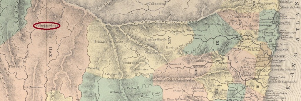
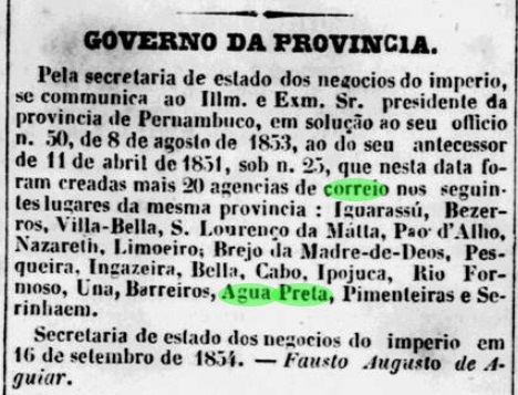
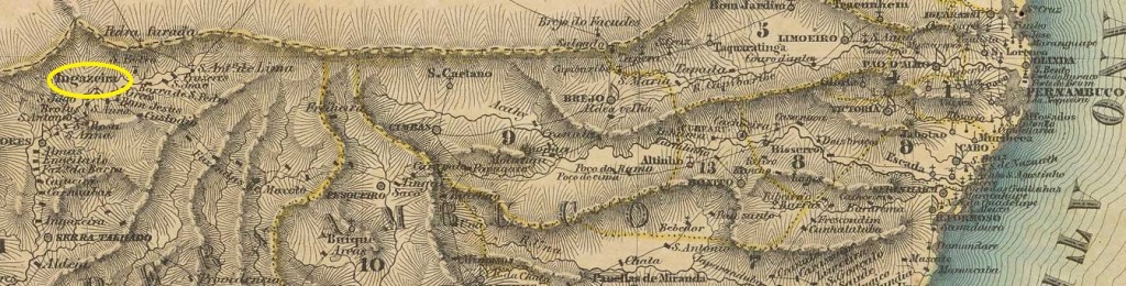
The Freguesia das Cabeceiras do Pajeú de S. José da Ingazeira, which has existed since 1836, belonged to the Vila de Flores and was located on the south bank of the Pajeú, 380 kilometres west of the provincial capital Recife. In May 1852, it was elevated to Vila de Ingazeira, followed by an eventful period in which the seat of the Vila was sometimes moved to Ingazeira, sometimes to the neighbouring village of Afogados (today: Afogados da Ingazeira). This ended in December 1948, when Ingazeira became a district in the Município de Tabira. Ingazeira has only been an independent município again since December 1963. The name refers to a plant of the Fabaceae family:
Inga feuillei (Photo: Drew Avery on Wikipedia)
Reinhold Koester writes in Carimbologia XXII that there had been a post office there since September 1854. The decision to create an agency is confirmed by the regional press:
Diario de Pernambuco, 07/10/1854
Nova Monteiro, however, in Administrações e Agencias Postaes do Brasil Imperio (Brasil Filatelico/RJ, 1934-5; reprint SPP 1994-1999), gives a date in January 1855, which could have been the date the post office opened.
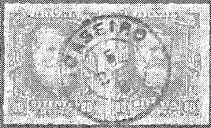
The first postmark has not yet been found. R. Koester (op. cit.) shows a stamp he attributed to Ingazeira/PE, which we believe to be a stamp from Joaseiro, in Bahia:
Ingaseiro/PE or Joaseiro/BA?
There is also a French type postmark IPE-0315b, the illustration of which is unfortunately still missing.
Villiers de l’Ile Adam: Carta (…) das Provincias de Pernambuco, Alagoas e Sergipe, 1848
Textaktualisierung am 11.12.2024
Andere Namen: Cabeceiras do Pajeú, Ingaseiro
Die seit 1836 bestehende Freguesia das Cabeceiras do Pajeú de S. José da Ingazeira gehörte zur Vila de Flores und lag am Südufer des Pajeú, 380 km westlich der Provinzhauptstadt Recife. Im Mai 1852 wurde sie zur Vila de Ingazeira erhoben, danach folgte eine wechselvolle Zeit, in der der Sitz der Vila mal nach Ingazeira, mal in den Nachbarort Afogados (heute: Afogados da Ingazeira) verlegt wurde. Dies endete im Dezember 1948, als Ingazeira ein Distrito im Município de Tabira wurde. Erst seit Dezember 1963 ist Ingazeira wieder ein eigenständiges Município. Der Name bezeichnet eine Pflanze der Familie Fabaceae:
Inga feuillei (Foto: Drew Avery auf Wikipedia)
Reinhold Koester schreibt in Carimbologia XXII, dass es dort seit September 1854 ein Postamt gab. Die Entscheidung, eine Agentur zu gründen, wird von der regionalen Presse bestätigt:
Diario de Pernambuco, 07.10.1854
Nova Monteiro gibt dagegen in Administrações e Agencias Postaes do Brasil Imperio (Brasil Filatelico/RJ, 1934-5; Reprint SPP 1994-1999) ein Datum im Januar 1855 an, das die Inbetriebnahme des Postamtes gewesen sein könnte.
Der erste Poststempel ist noch nicht gefunden worden. R. Koester (op. cit.) zeigt einen Stempel, den er Ingazeira/PE zuschreibt und von dem wir glauben, dass er ein Stempel aus Joaseiro in Bahia ist:
Ingaseiro/PE oder Joaseiro/BA?
Dann soll es einen Stempel französischer Art IPE-0315b geben, dessen Abbildung leider noch fehlt.
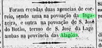
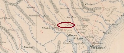
Ingazeira in the province of Alagoas is another place that has now disappeared from the map. We don’t even know exactly where this settlement was located, although it is clearly recognisable on the map from 1923 (see above): between the Paraíba and Mundaú rivers, almost 50 km northwest of the provincial capital of Maceió. It was probably a sugar cane fazenda whose owner dreamed of a prosperous settlement with a post office.
The post office was really created in April 1885, as the press in Rio reported:
Brazil/RJ, 18/04/1885
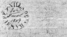
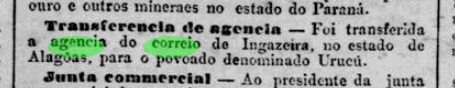
Shortly after, Ingazeira was elevated to the status of Distrito of Vila de Atalaia and retained this status at least until 1922, after which we were unable to find any further information about it. The post office was moved to the neighbouring village of Urucu at the beginning of 1891, which was a little further north in the direction of Rio Mundaú. There is no trace of this place either.
Jornal do Commercio/RJ 04.01.1891
Under these circumstances, it is not surprising that no imperial postmark from Ingazeira in the province of Alagoas has yet appeared. It must be very rare.
Carta Corographica do Estado de Alagoas, 1893
Mit Ingazeira in der Provinz Alagoas haben wir einen weiteren Ort, der heute von der Landkarte verschwunden ist. Wir wissen nicht einmal, wo diese Siedlung genau lag, obwohl sie auf der Karte von 1923 (siehe oben) deutlich zu erkennen ist: zwischen den Flüssen Paraíba und Mundaú, knapp 50 km nordwestlich der Provinzhauptstadt Maceió. Vermutlich handelte es sich um eine Zuckerrohr-Fazenda, deren Besitzer von einer wohlhabenden Siedlung mit Postamt träumte.
Die Einrichtung eines Postamts wurde tatsächlich im April 1885 beschlossen, wie die Presse in Rio berichtete:
Brazil/RJ, 18.04.1885
Kurze Zeit später wurde Ingazeira zum Distrito der Vila de Atalaia erhoben und behielt diesen Status mindestens bis 1922. Danach konnten wir keine weiteren Informationen finden. Das Postamt wurde Anfang 1891 in das Nachbardorf Urucu verlegt, das etwas weiter nördlich in Richtung Rio Mundaú lag. Auch von diesem Ort verliert sich die Spur.
Jornal do Commercio/RJ 04.01.1891
Unter diesen Umständen ist es nicht verwunderlich, dass bisher kein kaiserlicher Poststempel aus Ingazeira in der Provinz Alagoas aufgetaucht ist. Er muss sehr selten sein.
Villiers de l’Ile Adam: Carta (…) da Provincia de Minas Geraes, 1849
Other names: Infeccionado, Santa Rita Durão (1895)
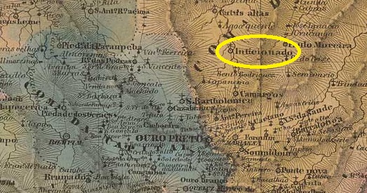
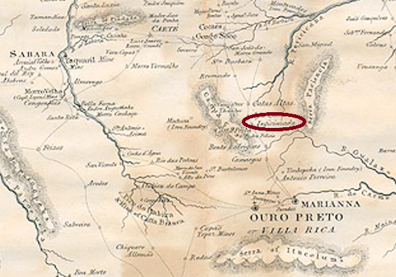
The old settlement on the west bank of the Piracicaba River was already a parish (paróquia) called N. Sra. de Nazareth do Inficionado in February 1718 and belonged to Vila de Mariana, 60 kilometres north of the later provincial capital Ouro Preto. The place name, which sounds strange even to Brazilian ears, is said to designate an ore variety that appeared contaminated (‘infected’). In 1836, Inficionado became a freguesia, which has been the district of Santa Rita Durão since June 1895.
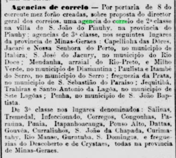
Both Paula Sobrinho (História Postal de Minas Gerais, Belo Horizonte, 1997) and R. Koester (Carimbologia XXII) write that there has been a post office there since November 1881. This is confirmed by the press in Rio:
Jornal do Commercio/RJ, 12/11/1881
Here, too, the postmark does not appear to have arrived in time, as there is a handwritten cancellation at the beginning (collect. Fuad Ferreira Fo.):
1884 (FF)
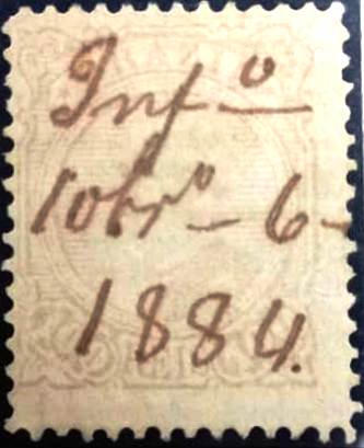
IMG-1335a is known from 1885 (image from the Internet):
IMG-1335a (EB) 1885-1894Province of Minas Geraes, 1835
Andere Namen: Infeccionado, Santa Rita Durão (1895)
Die alte Siedlung am Westufer des Piracicaba-Flusses war bereits im Februar 1718 eine Pfarrei (Paróquia) namens N. Sra. de Nazareth do Inficionado und gehörte zu Vila de Mariana, 60 km nördlich der späteren Provinzhauptstadt Ouro Preto. Der selbst für brasilianische Ohren merkwürdig klingende Ortsname soll eine Erzvarietät bezeichnen, die verunreinigt („infiziert“) erschien. 1836 wurde Inficionado eine Freguesia, die seit Juni 1895 der Bezirk von Santa Rita Durão ist.
Sowohl Paula Sobrinho (História Postal de Minas Gerais, Belo Horizonte, 1997) als auch R. Koester (Carimbologia XXII) schreiben, dass es dort seit November 1881 ein Postamt gab. Dies wird von der Presse in Rio bestätigt:
Jornal do Commercio/RJ, 12.11.1881
Auch hier scheint der Poststempel nicht rechtzeitig angekommen zu sein, denn am Anfang steht eine handschriftliche Entwertung (Samml. Fuad Ferreira Fo.):
1884 (FF)
Ab 1885 ist IMG-1335a bekannt (Abbildung aus dem Internet):
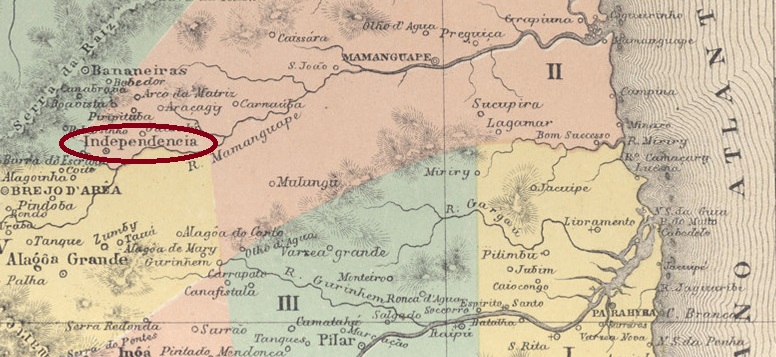
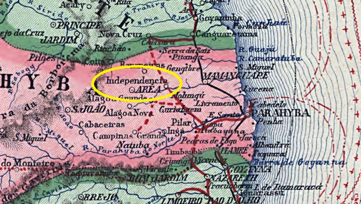
The Engenho Morgado has existed since 1694 as a sugar cane processing plant in the area 90 kilometres northwest of the later provincial capital Paraíba do Norte (today: João Pessoa). The settlement around the Engenho continued to grow as Povoação de Guarabira (the indigenous word means home of the herons) and became Villa da Independência in April 1837, in retrospective memory of Brazil’s independence in 1822. Since November 1877, the official name has been Cidade de N. Sra. da Luz de Guarabira.
As Nova Monteiro writes in Administrações e Agencias Postaes do Brasil Imperio (Brasil Filatelico/RJ, 1934-5; reprint SPP 1994-1999), there had been a post office in Vila de Independencia since January 1838, and postmarks with Independencia (see IPB-0135) were used until at least 1891, according to R. Koester (Carimbologia XXII). It is therefore unlikely that there are imperial postmarks with Guarabira. A Guarabira postal agency first appeared in the regional press around 1888:
Gazeta da Parahyba, 28/09/1888
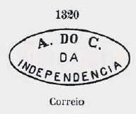
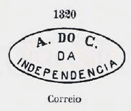
We know of 3 imperial postmarks with Independencia and believe that they belong here, as this town was much larger and more prosperous than the one of the same name in the province of Piauí (or later: Ceará). However, if no evidence is available, the cancels are presented here without code number. Beginning with no. 1320 in P. Ayres’ Catálogo de Carimbos Brasil-Império (S. Paulo, 1937, 1942):
P.A. 1320 (MPT 355)
Then a postmark (illustration from the Internet) with large letters and an ornament at the bottom, which appears in blue:
1882ff (EB)
And finally a cancel with a (2) at the bottom, illustrated in Koester’s Carimbologia XXII:
1889-1890ff (RK)Carta da Republica dos Estados unidos do Brazil, 1892
Andere Namen: Engenho Morgado
Siehe auch Guarabira (GPB-0135)
Seit 1694 existierte der Engenho Morgado als Zuckerrohrverarbeitungsbetrieb im Gebiet 90 km nordwestlich der späteren Provinzhauptstadt Paraíba do Norte (heute: João Pessoa). Die Siedlung um den Engenho wuchs als Povoação de Guarabira (das indigene Wort bedeutet Heimat der Reiher) weiter und wurde im April 1837 zur Villa da Independência, in nachträglicher Erinnerung an die Unabhängigkeit Brasiliens 1822. Seit November 1877 ist der offizielle Name Cidade de N. Sra. da Luz de Guarabira.
Wie Nova Monteiro in Administrações e Agencias Postaes do Brasil Imperio (Brasil Filatelico/RJ, 1934-5; Reprint SPP 1994-1999) schreibt, gab es in der Vila de Independencia seit Januar 1838 ein Postamt, und Poststempel mit Independencia (siehe IPB-0135) wurden laut R. Koester (Carimbologia XXII) bis mindestens 1891 verwendet. Es ist daher unwahrscheinlich, dass es kaiserliche Poststempel mit Guarabira gibt. Eine Postagentur Guarabira erschien erstmals um 1888 in der regionalen Presse:
Gazeta da Parahyba, 28.09.1888
Wir kennen 3 kaiserliche Poststempel mit Independencia und glauben, dass sie eher hierher gehören, da dieser Ort viel größer und wohlhabender war als der gleichnamige in der Provinz Piauí (bzw. später: Ceará). Solange jedoch keine Beweise vorliegen, werden die Stempel hier ohne Codenummer vorgestellt. Beginnend mit Nr. 1320 in P. Ayres‘ Catálogo de Carimbos Brasil-Império (S. Paulo, 1937, 1942):
P.A. 1320 (MPT 355)
Dann ein Stempel (Abb. aus dem Internet) mit großen Buchstaben und einem Ornament unten, der in Blau erscheint:
1882ff (EB)
Und zuletzt ein Stempel mit einer (2) unten, abgebildet in Koesters Carimbologia XXII:
Carta da Republica dos Estados Unidos do Brazil, 1892
Other names: Pelo Sinal
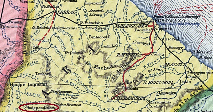
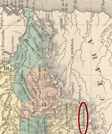
From September 1836, the village was a distrito called Pelo Sinal (Signum Crucis), which belonged to the Vila de Crateús in the province of Piauí and was located on the west bank of the Riacho Florisbela, 300 kilometres southwest of the later provincial capital Fortaleza. The town was elevated to a freguesia in October 1853 and to a Vila de Independencia in July 1857; since October 1880 Independência (as it is spelt today) has belonged to the province or state of Ceará.
As Nova Monteiro writes in Administrações e Agencias Postaes do Brasil Imperio (Brasil Filatelico/RJ, 1934-5; reprint SPP 1994-1999), there was a post office there since November 1861. Unfortunately, no imperial postmark could be assigned to this place with certainty.
Atlas do Imperio do Brasil, 1868
Andere Namen: Pelo Sinal
Der Ort war seit September 1836 ein Distrito namens Pelo Sinal (Signum Crucis), der zur Vila de Crateús in der Provinz Piauí gehörte und am Westufer des Riacho Florisbela lag, 300 km südwestlich der späteren Provinzhauptstadt Fortaleza. Der Ort wurde im Oktober 1853 zur Freguesia und im Juli 1857 zur Vila de Independencia erhoben; seit Oktober 1880 gehört Independência (wie es heute geschrieben wird) zur Provinz bzw. zum Bundesstaat Ceará.
Wie Nova Monteiro in Administrações e Agencias Postaes do Brasil Imperio (Brasil Filatelico/RJ, 1934-5; Reprint SPP 1994-1999) schreibt, gab es dort ein Postamt seit November 1861. Leider konnte bisher kein kaiserlicher Poststempel mit Sicherheit diesem Ort zugeordnet werden.
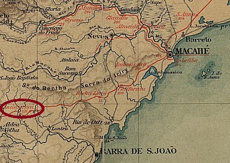
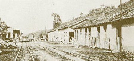
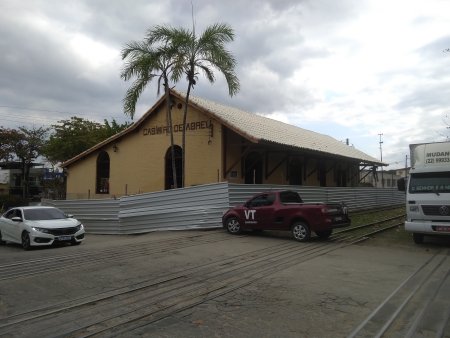
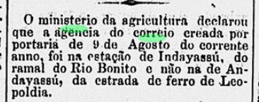
The Indayassú (Great Palm, in Tupi-Guarani) station was opened in July 1888 by the E.F. Leopoldina railway company, Rio Bonito branch, and was located in the Vila de Barra de S. João area, 140 km north-east of the capital Rio de Janeiro. The line was transferred to E.F. Leopoldina around 1890 and belonged to Rede Ferroviária Federal S.A. from 1975 until it was closed down. Today, the tracks still exist and the station building is a cultural centre for the municipality (estacoesferroviarias.com.br).
1922 (image by O Malho, on estacoesferroviarias.com.br)In August 2022 (photo: Renato R.C. Ramos, on estacoesferroviarias.com.br)
Indayassú became a municipality in August 1890 and Casimiro de Abreu municipality in December 1925, in memory of the poet born here (1839-1860).
Brazilian Academy of Literature
As the Rio press reported, there had been a post office at the railway station since August 1888:
Diario de Noticias, 28/09/1888
The imperial postmark is IRJ-0630a (image from the Internet):
IRJ-0630a (EB) 1888-1897E.F. Leopoldina
Andere Namen: Casimiro de Abreu (1925)
Der Bahnhof Indayassú (Große Palme, in Tupi-Guarani) wurde im Juli 1888 von der Eisenbahngesellschaft E.F. Leopoldina, Rio Bonito-Zweig, eröffnet und lag im Gebiet der Vila de Barra de S. João, 140 km nordöstlich der Hauptstadt Rio de Janeiro. Die Strecke ging um 1890 an die E.F. Leopoldina über und gehörte von 1975 bis zur Stilllegung der Rede Ferroviária Federal S.A. Heute sind die Gleise noch vorhanden, das Bahnhofsgebäude ist ein Kulturzentrum der Gemeinde (estacoesferroviarias.com.br).
1922 (Abb. O Malho, auf estacoesferroviarias.com.br)Im August 2022 (Foto: Renato R.C. Ramos, auf estacoesferroviarias.com.br)
Im August 1890 wurde Indayassú zum Munizip und im Dezember 1925 zum Munizip Casimiro de Abreu, in Erinnerung an den hier geborenen Dichter (1839-1860).
Brasilianische Akademie der Literatur
Wie die Presse aus Rio berichtete, gab es seit August 1888 ein Postamt am Bahnhof:
Diario de Noticias, 28.09.1888
Der kaiserliche Poststempel ist IRJ-0630a (Abbildung aus dem Internet):
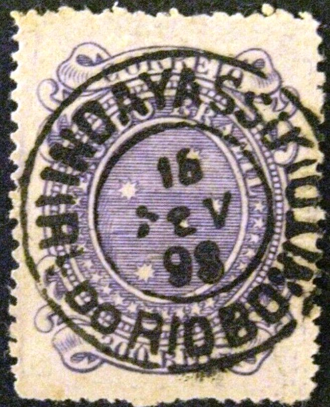
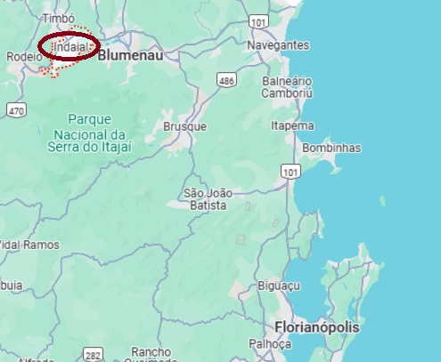
Indayal had been a distrito of the Vila de Blumenau since September 1886 and was located on the south bank of the Itajaí-Açu at the mouth of the Benedito, 170 kilometres northwest of the provincial capital Desterro (today: Florianópolis). The town was elevated to the status of a vila in October 1893, but lost this status again four years later. Indaial (as it is spelt today) only became a município again in February 1934. The name comes from the Tupi-Guarani language and means ‘many palm trees’.
R. Koester writes in Carimbologia XXII that there has been a post office there since December 1882. The imperial postmark ISC-0125a (coll. Marcio Duarte) exists also in blue:
ISC-0125a (MDu) 1884-1891Google Maps
Indayal war seit September 1886 ein Distrito der Vila de Blumenau und lag am Südufer des Itajaí-Açu an der Mündung des Benedito, 170 km nordwestlich der Provinzhauptstadt Desterro (heute: Florianópolis). Der Ort wurde im Oktober 1893 zur Vila erhoben, verlor diesen Status aber vier Jahre später wieder. Erst seit Februar 1934 ist Indaial (wie es heute geschrieben wird) wieder ein Município. Der Name aus der Tupi-Guarani-Sprache bedeutet “viele Palmen”.
R. Koester schreibt in Carimbologia XXII, dass es dort seit Dezember 1882 ein Postamt gab. Den kaiserlichen Poststempel ISC-0125a (Samml. Marcio Duarte) gibt es auch in Blau: