Categories
Carimbologia H-L

Iguape, São Paulo (ISP-0585)

Villiers de l’Ile Adam: Carta (…) da Provincia de São Paulo, 1847

Text update of March 9, 2025

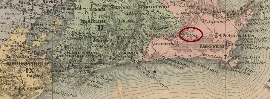
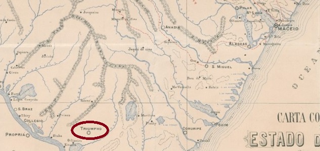
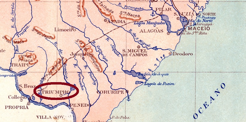
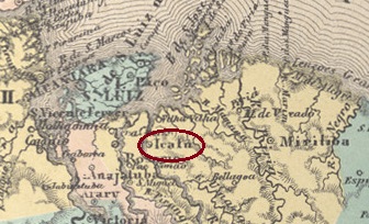
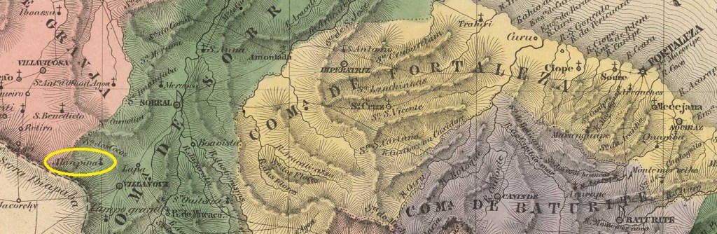
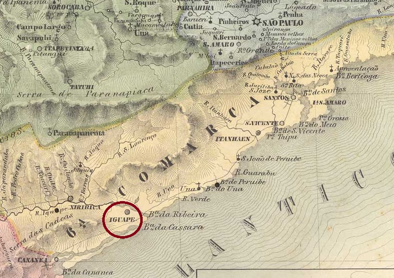
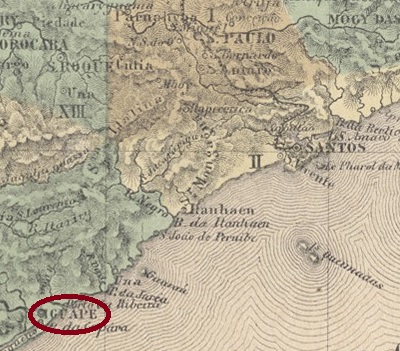
This settlement of Vila de Cananéia has existed since December 1538, at that time in the Capitania de São Vicente, at the mouth of the Ribeira de Iguape into the inland lake Mar Pequeno (‘Little Sea’), 200 km south-west of the later provincial capital of São Paulo. In 1577 it became the Freguesia de N. Sra. das Neves da Vila de Iguape and in April 1848 the town of Senhor Bom Jesus da Ribeira de Iguape.

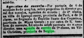
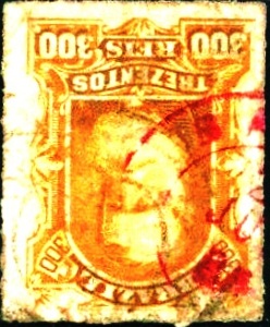
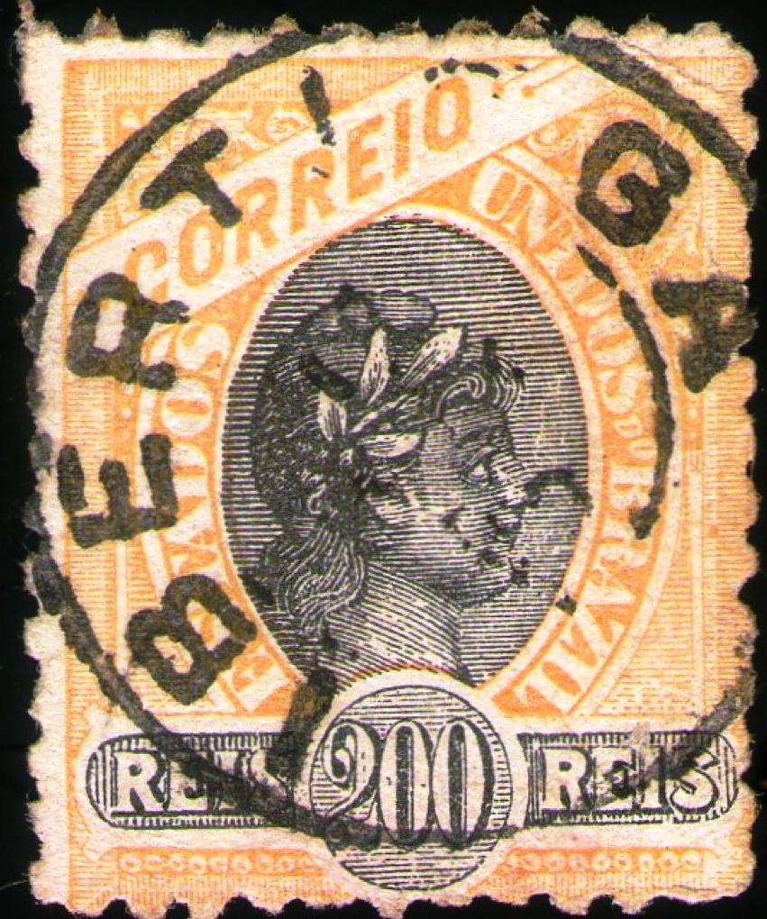
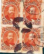
R. Koester writes in Carimbologia XXII that a post office had been in operation there since 1844, but at the same time reports on postal traffic and postmarks of Iguape from 1829. Philatelist Mário Celso Orsi Jr. writes that the agency was also created in 1828 and 1840, unfortunately without citing any sources.

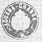
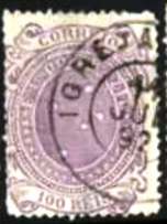
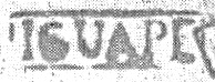
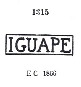
The oldest postmark is the pre-philatelic ISP-0585a (fig. R. Koester op. cit.).

ISP-0585a (RK) 1828-1843

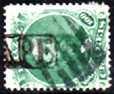
It was followed by a similar ISP-0585b, also existent in blue and green, which was given no. 1315 by P. Ayres in Catálogo de Carimbos Brasil-Império (S. Paulo, 1937, 1942):

ISP-0585b (P.A. 1315) 1866ff-1873

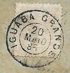
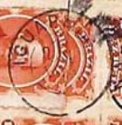
Its successor is the rare double circle ISP-0585c (Fig. Márcio Duarte), which also exists in blue:

ISP-0585c (MDu) 1878-1879

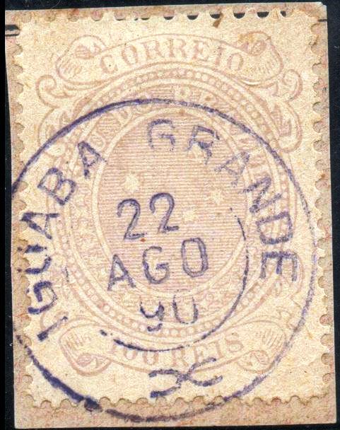
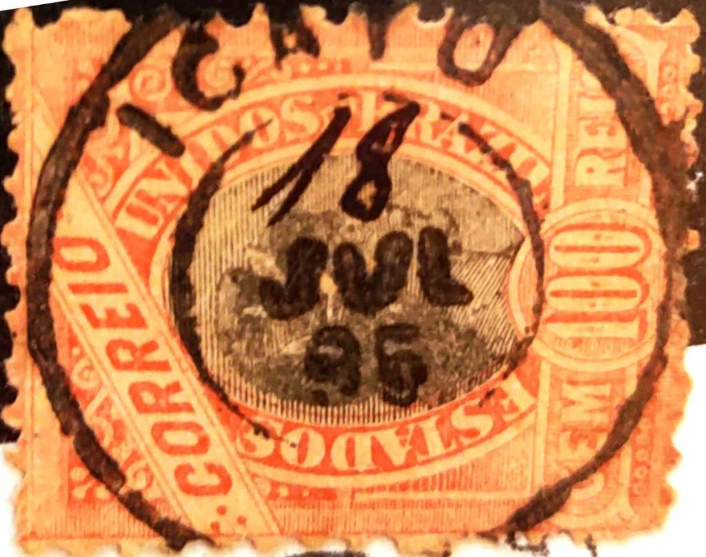
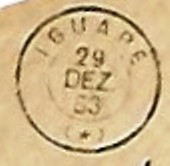
This was followed by the French type ISP-0585d (ill. José L. Fevereiro):

ISP-0585d (JLF) 1883-1903

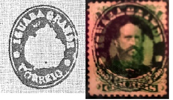
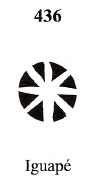
James Dingler and Klerman W. Lopes in Mute Cancellations of the Brazil Empire / Carimbos Mudos do Brasil Império (Brazil Philatelic Association, Rio de Janeiro, 2000) have also listed a mute cancellation from Iguape with no. 436:

BPA 436 (1883)

Another mute cancel was shown by Mário Celso Orsi Jr.

1866ff (MO)

Marcio Duarte has presented another mute postmark:

1878 (MDu)
Atlas do Imperio do Brasil, 1868

Textaktualisierung vom 09.03.2025

Seit Dezember 1538 bestand diese Siedlung der Vila de Cananéia, damals in der Capitania de São Vicente, an der Mündung der Ribeira de Iguape in den Binnensee Mar Pequeno („Kleines Meer“), 200 km südwestlich der späteren Provinzhauptstadt São Paulo. 1577 wurde daraus die Freguesia de N. Sra. das Neves da Vila de Iguape und im April 1848 die Stadt Senhor Bom Jesus da Ribeira de Iguape.

R. Koester schreibt in Carimbologia XXII, dass dort seit 1844 ein Postamt in Betrieb war, berichtet aber gleichzeitig über Postverkehr und Poststempel von Iguape aus dem Jahre 1829. Der Philatelist Mário Celso Orsi Jr. schreibt, dass die Agentur auch in den Jahren 1828 und 1840 gegründet wurde, leider ohne Quellenangaben.

Der älteste Poststempel ist der vorphilatelistische ISP-0585a (Abb. R. Koester op. cit.).

ISP-0585a (RK) 1828-1843

Ihm folgte ein ähnlicher ISP-0585b, ebenfalls in blau und grün vorkommend, der von P. Ayres in Catálogo de Carimbos Brasil-Império (S. Paulo, 1937, 1942) die Nr. 1315 erhielt:

ISP-0585b (P.A. 1315) 1866ff-1873

Sein Nachfolger ist der seltene Doppelkreis ISP-0585c (Abb. Márcio Duarte), den es auch in blau gibt:

ISP-0585c (MDu) 1878-1879

Danach kam der französische Typ ISP-0585d (Abb. José L. Fevereiro):

ISP-0585d (JLF) 1883-1903

James Dingler und Klerman W. Lopes haben in Mute Cancellations of the Brazil Empire / Carimbos Mudos do Brasil Império (Brazil Philatelic Association, Rio de Janeiro, 2000) auch einen stummen Stempel aus Iguape mit Nr. 436 aufgeführt:

BPA 436 (1883)

Mário Calso Orsi Jr. zeigte einen anderen stummen Stempel:

1866ff (MO)

Ein weiterer stummer Poststempel zeigte Marcio Duarte:

1878 (MDu)

Categories
Carimbologia H-L

Iguaba Grande, Rio de Janeiro (IRJ-1045)

Villiers de l’Ile Adam: Carta (…) da Provincia do Rio de Janeiro, 1850

The settlement of N. Sra da Conceição da Iguaba Grande has existed since around 1795. It belonged to the Freguesia de S. Pedro da Aldeia in the Vila de Cabo Frio area and was located on the northern shore of Lake Araruama, 130 kilometres east of the capital Rio de Janeiro. In 1890, the village was incorporated into the newly founded Município de Sapiatiba and in June 1954 became a district of the Município de S. Pedro da Aldeia. Iguaba Grade has been an independent município since June 1995.

As Nova Monteiro writes in Administrações e Agencias Postaes do Brasil Imperio (Brasil Filatelico/RJ, 1934-5; reprint SPP 1994-1999), there was a post office there since July 1855. The first postmark is IRJ-1045a, which also exists in red and dark violet and which was given the no. 1314 by P. Ayres in Catálogo de Carimbos Brasil-Império (S. Paulo, 1937, 1942):

IRJ-1045a (P.A. 1314) 1855-1890ff

This was followed by IRJ-1045b (fig. agenciaspostais.com.br):

IRJ-1045b (PN) 1878-1885

It was followed by IRJ-1045c (illus. from the internet):

IRJ-1045c (EB) 1888-1890

Two postmarks with the imperial seal were found from there. The first is IRJ-1045d (fig. R. Koester in Carimbologia XXII – Marcio Duarte)

IRJ-1045d (RK-MDu) 1866ff

The second is IRJ-1045e (fig. Koester):

IRJ-1045e (RK)

James Dingler and Klerman W. Lopes have included two mute cancellations from Iguaba Grande in Mute Cancellations of the Brazil Empire/ Carimbos Mudos do Brasil Império (Brazil Philatelic Association, Rio de Janeiro, 2000):

BPA 364 – 3871 (P.A. 671, 1866ff)
Colton & Colton: Provincia do Rio de Janeiro, 1866

Die Siedlung N. Sra da Conceição da Iguaba Grande bestand seit ca. 1795. Sie gehörte zur Freguesia de S. Pedro da Aldeia im Gebiet der Vila de Cabo Frio und lag am Nordufer des Araruama-Sees, 130 km östlich der Hauptstadt Rio de Janeiro. Im Jahre 1890 wurde der Ort in das neu gegründete Município de Sapiatiba eingegliedert und im Juni 1954 ein Distrito des Município de S. Pedro da Aldeia. Seit Juni 1995 ist Iguaba Grade ein selbständiges Município.

Wie Nova Monteiro in Administrações e Agencias Postaes do Brasil Imperio (Brasil Filatelico/RJ, 1934-5; Reprint SPP 1994-1999) schreibt, gab es dort ein Postamt seit Juli 1855. Der erste Poststempel ist IRJ-1045a, den es auch in rot und dunkelviolett gibt und der von P. Ayres in Catálogo de Carimbos Brasil-Império (S. Paulo, 1937, 1942) die Nr. 1314 erhielt:

IRJ-1045a (P.A. 1314) 1855-1890ff

Es folgte IRJ-1045b (Abb. agenciaspostais.com.br):

IRJ-1045b (PN) 1878-1885

Ihm folgte IRJ-1045c (Abb. aus dem Internet):

IRJ-1045c (EB) 1888-1890

Zwei Poststempel mit dem kaiserlichen Siegel wurden von dort gefunden. Der erste ist IRJ-1045d (Abb. R. Koester in Carimbologia XXII – Marcio Duarte)

IRJ-1045d (RK-MDu) 1866ff

Der zweite ist IRJ-1045e (Abb. Koester):

IRJ-1045e (RK)

James Dingler und Klerman W. Lopes haben zwei stumme Abstempelungen aus Iguaba Grande in Mute Cancellations of the Brazil Empire/ Carimbos Mudos do Brasil Império (Brazil Philatelic Association, Rio de Janeiro, 2000) aufgenommen:

BPA 364 – 3871 (P.A. 671, 1866ff)
Categories
Carimbologia H-L

Igreja Nova, Alagoas (IAL-0070)

Carta Corographica do Estado de Alagoas, 1893

Other names: Oitiseiro, Triumpho (1890-1928)

The Freguesia de Igreja Nova, which had existed since June 1880, belonged to the Vila de Agua Branca and was located on the north bank of the Riacho Boacica, 160 kilometres southwest of the provincial capital of Maceió. In June 1890 it was elevated to Vila de Triumpho, which became a town in May 1892. In July 1895, it was downgraded to a district of the Município de Penedo, before being elevated to a Município again in May 1897. The old name Igreja Nova returned in June 1928.

As Aldo Cardoso writes in Contribuição para a História dos Correios de Alagoas (Maceió, 1969), there had been a post office there since July 1868. The oldest postmark to date is IAL-0070b (image from the Internet):

IAL-0070b (Philasearch) 1887-1892
Briguiet: Estado de Alagoas, 1923

Andere Namen: Oitiseiro, Triumpho (1890-1928)

Die seit Juni 1880 bestehende Freguesia de Igreja Nova gehörte zur Vila de Agua Branca und lag am Nordufer des Riacho Boacica, 160 km südwestlich der Provinzhauptstadt Maceió. Im Juni 1890 wurde es zur Vila de Triumpho erhoben, die im Mai 1892 zur Stadt wurde. Im Juli 1895 wurde es zum Distrikt des Município de Penedo herabgestuft, bevor es im Mai 1897 wieder zum Município erhoben wurde. Im Juni 1928 kehrte der alte Name Igreja Nova zurück.

Wie Aldo Cardoso in Contribuição para a História dos Correios de Alagoas (Maceió, 1969) schreibt, gab es dort seit Juli 1868 ein Postamt. Der bisher älteste Poststempel ist IAL-0070b (Abbildung aus dem Internet):

IAL-0070b (Philasearch) 1887-1892
Categories
Carimbologia H-L

Igarapé-Mery, Pará (IPA-0125)

Villiers de l’Ile Adam: Carta (…) das Provincias do Gräo Pará e Alto Amazonas, 1850

Other names: Igarapé-Miri

The Freguesia de Sant’Anna do Igarapé-Mery, in existence since 1758, belonged to the Vila de Belém do Pará and was located on the north bank of the Igarapé-Miri, 90 kilometres southwest of the later provincial capital Belém do Pará. In October 1843 it became a Vila and in May 1896 the town of Igarapé-Miri (current spelling).

The list of imperial post offices (Tabella das Agencias do Correio do Imperio, Rio de Janeiro, 1885) shows that there had been a post office there since 1882. This was confirmed by the press in Rio:

Jornal do Commercio/RJ, 11/10/1882

No imperial postmarks have yet been found from Igarapé-Mery.

Carta da Republica dos Estados Unidos do Brazil, 1892

Andere Namen: Igarapé-Miri

Die seit 1758 bestehende Freguesia de Sant’Anna do Igarapé-Mery gehörte zur Vila de Belém do Pará und lag am Nordufer des Igarapé-Miri, 90 km südwestlich der späteren Provinzhauptstadt Belém do Pará. Im Oktober 1843 wurde es zur Vila und im Mai 1896 zur Stadt Igarapé-Miri (heutige Schreibweise) erhoben.

Aus dem Verzeichnis der kaiserlichen Postämter (Tabella das Agencias do Correio do Imperio, Rio de Janeiro, 1885) geht hervor, dass es dort seit 1882 ein Postamt gab. Dieses wurde von der Presse in Rio bestätigt:

Jornal do Commercio/RJ, 11.10.1882

Aus Igarapé-Mery sind bisher keine kaiserlichen Poststempel gefunden worden.

Categories
Carimbologia H-L

Icó, Ceará (ICE-0155)

Atlas do Imperio do Brasil, 1868

Other names: Ribeira dos Icós, Arraial Velho, Arraial Novo, Icó dos Fonsecas, Icó dos Montes 

The Vila do Arraial da Ribeira dos Icós had existed on the east bank of the Rio Salgado, 360 kilometres south of the later provincial capital of Fortaleza, since October 1736. In April 1764, this became the Freguesia de N. Sra. da Expectação de Icó. Icó has been a town since October 1842. The name comes from the indigenous language Tupi-Guarani and means field river. 

Two dates have been found for the foundation of the local post office. R. Koester in Carimbologia XXII gives December 1845, while Nova Monteiro in Administrações e Agencias Postaes do Brasil Imperio (Brasil Filatelico/RJ, 1934-5; reprint SPP 1994-1999) gives January 1847. 

The oldest postmark to date is ICE-0155a (fig. R. Koester, op. cit.), which also exists in red: 

ICE-0155a (RK) 1850ff

It is followed by ICE-0155b, which also exists in yellow and was given the no. 1313 by P. Ayres in Catálogo de Carimbos Brasil-Império, (S. Paulo, 1937, 1942): 

ICE-0155b (P.A. 1313) 1866ff-1879 

This was followed by the double circle ICE-0155c (fig. R. Koester), which also exists in dark violet: 

ICE-0155c (RK) 

Koester also showed the cachet ICE-0155d

ICE-0155d (RK) 
Villiers de l’Ie Adam: Carta (…) da Provincia do Ceará, 1849

Andere Namen: Ribeira dos Icós, Arraial Velho, Arraial Novo, Icó dos Fonsecas, Icó dos Montes 

Seit Oktober 1736 bestand am Ostufer des Rio Salgado, 360 km südlich der späteren Provinzhauptstadt Fortaleza, die Vila do Arraial da Ribeira dos Icós. Im April 1764 wurde daraus die Freguesia de N. Sra. da Expectação de Icó. Seit Oktober 1842 ist Icó eine Stadt. Der Name aus der indigenen Sprache Tupi-Guarani bedeutet Feldfluss. 

Für die Gründung des örtlichen Postamtes wurden zwei Daten gefunden. R. Koester nennt in Carimbologia XXII den Dezember 1845, während Nova Monteiro in Administrações e Agencias Postaes do Brasil Imperio (Brasil Filatelico/RJ, 1934-5; Nachdruck SPP 1994-1999) den Januar 1847 angibt. 

Der bisher älteste Stempel ist ICE-0155a (Abb. R. Koester, op. cit.), der auch in rot existiert: 

ICE-0155a (RK) 1850ff

Es folgt ICE-0155b, der auch in gelb existiert und von P. Ayres in Catálogo de Carimbos Brasil-Império, (S. Paulo, 1937, 1942) die Nr. 1313 erhielt: 

ICE-0155b (P.A. 1313) 1866ff-1879 

Danach kam der Doppelkreis ICE-0155c (Abb. R. Koester), der auch in dunkelviolett existiert: 

ICE-0155c (RK) 

Koester zeigte auch den Siegelstempel ICE-0155d

ICE-0155d (RK) 
Categories
Carimbologia H-L

Icatu, Maranhão (IMA-0135)

Villier de l’Ile Adam: Carta (…) da Provincia do Maranhão, 1850

Other names: Aguas Boas, Sta. Maria de Guaxenduba 

The former Vila de N. Sra. da Ajuda de Aguas Boas was founded in January 1688 and later moved to the site of the Arraial de Sta. Maria de Guaxenduba on the east bank of the Munim, 100 kilometres south-east of the provincial capital of São Luís do Maranhão. The Vila was given the name N. Sra. da Conceição do Icatu in April 1835. Icatu has been a town since April 1924. 

Two dates have been found for the foundation of the local post office. Nova Monteiro (Administrações e Agencias Postaes do Brasil Imperio, in Brasil Filatelico/RJ, 1934-5; Reprint SPP) gives March 1830, which is confirmed by the regional press: 

Pharol Maranhense/02/03/1830 

R. Koester (Carimbologia XXII) gives December 1832, as can also be read in the 1886 postal report (Relatorio dos Correios). The oldest postmark to date is IMA-0135b (fig. R. Koester, op. cit.): 

IMA-0135b (RK) 1866ff 

It was followed by IMA-0135c (fig. Jorge L. Pedreira): 

IMA-0135c (JLP) 1895 
Atlas do Imperio do Brasil, 1868

Andere Namen: Aguas Boas, Sta. Maria de Guaxenduba 

Die ehemalige Vila de N. Sra. da Ajuda de Aguas Boas wurde im Januar 1688 gegründet und später an die Stelle des Arraial de Sta. Maria de Guaxenduba am Ostufer des Munim, 100 km südöstlich der Provinzhauptstadt São Luís do Maranhão, verlegt. Die Vila erhielt im April 1835 den Namen N. Sra. da Conceição do Icatu. Seit April 1924 ist Icatu eine Stadt. 

Für die Gründung des örtlichen Postamtes wurden zwei Daten gefunden. Nova Monteiro (Administrações e Agencias Postaes do Brasil Imperio, in Brasil Filatelico/RJ, 1934-5; Reprint SPP) gibt den März 1830 an, was von der regionalen Presse bestätigt wird: 

Pharol Maranhense/02.03.1830 

R. Koester (Carimbologia XXII) nennt Dezember 1832, wie auch im Postbericht 1886 (Relatorio dos Correios) zu lesen ist. Der bisher älteste Poststempel ist IMA-0135b (Abb. R. Koester, op. cit.): 

IMA-0135b (RK) 1866ff 

Ihm folgte IMA-0135c (Abb. Jorge L. Pedreira):  

IMA-0135c (JLP) 1895 
Categories
Carimbologia H-L

Ibituruna (train station/Bahnhof), Minas Gerais (IMG-1325)

Estado de Minas Geraes, 1910

See also S. Gonçalo de Ibituruna (SMG-2310)

From November 1865, São Gonçalo de Ibituruna was a freguesia of the Vila de S. João d’El-Rei on the Rio das Mortes, about 230 km south-west of the provincial capital Ouro Preto. A railway station belonging to the E.F. Oeste de Minas company (Paraopeba Line) was opened there in October 1887. The line was transferred to Rede Mineira de Viação in 1931, to V.F. Centro-Oeste in 1965 and belonged to Rede Ferroviária Federal S.A. (estacoesferroviarias.com.br) from 1975 until it was closed in 1984. Today the tracks have disappeared, and the station building is a cultural centre of the municipality of Ibituruna, an independent município since 1962.

1914 (photo NN, on estacoesferroviarias.com.br)
2016 (photo Fernando Marietan, on estacoesferroviarias.com.br)

Paula Sobrinho (História Postal de Minas Gerais, Belo Horizonte, 1997) and R. Koester (Carimbologia XXII) agree that there has been a post office at the railway station since December 1887. This is confirmed by the regional press:

O Pharol, 19/12/1887

The oldest postmark to date is IMG-1325a (illustration by Luiz C. Fritzen):

IMG-1325a (LCF) 1893
E. F. Oeste de Minas, 1917

Siehe auch S. Gonçalo de Ibituruna (SMG-2310)

São Gonçalo de Ibituruna war seit November 1865 eine Freguesia der Vila de S. João d’El-Rei am Rio das Mortes, etwa 230 km südwestlich der Provinzhauptstadt Ouro Preto. Dort wurde im Oktober 1887 ein Bahnhof der Gesellschaft E.F. Oeste de Minas (Paraopeba-Linie) eröffnet. Die Strecke ging 1931 an die Rede Mineira de Viação, 1965 an die V.F. Centro-Oeste und gehörte von 1975 bis zu ihrer Stilllegung 1984 der Rede Ferroviária Federal S.A. (estacoesferroviarias.com.br). Heute sind die Gleise verschwunden, das Bahnhofsgebäude ist ein Kulturzentrum der Gemeinde Ibituruna, seit 1962 ein eigenständiges Município.

1914 (Foto NN, auf estacoesferroviarias.com.br)
2016 (Foto Fernando Marietan, auf estacoesferroviarias.com.br)

Paula Sobrinho (História Postal de Minas Gerais, Belo Horizonte, 1997) und R. Koester (Carimbologia XXII) sind sich einig, dass es seit Dezember 1887 ein Postamt am Bahnhof gab. Dies wird von der regionalen Presse bestätigt:

O Pharol, 19.12.1887

Der bisher älteste Poststempel ist IMG-1325a (Abb. Luiz C. Fritzen):

IMG-1325a (LCF) 1893


Categories
Carimbologia H-L

Ibitinga, São Paulo (ISP-0580)

Estado de São Paulo, 1910

The Freguesia de Senhor Bom Jesus de Ibitinga was founded in April 1885 and belonged to the Vila de Araraquara, near the north bank of the Jacaré-Guaçu, 350 kilometres northwest of the provincial capital of São Paulo. In July 1890 it was elevated to a Vila in its own Município.

R. Koester writes in Carimbologia XXII that there had been a post office there since February 1887. This is confirmed by the press in Rio:

Jornal do Commercio/RJ, 13/02/1887

The only postmark from the 19th century to date is ISP-0580a (image from the Internet):

ISP-0580a (EB) 1896-1897
Arthur D. Ribeiro: Estado de São Paulo, 1924

Die Freguesia de Senhor Bom Jesus de Ibitinga wurde im April 1885 gegründet und gehörte zur Vila de Araraquara, nahe dem Nordufer des Jacaré-Guaçu, 350 km nordwestlich der Provinzhauptstadt São Paulo. Im Juli 1890 erfolgte die Erhebung zur Vila im eigenen Município.

R. Koester schreibt in Carimbologia XXII, dass es dort seit Februar 1887 ein Postamt gab. Dies wird von der Presse in Rio bestätigt:

Jornal do Commercio/RJ, 13.02.1887

Der bisher einzige Poststempel aus dem 19. Jahrhundert ist ISP-0580a (Abbildung aus dem Internet):

ISP-0580a (EB) 1896-1897
Categories
Carimbologia H-L

Ibiapina, Ceará (ICE-0150)

Carta da Capitania do Ceará, 1818

Other names. Ibiapaba

In March 1842, the old settlement became a distrito of the Vila de São Benedito, located near the Serra de Ibiapaba, 310 kilometres west of the provincial capital Fortaleza. It was elevated to a Vila in November 1878, but it was not until August 1882 that it became the Freguesia de S. Pedro da Ibiapina. In May 1931, Ibiapina was downgraded to a Distrito in the Município S. Benedito, but in December 1933 its former status as a Vila was restored. Ibiapina has been a town since December 1938. The term comes from the Tupi language and means land without plants.

As R. Koester writes in Carimbologia XXII, there has been a post office there since March 1879. Two postmarks from the imperial era were found. ICE-0150a (FM collection) is only known in red:

ICE-0150a (FM) 1885

R. Koester (op. cit.) also shows the postmark with the imperial seal ICE-0150b:

ICE-0150b (RK)
Villiers de l’Ile Adam: Carta (…) da Provincia do Ceara, 1849

Andere Namen. Ibiapaba

Im März 1842 wurde die alte Siedlung ein Distrito der Vila de São Benedito, gelegen in der Serra de Ibiapaba, 310 km westlich der Provinzhauptstadt Fortaleza. Die Erhebung zur Vila erfolgte im November 1878, doch erst im August 1882 wurde der Ort zur Freguesia de S. Pedro da Ibiapina. Im Mai 1931 wurde Ibiapina zum Distrito im Município S. Benedito herabgestuft, aber im Dezember 1933 wurde der alte Status als Vila wiederhergestellt. Seit Dezember 1938 ist Ibiapina eine Stadt. Der Begriff stammt aus der Tupi-Sprache und bedeutet pflanzenloses Land

Wie R. Koester in Carimbologia XXII schreibt, gab es dort seit März 1879 ein Postamt. Aus der Kaiserzeit wurden zwei Poststempel gefunden. ICE-0150a (Sammlung FM) ist bisher nur in rot bekannt:

ICE-0150a (FM) 1885

R. Koester (op. cit.) zeigt auch den Stempel mit dem kaiserlichen Siegel ICE-0150b:

ICE-0150b (RK)
Categories
Carimbologia H-L

Ibertioga, Minas Gerais (IMG-1315)

Villiers de l’Ile Adam: Carta (…) da Provincia de Minas Geraes, 1849

Other names: Berthioga

Since 1836, the village was a distrito of the Vila de Barbacena on the south bank of the Elvas River, 170 kilometres south of the provincial capital Ouro Preto. In November 1880 it became the Freguesia de Sto. Antonio da Ibertioga, and in December 1938 the place name was changed to Distrito de Ibertioga. Ibertioga has been an independent município since December 1962. The name comes from the indigenous language Tupi-guarani and means home of the small mosquitoes.

As both Paula Sobrinho (História Postal de Minas Gerais, Belo Horizonte, 1997) and R. Koester (Carimbologia XXII) write, there had been a post office there since April 1881. The oldest postmark to date is the double circle IMG-1315a (ill. Claudio Coelho):

IMG-1315a (CC) 1887-1894ff
Provincia de Minas Geraes, 1873

Andere Namen: Berthioga

Der Ort war seit 1836 ein Distrito der Vila de Barbacena am Südufer des Flusses Elvas, 170 km südlich der Provinzhauptstadt Ouro Preto. Im November 1880 wurde es zur Freguesia de Sto. Antonio da Ibertioga, im Dezember 1938 wurde der Ortsname in Distrito de Ibertioga geändert. Seit Dezember 1962 ist Ibertioga ein eigenständiges Município. Der Name stammt aus der indigenen Sprache Tupi-guarani und bedeutet Heimat der kleinen Mücken.

Wie sowohl Paula Sobrinho (História Postal de Minas Gerais, Belo Horizonte, 1997) als auch R. Koester (Carimbologia XXII) schreiben, gab es dort seit April 1881 ein Postamt. Der bisher älteste Poststempel ist der Doppelkreis IMG-1315a (Abb. Claudio Coelho):

IMG-1315a (CC) 1887-1894ff