Categories
Carimbologia H-L

Larangeiras (train station/Bahnhof), Rio de Janeiro (LRJ-2460)

Almanak Laemmert, 1892

Other names: Laranjais (1943)

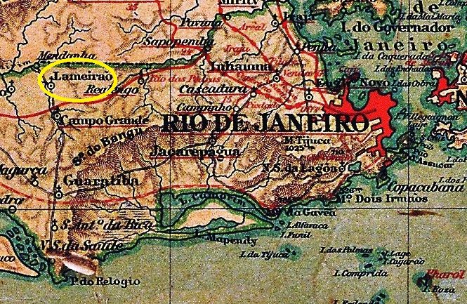
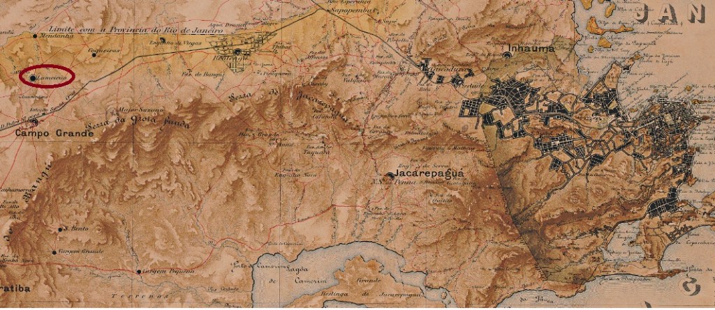
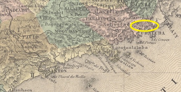
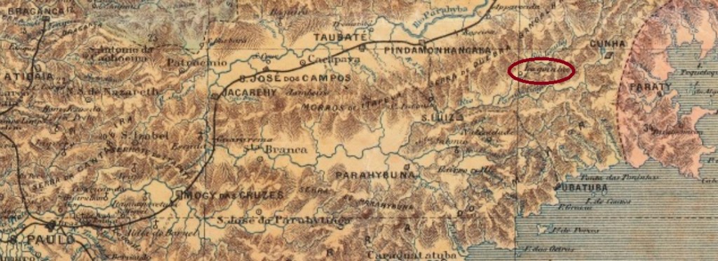
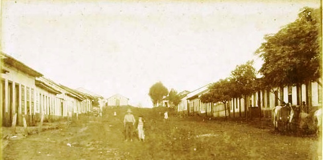
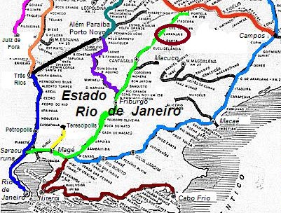
Larangeiras station was opened in 1881 by the Ramal Férreo de Cantagallo railway company and was located on the south bank of the Ribeirão das Areias in the municipality of Cantagallo, 260 km north-east of the capital Rio de Janeiro. The railway line was transferred to E.F. Macahe e Campos in 1888 and belonged to E.F. Leopoldina from 1890 until it was closed in 1967 (estacoesferroviarias.com.br). The tracks and station building have now disappeared.

Around 1950 (Photo: estacoesferroviarias.com.br)

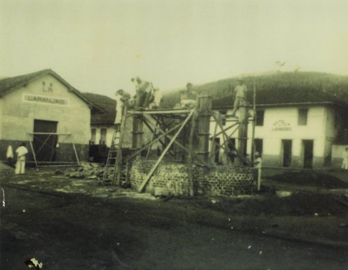
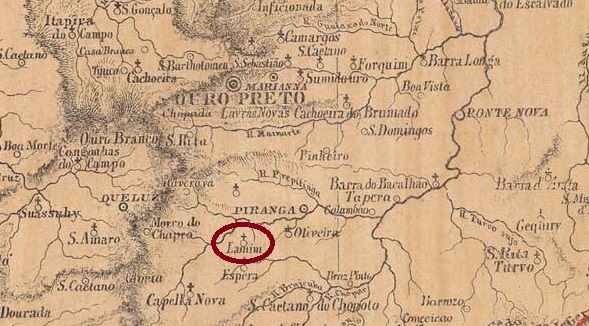
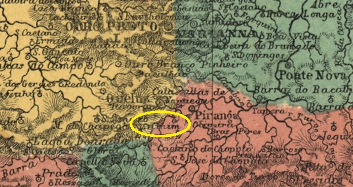
From April 1891, the railway station was in the district of the same name in the Município de Itaocara, since December 1943 under the place name Laranjais. The original name Larangeiras, which like Laranjais means orange groves, referred to a sugar cane plantation in the region.

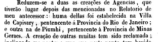
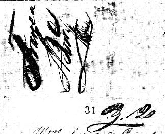
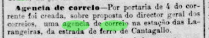
As the regional press reported, it was decided in March 1882 to create a post office at the railway station:

Jornal do Commercio, 07/03/1882

The directory of imperial post offices (Tabella das Agencias do Correio do Imperio, Rio de Janeiro, 1885) gives the year 1883 for the railway station post office, which could be the year it was opened. Paulo Novaes writes in agenciaspostais.com.br that the post office was closed in December 1943.

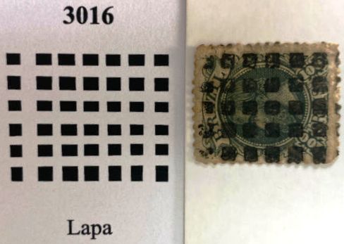
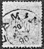
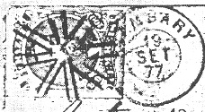
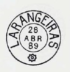
The oldest postmark here is LRJ-2460a (fig. R. Koester, in Carimbologia XXVI):

LRJ-2460a (RK) 1885

This was followed by LRJ-2460b, which was illustrated in P. Ayres’s Catálogo de Carimbos Brasil-Império (S. Paulo, 1937, 1942):

LRJ-2460b (P.A. p. 122) 1887-1889

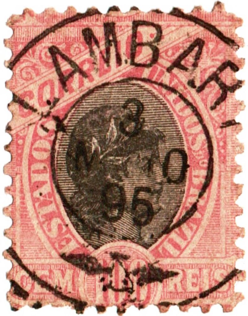
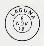
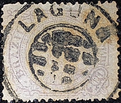
LRJ-2460c also appeared towards the end of the century (illustration from the Internet):

LRJ-2460c (EB) 1890-1899

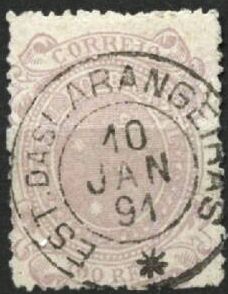
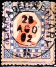
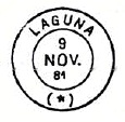
R. Koester also showed the postmark with the imperial seal LRJ-2460d in Carimbologia XXVI:

LRJ-2460d (RK)
Estrada de Ferro Leopoldina

Andere Namen: Laranjais (1943)

Der Bahnhof Larangeiras wurde 1881 von der Eisenbahngesellschaft Ramal Férreo de Cantagallo eröffnet und lag am Südufer des Ribeirão das Areias im Munizip Cantagallo, 260 km nordöstlich der Hauptstadt Rio de Janeiro. Die Bahnlinie ging 1888 an die E.F. Macahe e Campos über und gehörte von 1890 bis zu ihrer Stilllegung 1967 der E.F. Leopoldina (estacoesferroviarias.com.br). Gleise und Bahnhofsgebäude sind heute verschwunden.

Um 1950 (Foto: estacoesferroviarias.com.br)

Seit April 1891 befand sich der Bahnhof im gleichnamigen Distrito im Município de Itaocara, seit Dezember 1943 unter dem Ortsnamen Laranjais. Der ursprüngliche Name Larangeiras, der wie Laranjais Orangenhaine bedeutet, bezog sich auf eine Zuckerrohrplantage in der Region.

Wie die regionale Presse berichtete, wurde im März 1882 beschlossen, am Bahnhof ein Postamt einzurichten:

Jornal do Commercio, 07.03.1882

Das Verzeichnis der kaiserlichen Postämter (Tabella das Agencias do Correio do Imperio, Rio de Janeiro, 1885) gibt für das Bahnhofspostamt das Jahr 1883 an, was das Jahr seiner Inbetriebnahme sein könnte. Paulo Novaes schreibt in agenciaspostais.com.br, dass das Postamt im Dezember 1943 geschlossen wurde.

Der älteste Poststempel hier ist LRJ-2460a (Abb. R. Koester, in Carimbologia XXVI):

LRJ-2460a (RK) 1885

Es folgte LRJ-2460b, der im P. Ayres’ Catálogo de Carimbos Brasil-Império (S. Paulo, 1937, 1942) abgebildet wurde:

LRJ-2460b (P.A. p./S. 122) 1887-1889

Gegen Ende des Jahrhunderts erschien auch LRJ-2460c (Abb. aus dem Internet):

LRJ-2460c (EB) 1890-1899

R. Koester zeigte in Carimbologia XXVI auch den Poststempel mit dem kaiserlichen Siegel LRJ-2460d:

LRJ-2460d (RK)
Categories
Carimbologia H-L

Lapa, Paraná (LPR-0125)

Estado do Paraná, 1896

Other names: Villa Nova do Principe, Principe

See also Principe (R. Koester: Carimbologia XXXII)

The Freguesia de Santo Antonio da Lapa had existed since June 1797. It belonged to the Vila de Curitiba, then still in the Capitania de S. Paulo, and was located 70 kilometres southwest of the later provincial capital Curitiba. In June 1806 it was elevated to Villa Nova do Principe and as such was incorporated into the province of Paraná in 1853. Since March 1872, it has been the city of Lapa.

Nova Monteiro writes in Administrações e Agencias Postaes do Brasil Imperio (Brasil Filatelico/RJ, 1934-5; reprint SPP 1994-1999) that there has been a post office there since March 1836. The oldest postmark with the place name LAPA is LPR-0125a (collect. José A. Junges). Here the lower abbreviation P.P. is not clear; some read it as Porte Pago (fee paid), but Provincia do Paraná is more likely.

LPR-0125a (JJ) 1878ff-1890

This was followed by LPR-0125b (fig. Roberto Assef Jr.), which also exists in purple:

LPR-0125b (RA) 1891-1898

James Dingler and Klerman W. Lopes in Mute Cancellations of the Brazil Empire / Carimbos Mudos do Brasil Império (Brazil Philatelic Association, Rio de Janeiro, 2000) have also listed a mute cancellation for Lapa under no. 3016, here also in an example by R. Assef Jr:

BPA 3016 (P.A. 300-RA) 1882ff-1883

For postmarks with Principe see R. Koester’s Carimbologia XXXII.

Estado do Paraná, 1892

Andere Namen: Villa Nova do Principe, Principe

Siehe auch Principe (R. Koester: Carimbologia XXXII)

Die Freguesia de Santo Antonio da Lapa bestand seit Juni 1797. Sie gehörte zur Vila de Curitiba, damals noch in der Capitania de S. Paulo, und lag 70 km südwestlich der späteren Provinzhauptstadt Curitiba. Im Juni 1806 wurde sie zur Villa Nova do Principe erhoben und als solche 1853 in die Provinz Paraná eingegliedert. Seit März 1872 ist es die Stadt Lapa.

Nova Monteiro schreibt in Administrações e Agencias Postaes do Brasil Imperio (Brasil Filatelico/RJ, 1934-5; Reprint SPP 1994-1999), dass es dort seit März 1836 ein Postamt gab. Der älteste Poststempel mit der Ortsbezeichnung LAPA ist LPR-0125a (Samml. José A. Junges). Hier ist die untere Abkürzung P.P. nicht eindeutig; manche lesen sie als Porte Pago (Gebühr bezahlt), wahrscheinlicher ist aber Provincia do Paraná.

LPR-0125a (JJ) 1878ff-1890

Es folgte LPR-0125b (Abb. Roberto Assef Jr.), die es auch in violett gibt:

LPR-0125b (RA) 1891-1898

James Dingler und Klerman W. Lopes haben in Mute Cancellations of the Brazil Empire / Carimbos Mudos do Brasil Império (Brazil Philatelic Association, Rio de Janeiro, 2000) auch einen stummen Stempel für Lapa unter Nr. 3016 aufgeführt, hier auch in einem Beispiel von R. Assef Jr:

BPA 3016 (P.A. 300-RA) 1882ff-1883

Für Poststempel mit Principe siehe R. Koesters Carimbologia XXXII.

Categories
Carimbologia H-L

Lapa de Capivary, Rio de Janeiro (LRJ-0690)

Atlas do Imperio do Brasil, 1868

Other names: Capivary, Silva Jardim (1943)

The Freguesia de N. Sra. da Lapa de Capivary was founded in January 1755, belonged to the Vila de Cabo Frio and was located on the south bank of the Capivary, 110 km east of the capital Rio de Janeiro. The place was elevated to Vila in May 1841 and to town in January 1890. Since December 1943, the município has borne the name Silva Jardim, in honour of Antônio da Silva Jardim (1860-1891). He was a lawyer, journalist and politician who strongly supported the Republic and the abolition of slavery. He died shortly before his 31st birthday in an accident on Mount Vesuvius:

Silva Jardim, self-portrait

Three dates have been found for the founding of the local post office. First around 1841, as shown in the 1842 report of the Imperial Ministry:

Relatorio do Ministerio do Imperio, 1842

The next two dates are close together, from February 1843: Paulo Novaes (agenciaspostais.com.br) writes 3 February, while Nova Monteiro (Administrações e Agencias Postaes do Brasil Imperio, in Brasil Filatelico/RJ, 1934-5; reprint SPP 1994-1999) gives a date 10 days later.

The oldest postmarks bear the place name CAPIVARY (see CRJ-0300). Paulo Novaes writes in agenciaspostais.com.br that the post office was renamed LAPA DE CAPIVARY in March 1881. The first postmark with the new place name is LRJ-0690a (fig. Felipe Piccinini):

LRJ-0690a (FP) 1885-1889

This was followed at the end of the century by LRJ-0690b (illustration from the Internet):

LRJ-0690b (EB) 1891-1900ff
Villiers de l’Ile Adam: Carta (…) da Provincia do Rio de Janeiro, 1850

Andere Namen: Capivary, Silva Jardim (1943)

Die Freguesia de N. Sra. da Lapa de Capivary wurde im Januar 1755 gegründet, gehörte zur Vila de Cabo Frio und lag am Südufer des Capivary, 110 km östlich der Hauptstadt Rio de Janeiro. Der Ort wurde im Mai 1841 zur Vila und im Januar 1890 zur Stadt erhoben. Seit Dezember 1943 trägt der Município den Namen Silva Jardim, zu Ehren von Antônio da Silva Jardim (1860-1891). Dieser war Anwalt, Journalist und Politiker, der sich stark für die Republik und die Abschaffung der Sklaverei einsetzte. Er starb kurz vor seinem 31. Geburtstag bei einem Unfall auf dem Vesuv:

Silva Jardim, Selbstporträt

Für die Gründung des örtlichen Postamtes wurden drei Daten gefunden. Zuerst um 1841, wie aus dem Bericht des kaiserlichen Ministeriums von 1842 hervorgeht:

Relatorio do Ministerio do Imperio, 1842

Die nächsten beiden Daten sind nahe beieinander, aus dem Februar 1843: Paulo Novaes (agenciaspostais.com.br) schreibt den 3. Februar, während Nova Monteiro (Administrações e Agencias Postaes do Brasil Imperio, in Brasil Filatelico/RJ, 1934-5; Reprint SPP 1994-1999) ein um 10 Tage späteres Datum angibt.

Die ältesten Poststempel tragen die Ortsbezeichnung CAPIVARY (siehe CRJ-0300). Paulo Novaes schreibt in agenciaspostais.com.br, dass im März 1881 das Postamt zu LAPA DE CAPIVARY umbenannt wurde. Der erste Stempel mit der neuen Ortsbezeichnung ist LRJ-0690a (Abb. Felipe Piccinini):

LRJ-0690a (FP) 1885-1889

Am Ende des Jahrhunderts folgte LRJ-0690b (Abb. aus dem Internet):

LRJ-0690b (EB) 1891-1900ff
Categories
Carimbologia H-L

Lamim, Minas Gerais (LMG-1480)

Provincia de Minas Geraes, 1873

José Pires Lamim was the settler who had the first chapel built in July 1760, 65 kilometres south of the later provincial capital of Ouro Preto. The settlement was named after him and in 1840 became a district of Vila de Queluz (today: Conselheiro Lafaiete). In July 1859, it became the Freguesia de Espírito Santo do Lamim, which was subordinated to the Município de Rio Espera as a Distrito in December 1938. Lamim has been an independent município since December 1962.

Paula Sobrinho (História Postal de Minas Gerais, Belo Horizonte, 1997) and R. Koester (Carimbologia XXVI) agree that there has been a post office there since May 1879. The oldest postmark to date is still handwritten (fig. Koester, op. cit.):

1883ff (RK)

The postmark LMG-1480b (Fig. Koester) was only added towards the end of the century:

LMG-1480b (RK) 1890
Atlas do Imperio do Brasil, 1868

José Pires Lamim war der Siedler, der im Juli 1760 die erste Kapelle errichten ließ, 65 km südlich der späteren Provinzhauptstadt Ouro Preto. Die Siedlung wurde nach ihm benannt und 1840 zu einem Distrikt der Vila de Queluz (heute: Conselheiro Lafaiete). Im Juli 1859 wurde daraus die Freguesia de Espírito Santo do Lamim, die im Dezember 1938 als Distrito dem Município de Rio Espera unterstellt wurde. Seit Dezember 1962 ist Lamim ein unabhängiges Município.

Paula Sobrinho (História Postal de Minas Gerais, Belo Horizonte, 1997) und R. Koester (Carimbologia XXVI) sind sich einig, dass es dort seit Mai 1879 ein Postamt gab. Der bisher älteste Poststempel ist noch handschriftlich (Abb. Koester, op. cit.):

1883ff (RK)

Erst gegen Ende des Jahrhunderts kam der Poststempel LMG-1480b (Abb. Koester) hinzu:

LMG-1480b (RK) 1890

Categories
Carimbologia H-L

Lameirão, Município Neutro (LMN-0140)

Almanak Laemmert, 1892

Other names: Santissimo (1892)

Lameirão was the name of an estate with sugar cane cultivation and processing (Engenho) in the Freguesia do Campo Grande, 50 kilometres west of the capital Rio de Janeiro, at the beginning of the 19th century. The settlement around the chapel of N. Sra. da Conceição do Lameirão grew slowly and became the Santíssimo neighbourhood in 1892. Since July 1981, it has belonged to the administrative district (Região Administrativa) of Campo Grande in the Município Rio de Janeiro.

Paulo Novaes writes in agenciaspostais.com.br that there had been a post office there since April 1884. The only imperial postmark to date, LMN-0140a (fig. R. Koester, in Carimbologia XXVI), bears the imperial seal:

LMN-0140a (RK)
Mappa do Municipio Neutro, 1880

Andere Namen: Santissimo (1892)

Lameirão war der Name eines Landgutes mit Zuckerrohranbau und -verarbeitung (Engenho), das zu Beginn des 19. Jahrhunderts in der Freguesia do Campo Grande, 50 km westlich der Hauptstadt Rio de Janeiro, lag. Die Siedlung um die Kapelle N. Sra. da Conceição do Lameirão wuchs langsam und wurde 1892 zum Stadtteil Santíssimo. Dieser gehört seit Juli 1981 zum Verwaltungsbezirk (Região Administrativa) Campo Grande im Município Rio de Janeiro.

Paulo Novaes schreibt in agenciaspostais.com.br, dass es dort seit April 1884 ein Postamt gab. Der bisher einzige kaiserliche Poststempel LMN-0140a (Abb. R. Koester, in Carimbologia XXVI) trägt den kaiserlichen Siegel:

LMN-0140a (RK)
Categories
Carimbologia H-L

Lambary, Minas Gerais (LMG-1475)

Provincia de Minas Geraes, 1873

Other names: Lambarizinho, Jesuânia (1943)

See also Aguas Virtuosas (AMG-0050)

Lambari is the indigenous general term for almost 150 fish of the genus Astyanax (family Characidae), which can be found from Patagonia to Arizona in the American continent.

Astyanax anterior (Eigenmann, 1908, CC BY SA 4.0)

The Freguesia de Bom Jesus do Lambary, which has existed since September 1870, belonged to the Vila de Campanha and was located on the west bank of the Lambari, 380 kilometres southwest of the provincial capital Ouro Preto. It became a district of the Município de Aguas Virtuosas in September 1901 and from this point onwards at the latest, the histories of the two places are inextricably linked. In September 1923, a memorable name swap took place: Lambary became Lambarizinho, while Aguas Virtuosas was given the name Lambary. The devaluation of the place name was not well received by the population of Lambarizinho, so the district was renamed Jesuânia again in December 1943. Jesuânia has been an independent município since December 1948.

Nova Monteiro writes in Administrações e Agencias Postaes do Brasil Imperio (Brasil Filatelico/RJ, 1934-5; reprint SPP 1994-1999) that there had been a post office there since July 1866. This is also confirmed by Paula Sobrinho (História Postal de Minas Gerais, Belo Horizonte, 1997).

Presumably the postmark was not delivered in time, as the stamps were cancelled by hand at the beginning, as the Catálogo de Carimbos Brasil-Império (S. Paulo, 1937, 1942) by P. Ayres shows:

1866ff (P.A. p. 147)

The oldest postmark to date is LMG-1475a (fig. R. Koester in Carimbologia XXVI):

LMG-1475a (RK) 1877

Towards the end of the Empire, LMG-1475b also appeared (fig. Claudio Coelho):

LMG-1475b (CC) 1889-1895

James Dingler and Klerman W. Lopes in Mute Cancellations of the Brazil Empire / Carimbos Mudos do Brasil Império (Brazil Philatelic Association, Rio de Janeiro, 2000) have listed a mute cancellation for Lambary with no. 2336.

BPA 2336 (1877)
Atlas do Imperio do Brasil, 1868

Andere Namen: Lambarizinho, Jesuânia (1943)

Siehe auch Aguas Virtuosas (AMG-0050)

Lambari ist der indigene Allgemeinbegriff für knapp 150 Fische der Gattung Astyanax (Familie Characidae), die von Patagonien bis Arizona im amerikanischen Kontinent zu finden sind.

Astyanax anterior (Eigenmann, 1908, CC BY SA 4.0)

Die seit September 1870 bestehende Freguesia de Bom Jesus do Lambary gehörte zur Vila de Campanha und lag am Westufer des Lambari, 380 km südwestlich der Provinzhauptstadt Ouro Preto. Sie wurde im September 1901 ein Distrito des Município de Aguas Virtuosas und spätestens ab diesem Zeitpunkt sind die Geschichten der beiden Orte untrennbar miteinander verbunden. Im September 1923 kam es zu einem denkwürdigen Namenstausch: Aus Lambary wurde Lambarizinho, während Aguas Virtuosas den Namen Lambary erhielt. Die Abwertung des Ortsnamens kam bei der Bevölkerung von Lambarizinho nicht gut an, so dass der Bezirk im Dezember 1943 wieder in Jesuânia umbenannt wurde. Seit Dezember 1948 ist Jesuânia ein selbständiges Município.

Nova Monteiro schreibt in Administrações e Agencias Postaes do Brasil Imperio (Brasil Filatelico/RJ, 1934-5; Reprint SPP 1994-1999), dass es dort seit Juli 1866 ein Postamt gab. Dies wird auch von Paula Sobrinho (História Postal de Minas Gerais, Belo Horizonte, 1997) bestätigt.

Vermutlich wurde der Poststempel nicht rechtzeitig eingeliefert, da die Marken zu Beginn per Hand entwertet wurden, wie die Abbildung aus Catálogo de Carimbos Brasil-Império (S. Paulo, 1937, 1942) von P. Ayres zeigt:

1866ff (P.A. S. 147)

Der bisher älteste Poststempel ist LMG-1475a (Abb. R. Koester in Carimbologia XXVI):

LMG-1475a (RK) 1877

Gegen Ende des Kaiserreichs erschien auch LMG-1475b (Abb. Claudio Coelho):

LMG-1475b (CC) 1889-1895

James Dingler und Klerman W. Lopes haben in Mute Cancellations of the Brazil Empire / Carimbos Mudos do Brasil Império (Brazil Philatelic Association, Rio de Janeiro, 2000) einen stummen Stempel für Lambary mit Nr. 2336 aufgeführt:

BPA 2336 (1877)
Categories
Carimbologia H-L

Laguna, Santa Catarina (LSC-0160)

Villiers de l’Ile Adam: Carta (…) da Provincia de Santa Catharina, 1848

Other names: Alagoa

As early as July 1676, a settlement called Alagoa was established between the Lagoa de Imaruí and the Atlantic Ocean, 130 kilometres south of the future provincial capital of Desterro (today: Florianópolis). In 1714 it became the Vila de Sto. Antonio dos Anjos da Laguna and was elevated to the status of a town in April 1847. From July to September 1839, it was the capital of the short-lived Juliana Republic .

According to the list of imperial post offices (Tabella das Agencias do Correio do Imperio, Rio de Janeiro, 1885), there was already a post office in 1828. Luiz C. Fritzen also mentions February 1862 in Agências Postais da Província de Santa Catharina durante o Império Brasileiro (Boletim AFSC no. 56, Florianópolis, 2007). This is probably the appointment of a postal administrator.

R. Koester showed a handwritten cancellation from 1845 in Carimbologia XXVI:

1845 (RK)

The oldest postmark here so far is LSC-0160a, which also occurs in red and was given the no. 1149 by P. Ayres in Catálogo de Carimbos Brasil-Império (S. Paulo, 1937, 1942):

LSC-0160a (P.A. 1149) 1843ff-1888ff

Then came the double circle LSC-0160b, also illustrated by Ayres (op. cit.):

LSC-0160b (P.A.p. 122) 1877-1889, also in blue

This was followed by the French type LSC-0160c, also in blue, also found in Ayres:

LSC-0160c (P.A. p.117) 1877ff-1887

A curious postmark LSC-0160d (fig. Luiz C. Fritzen) appeared in the 1880s:

LSC-0160d (LCF) 1883ff

At the end of the Empire, LSC-0160e (ill. Luiz C. Fritzen) also appeared:

LSC-0160e (LCF) 1888ff-1894

In Carimbologia XXVI, R. Koester also showed the postmark with the imperial seal LSC-0160f:

LSC-0160f (RK)

Koester (op. cit.) also shows a handwritten cancellation from Laguna:

1885ff (RK)

Philatelist Carlos A. Balata was able to assign the mute cancellation with no. 1152 from Mute Cancellations of the Brazil Empire / Carimbos Mudos do Brasil Império (Brazil Philatelic Association, Rio de Janeiro, 2000) to the Laguna post office:

BPA 1152, 1878 (CB)
Atlas do Imperio do Brasil, 1868

Andere Namen: Alagoa

Bereits im Juli 1676 entstand zwischen der Lagoa de Imaruí und dem Atlantik, 130 km südlich der späteren Provinzhauptstadt Desterro (heute: Florianópolis), eine Siedlung mit dem Namen Alagoa. Sie wurde 1714 zur Vila de Sto. Antonio dos Anjos da Laguna gegründet und im April 1847 zur Stadt erhoben. Von Juli bis September 1839 war sie Hauptstadt der kurzlebigen Republik Juliana.

Wie aus dem Verzeichnis der kaiserlichen Postämter (Tabella das Agencias do Correio do Imperio, Rio de Janeiro, 1885) hervorgeht, gab es bereits 1828 ein Postamt. Luiz C. Fritzen nennt hierfür ebenfalls den Februar 1862 in Agências Postais da Província de Santa Catharina durante o Império Brasileiro (Boletim AFSC no. 56, Florianópolis, 2007). Es handelt sich hier wahrscheinlich um die Ernennung eines Postverwalters.

R. Koester zeigte in Carimbologia XXVI eine handschriftliche Entwertung aus dem Jahr 1845:

1845 (RK)

Der bisher älteste Poststempel hier ist LSC-0160a, der auch in rot vorkommt und von P. Ayres (Catálogo de Carimbos Brasil-Império, (S. Paulo, 1937, 1942) die Nr. 1149 in erhielt:

LSC-0160a (P.A. 1149) 1843ff-1888ff

Danach kam der Doppelkreis LSC-0160b, ebenfalls von Ayres (op. cit.) abgebildet:

LSC-0160b (P.A. S. 122) 1877-1889, auch in Blau

Es folgte der französische Typ LSC-0160c, auch in Blau und auch in Ayres zu finden:

LSC-0160c (P.A. S. 117) 1877ff-1887

Ein kurioser Poststempel LSC-0160d (Abb. Luiz C. Fritzen) tauchte in den 1880er Jahren auf:

LSC-0160d (LCF) 1883ff

Am Ende des Kaiserreichs erschien auch LSC-0160e (Abb. Luiz C. Fritzen):

LSC-0160e (LCF) 1888ff-1894

In Carimbologia XXVI zeigte R. Koester auch den Poststempel mit dem kaiserlichen Siegel LSC-0160f:

LSC-0160f (RK)

Auch von Koester (op. cit.) kommt eine handschriftliche Entwertung aus Laguna:

1885ff (RK)

Der Philatelist Carlos A. Balata konnte die stumme Abstempelung mit Nr. 1152 aus Mute Cancellations of the Brazil Empire / Carimbos Mudos do Brasil Império (Brazil Philatelic Association, Rio de Janeiro, 2000) dem Postamt Laguna zuordnen:

BPA 1152, 1878 (CB)
Categories
Carimbologia H-L

Lagoinha de São Paulo, São Paulo (LSP-0740)

Atlas do Imperio do Brasil, 1868

The settlement of Lagoinha (Small Lake) has existed since July 1863. It belonged to the Vila de S. Luiz do Paraitinga and was located on the west bank of the Paraitinga, 200 kilometres east of the provincial capital of São Paulo. In March 1866 it was elevated to the Freguesia de N. Sra. da Conceição da Lagoinha and in April 1880 to a Vila. In May 1934 Lagoinha was downgraded to a Distrito of the Município de Cunha, in November 1944 it was assigned as such to the Município de S. Luiz do Paraitinga and in December 1953 it became an independent Município again.

According to the Rio press, there had been a post office there since April 1881:

Gazeta de Noticias/RJ, 27/04/1881

The imperial postmark is the French type LSP-0740a (illustration by R. Koester in Carimbologia XXVI):

LSP-0740a (RK) 1882ff-1904
Carlos D. Rath: Provincia de São Paulo, 1886

Die Siedlung Lagoinha (Kleiner See) bestand seit Juli 1863. Sie gehörte zur Vila de S. Luiz do Paraitinga und lag am Westufer des Paraitinga, 200 km östlich der Provinzhauptstadt São Paulo. Im März 1866 wurde es zur Freguesia de N. Sra. da Conceição da Lagoinha und im April 1880 zur Vila erhoben. Im Mai 1934 wurde Lagoinha zu einem Distrito des Município de Cunha herabgestuft, im November 1944 als solcher dem Município de S. Luiz do Paraitinga zugeordnet und im Dezember 1953 wieder zu einem eigenständigen Município.

Wie die Presse aus Rio mitteilte, gab es dort seit April 1881 ein Postamt:

Gazeta de Noticias/RJ, 27.04.1881

Der kaiserliche Poststempel ist der französische Typ LSP-0740a (Abb. R. Koester in Carimbologia XXVI):

LSP-0740a (RK) 1882ff-1904
Categories
Carimbologia H-L

Lagoa Vermelha, Sergipe (LSE-0107)

Atlas do Imperio do Brasil, 1868

Other names: Boquinha da Mata, Boquim (1938, 1976)

See also Buquim (BSE-0030)

The history of this place is somewhat confusing, as it has changed not only its name but also its location. It was originally called Lagoa Vermelha (Red Lake), a parish on the Piauí River (also called Jacaré) founded in April 1855 and elevated to a vila in February 1857. However, the situation was very unfavourable: in addition to the malaria epidemics, there were frequent floods. Therefore, in March 1870, the entire community was moved to neighbouring Boquinha da Mata, 80 km west of the provincial capital Aracaju. It was given the name Sant’Anna do Buquim and became a town in December 1926, spelled Boquim since January 1976.

There had been a post office in Lagoa Vermelha since September 1862, as can be seen from the regional press:

Correio Sergipense/15.10.1862

The Buquim post office opened from 1879, as shown in the Imperial Postal Guide (Guia Postal do Imperio) for 1880. No imperial postmarks from Lagoa Vermelha in Sergipe are known so far.

Arthur D. Ribeiro: Estado de Sergipe, 1924

Andere Namen: Boquinha da Mata, Boquim (1938, 1976)

Siehe auch Buquim (BSE-0030)

Die Geschichte dieses Ortes ist etwas verwirrend, da er nicht nur seinen Namen, sondern auch seinen Sitz wechselte. Ursprünglich hieß er Lagoa Vermelha (Roter See), eine im April 1855 gegründete Pfarrei am Fluss Piauí (auch Jacaré genannt), die im Februar 1857 zur Vila erhoben wurde. Die Lage war jedoch sehr ungünstig: zu den Malariaepidemien kamen häufig Überschwemmungen hinzu. Daher wurde die gesamte Gemeinde im März 1870 in das benachbarte Boquinha da Mata, 80 km westlich der Provinzhauptstadt Aracaju, verlegt. Es erhielt den Namen Sant’Anna do Buquim und wurde im Dezember 1926 eine Stadt, die seit Januar 1976 Boquim geschrieben wird.

In Lagoa Vermelha gab es seit September 1862 ein Postamt, wie aus der regionalen Presse hervorgeht:

Correio Sergipense/15.10.1862

Das Postamt Buquim existierte ab 1879, wie aus dem kaiserlichen Postführer (Guia Postal do Imperio) für 1880 hervorgeht. Bisher sind keine kaiserlichen Poststempel mit Ortsnamen Lagoa Vermelha in Sergipe bekannt.

Categories
Carimbologia H-L

Lagoa Vermelha, Rio Grande do Sul (LRS-0205)

Provincia de São Pedro do Sul, 1877

The chapel of S. Paulo da Lagoa Vermelha existed since January 1845, it belonged to the Vila de Sto. Antonio da Patrulha and was located on the east bank of the Passinho Fundo, 320 kilometres north of the provincial capital Porto Alegre. In October 1850, the settlement was subordinated to the Vila de Vacaria and in January 1857 was elevated to the seat of this municipality. The very next month, however, Lagoa Vermelha was returned as a freguesia to the Município de Sto. Antonio da Patrulha. In April 1876, Lagoa Vermelha became an independent Município for the first time, lost this status in April 1878 when it became a Distrito de Vacaria again, and was promoted to Município for the second time in May 1881.

Dieses Bild hat ein leeres Alt-Attribut. Der Dateiname ist lagoavermelha-rs-ca1890-kopie.jpg
around 1890 (Photo: E.F. de São Paulo ao Rio Grande do Sul)

As Nova Monteiro writes in Administrações e Agencias Postaes do Brasil Imperio (Brasil Filatelico/RJ, 1934-5; reprint SPP 1994-1999), there had been a post office there since February 1860. Handwritten cancellations are known on the D. Pedro issue of 1866 (ill. Carlos A. Balata):

1866ff-1876ff (CB)

The oldest postmark to date is LRS-0205b (Ill. Carlos A. Balata), which also exists in red:

LRS-0205b (CB) 1877-1887ff

This was followed by LRS-0205c (fig. Felipe Piccinini):

LRS-0205c (FP) 1880ff-1890

R. Koester showed in Carimbologia XXVI the postmark with the imperial seal LRS-0205d:

LRS-0205d (RK)
Atlas do Imperio do Brasil, 1868

Seit Januar 1845 ist die Kapelle S. Paulo da Lagoa Vermelha bezeugt, die zur Vila de Sto. Antonio da Patrulha gehörte und am Ostufer des Passinho Fundo lag, 320 km nördlich der Provinzhauptstadt Porto Alegre. Im Oktober 1850 wurde die Siedlung der Vila de Vacaria unterstellt und im Januar 1857 zum Sitz dieses Municipios erhoben. Bereits im folgenden Monat wurde Lagoa Vermelha jedoch als Freguesia wieder dem Município de Sto. Antonio da Patrulha. Im April 1876 wurde Lagoa Vermelha zum ersten Mal ein eigenständiges Município, verlor diesen Status im April 1878, als es wieder ein Distrito de Vacaria wurde, und stieg im Mai 1881 zum zweiten Mal zum Município auf.

ca.1890 (Foto: E.F. de São Paulo ao Rio Grande do Sul)

Wie Nova Monteiro in Administrações e Agencias Postaes do Brasil Imperio (Brasil Filatelico/RJ, 1934-5; Reprint SPP 1994-1999) schreibt, gab es dort ein Postamt seit Februar 1860. Auf der D. Pedro-Ausgabe von 1866 sind handschriftliche Entwertungen bekannt (Abb. Carlos A. Balata):

1866ff-1876ff (CB)

Der bisher älteste Poststempel ist LRS-0205b (Abb. Carlos A. Balata), den es auch in rot gibt:

LRS-0205b (CB) 1877-1887ff

Es folgte LRS-0205c (Abb. Felipe Piccinini):

LRS-0205c (FP) 1880ff-1890

R. Koester zeigte in Carimbologia XXVI noch den Poststempel mit dem kaiserlichen Siegel LRS-0205d:

LRS-0205d (RK)