Categories
Carimbologia M-N

Maragogipe, Bahia (MBA-0465)

Villiers de l’Ile Adam: Carta (…) da Provincia da Bahia, 1848

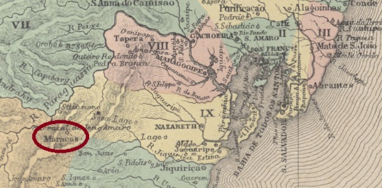
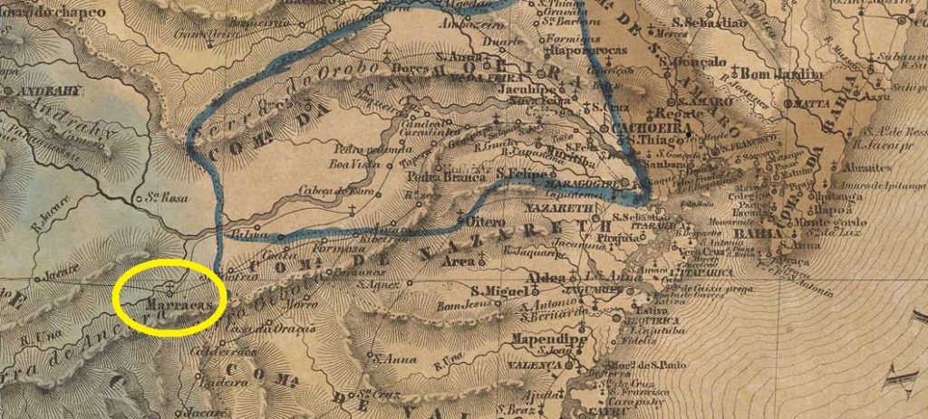
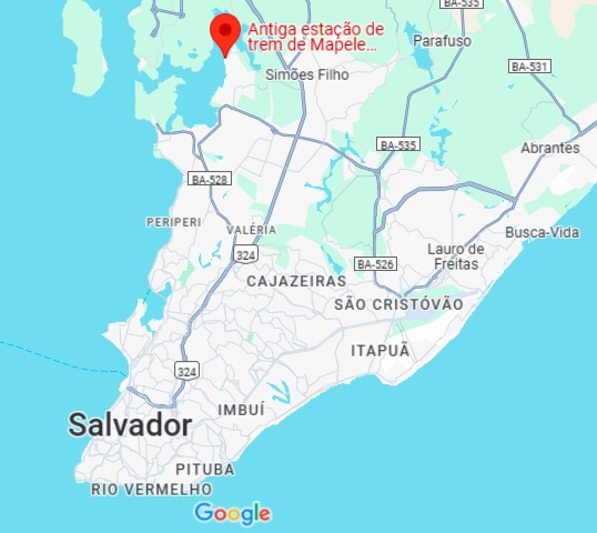
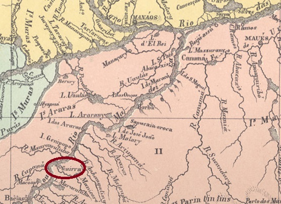
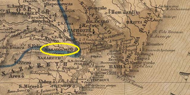
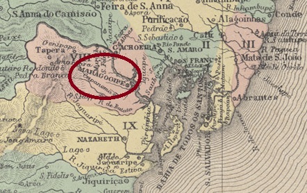
The Freguesia de S. Bartolomeu de Maragogipe existed since 1640 on the west bank of the Paraguaçu, 150 kilometres west of the colonial capital Salvador da Bahia. In February 1725, it was elevated to the status of a vila and in May 1850 to that of a city.

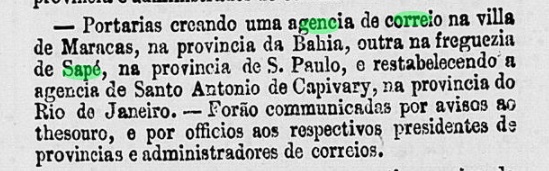
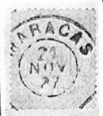
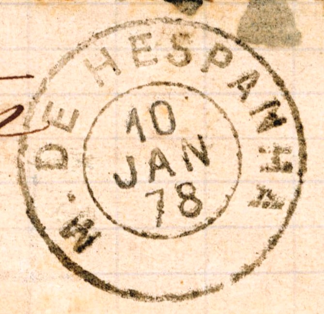
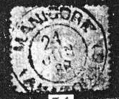
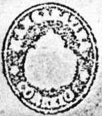
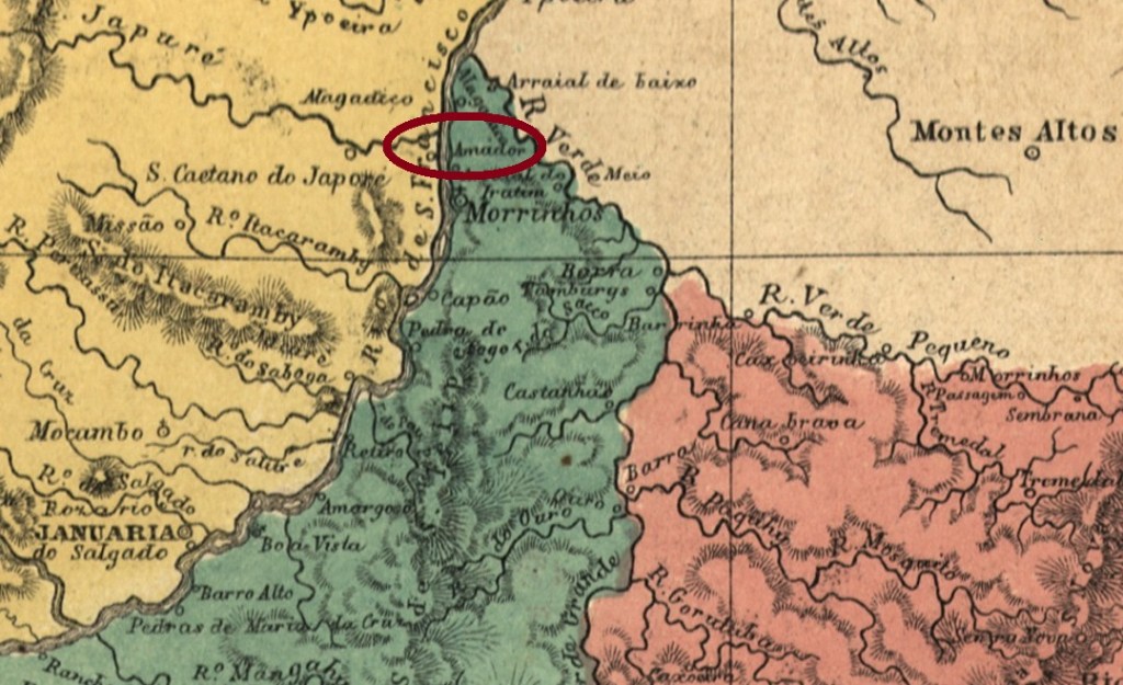
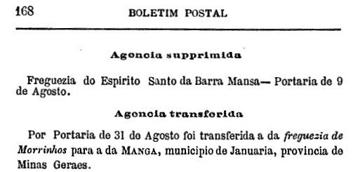
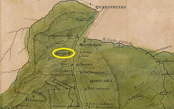
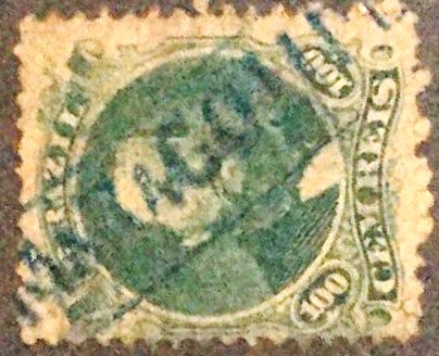
Two possible opening dates for the local post office have been found. The first was in May 1832, as Nova Monteiro writes in Administrações e Agencias Postaes do Brasil Imperio (Brasil Filatelico/RJ, 1934–1935; reprinted by SPP 1994–1999). A second time it was opened in 1864, as can be seen from the directory of imperial post offices (Tabella das Agencias do Correio do Imperio, Rio de Janeiro, 1885). The oldest postmark to date is MBA-0465a, the illustration of it in the RHM catalogue has been corrected by a specimen from the Klerman W. Lopes collection:

MBA-0465a (RHM – recte KL) 1843ff-1875

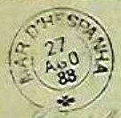
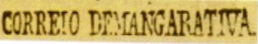
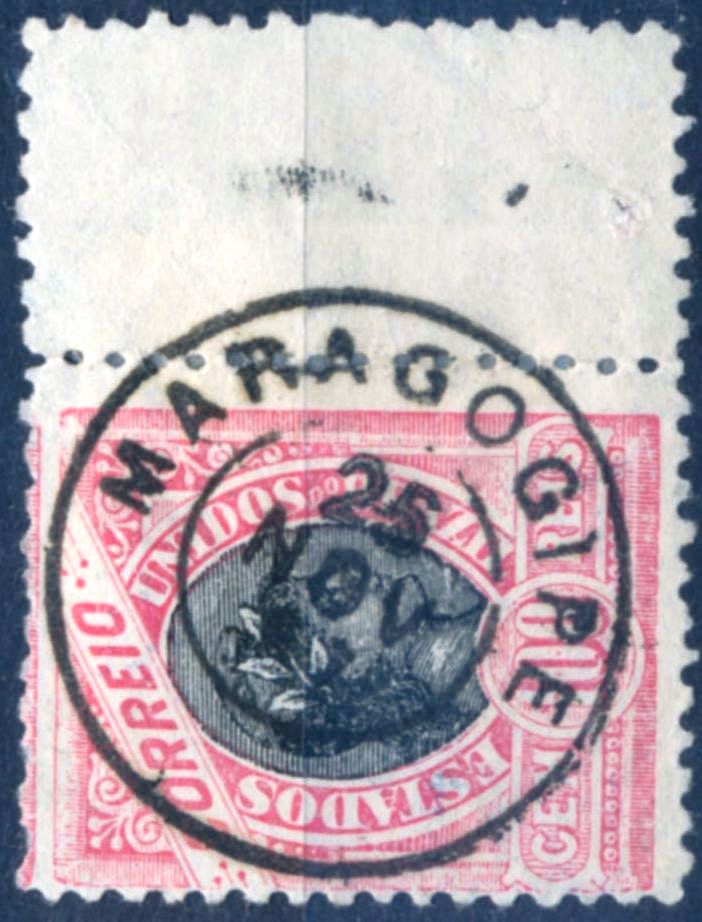
This was followed by MBA-0465b (image from the Internet), which was given the number 1352 in P. Ayres’ Catálogo de Carimbos Brasil-Império (S. Paulo, 1937, 1942):

MBA-0465b (EB – P.A. 1352) 1866ff

This was followed by the double circle MBA-0465c (illustration from the Internet):

MBA-0465c (EB) 1890-1899

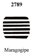
James Dingler and Klerman W. Lopes listed a mute postmark from Maragogipe under No. 2789 in Mute Cancellations of the Brazil Empire / Carimbos Mudos do Brasil Império (Brazil Philatelic Association, Rio de Janeiro, 2000):

BPA 2789 (1872)
Atlas do Imperio do Brasil, 1868

Die Freguesia de S. Bartolomeu de Maragogipe bestand seit 1640 am Westufer des Paraguaçu, 150 Kilometer westlich der Kolonialhauptstadt Salvador da Bahia. Im Februar 1725 wurde sie zur Vila und im Mai 1850 zur Stadt erhoben.

Es wurden zwei mögliche Eröffnungsdaten für das örtliche Postamt gefunden. Erstmals im Mai 1832, wie Nova Monteiro in Administrações e Agencias Postaes do Brasil Imperio (Brasil Filatelico/RJ, 1934–1935; Nachdruck SPP 1994–1999) schreibt. Ein zweites Mal wurde es im Jahr 1864 eröffnet, wie aus dem Verzeichnis der kaiserlichen Postämter (Tabella das Agencias do Correio do Imperio, Rio de Janeiro, 1885) hervorgeht. Der bisher älteste Poststempel ist MBA-0465a, wobei hier die Abbildung im RHM-Katalog durch ein Exemplar der Sammlung Klerman W. Lopes korrigiert werden konnte:

MBA-0465a (RHM – recte KL) 1843ff-1875

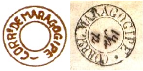
Es folgte MBA-0465b (Abb. aus dem Internet), der im Catálogo de Carimbos Brasil-Império (S. Paulo, 1937, 1942) von P. Ayres die Nr. 1352 erhielt:

MBA-0465b (EB – P.A. 1352) 1866ff

Danach kam der Doppelkreis MBA-0465c (Abb. aus dem Internet):

MBA-0465c (EB) 1890-1899

James Dingler und Klerman W. Lopes haben in Mute Cancellations of the Brazil Empire / Carimbos Mudos do Brasil Império (Brazil Philatelic Association, Rio de Janeiro, 2000) einen stummen Poststempel aus Maragogipe unter Nr. 2789 aufgeführt :

BPA 2789 (1872)

Categories
Carimbologia M-N

Maracás, Bahia (MBA-0460)

Atlas do Imperio do Brasil, 1868

The Freguesia de N. Sra. da Graça de Maracás existed since May 1842 on the west bank of the Jequiriçá River. It belonged to the Vila do Rio de Contas and was located 350 kilometres west of the provincial capital Salvador da Bahia. Five years later, the Freguesia fell under the jurisdiction of the Vila de Santa Izabel do Paraguaçu. In April 1855, Maracás became a Vila and in July 1910, it finally became a city. The name refers to a former Indian tribe from the area.

R. Koester writes in Carimbologia XXVII that there had been a post office there since January 1861. However, the correct date is likely to be nine months later, as can be seen from a ministerial protocol.

Expediente do Ministerio da Agricultura, 07.10.1861

The oldest postmark to date is MBA-0460b (illustration Koester, op. cit.).

MBA-0460b (RK) 1887–1894
Villiers de l’Ile Adam: Carta (…) da Provincia da Bahia, 1848

Die Freguesia de N. Sra. da Graça de Maracás bestand seit Mai 1842 am Westufer des Jequiriçá. Sie gehörte zur Vila do Rio de Contas und lag 350 Kilometer westlich der Provinzhauptstadt Salvador da Bahia. Fünf Jahre später fiel die Freguesia unter die Zuständigkeit der Vila de Santa Izabel do Paraguaçu. Im April 1855 wurde Maracás zur Vila und im Juli 1910 schließlich zur Stadt. Der Name bezieht sich auf einen früheren Indianerstamm aus der Gegend.

R. Koester schreibt in Carimbologia XXVII, dass es dort seit Januar 1861 ein Postamt gab. Allerdings dürfte das richtige Datum neun Monate später liegen, wie aus einem Ministerialprotokoll hervorgeht.

Expediente do Ministerio da Agricultura, 07.10.1861

Der bisher älteste Poststempel ist MBA-0460b (Abbildung Koester, op. cit.).

MBA-0460b (RK) 1887–1894
Categories
Carimbologia M-N

Mar d’Hespanha, Minas Gerais (MMG-1550)

Atlas do Imperio do Brasil, 1868

Other names: Arraial do Kagado, Ponte do Kagado, Mar de Espanha

The word ‘Cágado’ means turtle in Brazil. However, it used to be written without an accent on the front A, which made it sound like a word from the toilet language. To avoid misunderstandings, the small river Kagado and the arraial of the same name on its eastern bank were written with a K, a letter that does not otherwise occur in Portuguese. The village was in the area of Vila de S. João Nepomuceno, 280 kilometres south of the provincial capital Ouro Preto. In October 1851, it became the Freguesia de N. Sra. das Mercês do Kagado. A month earlier, it was officially renamed Vila de Mar d’Hespanha – after a neighbouring fazenda – and thus lost its former name problem. Since June 1859, Mar de Espanha (as it is spelled today) has been a city.

No fewer than four dates have been found for the establishment of the local post office, with the first three being close together. Nova Monteiro writes in Administrações e Agencias Postaes do Brasil Imperio (Brasil Filatelico/RJ, 1934–1935; reprinted SPP 1994–1999) that May 1852 was the correct date, which is also confirmed by the Rio press.

Diario do Rio de Janeiro, 25 May 1852

Paula Sobrinho writes in História Postal de Minas Gerais (Belo Horizonte, 1997) that it was June 1852, while the postal report (Relatorio dos Correios) from 1886 indicates July 1852. Finally, the directory of imperial post offices (Tabella das Agencias do Correio do Imperio, Rio de Janeiro, 1885) mentions the year 1881.

The problems with names and dates are also reflected in the postmarks. R. Koester reports in Carimbologia XXVII on handwritten cancellations from 1855 and 1856 – unfortunately without illustrations. The oldest postmark to date, MMG-1550b, only shows dates from 1878 onwards (ill. D. Feldman).

MMG-1550b (DF) 1878–1885, also in shades of blue

This was followed by MMG-1550c (Dieter Kerkhoff collection), which also occurs in red and blue-green.

MMG-1550c (DK) 1885–1894

James Dingler and Klerman W. Lopes have listed three silent postmarks from Mar d’Hespanha in Mute Cancellations of the Brazil Empire/Carimbos Mudos do Brasil Império (Brazil Philatelic Association, Rio de Janeiro, 2000).

BPA 462 (1878) – 2201 – 2426 (P.A. 423, 1866ff)
Villiers de l’Ile Adam: Carta (…) da Provincia de Minas Geraes, 1849

Andere Namen: Arraial do Kagado, Ponte do Kagado, Mar de Espanha

Das Wort „Cágado” bezeichnet in Brasilien eine Schildkröte. Früher wurde es jedoch ohne Akzent auf dem vorderen A geschrieben, wodurch es wie ein Wort aus der Fäkalsprache klang. Um Missverständnisse zu vermeiden, schrieb man den kleinen Fluss Kagado und auch den gleichnamigen Arraial an dessen Ostufer mit K, einem Buchstaben, der sonst im Portugiesischen nicht vorkommt. Die Ortschaft lag im Gebiet der Vila de S. João Nepomuceno, 280 Kilometer südlich der Provinzhauptstadt Ouro Preto. Im Oktober 1851 wurde sie zur Freguesia de N. Sra. das Mercês do Kagado. Einen Monat zuvor wurde sie offiziell in Vila de Mar d’Hespanha umbenannt – nach einer benachbarten Fazenda – und verlor damit ihren früheren Namen. Seit Juni 1859 ist Mar de Espanha (wie es heute geschrieben wird) eine Stadt.

Es wurden nicht weniger als vier Daten für die Entstehung des örtlichen Postamts gefunden, wobei die ersten drei nah beieinander liegen. Nova Monteiro schreibt in Administrações e Agencias Postaes do Brasil Imperio (Brasil Filatelico/RJ, 1934–1935; Nachdruck SPP 1994–1999), der Mai 1852 sei der richtige Zeitpunkt gewesen, was auch von der Presse aus Rio bestätigt wird.

Diario do Rio de Janeiro, 25.05.1852

Paula Sobrinho schreibt in História Postal de Minas Gerais (Belo Horizonte, 1997) den Juni 1852, während aus dem Postbericht (Relatorio dos Correios) von 1886 der Juli 1852 hervorgeht. Im Verzeichnis der kaiserlichen Postämter (Tabella das Agencias do Correio do Imperio, Rio de Janeiro, 1885) wird schließlich das Jahr 1881 genannt.

Die Probleme mit Namen und Daten spiegeln sich auch bei den Poststempeln wider. R. Koester berichtet in Carimbologia XXVII über handschriftliche Entwertungen aus den Jahren 1855 und 1856 – leider ohne Abbildungen. Der bisher älteste Poststempel MMG-1550b zeigt Daten erst ab 1878 (Abb. D. Feldman).

MMG-1550b (DF) 1878–1885, auch in Blautönen

Es folgte MMG-1550c (Sammlung Dieter Kerkhoff), der auch in Rot und Blaugrün vorkommt.

MMG-1550c (DK) 1885–1894

James Dingler und Klerman W. Lopes haben in Mute Cancellations of the Brazil Empire/Carimbos Mudos do Brasil Império (Brazil Philatelic Association, Rio de Janeiro, 2000) drei stumme Poststempel aus Mar d’Hespanha aufgeführt.

BPA 462 (1878) – 2201 – 2426 (P.A. 423, 1866ff)
Categories
Carimbologia M-N

Mapelle (train station/Bahnhof), Bahia (MBA-0455)

Rede Ferroviária da Bahia, 1898 (IBGE)

Alternative spelling: Mapele

Mapelle railway station was opened in September 1860 by the railway company E.F. da Bahia ao S. Francisco (Main Line). It was located near Capadócia Beach on Aratu Bay, 30 kilometres north of the provincial capital Salvador da Bahia. The railway line was transferred to Cie. Chemins de Fer Fédéraux du l’Est Brésilien in 1911 and to V.F.F. Leste Brasileiro in 1935. From 1975 until its closure in 1996, it belonged to Rede Ferroviária Federal S.A. (estacoesferroviarias.com.br). Today, the tracks are still in place and the station building was still being used as a residential building in 2005.

In October 2005 (photo on estacoesferroviarias.com.br)

The area around the station belonged to the district of Água Comprida from December 1953 and to the municipality of Simões Filho from November 1961.

R. Koester writes in Carimbologia XXVII that there had been a post office there since May 1881. The press in Rio de Janeiro reported as early as April the creation of a station post office in Mapelle.

Gazeta de Noticias/RJ, 21 April 1881

So far, we have not seen any imperial postmarks from Mapelle.

Google Maps

Andere Schreibweise: Mapele

Der Bahnhof Mapelle wurde im September 1860 durch die Eisenbahngesellschaft E.F. da Bahia ao S. Francisco (Hauptlinie) eröffnet. Er lag nahe dem Capadócia-Strand an der Aratu-Bucht, 30 Kilometer nördlich der Provinzhauptstadt Salvador da Bahia. Die Bahnlinie ging 1911 an die Cie. Chemins de Fer Fédéraux du l’Est Brésilien und 1935 an die V.F.F. Leste Brasileiro über. Von 1975 bis zur Stilllegung im Jahr 1996 gehörte sie der Rede Ferroviária Federal S.A. (estacoesferroviarias.com.br). Heute sind die Gleise noch vorhanden und das Bahnhofsgebäude diente im Jahr 2005 noch als Wohnhaus.

Im Oktober 2005 (Foto auf estacoesferroviarias.com.br)

Das Areal um den Bahnhof gehörte ab Dezember 1953 zum Distrikt Água Comprida und ab November 1961 zum Município Simões Filho.

R. Koester schreibt in Carimbologia XXVII, dass es dort seit Mai 1881 ein Postamt gab. Die Presse aus Rio de Janeiro berichtete bereits im April über den Beschluss, ein Bahnhofspostamt in Mapelle einzurichten.

Gazeta de Noticias/RJ, 21.04.1881

Bisher haben wir keinen kaiserlichen Poststempel aus Mapelle gesehen.

Categories
Carimbologia M-N

Mantiqueira (train station/Bahnhof), Minas Gerais (MMG-1545)

Estado de Minas Geraes, 1910

Mantiqueira Station was opened in June 1878 by the E. F. D. Pedro II railway company (Center Line). It was located on the north bank of the Rio do Pinho in the municipality of Barbacena, 180 kilometres south of the provincial capital Ouro Preto. Since July 1889, it has been located in the municipality of Palmira, and since July 1932, in the municipality of Santos Dumont. The railway line was transferred to E.F. Central do Brasil in 1889 and belonged to Rede Ferroviária Federal S.A. from 1975 until its closure in 1996 (estacoesferroviarias.com.br). Today, the tracks are still there, but the station building is in a state of disrepair.

In June 1906 (Revista da Semana, on estacoesferroviarias.com.br)
In March 2022 (photo: Puma Purple, on Google Maps).

Two dates have been found for the establishment of the station post office. The first was in February 1879, as reported in the Rio press.

Jornal do Commercio, 11 February 1879

It is mentioned a second time in July 1881, as can be read in the postal report (Relatorio dos Correios) for 1886. The second date probably corresponds to the opening of the post office. The imperial postmark is MMG-1545a (Fig. Luiz C. Fritzen), which appears in green-blue:

MMG-1545a (LCF) 1885-1897
Estações (…) de São Paulo, Rio de Janeiro e Minas Geraes, 1880

Der Bahnhof Mantiqueira wurde im Juni 1878 von der Eisenbahngesellschaft E. F. D. Pedro II. (Hauptlinie) eröffnet. Er lag am Nordufer des Rio do Pinho im Munizip Barbacena, 180 Kilometer südlich der Provinzhauptstadt Ouro Preto. Seit Juli 1889 liegt er im Município de Palmira und seit Juli 1932 im Município de Santos Dumont. Die Bahnlinie ging 1889 an die E.F. Central do Brasil über und gehörte von 1975 bis zur Stilllegung im Jahr 1996 zur Rede Ferroviária Federal S.A. (estacoesferroviarias.com.br). Heute sind die Gleise noch vorhanden, das Bahnhofsgebäude ist jedoch verwahrlost.

Im Juni 1906 (Revista da Semana, auf estacoesferroviarias.com.br)
Im März 2022 (Foto: Puma Purple, auf Google Maps)

Es wurden zwei Daten für die Entstehung des Bahnhofspostamts gefunden. Erstmals im Februar 1879, wie aus der Presse in Rio hervorgeht.

Jornal do Commercio, 11.02.1879

Ein zweites Mal wird es im Juli 1881 erwähnt, wie im Postbericht (Relatorio dos Correios) für 1886 nachzulesen ist. Vermutlich entspricht das zweite Datum der Inbetriebnahme des Postamts. Der kaiserliche Poststempel ist MMG-1545a (Abb. Luiz C. Fritzen), der in grünblau vorkommt:

MMG-1545a (LCF) 1885-1897

Categories
Carimbologia M-N

Manicoré, Amazonas (MAM-0070)

Atlas do Imperio do Brasil, 1868

Other names: Guerra

The Freguesia de Nossa Senhora das Dores de Manicoré existed since 1868 on the east bank of the Madeira River, 330 kilometres south of the provincial capital Manaus. The place was originally called Guerra, presumably in honour of João Barros e Guerra, a Portuguese captain who sailed the Madeira River. The name ‘Manicoré’ is of indigenous origin and refers both to an Indian tribe and to the Madeira’s tributary of the same name. Manicoré became a vila in 1877 and has been a city since 1896.

As R. Koester writes in Carimbologia XXVII, there has been a post office there since December 1884. The only imperial postmark to date is MAM-0070a (Fig. Koester, op. cit.):

MAM-0070a (RK) 1888
Carta da Republica dos Estados Unidos do Brazil, 1892

Andere Namen: Guerra

Die Freguesia de Nossa Senhora das Dores de Manicoré bestand seit 1868 am Ostufer des Madeira, 330 Kilometer südlich der Provinzhauptstadt Manaus. Der Ort hieß ursprünglich Guerra, vermutlich zu Ehren von João Barros e Guerra, einem portugiesischen Kapitän, der den Fluss Madeira befuhr. Der Name „Manicoré” ist indigenen Ursprungs und bezeichnet sowohl einen Indianerstamm als auch den gleichnamigen Nebenfluss des Madeira. Manicoré wurde 1877 zur Vila und ist seit 1896 eine Stadt.

Wie R. Koester in Carimbologia XXVII schreibt, gab es dort seit Dezember 1884 ein Postamt. Der bisher einzige kaiserliche Poststempel ist MAM-0070a (Abb. Koester, op. cit.):

MAM-0070a (RK) 1888
Categories
Carimbologia M-N

Manhuassú, Minas Gerais (MMG-3385)

Estado de Minas Geraes, 1910

See also S. Lourenço do Manhuassu (SMG-2505)

From November 1875 this was a freguesia of Ponte Nova, which was located about 200 east of the provincial capital Ouro Preto. In November 1877, it was transferred as a district to the municipality of São Simão, and in January 1880 it became a vila. Since September 1881, it has been the town of Manhuassú (now written Manhuaçu). The Manhuaçu is a tributary of the Rio Doce; its Indian name means Great Rain

As Paula Sobrinho writes in História Postal de Minas Gerais (Belo Horizonte, 1997), the post office was created in September 1880. The first postmark of the imperial era is the double circle SMG-2505a (José A. Junges collection):

SMG-2505a (JJ) 1885-1889

Its successor, MMG-3385a (FM collection), already shows dates from the republic:

MMG-3385a (FM) 1890-1896
Mappa Geral do Brazil, 1911

Siehe auch S. Lourenço do Manhuassu (SMG-2505)

Diese war ab November 1875 eine Freguesia von Ponte Nova, die gut 200 östlich der Provinzhauptstadt Ouro Preto entfernt lag. Im November 1877 ging sie als Distrikt zum Município von São Simão über und wurde im Januar 1880 der Hauptsitz der Vila. Seit September 1881 ist es die Stadt Manhuassú (heute Manhuaçu geschrieben). Der Manhuaçu ist ein Zufluss des Rio Doce; sein indianischer Name bedeutet Große Regen

Wie Paula Sobrinho in História Postal de Minas Gerais (Belo Horizonte, 1997) schreibt, entstand das Postamt im September 1880. Der erste Poststempel der Kaiserzeit ist der Doppelkreis SMG-2505a (Samml. José A. Junges):

SMG-2505a (JJ) 1885-1889

Sein Nachfolger MMG-3385a (Samml. FM) trägt bereits Daten der Republik:

MMG-3385a (FM) 1890-1896

Categories
Carimbologia M-N

Mangaratiba, Rio de Janeiro (MRJ-0710)

Villiers de l’Ile Adam: Carta (…) da Provincia do Rio de Janeiro, 1850

The Freguesia de Nossa Senhora da Guia de Mangaratiba existed since January 1764 and belonged to the Vila de Angra dos Reis. It was located at the mouth of the Rio do Saco where it flows into the Atlantic Ocean, 100 kilometres west of the colonial capital Rio de Janeiro. In November 1831, Mangaratiba was elevated to the status of a vila. In May 1892, it was downgraded to the district of Angra dos Reis, but regained its municipality status seven months later and has been a city since December 1929.

Nova Monteiro writes in Administrações e Agencias Postaes do Brasil Imperio (Brasil Filatelico/RJ, 1934-5; reprinted by SPP 1994-1999) that there has been a post office there since March 1823. The oldest postmark to date is MRJ-0710a, which was given the number P-RJ-17 in the RHM catalogue:

MRJ-0710a (RHM P-RJ-17) 1823ff ?

This was followed by MRJ-0710b, also found in the RHM catalogue, this time under P-RJ-16:

MRJ-0710b (RHM P-RJ-16) ca. 1840-1843ff

This was followed by MRJ-0710c, which also appears in blue and was given the number 1351 by P. Ayres in Catálogo de Carimbos Brasil-Império (S. Paulo, 1937, 1942):

MRJ-0710c (P.A. 1351) 1850ff

In the 1880s, the double circle MRJ-0710d (Everaldo N. dos Santos Collection) also appeared, which is also available in blue:

MRJ-0710d (ENS) 1884-1889

From the end of the Empire, MRJ-0710e (illustration by Felipe Piccinini) was also used:

MRJ-0710e (FP) 1889-1898

In Carimbologia XXVII, R. Koester shows the postmark with the imperial seal MRJ-0170f:

MRJ-0170f (RK)
Colton & Colton: Provincia do Rio de Janeiro, 1850

Die Freguesia de Nossa Senhora da Guia de Mangaratiba bestand seit Januar 1764 und gehörte zur Vila de Angra dos Reis. Sie lag an der Mündung des Rio do Saco in den Atlantik, 100 Kilometer westlich der Kolonialhauptstadt Rio de Janeiro. Im November 1831 wurde Mangaratiba zur Vila erhoben. Im Mai 1892 wurde sie zum Distrito von Angra dos Reis herabgestuft, erhielt jedoch sieben Monate später den Município-Status zurück und ist seit Dezember 1929 eine Stadt.

Nova Monteiro schreibt in Administrações e Agencias Postaes do Brasil Imperio (Brasil Filatelico/RJ, 1934-5; reprinted by SPP 1994-1999), dass es dort seit März 1823 ein Postamt gab. Der bisher älteste Poststempel ist MRJ-0710a, der im RHM-Katalog die Nr. P-RJ-17 erhielt:

MRJ-0710a (RHM P-RJ-17) 1823ff ?

Es folgte MRJ-0710b, ebenfalls im RHM-Katalog zu finden, diesmal unter P-RJ-16:

MRJ-0710b (RHM P-RJ-16) ca. 1840-1843ff

Danach kam MRJ-0710c, der auch in Blau vorkommt und von P. Ayres in Catálogo de Carimbos Brasil-Império (S. Paulo, 1937, 1942) die Nr. 1351 bekam:

MRJ-0710c (P.A. 1351) 1850ff

In den 1880er Jahren erschien auch der Doppelkreis MRJ-0710d (Samml. Everaldo N. dos Santos), den es auch in Blau gibt:

MRJ-0710d (ENS) 1884-1889

Ab Ende des Kaiserreichs wurde auch MRJ-0710e (Abb. Felipe Piccinini) verwendet:

MRJ-0710e (FP) 1889-1898

R. Koester zeigt in Carimbologia XXVII den Poststempel mit dem kaiserlichen Siegel MRJ-0170f:

MRJ-0170f (RK)
Categories
Carimbologia M-N

Manga, Piauí (MPI-0250)

Atlas do Imperio do Brasil, 1868

Other names: S. Pedro de Alcantara, Colonia, Floriano (1897)

See also Villa da Manga (VPI-0250)

The villa of N. Sa. de Uhyca da Manga was established after the detachment of Jerumenha in July 1864 and was located on the south bank of the Parnaiba River, 250 km south of the provincial capital Teresina. As early as 1873, the agricultural enterprise (Estabelecimento Rural) called São Pedro de Alcantara was established there as a prestigious colonisation project of the Empire. This settlement grew rapidly and became the headquarters of the Município in June 1890, albeit under the shortened name of Colonia, as the Republicans wanted the traces of the monarchy to disappear. Between September 1895 and June 1896, the place was briefly demoted as a district of Jerumenha. Since July 1897, the Município has been called Floriano, in memory of Marshal Floriano Peixoto, the 2nd President of Brazil, who died in 1895.

The local post office was established in March 1879, as reported in the regional press:

A Imprensa, 12.07.1879

A second opening is said to have taken place in 1882, as noted in the Directory of Imperial Post Offices (Tabella das Agencias do Correio do Imperio, Rio de Janeiro, 1885). The imperial postmark is VPI-0250a, as illustrated by R. Koester in Carimbologia XXVII. The only specimen seen so far is dated 1894.

VPI-0250a (RK/FM)
Arthur D. Ribeiro: Estado do Piauhy, 1924

Andere Namen: S. Pedro de Alcantara, Colonia, Floriano (1897)

Siehe auch Villa da Manga (VPI-0250)

Die Villa von N. Sa. de Uhyca da Manga wurde nach der Loslösung von Jerumenha im Juli 1864 ins Leben gerufen und lag am Südufer des Parnaiba-Flusses, 250 km südlich der Provinzhauptstadt Teresina entfernt. Bereits 1873 entstand dort das Landwirtschaftsunternehmen (Estabelecimento Rural) namens São Pedro de Alcantara als prestigeträchtiges Kolonisationsprojekt des Kaiserreichs. Diese Siedlung wuchs schnell und wurde Hauptsitz des Município im Juni 1890, allerdings unter dem gekürzten Namen Colonia, da die Republikaner die Spuren der Monarchie verschwinden lassen wollten. Zwischen September 1895 und Juni 1896 war der Ort kurzzeitig als Distrikt von Jerumenha degradiert. Seit Juli 1897 heißt der Município Floriano, in Erinnerung an Marschall Floriano Peixoto, den 2. Präsidenten Brasiliens, der 1895 verstarb.

Das örtliche Postamt entstand im März 1879, wie die Regionalpresse berichtet:

A Imprensa, 12.07.1879

Eine zweite Eröffnung soll 1882 stattgefunden haben, wie im Verzeichnis der kaiserlichen Postämter (Tabella das Agencias do Correio do Imperio, Rio de Janeiro, 1885) vermerkt. Der kaiserliche Poststempel ist VPI-0250a, wie von R. Koester in Carimbologia XXVII abgebildet. Das bisher einzig gesehene Exemplar ist 1894 datiert.

VPI-0250a (RK/FM)
Categories
Carimbologia M-N

Manga, Minas Gerais (MMG-1540)

Atlas do Imperio do Brasil, 1868

Other names: São Caetano do Japoré, Amador, Sto. Antonio da Manga

From 1731 onwards, this arraial was a port belonging to the parish of São Caetano do Japoré on the west bank of the São Francisco River in the area of Vila de Januária, located 790 kilometres north of the later provincial capital of Ouro Preto. Around 1850, the port was renamed Porto de Manga do Amador and, about 30 years later, it became the parish of Sto. Antonio da Manga. In September 1891, the locality regained its old name of S. Caetano do Japoré and became a district. Since September 1923, it is Município de Manga.

Two dates have been found for the creation of the local post office. One is April 1885, as written by Paula Sobrinho (História Postal de Minas Gerais, Belo Horizonte, 1997) and R. Koester (Carimbologia XXVII). The second date is August 1889, when the post office was moved from Morrinhos to Manga, as reported in the Post Bulletin (Boletim Postal).

Boletim Postal No. 5/1889

According to Paula Sobrinho (op. cit.), the post office was closed again in June 1900.

No imperial postmark from this post office has been found to date.

Villiers de l’Ile Adam: Carta (…) da Provincia de Minas Geraes, 1849

Andere Namen: São Caetano do Japoré, Amador, Sto. Antonio da Manga

Dieser Arraial war ab 1731 ein Hafen der Freguesia de São Caetano do Japoré am Westufer des São Francisco im Gebiet der späteren Vila de Januária, die 790 Kilometer nördlich der späteren Provinzhauptstadt Ouro Preto lag. Um 1850 wurde der Hafen in Porto de Manga do Amador umbenannt und stieg ca. 30 Jahre später zur Freguesia de Sto. Antonio da Manga auf. Im September 1891 erhielt der Ort den alten Namen S. Caetano do Japoré zurück und wurde zum Distrikt. Seit September 1923 heißt die Stadt Município de Manga.

Es wurden zwei Zeitpunkte für die Gründung des örtlichen Postamtes gefunden. Einerseits im April 1885, wie Paula Sobrinho (História Postal de Minas Gerais, Belo Horizonte, 1997) und R. Koester (Carimbologia XXVII) schreiben. Ein zweiter Zeitpunkt ist der August 1889, als die Postagentur von Morrinhos nach Manga verlegt wurde, wie das Postbulletin (Boletim Postal) berichtete.

Boletim Postal Nr. 5/1889

Laut Paula Sobrinho (op. cit.) wurde das Postamt im Juni 1900 wieder geschlossen.

Bisher wurde kein kaiserlicher Poststempel von diesem Postamt gefunden.