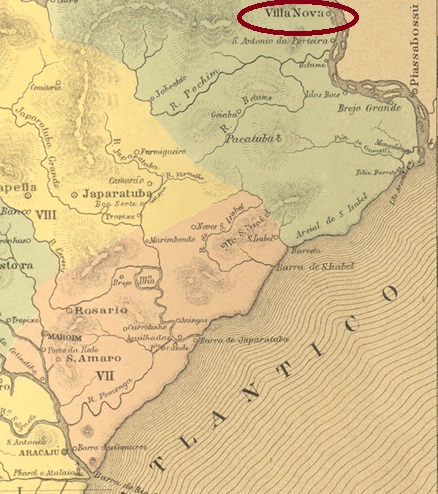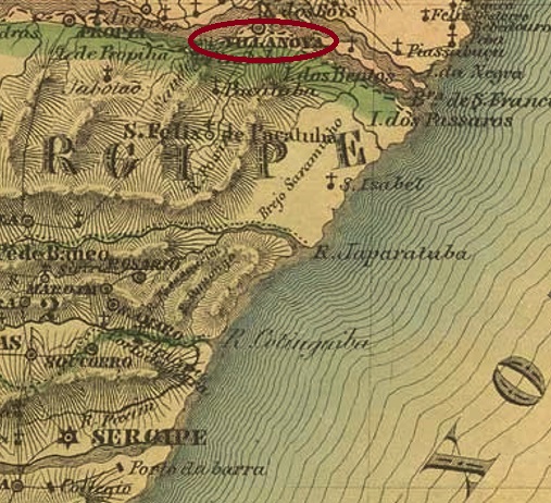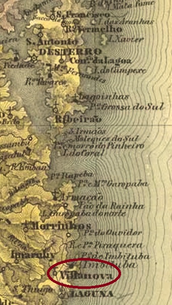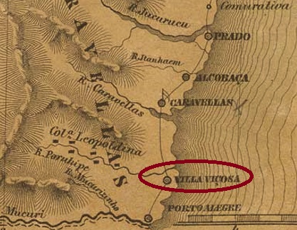
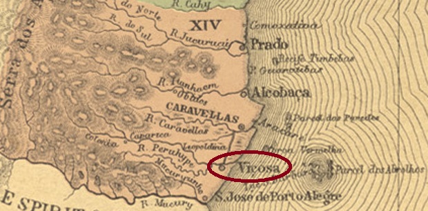
Other names: Campinhos, Marobá, Nova Viçosa (1953)
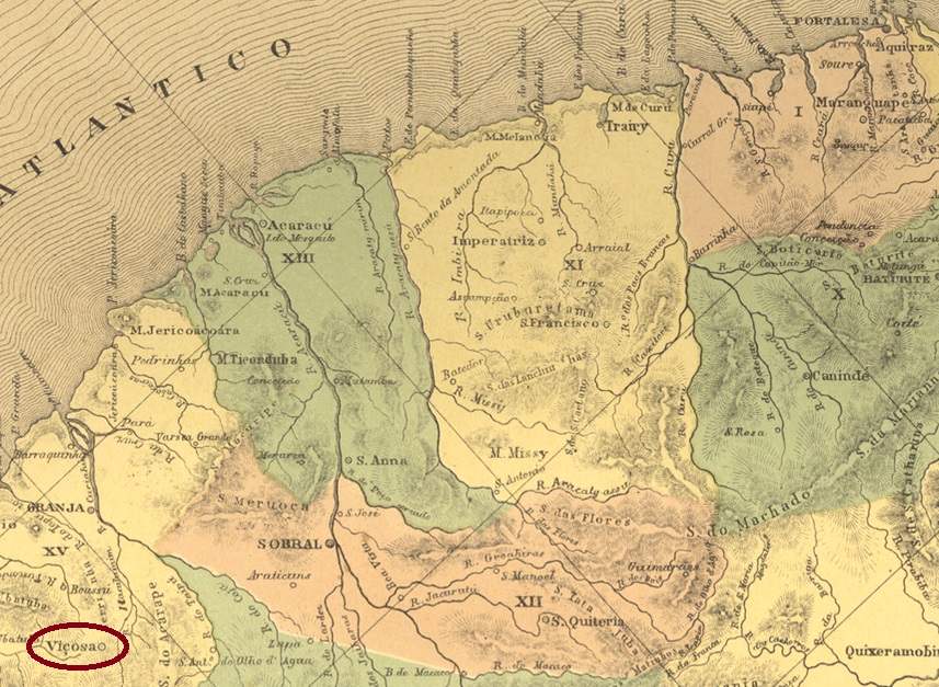
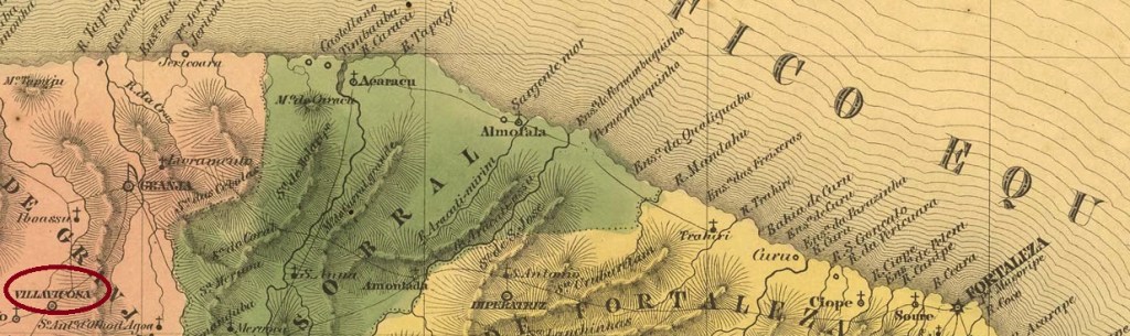
The Arraial of Nossa Senhora da Conceição de Campinhos was founded in 1748, belonged to the Vila of Mucury and was located directly on the Atlantic Ocean, 900 km south of the later provincial capital Salvador da Bahia. By Royal Decree (Alvará Real) of October 1768, it became the Villa Viçosa. After the Republic, there was a period of stagnation, and the place was downgraded as a district of the município of Mucury in January 1931. After that two name changes came: in December 1943 to Marobá and exactly ten years later to Nova Viçosa. Since July 1962, Nova Viçosa has once again been an independent município.
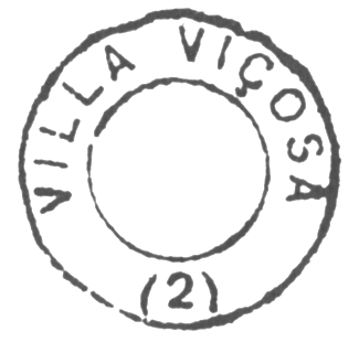
As can be read in the Directory of Imperial Post Offices (Tabella das Agencias do Correio do Imperio, Rio de Janeiro, 1885), there had been a post office there since 1870. The oldest postmark is the French type VBA-0765a (Coll. José A. Junges), which was used until at least 1876: the inscription at the top is VIÇOZA, and the small star between brackets can be seen at the bottom. It was followed by VBA-0845a (Coll. Dieter Kerkhoff): in this double circle the upper inscription is now VILLA VIÇOSA, below there is an (I), and the dates inside go from 1880 to 1894.
Andere Namen: Campinhos, Marobá, Nova Viçosa (1953)
Der Arraial von Nossa Senhora da Conceição de Campinhos wurde 1748 gegründet und lag bei der Vila von Mucury direkt am Atlantik, 900 km südlich der späteren Provinzhauptstadt Salvador da Bahia entfernt. Durch Königliche Verfügung (Alvará Real) vom Oktober 1768 wurde daraus die Villa Viçosa. Nach der Republik kam eine Periode der Stagnation, und der Ort wurde im Januar 1931 als Distrikt im Município von Mucury herabgestuft. Danach kamen zwei Namensänderungen: im Dezember 1943 zu Marobá und genau zehn Jahre später zu Nova Viçosa. Seit Juli 1962 ist Nova Viçosa wieder ein eigenständiger Município.
Wie im Verzeichnis der kaiserlichen Postämter (Tabella das Agencias do Correio do Imperio, Rio de Janeiro, 1885) zu lesen ist, gab es dort seit 1870 ein Postamt. Der älteste Poststempel ist der französische Typus VBA-0765a (Samml. José A. Junges), der bis mindestens 1876 verwendet wurde: die Inschrift oben lautet VIÇOZA, unten ist der kleine Stern zwischen Klammern zu sehen. Ihm folgte VBA-0845a (Samml. Dieter Kerkhoff): in diesem Doppelkreis lautet die obere Inschrift VILLA VIÇOSA, unten ist eine (I), und die Daten in Inneren gehen von 1880 bis 1894.