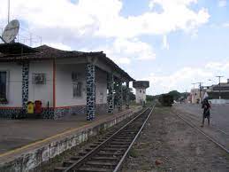
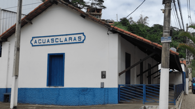
Aguas Claras station was inaugurated in November 1886 by the E.F. Principe do Grão-Pará railway company and was the last station on the Rio Preto branch, located before the terminus at São José do Rio Preto, 140 km north of the capital Rio de Janeiro. The railway line passed to the E.F. Leopoldina in 1890 and was closed in 1947. The station has since been restored and serves as a cultural centre for the community (estacoesferroviarias.com.br).
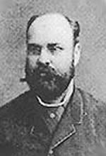
Aguas Claras (Bright Waters) was the name of a large-scale coffee plantation in the region around 1800 that belonged to the Souza Leite family. The engineer Guilherme Souza Leite (1850- 1918) became the Baron of Aguas Claras in 1887.
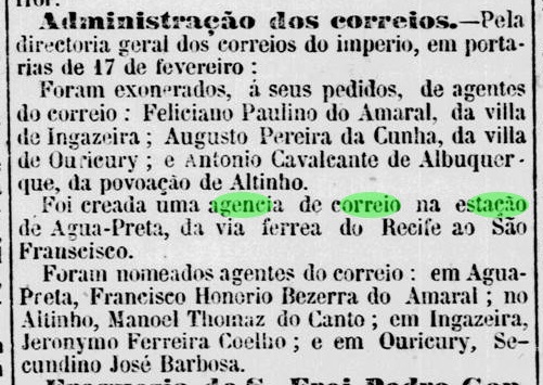
As Paulo Novaes writes in agenciaspostais.com.br, a post office was established at the station in October 1886. The imperial postmark is ARJ-0005a (Coll. Marcio Protzner): a double circle with the inscriptions EST. DE AGUAS CLARAS at the top and (E.F.GRĀOPARA) at the bottom. The internal dates found so far originate from the period 1886-1899.
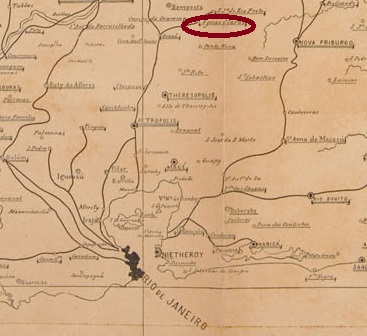
Der Bahnhof Aguas Claras wurde im November 1886 durch die Bahngesellschaft E.F. Principe do Grão-Pará eingeweiht und war der letzte Bahnhof der Rio Preto Abzweigung, vor der Endstation São José do Rio Preto gelegen, 140 km nördlich der Hauptstadt Rio de Janeiro entfernt. Die Bahnlinie ging 1890 zur E.F. Leopoldina über und wurde 1947 stillgelegt. Der Bahnhof ist inzwischen restauriert und dient als Kulturzentrum der Gemeinde (estacoesferroviarias.com.br).


Aguas Claras (Helle Gewässer) hieß eine um 1800 groß angelegte Kaffeeplantage in der Region, die der Familie Souza Leite gehörte. Der Ingenieur Guilherme Souza Leite (1850- 1918) wurde 1887 der Baron von Aguas Claras.

Wie Paulo Novaes in agenciaspostais.com.br schreibt, entstand dort im Oktober 1886 ein Postamt. Der kaiserliche Poststempel ist ARJ-0005a (Samml. Marcio Protzner): ein Doppelkreis mit den Inschriften EST. DE AGUAS CLARAS oben und (E.F.GRĀOPARA) unten. Die inneren Daten wurden bisher für den Zeitraum 1886-1899 gefunden.