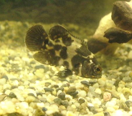
Acará is the indigenous name for fish of the family Cichlidae, which is widespread throughout Brazil. In the north of the country, it usually refers to the genus Astronotus, such as the Oscarfish (Astronotus Ocellatus, Agassiz 1831):

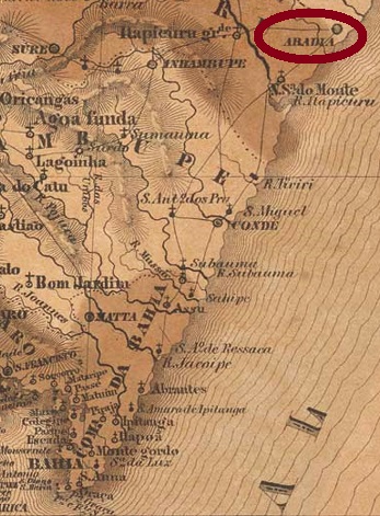
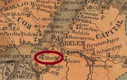
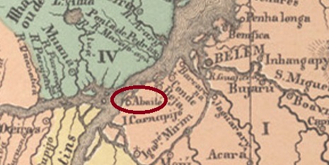
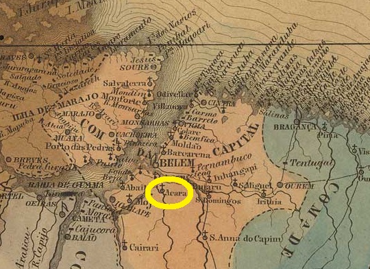
The parish of São José de Acará was established in 1758 on the north bank of the Acará River, near Mojú, 100 km south of the later provincial capital Belém do Pará. It was elevated to villa status in April 1875 but passed as a district of the provincial capital in November 1930, rising again to villa status in January 1932.
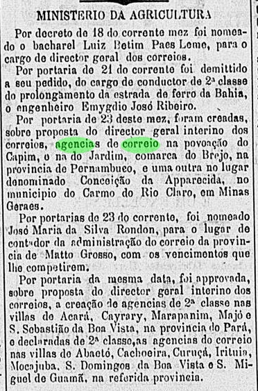
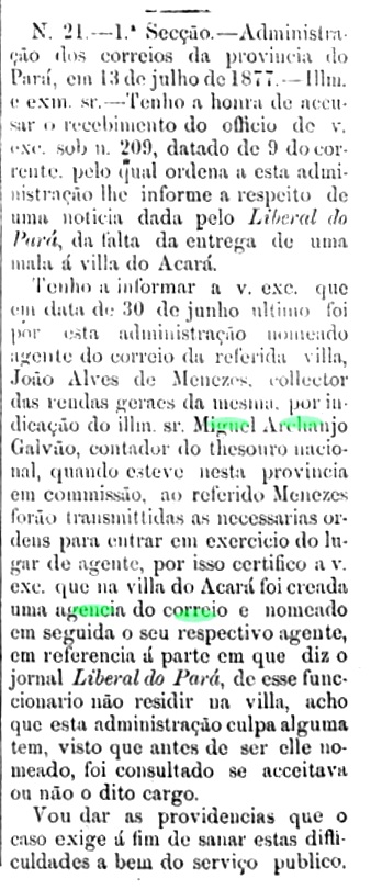
The local post office was probably first established around June 1877, according to the regional press:

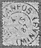
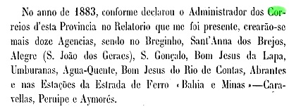
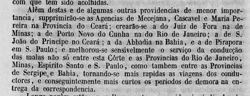
However, as problems with the local postal service soon became public, the post office closed soon after. Further openings took place in 1880, as listed in the Directory of Imperial Post Offices (Tabella das Agencias do Correio do Imperio, Rio de Janeiro, 1885), and in March 1882, according to a press release from Rio de Janeiro:
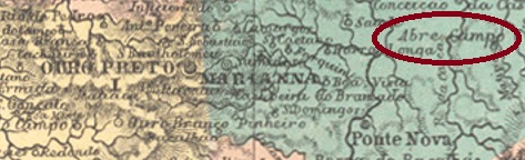
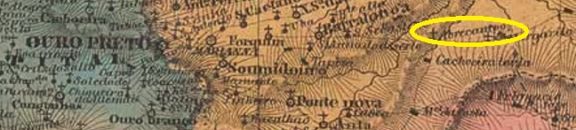
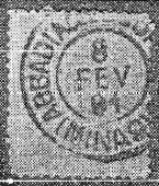
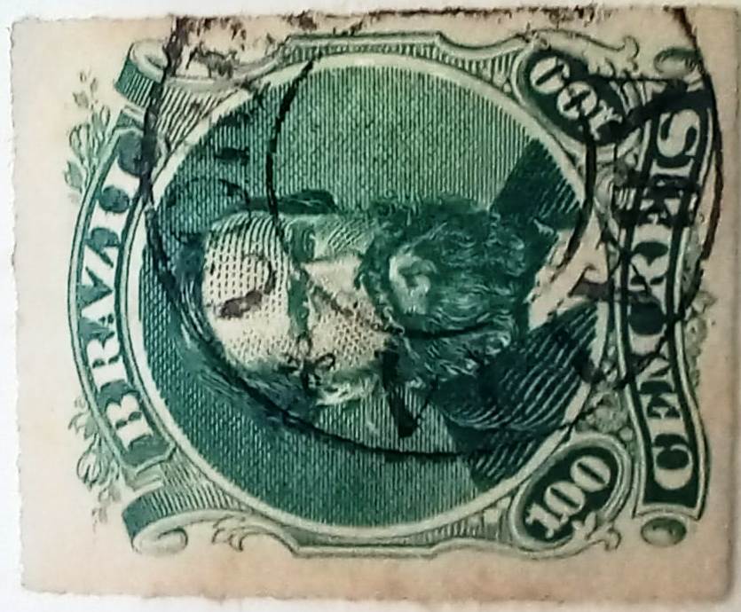
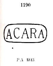
Given these dates, it is extremely unlikely that postmark no. 1190, as presented by Paulo Ayres in Catálogo de Carimbos Brasil-Império (S. Paulo, 1937, 1942) with use date “from 1843”, is genuine:
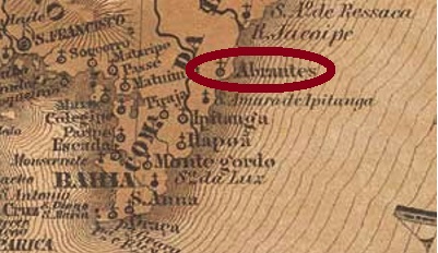
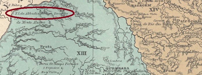
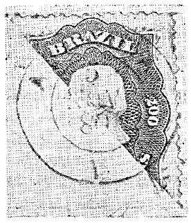
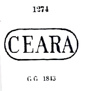
Possibly there is confusion here, e.g., with the stamp P.A. 1274, from the province of Ceará:
Beyond that, no other postmarks from imperial Acará are known.
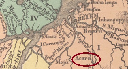
Acará ist der im ganzen Brasilien verbreitete indigene Name für Fische der Familie Cichlidae, wobei im Norden des Landes meistens die Gattung Astronotus gemeint ist, wie z.B. der Pfauenaugenbuntbarsch (Astronotus Ocellatus, Agassiz 1831):
Die Pfarrei von São José de Acará wurde 1758 am Nordufer des Flusses Acará errichtet und lag bei Mojú, 100 km südlich der späteren Provinzhauptstadt Belém do Pará entfernt. Im April 1875 wurde der Ort zur Villa erhoben, ging aber im November 1930 als Distrikt der Landeshauptstadt, um im Januar 1932 nochmals zu einer Villa aufzusteigen.
Das örtliche Postamt wurde wohl erstmals um Juni 1877 ins Leben gerufen, wie die Regionalpresse berichtet:
Da es aber bald Probleme mit dem Postbetrieb vor Ort publik wurden, schloss das Postamt wenig später. Weitere Eröffnungen erfolgten 1880, wie imVerzeichnis der kaiserlichen Postämter (Tabella das Agencias do Correio do Imperio, Rio de Janeiro, 1885) aufgelistet, und im März 1882, laut einer Pressemittelung aus Rio de Janeiro:

Angesichts dieser Daten ist es äußert unwahrscheinlich, dass der Poststempel Nr. 1190, wie ihn Paulo Ayres in Catálogo de Carimbos Brasil-Império (S. Paulo, 1937, 1942) mit Verwendungszeit „ab 1843“ präsentiert hatte, echt ist:

Möglicherweise liegt hier eine Verwechslung vor, z.B. mit dem Stempel P.A. 1274, aus der Provinz Ceará:

Darüber hinaus sind keine weiteren Poststempel aus dem kaiserlichen Acará bekannt.