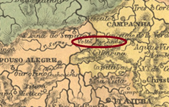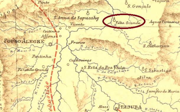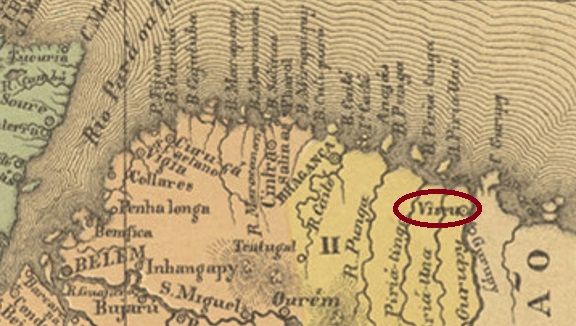
Other names: Valla Grande, Volta Grande de Além Parahyba
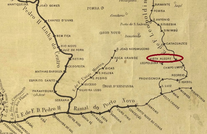
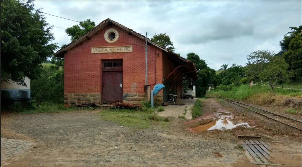
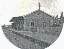
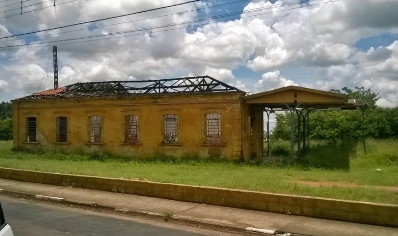
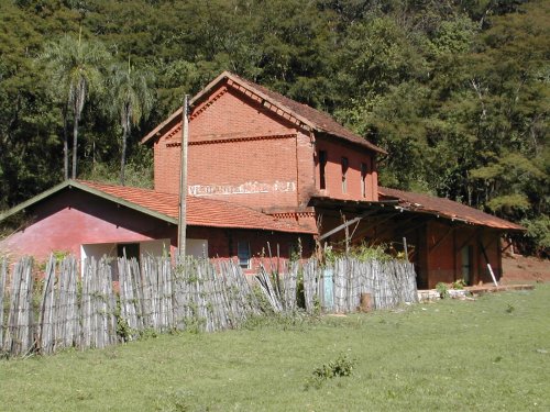
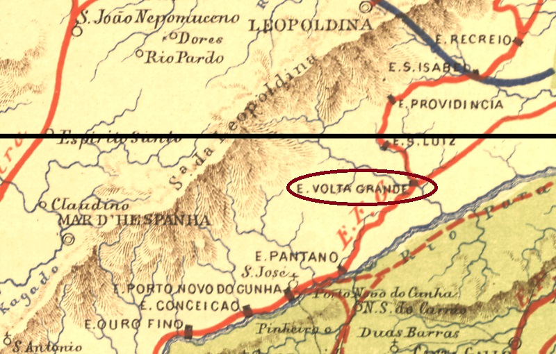
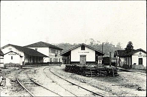
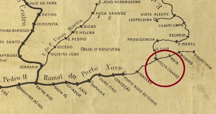
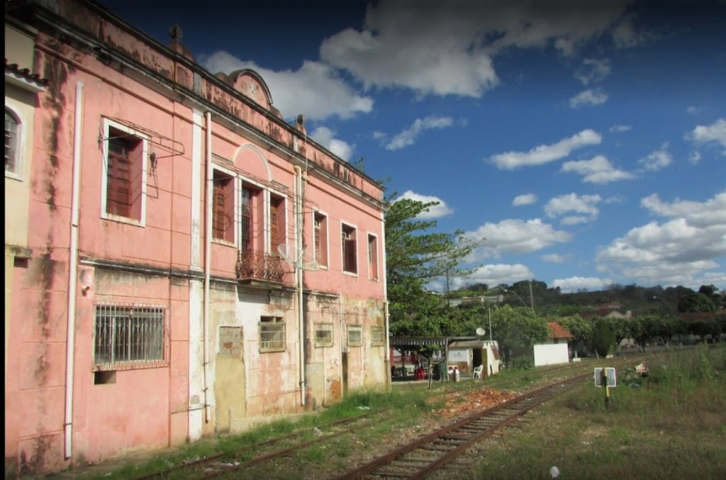
The Volta Grande railway station was inaugurated in August 1874 by the Estrada de Ferro Leopoldina in the município of Mar d’Hespanha, located on the south bank of the Angu River, 300 km south of the provincial capital Ouro Preto. The railway line belonged to Rede Ferroviária Federal S.A. from 1975 until its closure in 1996. Today, the station building serves as accommodation for railway employees (estacoesferroviarias.com.br).

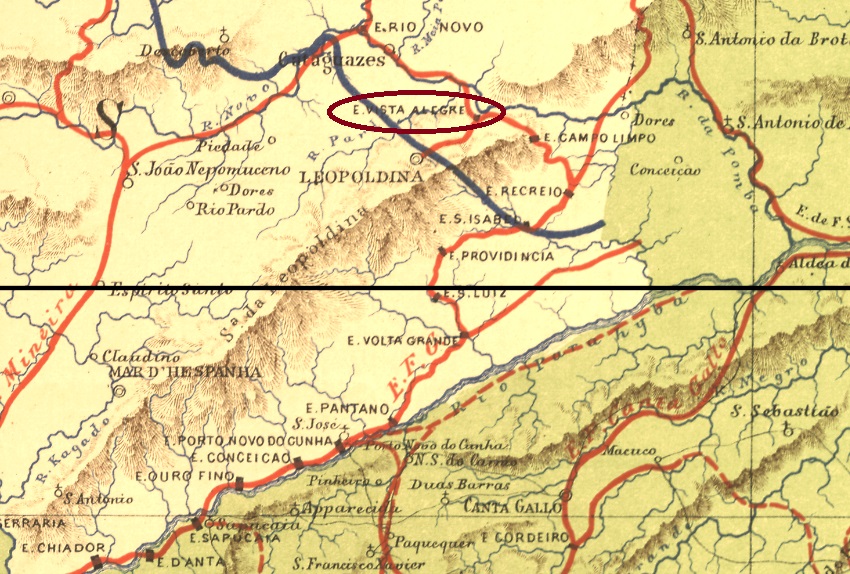
Around the station, the settlement continued to grow and became a district in the município of Além-Parahyba in March 1891. Volta Grande has been an independent município since December 1938.
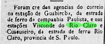
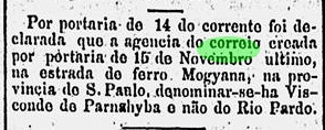
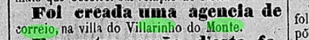
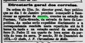
Three years of origin for the station post office were found. The first one was around December 1874, according to the Rio press. However, the station is here called Valla Grande:
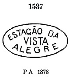
The second post office opening is said to have taken place in 1878, as listed in the Directory of Imperial Post Offices (Tabella das Agencias do Correio do Imperio, Rio de Janeiro, 1885). Finally, Paula Sobrinho writes in História Postal de Minas Gerais (Belo Horizonte, 1997) that there was a post office there since July 1881.
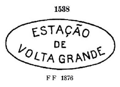
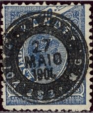
Five town postmarks and two mute postmarks were found for the 19th century. VMG-3220a is probably the first among them. It was in use from the beginning until at least 1876 and was already presented by Paulo Ayres in Catálogo de Carimbos Brasil-Império, (S. Paulo, 1937, 1942) under no. 1538:
It was followed by the enigmatic VMG-3220b (Coll. José A. Junges): a three-liner with the inscription AGENCIA/DO CORREIO/DE VOLTA GRANDE, without frame or date. Then there came two stamps as double circles. VMG-3220c (Coll. José A. Junges) has only the inscription VOLTA GRANDE at the top, with internal dates from 1884 to 1886. VMG-3220d (Coll. José A. Junges) has now the inscription (EST.) at the bottom, with dates in the middle from 1884 to 1893. VMG-3220e (Coll. Márcio Protzner) is a beautiful negative-look postmark:

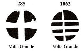
The two mute cancellations are listed in Mute Cancellations of the Brazil Empire / Carimbos Mudos do Brasil Império (Brazil Philatelic Association, Rio de Janeiro, 2000) by J. Dingler and K.W. Lopes under nos. 285 and 1062. BPA 285 is also listed under Paulo Ayres (op. cit.) with no. 18:

Andere Namen: Valla Grande, Volta Grande de Além Parahyba
Der Bahnhof Volta Grande wurde im August 1874 durch die Estrada de Ferro Leopoldina im Município von Mar d’Hespanha eingeweiht und lag am Südufer des Flusses Angu, 300 km südlich der Provinzhauptstadt Ouro Preto entfernt. Die Bahnlinie gehörte von 1975 bis zur Stilllegung 1996 der Rede Ferroviária Federal S.A. (estacoesferroviarias.com.br). Heute dient das Bahnhofsgebäude als Unterkunft für Bahnmitarbeiter.

Um den Bahnhof herum wuchs die Siedlung weiter und wurde im März 1891 ein Distrikt im Município vom Além-Parahyba. Seit Dezember 1938 ist Volta Grande ein selbständiger Município.
Drei Entstehungsjahre fürs Bahnhofspostamt wurden gefunden. Erstmals um Dezember 1874, wie aus der Presse aus Rio hervorgeht. Allerdings heißt der Bahnhof hier Valla Grande:

Die zweite Postamteröffnung soll 1878 stattgefunden haben, wie im Verzeichnis der kaiserlichen Postämter (Tabella das Agencias do Correio do Imperio, Rio de Janeiro, 1885) aufgelistet. Schließlich schreibt Paula Sobrinho in História Postal de Minas Gerais (Belo Horizonte, 1997), dass es dort seit Juli 1881 ein Postamt gab.
Fünf Ortsstempel und zwei stumme Stempel wurden für das 19. Jahrhundert gefunden. VMG-3220a ist wohl der erste darunter. Er war von Beginn an bis mindestens 1876 in Verwendung und wurde bereits durch Paulo Ayres in Catálogo de Carimbos Brasil-Império, (S. Paulo, 1937, 1942) unter Nr. 1538 vorgestellt:

Ihm folgte der rätselhafte VMG-3220b (Samml. José A. Junges): ein Dreizeiler mit der Inschrift AGENCIA/DO CORREIO/DE VOLTA GRANDE, ohne Rahmen oder Datumsangabe. Danach kamen zwei Stempel als Doppelkreise. VMG-3220c (Samml. José A. Junges) hat lediglich die Inschrift VOLTA GRANDE oben, mit inneren Daten von 1884 bis 1886. VMG-3220d (Samml. José A. Junges) hat nun dazu die Angabe (EST.) unten, mit Daten in der Mitte von 1884 bis 1893. VMG-3220e (Samml. Márcio Protzner) ist ein wunderschöner Poststempel in Negativ-Look:
Die zwei stummen Entwertungen sind in Mute Cancellations of the Brazil Empire/Carimbos Mudos do Brasil Império (Brazil Philatelic Association, Rio de Janeiro, 2000) von J. Dingler und K.W. Lopes unter den Nr. 285 und 1062 zu sehen. BPA 285 ist auch unter Paulo Ayres (op. cit.) mit Nr. 18 aufgelistet: