See also: Presídio (Koester: Carimbologia XXXII), Rio Branco (RMG-2110)
Other names: Presídio, Presídio de Ubá, São João Baptista do Presídio, Rio Branco, Visconde do Rio Branco
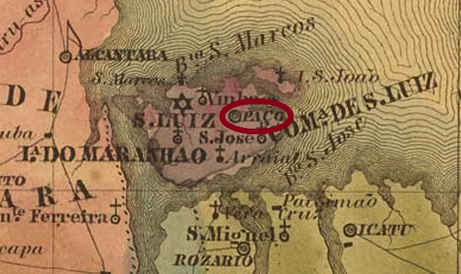
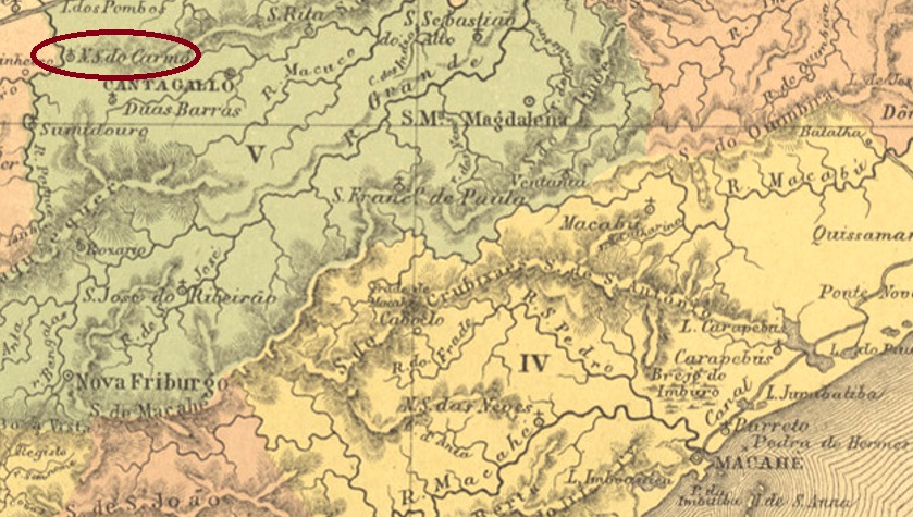
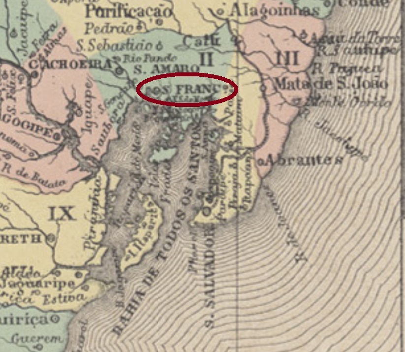
The long rivalry between the neighbour towns of Visconde do Rio Branco and Ubá in southeast of Minas Gerais has historical roots. The former was originally a district of the municipality of Pomba in 1810, with the sonorous name Distrito de São João Baptista dos Índios Coropós. Eventually after that, the locality became an open prison, surrounded by woods and called S. João Baptista do Presídio, which was made a Villa in February or March 1839. Sometime later there must have been an economic decay, for in 1853 it was degraded to a district of the municipality of Ubá and therefore called Presídio de Ubá (= Ubá Prison). It recovered the old name and Villa status only in 1881, and in the following year was elevated to a town named Visconde do Rio Branco. Such measures show understandingly a wish to leave behind both names of prison and Ubá, even though José Maria da Silva Paranhos, the Viscount of Rio Branco (1819-1880), father of the famous Baron of Rio Branco, probably never visited Minas Gerais.
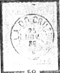
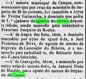
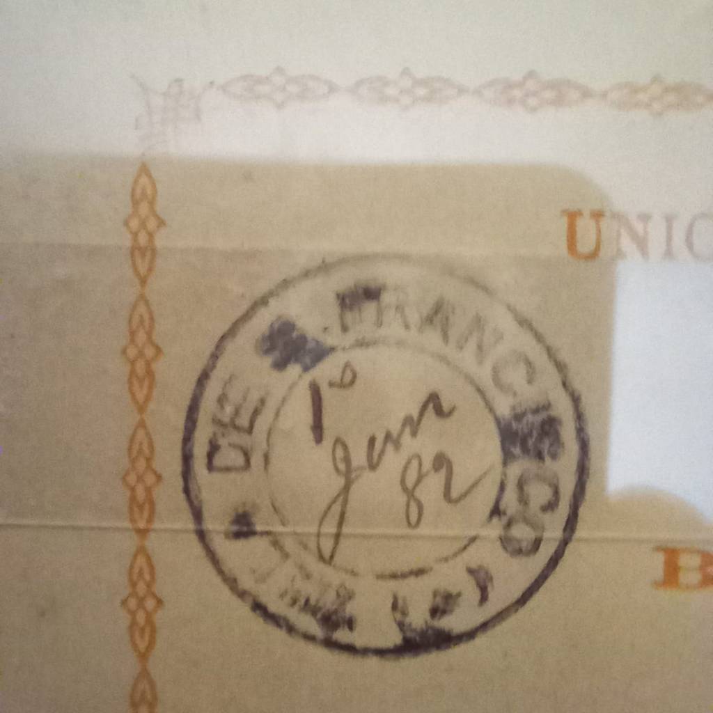
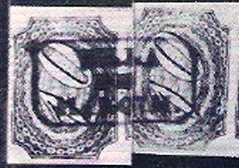
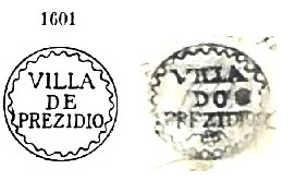
According to Nova Monteiro (Administrações e Agências Postaes do Brasil-Império 1798-1869), a post office was created in December 1839, but seems to have been closed by 1856, for it is absent in Guia do Correio do Brazil of 1857. A famous postal cancel from this early period was used on Bull’s Eyes and already presented by Paulo Ayres (1937) under #1601.
However, Ayres’ image differs considerably from the original, which is presented here through a letter of 1843 from the José L. Fevereiro collection:

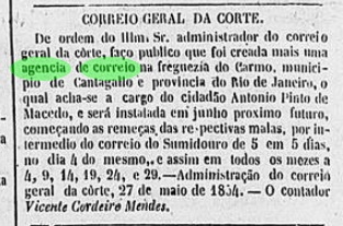
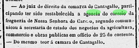
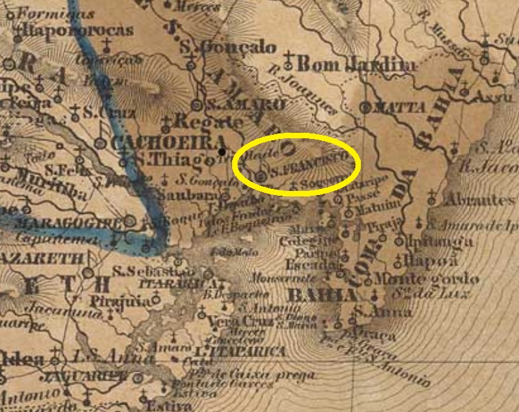
Apparently, the post office reopened only in September 1870 (Paula Sobrinho: História Postal de Minas Gerais, Belo Horizonte, 1997). The postmarks from this period were already shown by R. Koester under Presídio (Carimbologia XXXII). Postmarks featuring Rio Branco appeared by 1882 an can be seen under RMG-2110.

Siehe auch: Presídio (Koester, Carimbologia XXXII), Rio Branco (RMG-2110)
Andere Namen: Presídio, Presídio de Ubá, São João Baptista do Presídio, Rio Branco, Visconde do Rio Branco
Die lange Rivalität zwischen den Nachbarstädtchen Visconde do Rio Branco und Ubá im Südosten von Minas Gerais hat eine ebenso lange Vorgeschichte. Erstes war ursprünglich (ab 1810) ein Distrikt im Município von Pomba, mit dem wohlklingenden Namen Distrito de São João Baptista dos Índios Coropós. Irgendwann danach wurde aus der Ortschaft ein offenes Gefängnis mitten im Urwald, das sich S. João Baptista do Presídio nannte, das im Februar oder März 1839 als Villa aufgewertet wurde. Aber später soll es wirtschaftlich so weit bergab gegangen sein, dass die Villa in 1853 zum Distrikt vom Nachbar Ubá degradiert wurde, unter dem – zugegeben nicht sehr schmeichelhaften – Namen Presídio de Ubá (= Ubás Gefängnis). Der Status einer Villa mit eigener Verwaltungsautonomie wurde erst in 1881 wieder erlangt, und ein Jahr später war der Ort zur Stadt Visconde do Rio Branco umbenannt. Die letzten Verwaltungsakte zeigen unmissverständlich den Wunsch, die Bezeichnungen Presídio und Ubá loszuwerden, auch wenn José Maria das Silva Paranhos (1819-1880), der Vicomte von Rio Branco und Vater des berühmten Baron von Rio Branco, womöglich niemals in Minas Gerais unterwegs war.
Laut Nova Monteiro (Administrações e Agências Postaes do Brasil-Império 1798-1869) wurde ein Postamt bereits im Dezember 1839 errichtet, das gleichwohl schon vor 1856 wieder geschlossen war, da es nicht im Guia do Correio do Brazil von 1857 aufgelistet wurde. Von dieser Frühzeit ist ein einziger Stempel überliefert, der auf Ochsenaugen zu finden ist und von Paulo Ayres (1937) unter Nr. 1601 registriert wurde. Dennoch zeigt die Ayres’ Abbildung erhebliche Abweichungen, wenn man sie mit dem Originalbild vergleicht, hier in einem Brief vom Jahr 1843 aus der Sammlung José L. Fevereiro:
Das Postamt wurde wohl erst im September 1870 (Paula Sobrinho: História Postal de Minas Gerais, Belo Horizonte, 1997) wieder eröffnet. Die Stempel aus dieser Zeit wurden bereits von R. Koester unter Presídio (Carimbologia XXXII) vorgestellt. Poststempel mit Rio Branco kamen erst um ca. 1882 und können unter RMG-2110 gesehen werden.