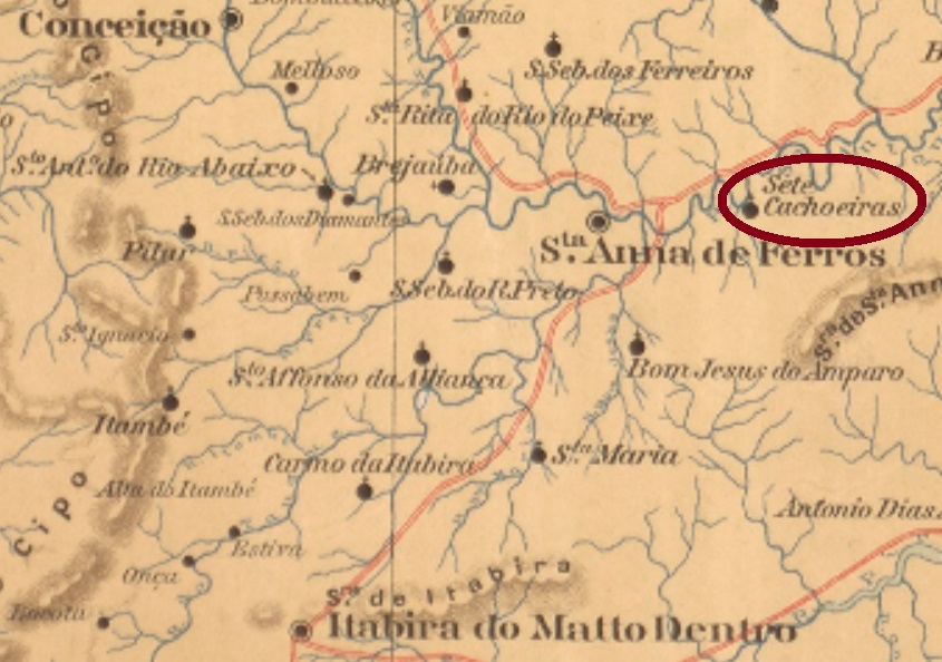
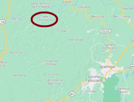
Sete Cachoeiras (Seven Waterfalls) was, as of June 1876, a district of Itabira located on the south bank of the Santo Antonio River, 250 km north of the provincial capital Ouro Preto. In September 1884, it changed to the newly founded município of Sant’Anna dos Ferros, which has only been called Ferros since September 1923. And that is how it has remained until today.
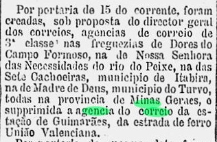
There has been a post office there since December 1881, as one can read in the Rio press:
Gazeta de Noticias/RJ, 18.12.1881
The imperial postmark from there is SMG-3105a (Coll. José A. Junges): a double circle with the inscriptions SETE CACHOEIRAS above and (MINAS) below. Dates from 1886 until 1889, in the middle.
Google Maps
Sete Cachoeiras (Sieben Wasserfälle) war ab Juni 1876 ein Distrikt von Itabira, der am Südufer des Flusses Santo Antonio lag, 250 km nördlich der Provinzhauptstadt Ouro Preto entfernt. Im September 1884 wechselte er zum neu gegründeten Município von Sant’Anna dos Ferros, der seit September 1923 nur noch Ferros heißt. Und so ist es bis heute geblieben.
Ein Postamt gibt es dort seit Dezember 1881, wie man in der Presse aus Rio lesen kann:
Gazeta de Noticias/RJ, 18.12.1881
Der kaiserliche Poststempel von dort ist SMG-3105a (Samml. José A. Junges): ein Doppelkreis mit den Inschriften SETE CACHOEIRAS oben und (MINAS) unten. Die Daten in der Mitte gehen von 1886 bis 1889.
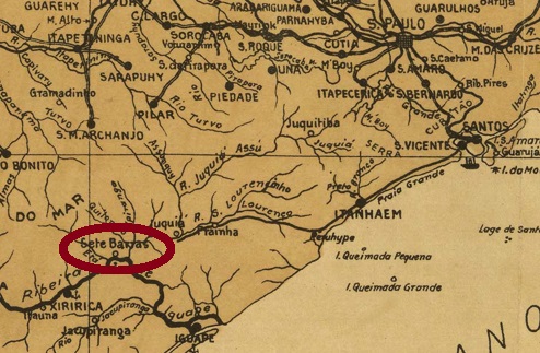
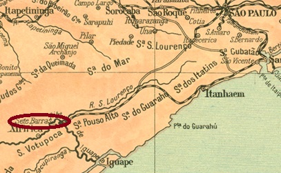
This locality was a district of Iguape as of March 1885, located on the north bank of the Ribeira de Iguape River, 200 km southwest of the provincial capital of São Paulo. Sete Barras means Seven Estuaries, and indeed the Ribeira de Iguape has seven tributaries in the area, five of them on the left bank. The district changed to Xiririca in April 1887 and to Registro in November 1944, before becoming an independent município in February 1959.
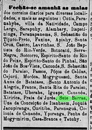
In the Imperial Mail Register (Tabella das Agencias do Correio do Imperio, Rio de Janeiro, 1885), one reads that there was a post office there from 1880. However, this could mean a reopening, because there was already a postal route through Sete Barras in March 1877, as can be read on the regional press:
Diario de São Paulo, 21.3.77
The imperial postmark is the French type SSP-1380a (Coll. Mario Celso Orsi Jr.): a double circle with the inscription SETE BARRAS above and the star between brackets below. Dates in the centre: from about 1880 to 1897.
Monteiro e Oliveira: Estado de São Paulo, 1927
Diese Ortschaft war ab März 1885 ein Distrikt von Iguape, der am Nordufer des Flusses Ribeira de Iguape lag, 200 km südwestlich der Provinzhauptstadt São Paulo entfernt. Sete Barras bedeutet Sieben Mündungen, und tatsächlich hat der Ribeira die Iguape in der Gegend sieben Zuflüsse, davon fünf am linken Ufer. Der Distrikt wechselte im April 1887 zu Xiririca und im November 1944 zu Registro, bevor er im Februar 1959 ein eigenständiger Município wurde.
Im Verzeichnis der kaiserlichen Postämter (Tabella das Agencias do Correio do Imperio, Rio de Janeiro, 1885) liest man, dass es dort ab 1880 ein Postamt gab. Diese Jahresangabe könnte allerdings eine Wiedereröffnung bedeuten, denn bereits im März 1877 gab es schon eine Postroute durch Sete Barras, wie aus der Regionalpresse hervorgeht:
Diario de São Paulo, 21.3.77
Der Ortsstempel aus der Kaiserzeit ist der Französischer Typus SSP-1380a (Samml. Mario Celso Orsi Jr.): ein Doppelkreis mit der Inschrift SETE BARRAS oben und den Stern zwischen Klammern unten. Daten in der Mitte: ab ca. 1880 bis 1897.
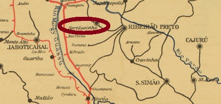
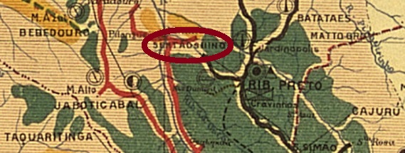
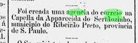
The Freguesia of Nossa Senhora da Conceição Apparecida de Sertãosinho was founded in March 1885 in the município of Ribeirão Preto, about 340 km north of the provincial capital São Paulo. In December 1896 it became a vila, and today it is the município of Sertãozinho.
The local post office was established at the beginning of 1887, as can be seen from the Rio press:
O Paiz/RJ, 01/01/1887
Two early postmarks were found. On the double circle SSP-1375a (Coll. José A. Junges) unfortunately the left side is not visible, only (…)O DO SERTÃOZINHO, Below there is an ornament in lozenge, in the centre a date from 1889. The successor SSP-1375b (Coll. José A. Junges) has in the double circle the inscriptions SERTÃOZINHO above and (S. PAULO) below. The date inside is already from the early 20th century.
Estado de São Paulo, 1910
Textaktualisierung von 12. August 2024
Anderer Name: Apparecida do Sertãosinho
Die Freguesia von Nossa Senhora da Conceição Apparecida de Sertãosinho wurde im März 1885 im Município von Ribeirão Preto gegründet und lag rund 340 km nördlich der Provinzhauptstadt São Paulo entfernt. Im Dezember 1896 wurde daraus eine Vila, und heute ist es der Município von Sertãozinho.
Das örtliche Postamt wurde Anfang 1887 ins Leben gerufen, wie aus der Rio-Presse hervorgeht:
O Paiz/RJ, 01.01.1887
Zwei frühe Poststempel wurden gefunden. Beim Doppelkreis SSP-1375a (Samml. José A. Junges) ist leider die linke Seite nicht zu sehen, nur (…)O DO SERTÃOZINHO, Unten ist ein Ornament in Raute, in der Mitte ein Datum aus 1889. Der Nachfolger SSP-1375b (Samml. José A. Junges) hat im Doppelkreis die Inschriften SERTÃOZINHO oben und (S. PAULO) unten. Das Datum im Inneren liegt bereits im 20. Jahrhundert.
Carta Corographica da Provincia de Pernambuco, 1880
Other names: Colonia Soccorro, Sertãozinho de Baixo (1930)
See also Riacho do Matto (RPE-0720)
The amazing story of this small village near the Alagoas border in southern Pernambuco has yet to be told. Until about 1870, it was still an Indian reservation. Around that time, a dispute arose between Indians and farmers, at the end of which a land survey project was launched by the provincial government. In 1872, the dispute escalated into open conflict, and the whole area was subsequently redemarcated.
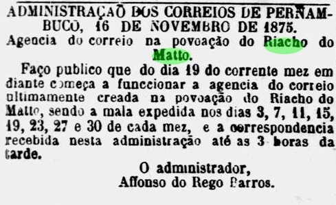
By July 1875, the Indian reservation was history, making way for an ambitious government settlement plan that included three colonies. A few months later, the new post office for Riacho do Matto was announced:
Diario de Pernambuco, 18.11.1875
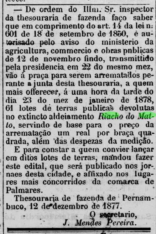
However, the land parcels were not put up for public auction until December 1877:
Diario de Pernambuco, December 16, 1877
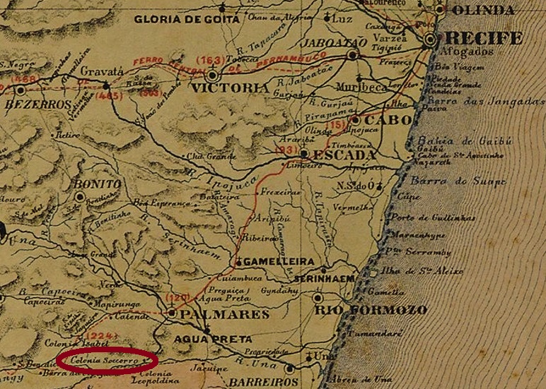
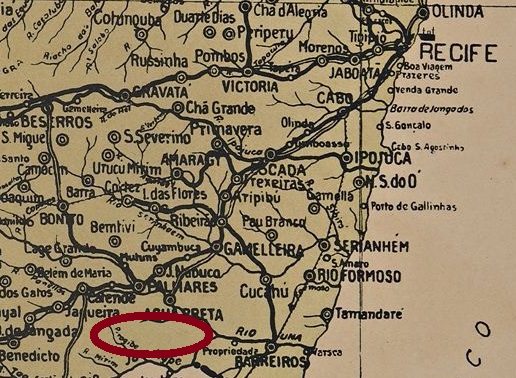
In April 1878, the first colonist train arrived at Cinco Pontas station, about 30 km away, to ceremoniously inaugurate the new colonisation of Riacho do Matto. Most of the new settlers were refugees from the drought areas in Brazil’s northeast. But they were also joined by many poor people from Recife who had been persuaded to leave the provincial capital with the prospect of a piece of land. This new colony was called Colonia Soccorro, and lay between Colonia Isabel (see also Koester, Carimbologia XII) and Colonia Leopoldina. (see map above).
Within a month, the population reached over 3,000 inhabitants, causing major problems in the social fabric of the new municipality. In the 1980s, even veterans from the region who had returned from the war against Paraguay applied to the Pernambuco government for their land parcels.
The settlement was renamed Sertãozinho in 1893 – after an old fazenda in the region – and was now under the control of the Villa of Água Preta. In 1930 it was given its current name, Sertãozinho de Baixo (= Lower Sertãozinho), and from 1938 it became a district of the newly founded Município of Maraial.
So far, no stamp from the imperial period could be found for this locality.
Arthur D. Ribeiro: Estado de Pernambuco, 1924
Andere Namen: Colonia Soccorro, Sertãozinho de Baixo (1930)
Siehe auch Riacho do Matto (RPE-0720)
Die erstaunliche Geschichte dieser kleinen Ortschaft nahe der Alagoas-Grenze im südlichen Pernambuco wurde noch nicht erzählt. Bis ca. 1870 war sie noch ein Indianerreservat. Um diese Zeit entfachte sich ein Disput zwischen Indianer und Farmern, am dessen Ende ein Landvermessungsprojekt von der Provinzregierung gestartet wurde. In 1872 eskalierte der Streit zum offenen Konflikt, und das ganze Gebiet wurde anschließend neu demarkiert.
Bis Juli 1875 war das Indianerreservat bereits Geschichte und machte Platz einem ehrgeizigen Siedlungsplan der Regierung, der drei Kolonien vorsah. Ein Paar Monate später kündigte man schon das neue Postamt für Riacho do Matto an:
Diario de Pernambuco, 18.11.1875
Die Landparzellen wurden gleichwohl erst im Dezember 1877 zur Versteigerung öffentlich ausgeschrieben:
Diario de Pernambuco, 16. Dezember 1877
In April 1878 kam der erste Kolonistenzug am ca. 30 km entfernten Bahnhof Cinco Pontas an, um die Neukolonisierung von Riacho do Matto feierlich einzuleiten. Die meisten der neuen Siedler waren Flüchtlinge aus den Dürregebieten in Brasiliens Nordosten. Dazu kamen aber auch viele Arme aus Recife, die überredet worden waren, mit der Aussicht auf ein Stück Land die Provinzhauptstadt zu verlassen. Diese neue Kolonie wurde Colonia Soccorro genannt, und lag zwischen Colonia Isabel (s.a. Koester, Carimbologia XII) und Colonia Leopoldina. (s. Karte zu Beginn des englischen Textes).
Binnen eines Monates erreichte die Bevölkerungszahl über 3.000 Einwohner, was große Probleme im sozialen Gefüge der neuen Gemeinde mit sich brachte. In den 80er Jahren haben sogar Veteranen aus der Region, die zurück aus dem Krieg gegen Paraguay zurückgekehrt waren, ihre Landesparzellen bei der Pernambuco-Regierung beantragt.
Die Siedlung wurde in 1893 in Sertãozinho umbenannt – nach einer alten Fazenda der Region – und war nun der Villa von Água Preta unterstellt. In 1930 erhielt sie nun die aktuelle Bezeichnung, Sertãozinho de Baixo (= Untere Sertãozinho), und wurde ab 1938 ein Distrikt des neu gegründeten Município von Maraial.
Bisher konnte kein Stempel aus der Kaiserzeit für diese Ortschaft gefunden werden.
Carta da Republica dos Estados Unidos do Brazil, 1892
Other names: Colonia do Assunguy, Nossa Senhora da Guia do Serro Azul, Cerro Azul (1929).
See also Assunguy (R. Koester: Carimbologia II)
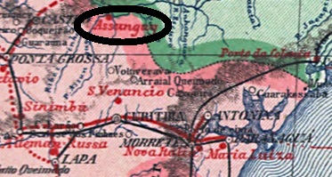
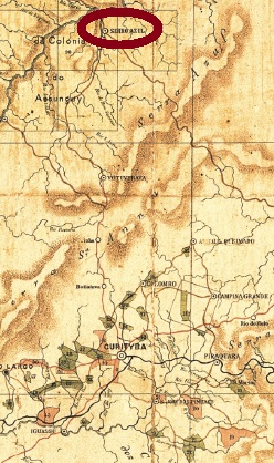
This village was established around 1860, when the colony of Assunguy was founded on the east bank of the Ponta Grossa River, 90 km north of the provincial capital Curitiba. Assunguy is a Tupi-Guarani language word meaning Blue River. In April 1872, the village rose to a freguesia in the município of Votuverava, in October 1882, to a vila called Serro Azul, and in December 1897, to a town. Since 1929, Cerro Azul – as it is now written – has been an independent município.
According to the Imperial Mail Register (Tabella das Agencias do Correio do Imperio, Rio de Janeiro, 1885), there has been a post office there since 1875. The only 19th century postmark so far is SPR-0210a (image from the internet): a circle with the inscriptions SERRO AZUL above and PARANA below. The copy seen is red and bears a date from 1890 in the centre. Earlier stamps will probably show ASSUNGUY.
Estado do Paraná, 1892
Andere Namen: Colonia do Assunguy, Nossa Senhora da Guia do Serro Azul, Cerro Azul (1929)
Siehe auch Assunguy (R. Koester: Carimbologia II)
Diese Ortschaft entstand um 1860, als die Kolonie Assunguy am Ostufer des Flusses Ponta Grossa gegründet wurde, 90 km nördlich der Provinzhauptstadt Curitiba entfernt. Assunguy ist ein Begriff der Tupi-Guarani Sprache und bedeutet Blauer Fluss. Im April 1872 stieg der Ort zur Freguesia im Município von Votuverava, im Oktober 1882 zur Vila namens Serro Azul und im Dezember 1897 zur Stadt. Seit 1929 ist Cerro Azul – wie man jetzt schreibt – ein eigenständiger Município.
Laut Verzeichnis der kaiserlichen Postämter (Tabella das Agencias do Correio do Imperio, Rio de Janeiro, 1885) gibt es dort ein Postamt seit 1875. Der bisher einzige Poststempel im 19. Jahrhundert ist SPR-0210a (Abb. aus dem Internet): ein Kreis mit den Inschriften SERRO AZUL oben und PARANA unten. Das gesichtete Exemplar ist rot und trägt ein Datum aus 1890 in der Mitte. Frühere Stempel werden wohl ASSUNGUY haben.
Other names: Grande Serro do Frio, Arraial das Lavras Velhas do Ivituruhy, Villa do Principe.
See also Conceição do Serro (R. Koester: Carimbologia XIII)
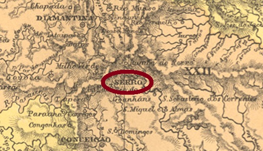
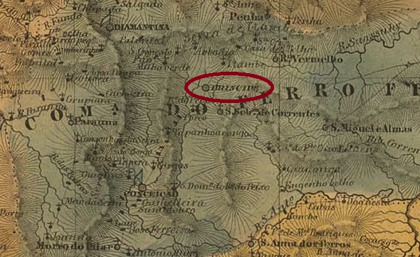
This very old settlement was already the Villa do Principe in January 1714, located in the north of the Capitania of Minas Gerais, 330 km north of the future provincial capital Ouro Preto. In March 1838, the place rose to become a town, and is today a tourist magnet as a historical site.
Paula Sobrinho writes in História Postal de Minas Gerais (Belo Horizonte, 1997) that there was a post office there from March 1798. Three postmarks with place names and one “mute” postmark were found. The first one is SMG-3100a, which was also used in red between 1839 and at least 1850, and can be seen in the RHM catalogue under P-MG-22:
SMG-3100a (RHM P-MG-22)
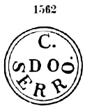
The C above probably means Cidade (city). It was followed by the SMG-3100b variant. This cancel has a double circle, also appears in blue and red, was in circulation from about 1844 to 1868 and was already presented by Paulo Ayres in Catálogo de Carimbos Brasil-Império (S. Paulo, 1937, 1942) under no. 1562:
SMG-3100b (P.A. 1562)
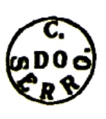
The last place cancel in the Empire was SMG-3100c (Coll. José A. Junges): a double circle with the simple inscription SERRO at the top. Dates in the centre were found for the period between 1877 and 1901. Attention: do not confuse with the very similar cancel with the inscription C. DO SERRO: this one comes from nearby Conceição do Serro.
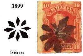
The mute cancel is the pretty no. 601 in Paulo Ayres (op. cit.), which is identical with no. 3899 in Mute Cancellations of the Brazil Empire / Carimbos Mudos do Brasil Império (Brazil Philatelic Association, Rio de Janeiro, 2000) by J. Dingler and K.W. Lopes. This cancel was found in covers around 1877 to 1879:
BPA 3899, P.A. 601 (image from the Internet)
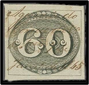
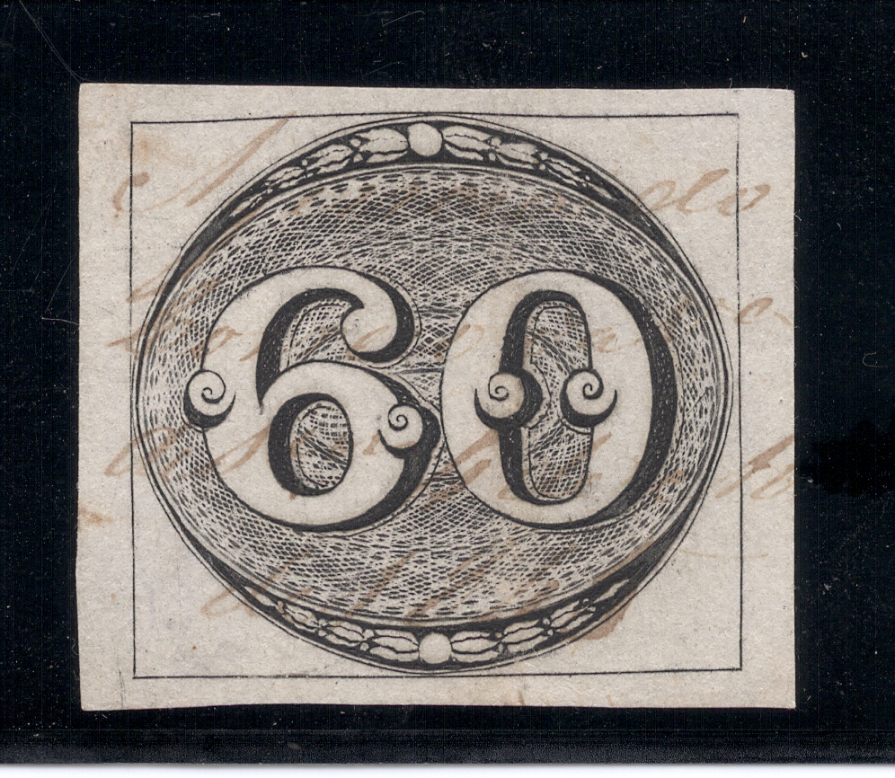
Finally, handwritten cancellations from Serro have been found, which were used on Bull’s-eyes from 1843:
Corinphila(Coll. José A. Junges)Villiers de l’Ile Adam: Carta (…) da Provincia de Minas Geraes, 1849
Andere Namen: Grande Serro do Frio, Arraial das Lavras Velhas do Ivituruhy, Villa do Principe
Siehe auch Conceição do Serro (R. Koester: Carimbologia XIII)
Diese sehr alte Siedlung war bereits im Januar 1714 die Villa do Principe und lag im Norden der Capitania von Minas Gerais, 330 km nördlich der künftigen Provinzhauptstadt Ouro Preto entfernt. Im März 1838 stieg der Ort zur Stadt auf und ist bis heute als historische Stätte ein Touristenmagnet.
Paula Sobrinho schreibt in História Postal de Minas Gerais (Belo Horizonte, 1997) dass es dort ab März 1798 ein Postamt gab. Drei Poststempel mit Ortsbezeichnung und ein „stummer“ Stempel wurden gefunden. Der erste Stempel ist SMG-3100a, der zwischen 1839 und zumindest 1850 auch in Rot Verwendung fand, und wie im RHM-Katalog unter P-MG-22 zu sehen ist:
SMG-3100a (RHM P-MG-22)
Das C oben bedeutet wohl Cidade (Stadt). Ihm folgte die Variante SMG-3100b. Dieser Stempel hat einen doppelten Kreis, kommt auch in blau und rot vor, war im Umlauf ab ca. 1844 bis 1868 und wurde bereits durch Paulo Ayres in Catálogo de Carimbos Brasil-Império, (S. Paulo, 1937, 1942) unter Nr. 1562 vorgestellt:
SMG-3100b (P.A. 1562)
Der letzte Ortstempel im Kaiserreich war SMG-3100c (Samml. José A. Junges): ein Doppelkreis mit der schlichten Inschrift SERRO oben. Daten in der Mitte zwischen 1877 und 1901. Achtung: nicht mit dem sehr ähnlichen Stempel mit der Inschrift C. DO SERRO verwechseln: dieser kommt aus dem nahen Conceição do Serro.
Der „stumme“ Stempel ist der hübsche Nr. 601 bei Paulo Ayres (op. cit.), der identisch mit Nr. 3899 in Mute Cancellations of the Brazil Empire / Carimbos Mudos do Brasil Império, (Brazil Philatelic Association, Rio de Janeiro, 2000) von J. Dingler und K.W. Lopes ist. Dieser Stempel wurde in Belegen um 1877 bis 1879 gefunden:
BPA 3899, P.A. 601 (Abb. aus dem Internet)
Schließlich sind noch handschriftliche Entwertungen aus Serro gefunden worden, die auf Ochsenaugen von 1843 Verwendung fanden:
Other names: Nossa Sra. do Rosário do Serrito, Cerrito Velho, Cerrito (1937)
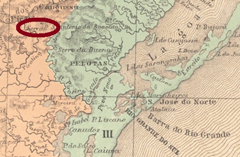
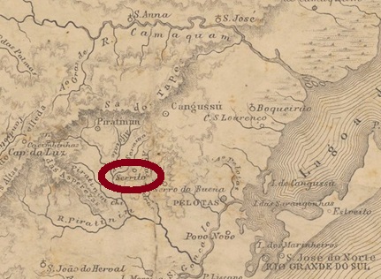
The old settlement of Nossa Senhora do Rosário do Serrito near Pelotas only in about 1890 became a district in the Município of Cangussu (now spelled Canguçu), located a good 300 km southwest of the provincial capital Porto Alegre. In April 1959, the town transferred as Cerrito to the newly created Município of Pedro Osório and received its administrative autonomy in December 1995.
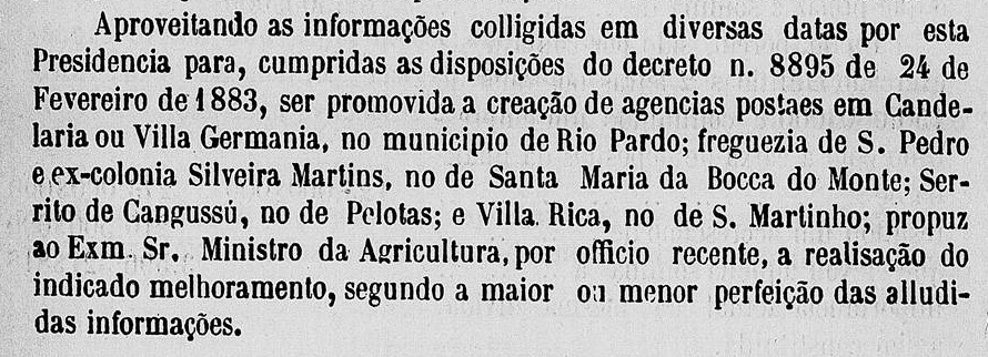
The local post office came into being in August 1887, as Luís Claudio Fritzen writes in Agencias Postais da Provincia de São Pedro do Sul durante o Império Brasileiro (Rio Grande Filatélico 49, Porto Alegre, 2007). This is confirmed by the report of the provincial president:
Relatório do Presidente da Província, 1887
So far, no postmark of the imperial period has been found from this locality.
Provincia de São Pedro, 1877
Andere Namen: Nossa Sra. do Rosário do Serrito, Cerrito Velho, Cerrito (1937)
Die alte Siedlung von Nossa Senhora do Rosário do Serrito bei Pelotas wurde erst ca. 1890 zu einem Distrikt im Município von Cangussu (heute Canguçu geschrieben), der gut 300 km südwestlich der Provinzhauptstadt Porto Alegre entfernt lag. Im April 1959 wechselte der Ort als Cerrito zum neu gegründeten Município von Pedro Osório und erhielt seine Verwaltungsautonomie im Dezember 1995.
Das örtliche Postamt entstand im August 1887, wie Luís Claudio Fritzen in Agencias Postais da Provincia de São Pedro do Sul durante o Império Brasileiro (Rio Grande Filatélico 49, Porto Alegre, 2007) schreibt. Dies wird durch den Bericht des Provinzpräsidenten bestätigt:
Relatório do Presidente da Província, 1887
Bisher wurde kein Poststempel der Kaiserzeit aus dieser Ortschaft gefunden.
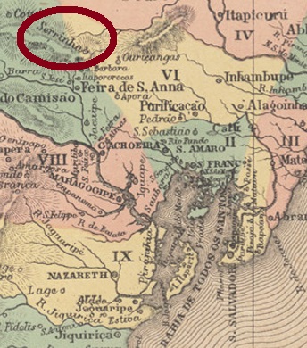
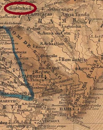
The freguesia of Sant’Anna da Serrinha was inaugurated in June 1838 in the Município of Purificação and was located on the east bank of the Rio do Peixe, 180 km north of the provincial capital Salvador da Bahia. The place rose to the status of villa in June 1876 and to a town in June 1891.
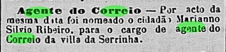
According to the Imperial Mail Register (Tabella das Agencias do Correio do Imperio, Rio de Janeiro, 1885), there has been a post office there since 1879. This must have happened right at the beginning of the year, because the first postal employee was already introduced in January by the regional press:
O Monitor, 24. 1. 187
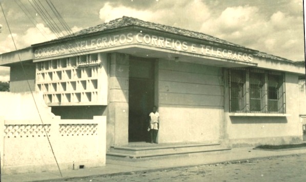
No local postmark from the Empire has yet appeared. But there is a picture of the Serrinha post office in 1957:
IBGEVilliers de l’Ile Adam: Carta (…) da Provincia da Bahia, 1848
Anderer Name: Sant’Anna da Serrinha
Die Freguesia von Sant’Anna da Serrinha wurde im Juni 1838 im Município von Purificação eingeweiht und lag am Ostufer des Rio do Peixe, 180 km nördlich der Provinzhauptstadt Salvador da Bahia entfernt. Der Ort stieg im Juni 1876 zur Villa und im Juni 1891 zur Stadt auf.
Wie aus dem Verzeichnis der kaiserlichen Postämter (Tabella das Agencias do Correio do Imperio, Rio de Janeiro, 1885) hervorgeht, gibt es dort ein Postamt seit 1879. Dies dürfte gleich zu Jahresbeginn passiert sein, denn der erste Postangestellte wurde bereits in Januar durch die Regionalpresse vorgestellt:
O Monitor, 24. 1. 1879
Von dort ist bisher kein Poststempel aus dem Kaiserreich aufgetaucht. Dafür aber ein Bild vom Postamt Serrinha anno 1957:
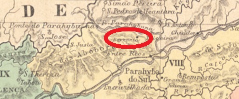
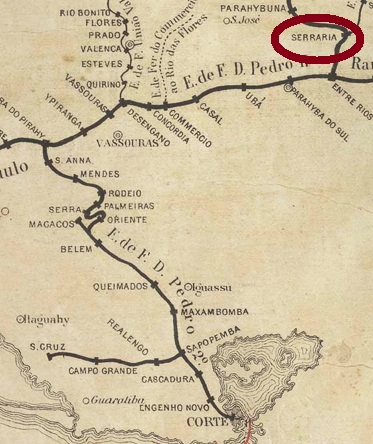
Serraria (sawmill) was a small village near Santo Antonio do Parahybuna (today: Juiz de Fora) located directly on the north bank of the Rio Paraibuna and thus on the provincial border with Rio de Janeiro, 260 km south of the provincial capital Ouro Preto. The town changed political jurisdiction twice: in September 1923 to Matias Barbosa and in December 1953 to Santana do Deserto. Today it is a rural suburb of the latter municipality.
According to Ralph Giesbrecht (estacoesferroviarias.com.br), a station of the E.F. D. Pedro II Railway Company (Main Line) was inaugurated there in September 1874. The line passed in 1889 with the arrival of the Republic to the E. F Central do Brasil and in 1975 to Rede Ferroviária Federal S.A. until the end of operations in 1996.
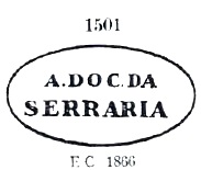
Paulo Novaes writes in agenciaspostais.com.br that there was a post office in Serraria from September 1861. It is likely that the postal service transitioned seamlessly at the station from 1874, although the first postmarks with EST. (abbreviation for station) did not appear until the 1880s. The first postmark is SRJ-1590a. It also appears in blue, was in circulation until at least 1876 and was already presented by Paulo Ayres in Catálogo de Carimbos Brasil-Império (S. Paulo, 1937, 1942) under no. 1501:
SRJ-1590a (P.A. 1501)
It was followed by SRJ-1590b, also presented by P. Ayres (op. cit.) and found with dates between 1882 and 1885:
SRJ-1590b (P.A. p.126)
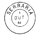
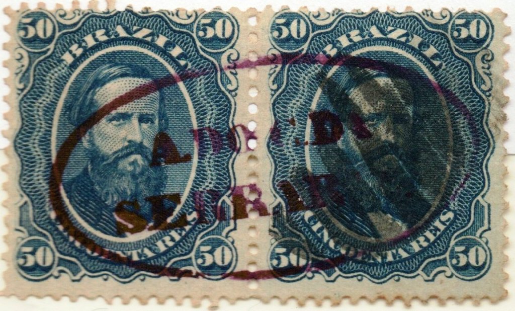
SRJ-1591a (Coll. José A. Junges) is a double circle with the inscriptions SERRARIA at the top and (EST.) at the bottom, the dates in the middle going from 1886 to 1894 – although according to P. Novaes the post office was supposedly closed in February 1891. Finally, SRJ-1591b (image from the Internet) is an ambulatory postmark of the so-called Serraria branch (Ramal da Serraria). The branch was in operation between 1879 and 1904, built by the E.F. Cia. União Mineira railway company and later taken over by the E.F. Leopoldina. The stamp has a double circle with the inscriptions C.AMB. LEOPOL.A at the top and (R.SERRARIA) at the bottom. One copy sighted so far, dated 1890 in the centre.
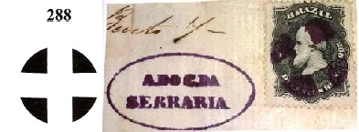
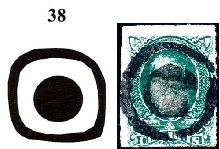
In addition, three mute postmarks from Serraria have appeared, two of which have already been presented in Mute Cancellations of the Brazil Empire / Carimbos Mudos do Brasil Império (Brazil Philatelic Association, Rio de Janeiro, 2000) by J. Dingler and K. W. Lopes under nos. 38 and 288:
BPA 38 (Coll. José A. Junges) 1877ff-1882BPA 288 (Coll. Fuad Ferreira Fo.) 1866ff-1876ff
The third mute cancel was used in connection with a D. Pedro issue from 1866:
1866ff (Coll. José A. Junges)Estações Ferroviárias do Rio de Janeiro, São Paulo e Minas Geraes, 1880
Serraria (Sägewerk) war eine kleine Ortschaft bei Santo Antonio do Parahybuna (heute: Juiz de Fora) die direkt am Nordufer des Rio Paraibuna und damit an der Provinzgrenze zu Rio de Janeiro lag, 260 km südlich der Provinzhauptstadt Ouro Preto entfernt. Der Ort wechselte zweimal die politische Zuständigkeit: im September 1923 zu Matias Barbosa und im Dezember 1953 zu Santana do Deserto. Heute ist er ein ländlicher Vorort dieser letztgenannten Gemeinde.
Laut Ralph Giesbrecht (estacoesferroviarias.com.br) wurde dort im September 1874 ein Bahnhof der E.F. D. Pedro II Bahngesellschaft (Hauptlinie) eingeweiht. Die Linie ging 1889 mit dem Advent der Republik zur E. F Central do Brasil und 1975 bis Betriebsende 1996 zur Rede Ferroviária Federal S.A. über.
Paulo Novaes schreibt in agenciaspostais.com.br, dass es in Serraria ab September 1861 ein Postamt gab. Wahrscheinlich ging der Postbetrieb ab 1874 im Bahnhof nahtlos über, obwohl die ersten Poststempel mit EST. (Abk. für Bahnhof) erst in den 80er Jahren aufgetaucht sind. Der erste Poststempel ist SRJ-1590a. Er kommt auch in blau vor, war bis mindestens 1876 im Umlauf und wurde bereits durch Paulo Ayres in Catálogo de Carimbos Brasil-Império (S. Paulo, 1937, 1942) unter Nr. 1501 vorgestellt:
SRJ-1590a (P.A. 1501)
Ihm folgte SRJ-1590b, der ebenfalls durch P. Ayres (op. cit.) präsentiert wurde und mit Daten zwischen 1882 und 1885 zu finden war:
SRJ-1590b (P.A. p./S.126)
SRJ-1591a (Samml. José A. Junges) ist ein Doppelkreis mit den Inschriften SERRARIA oben und (EST.) unten, die Daten in der Mitte gehen von 1886 bis 1894 – obwohl laut P. Novaes das Postamt in Februar 1891 angeblich geschlossen wurde. Schließlich, SRJ-1591b (Abb. aus dem Internet) ist ein ambulanter Poststempel der sog. Serraria-Abzweigung (Ramal da Serraria). Die Abwzeigung war zwischen 1879 und 1904 in Betrieb, gebaut von der E.F. Cia. União Mineira Bahngesellschaft und später durch die E.F. Leopoldina übernommen. Der Stempel hat einen Doppelkreis mit den Inschriften C.AMB. LEOPOL.A oben und (R.SERRARIA) unten. Ein Exemplar bisher gesichtet, datiert 1890 in der Mitte.
Darüber hinaus sind drei „stumme“ Stempel aus Serraria aufgetaucht, davon zwei bereits in Mute Cancellations of the Brazil Empire / Carimbos Mudos do Brasil Império (Brazil Philatelic Association, Rio de Janeiro, 2000) von J. Dingler und K. W. Lopes unter Nr. 38 und 288 vorgestellt:
BPA 38 (Samml. José A. Junges) 1877ff-1882BPA 288 (Samml. Fuad Ferreira Fo.) 1866ff-1876ff
Der dritte stumme Stempel war in Verbindung mit einer D. Pedro Marke aus 1866 zu sehen:
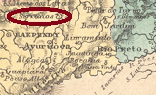
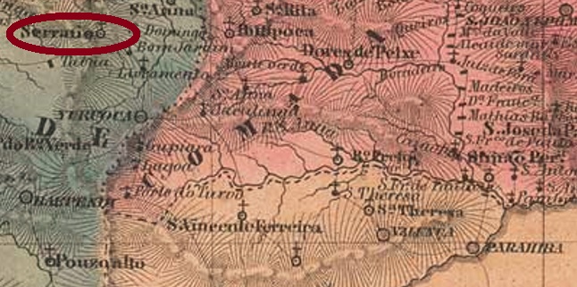
The Freguesia of Nossa Senhora do Bom Successo dos Serranos (Our Lady of the Good Success of the Mountain People) originated in April 1840 in the Município of Aiuruoca and was located on the west bank of the Aiuruoca River, 270 km southwest of the provincial capital of Ouro Preto. In August 1911, the place name was shortened to Serranos, which has been an independent Município since December 1958.
Paula Sobrinho writes in História Postal de Minas Gerais (Belo Horizonte, 1997) that there has been a post office there since August 1881. The imperial postmark is SMG-3095a (Coll. José A. Junges): a double circle with the inscriptions SERRANOS above and (MINAS) below. The dates in the centre are from the period 1885-1894.
Villiers de l’Ile Adam: Carta (…) da Provincia de Minas Geraes, 1849
Die Freguesia von Nossa Senhora do Bom Successo dos Serranos (Unsere Liebe Frau des Guten Erfolgs der Bergbewohner) entstand im April 1840 im Município von Aiuruoca und lag am Westufer des Aiuruoca-Flusses, 270 km südwestlich der Provinzhauptstadt Ouro Preto entfernt. Im August 1911 wurde der Ortsname zu Serranos gekürzt, der seit Dezember 1958 ein eigenständiger Município ist.
Paula Sobrinho schreibt in História Postal de Minas Gerais (Belo Horizonte, 1997), dass es dort seit August 1881 ein Postamt gibt. Der kaiserliche Poststempel ist SMG-3095a (Samml. José A. Junges): ein Doppelkreis mit den Inschriften SERRANOS oben und (MINAS) unten. Die Daten in der Mitte entstammen dem Zeitraum 1885-1894.