Print edition update, on January 2, 2022
Other names: Bomfim da Serra da Raiz, Cupaoba (1938-1943)
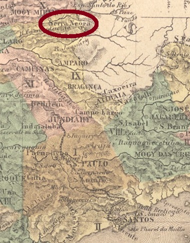
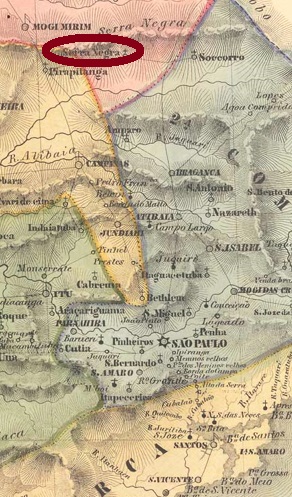
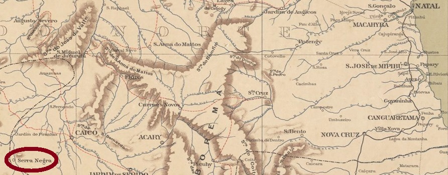
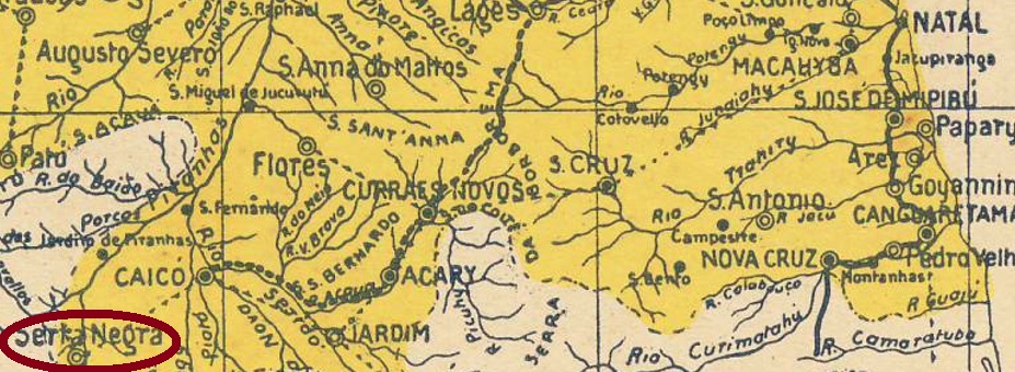
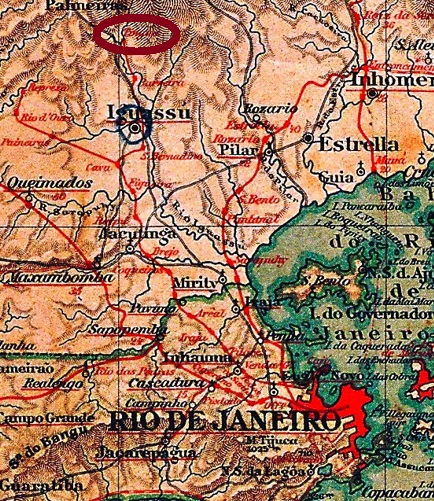
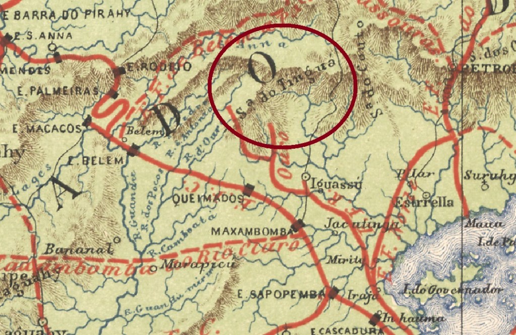
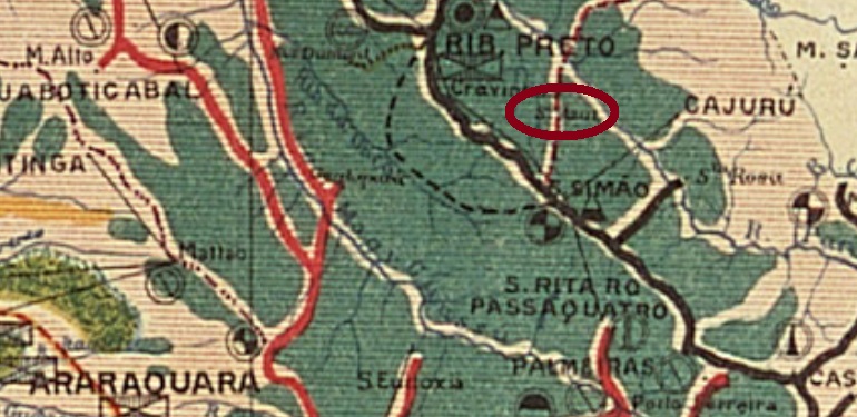
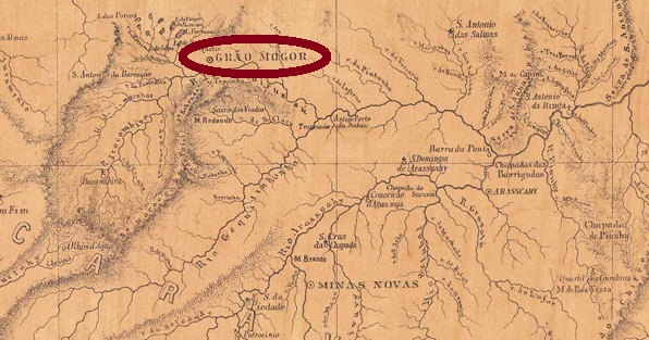
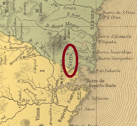
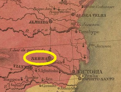
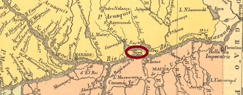
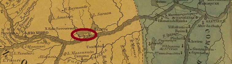
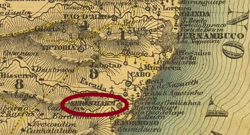
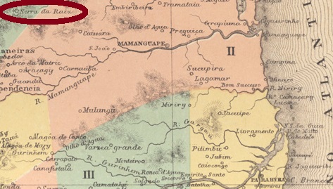
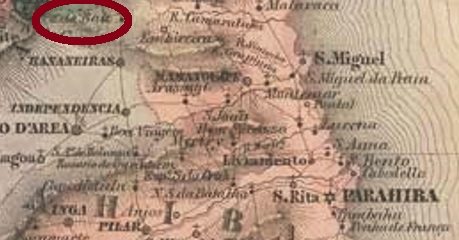
The settlement of Bomfim da Serra da Raiz has a long and confused history, marked by a long rivalry with the neighbouring locality of Caiçaras. To make the situation even more complicated, both settlements have long and repeatedly belonged to one municipality, which sometimes was called Guarabira, sometimes Independência. In November 1877, Serra da Raiz became a freguesia of Independencia (ex-Guarabira), which was located on the mountain range of the same name, more than 100 km northwest of the provincial capital Parahyba do Norte (today: João Pessoa). Afterwards, Serra da Raiz became a district of Caiçara twice (in December 1883 and in November 1908), and once it belonged to Guarabira again (in October 1884, together with Caiçara). Between late 1938 and late 1843, the place was called Cupaoba. This is the Tupi name for Serra da Raiz and means endless mountains. Since January 1959, Serra da Raiz has been an independent município.
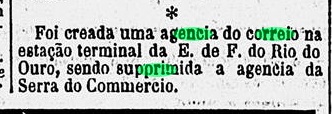
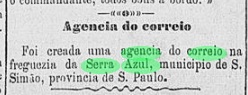
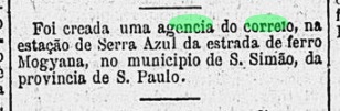
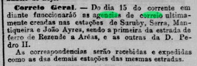
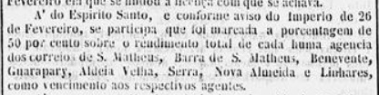
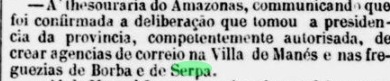
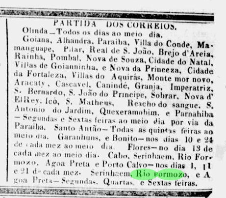
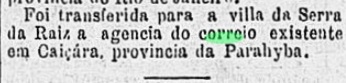
The local post office was created in October 1885, when the previous post office in Caiçaras was moved to Serra da Raiz, as reported by the Rio press:

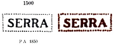
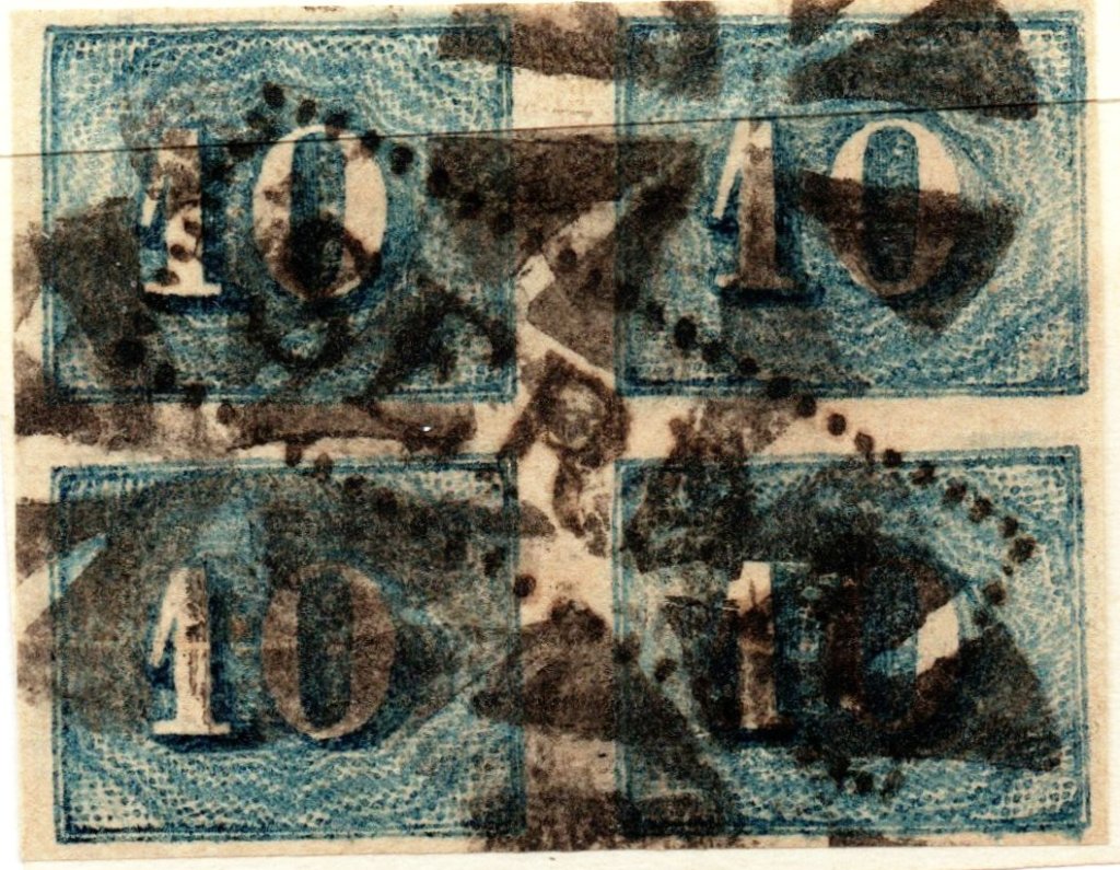
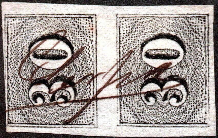
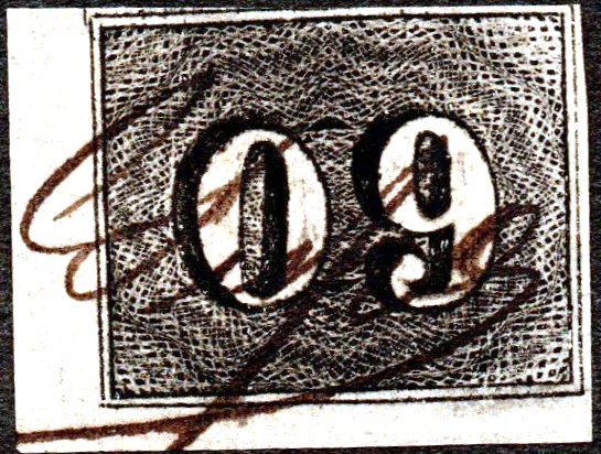
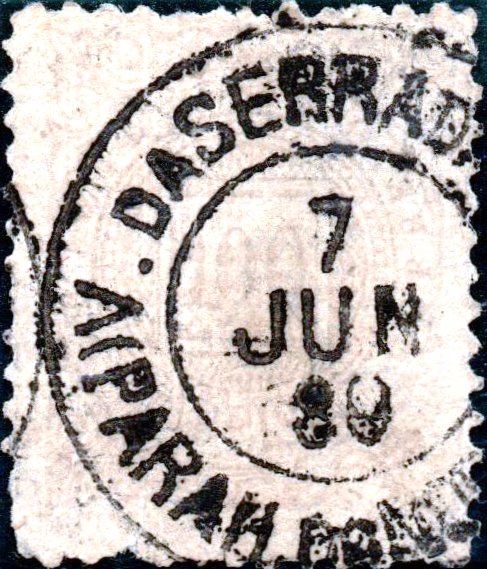
After the publication of Carimbologia S2, a postmark from the imperial period has been discovered. Here is SPB-0235a, from the José A. Junges collection:
Aktualisierung der Printausgabe, am 2. Januar 2022
Andere Namen: Bomfim da Serra da Raiz, Cupaoba (1938-1943)
Die Siedlung von Bomfim da Serra da Raiz hat eine lange und konfuse Geschichte, die von einer langen Rivalität mit der Nachbargemeinde Caiçaras geprägt ist. Um die Lage noch verworrener zu machen, gehörten beide Ortschaften lange und immer wieder einer Gemeinde, die mal Guarabira, mal Independência hieß. Im November 1877 wurde Serra da Raiz eine Freguesia von Independencia (ex-Guarabira), die am gleichnamigen Gebirge lag, über 100 km nordwestlich der Provinzhauptstadt Parahyba do Norte (heute: João Pessoa) entfernt. Danach wurde Serra da Raiz zweimal ein Distrikt von Caiçara (im Dezember 1883 und im November 1908), und einmal gehörte der Ort wieder Guarabira (im Oktober 1884, zusammen mit Caiçara). Zwischen Ende 1938 und Ende 1843 hieß der Ort Cupaoba. Dies ist der Tupi-Name für Serra da Raiz und bedeutet endloses Gebirge. Seit Januar 1959 ist Serra da Raiz ein eigenständiger Município.
Das örtliche Postamt entstand im Oktober 1885, als das bisherige Postamt in Caiçaras nach Serra da Raiz verlegt wurde, wie die Presse aus Rio berichtete:
Nach der Erscheinung von Carimbologia S2 ist ein Poststempel aus der Kaiserzeit entdeckt worden. Hier ist SPB-0235a, aus der Sammlung José A. Junges: