Other names: Nossa Sra. das Dores da Fazendinha, Sarapuí
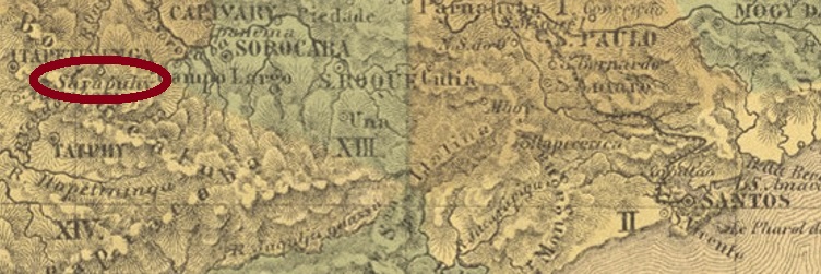
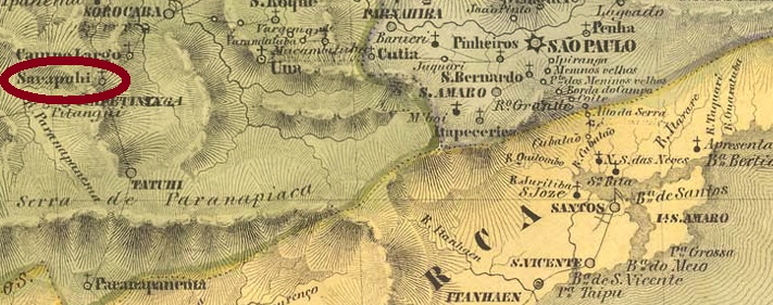
Sarapuhy was a freguesia in the Município of Itapetininga from February 1844, located about 150 km west of the provincial capital São Paulo. In March 1872, the place rose to the status of a villa, but in May 1934, the relegation to the district of Itapetininga came back. Then in October 1937, the Município of Sarapuí was finally created.
As shown in the Imperial Mail Register(Tabella das Agencias do Correio do Imperio, Rio de Janeiro, 1885), there has been a post office there since 1874. The imperial postmark is SSP-1360a (Coll. José A. Junges): a double circle with the inscription SARAPUHY at the top and a (2) at the bottom. The dates in the middle were found for the period 1884-1897.
Villiers de l’Ile Adam: Carta (…) da Provincia de São Paulo, 1847
Andere Namen: Nossa Sra. das Dores da Fazendinha, Sarapuí
Sarapuhy war ab Februar 1844 eine Freguesia im Município von Itapetininga, die ca. 150 km westlich der Provinzhauptstadt São Paulo entfernt lag. Im März 1872 stieg der Ort zur Villa, aber im Mai 1934 kam der Abstieg zum Distrikt von Itapetininga zurück. Dann im Oktober 1937 entstand schließlich der Município von Sarapuí.
Wie aus dem Verzeichnis der kaiserlichen Postämter (Tabella das Agencias do Correio do Imperio, Rio de Janeiro, 1885) hervorgeht, gibt es dort ein Postamt seit 1874. Der kaiserliche Poststempel ist SSP-1360a (Samml. José A. Junges): ein Doppelkreis mit der Inschrift SARAPUHY oben und eine (2) unten. Die Daten in der Mitte wurden für den Zeitraum 1884-1897 gefunden.
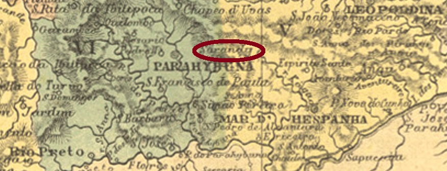
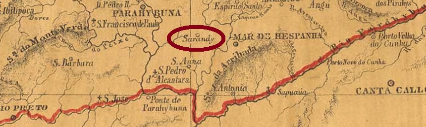
The freguesia of N. Sra. do Livramento de Sarandy was created in January 1880, located in the Município of Juiz de Fora, over 240 km south of the provincial capital of Ouro Preto. The town’s name was changed to Sarandira in December 1943, and it remains so today.
The local post office was established in June 1875, according to the regional press:
Diario de Minas, 10.06.1875
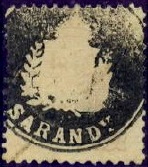
Two imperial postmarks were found: SMG-3085a (Coll. José A. Junges) is a double circle – with the outer circle often barely visible – with the inscription SARANDY above and an ornament in cross with wide side wings below. The inner dates have so far been recorded for the period 1885-1899.
SMG-3085b (Coll. Klerman Lopes) appeared after the release of Carimbologia S2:
SMG-3085b (KL) 1884ffProvincia de Minas Geraes, 1873
Aktualisierung der Printausgabe, am 4. Januar 2022
Anderer Name: Sarandira (1943)
Die Freguesia von N. Sra. do Livramento de Sarandy wurde im Januar 1880 ins Leben gerufen und lag im Município von Juiz de Fora, über 240 km südlich der Provinzhauptstadt Ouro Preto entfernt. Der Ortsname wurde im Dezember 1943 zu Sarandira geändert, und so ist es bis heute geblieben.
Das örtliche Postamt entstand im Juni 1875, wie aus der regionalen Presse hervorgeht:
Diario de Minas, 10.06.1875
Zwei kaiserliche Poststempel waren auffindbar: SMG-3085a (Samml. José A. Junges) ist ein Doppelkreis – wobei der äußere Kreis oft kaum zu sehen ist – mit der Inschrift SARANDY oben und einem Ornament in Kreuz mit breiten Seitenflügeln unten. Die Daten im Inneren wurden bisher für den Zeitraum 1885-1899 registriert.
Nach der Veröffentlichung von Carimbologia S2 erschien auch SMG-3085b (Samml. Klerman Lopes):
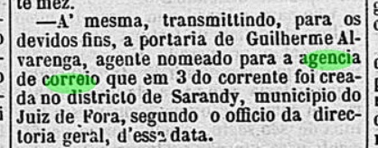
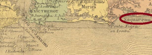
From January 1755, Nossa Senhora de Nazaré de Saquarema was a freguesia of Cabo Frio named by royal decree (Alvará Real) and located on the lagoon of the same name, about 100 km east of the capital Rio de Janeiro. In May 1851, the village rose to the status of an independent villa, but in December 1859 it was again demoted to a district – this time of Araruama. Immediately in July 1860, it was again promoted to villa status, and since January 1890 Saquarema has been a town.
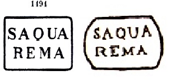
As Nova Monteiro writes in Administrações e Agencias Postaes do Brasil Imperio (Brasil Filatelico/RJ, 1934-5; Reprint SPP 1994-1999), there has been a post office there since March 1839. Two postmarks with place names from the 19th century were found, plus a “mute” cancellation. There are two versions of SRJ-0965a, which was in circulation from the beginning until at least 1877: from Paulo Ayres (Catálogo de Carimbos Brasil-Império, S. Paulo, 1937, 1942) under No. 1494 and from the RHM catalogue, now under P-RJ-44):
SRJ-0965a (P.A.1494 – RHM P-RJ-44)
It was followed by SRJ-0965b (image from the internet): a double circle with the inscription SAQUAREMA. The inner dates were found for the period 1890-1893.
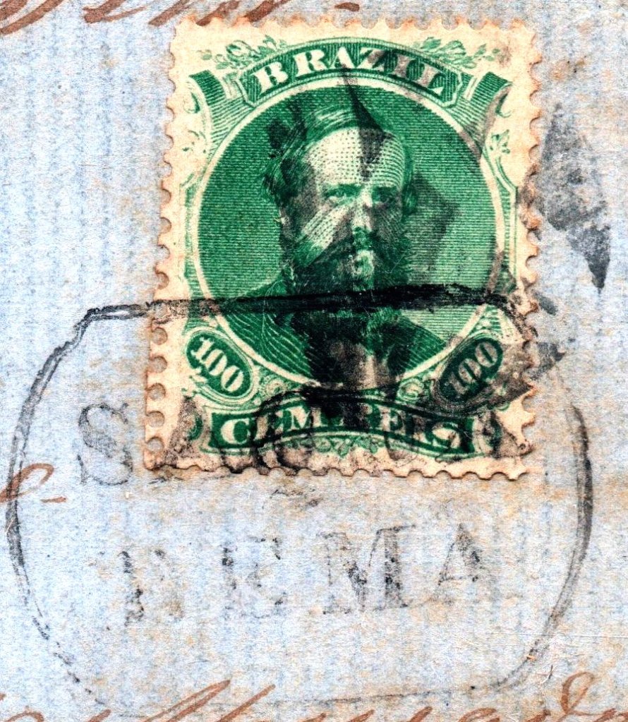
The mute cancellation (Coll. José A. Junges) was found on a letter from 1868 in connection with SRJ-0965a:
1868 (Coll. J.A. Junges)Villiers de l’Ile Adam: Carta (…) da Provincia do Rio de Janeiro, 1850
Nossa Senhora de Nazaré de Saquarema war ab Januar 1755 eine durch königliche Verfügung (Alvará Real) genannte Freguesia von Cabo Frio, die an der gleichnamigen Lagune lag, ca. 100 km östlich der Hauptstadt Rio de Janeiro entfernt. Im Mai 1851 stieg der Ort zur eigenständigen Villa, die aber im Dezember 1859 wieder zum Distrikt – diesmal von Araruama – degradiert wurde. Gleich im Juli 1860 erfolgte der erneute Aufstieg zur Villa, und seit Januar 1890 ist Saquarema eine Stadt.
Wie Nova Monteiro in Administrações e Agencias Postaes do Brasil Imperio (Brasil Filatelico/RJ, 1934-5; Reprint SPP 1994-1999) schreibt, gibt es dort seit März 1839 ein Postamt. Zwei Poststempel mit Ortsbezeichnung aus dem 19. Jahrhundert wurden gefunden, dazu eine „stumme“ Entwertung. Von SRJ-0965a, der von Beginn an bis mindestens 1877 im Umlauf war, gibt es zwei Versionen: aus Paulo Ayres (Catálogode Carimbos Brasil-Império, S. Paulo, 1937, 1942) unter der Nr. 1494 und aus dem RHM-Katalog, nun unter P-RJ-44):
SRJ-0965a (P.A.1494 – RHM P-RJ-44)
Ihm folgte SRJ-0965b (Abb. aus dem Internet): ein Doppelkreis mit der Inschrift SAQUAREMA. Die bisherigen Daten wurden gefunden für den Zeitraum 1890-1893.
Die stumme Entwertung (Samml. José A. Junges) wurde auf einem Brief von 1868 in Verbindung mit SRJ-0965a gefunden:
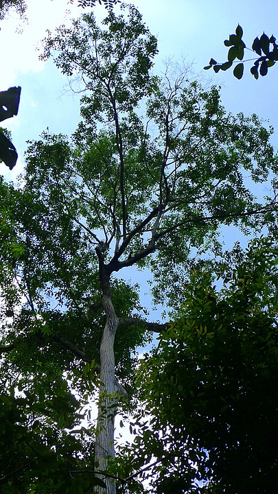
Sapucaia is a South American chestnut tree (Lecythis Sp.) that is now endangered because of its popularity. The Tupi word means fruit whose eye springs.
Photo: Alex Popovkin (CC BY 2.0)
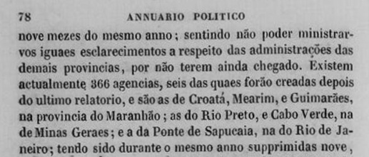
The village was the freguesia of Santo Antonio de Sapucaia (also written Sapocaia) from September 1871 and was located near Magé on the south bank of the Paraíba do Sul River, over 150 km north of the capital Rio de Janeiro. The place rose to the status of a villa in December 1874 and a town 15 years later.
As Nova Monteiro writes in Administrações e Agencias Postaes do Brasil Imperio (Brasil Filatelico/RJ, 1934-5; Reprint SPP 1994-1999), there had been a post office there since August 1846. This can be confirmed by the official annual report for 1847:
Annuario Politico, Historico e Estatistico, 1847
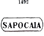
Through Paulo Novaes (agenciaspostais.com.br) we know that the agency was closed in June 1861, only to reopen four months later. Four early postmarks have been found, the two older ones were made known by Paulo Ayres (Catálogo de Carimbos Brasil-Império, S. Paulo, 1937, 1942). SRJ-0960a corresponds to P. Ayres No. 1492, which was in circulation ca. 1866-1888 and also occurs in blue, red and green:
SRJ-0960a (P.A. 1492)
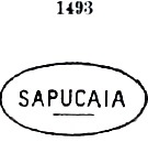
SRJ-0960b is P. Ayres No. 1493, which was also in use around the same time:
SRJ-0960b (P.A. 1493) 1866ff-1877ff
Two postmarks in double circle followed. SRJ-0960c (Coll. José A. Junges) has the inscription SAPUCAIA at the top, dates inside go from about 1877 to 1890. SRJ-0960d (image from the Internet) has the same inscription at the top, with a four-leaf ornament in X at the bottom. Dates inside, from 1890 to 1897.
Villiers de l’Ile Adam: Carta (…) da Provincia do Rio de Janeiro, 1850
Anderer Name: Ponte de Sapucaia
Sapucaia ist ein südamerikanischer Kastanienbaum (Lecythis Sp.), der wegen seiner Beliebtheit inzwischen gefährdet ist. Das Tupi-Wort bedeutet Frucht, deren Auge springt.
Foto: Alex Popovkin (CC BY 2.0)
Die Ortschaft war ab September 1871 die Freguesia von Santo Antonio de Sapucaia (auch Sapocaia geschrieben) und lag bei Magé am Südufer des Flusses Paraíba do Sul, über 150 km nördlich der Hauptstadt Rio de Janeiro. Der Ort stieg im Dezember 1874 zur Villa und 15 Jahre später zur Stadt auf.
Wie Nova Monteiro in Administrações e Agencias Postaes do Brasil Imperio (Brasil Filatelico/RJ, 1934-5; Reprint SPP 1994-1999) schreibt, gab es dort ein Postamt seit August 1846. Das kann durch den amtlichen Jahresbericht für 1847 bestätigt werden:
Annuario Politico, Historico e Estatistico, 1847
Durch Paulo Novaes (agenciaspostais.com.br) wissen wir, dass die Agentur im Juni 1861 geschlossen wurde, um vier Monate später abermals zu eröffnen. Vier frühe Poststempel wurden gefunden, die zwei älteren davon sind durch Paulo Ayres (Catálogo de Carimbos Brasil-Império, S. Paulo, 1937, 1942) bekannt gemacht worden. SRJ-0960a entspricht P. Ayres Nr. 1492, der ca. 1866-1888 im Umlauf war und auch in blau, rot und grün vorkommt:
SRJ-0960a (P.A. 1492)
SRJ-0960b ist P. Ayres Nr. 1493, der auch um die gleiche Zeit verwendet wurde:
SRJ-0960b (P.A. 1493) 1866ff-1877ff
Es folgten zwei Poststempel in Doppelkreis. SRJ-0960c (Samml. José A. Junges) hat oben die Inschrift SAPUCAIA, die Daten im Inneren gehen von ca. 1877 bis 1890. SRJ-0960d (Abb. aus dem Internet) hat oben die gleiche Inschrift, unten ist ein vierblättriges Ornament in X. Daten in der Mitte von 1890 bis 1897.
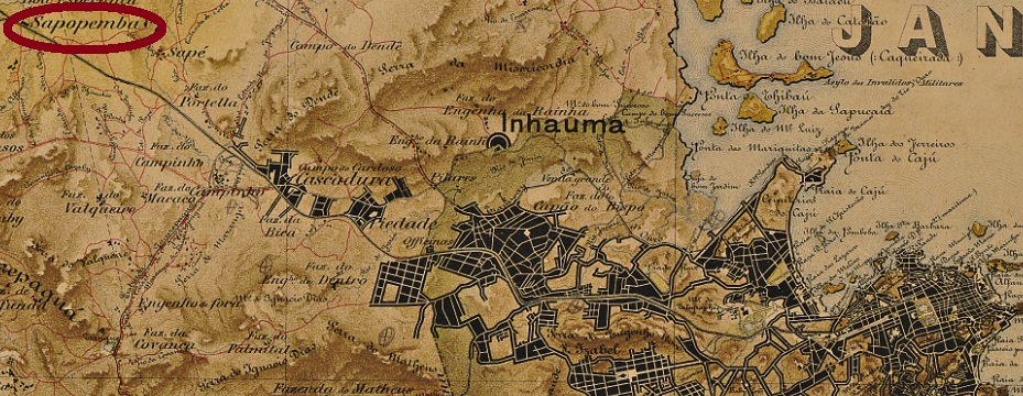
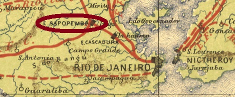
This station was inaugurated as early as March 1859 by the Estrada de Ferro D. Pedro II railway company and was located on the main line (Linha do Centro), less than 30 km west of the centre of Rio de Janeiro. With the Republic, the railway operator changed to E.F. Central do Brasil. Two more changes followed: in 1975 to Rede Ferroviária Federal S.A. and in 1997 to the current Supervia. Since 1908, the station has been called Deodoro, in honour of Marshal Deodoro da Fonseca (1827-1892), Brazil’s first president.
Paulo Novaes writes in agenciaspostais.com.br that there has been a station post office on place since August 1865. Two postmarks were found for the 19th century. SMN-2255a (Coll. José A. Junges) is a double ellipse with the inscriptions A. DO C. above and SAPOPEMBA below. Found on a D. Pedro issue from 1866. SMN-2255b (Coll. José A. Junges) is your double circle with the inscription SAPOPEMBA above and an 8-pointed star below. Dated in the centre from 1894 to 1895, so far.
E. F. Central do Brasil, 1890
Anderer Name: Est. Deodoro (1910)
Dieser Bahnhof wurde bereits im März 1859 durch die Estrada de Ferro D. Pedro II Bahngesellschaft eingeweiht und lag an der Hauptstrecke (Linha do Centro), knapp 30 km westlich der Stadtmitte von Rio de Janeiro. Mit der Republik änderte sich der Bahnbetreiber zu E.F. Central do Brasil. Zwei weitere Änderungen folgten: 1975 zur Rede Ferroviária Federal S.A. und 1997 zur aktuellen Supervia. Seit 1908 heißt der Bahnhof Deodoro, zu Ehren von Marschall Deodoro da Fonseca (1827-1892), Brasiliens erster Präsident.
Paulo Novaes schreibt in agenciaspostais.com.br, dass es dort seit August 1865 ein Bahnhofspostamt gibt. Zwei Poststempel wurden für den 19. Jahrhundert gefunden. SMN-2255a (Samml. José A. Junges) ist eine Doppelellipse mit den Inschriften A. DO C. oben und SAPOPEMBA unten. Gessehen auf einer D. Pedro-Ausgabe von 1866. SMN-2255b (Samml. José A. Junges) ist ein Doppelkreis mit der Inschrift SAPOPEMBA oben und einem 8-zackigen Stern unten. Bisherige Daten in der Mitte: von 1894 bis 1895.
Other names: Nossa Senhora das Dores do Sapé, Bariri (1890).
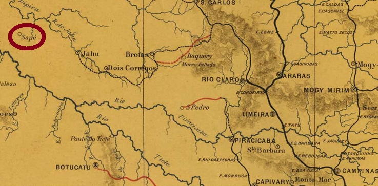
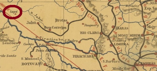
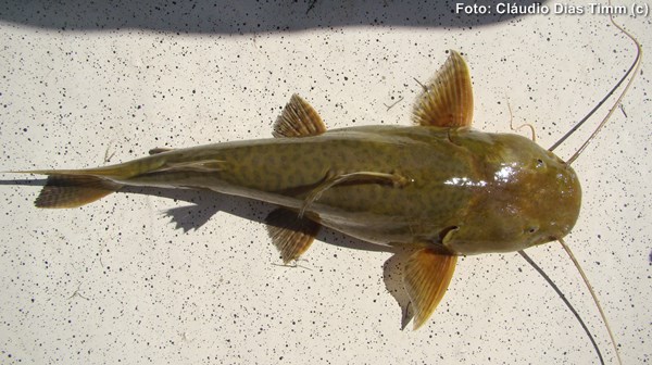
This locality was the district of Nossa Senhora das Dores do Sapé (Our Lady of Sorrows of Sapé) from May 1877, in the municipality of Jahú, which was close to the south bank of the Jahú River, more than 300 km northwest of the provincial capital of São Paulo. Sapé is a type of reed that was used as roofing in rural Brazil, and Jahú (now spelled Jaú) is a large catfish (Zungaro zungaro, Humboldt & Valenciennes, 1821), but it is not so common in the area today:
Zungaro zungaro (Photo: Claudio D. Timm)
In June 1890 the place rose to a villa called Bariri. Bariri has been a town since December 1906. The Indian language word means noisy rapids.
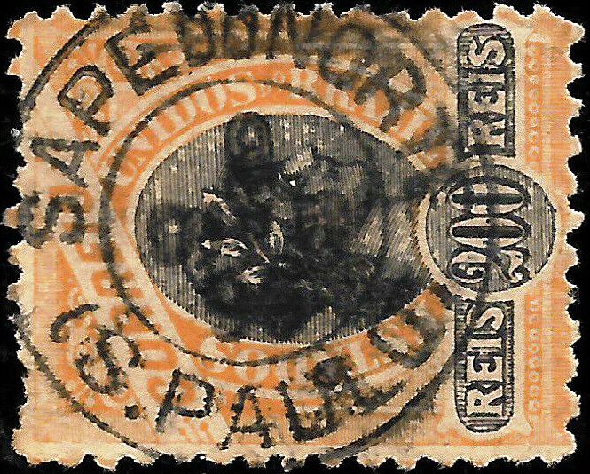
As can be read in the Imperial Mail Register (Tabella das Agencias do Correio do Imperio, Rio de Janeiro, 1885), there has been a post office there since 1881. The only imperial-era postmark found so far is the French type SSP-1355a (Coll. José A. Junges): a double circle with the inscription SAPE DO JAHU above and the typical star in brackets below. The copies found so far are all dated 1889 in the centre.
Provincia de São Paulo, 1886
Andere Namen: Nossa Senhora das Dores do Sapé, Bariri (1890)
Diese Ortschaft war ab Mai 1877 der Distrikt von Nossa Senhora das Dores do Sapé (Unsere Liebe Frau der Schmerzen von Sapé) in der Gemeinde von Jahú, der nah am Südufer des Flusses Jahú lag, über 300 km nordwestlich der Provinzhauptstadt São Paulo entfernt. Sapé ist eine Schilfart, die im ländlichen Brasilien als Dachabdeckung gebraucht wurde, und Jahú (heute Jaú geschrieben) ist ein großer Wels (Zungaro zungaro, Humboldt & Valenciennes, 1821), der heute aber nicht mehr so häufig in dieser Gegend vorkommt:
Zungaro zungaro (Foto: Claudio D. Timm)
Der Ort stieg im Juni 1890 zu einer Villa auf, die Bariri genannt wurde. Seit Dezember 1906 ist Bariri eine Stadt. Das Wort der Indianersprache bedeutet laute Stromschnellen. Wie im Verzeichnis der kaiserlichen Postämter (Tabella das Agencias do Correio do Imperio, Rio de Janeiro, 1885) zu lesen ist, gibt es dort ein Postamt seit 1881. Der einzige bisher gefundene Poststempel der Kaiserzeit ist der Französischer Typus SSP-1355a (Samml. José A. Junges): ein Doppelkreis mit der Inschrift SAPE DO JAHU oben und dem typischen Stern in Klammern unten. Die bisher gefundenen Exemplare sind allesamt 1889 in der Mitte datiert.
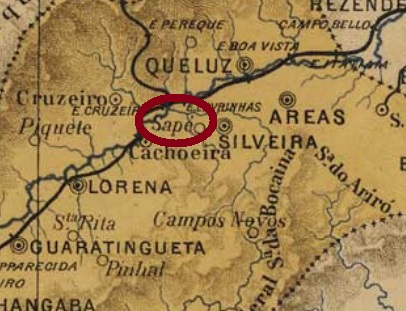
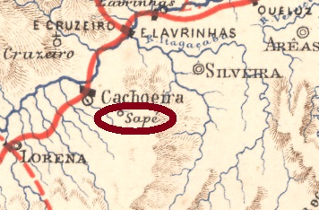
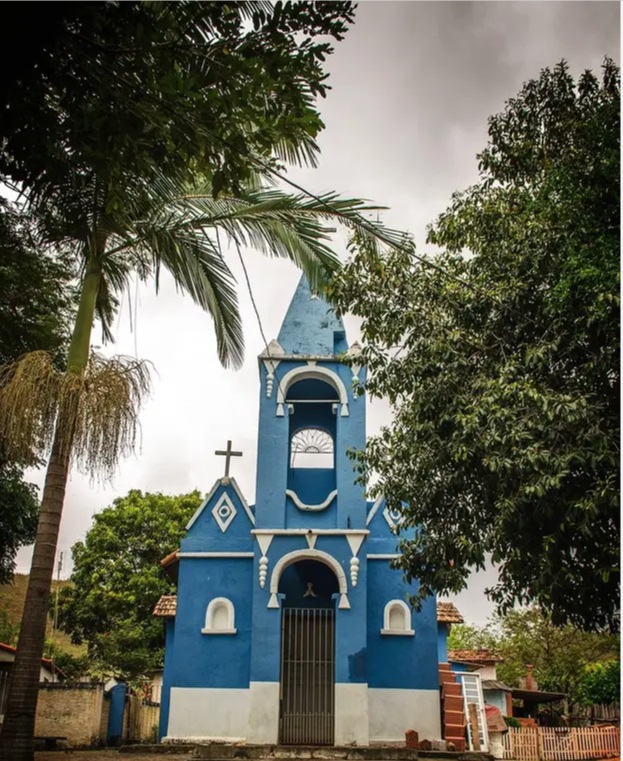
With Sapé, we finally leave the long line of Brazilian localities with saint’s names in the empire. The old village was a freguesia of Silveiras from April 1857, close to the south bank of the Rio Paraíba, more than 200 km northeast of the provincial capital São Paulo. With coffee cultivation came prosperity; the decline of this culture in the region was followed by decadence. So, in April 1887, the place became an independent município called Jatahy. The Indian word denotes both a plant of the Faseolaceae family (also called Butiá) and a variety of bee. At the end of the Empire, over three thousand people lived there. In May 1934, the place descended to the district of Cachoeira, and today it is a sparsely inhabited rural suburb of Cachoeira Paulista. Only the church of N. Sa. da Piedade reminds us of the old days:
Photo: Paulo Pontes
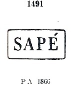
As Nova Monteiro writes in Administrações e Agencias Postaes do Brasil Imperio (in Brasil Filatelico/RJ, 1934-5; reprint SPP 1994-1999), there was a post office there from October 1861. At the beginning there were two postmarks, which are very similar. SSP-1350b also occurs in brown and red and was already presented by Paulo Ayres in Catálogo de Carimbos Brasil-Império, (S. Paulo, 1937, 1942) under no. 1491:
SSP-1350b (P.A. 1491) 1866ff-1869
Even older seems to be the variant SSP-1350a (Coll. José A. Junges), which shows a dot after the E and thus has a somewhat larger frame. Later, the cancel in the double circle SSP-1350c (Coll. José A. Junges) was added: here, one reads only the inscription SAPÉ at the top, and the dates (from 1881 to 1887) in the middle.
Paulo Ayres (op.cit. p.147) shows us another handwritten cancellation from Sapé, and from the Junges’ collection we also know a mute stamp:
P. Ayres (op.cit) 1866ff1876ff (Coll. José A. Junges)
Although the change of place name to Jatahy took place already in 1887, R. Koester does not mention a cancel under this name in his Carimbologia. Instead, one can find the rare cancel with Sapé do Norte in the early Republic:
1896 (image from the Internet)E.F. Central do Brasil, 1890
Andere Namen: Sapé do Norte, Jatahy (1887)
Mit Sapé verlassen wir endlich die lange Reihe der brasilianischen Ortschaften mit Heiligennamen im Kaiserreich. Die alte Ortschaft war schon ab April 1857 eine Freguesia bei Silveiras, die nah am Südufer des Rio Paraíba lag, über 200 km nordöstlich der Provinzhauptstadt São Paulo entfernt. Mit dem Kaffeeanbau kam der Wohlstand, dem Niedergang dieser Kultur in der Region folgte die Dekadenz. So wurde der Ort im April 1887 zum selbständigen Município namens Jatahy. Das indianische Wort bezeichnet sowohl eine Pflanze der Fam. Faseolaceae (auch Butiá genannt) als auch eine Bienensorte. Am Ende des Kaiserreichs wohnten dort über dreitausend Menschen. Im Mai 1934 stieg der Ort zum Distrikt von Cachoeira ab, und heute ist es ein wenig bewohnter ländlicher Vorort von Cachoeira Paulista. Nur die Kirche von N. Sa. da Piedade erinnert noch an die alten Zeiten:
Foto: Paulo Pontes
Wie Nova Monteiro inAdministrações e Agencias Postaes do Brasil Imperio (in Brasil Filatelico/RJ, 1934-5; Reprint SPP 1994-1999) schreibt, gab es dort ein Postamt ab Oktober 1861. Zu Beginn gab es zwei Poststempel, die sehr ähnlich sind. SSP-1350b kommt auch in braun und rot vor und wurde bereits durch Paulo Ayres im Catálogo de Carimbos Brasil-Império, (S. Paulo, 1937, 1942) unter Nr. 1491 vorgestellt:
SSP-1350b (P.A. 1491) 1866ff-1869
Noch älter scheint die Variante SSP-1350a (Samml. José A. Junges) zu sein, die einen Punkt nach dem E zeigt und dadurch einen etwas größeren Rahmen hat. Hier gehen die Daten sogar bis mindestens 1876. Später kam der Stempel im Doppelkreis SSP-1350c (Samml. José A. Junges) dazu: hier liest man nur die Inschrift SAPÉ oben, und die Daten (v. 1881 bis 1887) in der Mitte.
Paulo Ayres (op.cit. S.147) zeigt uns noch eine handschriftliche Entwertung aus Sapé, und aus der Junges’ Sammlung kennen wir auch einen stummen Stempel:
P. Ayres (op.cit.) 1866ff1876ff (Samml. José A. Junges)
Obwohl der Ortsnamenwechsel zu Jatahy bereits 1887 erfolgte, nennt R. Koester keinen Stempel unter diesem Namen in seiner Carimbologia. Stattdessen sieht man den seltenen Stempel mit Sapé do Norte in der frühen Republik:
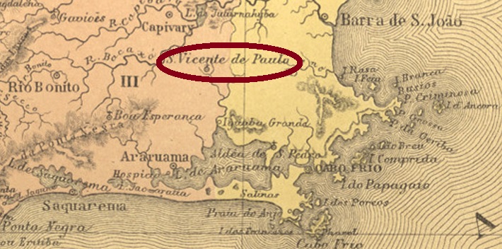
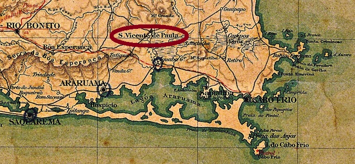
Other names: São Vicente de São Paulo, São Vicente
This locality has been a district of Araruama since February 1859, located on the east bank of the Rio Una, 130 km east of the capital Rio de Janeiro. As the Brazilian Geography and Statistics Agency (IBGE) informs us, the place was originally called São Vicente de São Paulo and only received its current name around 1938.
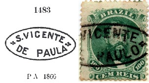
Paulo Novaes writes on his website agenciaspostais.com.br that there has been a post office there since December 1876. It is therefore somewhat surprising that there are so many postmarks with the Dom Pedro issue from 1866, when the following issue from 1876 was already available when the agency opened. Anyway, the oldest cancel is SRJ-1510a, which can be seen by Paulo Ayres in his Catálogo de Carimbos Brasil-Império (S. Paulo, 1937, 1942) under No. 1483 with PAULA instead of PAULO):
SRJ-1510a (P.A. 1483 recte/JJ) 1876ff
Its successor SRJ-1510b was also presented by P. Ayres:
SRJ-1510b (P.A. p/S. 126) 1879
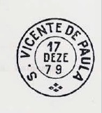
It was followed by SRJ-1510c (Coll. José A. Junges): a double circle with the above inscription S. V. DE PAULA. One copy found, dated 1879 in the centre. Then came SRJ-1510d (Coll. Paulo Novaes); this one should already be Republican: in the double circle one reads S. VICENTE DE PAULA above, below there is an ornament in cross.
Three different mute cancels were used in connection with SRJ-1510a:
(RHM)Almanak Laemmert, 1892
Andere Namen: São Vicente de São Paulo, São Vicente
Diese Ortschaft ist seit Februar 1859 ein Distrikt von Araruama, der am Ostufer des Rio Una liegt, 130 km östlich der Hauptstadt Rio de Janeiro entfernt. Wie die brasilianische Geografie- und Statistikbehörde (IBGE) informiert, hie der Ort ursprünglich São Vicente de São Paulo und erst um 1938 erhielt den aktuellen Namen.
Paulo Novaes schreibt auf seiner Website agenciaspostais.com.br, dass es dort seit Dezember 1876 ein Postamt gibt. Es ist daher etwas verwunderlich, dass es so viele Stempel mit der Dom-Pedro-Ausgabe von 1866 gibt, wenn die folgende Ausgabe aus 1876 bei der Agentureröffnung bereits erhältlich war. Wie es dem auch sei, der älteste Stempel ist SRJ-1510a, der durch Paulo Ayres in seinem Catálogo de Carimbos Brasil-Império (S. Paulo, 1937, 1942) unter Nr. 1483 mit PAULA statt eigentlich PAULO) zu sehen ist:
SRJ-1510a (P.A. 1483 recte/JJ) 1876ff
Sein Nachfolger SRJ-1510b wurde ebenfalls durch P. Ayres vorgestellt:
SRJ-1510b (P.A. p/S. 126) 1879
Ihm folgte SRJ-1510c (Samml. José A. Junges): ein Doppelkreis mit der obigen Inschrift S. V. DE PAULA. Ein Exemplar gefunden, datiert 1879 in der Mitte. Danach kam SRJ-1510d (Samml. Paulo Novaes); dieser dürfte bereits republikanisch sein: im Doppelkreis liest man S. VICENTE DE PAULA oben, unten ist ein Ornament in Kreuz.
Drei verschiedene „stummen“ Stempel wurden in Zusammenhang mit SRJ-1510a verwendet:
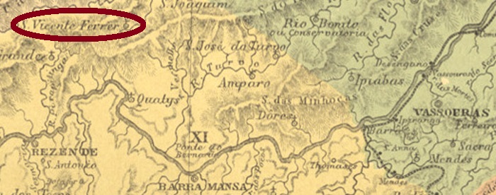
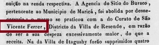
This fourth São Vicente Ferrer in Imperial Brazil was a district of Arraial de Campo Alegre (now Resende) from May 1843, located close to the provincial border with Minas Gerais, over 180 km northwest of the capital Rio de Janeiro. In December 1938, the place name changed to Fumaça. This actually means smoke, but here it probably means water vapour, rising either from the river or from the nearby mountainside.
It has not yet been determined when the local post office first opened. However, it closed around 1833, as can be seen from the report of the imperial ministry from that year:
Relatorio do Ministério do Império, 1833
The postal agency did not reopen until 1872, as can be read in the Imperial Mail Register (Tabella das Agencias do Correio do Imperio, Rio de Janeiro, 1885). The earliest postmark so far is SRJ-1515b (Coll. Paulo Daróz): a double circle with the inscriptions S. VICENTE FERRER above and (REZENDE) below. The dates in the middle have so far been found for the period 1894-1906.
Villiers de l’Ile Adam: Carta (…) da Provincia do Rio de Janeiro, 1850
Anderer Name: Fumaça (1938)
Dieser vierte São Vicente Ferrer im kaiserlichen Brasilien war ab Mai 1843 ein Distrikt vom Arraial de Campo Alegre (heute Resende), der nah an der Provinzgrenze zu Minas Gerais lag, über 180 km nordwestlich der Hauptstadt Rio de Janeiro entfernt. Im Dezember 1938 wechselte der Ortsname zu Fumaça. Das bedeutet eigentlich Rauch, meint hier wohl Wasserdampf, der entweder vom Fluss oder vom nahen Berghang steigt.
Wann das örtliche Postamt erstmals eröffnet hat, konnte bisher nicht ermittelt werden. Dieses aber schloss ca. 1833, wie aus dem Bericht vom kaiserlichen Ministerium aus diesem Jahr hervorgeht:
Relatorio do Ministério do Império, 1833
Die Postagentur eröffnete erst wieder 1872, wie im Verzeichnis der kaiserlichen Postämter (Tabella das Agencias do Correio do Imperio, Rio de Janeiro, 1885) zu lesen ist. Der bisher früheste Poststempel ist SRJ-1515b (Samml. Paulo Daróz): ein Doppelkreis mit den Inschriften S. VICENTE FERRER oben und (REZENDE) unten. Die Daten in der Mitte wurden bisher für den Zeitraum 1894-1906 gefunden.
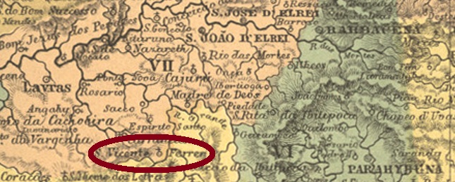
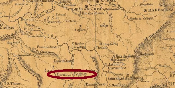
Other names: São Vicente Ferrer do Turvo, Francisco Sales, São Vicente de Minas (1953).
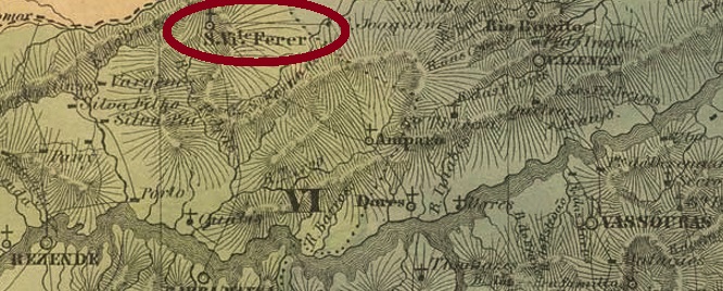
This locality was a district of Turvo from May 1856, located on the north bank of the Rio Grande and thus on the provincial border with São Paulo, more than 240 km southwest of the provincial capital Ouro Preto. In December 1938, it became the Município of Francisco Sales, but five years later the municipality was renamed São Vicente de Minas.
As Paula Sobrinho writes in História Postal de Minas Gerais (Belo Horizonte, 1997), there has been a post office there since April 1873. The first postmark has not yet been identified beyond doubt. SMG-2670b (Coll. Márcio Protzner) was its successor: a double circle with the inscriptions S. VICENTE FERRER above and (MINAS) below. The only copy seen so far bears a date of 1906 in the centre.
Provincia de Minas Geraes, 1873
Andere Namen: São Vicente Ferrer do Turvo, Francisco Sales, São Vicente de Minas (1953)
Diese Ortschaft war ab Mai 1856 ein Distrikt von Turvo, der am Nordufer des Rio Grande und damit an der Provinzgrenze zu São Paulo lag, über 240 km südwestlich der Provinzhauptstadt Ouro Preto entfernt. Im Dezember 1938 wurde daraus der Município von Francisco Sales, aber fünf Jahre später wurde die Gemeinde zu São Vicente de Minas umbenannt.
Wie Paula Sobrinho in História Postal de Minas Gerais (Belo Horizonte, 1997) schreibt, gibt es dort ein Postamt seit April 1873. Der erste Poststempel konnte bisher nicht zweifelsfrei identifiziert werden. SMG-2670b (Samml. Márcio Protzner) war sein Nachfolger: ein Doppelkreis mit den Inschriften S. VICENTE FERRER oben und (MINAS) unten. Das einzig bisher gesehene Exemplar trägt ein Datum von 1906 in der Mitte.