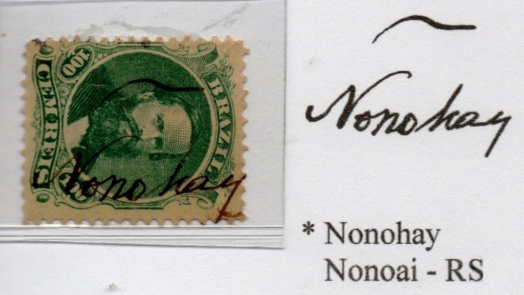
Other names: Urtigal, Anta Esfolada
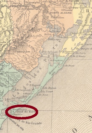
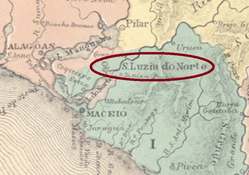
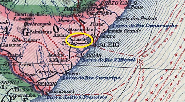
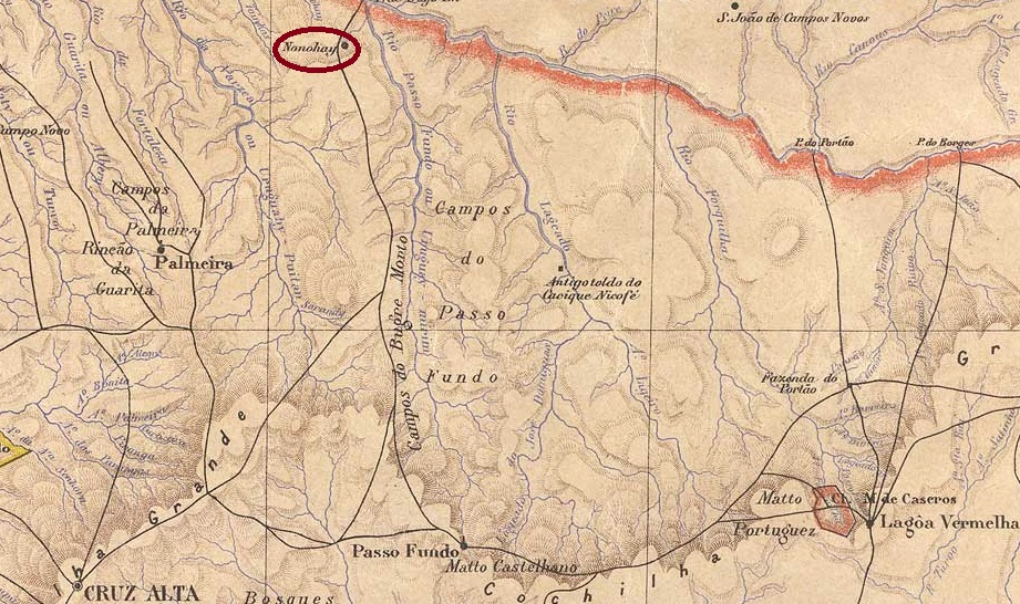
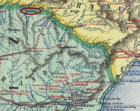
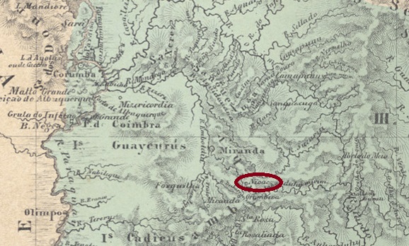
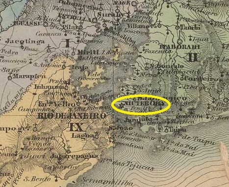
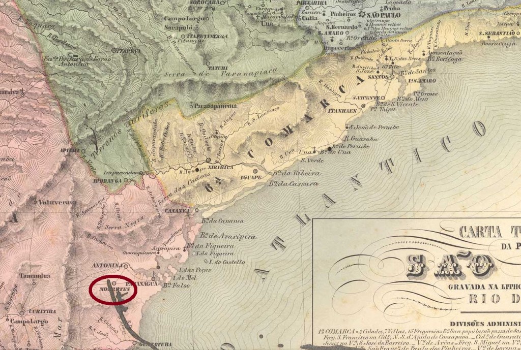
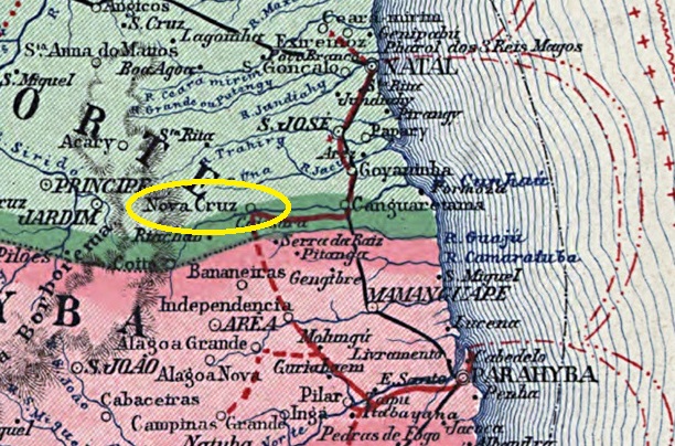
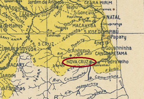
The village was originally called Urtigal (Nettle Field) and Anta Esfolada (Skinned Tapir) before it was given the name Freguesia de Nossa Senhora da Conceição de Nova Cruz. It belonged to Vila de São Bento and was located on the south bank of the Curimataú, 110 kilometres south of the provincial capital Natal. On old maps, Nova Cruz was further away from the provincial border with Paraíba, but today the town is located directly on this border.
In March 1852, Nova Cruz became the municipal seat of Vila de S. Bento. Sixteen years later, in December 1919, Nova Cruz was elevated to city status.
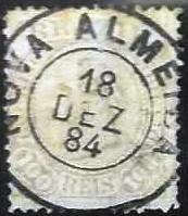
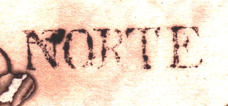
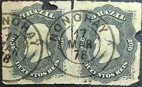
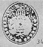
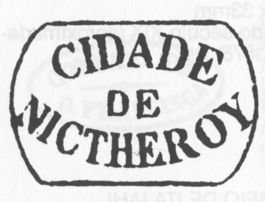
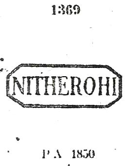
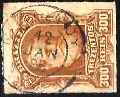
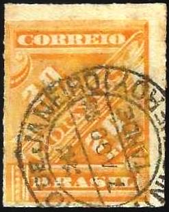
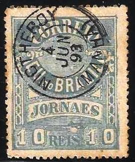
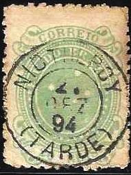
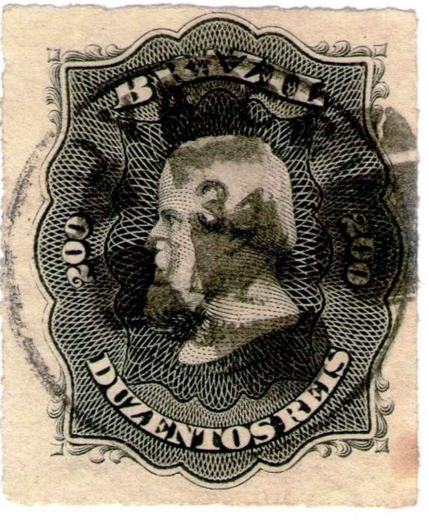
As R. Koester wrote in Carimbologia XXVIII, there had been a post office there since June 1869. The only imperial postmark with this place name to date is NRN-0120b (image from the Internet):

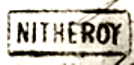
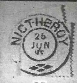
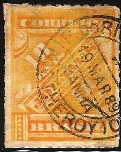
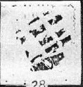
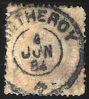
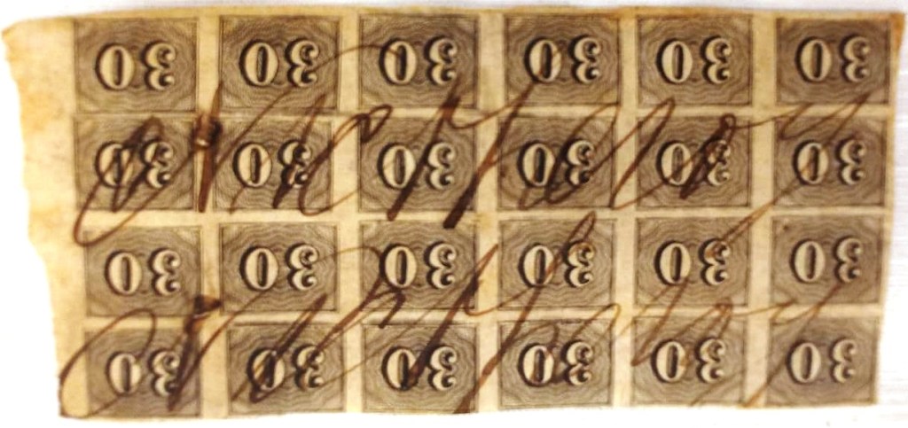
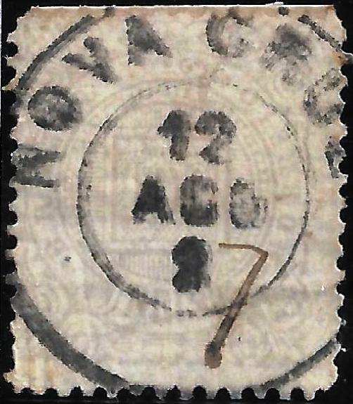
Philatelist Claudio Coelho has also shown a mute postmark from Nova Cruz:
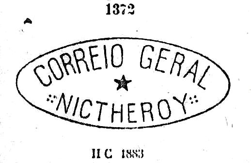
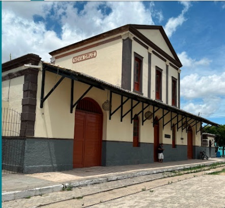
In April 1883, a railway station belonging to the E. F. de Natal a Nova Cruz railway company (main line) was opened in Nova Cruz. The line was transferred to Great Western in 1902, to E.F. Sampaio Correia in 1939, to Rede Ferroviária do Nordeste in 1957, and belonged to Rede Ferroviária Federal S.A. from 1975 until its closure in 1996 (estacoesferroviarias.com.br). Today, the tracks are still in place and the restored station building serves as a cultural centre for the community of Nova Cruz.

According to reports in the Rio press, a post office was established at the station in July 1883.

Even though the village was not large at the time, both post offices (at the station and in the village) were still listed in the directory of imperial post offices (Tabella das Agencias do Correio do Imperio, Rio de Janeiro, 1885). However, one of them was probably closed soon afterwards.
Outros nomes: Urtigal, Anta Esfolada
A localidade chamava-se originalmente Urtigal e Anta Esfolada, antes de receber o nome de Freguesia de Nossa Senhora da Conceição de Nova Cruz. Pertencia à Vila de São Bento e ficava na margem sul do Curimataú, 110 quilômetros ao sul da capital da provincia, Natal. Em mapas antigos, Nova Cruz ficava mais distante da fronteira com o estado da Paraíba, mas hoje a localidade fica nessa fronteira.
Em março de 1852, Nova Cruz tornou-se sede da Vila de S. Bento. Dezesseis anos depois, em dezembro de 1919, Nova Cruz foi elevada à categoria de cidade.
Como escreveu R. Koester em Carimbologia XXVIII, havia uma agência dos correios no local desde junho de 1869. O único carimbo postal imperial com esse nome até hoje é o NRN-0120b (figura da internet):

O filatelista Claudio Coelho também mostrou um carimbo postal mudo de Nova Cruz:

Em abril de 1883, foi inaugurada em Nova Cruz uma estação ferroviária da E. F. de Natal a Nova Cruz (Linha Tronco). A linha passou para a Great Western em 1902, para a E.F. Sampaio Correia em 1939, para a Rede Ferroviária do Nordeste em 1957 e pertenceu à Rede Ferroviária Federal S.A. de 1975 até ao seu encerramento em 1996 (estacoesferroviarias.com.br). Hoje, os trilhos ainda existem e o prédio restaurado da estação serve como centro cultural do município de Nova Cruz.
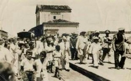

Conforme noticiado pela imprensa do Rio, em julho de 1883 foi criada uma agência dos correios na estação.
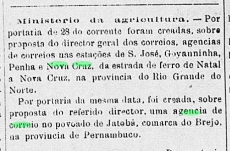
Embora a vila não fosse grande na época, ambas as agências dos correios (na estação ferroviária e na vila) ainda constavam na Tabella das Agencias do Correio do Imperio (Rio de Janeiro, 1885). No entanto, provavelmente uma delas foi fechada logo em seguida.
Andere Namen: Urtigal, Anta Esfolada
Die Ortschaft hieß ursprünglich Urtigal (Brennnesselfeld) und Anta Esfolada (Enthäuteter Tapir), bevor sie den Namen Freguesia de Nossa Senhora da Conceição de Nova Cruz erhielt. Sie gehörte zur Vila de São Bento und lag am Südufer des Curimataú, 110 Kilometer südlich der Provinzhauptstadt Natal. Auf alten Karten lag Nova Cruz weiter von der Provinzgrenze zu Paraíba entfernt, doch heute liegt der Ort unmittelbar an dieser Grenze.
Im März 1852 wurde Nova Cruz zum Gemeindesitz der Vila de S. Bento. 16 Jahre später, im Dezember 1919, wurde Nova Cruz zur Stadt erhoben.
Wie R. Koester in Carimbologia XXVIII schrieb, gab es dort seit Juni 1869 ein Postamt. Der bisher einzige kaiserliche Poststempel mit diesem Ortsnamen ist NRN-0120b (Abb. aus dem Internet):
Der Philatelist Claudio Coelho zeigte auch einen stummen Poststempel aus Nova Cruz:

Im April 1883 wurde in Nova Cruz ein Bahnhof der Eisenbahngesellschaft E. F. de Natal a Nova Cruz (Hauptlinie) eröffnet. Die Linie ging 1902 an die Great Western, 1939 an die E.F. Sampaio Correia, 1957 an die Rede Ferroviária do Nordeste und gehörte von 1975 bis zur Stilllegung im Jahr 1996 zur Rede Ferroviária Federal S.A. (estacoesferroviarias.com.br). Heute sind die Gleise noch vorhanden und das restaurierte Bahnhofsgebäude dient als Kulturzentrum der Gemeinde Nova Cruz.


Wie die Presse aus Rio berichtete, entstand im Juli 1883 ein Postamt am Bahnhof.

Auch wenn die Vila damals nicht groß war, waren beide Postämter (am Bahnhof und im Ort) noch im Verzeichnis der kaiserlichen Postämter (Tabella das Agencias do Correio do Imperio, Rio de Janeiro, 1885) aufgeführt. Doch vermutlich wurde eines davon bald geschlossen.