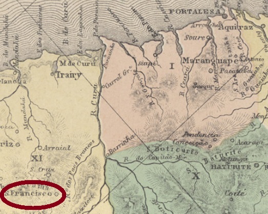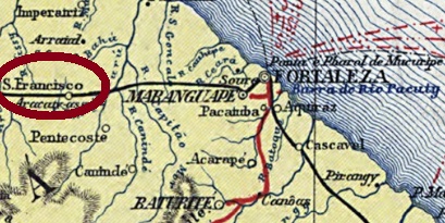
Other name: São Francisco do Sul (1943)
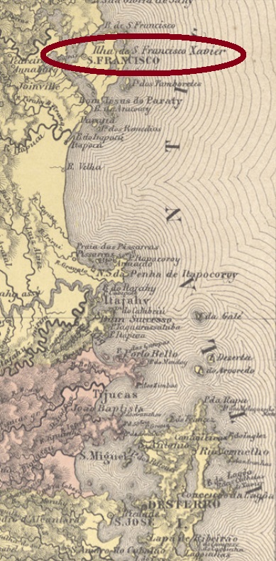
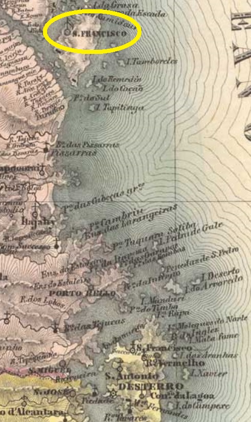
This São Francisco in the province of Santa Catarina was already in 1660 a villa with the beautiful name Nossa Senhora da Graça do Rio São Francisco. On old maps one will search in vain for a river that was called so. Rather, São Francisco Xavier was the name of the island on which this historic port town was built, about 180 km north of the later provincial capital Desterro (now Florianópolis). In April 1847, the villa ascended to a town, and the current name of São Francisco do Sul was first given to it for six months in 1938, before finally returning in December 1943.
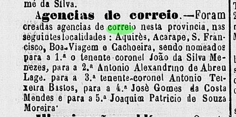
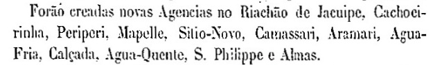
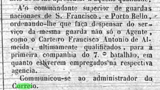
Nova Monteiro (Administrações e Agencias Postaes do Brasil Imperio, in Brasil Filatelico/RJ, 1934-5; Reprint SPP 1994-1999) writes that the local postal agency was created in June 1860. This date, however, would be a re-establishment, because already in 1849 the local postal system was reported on in the regional press, when two soldiers were transferred to postal services:

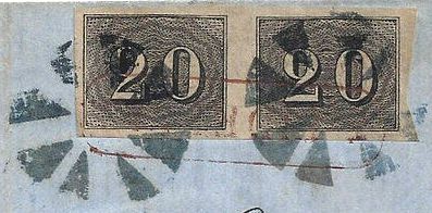
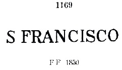
On the other hand, the Imperial Mail Register (Tabella das Agencias do Correio do Imperio) of 1885 lists the agency with creation year 1848. This is more plausible, because the first postmark, SSC-2010a, was already found on Bull’s-Eye issues from 1843 and was in use until at least 1866. Paulo Ayres provides the illustration in his Catalogo de Carimbos Brasil-Império (S. Paulo, 1937, 1942):
The next cancel did not appear until about 1888, possibly there is an undiscovered postmark from the meantime. SSC-2010c (Coll. José A. Junges) is also available in blue and was used until about 1898: a double circle with the inscriptions S. FRANCISCO above and (SA. CATHARINA) below, with date at the centre.
Anderer Name: São Francisco do Sul (1943)
Dieser São Francisco in der Provinz Santa Catarina war bereits 1660 eine Villa mit dem schönen Namen Nossa Senhora da Graça do Rio São Francisco. Wobei man auf alten Karten vergeblich nach einem Fluss suchen wird, der so hieß. Vielmehr war São Francisco Xavier der Name der Insel, auf der dieses historische Hafenstädtchen gebaut wurde, ca. 180 km nördlich der späteren Provinzhauptstadt Desterro (heute Florianópolis). Im April 1847 stieg die Villa zur Stadt auf, und der aktuelle Name São Francisco do Sul wurde ihr 1938 erstmals für sechs Monate vergeben, bevor er im Dezember 1943 endgültig zurückkehrte.
Nova Monteiro (Administrações e Agencias Postaes do Brasil Imperio, in Brasil Filatelico/RJ, 1934-5; Reprint SPP 1994-1999) schreibt, die örtliche Postagentur wurde im Juni 1860 ins Leben gerufen. Dieses Datum wird allerdings einer Wiedererrichtung entsprechen, denn bereits 1849 wurde über das Postwesen vor Ort in der der Regionalpresse berichtet, als zwei Soldaten zum Postdienst abkommandiert wurden:
Das Verzeichnis der kaiserlichen Postämter (Tabella das Agencias do Correio do Imperio) von 1885 listet die Agentur mit Entstehungsjahr 1848. Dieses Jahr ist plausibler, denn der erste Poststempel, SSC-2010a, wurde schon auf Ochsenaugen-Ausgaben von 1843 gefunden und war bis mindestens 1866 in Gebrauch. Paulo Ayres liefert davon die Abbildung in seinem Catálogo de Carimbos Brasil-Império (S. Paulo, 1937, 1942):

Der nächste Stempel tauchte erst ca. 1888 auf, möglicherweise ist aus der Zwischenzeit noch was zu entdecken. SSC-2010c (Samml. José A. Junges) gibt es auch in blau und wurde bis ca. 1898 verwendet: ein Doppelkreis mit den Inschriften S. FRANCISCO oben und (SA. CATHARINA) unten, dazu Datum in der Mitte.