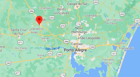
Other names: Rio Preto do Serro, Felisberto Caldeira (1923-1986)
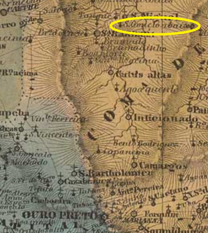
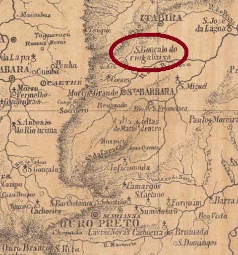
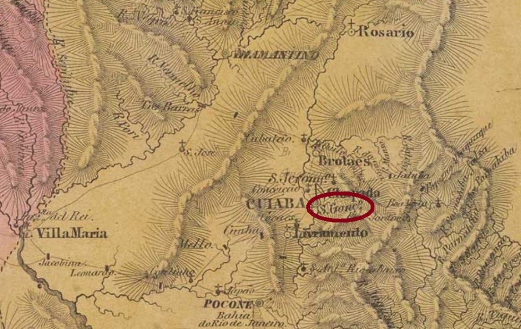
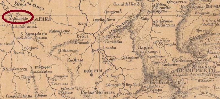
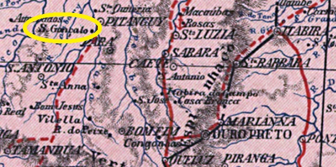
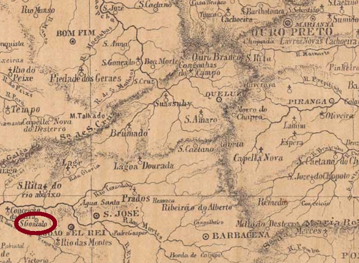
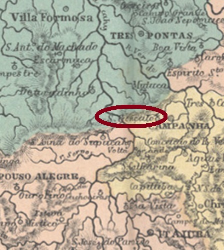
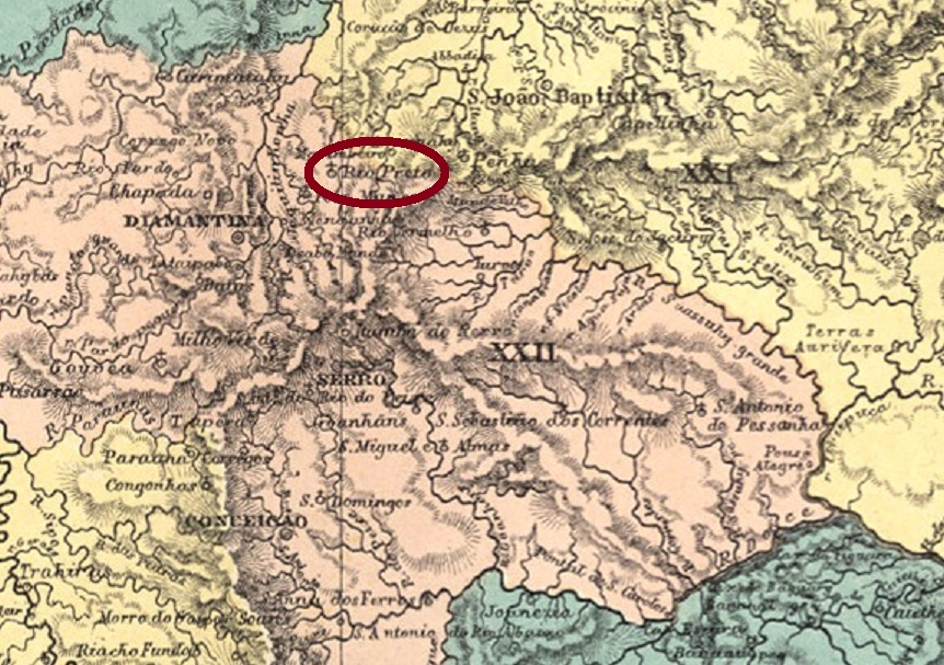
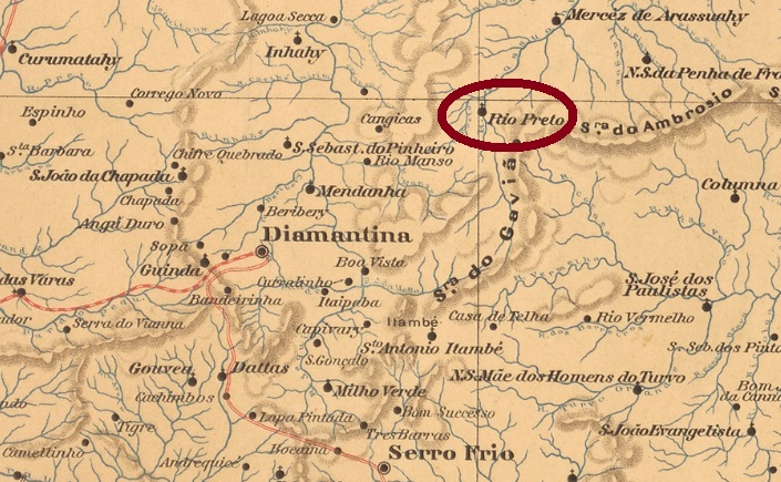
Since October 1821, São Gonçalo do Rio Preto (also known as Rio Preto do Serro) was a freguesia near Diamantina, more than 400 km north of the future provincial capital Ouro Preto. It remained so until September 1923, when it was renamed as the district of Felisberto Caldeira. The name was to be reminiscent of Felisberto Caldeira Brant (ca. 1700-1756), a dazzling personality of the region. Caldeira Brant had received a concession for the exploitation of diamonds in Tejuco (now Diamantina). He became eventually very rich but lost everything due to a tax dispute with the Portuguese authorities. In December 1962, the village became an independent municipality, which since July 1986 has been again called São Gonçalo do Rio Preto.
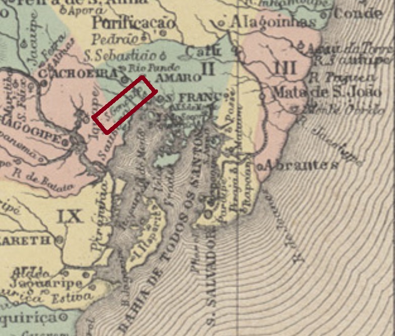
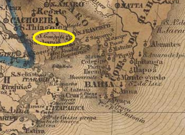
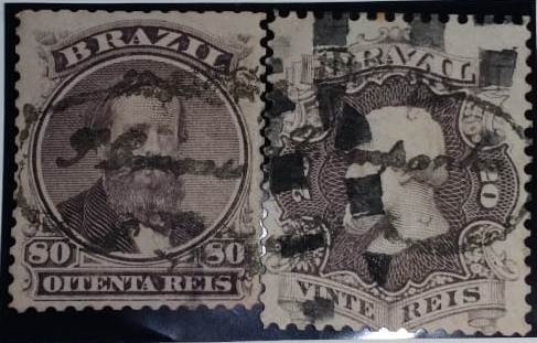
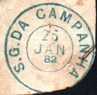
Paula Sobrinho (História Postal de Minas Gerais, Belo Horizonte, 1997) and Nova Monteiro (Administrações e Agencias Postaes do Brasil Imperio, in Brasil Filatelico/RJ, 1934-5; Reprint SPP 1994-1999) agree that a post office was opened there in September 1866. However, the agency was later closed and reopened in 1880, as can be read in the Imperial Mail Register(Tabella das Agencias do Correio do Imperio) from 1885. A handwritten cancellation of the second operating period was found: SMG-2325a (Coll. Márcio Protzner) t was found on an issue from 1884. One reads “S. Gon” (çalo do Rio) Preto, (…) de 18 (…)”.
Andere Namen: Rio Preto do Serro, Felisberto Caldeira (1923-1986)
São Gonçalo do Rio Preto – auch Rio Preto do Serro genannt – war schon im Oktober 1821 eine Freguesia bei Diamantina, die über 400 km nördlich der künftigen Provinzhauptstadt Ouro Preto entfernt lag. Und so blieb es bis September 1923, als es zum Distrikt von Felisberto Caldeira ernannt wurde. Der Name sollte an Felisberto Caldeira Brant (ca. 1700-1756) erinnern, eine schillernde Persönlichkeit der Region. Caldeira Brant hatte eine Konzession zur Ausbeutung von Diamanten in Tejuco (heute Diamantina) erhalten. Er wurde dadurch sehr reich, verlor aber alles durch einen Steuerstreit mit der portugiesischen Obrigkeit. Im Dezember 1962 wurde die Ortschaft ein eigenständiger Município, der seit Juli 1986 wieder São Gonçalo do Rio Preto heißt.
Paula Sobrinho (História Postal de Minas Gerais, Belo Horizonte, 1997) und Nova Monteiro (Administrações e Agencias Postaes do Brasil Imperio, in Brasil Filatelico/RJ, 1934-5; Reprint SPP 1994-1999) sind sich darüber einig, dass es dort ein Postamt im September 1866 eröffnet wurde. Allerdings war die Agentur später geschlossen und eröffnete 1880 wieder, wie im Verzeichnis der kaiserlichen Postämter (Tabella das Agencias do Correio do Imperio) aus 1885 zu lesen ist. Eine handschriftliche Entwertung der zweiten Betriebsperiode wurde gefunden: SMG-2325a (Samml. Márcio Protzner) war auf einer Marke aus 1884 anzutreffen. Man liest „S. Gonç(alo do Rio) Prêto, (…) de 18 (…)“