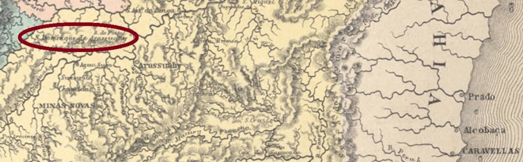
The Arassuahy (today written Araçaí) is a tributary on the right bank of the Jequitinhonha River in northeastern Minas Gerais. The name probably has an Indian origin and probably means river of the red macaws. From a settlement on the north shore from the early 18th century, the parish of São Domingos was founded in 1840 in the municipality of Minas Novas, about 650 km northeast of the provincial capital Ouro Preto. The village rose to a villa in September 1891 and to a city in December 1948, now under the current name Virgem da Lapa (= Virgin of the Grotto).
According to Paula Sobrinho (História Postal de Minas Gerais, Belo Horizonte, 1997), the local post office was established in March 1885. The only postmark so far bears a date from the Republic but could be much older. SMG-2240a (Coll. Márcio Protzner) has a double circle with the inscription S. DOMINGOS DO ARASSUAHY above and the date (from 1902) at the centre.
Villiers de l’Ile Adam: Carta (…) da Provincia de Minas Geraes, 1849
Anderer Name: Virgem da Lapa (1948)
Der Arassuahy (heute Araçuaí geschrieben) ist ein ca. 400 km langen Zufluss am rechten Ufer des Jequitinhonha in Nordosten von Minas Gerais. Der Name hat wohl einen indianischen Ursprung und soll Fluss der roten Aras bedeuten. Aus einer Siedlung am Nordufer aus dem frühen 18. Jahrhundert wurde 1840 die Pfarrei von São Domingos in der Gemeinde Minas Novas gegründet, knapp 650 km nordöstlich der Provinzhauptstadt Ouro Preto entfernt. Der Ort stieg im September 1891 zur Villa und im Dezember 1948 zur Stadt auf, nun unter dem aktuellen Namen Virgem da Lapa (= Jungfrau der Grotte).
Laut Paula Sobrinho (História Postal de Minas Gerais, Belo Horizonte, 1997), entstand das örtliche Postamt im März 1885. Der bisher einzige Poststempel trägt zwar ein Datum aus der Republik, könnte aber noch wesentlich älter sein. SMG-2240a (Samml. Márcio Protzner) hat einen Doppelkreis mit der Inschrift S. DOMINGOS DO ARASSUAHY oben und das Datum (aus 1902) in der Mitte.
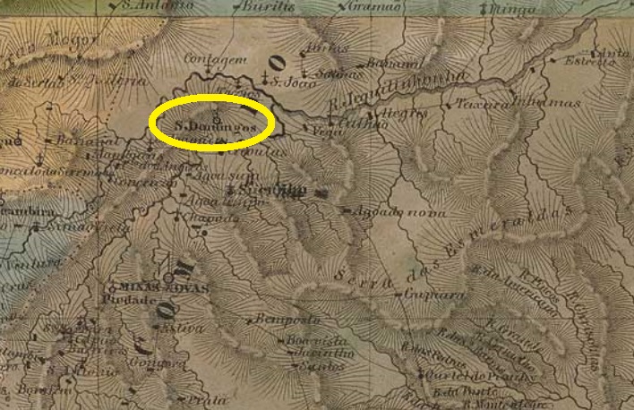
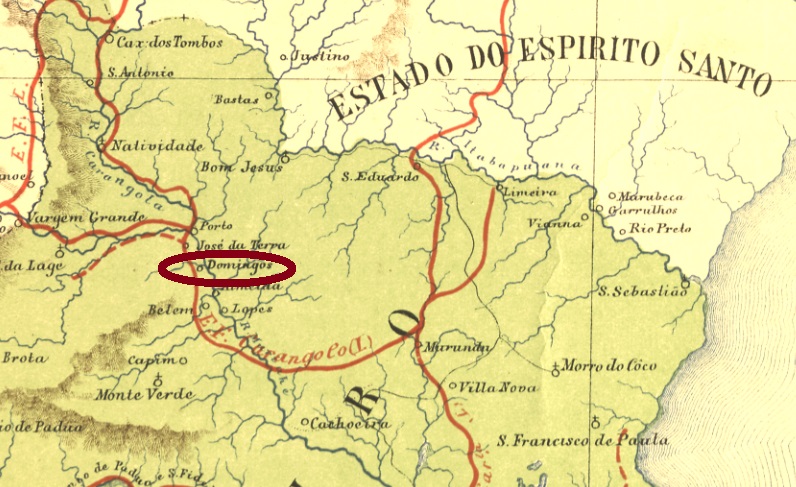
São Domingos was the name of a large fazenda on the west bank of the Muriahé River in the Campos district of the province of Rio de Janeiro, which was located about 400 km northeast of the imperial capital. The large estate gave the name to a small railway station of the E.F. Carangola Railway Company, which started operations in June 1881. In November 1885, the station and surrounding area were assigned to the new municipality of Natividade do Itaperuna (today only Itaperuna). Now the village is in the district of N. Sra. da Penha.
The railway line also changed hands frequently: in 1890 to the Cia. Barão de Araruama, and a few months later to E. F. Leopoldina. In the 1940s, the station was renamed Aré, today a small hamlet with the simple chapel of S. Domingos de Gusmão. From 1975 until the operation end in 1977, the railway line belonged to the Rede Ferroviária Federal Company. The station building was demolished and today its exact location in unknown (estacoesferroviarias.com.br).
As Paulo Novaes (agenciaspostais.com.br) reports, there has been a station post office in São Domingos since October 1888. Novaes also provides the illustration of the first station cancel: SRJ-0920a consists of a double circle with the inscription E. DE S. DOMINGOS above and (E.F. CARANGOLA) below, along with a date from February 1890 at the centre.
Almanak Laemmert, 1892
Anderer Name: Bahnhof Aré (ca. 1940)
São Domingos hieß eine große Fazenda am Westufer des Flusses Muriahé im Bezirk Campos im Norden der Provinz Rio de Janeiro, die knapp 400 km nordöstlich der kaiserlichen Hauptstadt entfernt lag. Der Großgrundbesitz gab den Namen einem kleinen Bahnhof der E.F. Carangola Eisenbahngesellschaft, der den Betrieb im Juni 1881 aufgenommen hat. Im November 1885 wurden Bahnhof und Umgebung der neuen Gemeinde Natividade do Itaperuna (heute nur Itaperuna) zugesprochen. Heute liegt die Ortschaft im Distrikt von N. Sra. da Penha.
Auch die Bahnlinie wechselte häufig den Besitzer: 1890 zur Cia. Barão de Araruama, und ein Paar Monate später zur E. F. Leopoldina. In den 40er Jahren des 20. Jahrhunderts wurde der Bahnhof zu Aré umbenannt, heute ein kleiner Weiler mit der schlichten Kapelle S. Domingos de Gusmão. Von 1975 bis zum Betriebsende 1977 gehörte die Bahnlinie der Rede Ferroviária Federal. Das Bahnhofsgebäude wurde abgerissen und heute weiß man nicht mehr, wo es sich genau befand (estacoesferroviarias.com.br).
Wie Paulo Novaes (agenciaspostais.com.br) berichtet, gab es ein Bahnhofspostamt São Domingos seit Oktober 1888. Novaes liefert auch die Abbildung des wohl ersten Bahnhofsstempels: SRJ-0920a besteht aus einem Doppelkreis mit der Inschrift E. DE S. DOMINGOS oben und (E.F. CARANGOLA) unten, dazu ein Datum aus Februar 1890 in der Mitte.
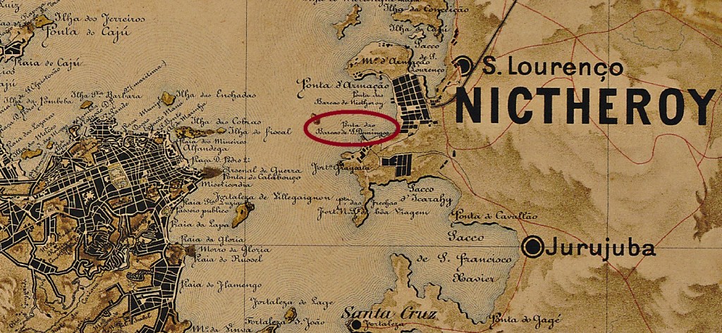
Other names: São Domingos da Praia Grande, São Domingos de Nictheroy
This locality was already made in May 1819 to the villa of São Domingos da Praia Grande (= from the Long Beach) and was located on the eastern shore of the Bay of Guanabara, about 7 km in linear distance from the imperial capital Rio de Janeiro. Political independence did not last long, as in March 1835 the town was incorporated by the town of Niterói, first as a district, then since December 1943 as a city quarter.
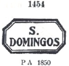
According to Nova Monteiro’s report in Administrações e Agencias Postaes do Brasil Imperio (Brasil Filatelico/RJ, 1934-5; Reprint SPP 1994-1999), there is a post office there since September 1856. Two cancellations from the Empire were to be found. SRJ-1360a was used from the beginning and is already made known through Paulo Ayres (Catálogo de Carimbos Brasil-Império, S. Paulo, 1937, 1942) under # 1454:
SRJ-1360a (Paulo Ayres #1454)
It was followed by SRJ-1360b (Coll. José A. Junges): a double circle with the inscription S. DOMINGOS above and an unfortunately unidentifiable number in parentheses below. The only available copy shows a date from 1887 at the centre.
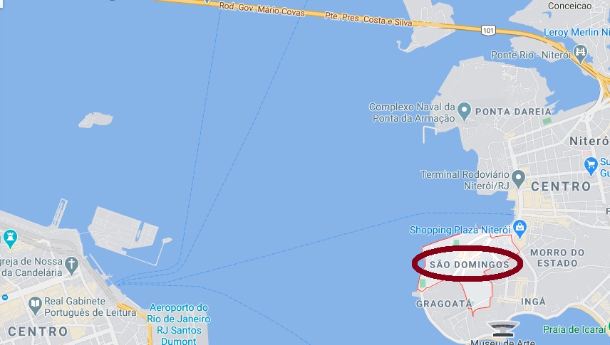
Google Maps
Andere Namen: São Domingos da Praia Grande, São Domingos de Nictheroy
Diese Ortschaft stieg bereits im Mai 1819 zur Villa auf, unter dem Namen São Domingos da Praia Grande (= vom Langen Strand) und lag am Ostufer der Bucht von Guanabara, knapp 7 km Luftlinie von der kaiserlichen Hauptstadt Rio de Janeiro entfernt. Die politische Eigenständigkeit währte nicht lange, da im März 1835 der Ort durch die Stadt Niterói eingemeindet wurde, zunächst als Distrikt, dann seit Dezember 1943 als Stadtteil.
Ihm folgte SRJ-1360b (Samml. José A. Junges) : ein Doppelkreis mit der Inschrift S. DOMINGOS oben und einer leider nicht identifizierbaren Zahl in Klammern unten. Das einzig vorhandene Exemplar zeigt ein Datum aus dem Jahr 1887 in der Mitte.
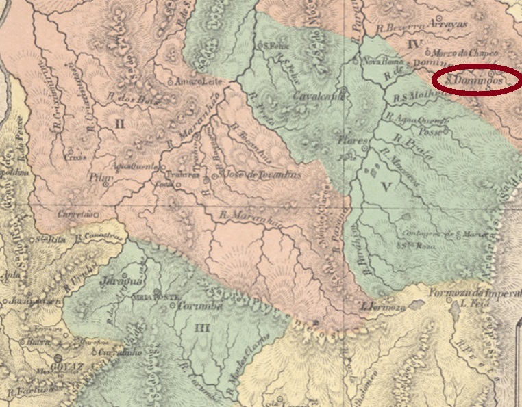
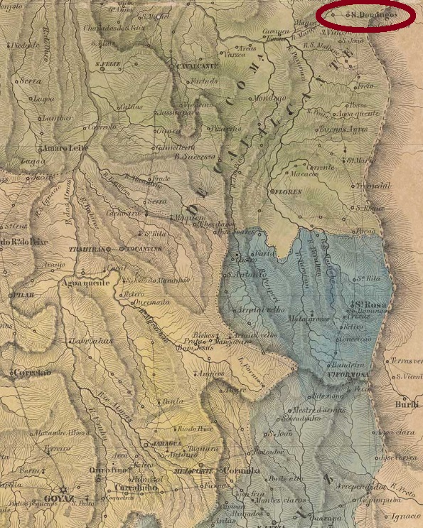
São Domingos is one of those localities in Brazilian Midwest whose relatively long history presents plenty of gaps. Official records are rare, because state structure has remained precarious for centuries. It was situated almost 750 km northeast of the former province capital Goyaz (today Goiás Velho) and became a district of the municipality of Arraias in July 1835. In October 1854 it emancipated as a villa in own municipality.
The post office would reopen only in 1874, according to the 1885 Imperial Mail Register (Tabella das Agencias do Correio do Imperio), although postal routes are reported to pass through São Domingos at least two years before. No imperial post cancel from this locality has been found until now.
Villers de l’Ile Adam: Carta (…) da Provincia de Goyaz, 1849
São Domingos ist eine von diesen Ortschaften in der Mitte Brasiliens, deren vergleichsweise lange Geschichte viele Lücken aufweist. Offizielle Angaben über Verwaltung und öffentliches Leben sind selten, da viele staatliche Stellen vor Ort chronisch unterbesetzt geblieben sind. São Domingos lag fast 750 km nordöstlich der ehemaligen Provinzhauptstadt Goyaz (heute Goiás Velho) entfernt und wurde ein Distrikt im Município von Arraias im Juli 1835. Im Oktober 1854 wurde daraus eine Villa im eigenen Município.
Wie Nova Monteiro in Administrações e Agencias Postaes do Brasil Imperio (Brasil Filatelico/RJ, 1934-5; Reprint SPP 1994-1999) schreibt, gab es dort ab März 1829 ein Postamt. Gleichwohl berichtet Aureo G. Santos, dieses Postamt wurde im Januar 1851 geschlossen (Agências de Correio Criadas e Suprimidas 1851, 1855, 1856 e 1857, in Brasil Filatélico 181, 1977):
Aureo G. Santos (op. cit.)
Die Agentur würde erst 1874 wieder eröffnen, wie im Verzeichnis der kaiserlichen Postämter (Tabella das Agencias do Correio do Imperio) von 1885 aufgelistet, obwohl Postrouten durch São Domingos mindestens zwei Jahre zuvor in Betrieb waren. Bisher konnte kein Poststempel aus dem Kaiserreich für diese Ortschaft gefunden werden.
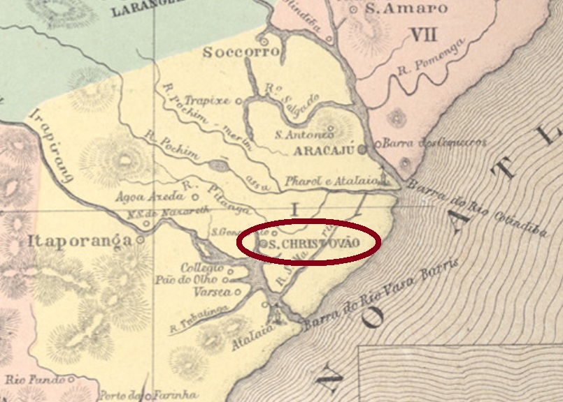
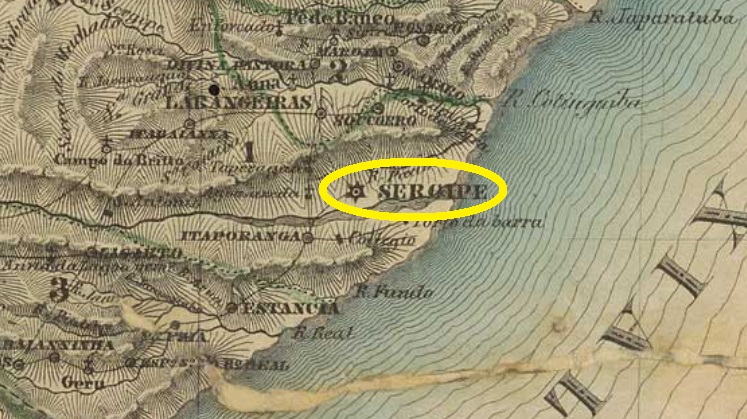
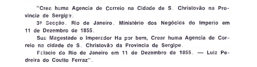
São Christovão is one of the oldest towns in northeast Brazil, founded as a villa in January 1590, during the Spanish government of Portugal and its colonies. It is situated about 25 km southwest of the later province capital Aracaju and was the capital of the colonnial and imperial Sergipe-del-Rey from July 1820 until March 1855. Since April 1823 it has the town status.
Perhaps that was a recreation, for it is hardly imaginable a regional capital without postal services for decades before that date. Indeed, there are earlier capital cancels with legend SERGIPE, which will be presented in the last Carimbologia volume (scheduled for 2023).
Three early São Christovão cancels were found. The first among them, SSE-0150a (Coll. José A. Junges) is unfortunately incomplete: a somewhat circular legend (S. CH)RIST(OVAO) without any frame, seen only on a D. Pedro issue of 1866. Secondly, SSE-0150b (Coll. José A. Junges) has a double circle with inscription S. CHRISTOVÃO on top. The sole example is dated 1885 at the centre. Finally, SSE-0150c (Coll. José A. Junges) may be already republcian, for only one example dated 1890 was seen : a double circle with inscriptions S. CHRISTOVÃO on top and (SERGIPE) below, dated at the centre.
Villiers de l’Ile Adam: Carta (…) das Provincias de Pernambuco, Alagoas e Sergipe, 1848
Anderer Name: Sergipe
São Christovão ist eine der ältesten Städte im Nordosten Brasiliens; sie wurde bereits als Villa im Januar 1590 gegründet, während der spanischen Verwaltung von Portugal und seinen Kolonien. Die Stadt liegt etwa 25 km südwestlich der späteren Provinzhauptstadt Aracaju und war die Hauptstadt des kolonialen und imperialen Gebiets von Sergipe-del-Rey von Juli 1820 bis März 1855. Seit April 1823 besteht der Stadtstatus.
Laut Nova Monteiro (Administrações e Agencias Postaes do Brasil Imperio, in Brasil Filatelico/RJ, 1934-5, Reprint SPP 1994-1999) entstand das örtliche Postamt im Dezember 1855, d.h. neun Monate nach dem Hauptstadtumzug nach Aracaju. Dies wird durch Aureo G. Santos (Agências de Correio Criadas e Suprimidas 1851, 1855, 1856 e 1857, in Brasil Filatélico 181, Rio de Janeiro, 1977) bestätigt:
Aureo G. Santos (op. cit.)
Vermutlich war das die Wiedererrichtung der Postagentur, da es kaum vorstellbar ist, dass vor diesem Datum eine regionale Hauptstadt Jahrzehnte ohne Postdienste auskommen musste. Tatsächlich sind frühere (Hauptstadt-)Stempel mit Legende SERGIPE vorhanden, diese werden im letzten Band der Carimbologia (geplant für 2023) vorgestellt.
Drei frühe Stempel aus São Christovão sind bekannt. Der älteste davon, SSE-0150a (Samml. José A. Junges) ist leider unvollständig abgebildet: eine etwa kreisförmige Legende (S. CH)RIST(OVAO) ohne Ränder, nur auf einer D. Pedro-Ausgabe von 1866 gesehen. Danach kam, SSE-0150b (Samml. José A. Junges): ein Doppelkreis mit Inschrift S. CHRISTOVÃO oben. Das einzige Exemplar trägt ein Datum von 1885 in der Mitte. Schließlich SSE-0150c (Samml. José A. Junges), der bereits republikanisch sein mag, da bisher nur mit Datum 1890 zu sehen war: ein Doppelkreis mit Inschriften S. CHRISTOVÃO oben und (SERGIPE) unten, dazu Datum in der Mitte.
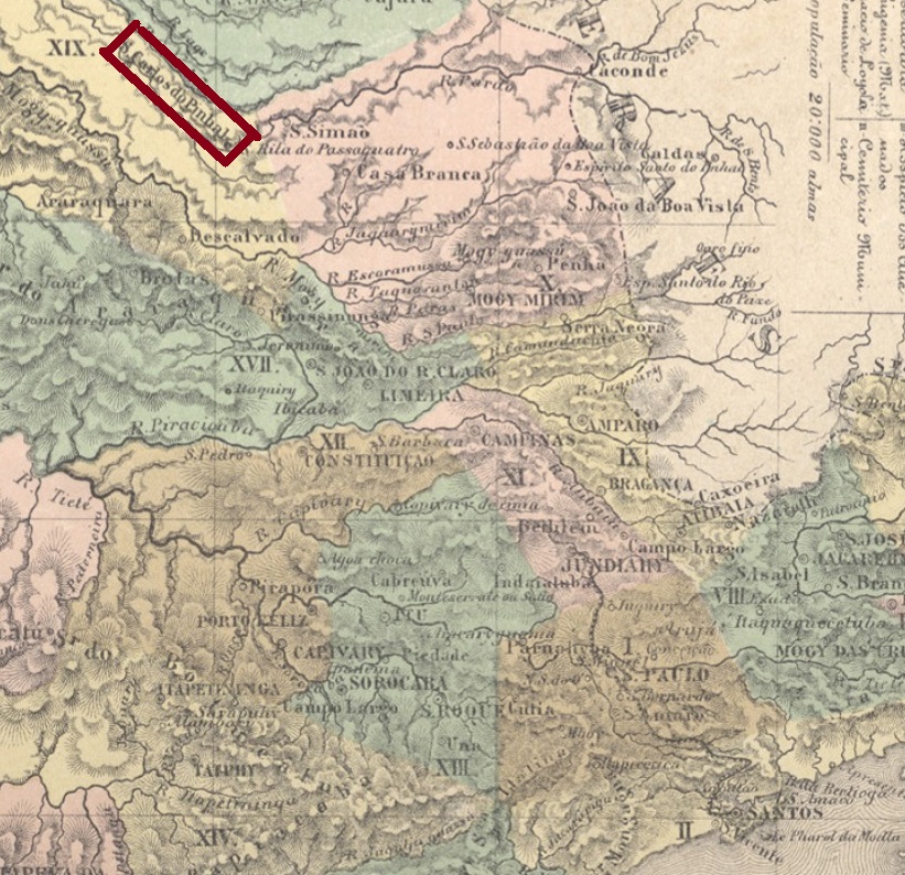
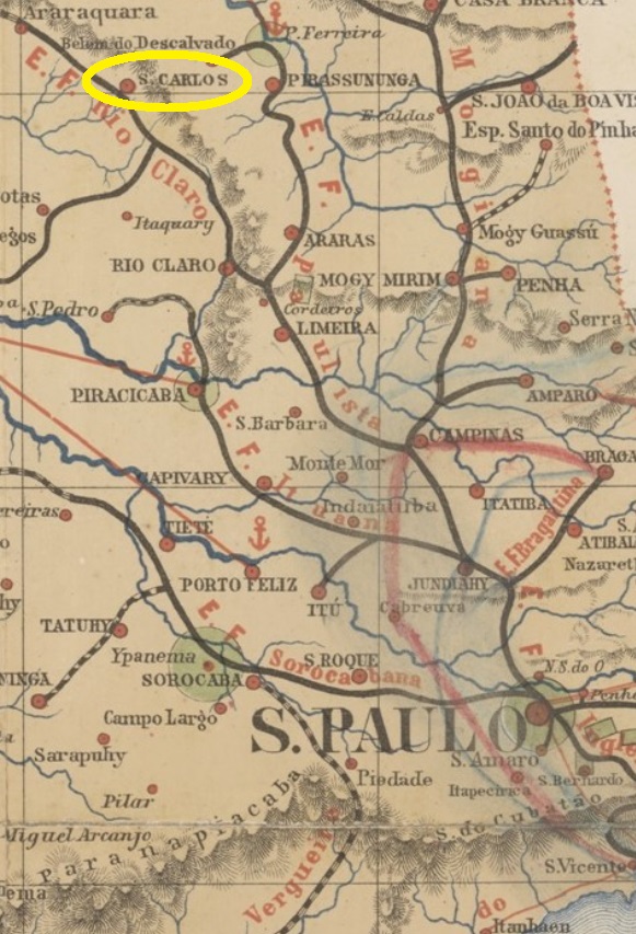
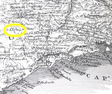
The actual town of São Carlos in the São Paulo state has developed very fast along the second half of the 19th century. The former district of Araraquara, established in April 1858, was situated almost 250 km northwest of the province capital. It became a villa less than seven years later, and a town in April 1880. Since December 1908 the municipality has the actual name.
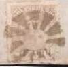
There follows SSP-1675b (Coll. José A. Junges): a double circle with the inscription S.C. DO PINHAL on top and dates at the centre between 1877 and at least 1881. SSP-1675c (Coll. José A. Junges) is a rare French-type, whose only found example is dated 1886: a double circle with inscription S. CARLOS DO PINHAL on top and the star in parentheses below. SSP-1675d (Coll. José A. Junges) has within circles the same inscription as before, now with a four-leg star ornament below. Dates at the centre 1876ff-1894. SSP-1675e (image from the internet) occurs in black and blue and has the same inscription between circles on top as before, but here the letters are shorter and rounder, and the ornament below resembles an eight-leg star. Dates at the centre: 1884-1894.
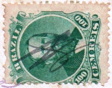
SSP-1675f (Coll. Klerman W. Lopes) is a railway ambulant cancel, with inscription S. CARLOS between circles on top and (C.A.) below, dated at the centre 1886-1892. Finally, there are two manuscript cancellations and a mute one:
1874 (Coll. José A. Junges)1874 (Coll. Mario J. Orsi Jr.)1883ff (Coll. Fuad Ferreira Fo.)Provincia de São Paulo, 1886
Buchtest-Aktualisierung von 22. Januar 2021
Anderer Name: São Carlos (1908)
Die heutige Stadt São Carlos im Busdesstaat São Paulo hat sich rasch während der zweiten Hälfte des 19. Jahrhunderts entwickelt. Der im April 1858 gegründete Distrikt von Araraquara lag fast 250 km nordwestlich der Provinzhauptstadt entfernt. Er wurde eine Villa in weniger als sieben Jahre, und eine Stadt im April 1880. Seit Dezember 1908 trägt der Município seinen aktuellen Namen.
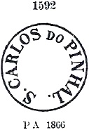
Laut Nova Monteiro (Administrações e Agencias Postaes do Brasil Imperio, in Brasil Filatelico/RJ, 1934-5; Reprint SPP 1994-1999) gibt es dort ein Postamt seit Juni 1858. Neun postalische Entwertungen der Kaiserzeit wurden bisher gefunden. Anscheinend ist SSP-1675a die früheste davon. Es gibt sie in schwarz, violett und sepia, und sie wurde bereits durch Paulo Ayres (Catálogo de Carimbos Brasil-Império, S. Paulo, 1937, 1942) unter Nr. 1592 abgebildet:
SSP-1675a, P.A. 1592, 1866ff-1883ff
Es folgte SSP-1675b (Samml. José A. Junges): ein Doppelkreis mit der Inschrift S.C. DO PINHAL oben und Daten in der Mitte zwischen 1877 und 1881ff. SSP-1675c (Samml. José A. Junges) ist ein seltener Französischer-Typus, das einzige gefundene Exemplar trägt ein Datum aus 1886: ein Doppelkreis mit Inschrift S. CARLOS DO PINHAL oben und den Stern in Klammern unten. SSP-1675d (Samml. José A. Junges) hat die gleiche Inschrift oben zwischen den Kreisen wie vorher, hier aber mit einem vierzackigen Stern als Ornament unten. Daten in der Mitte von 1876ff-1894. SSP-1675e (Abb. aus dem Internet) kommt in schwarz und blau vor und hat derselben Inschrift oben zwischen den Kreisen, wobei hier die Buschstaben kürzer und etwas runder sind. Das Ornament unten ähnelt einem achtzackigen Stern. Daten in der Mitte: 1884-1894.
SSP-1675f (Samml. Klerman W. Lopes) ist eine Eisenbahn-Abstempelung für die ambulante Post, mit Inschrift S. CARLOS oben zwischen den Kreisen und (C.A.) unten, in der Mitte 1886-1892 datiert. Schließlich gibt es noch zwei handgeschriebene Entwertungen und einen stummen Stempel zu zeigen:
1874 (Coll. José A. Junges)1874 (Coll. Mário J. Orsi Jr.)1883ff (Coll. Fuad Ferreira Fo.)
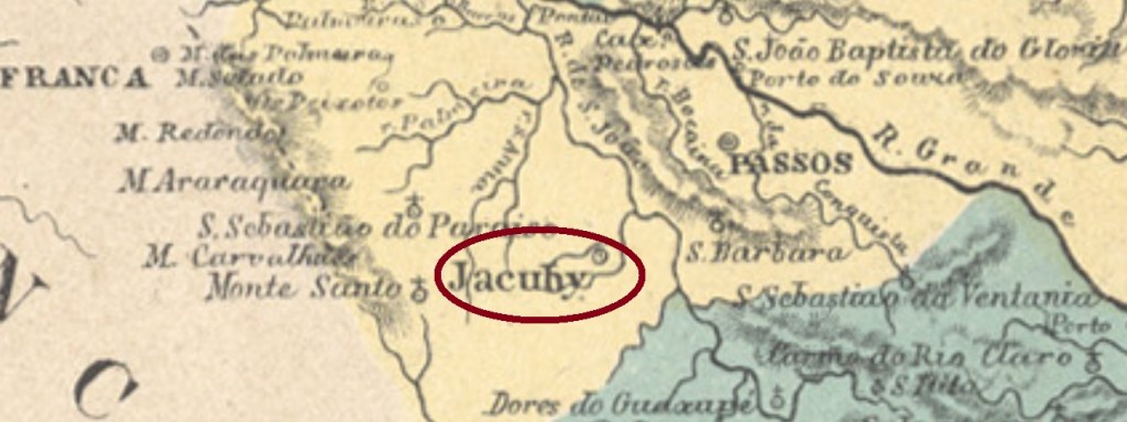
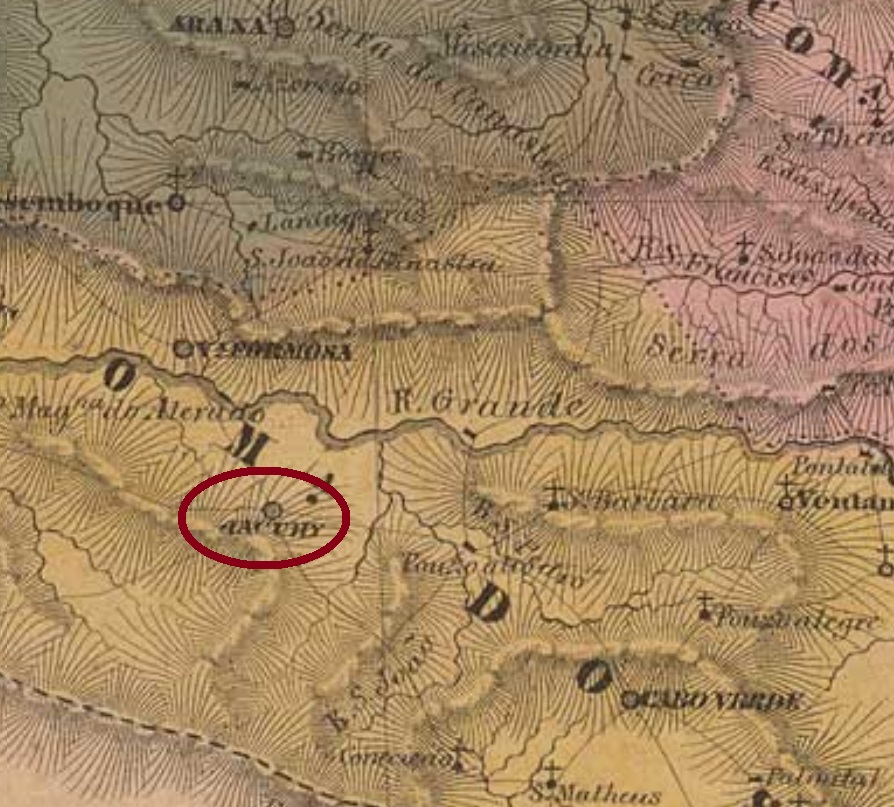
Other names: Descoberto de N.S. da Conceição do Rio Grande, Ribeirão de S. Pedro de Alcântara e Almas
See also Jacuhy (R. Koester: Carimbologia XXV)
This is another locality in the Minas Gerais province whose turbulent history reflects in many dates, although its earliest names (see above) were apparently never official. A former freguesia of Campanha, it arose to a villa as soon as July 1814 and to a town in October 1869. At that time, the local economy must have been already in trouble, for less than a year later it became a simple district of São Sebastião do Paraizo. In September 1881 it recovered the villa status, and in the early republic, in May 1892, it was a town again. Since September 1923 it is called simply Jacuhy.
Accordingly, three different years were found for the creation of the local post office. Nova Monteiro (Administrações e Agencias Postaes do Brasil Imperio, in Brasil Filatelico/RJ, 1934-5; Reprint SPP 1994-1999) writes the earliest date: March 5, 1829. Paula Sobrinho (História Postal de Minas Gerais, Belo Horizonte, 1997) asserts it took place on September 12, 1833. This could be a misprint, for both R. Koester (Carimbologia XXV) and the Imperial Mail Register (Tabella das Agencias do Correio do Imperio) of 1885 list this agency with exactly the same date, but now within the year 1883. Since the office is not recorded either in the 1857 Postal Guide (Guia do Correio do Brazil) or in the imperial Postal Guide (Guia Postal do Império) for 1880, we can assume it remained closed for a long time.
One imperial cancel was found: SMG-1405a (Coll. José A. Junges) has a double circle with the inscription S. CARLOS DE JACUHY above and a small double circle below, between the bigger ones. The dates at the centre were found for the period 1885-1908. For earlier cancels featuring only JACUHY see R. Koester (Carimbologia XXV).
Villiers de l’Ile Adam: Carta (…) da Provincia de Minas Geraes, 1849
Andere Namen: Descoberto de N.S. da Conceição do Rio Grande, Ribeirão de S. Pedro de Alcântara e Almas
Siehe auch Jacuhy (R. Koester: Carimbologia XXV)
Diese ist wieder eine Ortschaft in der Provinz Minas Gerais, deren turbulente Geschichte sich in vielen Daten widerspiegelt, obwohl die ersten Ortsbezeichnungen (siehe oben) scheinbar nicht registriert wurden. Die ehemalige Freguesia der Gemeinde Campanha stieg bereits im Juli 1814 zur Villa auf, und im Oktober 1869 zu einer Stadt. Allerdings scheint die damalige Wirtschaftslage bereits schwer unter Beschuss gewesen zu sein, denn weniger als ein Jahr später wurde aus dem Ort ein einfacher Distrikt von São Sebastião do Paraizo. Im September 1881 wurde der Villa-Status wieder erreicht, und im Mai 1892, also schon in der Republik, wurde die Ortschaft wieder eine Stadt, die seit September 1923 einfach Jacuhy heißt.
Der Geschichte entsprechend sind drei verschiedene Jahresangaben fürs örtliche Postamt überliefert. Nova Monteiro (Administrações e Agencias Postaes do Brasil Imperio, in Brasil Filatelico/RJ, 1934-5; Reprint SPP 1994-1999) schreibt davon das früheste, den 5. März 1829. Paula Sobrinho (História Postal de Minas Gerais, Belo Horizonte, 1997) behauptet, die Postamtsentstehung fand erst am 12. September 1833 statt. Das könnte aber auch ein Druckfehler sein, da sowohl R. Koester (Carimbologia XXV) als auch das Verzeichnis der kaiserlichen Postämter (Tabella das Agencias do Correio do Imperio) von 1885 listen diese Agentur – mit exakt dem gleichen Datum – ab dem Jahr 1883 auf. Da dieses Postamt weder im Postführer von 1857 noch im kaiserlichen Postführer (Guia Postal do Império) für 1880 erscheint, können wir davon ausgehen, dass es für eine längere Zeit geschlossen blieb.
Ein Poststempel der Kaiserzeit war zu finden: SMG-1405a (Samml. José A. Junges) hat einen Doppelkreis mit der Inschrift S. CARLOS DE JACUHY oben und einen kleinen Doppelkreis zwischen den größeren unten. Die Daten in der Mitte wurden bisher für den Zeitraum 1885-1908 ermittelt. Für frühere Stempel nur mit JACUHY siehe R. Koester (Carimbologia XXV).
Villiers de l’Ile Adam: Carta (…) da Provincia de São Paulo, 1847
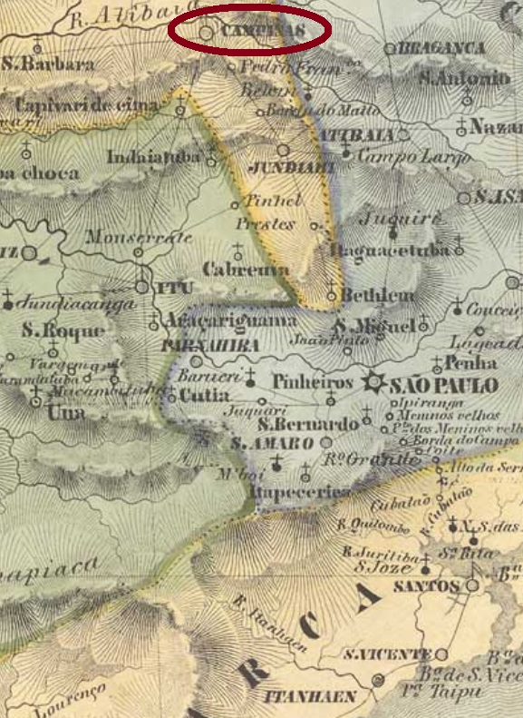
See also Campinas (R. Koester: Carimbologia VIII)
This São Carlos from the early imperial province of São Paulo is not the actual one, the former São Carlos do Pinhal (SSP-1675), but rather today’s Campinas with over one million inhabitants. It was founded in July 1774 as the freguesia of Nossa Senhora da Conceição de Campinas, which belonged to Jundiahy, located almost 100 km north of the province capital, and became a villa in November 1797. The official name Campinas returned definitively in February 1842, when the locality became a town.
According to Nova Monteiro (Administrações e Agencias Postaes do Brasil Imperio, in Brasil Filatelico/RJ, 1934-5; Reprint SPP 1994-1999), the local post office was created in January 1824. In conclusion, all local postmarks are pre-philatelic and should be dated between 1824 and 1842. Both existing cancels also occur in sepia and were already presented in the RHM catalogue:
Siehe auch Campinas (R. Koester: Carimbologia VIII)
Dieser São Carlos aus der Frühzeit der kaiserlichen Provinz São Paulo ist nicht der aktuelle, der damals São Carlos do Pinhal (SSP-1675) hieß, sondern die heutige Metropole mit über eine Million Einwohnern. Sie wurde im Juli 1774 als die freguesia of Nossa Senhora da Conceição de Campinas gegründet. Damals gehörte sie zu Jundiahy und lag fast 100 km nördlich der Provinzhauptstadt São Paulo entfernt. Sie wurde eine eigenständige Villa im November 1797, doch der offizielle Name Campinas kehrte endgültig erst im Februar 1842 zurück, als die Ortschaft eine Stadt wurde.
Laut Nova Monteiro (Administrações e Agencias Postaes do Brasil Imperio, in Brasil Filatelico/RJ, 1934-5; Reprint SPP 1994-1999) gibt es dort ein Postamt seit Januar 1824. Daraus folgt, dass alle Poststempel aus der Vorphila-Zeit stammen und Daten zwischen 1824 und 1842 haben sollen. Die zwei vorhandenen Stempel kommen auch in sepia vor und wurden bereits im RHM-Katalog abgebildet:
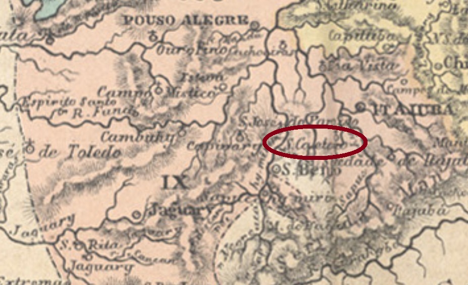
The third São Caetano locality in the Minas Gerais province was from March 1846 on the district of Vargem Grande in the municipality of Itajubá, situated round 450 km southwest of the province capital Ouro Preto. Vargem Grande (= Big Wetlands) is a brook which crosses the settlement. This was given the additional saint to its name in September 1848, being elevated to a villa in September 1901. Since then, the toponym has changed twice: in October 1909 to Villa Braz and in September 1923 to the actual Brazópolis, an artificial construct lacking the charm of the earlier names.
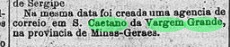
According to Nova Monteiro (Administrações e Agencias Postaes do Brasil Imperio, in Brasil Filatelico/RJ, 1934-5; Reprint SPP 1994-1999), the local post office was created in September 1864. Paula Sobrinho writes 1865 in his História Postal de Minas Gerais (Belo Horizonte, 1997), but a press note from Rio confirms Nova Monteiro’s data:
Diario do Rio de Janeiro, September 21, 1864
Two imperial post cancels were reported. SMG-2215a (Coll. José A. Junges) has a double circle with the inscription S. C. DA VARGEM GRANDE on top. The dates were partially handwritten at the centre, between 1878ff and 1886. SMG-2215b (Coll. José A. Junges) occurs also in blue and has now the inscription S. CAETANO DA V. GRANDE on top between circles, and (MINAS) below. Dates at the centre from ca. 1888 until 1908.
Carta da Republica dos Estados Unidos do Brazil, 1892
Andere Namen: Villa Braz, Brazópolis (1923)
Der dritte São Caetano unter den Ortschaften in der Provinz Minas Gerais war ab März 1846 der Distrikt von Vargem Grande im Município von Itajubá und lag rund 450 km südwestlich der Hauptstadt Ouro Preto entfernt. Vargem Grande (= Große Aue) ist ein kleiner Fluss, der durch die Ortschaft fließt. Der Heilige Kajetan kam zum Ortsnamen im September 1848 dazu, und der Ort wurde eine Villa im September 1901. Danach wechselte der Namen noch zweimal: im Oktober 1909 zu Villa Braz und im September 1923 zum aktuellen Brazópolis, einer künstlichen Bezeichnung, die den Charm der alten Namen vermissen lässt.
Laut Nova Monteiro (Administrações e Agencias Postaes do Brasil Imperio, in Brasil Filatelico/RJ, 1934-5; Reprint SPP 1994-1999) ist ein Postamt dort ab September 1864 zu melden. Paula Sobrinho schreibt zwar dafür das Jahr 1865 in seiner História Postal de Minas Gerais (Belo Horizonte, 1997), aber eine Pressenotiz aus Rio kann die Angaben von Nova Monteiro bestätigen:
Diario do Rio de Janeiro, 21. September 1864
Zwei kaiserliche Poststempel wurden gefunden. SMG-2215a (Samml. José A. Junges) hat einen Doppelkreis mit der Inschrift S. C. DA VARGEM GRANDE oben. Die Daten wurden teilweise per Hand geschrieben, zwischen 1878ff und 1886. SMG-2215b (Samml. José A. Junges) erscheint auch in blau und hat nun die Inschrift S. CAETANO DA V. GRANDE oben zwischen den Kreisen, dazu (MINAS) unten. Daten in der Mitte von ca. 1888 bis 1908.
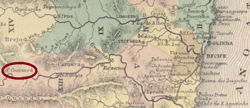
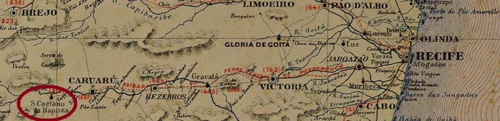
Saint Cajetan (1480-1547) was Italian, but his high popularity in Spain and Portugal has originated many localities in South America. Like São Caetano da Rapoza (= of the Fox), which was since May 1844 a district in the municipality of Caruaru, situated on the Ipojuca River, almost 150 km west of the province capital Recife. In July 1909 it ascended to a villa, and in September 1928, to a town, meanwhile spelled São Caitano. The fox mentioned in the original denomination is certainly not the European Vulpes vulpes, and rather his South American cousin (Lycalopex vetulus, Lund 1842), today almost extinct in the region:
One early cancel was found, probably not the earliest: SPE-0530b (Coll. Claudio Coelho) is a French-Type, with the inscription S. CAETANO DA RAPOZA on top between circles, the star between parentheses below and the centre free for a handwritten date. The only available example is dated 1890.
Carta Corographica da Provincia de Pernambuco, 1880
Anderer Name: São Caitano (ca. 1944)
Der Heiliger Kajetan von Thiene (1480-1547) war Italiener, gleichwohl so beliebt in Spanien und Portugal, dass viele Ortschaften in Südamerika nach ihm benannt wurden. Wie São Caetano da Rapoza (= vom Fuchs), im Mai 1844 als Distrikt des Município von Caruaru gegründet. Die Ortschaft lag am Fluss Ipojuca, fast 150 km westlich der Provinzhauptstadt Recife entfernt. Im Juli 1909 wurde daraus eine Villa, und im September 1928 eine Stadt, die inzwischen São Caitano geschrieben wird. Der im ursprünglichen Ortsnamen erwähnte Fuchs ist sicher nicht der europäische Vulpes vulpes, sondern eher sein südamerikanischer Vetter (Lycalopex vetulus, Lund 1842), heute praktisch ausgestorben in dieser Gegend:
Foto: Carlos Henrique L.N. de Almeida (CC-BY SA)
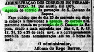
Laut Verzeichnis der kaiserlichen Postämter (Tabella das Agencias do Correio do Imperio) von 1885 gibt es dort ein Postamt seit 1876. Wie die Regionalpresse berichtet, startete dieses am 25. April den Betrieb:
Diario de Pernambuco, 24. April 1876
Nur ein früher Stempel war zu finden, wohl nicht der früheste: SPE-0530b (Samml. Claudio Coelho) ist ein Französischer-Typus, mit der Inschrift S. CAETANO DA RAPOZA zwischen den Kreisen oben, dem Stern in Klammern unten und der Mitte frei für ein handgeschriebenes Datum. Das einzige vorhandene Exemplar ist aus dem Jahr 1890.