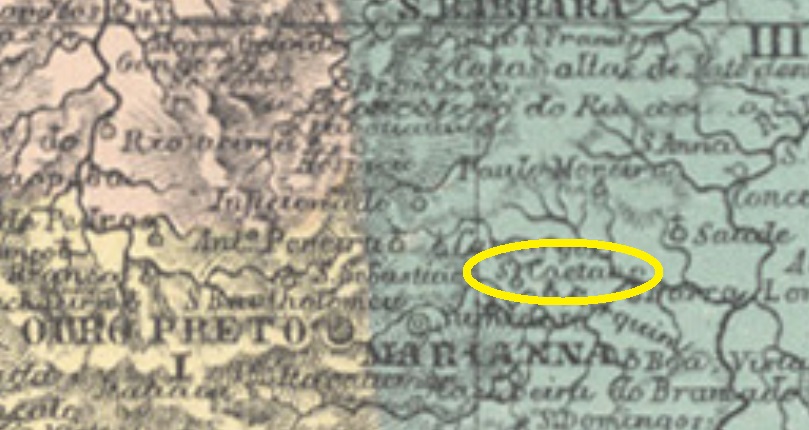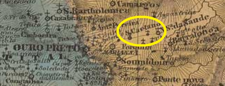
Another name: São Caitano (ca. 1944)
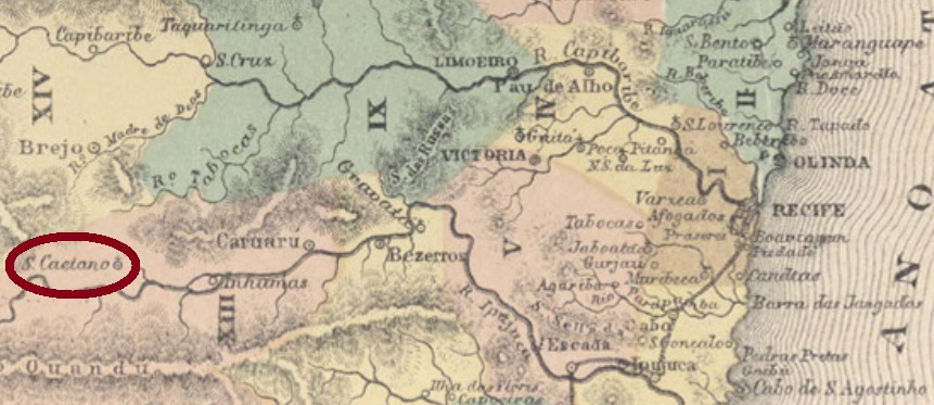
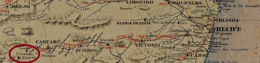
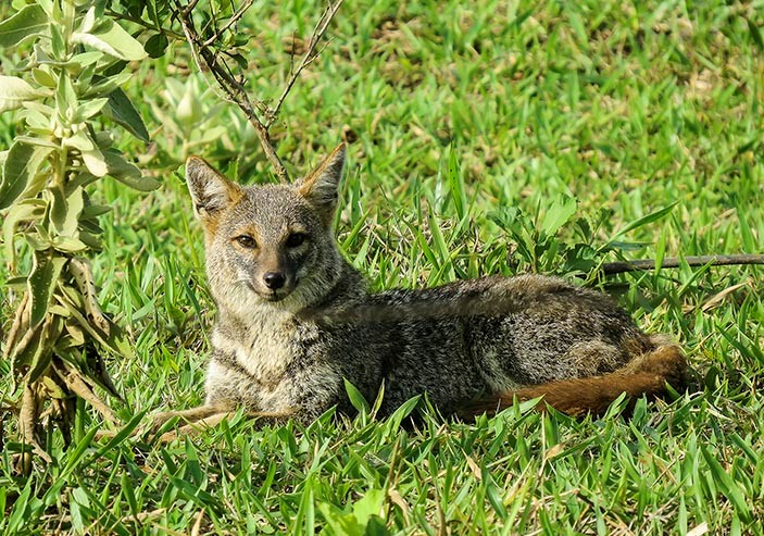
Saint Cajetan (1480-1547) was Italian, but his high popularity in Spain and Portugal has originated many localities in South America. Like São Caetano da Rapoza (= of the Fox), which was since May 1844 a district in the municipality of Caruaru, situated on the Ipojuca River, almost 150 km west of the province capital Recife. In July 1909 it ascended to a villa, and in September 1928, to a town, meanwhile spelled São Caitano. The fox mentioned in the original denomination is certainly not the European Vulpes vulpes, and rather his South American cousin (Lycalopex vetulus, Lund 1842), today almost extinct in the region:

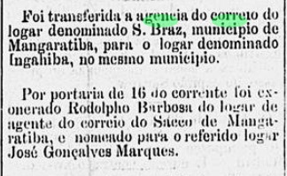
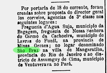
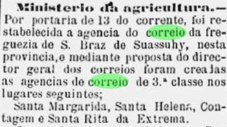
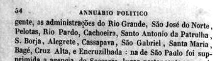
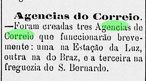
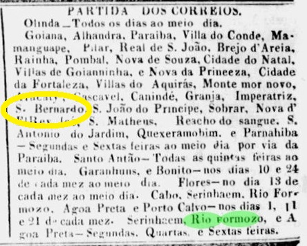
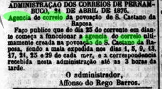
According to the Imperial Mail Register (Tabella das Agencias do Correio do Imperio) of 1885, the local post office was created in 1876, starting operations on April 25, as reported by the regional press:

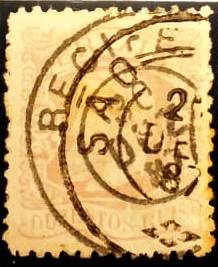
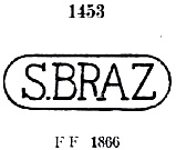
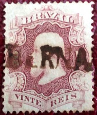
One early cancel was found, probably not the earliest: SPE-0530b (Coll. Claudio Coelho) is a French-Type, with the inscription S. CAETANO DA RAPOZA on top between circles, the star between parentheses below and the centre free for a handwritten date. The only available example is dated 1890.
Anderer Name: São Caitano (ca. 1944)
Der Heiliger Kajetan von Thiene (1480-1547) war Italiener, gleichwohl so beliebt in Spanien und Portugal, dass viele Ortschaften in Südamerika nach ihm benannt wurden. Wie São Caetano da Rapoza (= vom Fuchs), im Mai 1844 als Distrikt des Município von Caruaru gegründet. Die Ortschaft lag am Fluss Ipojuca, fast 150 km westlich der Provinzhauptstadt Recife entfernt. Im Juli 1909 wurde daraus eine Villa, und im September 1928 eine Stadt, die inzwischen São Caitano geschrieben wird. Der im ursprünglichen Ortsnamen erwähnte Fuchs ist sicher nicht der europäische Vulpes vulpes, sondern eher sein südamerikanischer Vetter (Lycalopex vetulus, Lund 1842), heute praktisch ausgestorben in dieser Gegend:
Laut Verzeichnis der kaiserlichen Postämter (Tabella das Agencias do Correio do Imperio) von 1885 gibt es dort ein Postamt seit 1876. Wie die Regionalpresse berichtet, startete dieses am 25. April den Betrieb:
Nur ein früher Stempel war zu finden, wohl nicht der früheste: SPE-0530b (Samml. Claudio Coelho) ist ein Französischer-Typus, mit der Inschrift S. CAETANO DA RAPOZA zwischen den Kreisen oben, dem Stern in Klammern unten und der Mitte frei für ein handgeschriebenes Datum. Das einzige vorhandene Exemplar ist aus dem Jahr 1890.