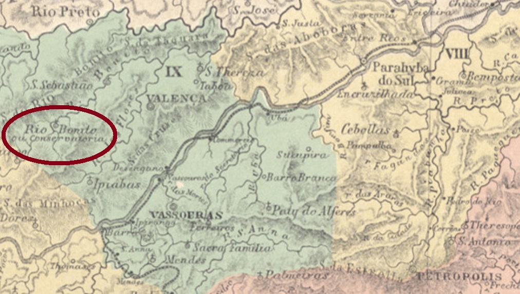
Other names: Rio Bonito de Valença, Conservatória (1938)
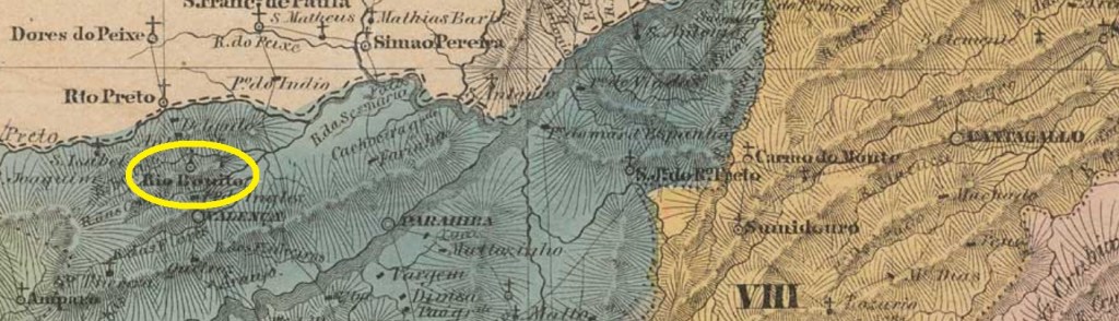
Santo Antonio do Rio Bonito (= of the Beautiful River) was since March 1839 a district in the municipality of Valença, situated round 150 km northwest of the imperial capital Rio de Janeiro. The Rio Bonito is an affluent on the left bank of the Rio das Flores, but barely visible on actual maps. In March 1938 the district was given the actual toponym Conservatória.
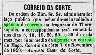
According to Nova Monteiro (Administrações e Agencias Postaes do Brasil Imperio, in Brasil Filatelico/RJ, 1934-5; Reprint SPP 1994-1999), the local post office was created in February 1849, which can be ratified by the local press:
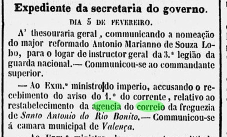
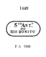
However, the official text mentions a restabelecimento (re-establishment), thus suggesting the existence of an earlier agency on place, which has been closed in the interim. Three early post cancels were found; the oldest of them, SRJ-0910a, circulated supposedly from 1849 until at least 1878 and was already presented by Paulo Ayres in his Catálogo de Carimbos Brasil-Império (S. Paulo, 1937,1942) under # 1449:

In Ayres’ image of SRJ-0910a there is a missing dot after BONITO. There followed SRJ-0910b (Coll. Karlheinz Wittig): a double circle with the inscription S.A. DO R. BONITO. The dates in the inner circle go from 1879 to 1889. The last cancel may be already republican, for it shows dates of 1894-1895 inside. SRJ-0910c (Coll. Paulo Novaes) has a double circle with the inscription S. ANT. DO RIO BONITO above and an ornament below, unfortunately not clearly visible in the observed examples.
Andere Namen: Rio Bonito de Valença, Conservatória (1938)
Santo Antonio do Rio Bonito (= vom Schönen Fluss) war ab März 1839 ein Distrikt im Município von Valença, der rund 150 km nordwestlich der kaiserlichen Hauptstadt Rio de Janeiro lag. Der Rio Bonito ist ein Zufluss am linken Ufer des Rio das Flores, heute aber kaum auf Karten zu finden. Im März 1938 erhielt der Distrikt den aktuellen Namen Conservatória.
Laut Nova Monteiro (Administrações e Agencias Postaes do Brasil Imperio, in Brasil Filatelico/RJ, 1934-5; Reprint SPP 1994-1999) gibt es dort ein Postamt seit Februar 1849, was dudrch die Regionalpress bestätigt wird:

Gleichwohl wird hier von offizieller Seite ein restabelecimento (Wiedererrichtung) erwähnt, und damit die Existenz einer früheren Agentur dort angedeutet, die dann geschlossen wurde. Drei frühe Poststempel waren auffindbar; der Älteste davon, SRJ-0910a, war wohl von 1849 an bis mindestens 1878 im Umlauf und wurde bereits durch Paulo Ayres in seinem Catálogo de Carimbos Brasil-Império (S. Paulo, 1937, 1942) unter Nr. 1449 vorgestellt:
In Ayres’ Abbildung fehlt dennoch ein Punkt nach BONITO. Der zweite Stempel ist SRJ-0910b (Samml. Karlheinz Wittig): ein Doppelkreis mit der Inschrift S.A. DO R. BONITO. Die Daten in inneren Kreis gehen von 1879 bis 1889. Der letzte Stempel wäre vielleicht schon republikanisch, da seine Daten um 1894-1895 liegen. SRJ-0910c (Samml. Paulo Novaes) hat einen Doppelkreis mit der Inschrift S. ANT. DO RIO BONITO oben und einem Ornament unten, das leider nicht klar leserlich ist.