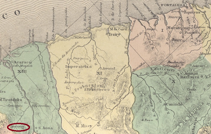
Meruoca had been a district of Vila de Acaraú since August 1861, located on the north bank of the Riacho do Salão, 260 kilometres west of the provincial capital Fortaleza. In January 1879, it became the Freguesia de Nossa Senhora da Conceição de Meruoca. This freguesia was subsequently transferred to Vila de Sobral. In November 1885, it was elevated to the status of Vila, but in October 1920, it was downgraded to Distrito in the Município de Massapê. This district was returned to the Município de Sobral in May 1931. Since November 1951, Meruoca has once again been an independent município.
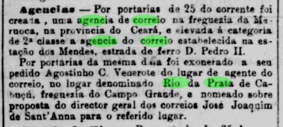
As reported by the Rio press, there has been a post office there since January 1883.
Jornal do Commercio/RJ, 27 January 1883
The imperial postmark is the double circle MCE-0215a (Fig. Koester, in Carimbologia XXVII):
MCE-0215a (RK) 1889Villiers de l’Ile Adam: Carta (…) da Provincia do Ceara, 1849
Meruoca war seit August 1861 ein Distrikt der Vila de Acaraú, der am Nordufer des Riacho do Salão lag, 260 Kilometer westlich der Provinzhauptstadt Fortaleza. Im Januar 1879 wurde Meruoca zur Freguesia de Nossa Senhora da Conceição de Meruoca erhoben. Diese Freguesia ging anschließend zur Vila de Sobral über. Im November 1885 erfolgte die Erhebung zur Vila, die jedoch im Oktober 1920 zur Herabstufung zum Distrito im Município de Massapê führte. Dieser Distrikt ging im Mai 1931 zurück zum Município de Sobral. Seit November 1951 ist Meruoca wieder ein eigenständiger Município.
Wie die Presse aus Rio bekannt gab, gab es dort seit Januar 1883 ein Postamt.
Jornal do Commercio/RJ, 27.01.1883
Dier kaiserliche Poststempel ist der Doppelkreis MCE-0215a (Abb. Koester, in Carimbologia XXVII):
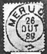
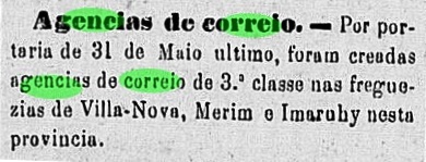
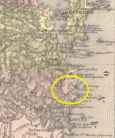
The Freguesia de Sant’Anna do Mirim existed since April 1856 and belonged to the Vila de Laguna. It was located on the northern shore of Lake Imaruí, 90 km south of the provincial capital Desterro (today Florianópolis). In June 1958, Mirim became a district of the Municipality of Henrique Lage and has been part of the Municipality of Imbituba since October 1959.
According to the regional press, there has been a post office there since May 1881:
O Despertador, 08.06.1881
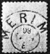
The imperial postmark is the double circle MSC-0165a (Fig. Koester in Carimbologia XXVII):
MSC-0165a (RK) 1885ffAtlas do Imperio do Brasil, 1868
Andere Schreibweise: Mirim
Die Freguesia de Sant’Anna do Mirim bestand seit April 1856 und gehörte zur Vila de Laguna. Sie lag am Nordufer des Imaruí-Sees, 90 km südlich der Provinzhauptstadt Desterro (heute Florianópolis). Im Juni 1958 wurde Mirim ein Distrikt des Município de Henrique Lage und liegt seit Oktober 1959 im Município de Imbituba.
Wie aus der regionalen Presse hervorgeht, gab es dort ein Postamt seit Mai 1881:
O Despertador, 08.06.1881
Der kaiserliche Poststempel ist der Doppelkreis MSC-0165a (Abb. Koester in Carimbologia XXVII):
Villiers de l’Ile Adam: Carta (…) da Provincia de Minas Geraes, 1849
Other names: Capellinha das Mercês
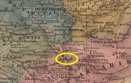
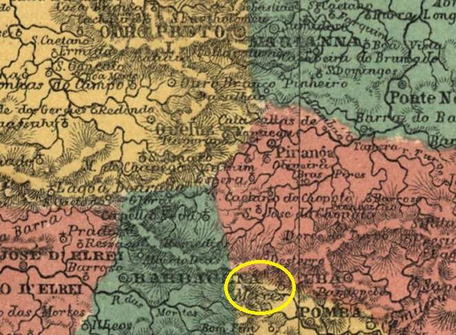
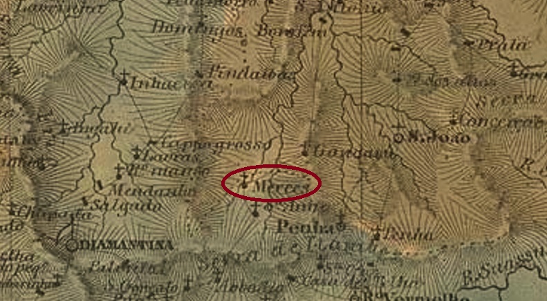
The Curato de Capellinha das Mercês existed since October 1791 near the north bank of the Pomba River, 130 kilometres south of the future provincial capital Ouro Preto. In April 1841, it became the Freguesia de Nossa Senhora das Mercês, which belonged to the Vila de Pomba, and in August 1911, it was elevated to the status of Vila de Mercês. Mercês has been a city since September 1925.
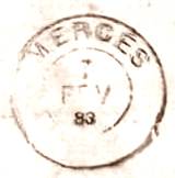
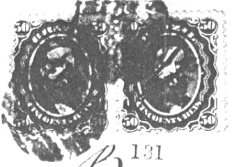
According to Nova Monteiro, there has been a post office there since July 1859. This is evident from his work Administrações e Agencias Postaes do Brasil Imperio (Brasil Filatelico/RJ, 1934–1935; reprinted by SPP 1994–1999). The oldest postmark to date is the double circle MMG-3395b (Fuad Ferreira Fo. collection).
MMG-3395b (FF) 1883–1885
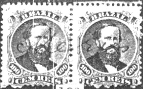
Before that, stamps were also cancelled by hand, as R. Koester showed in Carimbologia XXVII:
1866 ff (RK)
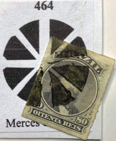
James Dingler and Klerman W. Lopes show a mute postmark from there in Mute Cancellations of the Brazil Empire / Carimbos Mudos do Brasil Império (Brazil Philatelic Association, Rio de Janeiro, 2000) under No. 464, here in an example from Roberto Assef Jr.:
BPA 464, 1871–1876 ff (RA)
R. Koester (op. cit.) listed another mute cancellation from Mercês:
1869-1872 (RK)Atlas do Imperio do Brasil, 1868
Andere Namen: Capellinha das Mercês
Der Curato de Capellinha das Mercês bestand seit Oktober 1791 nahe dem Nordufer des Pomba, 130 Kilometer südlich der späteren Provinzhauptstadt Ouro Preto. Im April 1841 wurde er zur Freguesia de Nossa Senhora das Mercês, die zur Vila de Pomba gehörte, und im August 1911 erfolgte die Erhebung zur Vila de Mercês. Seit September 1925 ist Mercês eine Stadt.
Laut Nova Monteiro gab es dort seit Juli 1859 ein Postamt. Dies geht aus seinem Werk Administrações e Agencias Postaes do Brasil Imperio (Brasil Filatelico/RJ, 1934–1935; Nachdruck SPP 1994–1999) hervor. Der bisher älteste Poststempel ist der Doppelkreis MMG-3395b (Sammlung Fuad Ferreira Fo.).
MMG-3395b (FF) 1883–1885
Davor wurden die Briefmarken auch handschriftlich entwertet, wie R. Koester in Carimbologia XXVII zeigte:
1866ff (RK)
James Dingler und Klerman W. Lopes zeigen in Mute Cancellations of the Brazil Empire / Carimbos Mudos do Brasil Império (Brazil Philatelic Association, Rio de Janeiro, 2000) unter Nr. 464 einen stummen Stempel von dort, hier in einem Beispiel von Roberto Assef Jr.:
BPA 464, 1871–1876 ff (RA)
R. Koester (op. cit.) führte eine weitere stumme Abstempelung von Mercês auf:
Villers de l’Ile Adam: Carta (…) da Provincia de Minas Geraes, 1849
Other names: Mercês/Mercez, Calabar, Mercês de Diamantina, Senador Modestino Gonçalves (1962)
See also Arassuahy (Mercês, AMG-0120)
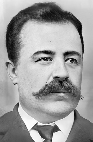
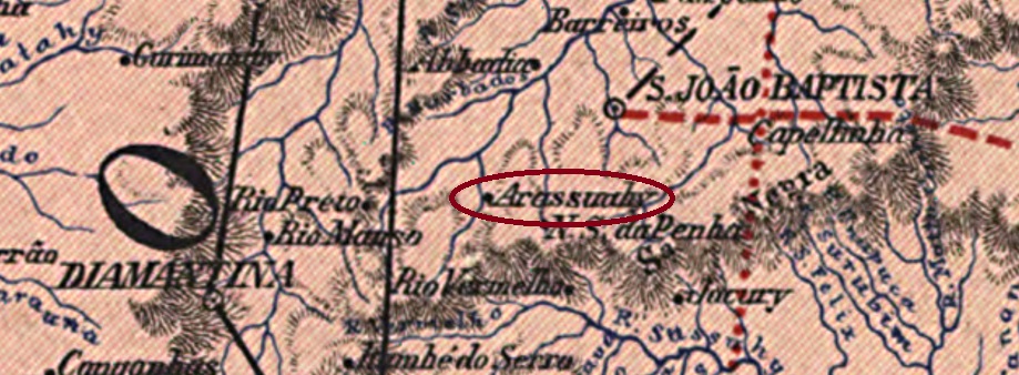
The smaller Arassuahy locality in the province of Minas Gerais was a settlement founded in 1744 on the east bank of the Arassuahy, 390 km north of the capital Ouro Preto. In September 1873, it became the Freguesia of N. Sra. das Mercês do Arassuahy, which belonged to Diamantina. After that, the place name changed three times: in September 1923 as the district of Calabar, in December 1938 to Mercês de Diamantina, and finally in December 1962 to Senador Modestino Gonçalves, when the place became an independent Município. The name is meant to commemorate Modestino Gonçalves Moreira (1861-1941), a Minas-born politician who became Prefeito of Santa Luzia and a provincial senator.
Modestino Gonçalves (Wikipedia)
The local post office dates from January 1881, as Paula Sobrinho writes in História Postal de Minas Gerais (Belo Horizonte, 1997). The oldest postmark from this town to date is MMG-0120a (José A. Junges collection):
MMG-0120a (JJ) 1893Carta da Republica dos Estados Unidos do Brazil, 1892
Andere Namen: Mercês/Mercez, Calabar, Mercês de Diamantina, Senador Modestino Gonçalves (1962)
Siehe auch Arassuahy (Mercês, AMG-0120)
Die kleinere Arassuahy-Ortschaft in der Provinz Minas Gerais war eine 1744 gegründete Siedlung am Ostufer des Arassuahy, die 390 km nördlich der Hauptstadt Ouro Preto lag. Im September 1873 wurde daraus die Freguesia von N. Sra. das Mercês do Arassuahy, die bei Diamantina lag. Danach änderte sich der Ortsname dreimal: im September 1923 zum Distrikt von Calabar, im Dezember 1938 zu Mercês de Diamantina, und schließlich im Dezember 1962 zu Senador Modestino Gonçalves, als der Ort zum eigenständigen Município wurde. Der Name soll an Modestino Gonçalves Moreira (1861-1941) erinnern, der als Provinzpolitiker Prefeito von Santa Luzia und Landessenator wurde.
Modestino Gonçalves (Wikipedia)
Das örtliche Postamt datiert vom Januar 1881, wie Paula Sobrinho in História Postal de Minas Gerais (Belo Horizonte, 1997) schreibt. Der bisher älteste Poststempel dieser Ortschaft ist MMG-0120a (Samml. José A. Junges):
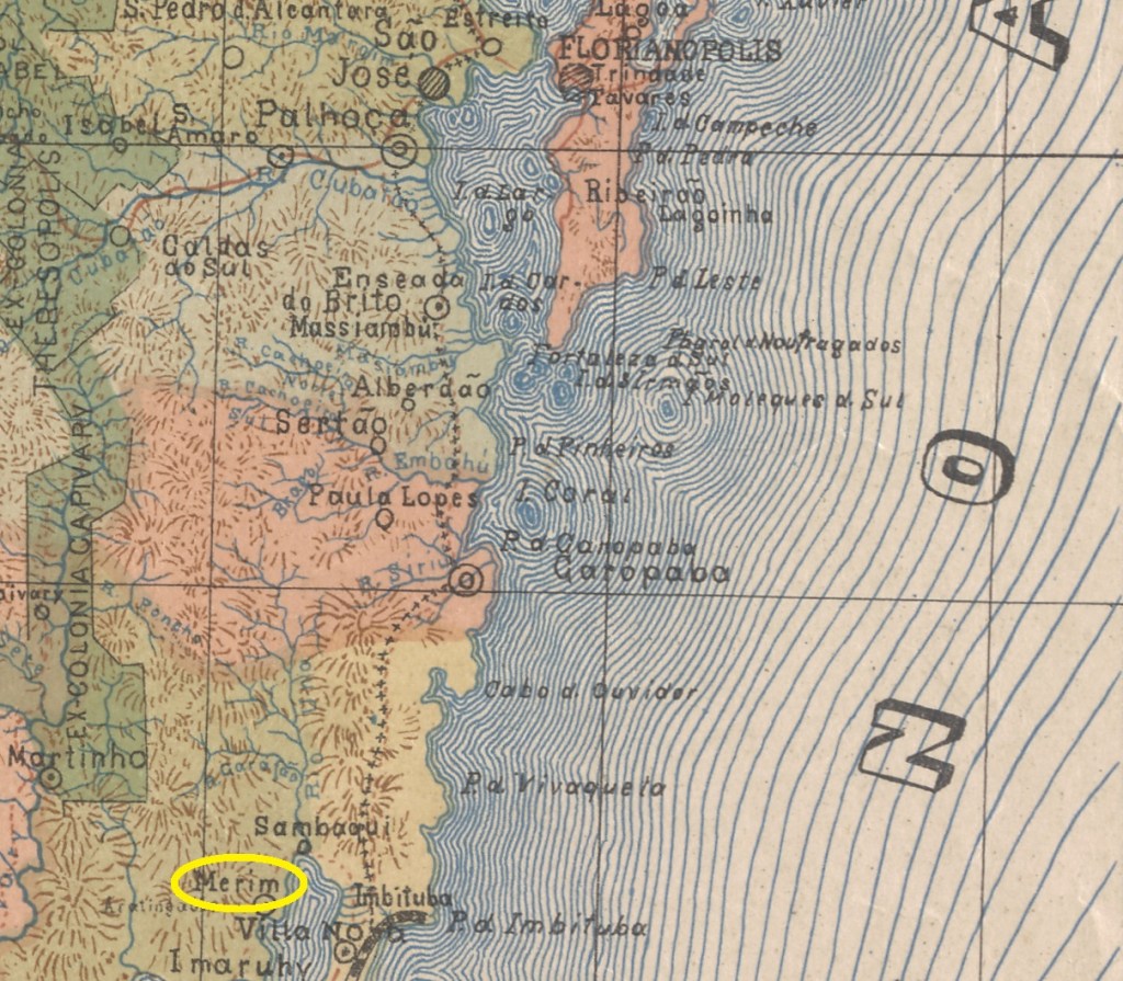
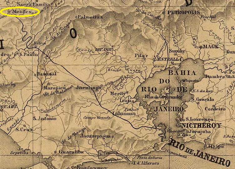
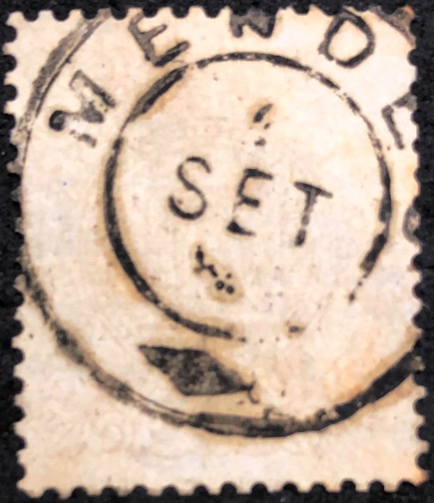
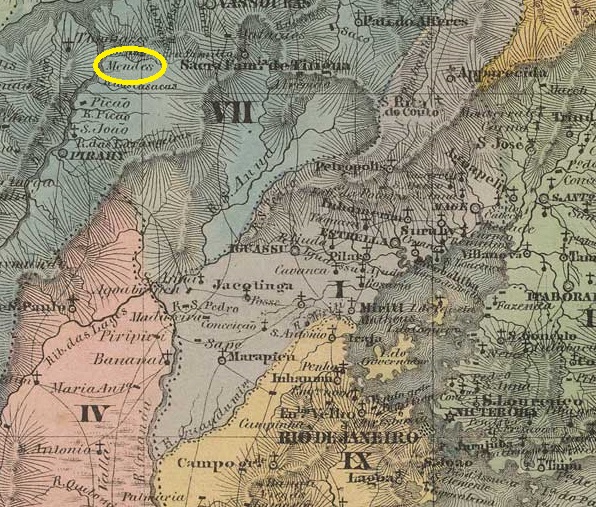
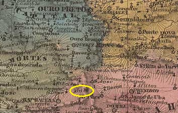
Since October 1838, Sta. Cruz dos Mendes was a curato (parish) of Vila de Piraí, 120 kilometres northwest of the capital Rio de Janeiro. The village became a freguesia in September 1855, a district of the Município de Barra do Piraí in March 1890 and a Município de Mendes in July 1952.
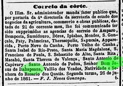
As Nova Monteiro writes in Administrações e Agencias Postaes do Brasil Imperio (Brasil Filatelico/RJ, 1934-5; reprint SPP 1994-1999), there had been a post office there since January 1856. However, this was closed in June 1861, as the press in Rio reported:
Correio Mercantil, 29/06/1861
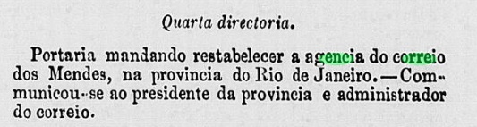
The agency was soon reopened, as can be seen from the minutes of the imperial ministry:
Expediente do Ministerio do Imperio, 14/08/1861
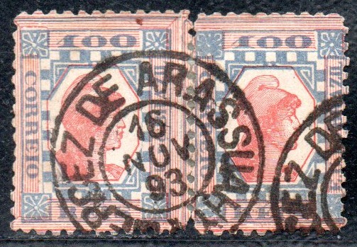
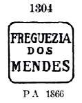
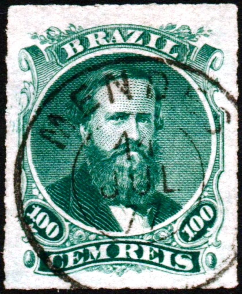
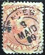
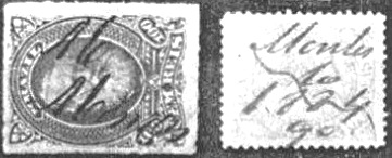
The first cancel is FRJ-2405a, which was given the number 1304 by Paulo Ayres (Catálogo de Carimbos Brasil-Império, S. Paulo, 1937, 1942):
FRJ-2405a (P.A. 1304) 1856-1877ff
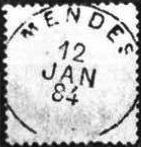
This was followed by the double circle MRJ-0725a (illustration by Claudio Coelho):
MRJ-0725a (CC) 1876ff-1884
Then, for a short time, came the rare MRJ-0725b (illustration by Koester in Carimbologia XXVII), which has slightly spread-out letters and seems to have no inner circle.
MRJ-0725b (RK) 1884
In the final years of the empire, two circle cancels with ornaments were added, beginning with MRJ-0725c (see illustration by Felipe Picinnini):
MRJ-0725c (FP) 1883–1887
The second ornamented cancel is MRJ-0725d (ill. from agenciaspostais.com.br):
MRJ-0725d (PN) 1888–1889
R. Koester (op. cit.) also showed two handwritten cancellations from Mendes:
1877 ff. – 1884 (RK)
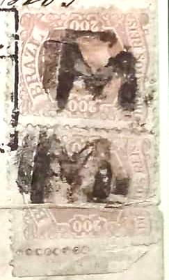
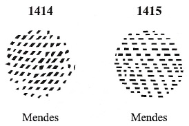
James Dingler and Klerman W. Lopes have reproduced two mute cancellations from this locality in ‘Mute Cancellations of the Brazil Empire / Carimbos Mudos do Brasil Império’ (Brazil Philatelic Association, Rio de Janeiro, 2000).
1877 ff. – 1884 (RK)
An other postmark, with the locality initial, was found in the Fuad Ferreira Fo. collection.
1883 (FF)
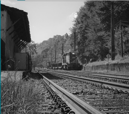
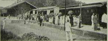
Since both the Postal Guide (Guia Postal do Império, 1880) and the directory of imperial post offices (Tabella das Agências do Correio do Império, Rio de Janeiro, 1885) list the Mendes post office as a railway station post office, it is likely that it moved in 1879 at the latest, even though postmarks with ‘EST.’ (for Estação/station) only appear in the Republic.
The station was opened in August 1864 by the E. F. D. Pedro II railway company as part of the main line. From 1889, the railway line belonged to E.F. Central do Brasil and from 1975 until its closure in 1996 to Rede Ferroviária Federal S. A. (source: estacoesferroviarias.com.br). Today, the tracks are still in place and the station building was still being used as a residential building in 2010.
In 1929 (image from O Malho on estacoesferroviarias.com.br)In June 2023 (photo: Beto Lee, on Google Maps)Villiers de l’Ile Adam: Carta (…) da Provincia do Rio de Janeiro, 1850
Siehe auch Freguesia dos Mendes (FRJ-2405)
Seit Oktober 1838 war Sta. Cruz dos Mendes ein Curato (Pfarrei) der 120 km nordwestlich der Hauptstadt Rio de Janeiro gelegenen Vila de Piraí. Der Ort wurde im September 1855 zur Freguesia, im März 1890 zum Distrikt des Município de Barra do Piraí und im Juli 1952 zum Município de Mendes.
Wie Nova Monteiro in Administrações e Agencias Postaes do Brasil Imperio (Brasil Filatelico/RJ, 1934-5; Reprint SPP 1994-1999) schreibt, gab es dort seit Januar 1856 ein Postamt. Dieses wurde jedoch bereits im Juni 1861 geschlossen, wie die Presse in Rio berichtete:
Correio Mercantil, 29.06.1861
Die Agentur wurde dennoch bald wieder eröffnet, wie aus dem Protokoll des kaiserlichen Ministeriums hervorgeht:
Expediente do Ministerio do Imperio, 14.08.1861
Der erste Stempel ist FRJ-2405a, der von Paulo Ayres (Catálogo de Carimbos Brasil-Império, S. Paulo, 1937, 1942) die Nummer 1304 erhielt:
FRJ-2405a (P.A. 1304) 1856-1877ff
Es folgte der Doppelkreis MRJ-0725a (Abb. Claudio Coelho):
MRJ-0725a (CC) 1876ff-1884
Danach kam für kurze Zeit der seltene MRJ-0725b (Abbildung bei Koester in Carimbologia XXVII), der etwas ausgebreitete Buchstaben und scheinbar keinen inneren Kreis aufweist.
MRJ-0725b (RK) 1884
In den letzten Jahren des Kaiserreichs kamen auch zwei Kreisstempel mit Ornamenten hinzu, beginnend mit MRJ-0725c (Abbildung von Felipe Picinnini):
MRJ-0725c (FP) 1883–1887
Der zweite Ornamentstempel ist MRJ-0725d (siehe agenciaspostais.com.br):
MRJ-0725d (PN) 1888–1889
R. Koester (op. cit.) zeigte auch zwei handschriftliche Entwertungen aus Mendes:
1877 ff. – 1884 (RK)
James Dingler und Klerman W. Lopes haben in „Mute Cancellations of the Brazil Empire / Carimbos Mudos do Brasil Império” (Brazil Philatelic Association, Rio de Janeiro, 2000) zwei stumme Abstempelungen aus dieser Ortschaft abgebildet.
1877 ff. – 1884 (RK)
Ein weiterer Stempel mit dem Anfangsbuchstaben des Ortes stammt aus der Sammlung Fuad Ferreira Fo.
1883 (FF)
Da sowohl der Postführer (Guia Postal do Império, 1880) als auch das Verzeichnis der kaiserlichen Postämter (Tabella das Agências do Correio do Império, Rio de Janeiro, 1885) das Postamt Mendes als Bahnhofspostamt auflisten, ist es wahrscheinlich, dass dieses spätestens 1879 umgezogen ist, auch wenn Poststempel mit „EST.” (für Estação/Bahnhof) erst in der Republik vorkommen.
Der Bahnhof wurde im August 1864 von der Eisenbahngesellschaft E. F. D. Pedro II als Teil der Hauptlinie eröffnet. Die Bahnlinie gehörte ab 1889 der E.F. Central do Brasil und von 1975 bis zur Stilllegung im Jahr 1996 der Rede Ferroviária Federal S. A. (Quelle: estacoesferroviarias.com.br). Heute sind die Gleise noch vorhanden und das Bahnhofsgebäude diente im Jahr 2010 noch als Wohnhaus.
1929 (Abb. aus O Malho auf estacoesferroviarias.com.br)Im Juni 2023 (Foto: Beto Lee, auf Google Maps)
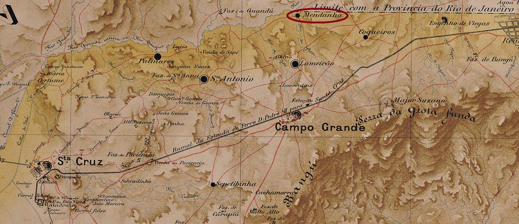
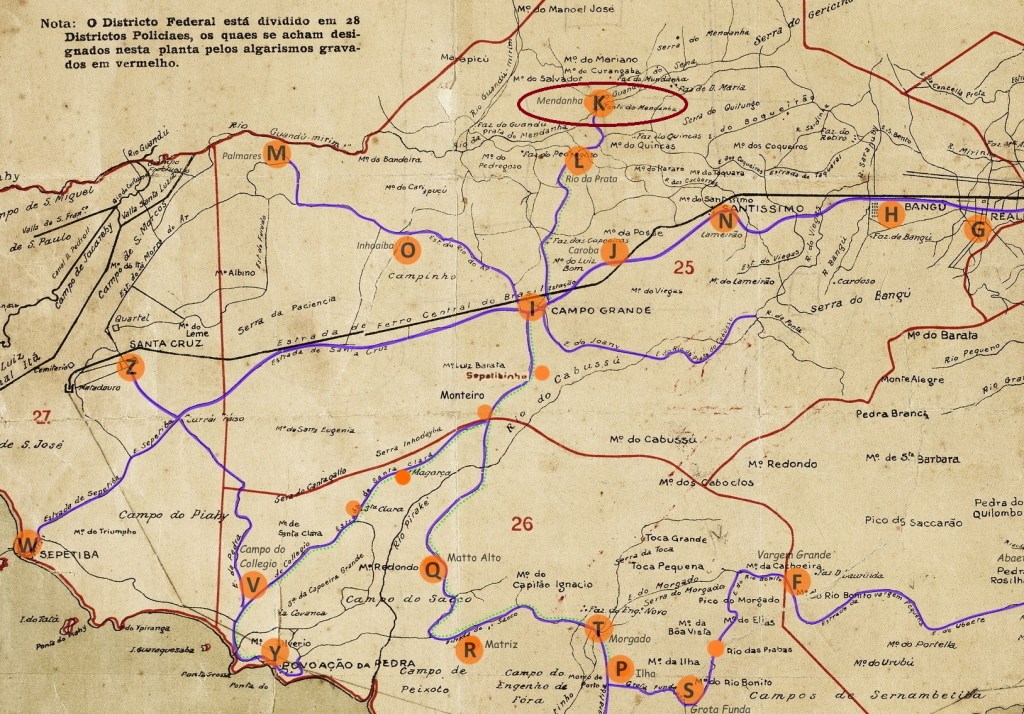
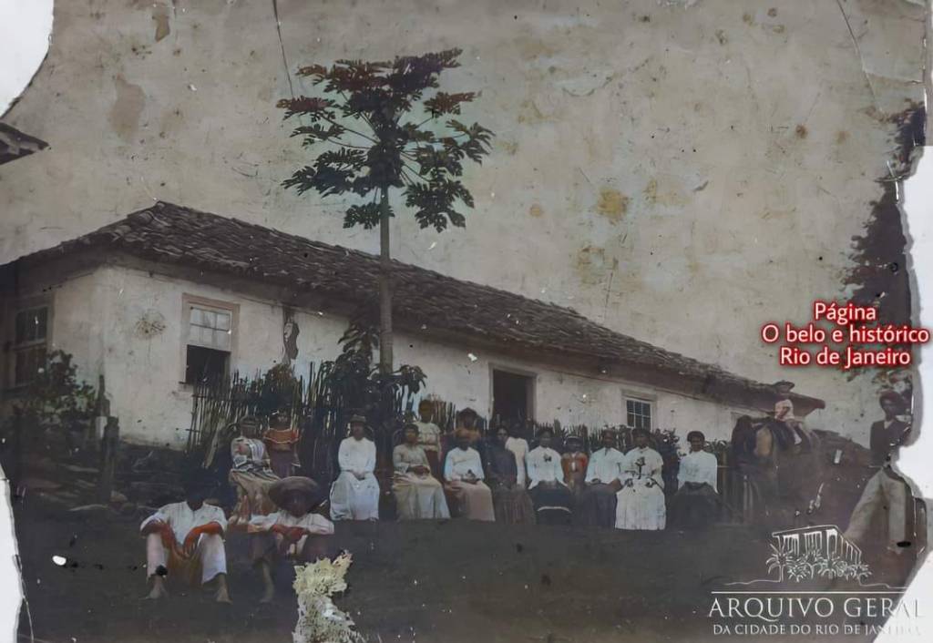
Around 1700, this village was the fazenda of Luis Vieira de Mendanha e Sottomayor, the captain-major (Capitão-Mor) of Guaratiba and Marambaia. It was located on Porangaba Mountain, 45 km west of the capital Rio de Janeiro. Sugar cane was initially cultivated on the large estate; but at the end of the 18th century, the first coffee plantation in the province of Rio was established there. Towards the end of the 19th century, the main building was first used as a school and later as the Sítio of the Freguesia de Campo Grande. The building has since been demolished and the agricultural land released for construction. Mendanha is now a sub-Bairro in the district of Campo Grande.
Fazenda building, late 19th century(Archive of the city of Rio de Janeiro)
According to the Rio press, there had been a post office there since February 1882.
Gazeta de Noticias, 09.02.1882
However, no imperial postmark from this location has been found to date.
Mappa do Districto Federal, 1920 (agenciaspostais.com.br)
Diese Ortschaft war um 1700 die Fazenda von Luis Vieira de Mendanha e Sottomayor, dem Oberkapitän (Capitão-Mor) von Guaratiba und Marambaia. Sie lag am Porangaba-Berg, 45 km westlich der Hauptstadt Rio de Janeiro. Auf dem Großgrundbesitz wurde zunächst Zuckerrohr angebaut; am Ende des 18. Jahrhunderts wurde dort die erste Kaffeeplantage der Provinz Rio angelegt. Gegen Ende des 19. Jahrhunderts wurde das Hauptgebäude zunächst als Schule und später als Sítio der Freguesia de Campo Grande genutzt. Das Gebäude wurde inzwischen abgerissen und die Agrarfläche als Bauland freigegeben. Mendanha ist heute ein Sub-Bairro im Distrikt Campo Grande.
Fazenda-Gebäude, Ende des 19. Jahrhunderts (Stadtarchiv Rio de Janeiro)
Wie die Presse aus Rio bekannt gab, gab es dort seit Februar 1882 ein Postamt.
Gazeta de Noticias, 09.02.1882
Bisher wurde jedoch kein kaiserlicher Poststempel aus diesem Ort gefunden.
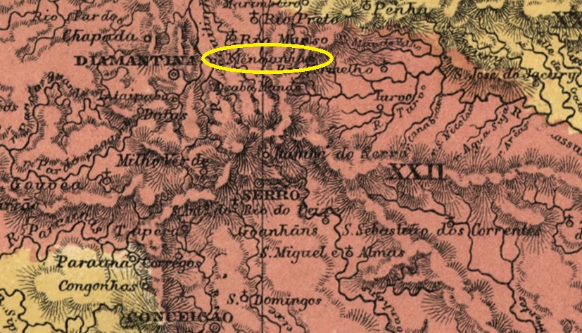
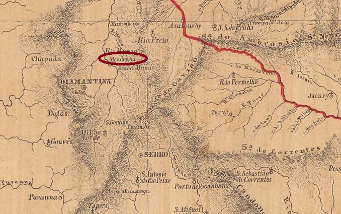
This district of Vila de Diamantina on the west bank of the Jequitinhonha River had existed since November 1865, 400 km north of the provincial capital Ouro Preto. Eight years later, it was elevated to the status of Freguesia de Nossa Senhora das Mercês do Mendanha. In September 1923, Mendanha was placed under the jurisdiction of the municipality of Rio Manso as a district, but returned to the municipality of Diamantina in December 1938.
As reported by the Rio press, there had been a post office there since November 1881:
Jornal do Commercio/RJ, 12 November 1881
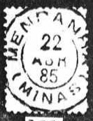
The only imperial postmark to date is MMG-1600a (illustration by Koester in Carimbologia XXVII):
MMG-1600a (RK) 1885Provincia de Minas Geraes, 1873
Dieser Distrikt der Vila de Diamantina am Westufer des Jequitinhonha bestand seit November 1865, 400 km nördlich der Provinzhauptstadt Ouro Preto. Acht Jahre später wurde er zur Freguesia de Nossa Senhora das Mercês do Mendanha erhoben. Im September 1923 wurde Mendanha als Distrikt dem Munizip Rio Manso unterstellt, kehrte jedoch im Dezember 1938 zum Munizip Diamantina zurück.
Wie die Presse aus Rio bekannt gab, gab es dort seit November 1881 ein Postamt:
Jornal do Commercio/RJ, 12.11.1881
Der bisher einzige kaiserliche Poststempel ist MMG-1600a (Abb. Koester in Carimbologia XXVII):
Villiers de l’Ile Adam: Carta (…) da Provincia de Minas Geraes, 1849
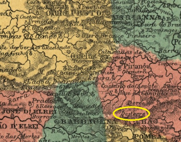
Other names: Desterro do Mello
Founded in 1842, the District of Desterro do Mello belonged to the town of Barbacena and was located on the north bank of the Xopotó River, 150 km south of the provincial capital Ouro Preto. In October 1871, it was elevated to the parish of N. Sra. de Mello do Desterro and finally, in December 1962, to an independent municipality, which once again bore the name Desterro do Melo (in today’s spelling). The Portuguese José de Mello was one of the first European settlers in the region in 1761.
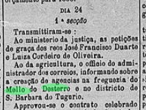
According to Paula Sobrinho (História Postal de Minas Gerais, Belo Horizonte, 1997) and R. Koester (Carimbologia XXVII), there had been a post office there since April 1885. However, this probably corresponds to the opening of the agency, as it was announced in the regional press a month earlier:
Liberal Mineiro, 30 March 1885
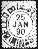
The oldest postmark to date is MMG-1595a (Fig. Koester, op. cit.).
MMG-1595a (RK) 1890Atlas do Imperio do Brasil, 1868
Andere Namen: Desterro do Mello
Der 1842 gegründete Distrito de Desterro do Mello gehörte zur Vila de Barbacena und lag am Nordufer des Xopotó, 150 km südlich der Provinzhauptstadt Ouro Preto. Im Oktober 1871 wurde er zur Freguesia de N. Sra. de Mello do Desterro erhoben und im Dezember 1962 schließlich zum eigenständigen Município, das wieder den Namen Desterro do Melo (in der heutigen Schreibweise) trug. Der Portugiese José de Mello war 1761 einer der ersten europäischen Siedler in der Region.
Laut Paula Sobrinho (História Postal de Minas Gerais, Belo Horizonte, 1997) und R. Koester (Carimbologia XXVII) gab es dort seit April 1885 ein Postamt. Dies dürfte jedoch der Inbetriebnahme der Agentur entsprechen, da diese einen Monat zuvor in der regionalen Presse angekündigt wurde:
Liberal Mineiro, 30.03.1885
Der bisher älteste Poststempel ist MMG-1595a (Abb. Koester, op. cit.)
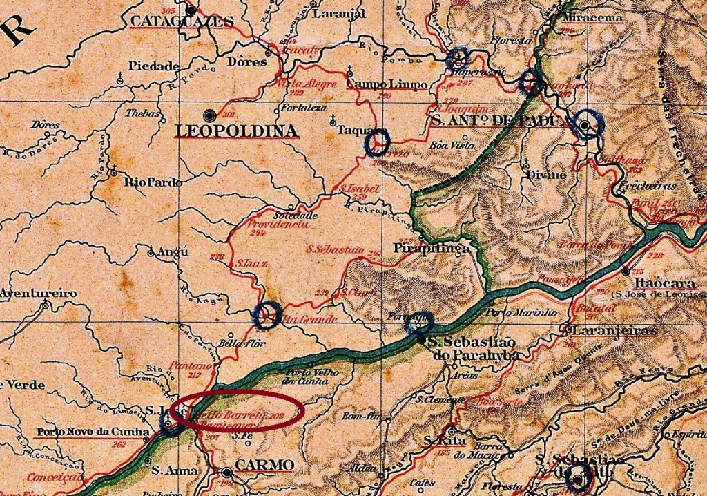
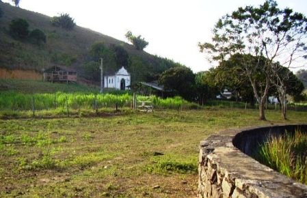
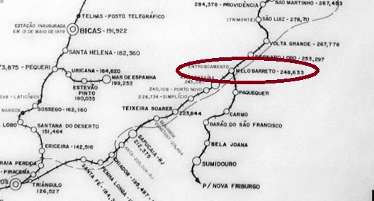
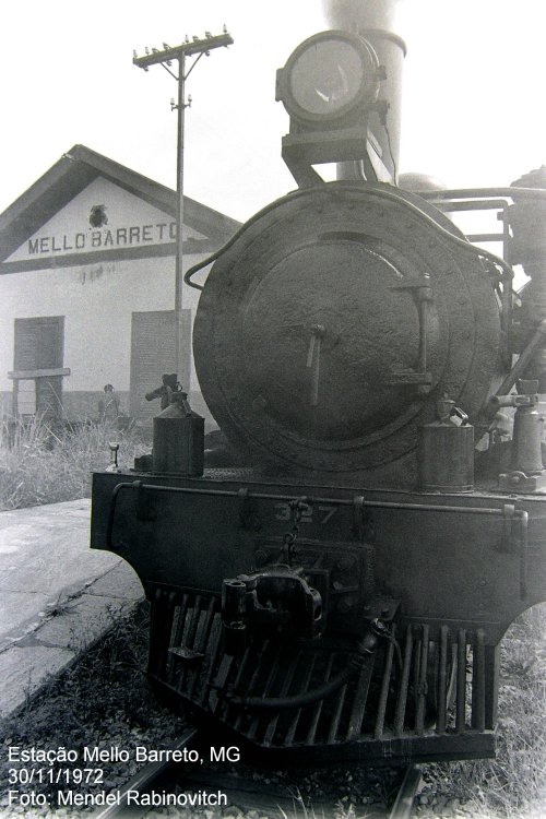
Mello Barreto Station was opened in April 1887 by the E. F. Leopoldina railway company (Main Line) on the north bank of the Paraíba do Sul in the municipality of Além Paraíba. It was located 300 km southeast of the provincial capital Ouro Preto. Antonio Paulo de Mello Barreto (1839-1908) was a director of Leopoldina. Ralph Giesbrecht writes on his website estacoesferroviarias.com.br that the station used to be called ‘Entroncamento’ (junction) because the branch line to Sumidouro in the province of Rio de Janeiro started from there. The railway line belonged to Rede Ferroviaria Federal S.A. from 1975 until it was decommissioned in 1996. Today, the tracks are still there, but the station building has already been demolished.
In November 1972 (photo: Mendel Rabinovitch, on estacoesferroviarias.com.br)In July 2007 (photo: Ricardo Quinteiro de Mattos, on estacoesferroviarias.com.br)
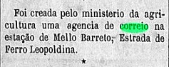
Both Paula Sobrinho (História Postal de Minas Gerais, Belo Horizonte, 1997) and R. Koester (Carimbologia XXVII) write that there had been a post office there since February 1888. This is confirmed by the Rio press:
Gazeta Nacional/RJ, 17 February 1888
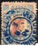
The imperial postmark is MMG-1590a (Fig. Filatélica Minas Gerais), which is also available in blue:
MMG-1590a (FMG) 1888-1891Amarildo Mayrink: E. F. Leopoldina
Andere Namen: Entroncamento
Der Bahnhof Mello Barreto wurde im April 1887 durch die Eisenbahngesellschaft E. F. Leopoldina (Hauptlinie) am Nordufer des Paraíba do Sul im Município de Além Paraíba eröffnet. Er lag 300 km südöstlich der Provinzhauptstadt Ouro Preto. Antonio Paulo de Mello Barreto (1839-1908) war ein Direktor der Leopoldina. Ralph Giesbrecht schreibt auf seiner Website estacoesferroviarias.com.br, dass der Bahnhof früher „Entroncamento” (Abzweigung) hieß, da von dort aus die Nebenlinie nach Sumidouro in der Provinz Rio de Janeiro startete. Die Bahnlinie gehörte von 1975 bis zur Stilllegung im Jahr 1996 der Rede Ferroviaria Federal S.A. Heute sind die Gleise noch vorhanden, das Bahnhofsgebäude wurde jedoch bereits abgerissen.
Im November 1972 (Foto: Mendel Rabinovitch, auf estacoesferroviarias.com.br)Im Juli 2007 (Foto: Ricardo Quinteiro de Mattos, auf estacoesferroviarias.com.br)
Sowohl Paula Sobrinho (História Postal de Minas Gerais, Belo Horizonte, 1997) als auch R. Koester (Carimbologia XXVII) schreiben, dass es dort seit Februar 1888 ein Postamt gab. Dies wird durch die Presse von Rio bestätigt:
Gazeta Nacional/RJ, 17.02.1888
Der kaiserliche Poststempel ist MMG-1590a (Abb. Filatélica Minas Gerais), den es auch in Blau gibt:
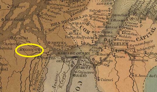
Villiers de l’Ile Adam: Carta (…) das Provincias do Grão-Pará e Alto Amazonas, 1850
Other names: Arycuru
The former settlement of Arycuru was located on the western shore of what is now Melgaço Bay, 250 kilometres west of the later provincial capital Belém do Pará.
In 1758, it was elevated to the status of Vila de Melgaço, named after a town on the Upper Minho in Portugal, which had a population of 1,560 in 2011. In January 1851, it was designated Freguesia de São Miguel de Melgaço in the territory of Vila de Breves. In August 1856, Melgaço became an independent vila. In November 1930, Melgaço was downgraded to a district, but in December 1961 it was again designated a município.
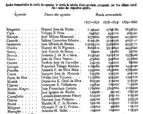
We do not know when the local post office was opened, but it was in operation by 1877 at the latest, as evidenced by the provincial president’s report from February 1881:
Relatorio do Presidente da Provincia, February 1881
No imperial postmark from Melgaço in the province of Pará has been seen to date.
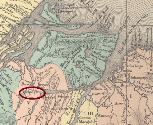
Atlas do Imperio do Brasil, 1868
Andere Namen: Arycuru
Die ehemalige Siedlung Arycuru lag am Westufer der heutigen Bucht von Melgaço, 250 Kilometer westlich der späteren Provinzhauptstadt Belém do Pará.
Im Jahr 1758 wurde sie zur Vila de Melgaço erhoben, benannt nach einer Ortschaft am Oberen Minho in Portugal, die im Jahr 2011 1.560 Einwohner zählte. Im Januar 1851 erfolgte die Ernennung zur Freguesia de São Miguel de Melgaço im Gebiet der Vila de Breves. Im August 1856 wurde Melgaço eine eigenständige Vila. Im November 1930 wurde Melgaço zum Distrikt herabgestuft, im Dezember 1961 jedoch wieder zum Município ernannt.
Wir wissen nicht, wann das örtliche Postamt eröffnet wurde; es war jedoch spätestens 1877 in Betrieb, wie aus dem Bericht des Provinzpräsidenten vom Februar 1881 hervorgeht:
Relatorio do Presidente da Provincia, Februar 1881
Bisher wurde kein kaiserlicher Poststempel aus Melgaço in der Provinz Pará gesehen.