Categories
Carimbologia E-G

Entroncamento (train station/Bahnhof – E.F. Macahe e Campos), Rio de Janeiro (ERJ-0480)

Almanak Laemmert, 1892

Other names: Conde de Araruama

See also Santa Fé de Macabu (SRJ-2235)

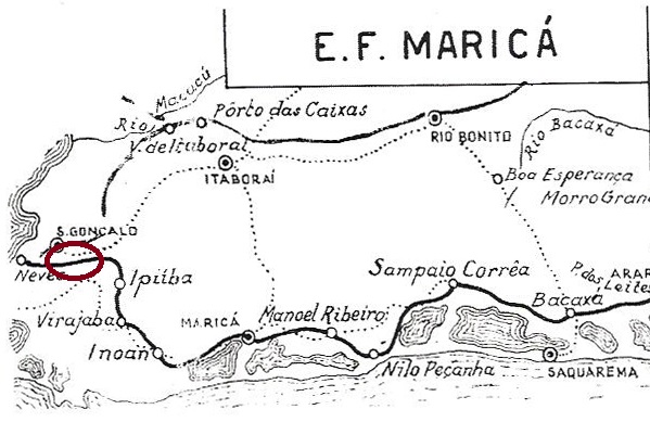
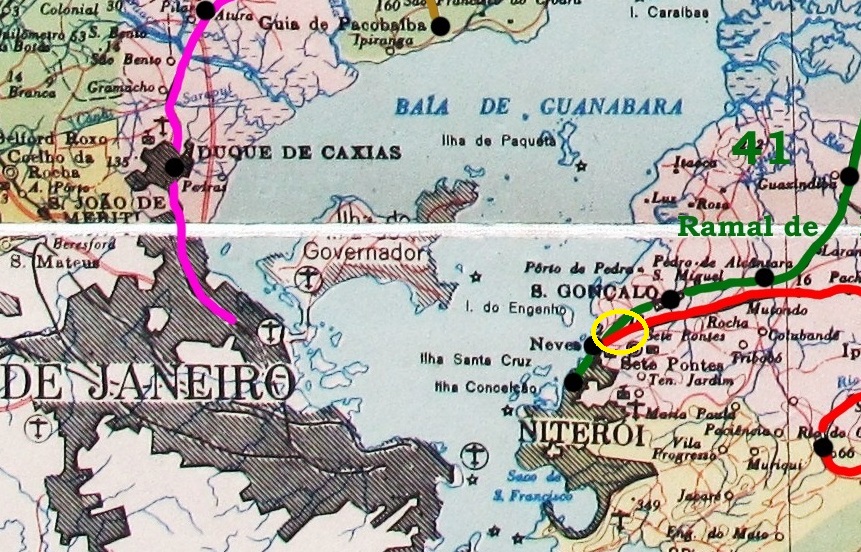
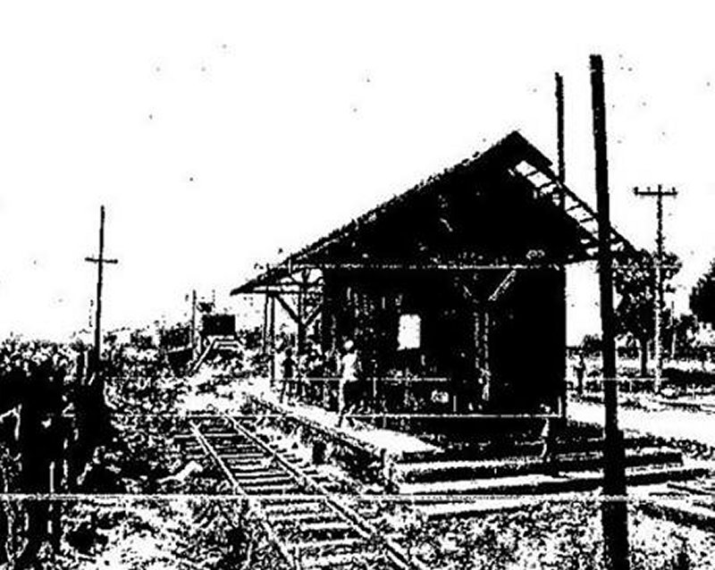
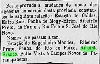
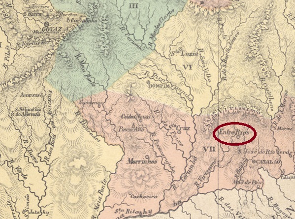
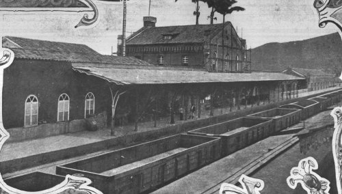
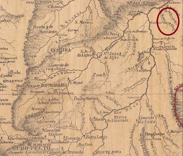
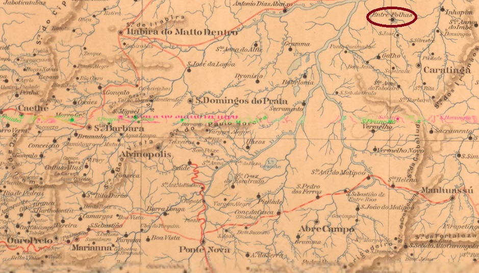
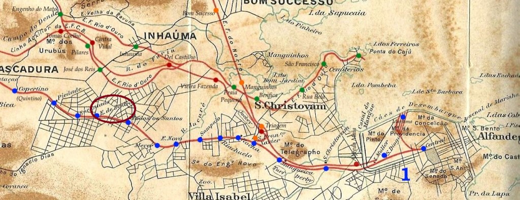
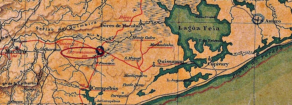
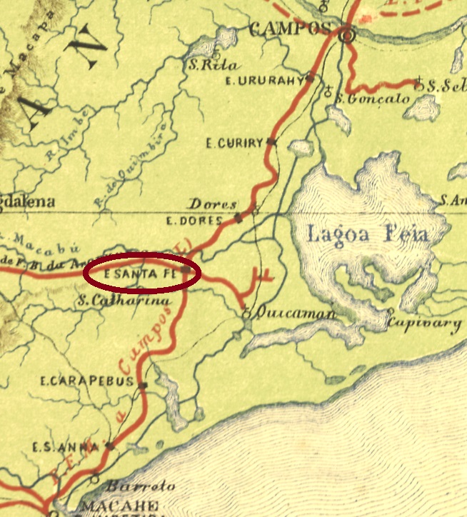
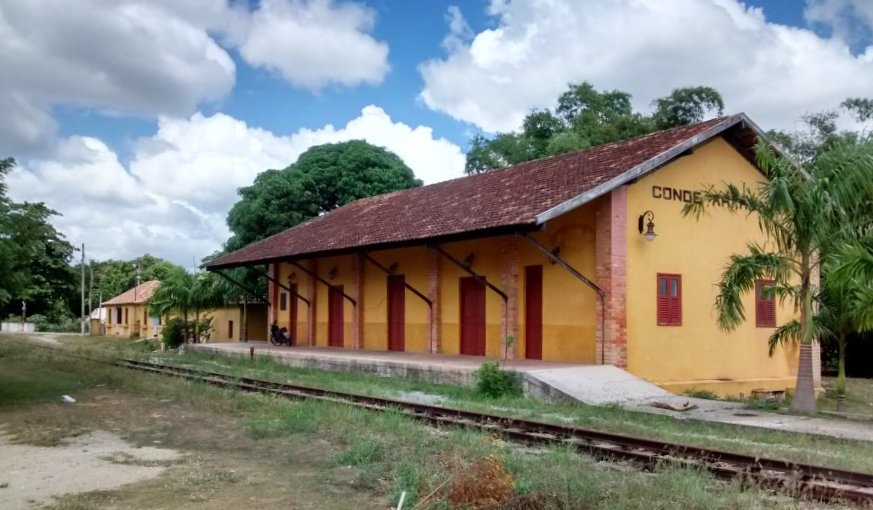
Santa Fé de Macabu (or simply Santa Fé) station was built in 1875 by the Estrada de Ferro de Macaé a Campos in the municipality of Quissaman, over 200 km northeast of Rio de Janeiro. Three years later, it moved two kilometers away, to stay directly at the crossing with the Santa Maria Magdalena railway branch. For this reason, the station was renamed as Entroncamento (= crossing) in December 1886, and changed the name again in August 1897, to Conde de Araruama. The railway control changed too, in 1887 to the Estrada de Ferro Leopoldina, and from 1975 until operation end in 1996, to the Rede Ferroviária Federal S.A. The station house is nowadays a restaurant.

In 2017 (Foto: Leandro Santos, on estacoesferroviarias.com.br)

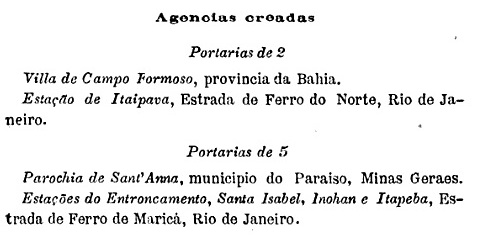
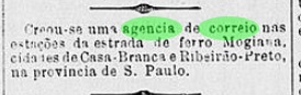
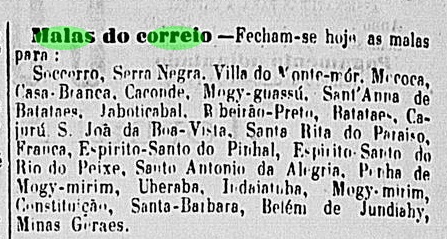
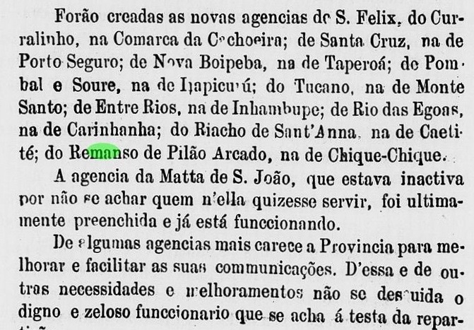
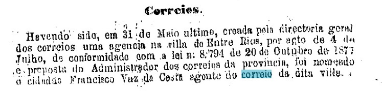
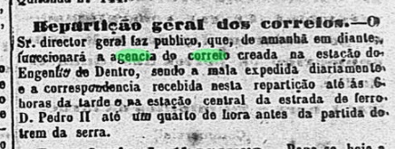
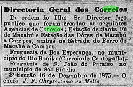
The station post office was created in December 1875, as noticed by the Rio press:

 O Globo, 17.12.1875

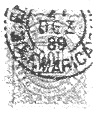
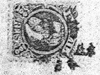
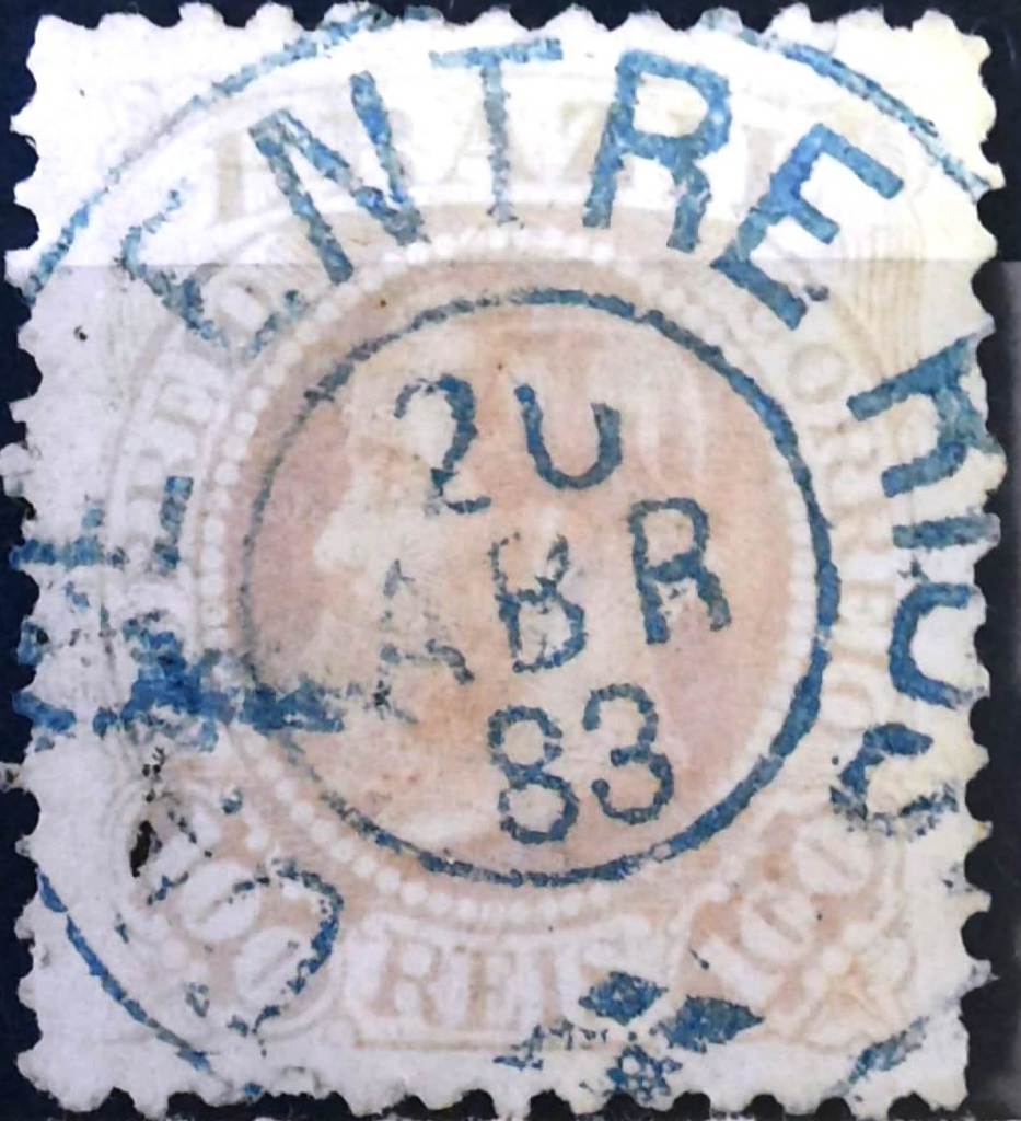
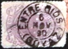
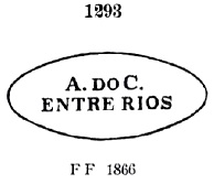
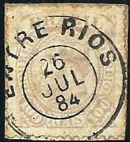
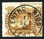
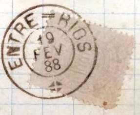
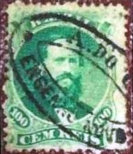
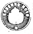
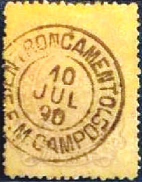
Postmarks with Santa Fé de Macabu (see SRJ-2235) have been found with dates up to 1890. It is therefore unlikely that Entroncamento postmarks with dates from the imperial period exist. The first of the republican cancels is ERJ-0480a (coll. Fuad Ferreira Fo.):

ERJ-0480a (FF) 1890-1891

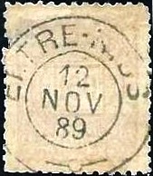
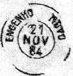
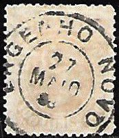
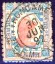
This was followed by ERJ-0480b (image from the Internet):

ERJ-0480b (EB) 1892
E.F. Central do Brasil, 1890

Andere Namen: Conde de Araruama

Siehe also Santa Fé de Macabu (SRJ-2235)

Der Bahnhof Santa Fé de Macabu (oder einfach Santa Fé) wurde 1875 durch die Estrada de Ferro de Macaé a Campos im Município von Quissaman erbaut und lag über 200 km nordöstlich von Rio de Janeiro entfernt. Drei Jahre später zog er 2 km weiter um, dadurch lag er direkt an der Linienkreuzung mit der Abzweigung nach Santa Maria Magdalena. Deswegen wurde der Bahnhof im Dezember 1886 Entroncamento (= Kreuzung) umbenannt. Er wechselte abermals den Namen im August 1897 und hieß fortan Conde de Araruama. Die Bahnlinie wechselte ebenfalls: 1887 zur Estrada de Ferro Leopoldina, und von 1975 bis Betriebsende 1996, zur Rede Ferroviária Federal S.A. Heute wird das Bahnhofsgebäude als Restaurant benutzt.

2017 (Foto: Leandro Santos, auf estacoesferroviarias.com.br)

Das Bahnhofspostamt entstand im Dezember 1875, wie die Presse aus Rio berichtet:

O Globo, 17.12.1875

Poststempel mit Santa Fé de Macabu (siehe SRJ-2235) wurden mit Daten bis 1890 gefunden. Es ist daher unwahrscheinlich, dass Entroncamento-Stempel mit Daten aus der Kaiserzeit existieren. Der erste republikanische Stempel ist ERJ-0480a (Samml. Fuad Ferreira Fo.):

ERJ-0480a (FF) 1890-1891

Es folgte ERJ-0480b (Abbildung aus dem Internet):

ERJ-0480b (EB) 1892
Categories
Carimbologia E-G

Entroncamento (train station/Bahnhof – E.F. de Maricá), Rio de Janeiro (ERJ-0475)

Estrada de Ferro de Maricá

Other names: Vila Lage, Ligação Maricá

This station was opened in November 1888 by the E.F. Maricá railway company in the Município de São Gonçalo, 20 km north-east of the capital Rio de Janeiro. The line soon became the property of E.F. Leopoldina and belonged to Rede Ferroviária Federal S.A. from 1971 until its closure in 1996 (estacoesferroviarias.com.br). Today, the building has been demolished and the tracks removed.

In 1980, as Vila Lage railway station (on estacoesferroviarias.com.br)

Paulo Novaes (agenciaspostais.com.br) writes that there had been a post office there since October 1889. This is confirmed by the postal bulletin (Boletim Postal) of the following month:

Boletim Postal No. 7, November 1889

According to Novaes (op. cit.), the agency was closed again in December 1896. The oldest postmark from this agency to date is the rare ERJ-0475a (fig. R. Koester, in Carimbologia XVIII):

 ERJ-0475a (RK) 1889, dark violet
agenciaspostais.com.br

Andere Namen: Vila Lage, Ligação Maricá

Dieser Bahnhof wurde im November 1888 von der Eisenbahngesellschaft E.F. Maricá im Município de São Gonçalo, 20 km nordöstlich der Hauptstadt Rio de Janeiro, eröffnet. Die Strecke ging bald in den Besitz der E.F. Leopoldina über und gehörte von 1971 bis zu ihrer Stilllegung 1996 der Rede Ferroviária Federal S.A. (estacoesferroviarias.com.br). Heute ist das Gebäude abgerissen und die Gleise entfernt.

1980, als Bahnhof Vila Lage (auf estacoesferroviarias.com.br)

Paulo Novaes (agenciaspostais.com.br) schreibt, dass es dort seit Oktober 1889 ein Postamt gab. Dies wird durch das Postbulletin (Boletim Postal) des folgenden Monats bestätigt:

Boletim Postal Nr. 7, November 1889

Nach Novaes (a.a.O.) wurde die Agentur im Dezember 1896 wieder geschlossen. Der bisher älteste Poststempel von dieser Agentur ist der seltene ERJ-0475a (Abb. R. Koester, in Carimbologia XVIII):

 ERJ-0475a (RK) 1889, dunkelviolett
Categories
Carimbologia E-G

Entre Rios, São Paulo (ESP-0455)

J. M. Ribeiro Lisboa: Provincia de São Paulo, 1884

See also Ribeirão Preto (RSP-1095)

The district of São Sebastião do Ribeirão Preto was founded in April 1870 around 300 kilometres northwest of São Paulo in the vila of São Simão. The town must have experienced a rapid upswing in the years that followed, as political emancipation took place just one year later and Ribeirão Preto became a villa. A name change to Entre-Rios in 1879 led to fierce resistance among the population, and two years later the old place name was rehabilitated. In April 1889, shortly before the proclamation of the Republic, Ribeirão Preto became a town.

The exact date of the founding of the local post office has not yet been determined. However, as the first mention in the press dates to August 1875, it can be assumed that the post office was established shortly before:

Correio Paulistano, 15/08/1875

The railway station was built in November 1883 by the Cia. Mogyana railway company and was located about 3 km south of the town centre. According to the 1885 list of imperial post offices (Tabella das Agencias do Correio do Império), the station post office was established in 1884. This is confirmed by the press from Rio:

Brazil/RJ, 08/04/1884

Reinhold Koester (Carimbologia XVII) shows a postmark with Entre-Rios under ESP-0455a, which was used between 1882 and 1884, long after the town was called Ribeirão Preto again:

ESP-0455a (RK) 1882-1884

Koester also shows a local mute cancellation from 1882:

1882 (RK)

In fact, the old official name for the post office was not restored until 1886:

Correio Paulistano, 14/09/1886

For postmarks with Ribeirão Preto see RSP-1095.

Provincia de São Paulo, 1879

Siehe auch Ribeirão Preto (RSP-1095)

Der Distrikt São Sebastião do Ribeirão Preto wurde im April 1870 etwa 300 km nordwestlich von São Paulo in der Villa de São Simão gegründet. In der Folgezeit muss der Ort einen raschen Aufschwung erlebt haben, denn bereits ein Jahr später erfolgte die politische Emanzipation und Ribeirão Preto wurde zu einer Villa. Eine Namensänderung in Entre-Rios im Jahre 1879 führte zu heftigem Widerstand in der Bevölkerung, und zwei Jahre später wurde der alte Ortsname rehabilitiert. Im April 1889, kurz vor der Ausrufung der Republik, wurde Ribeirão Preto eine Stadt.

Das genaue Datum der Gründung des örtlichen Postamtes konnte bisher nicht ermittelt werden. Da aber die erste Erwähnung in der Presse vom August 1875 stammt, kann man davon ausgehen, dass das Postamt kurz vorher eingerichtet wurde:

Correio Paulistano, 15.08.1875

Der Bahnhof wurde im November 1883 von der Eisenbahngesellschaft Cia. Mogyana gebaut und befand sich etwa 3 km südlich des Ortszentrums. Nach dem Verzeichnis der kaiserlichen Postämter von 1885 (Tabella das Agencias do Correio do Império) wurde das Bahnhofspostamt 1884 eingerichtet. Dies wird durch die Presse aus Rio bestätigt:

Brazil/RJ, 08.04.1884

Reinhold Koester (Carimbologia XVII) zeigt unter ESP-0455a einen Poststempel mit Entre-Rios, der zwischen 1882 und 1884 verwendet wurde, also lange nachdem der Ort wieder Ribeirão Preto hieß:

ESP-0455a (RK) 1882-1884

Aus dem Jahr 1882 zeigt Koester auch einen stummen Stempel von dort:

1882 (RK)

Tatsächlich wurde der alte offizielle Name für das Postamt erst 1886 wiederhergestellt:

Correio Paulistano, 14.09.1886

Für Stempel mit Ribeirão Preto siehe RSP-1095.

Categories
Carimbologia E-G

Entre Rios, Bahia (EBA-0350)

Carta da Republica dos Estados Unidos do Brazil, 1892

Other names: N. Sra. dos Prazeres

This place had been the Freguesia de N. Sra. dos Prazeres de Inhambupe since July 1848, belonged to the Vila de Inhambupe and was situated between the Inhambupe and Subaúma rivers, 140 kilometres north of the provincial capital Salvador da Bahia. In April 1872 it was elevated to Vila de Entre Rios, in its own município.

R. Koester writes in Carimbologia XVII that there had been a post office there since August 1875. This is confirmed by the report of the provincial president the following year:

Relatorio do Presidente da Provincia, 1876

So far, no imperial postmark could be assigned to this place with certainty.

Mappa Geral do Brazil, 1911

Andere Namen: N. Sra. dos Prazeres

Dieser Ort war seit Juli 1848 die Freguesia de N. Sra. dos Prazeres de Inhambupe, gehörte zur Vila de Inhambupe und lag zwischen den Flüssen Inhambupe und Subaúma, 140 km nördlich der Provinzhauptstadt Salvador da Bahia. Im April 1872 erfolgte die Erhebung zur Vila de Entre Rios, im eigenen Município.

R. Koester schreibt in Carimbologia XVII, dass es dort seit August 1875 ein Postamt gab. Dies wird durch den Bericht des Provinzpräsidenten im folgenden Jahr bestätigt:

Relatorio do Presidente da Provincia, 1876

Bisher konnte kein kaiserlicher Poststempel mit Sicherheit diesem Ort zugeordnet werden.

Categories
Carimbologia E-G

Entre Rios, Minas Gerais (EMG-1120)

Provincia de Minas Geraes, 1873

Other names: Brumado, João Ribeiro, Entre Rios de Minas (1953)

See also Brumado (Suassuhy, BMG-0410)

The parish of N. Sra. das Grotas de Brumado was founded in July 1832, belonged to the Vila of Queluz and was located between the rivers Brumado and Camapuã, 90 km southwest of the provincial capital Ouro Preto. In January 1875, it became the Vila of Brumado do Suassuhy, which was renamed Entre Rios in October 1878. In January 1880, it became a town, and has since had two new names: in December 1938, it was called João Ribeiro, and 15 years later, Entre Rios de Minas.

Two dates of origin were found for the local post office. As they are close to each other, the second date could be when the agency started operating. First in March 1867, as can be read in Administrações e Agencias Postaes do Brasil Imperio (Brasil Filatelico/RJ, 1934-5; Reprint SPP 1994-1999). Then again in July of the same year, as Paula Sobrinho writes in História Postal de Minas Gerais (Belo Horizonte, 1997).

The oldest postmark to date with the place name Entre Rios is EMG-1120a (ill. Marcio Javaroni), which also exists in blue:

EMG-1120a (MJ) 1880ff-1887

For cancels with Brumado see BMG-0410.

Atlas do Imperio do Brasil, 1868

Andere Namen: Brumado, João Ribeiro, Entre Rios de Minas (1953)

Siehe auch Brumado (Suassuhy, BMG-0410)

Die Pfarrei von N. Sra. das Grotas de Brumado wurde im Juli 1832 gegründet, gehörte der Vila von Queluz und lag zwischen den Flüssen Brumado und Camapuã, 90 km südwestlich der Provinzhauptstadt Ouro Preto entfernt. Im Januar 1875 wurde daraus die Vila von Brumado do Suassuhy, die im Oktober 1878 zu Entre Rios umbenannt wurde. Im Januar 1880 erfolgte die Ernennung zu einer Stadt, die seitdem zwei neue Namen bekam: im Dezember 1938 hieß sie João Ribeiro und 15 Jahre später Entre Rios de Minas.

Zwei Entstehungsdaten wurden fürs örtliche Postamt gefunden. Da sie eng beieinander liegen, könnte das zweite Datum die der Inbetriebnahme der Agentur sein. Erstmals im März 1867, wie man im Administrações e Agencias Postaes do Brasil Imperio (Brasil Filatelico/RJ, 1934-5; Reprint SPP 1994-1999) lesen kann. Dann wieder im Juli desselben Jahres, wie Paula Sobrinho in História Postal de Minas Gerais (Belo Horizonte, 1997) schreibt.

Der bisher älteste Poststempel mit Ortsnamen Entre Rios ist EMG-1120a (Abb. Marcio Javaroni), den es auch in Blau gibt:

EMG-1120a (MJ) 1880ff-1887

Für Poststempel mit Brumado siehe BMG-0410.

Categories
Carimbologia E-G

Entre Rios, Goiás (EGO-0065)

Atlas do Imperio do Brasil, 1868

Other names: Espirito Santo do Vai-Vem, Ipameri (1904)

The Freguesia do Divino Espirito Santo do Vai-Vem (Holy Spirit of Vai-Vem), founded in July 1845, belonged to Vila de Catalão and was located between the large rivers Veríssimo and Braço, 340 kilometres south-east of the provincial capital Goyaz (today: Goiás Velho). The Vai-Vem was a small river that flowed through the town. In July 1858, it was elevated to the status of Vila de Entre-Rios, which initially only existed until August 1863, when Entre Rios once again became a freguesia of Catalão. A second elevation do vila occurred in September 1870. Since April 1880, Entre Rios has been a town, which was renamed Município de Ipameri in March 1904, probably to avoid confusion with places of the same name in the country. The name comes from the Tupi-Guarani and means between the rivers.

R. Koester writes in Carimbologia XVII that there had been a post office there since May 1878, which is confirmed by the July report of the provincial president:

Relatorio do Presidente da Provincia 07/1878

The only imperial postmark to date is EGO-0065a (image from the internet):

EGO-0065a (EB) 1887ff-1901
Carta da Provincia de Goyaz, 1875

Andere Namen: Espirito Santo do Vai-Vem, Ipameri (1904)

Die im Juli 1845 gegründete Freguesia do Divino Espirito Santo do Vai-Vem (Heiliger Geist des Vai-Vem) gehörte zu Vila de Catalão und lag zwischen den großen Flüssen Veríssimo und Braço, 340 km südöstlich der Provinzhauptstadt Goyaz (heute: Goiás Velho). Der Vai-Vem war ein kleiner Fluss, der den Ort durchfloss. Im Juli 1858 erfolgte die Erhebung zur Vila de Entre-Rios, die zunächst nur bis August 1863 bestand, als Entre Rios wieder eine Freguesia von Catalão wurde. Die erneute Erhebung zur Vila erfolgte im September 1870. Seit April 1880 ist Entre Rios eine Stadt, die im März 1904 in Município de Ipameri umbenannt wurde, wahrscheinlich um Verwechslungen mit gleichnamigen Orten im Land zu vermeiden. Der Name stammt aus dem Tupi-Guarani und bedeutet zwischen den Flüssen.

R. Koester schreibt in Carimbologia XVII, dass es dort seit Mai 1878 ein Postamt gab, was durch den Juli-Bericht des Provinzpräsidenten bestätigt wird:

Relatorio do Presidente da Provincia 07/1878

Der bisher einzige kaiserliche Stempel ist EGO-0065a (Abbildung aus dem Internet):

EGO-0065a (EB) 1887ff-1901
Categories
Carimbologia E-G

Entre Rios (train station/Bahnhof), Rio de Janeiro (ERJ-1765)

Estações (…) do Rio de Janeiro, São Paulo e Minas Geraes, 1880

Other names: Três Rios (1944)

The Entre Rios (Between the Rivers) station was opened in October 1867 by the railway company E.F.D. Pedro II (Central Line) on the north bank of the Paraíba do Sul in the area of the Vila of the same name, 130 km north of the capital Rio de Janeiro. The line was taken over by E.F. Central do Brasil in 1889, belonged to Rede Ferroviária Federal S.A. from 1975 to 1997 and has been operated by the MRS consortium since 2012. In 1944, the station name was changed to Três Rios (Three Rivers).

1908: Photo from Memoria Historica da EFCB (Manuel F. Figueira, on estacoesferroviarias.com.br)
In October 2012 (photo: Jorge A. Ferreira Jr. on estacoesferroviarias.com.br)

The area around the railway station became the Município de Entre Rios in December 1938, which was renamed Três Rios two weeks later. The three rivers here are the Paraíba and its tributaries Paraibuna and Preto.

As Paulo Novaes (agenciaspostais.com.br) writes, there had been a railway station post office since August 1861. The oldest postmark is ERJ-1765a, which was already presented by Paulo Ayres (Catálogo de Carimbos Brasil-Império, S. Paulo, 1937, 1942) under no. 1293:

ERJ-1765a (P.A. 1293) 1861-1876ff

This was followed by ERJ-1765b (fig. agenciaspostais.com.br), the attribution of which is not certain according to R. Koester (Carimbologia XVII):

ERJ-1765b (PN) 1884-1886

Then came ERJ-1765c (illus. Rodrigo Baldassare):

ERJ-1765c (RB) 1886-1888

The rare ERJ-1765d comes from the Everaldo N. dos Santos collection:

ERJ-1765d (ENS) 1888

ERJ-1765e (fig. agenciaspostais.com.br), which also occurs in blue, also appeared at the end of the Empire:

ERJ-1765e (PN) 1888ff-1891
Atlas do Imperio do Brasil, 1868

Andere Namen: Três Rios (1944)

Der Bahnhof Entre Rios (Zwischen den Flüssen) wurde im Oktober 1867 von der Eisenbahngesellschaft E.F.D. Pedro II (Hauptlinie) eröffnet und liegt am Nordufer des Paraíba do Sul im Gebiet der gleichnamigen Vila, 130 km nördlich der Hauptstadt Rio de Janeiro. Die Strecke wurde 1889 von der E.F. Central do Brasil übernommen, gehörte von 1975 bis 1997 der Rede Ferroviária Federal S.A. und wird seit 2012 vom Konsortium MRS betrieben. 1944 wurde der Stationsname in Três Rios (Drei Flüsse) geändert.

1908: Foto aus Memoria Historica da EFCB (Manuel F. Figueira, auf estacoesferroviarias.com.br)
Im Oktober 2012 (Foto: Jorge A. Ferreira Jr. auf estacoesferroviarias.com.br)

Das Gebiet um den Bahnhof wurde im Dezember 1938 zum Município de Entre Rios, das zwei Wochen später in Três Rios umbenannt wurde. Die drei Flüsse sind hier der Paraíba und seine Nebenflüsse Paraibuna und Preto.

Wie Paulo Novaes (agenciaspostais.com.br) schreibt, gab es seit August 1861 ein Bahnhofspostamt. Der älteste Poststempel ist ERJ-1765a, der bereits von Paulo Ayres (Catálogo de Carimbos Brasil-Império, S. Paulo, 1937, 1942) mit der Nr. 1293 vorgestellt wurde:

ERJ-1765a (P.A. 1293) 1861-1876ff

Es folgte ERJ-1765b (Abb. agenciaspostais.com.br), dessen Zuschreibung laut R. Koester (Carimbologia XVII) nicht sicher ist:

ERJ-1765b (PN) 1884-1886

Dann kam ERJ-1765c (Abb. Rodrigo Baldassare):

ERJ-1765c (RB) 1886-1888

Aus der Sammlung Everaldo N. dos Santos stammt der seltene ERJ-1765d:

ERJ-1765d (ENS) 1888

Am Ende des Kaiserreichs erschien auch ERJ-1765e (Abb. agenciaspostais.com.br), der auch in blau vorkommt:

ERJ-1765e (PN) 1888ff-1891
Categories
Carimbologia E-G

Entre Folhas, Minas Gerais (EMG-1115)

Provincia de Minas Geraes, 1873

Other names: Vargem Alegre

The Freguesia de N. Sra. do Rosário de Entre Folhas, which has existed since March 1889, belonged to the Vila de Caratinga and was located on the west bank of the Entre Folhas (Among Leaves) river, 250 kilometres north-east of the provincial capital Ouro Preto. In December 1953, the village was renamed Vargem Alegre as a district and has been a município under the old place name Entre Folhas since April 1992.

Both Paula Sobrinho (História Postal de Minas Gerais, Belo Horizonte, 1997) and R. Koester (Carimbologia XVII) write that there has been a post office there since November 1887. No imperial postmarks from this place are known to date.

Estado de Minas Geraes, 1910

Andere Namen: Vargem Alegre

Die seit März 1889 bestehende Freguesia de N. Sra. do Rosário de Entre Folhas gehörte zur Vila de Caratinga und lag am Westufer des Flusses Entre Folhas (Zwischen Blättern), 250 km nordöstlich der Provinzhauptstadt Ouro Preto. Im Dezember 1953 wurde der Ort als Distrikt zu Vargem Alegre umbenannt und ist seit April 1992 ein Município unter dem alten Ortsnamen Entre Folhas.

Sowohl Paula Sobrinho (História Postal de Minas Gerais, Belo Horizonte, 1997) als auch R. Koester (Carimbologia XVII) schreiben, dass es dort seit November 1887 ein Postamt gab. Bisher sind keine kaiserlichen Poststempel aus diesem Ort bekannt.

Categories
Carimbologia E-G

Engenho Novo (train station/Bahnhof), Município Neutro (EMN-0015)

Mappa do Municipio Neutro, ca. 1880

The Engenho Novo (New Sugar Factory) station was opened in 1858 by the railway company E.F. D. Pedro II (Central Line), located 10 km west of the city centre of Rio de Janeiro. The line was transferred to E.F. Central do Brasil in 1889, to Rede Ferroviária Federal S.A. in 1975 and has been operated by the Supervia consortium (estacoesferroviarias.com.br) since 1997.

ca. 1891 (coll. Marc Ferrez, Instituto Moreira Salles, on estacoesferroviarias.com.br)
2007 (Photo Anderson Silva, on estacoesferroviarias.com.br)

As Paulo Novaes (agenciaspostais.com.br) writes, there has been a post office at the railway station since August 1865. The oldest postmark is EMN-0015a (collect. Fuad Ferreira Fo.):

EMN-0015a (FF) 1866ff

Two postmarks as double circles followed:

EMN-0015b (RK) 1884
EMN-0015c (EB) 1880-1890

R. Koester (Carimbologia XVII) also showed the postmark with the imperial seal EMN-0015d:

EMN-0015d (RK)
agenciaspostais.com.br

Der Bahnhof Engenho Novo (Neue Zuckerfabrik) wurde 1858 von der Eisenbahngesellschaft E.F. D. Pedro II (Hauptlinie) eröffnet und liegt 10 km westlich des Stadtzentrums von Rio de Janeiro. Die Strecke ging 1889 an die E.F. Central do Brasil, 1975 an die Rede Ferroviária Federal S.A. und wird seit 1997 vom Konsortium Supervia (estacoesferroviarias.com.br) betrieben.

ca. 1891 (Samml. Marc Ferrez, Instituto Moreira Salles, auf estacoesferroviarias.com.br)
2007 (Foto Anderson Silva, auf estacoesferroviarias.com.br)

Wie Paulo Novaes (agenciaspostais.com.br) schreibt, gab es ein Postamt am Bahnhof seit August 1865. Der älteste Poststempel ist EMN-0015a (Samml. Fuad Ferreira Fo.):

EMN-0015a (FF) 1866ff

Es folgten zwei Poststempel als Doppelkreise:

EMN-0015b (RK) 1884
EMN-0015c (EB) 1880-1890

R. Koester (Carimbologia XVII) zeigte auch den Stempel mit dem kaiserlichen Siegel EMN-0015d:

EMN-0015d (RK)
Categories
Carimbologia E-G

Engenho de Dentro (train station/Bahnhof), Município Neutro (EMN-0090)

Mappa do Municipio Neutro, ca. 1880

Other names: Officinas

This station was opened in 1873 under the name Officinas (Workshops) by the railway company E.F.D. Pedro II (Central Line) 15 km west of the city centre of Rio de Janeiro. In 1889 the line was transferred to E.F. Central do Brasil, in 1975 to Rede Ferroviária Federal S.A. and has been operated by the Supervia consortium since 1997 (estacoesferroviarias.com.br).

1908 (photo on estacoesferroviarias.com.br)
December 2008 (photo J.B. Damasco Penna Jr, on estacoesferroviarias.com.br)

In July 1898, the station was officially renamed Engenho de Dentro, although this name had been used earlier.

According to the Rio press, the station post office was created in July 1874:

Diario do Rio de Janeiro, 08/07/1874

P. Novaes (agenciaspostais.com.br) writes that there were postmarks with Engenho de Dentro from 1898; for postmarks with Officinas see R. Koester (Carimbologia XXIX).

agenciaspostais.com.br

Andere Namen: Officinas

Dieser Bahnhof wurde 1873 unter dem Namen Officinas (Werkstätten) von der Eisenbahngesellschaft E.F.D. Pedro II (Hauptstrecke) eröffnet und liegt 15 km westlich des Stadtzentrums von Rio de Janeiro. 1889 ging die Strecke an die E.F. Central do Brasil, 1975 an die Rede Ferroviária Federal S.A. über und wird seit 1997 vom Konsortium Supervia betrieben (estacoesferroviarias.com.br).

1908 (Foto auf estacoesferroviarias.com.br)
Dezember 2008 (Foto J.B. Damasco Penna Jr, auf estacoesferroviarias.com.br)

Im Juli 1898 wurde der Bahnhof in Engenho de Dentro umbenannt, obwohl dieser Name schon früher verwendet wurde.

Das Bahnhofspostamt wurde laut Presseberichten im Juli 1874 gegründet:

Diario do Rio de Janeiro, 08.07.1874

Nach P. Novaes (agenciaspostais.com.br) gab es Poststempel mit Engenho de Dentro ab 1898; für Stempel mit Officinas siehe R. Koester (Carimbologia XXIX).