Categories
Carimbologia C-D

Carandahy, Minas Gerais (CMG-0610)

Atlas do Imperio do Brasil, 1868

Other names: Sant’Anna da Ressaca

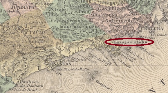
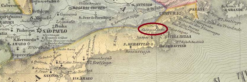
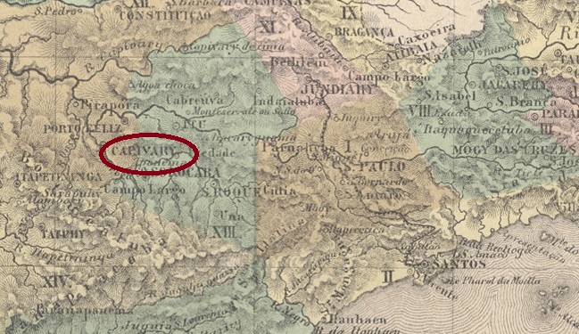
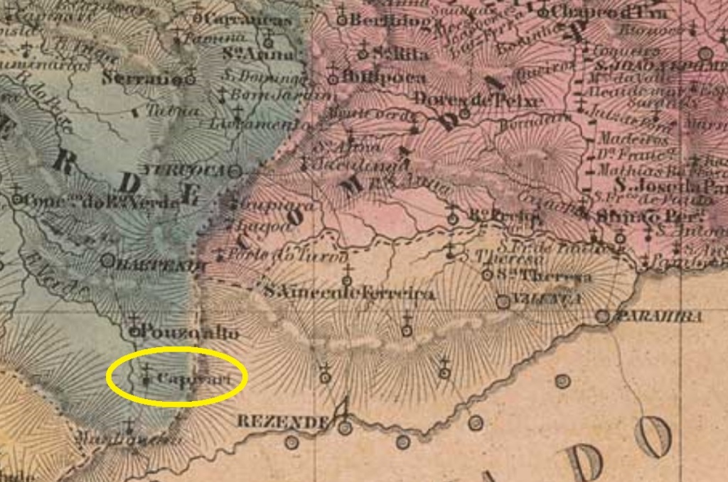
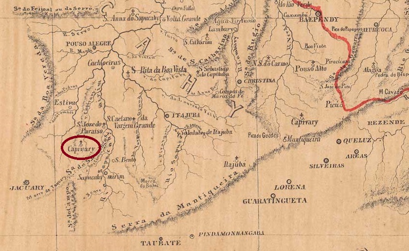
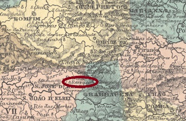
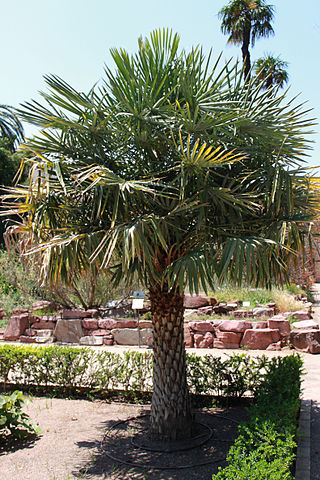
The Freguesia de Sant’Anna da Ressaca was founded in July 1872, belonged to the Vila de S. José d’El-Rei and was located on the south bank of the Carandaí, 90 km south of the provincial capital Ouro Preto. Already in July 1876, the name was changed to Sant’Anna de Carandahy, probably because the village was moved closer to the river. Ressaca was the name of an old fazenda in the area. The name Carandahy comes from the Tupi language and means river of the Carandás. Carandá is a palm from the Arecaceae family, such as Copernica australis.

Copernicia australis Brcc. (Photo falconaumanni, CC-BY-SA-3.0)

Since September 1923, Carandaí (as it is written today) has been an independent município.

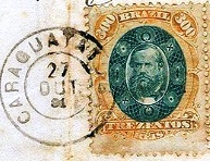
The local post office was opened in May 1875, as both Paula Sobrinho (História Postal de Minas Gerais, Belo Horizonte, 1997) and R. Koester (Carimbologia IX) write. According to them, the existence of a postmark with Sant’Anna da Ressaca would be possible, but it has not been seen so far. Since the post office is not mentioned in the postal guide (Guia Postal do Imperio) of 1880, it can be assumed that it has been closed in the meantime.

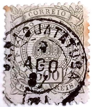
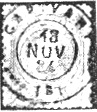
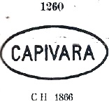
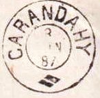
From Carandahy comes the imperial postmark CMG-0610a (image from the internet):

CMG-0610a (Delcampe) 1884-1906

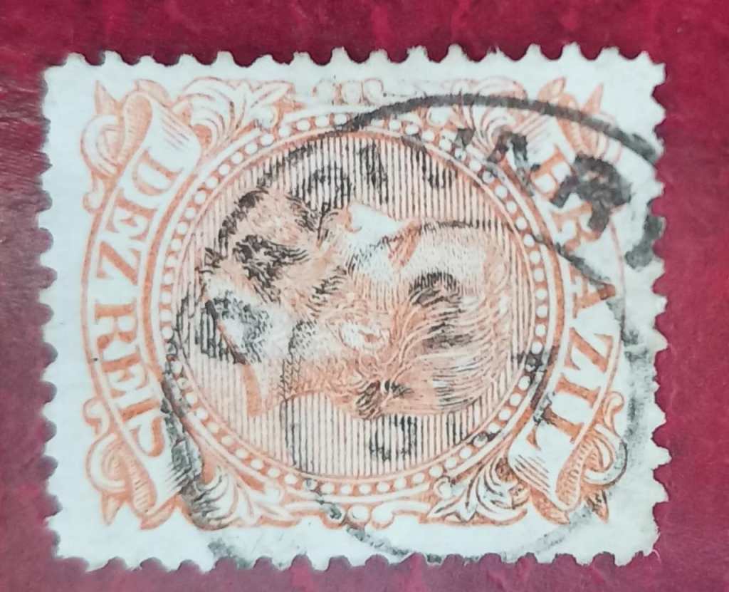
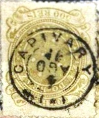
Two mute cancels were also found and registered by James Dingler and Klerman W. Lopes in Mute Cancellations of the Brazil Empire / Carimbos Mudos do Brasil Império (Brazil Philatelic Association, Rio de Janeiro, 2000):

BPA 3921 (P.A. 607) 1875ff-1883ff
BPA 3929
Villiers de l’Ile Adam: Carta (…) da Provincia de Minas Geraes, 1849

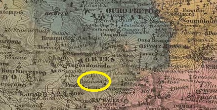
Andere Namen: Sant’Anna da Ressaca

Die Freguesia de Sant’Anna da Ressaca wurde im Juli 1872 gegründet, gehörte zur Vila de S. José d’El-Rei und lag am Südufer des Carandaí, 90 km südlich der Provinzhauptstadt Ouro Preto. Bereits im Juli 1876 wurde der Name in Sant’Anna de Carandahy geändert, wahrscheinlich weil der Ort näher an den Fluss verlegt wurde. Ressaca war der Name einer alten Fazenda in der Gegend. Der Name Carandahy stammt aus der Tupi-Sprache und bedeutet Fluss der Carandás. Carandá ist eine Palme aus der Familie der Arecaceae, wie z.B. Copernica australis.

Copernicia australis Brcc. (Foto: falconaumanni, CC-BY-SA-3.0)

Seit September 1923 ist Carandaí (wie es heute geschrieben wird) ein eigenständiges Município.

Das örtliche Postamt wurde im Mai 1875 eröffnet, wie sowohl Paula Sobrinho (História Postal de Minas Gerais, Belo Horizonte, 1997) als auch R. Koester (Carimbologia IX) schreiben. Demnach wäre die Existenz eines Poststempels mit Sant‘Anna da Ressaca möglich, der aber bisher nicht gesehen wurde. Da das Postamt im Postführer (Guia Postal do Imperio) von 1880 nicht erwähnt wird, ist anzunehmen, dass es zwischenzeitlich geschlossen wurde.

Aus Carandahy stammt der kaiserliche Poststempel CMG-0610a (Abbildung aus dem Internet):

CMG-0610a (Delcampe) 1884-1906

Es wurden auch zwei stumme Stempel gefunden und von James Dingler und Klerman W. Lopes in Mute Cancellations of the Brazil Empire / Carimbos Mudos do Brasil Império (Brazil Philatelic Association, Rio de Janeiro, 2000) registriert:

BPA 3921 (P.A. 607) 1875ff-1883ff
BPA 3929
Categories
Carimbologia C-D

Caraguatatuba, São Paulo (CSP-0310)

Atlas do Imperio do Brasil, 1868

Text update on November 7, 2023

Other names: Caraguatuba

The Freguesia de Sto. Antonio de Caraguatatuba was founded in March 1847, belonged to the Vila de São Sebastião and was idyllically situated by the sea, 180 km east of the provincial capital São Paulo. It was elevated to the status of vila in April 1857 and city in December 1906. This name is also of indigenous origin and means a lot of Caraguatá. This is a plant from the bromelia family:

Caraguatá (Bromelia penguin, L )

Two dates have been found for the foundation of the local post office. First in January 1846, as Nova Monteiro writes in Administrações e Agencias Postaes do Brasil Imperio (Brasil Filatelico/RJ, 1934-5; Reprint SPP 1994-1999), and then in 1848, as stated in the Directory of Imperial Post Offices (Tabella das Agencias do Correio do Imperio, Rio de Janeiro, 1885). Although Caraguatatuba had a port and was therefore of economic importance, no press report about its postal agency was found until 1853. The first postmark is also unknown, it went probably broken, because between 1875 and 1877 the stamps there were cancelled by hand, as this example from the Fuad Ferreira Fo. collection shows:

(FF) 1875-1877

Then came the double circle CSP-0310b (Fig. RHM):

CSP-0310b (RHM) 1878-1881

In the last imperial years there appeared the French type CSP-0310c (Coll. Fuad Ferreira Fo.)

CSP-0310c (FF) 1886-1887
Villiers de l’Ile Adam: Carta (…) da Provincia de São Paulo, 1847

Textaktualisierung am 7. November 2023

Andere Namen: Caraguatuba

Die Freguesia de Sto. Antonio de Caraguatatuba wurde im März 1847 gegründet, gehörte zur Vila de São Sebastião und lag idyllisch am Meer, 180 km östlich der Provinzhauptstadt São Paulo. Im April 1857 wurde es zur Vila und im Dezember 1906 zur Stadt erhoben. Auch dieser Name ist indigenen Ursprungs und bedeutet viele Caraguatás. Es handelt sich hier um eine Pflanze aus der Familie der Bromeliengewächse:

Caraguatá (Bromelia pinguin, L )

Für die Gründung des örtlichen Postamtes wurden zwei Daten gefunden. Zuerst im Januar 1846, wie Nova Monteiro in Administrações e Agencias Postaes do Brasil Imperio (Brasil Filatelico/RJ, 1934-5; Reprint SPP 1994-1999) schreibt, und dann 1848, wie im Verzeichnis der kaiserlichen Postämter (Tabella das Agencias do Correio do Imperio, Rio de Janeiro, 1885) zu lesen ist. Obwohl Caraguatatuba über einen Hafen verfügte und somit von wirtschaftlicher Bedeutung war, findet sich bis 1853 keine Pressemeldung über seine Postagentur. Auch der erste Poststempel ist unbekannt, vermutlich ist er zerbrochen, denn zwischen 1875 und 1877 wurden die Marken dort von Hand entwertet, wie dieses Beispiel aus der Sammlung Fuad Ferreira Fo zeigt:

(FF) 1875-1877

Danach kam der Doppelkreis CSP-0310b (Abb. RHM):

CSP-0310b (RHM) 1878-1881

Gegen Ende des Kaiserreichs erschien auch der französische Typus CSP-0310c (Samml. Fuad Ferreira Fo.)

CSP-0310c (FF) 1886-1887
Categories
Carimbologia C-D

Capivary, São Paulo (CSP-0305)

Atlas do Imperio do Brasil, 1868

Founded in October 1826, the Freguesia de S. João Baptista do Capivary de Baixo belonged to the Vila de Porto Feliz and was located on the north bank of the Capivary, 140 km northwest of the provincial capital São Paulo. The place was elevated to vila in July 1832 and to town in April 1864.

Two dates have been found for the creation of the post office. Once in August 1833, as Nova Monteiro writes in Administrações e Agencias Postaes do Brasil Imperio (Brasil Filatelico/RJ, 1934-5; reprinted by SPP 1994-1999). Then in 1847, as shown in the Directory of Imperial Post Offices (Tabella das Agencias do Correio do Imperio, Rio de Janeiro. 1885).

The oldest cancel is CSP-0305a (Fig. Mário Celso R. Orsi Jr.), used in the pre-philatelic period and often confused with a similar cancel (CRJ-0300a) from Capivary/RJ:

CSP-0305a (MO) 1834-1843ff

Its two successors, on the other hand, are unmistakable. CSP-0305b also occurs in blue and was assigned No. 1543 by Paulo Ayres (Catálogo de Carimbos Brasil-Império, S. Paulo, 1937, 1942):

CSP-0305b (P.A. 1543) 1844-1866

Somewhat later, CSP-0305c, also known by P. Ayres (op. cit.), also appeared, this time with no. 1263:

CSP-0305c (P.A. 1263) 1850ff-1875

This was followed by the double circle CSP-0305d (fig. R. Koester in Carimbologia IX):

CSP-0305d (RK) 1880-1884

The assignment of the following cancel CSP-0305e (Fig. José L. Fevereiro) has not yet been clarified beyond doubt, but its dates fit very well into the chronological gap until its successor:

CSP-0305e (JLF) 1885-1889

The French type CSP-0305f (picture from the internet) on the other hand is certainly from Capivary/SP:

CSP-0305f (EB) 1890-1897
Villiers de l’Ile Adam: Carta (…) da Provincia de São Paulo, 1847

Die im Oktober 1826 gegründete Freguesia de S. João Baptista do Capivary de Baixo gehörte zur Vila de Porto Feliz und lag am Nordufer des Capivary, 140 km nordwestlich der Provinzhauptstadt São Paulo. Der Ort wurde im Juli 1832 zur Vila und im April 1864 zur Stadt erhoben.

Für die Gründung des Postamtes wurden zwei Daten gefunden. Einmal im August 1833, wie Nova Monteiro in Administrações e Agencias Postaes do Brasil Imperio (Brasil Filatelico/RJ, 1934-5; Nachdruck SPP 1994-1999) schreibt. Dann 1847, wie aus dem Verzeichnis der kaiserlichen Postämter (Tabella das Agencias do Correio do Imperio, Rio de Janeiro. 1885) hervorgeht.

Der älteste Stempel ist CSP-0305a (Abb. Mário Celso R. Orsi Jr.), der in der Vorphila-Zeit verwendet wurde und oft mit einem ähnlichen Stempel (CRJ-0300a) aus Capivary/RJ verwechselt wird:

CSP-0305a (MO) 1834-1843ff

Seine beiden Nachfolger sind dagegen unverwechselbar. CSP-0305b kommt auch in blau vor und wurde von Paulo Ayres (Catálogo de Carimbos Brasil-Império, S. Paulo, 1937, 1942) mit der Nr. 1543 versehen:

CSP-0305b (P.A. 1543) 1844-1866

Etwas später erschien auch CSP-0305c, ebenfalls bekannt durch P. Ayres (op. cit.), diesmal mit der Nr. 1263:

CSP-0305e (P.A. 1263) 1850ff-1875

Es folgte der Doppelkreis CSP-0305d (Abb. R. Koester in Carimbologia IX):

CSP-0305d (RK) 1880-1884

Die Zuordnung des folgenden Stempels CSP-0305e (Abb. José L. Fevereiro) ist noch nicht zweifelsfrei geklärt, aber seine Daten passen sehr gut in die zeitliche Lücke bis zu seinem Nachfolger:

CSP-0305e (JLF) 1885ff-1889

Der französische Typ CSP-0305f (Bild aus dem Internet) ist dagegen sicher aus Capivary/SP:

CSP-0305f (EB) 1890-1897
Categories
Carimbologia C-D

Capivary, Rio de Janeiro (CRJ-0300)

Villiers de l’Ile Adam: Carta (…) da Provincia do Rio de Janeiro, 1850

Other names: Lapa de Capivary, Silva Jardim (1943)

The Freguesia de N. Sra. da Lapa de Capivary was founded in January 1755, belonged to the Vila de Cabo Frio and was located on the south bank of the Capivary, 110 km east of the capital Rio de Janeiro. The place was elevated to Vila in May 1841 and to town in January 1890. Since December 1943, the município has borne the name Silva Jardim, in honour of Antônio da Silva Jardim (1860-1891). He was a lawyer, journalist and politician who strongly supported the Republic and the abolition of slavery. He died shortly before his 31st birthday in an accident on Mount Vesuvius:

Silva Jardim, self-portrait

Three dates have been found for the founding of the local post office. First around 1841, as shown in the 1842 report of the Imperial Ministry:

Relatorio do Ministerio do Imperio, 1842

The next two dates are close together, from February 1843: Paulo Novaes (agenciaspostais.com.br) writes 3 February, while Nova Monteiro (Administrações e Agencias Postaes do Brasil Imperio, in Brasil Filatelico/RJ, 1934-5; reprint SPP 1994-1999) gives a date 10 days later. The oldest postmark is CRJ-0300a, which probably dates from the pre-phila period. It is registered with P. Ayres (Catálogo de Carimbos Brasil-Império, S. Paulo, 1937, 1942) under no. 1261.

CRJ-0300a (P.A. 1261) 1841ff-1844ff

This was followed by CRJ-0300b, also in P. Ayres (op. cit.), now under No. 1262:

CRJ-0300b (P.A. 1262) 1850ff-1866f

Then came CRJ-0300c (picture from the internet):

CRJ-0300c (EB) 1877-1883

The assignment of the following cancel CRJ-0300d (image P. Novaes) is not yet certain.

CRJ-0300d (PN) 1886

From 1887 postmarks with the place name LAPA DE CAPIVARY circulated (see also Carimbologia XXVI).

Atlas do Imperio do Brasil, 1868

Andere Namen: Lapa de Capivary, Silva Jardim (1943)

Die Freguesia de N. Sra. da Lapa de Capivary wurde im Januar 1755 gegründet, gehörte zur Vila de Cabo Frio und lag am Südufer des Capivary, 110 km östlich der Hauptstadt Rio de Janeiro. Der Ort wurde im Mai 1841 zur Vila und im Januar 1890 zur Stadt erhoben. Seit Dezember 1943 trägt der Município den Namen Silva Jardim, zu Ehren von Antônio da Silva Jardim (1860-1891). Dieser war Anwalt, Journalist und Politiker, der sich stark für die Republik und die Abschaffung der Sklaverei einsetzte. Er starb kurz vor seinem 31. Geburtstag bei einem Unfall auf dem Vesuv:

Silva Jardim, Selstporträt

Für die Gründung des örtlichen Postamtes wurden drei Daten gefunden. Zuerst um 1841, wie aus dem Bericht des kaiserlichen Ministeriums von 1842 hervorgeht:

Relatorio do Ministerio do Imperio, 1842

Die nächsten beiden Daten sind nahe beieinander, aus dem Februar 1843: Paulo Novaes (agenciaspostais.com.br) schreibt den 3. Februar, während Nova Monteiro (Administrações e Agencias Postaes do Brasil Imperio, in Brasil Filatelico/RJ, 1934-5; Reprint SPP 1994-1999) ein um 10 Tage späteres Datum angibt. Der älteste Poststempel ist CRJ-0300a, der wahrscheinlich aus der Vorphila-Zeit stammt. Er ist bei P. Ayres (Catálogo de Carimbos Brasil-Império, S. Paulo, 1937, 1942) unter Nr. 1261 registriert.

CRJ-0300a (P.A. 1261) 1841ff-1844ff

Es folgte CRJ-0300b, ebenfalls bei P. Ayres (op. cit.), jetzt unter Nr. 1262:

CRJ-0300b (P.A. 1262) 1850ff-1866ff

Dann kam CRJ-0300c (Bild aus dem Internet):

CRJ-0300c (EB) 1877-1883

Die Zuordnung des folgenden Stempels CRJ-0300d (Abb. P. Novaes) ist noch nicht gesichert

CRJ-0300d (PN) 1886

Ab 1887 kursierten Poststempel mit der Ortsbezeichnung LAPA DE CAPIVARY (s.a. Carimbologia XXVI).

Categories
Carimbologia C-D

Capivary, Minas Gerais (CMG-0600)

Atlas do Imperio do Brasil, 1868

See also: Sant’Anna do Capivary (SMG-2740)

This Sant’Anna in provincial Minas Gerais was since December 1874 a district of the municipality of Pouso Alto, situated over 350 km southwest of the capital Ouro Preto and whose political status has remained until our days, with remarkable steadiness. The Capivary in the name is a tupi-guarani word that means Capybara River and refers to the upper course of the river around which this mammal must have been abundant.

According to Paula Sobrinho (História Postal de Minas Gerais, Belo Horizonte, 1997), the local post office was created in October 1889, but this is either a reopening date or a misprint, for there exist some cancels with earlier dates. Moreover, the local post office was announced by the Rio press as early as July 1877:

Jornal do Commercio/RJ, July 10,1877

So far, no postmark with CAPIVARY could be assigned to this locality with certainty. Postmarks with the inscription SANT’ANNA DE CAPIVARY appeared from about 1879 and can be found under SMG-2740.

Villiers de l’Ile Adam: Carta (…) da Provincia de Minas Geraes, 1910

Siehe auch: Sant’Anna do Capivary (SMG-2740)

Diese Sant’Anna in der Provinz Minas Gerais war seit Dezember 1874 ein Distrikt im Município von Pouso Alto, lag über 350 km südwestlich der Hauptstadt Ouro Preto und behielt mit bemerkenswerter Beständigkeit den Verwaltungsstatus bis heute. Das im Ortsnamen erwähnte Capivary ist ein Wort der tupi-guarani-Sprache, das Fluss der Capybaras bedeutet und darauf hinweist, dass im Flussoberlauf damals diese Säugetiere oft anzutreffen waren.

Laut Paula Sobrinho (História Postal de Minas Gerais, Belo Horizonte, 1997) entstand das örtliche Postamt im Oktober 1889, aber das ist entweder ein Wiedereröffnungsdatum oder einfach ein Druckfehler. Denn erstens sind Poststempel aus früheren Daten vorhanden, und zweitens wurde die Agentur bereits im Juli 1877 durch die Rio Presse angekündigt:

Jornal do Commercio/RJ, 10.07.1877

Bisher konnte kein Poststempel mit CAPIVARY dieser Ortschaft mit Sicherheit zugeordnet werden. Poststempel mit der Inschrift SANT’ANNA DE CAPIVARY erschienen ab ca. 1879 und sind unter SMG-2740 zu finden.

Categories
Carimbologia C-D

Capivary (train station/Bahnhof), Minas Gerais (CMG-3720)

Estrada de Ferro Central do Brasil, 1890

Other names: Itanhandu (1904)

Capivary station was opened in June 1884 by the E.F. Minas e Rio railway company in the Município Pouso Alto, 360 km southwest of the provincial capital Ouro Preto. Afterwards, the line changed hands four times: in 1910 to Rede Sul-Mineira, in 1931 to Rede Mineira de Viação, in 1965 to V.F. Centro Oeste and from 1975 until its closure in 1996 it belonged to Rede Ferroviária Federal S.A. Today, the tracks still exist and the station building seems to be in good condition.

In 1932 (From Illustração Brasileira, on estacoesferroviarias.com.br)
In 2018 (Photo: Rafael Asquini, on estacoesferroviarias.com.br)

In 1904, the station was renamed Itanhandu, after a stream in the area. Itanhandu has been an independent municipality since September 1923.

As reported by the German-language Rio Post (!), there had been a post office at the station since July 1886

Rio-Post 24 July 1886

No imperial postmark could be undoubtedly assigned to this station.

Estado de Minas Geraes, 1910

Andere Namen: Itanhandu (1904)

Der Bahnhof Capivary wurde im Juni 1884 von der Eisenbahngesellschaft E.F. Minas E Rio eröffnet und lag im Município Pouso Alto, 360 km südwestlich der Provinzhauptstadt Ouro Preto. Danach wechselte die Strecke viermal den Besitzer: 1910 an die Rede Sul-Mineira, 1931 an die Rede Mineira de Viação, 1965 an die V.F. Centro Oeste und von 1975 bis zur Stilllegung 1996 gehörte sie der Rede Ferroviária Federal S.A. Heute sind die Gleise noch vorhanden, das Bahnhofsgebäude scheint in gutem Zustand zu sein.

2018 (Abb. Illustração Brasileira, nach estacoesferroviarias.com.br)
2018 (Foto: Rafael Asquini, auf esracoesferroviarias.com.br)

1904 wurde die Station in Itanhandu umbenannt, nach einem Bach in der Umgebung. Seit September 1923 ist Itanhandu ein eigenständiges Munizip.

Wie die deutschsprachige Rio-Post (!) berichtete, gab es seit Juli 1886 ein Postamt auf dem Bahnhof:

Rio-Post, 24.07.1886

Ein kaiserlicher Poststempel konnte diesem Bahnhof bisher nicht zweifelsfrei zugeordnet werden.

Categories
Carimbologia C-D

Capivary (Freguesia), Minas Gerais (CMG-3725)

Atlas do Imperio do Brasil, 1868

Other names: Capivary do Paraíso, Tapiry, Consolação (1943)

The name Capivary (now spelled Capivari) was and is widely used in Brazil and means river of the Capibaras in the Tupi-Guarani language. The first of three Capivary post offices in Imperial Minas Gerais was the Freguesia de N. Sra. da Consolação do Capivary, founded in July 1857. It belonged to the Vila de S. José do Paraíso (today: Paraisópolis) and was located on the west bank of the Capivari, 490 km southwest of the provincial capital Ouro Preto. The place name changed twice: in September 1923 to Tapiry (= River of the Tapirs) and in December 1943 to Consolação. Since December 1963, Consolação has been a town in its own Município.

Paula Sobrinho in História Postal de Minas Gerais (Belo Horizonte, 1997) and Reinhold Koester in Carimbologia IX agree that there was a post office there since March 1883. So far, a handwritten cancellation from about 1884 has been found, which is illustrated in Koester (loc. cit.):

1883ff (RK)

Obviously, the first postmark was not delivered in time. It was not until the end of the Empire that CMG-3725a (FM collection) was in use:

CMG-3725a (FM) 1890ff
Provincia de Minas Geraes, 1873

Andere Namen: Capivary do Paraíso, Tapiry, Consolação (1943)

Der Name Capivary (heute Capivari geschrieben) war und ist in Brasilien weit verbreitet und bedeutet in der Tupi-Guarani-Sprache Fluss der Capibaras. Das erste von drei Capivary-Postämtern in der kaiserlichen Provinz Minas Gerais war die Freguesia de N. Sra. da Consolação do Capivary, die im Juli 1857 gegründet wurde. Sie gehörte zur Vila de S. José do Paraíso (heute: Paraisópolis) und lag am Westufer des Capivari, 490 km südwestlich der Provinzhauptstadt Ouro Preto. Der Ortsname wurde zweimal geändert: im September 1923 in Tapiry (= Fluss der Tapire) und im Dezember 1943 in Consolação. Seit Dezember 1963 ist Consolação eine Stadt im eigenen Município.

Paula Sobrinho in História Postal de Minas Gerais (Belo Horizonte, 1997) und Reinhold Koester in Carimbologia IX sind sich einig, dass es dort seit März 1883 ein Postamt gab. Von dort konnte bisher zunächst eine handschriftliche Entwertung von ca. 1884 gefunden werden, die bei Koester (a.a.O.) abgebildet ist:

1883ff (RK)

Offenbar war der erste Poststempel nicht rechtzeitig eingeliefert. Erst gegen Ende des Kaiserreichs war CMG-3725a (Abb. Sammlung FM) in Gebrauch:

CMG-3725a (FM) 1890ff
Categories
Carimbologia C-D

Capivara, Minas Gerais (CMG-0595)

Provincia de Minas Geraes, 1873

São Francisco de Assis do Capivara (= of the Capybara) was a freguesia in the municipality of Cataguazes from August 1864, about 250 km southeast of the former provincial capital Ouro Preto. The Capybara (Hydrochoerus hidrochaeris, Linneaus 1766) must be often seen on site at that time, but probably no longer. In December 1890, the village was elevated to a villa, which was called Palma three months later. Since May 1892 Palma is a city.

As Paula Sobrinho (História Postal de Minas Gerais, Belo Horizonte, 1997) reports, the local post office came into being in December 1873. However, the agency did not start operations until February 1874, as can be seen from the press in Rio:

Jornal do Commercio/RJ, 19.02.1874

The first postmark is CMG-0590a and was already presented in Catálogo de Carimbos Brasil-Império (S. Paulo, 1937, 1942) by Paulo Ayres under no. 1260:

CMG-0595a (P.A. 1260) 1874ff

For cancels with S. Francisco de Assis do Capivara see SMG-2265.

Atlas do Imperio do Brasil, 1868

São Francisco de Assis do Capivara (= des Capybaras) war ab August 1864 eine Freguesia im Município von Cataguazes, die ca. 250 km sudöstlich der ehemaligen Provinzhauptstadt Ouro Preto entfernt lag. Das Capybara (Hydrochoerus hidrochaeris, Linneaus 1766) muss damals häufig vor Ort zu sehen sein, jetzt wohl nicht mehr. Im Dezember 1890 wurde die Ortschaft zur Villa erklärt, die drei Monate später Palma hieß. Seit Mai 1892 ist Palma eine Stadt.

Wie Paula Sobrinho (História Postal de Minas Gerais, Belo Horizonte, 1997) berichtet, entstand das örtliche Postamt im Dezember 1873.  Allerdings nahm die Agentur den Betrieb erst im Februar 1874 auf, wie aus der Presse in Rio hervorgeht:

Jornal do Commercio/RJ, 19.02.1874

Der erste Poststempel ist CMG-0590a und wurde bereits in Catálogo de Carimbos Brasil-Império (S. Paulo, 1937, 1942) von Paulo Ayres unter Nr. 1260 vorgestellt:

CMG-0595a (P.A. 1260) 1874ff

Für Stempel mit S. Francisco de Assis do Capivara siehe SMG-2265.

Categories
Carimbologia C-D

Capituba, Minas Gerais (CMG-0590)

Atlas do Imperio do Brasil, 1868

Other names: Pedra Branca, Pedralva (1943)

See also São Sebastião da Pedra Branca (SMG-2595)

São Sebastião do Capituba was a freguesia of Christina from July 1832, situated 400 km southwest of the provincial capital Ouro Preto. Capituba is the name given in Brazil to an aquatic plant (Rynchospora aurea) of the Cyperaceae family:

Rynchospora aurea (plants.jstor.org)

In November 1880, the place rose to the status of a district under the name of São Sebastião da Pedra Branca (= of the white stone), which was elevated to the status of a villa in October 1884. After that, the place name changed twice: in September 1891 to Pedra Branca and in December 1943 to Pedralva.

Paula Sobrinho writes in História Postal de Minas Gerais (Belo Horizonte, 1997) that the local post office was created in October 1877. However, it did not start operating until April of the following year, as noticed by the Rio press:

Gazeta de Noticias/RJ, 20/03/1878

The oldest postmark from there is CMG-0590a, which also occurs in red and was shown by R. Koester in Carimbologia IX:

CMG-0590a (RK) 1886-1887
Villiers de l’Ile Adam: Carta (…) da Provincia de Minas Geraes, 1849

Andere Namen: Pedra Branca, Pedralva (1943)

Siehe auch São Sebastião da Pedra Branca (SMG-2595)

São Sebastião do Capituba war ab Juli 1832 eine Freguesia von Christina, die 400 km südwestlich der Provinzhauptstadt Ouro Preto entfernt lag. Capituba nennt man in Brasilien eine Wasserpflanze (Rynchospora aurea) der Familie Cyperaceae:

Rynchospora aurea (plants.jstor.org)

Im November 1880 stieg der Ort zum Distrikt unter dem Namen São Sebastião da Pedra Branca (= vom weißen Stein), der im Oktober 1884 zur Villa erhoben wurde. Danach wechselte der Ortsname zweimal: im September 1891 zu Pedra Branca und im Dezember 1943 zu Pedralva.

Paula Sobrinho schreibt in História Postal de Minas Gerais (Belo Horizonte, 1997), dass das örtliche Postamt im Oktober 1877 entstanden ist. Allerdings wurde der Betrieb erst im April des folgenden Jahres aufgenommen, wie die Presse aus Rio informiert:

Gazeta de Noticias/RJ, 20.03.1878

Der älteste Poststempel von dort ist CMG-0590a, der auch in Rot vorkommt und von R. Koester in Carimbologia IX gezeigt wurde:

CMG-0590a (RK) 1886-1887
Categories
Carimbologia C-D

Capitão Mor, São Paulo (CSP-0300)

agenciaspostais.com.br

Other names: Alambary, Arapeí (1944)

With Capitão-Mor we have another place that is hardly to be found on maps under this name: around 1873 it was a rural district of Vila Bananal on the Caminho Novo in the direction of S. José do Barreiro, 300 km northeast of the provincial capital S. Paulo and did not even have a church. This was in the neighbouring Curato de Alambary. Capitão Mor and Alambary were also the names of two streams that flowed parallel to the north and joined in Alambary.

Capitão-Mor as a place disappeared around 1890. It is likely that it was absorbed into Alambary. This in turn was not the freguesia of Itapetininga (see ASP-0010), but became the district of Bananal in May 1891, changed its name to Arapeí in November 1944 and has been an independent município since December 1991.

According to the Rio press, there has been a post office there since December 1864:

Jornal do Commercio/RJ, 14.12.1864

Two postmarks have survived from the imperial period. CSP-0300b was shown by R. Koester in Carimbologia IX.

CSP-0300b (RK) 1882-1887

Its successor CSP-0300c (fig. Felipe Piccinini) is a French type:

CSP-0300c (FP) 1889-1897

As seen, the late dates possibly indicate that the cancel remained after the place name has disappeared. Perhaps the cancel was used later in Alambary?

Google Maps

Andere Namen: Alambary, Arapeí (1944)

Mit Capitão-Mor haben wir einen weiteren Ort, der unter diesem Namen kaum auf Karten zu finden ist: Es war um 1873 ein ländlicher Ortsteil von Vila Bananal auf dem Caminho Novo in Richtung S. José do Barreiro, 300 km nordöstlich der Provinzhauptstadt S. Paulo gelegen und hatte nicht einmal eine Kirche. Diese befand sich im benachbarten Curato de Alambary. Capitão Mor und Alambary waren auch die Namen zweier Bäche, die parallel nach Norden flossen und sich in Alambary vereinigten.

Capitão-Mor als Ort verschwand um 1890. Es ist anzunehmen, dass es in Alambary aufgegangen ist. Dieser wiederum war nicht die Freguesia von Itapetininga (siehe ASP-0010), sondern wurde im Mai 1891 zum Distrikt von Bananal, änderte seinen Namen in Arapeí im November 1944 und ist seit Dezember 1991 ein eigenständiges Município.

Wie der Presse von Rio zu entnehmen ist, gibt es dort seit Dezember 1864 ein Postamt:

Jornal do Commercio/RJ 14.12.1864

Aus der Kaiserzeit sind zwei Poststempel erhalten. CSP-0300b wurde von R. Koester in Carimbologia IX veröffentlicht.

CSP-0300b (RK) 1882-1887

Sein Nachfolger CSP-0300c (Abb. Felipe Piccinini) ist ein französischer Typ:

CSP-0300c (FP) 1889-1897

Wie man sieht, deuten die späten Daten möglicherweise darauf hin, dass der Stempel den Ortsnamen überlebt hat. Vielleicht wurde der Stempel später in Alambary verwendet?