Another name: Nova Soure (1944)
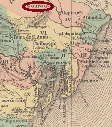
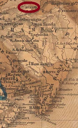
The Freguesia of Nossa Senhora da Conceição do Soure was created in May 1758 by royal decree (Provisão Real) and was located close to the south bank of the river Itapicuru, 250 km north of the future provincial capital Salvador da Bahia. Just 9 months later, the place was a villa. Later, it was twice demoted to the district of Cipó: in July 1931 and in December 1943. In between – more precisely in July 1935 – Soure became a Município. Political autonomy returned in June 1944, now under the name of Nova Soure.
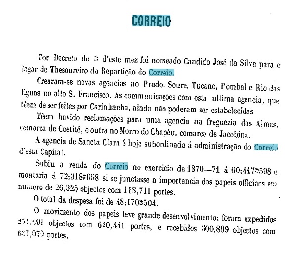
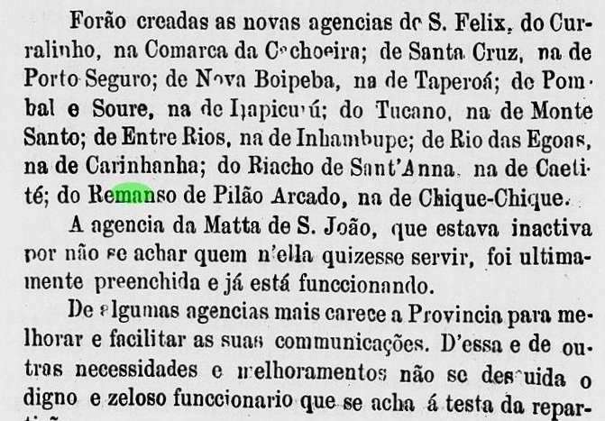
Two dates of origin for the local post office were found, 1872 and 1875, both documented by the provincial president’s report:

An early postmark has been found, certainly not the first: SBA-0720b (image from the internet) is a double circle with the inscriptions SOURE above and (BAHIA) below. The only known example has a date from 1903 in the middle.
Anderer Name: Nova Soure (1944)
Die Freguesia von Nossa Senhora da Conceição do Soure entstand im Mai 1758 durch königliche Verfügung (Provisão Real) und lag nah am Südufer des Flusses Itapicuru, 250 km nördlich der künftgen Provinzhauptstadt Salvador da Bahia entfernt. Bereits 9 Monaten später war der Ort eine Villa. Später wurde er zweimal zum Distrikt von Cipó degradiert: im Juli 1931 und im Dezember 1943. Dazwischen – genauer im Juli 1935 – wurde Soure ein Município. Auch im Juni 1944 kam der politische Aufstieg, nun unter dem Namen Nova Soure.
Zwei Entstehungstermine fürs örtliche Postamt wurden gefunden, 1872 und 1875, jeweils durch den Bericht des Provinzpräsidenten dokumentiert:

Ein früher Poststempel wurde gefunden, sicher nicht der erste: SBA-0720b (Abb. aus dem Internet) ist ein Doppelkreis mir den Inschriften SOURE oben und (BAHIA) unten. Das einzig bekannte Exemplar hat ein Datum aus 1903 in der Mitte.
