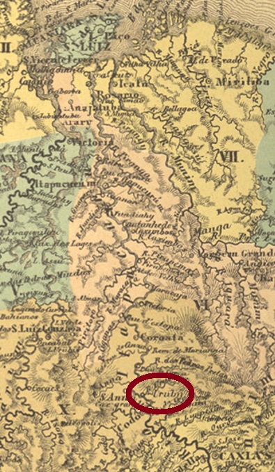
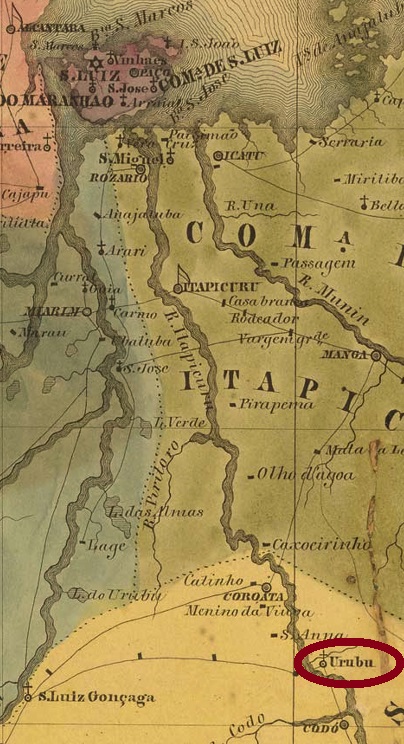
Other names: Monte Alegre, Timbiras (1943)
This settlement in the Codó region has been known since 1838 and was located on the east bank of the Itapicuru River, 280 km south of the provincial capital São Luís. Around 1889, the place name was changed to Monte Alegre, and since December 1943, it has been the Município of Timbiras. The term refers to a whole group of Indian tribes in the north and northeast of Brazil.
As the postal report (Relatorio Postal) for 1887 shows, there was a post office there from February 1869. An imperial postmark from this place has appeared, not the first one. UMA-0275b (Collected by Fuad Ferreira Fo.) is a double circle with the inscription URUBÚ above and one (2) below. The dates in the middle go from 1883 to 1886.
Andere Namen: Monte Alegre, Timbiras (1943)
Diese Siedlung in der Gemarkung Codó ist seit 1838 überliefert und lag am Ostufer des Flusses Itapicuru, 280 km südlich der Provinzhauptstadt São Luís. Gegen 1889 wurde der Ortsname zu Monte Alegre geändert, und seit Dezember 1943 ist der Ort der Município von Timbiras. Der Begriff bezeichnet eine ganze Gruppe von Indianerstämmen im Norden und Nordosten Brasiliens.
Wie aus dem Postbericht (Relatorio Postal) für 1887 hervorgeht, gab es dort ein Postamt ab Februar 1869. Ein kaiserlicher Poststempel aus diesem Ort ist aufgetaucht, aber nicht der erste. UMA-0275b (Samml. Fuad Ferreira Fo.) ist ein Doppelkreis mit der Inschrift URUBÚ oben und einer (2) unten. Die Daten in der Mitte gehen von 1883 bis 1886.
