See also Brejo d’Area (R. Koester: Carimbologia VI)
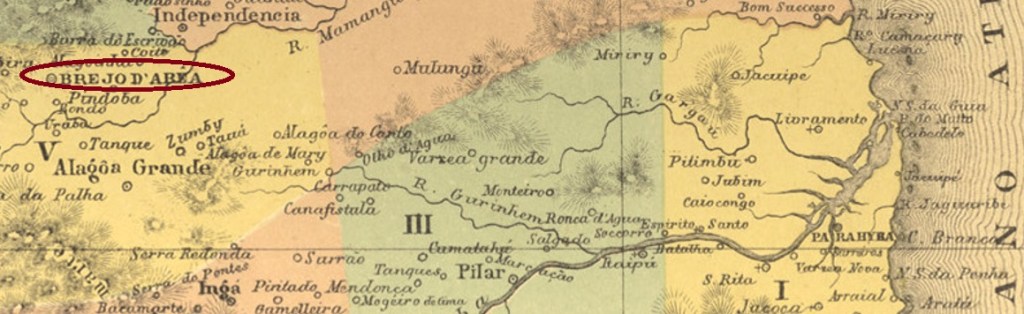
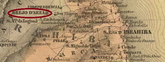
The freguesia of N. Sa. da Conceição do Brejod’Area was founded in June 1813 and was located at the Vila of Monte-Mor (today: Mamanguape), 130 km west of the later provincial capital of Parahyba do Norte (today: João Pessoa). Two years later, the place became the Vila of Brejo d’Area, and since May 1846 it has been a town, simply called Areia (Sand) until nowadays.
As Nova Monteiro writes in Administrações e Agencias Postaes do Brasil Imperio (Brasil Filatelico/RJ, 1934-5; Reprint SPP 1994-1999), there was a post office there as early as May 1829. The only imperial-era postmark from this locality so far is APB-0040b (image from the internet). In this French type, AREIA is read at the top and the small star appears between brackets at the bottom. The dates inside – if there is any – go from 1881 to at least 1894.
Siehe auch Brejo d’Area (R. Koester: Carimbologia VI)
Die Freguesia von N. Sa. da Conceição do Brejod’Area wurde im Juni 1813 gegründet und lag bei der Vila von Monte-Mor (heute: Mamanguape), 130 km westlich der späteren Provinzhauptstadt Parahyba do Norte (heute: João Pessoa) entfernt. Zwei Jahre später wurde der Ort zur Vila von Brejo d’Area, und seit Mai 1846 ist er eine Stadt, die bis heute einfach Areia (Sand) heißt.
Wie Nova Monteiro in Administrações e Agencias Postaes do Brasil Imperio (Brasil Filatelico/RJ, 1934-5; Reprint SPP 1994-1999) schreibt, gab es dort ein Postamt bereits ab Mai 1829. Der bisher einzige Poststempel der Kaiserzeit aus dieser Ortschaft ist APB-0040b (Abb. aus dem Internet). In diesem französischen Typus liest man AREIA oben und unten erscheint der kleine Stern zwischen Klammern. Die Daten im Inneren – wenn überhaupt vorhanden – gehen von 1881 bis mindestens 1894.
