Categories
Carimbologia A-B

Agua-Pé, Minas Gerais (AMG-2285)

Atlas do Imperio do Brasil, 1868

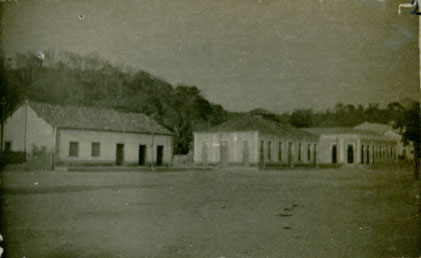
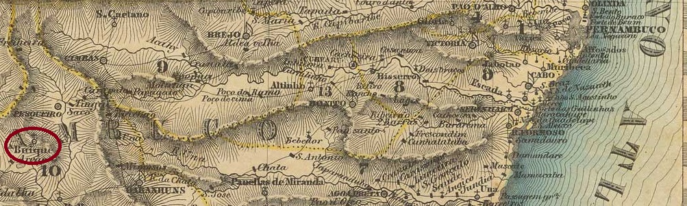
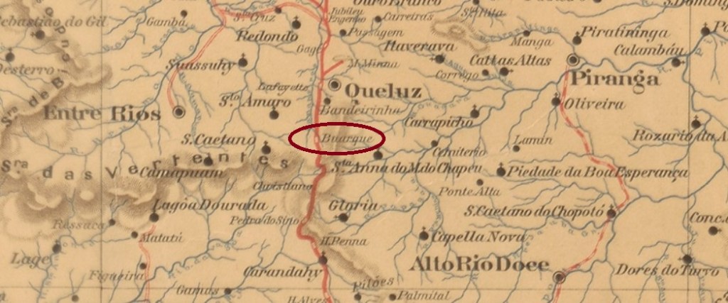
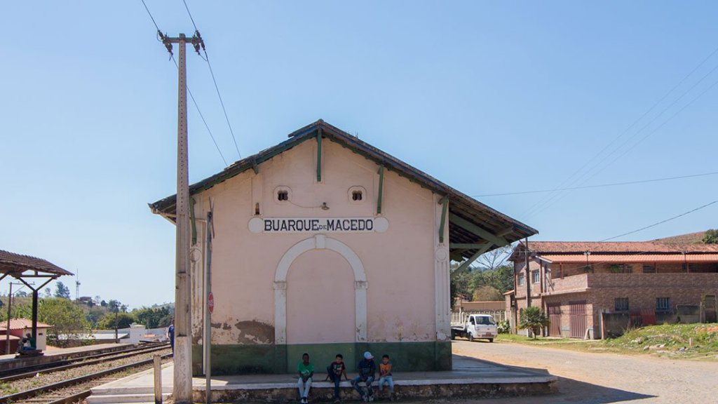
Other names: S. Francisco do Rio Grande, Guapé (1923)

See also S. Francisco do Agua-Pé (SMG-2285)

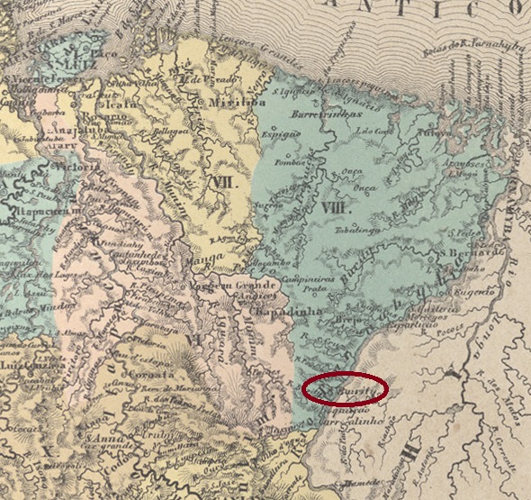
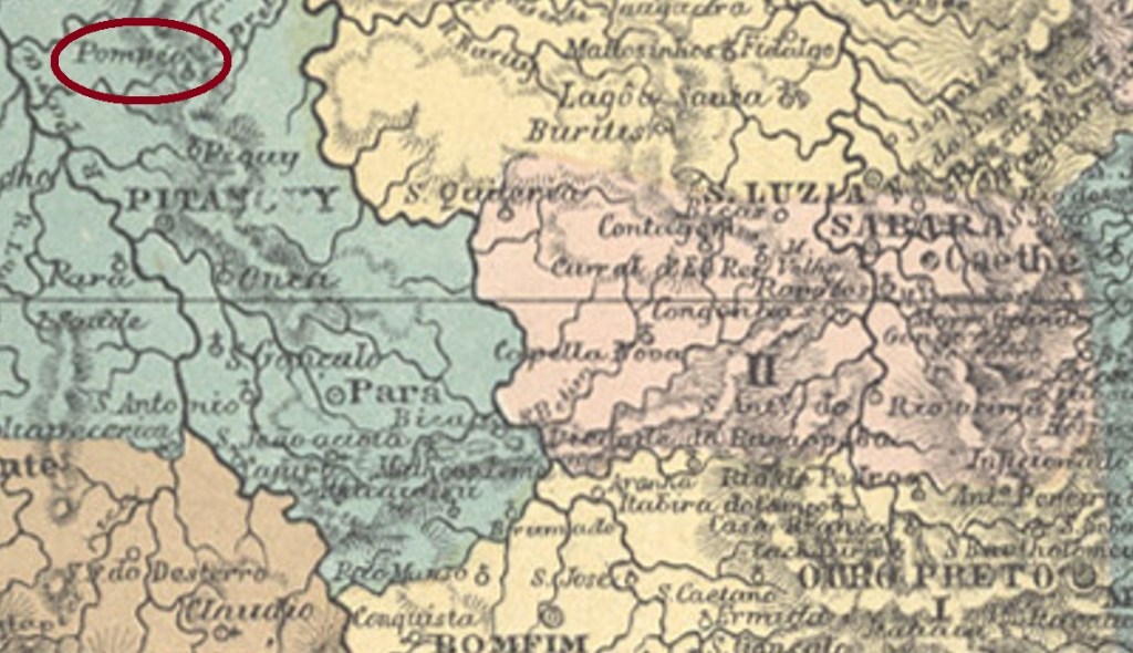
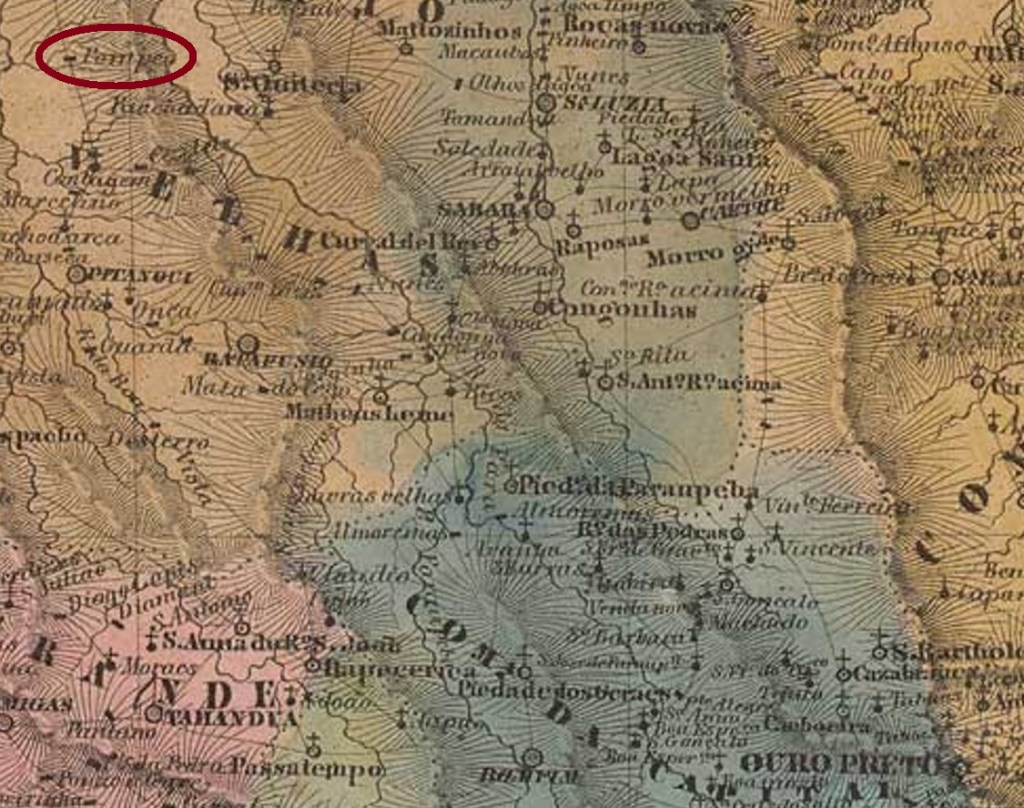
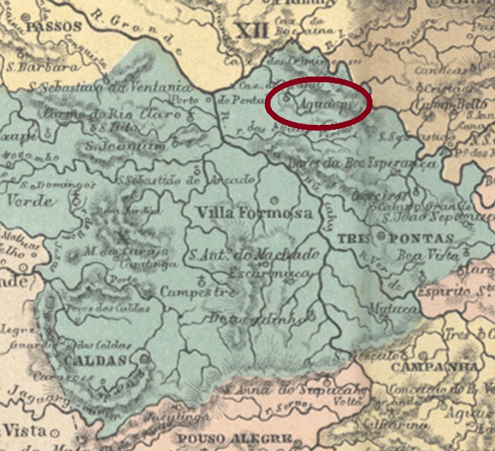
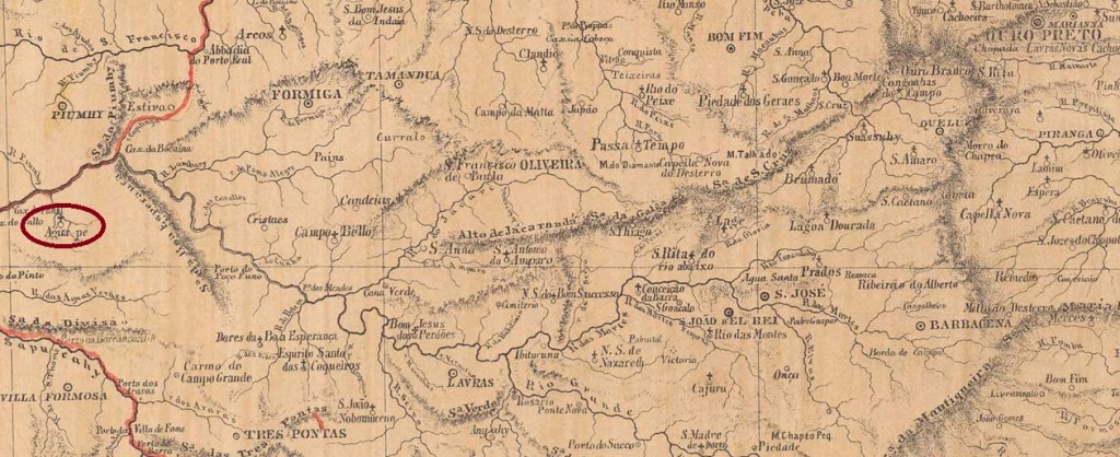
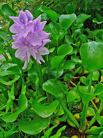
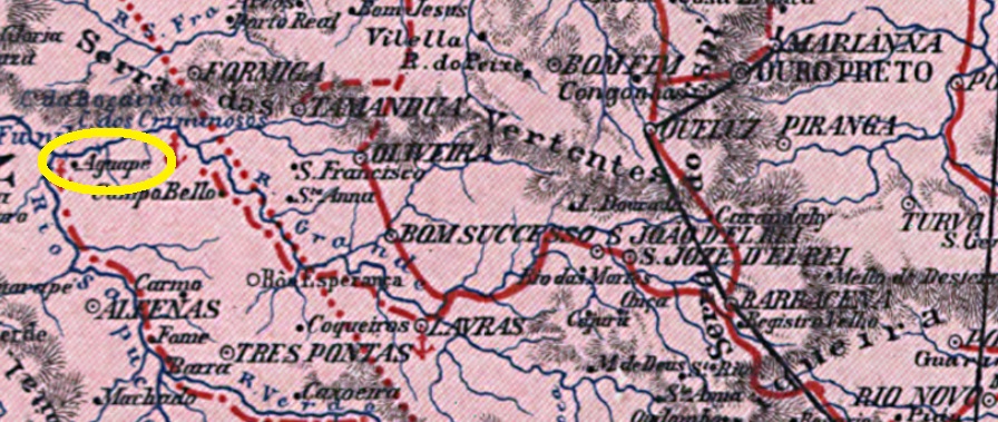
The name Agua-Pé does not mean ‘water foot’, but is the Brazilian name for the thick-stemmed water hyacinth (Eichhornia crassipes). This plant was certainly very common in the area where, in May 1856, the district of São Francisco do Agua-Pé was founded on the south bank of the Rio Grande in the municipality of Três Pontas. It lies over 350 km west of the provincial capital, Ouro Preto. In September 1891, it became the district of S. Francisco do Rio Grande within the newly formed municipality of Dores da Boa Esperança. Since September 1923, it has been the independent municipality of Guapé.

Eichhornia crassipes, Mart./Solms (CC BY-SA 3.0)

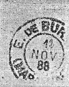
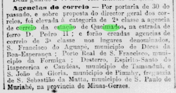
According to Paula Sobrinho (História Postal de Minas Gerais, Belo Horizonte, 1997), there had been a post office there since February 1881, a fact also confirmed in the Rio press. However, at the beginning of December of the same year, a report appeared once again in the Rio de Janeiro press regarding a newly established postal agency in S. Francisco do Agua-Pé.

Jornal do Commercio/RJ, 2 December 1881

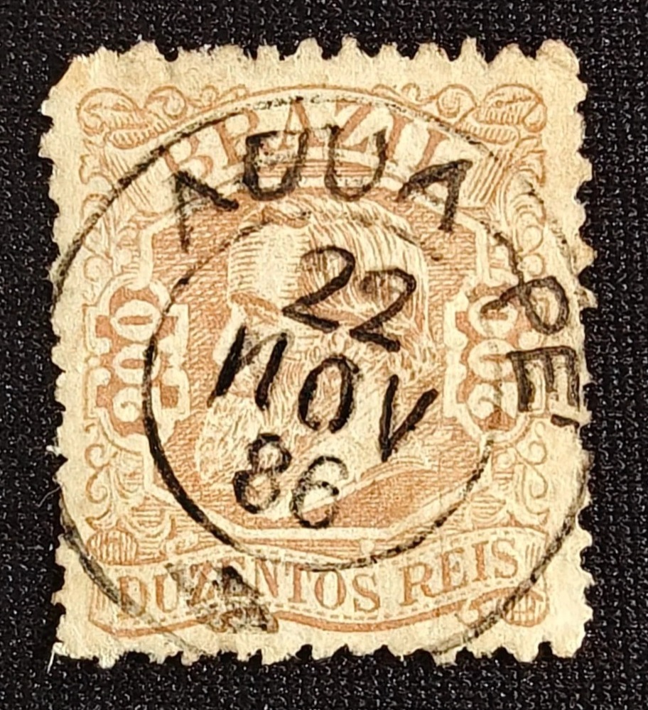
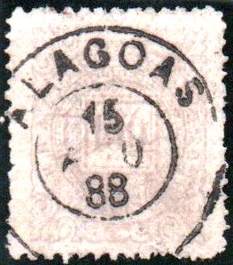
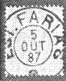
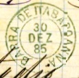
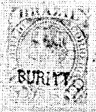
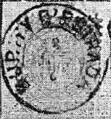
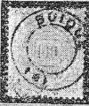
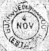
Presumably, the opening of the post office was delayed to such an extent that the entire establishment process had to be repeated. The imperial postmark is AMG-2285a (Fig. Felipe Piccinini):

AMG-2285a (FP) 1886
Provincia de Minas Geraes, 1873

Outros nomes: S. Francisco do Rio Grande, Guapé (1923)

Veja também S. Francisco do Agua-Pé (SMG-2285)

O aguapé (Eichhornia crassipes) certamente era muito comum na região onde, em maio de 1856, foi fundado o distrito de São Francisco do Agua-Pé, na margem sul do Rio Grande, município de Três Pontas. O local ficana a cerca de 350 km a oeste da capital provincial, Ouro Preto. Em setembro de 1891, passou a ser o distrito de São Francisco do Rio Grande, no recém-criado município de Dores da Boa Esperança. Desde setembro de 1923, é o município autônomo de Guapé.

Eichhornia crassipes, Mart./Solms (CC BY-SA 3.0)

Segundo Paula Sobrinho (História Postal de Minas Gerais, Belo Horizonte, 1997), havia ali uma agência dos correios desde fevereiro de 1881, o que também é confirmado pela imprensa do Rio. No entanto, no início de dezembro do mesmo ano, surgiu novamente na imprensa carioca uma notícia sobre uma agência dos correios recém-fundada em São Francisco do Água-Pé.

Jornal do Comércio/RJ, 2 de dezembro de 1881

Provavelmente, a entrada em funcionamento da agência postal atrasou-se tanto que todo o processo de criação teve de ser repetido. O carimbo postal imperial é o AMG-2285a (Ilustração de Felipe Piccinini):

AMG-2285a (FP) 1886
Carta da Republica dos Estados Unidos do Brasil, 1892

Andere Namen: S. Francisco do Rio Grande, Guapé (1923)

Siehe auch S. Francisco do Agua-Pé (SMG-2285)

Der Name Agua-Pé bedeutet nicht „Wasserfuß”, sondern ist die brasilianische Bezeichnung für die Dickstielige Wasserhyazinthe (Eichhornia crassipes). Diese Pflanze kam bestimmt sehr häufig in der Gegend vor, in der im Mai 1856 der Distrikt São Francisco do Agua-Pé am Südufer des Rio Grande im Município Três Pontas gegründet wurde. Der Ort liegt gut 350 km westlich der Provinzhauptstadt Ouro Preto. Im September 1891 wurde daraus der Distrikt S. Francisco do Rio Grande im neu entstandenen Município Dores da Boa Esperança. Seit September 1923 ist es die eigenständige Gemeinde Guapé.

Eichhornia crassipes, Mart./Solms (CC BY-SA 3.0)

Laut Paula Sobrinho (História Postal de Minas Gerais, Belo Horizonte, 1997), gab es dort ein Postamt seit Februar 1881, was auch in der Presse aus Rio bestätigt wird. Allerdings erschien Anfang Dezember desselben Jahres erneut eine Meldung über eine neu gegründete Postagentur in S. Francisco do Agua-Pé in der Presse von Rio de Janeiro.

Jornal do Commercio/RJ, 2. Dezember 1881

Vermutlich hat sich die Inbetriebnahme des Postamts so stark verzögert, dass der gesamte Entstehungsprozess wiederholt werden musste. Der kaiserliche Poststempel ist AMG-2285a (Abb. Felipe Piccinini):

AMG-2285a (FP) 1886
Categories
Carimbologia A-B

Alagoas, Alagoas (AAL-0010)

Atlas do Imperio do Brasil, 1868

Text update of March 21, 2025

Other names: Magdalena, Marechal Deodoro (1939)

The history of this locality began around 1633, when the settlement called Magdalena was established, which was declared a villa just three years later. In March 1823, the name was changed to N. Sra. da Conceição das Alagoas, when the place – now as a town – became the provincial capital. The rather inconvenient location on the southern shore of Lake Manguaba was probably the deciding factor in 1839 to move the capital to Maceió, which was 30 km further northeast with better transport links. A long period of decadence followed, until in November 1939 the old town of Alagoas became the Município of Marechal Deodoro. The name celebrates Manuel Deodoro da Fonseca (1827-1892), the first president of the Brazilian Republic, who was born there.  

Three dates of origin for the local post office have been found, all from the capital period. Aldo Cardoso (Contribuição para a História dos Correios de Alagoas, Maceió, 1969) gives October 1827, while the Imperial Post Office Directory (Tabella das Agencias do Correio do Imperio, Rio de Janeiro, 1885) lists the year 1829. And Nova Monteiro gives November 1834 in Administrações e Agencias Postaes do Brasil Imperio (Brasil Filatelico/RJ, 1934-5; Reprint SPP 1994-1999).

We do not know of any Alagoas postmarks from the provincial capital period. The oldest cancel to date is AAL-0010b (coll. Fuad Ferreira Fo.) and apparently bears the inscription ALAGOA, which would presumably be the old spelling of the city:

AAL-0010b (FF) 1850ff

It was followed by the rare French type AAL-0010c (coll. Fuad Ferreira Fo.):

AAL-0010c (FF) 1877

This was followed by the double circle AAL-0010d (coll. José A. Junges):

AAL-0010d (JJ)

AAL-0010e (coll. Denis Forte) dates from the beginning of the Republic:

AAL-0010e (DFo) 1891-1895
Villiers de l’Ile Adam: Carta (…) das Provincias de Pernambuco, Alagoas e Sergipe, 1848

Textaktualisierung am 21. März 2025

Andere Namen: Magdalena, Marechal Deodoro (1939)

Die Geschichte dieser Ortschaft fing um 1633 an, als die Siedlung namens Magdalena entstand, die bereits drei Jahre später zur Villa erklärt wurde. Im März 1823 wurde der Name zu N. Sra. da Conceição das Alagoas geändert, als der Ort – nun als Stadt – Provinzhauptstadt wurde. Die eher ungünstige Lage am Südufer des Manguabasees war wohl 1839 ausschlaggebend, um die Hauptstadt nach Maceió zu verlegen, die 30 km weiter nordöstlich mit besserer Verkehrsanbindung lag. Es folgte eine lange Periode der Dekadenz, bis im November 1939 aus dem alten Ort Alagoas der Município von Marechal Deodoro wurde. Der Name erinnert an Manuel Deodoro da Fonseca (1827-1892), den ersten Präsidenten der brasilianischen Republik, der dort geboren wurde.   

Drei Entstehungstermine fürs örtliche Postamt wurden gefunden, alle aus der Hauptstadtzeit. Aldo Cardoso (Contribuição para a História dos Correios de Alagoas, Maceió, 1969) schreibt dafür den Oktober 1827. Im Verzeichnis der kaiserlichen Postämter  (Tabella das Agencias do Correio do Imperio, Rio de Janeiro, 1885) wird das Jahr 1829 angegeben. Und Nova Monteiro nennt den November 1834 in Administrações e Agencias Postaes do Brasil Imperio (Brasil Filatelico/RJ, 1934-5; Reprint SPP 1994-1999).

Alagoas-Poststempel aus der Zeit als Provinzhauptstadt kennen wir nicht. Der bisher älteste Stempel ist AAL-0010b (Samml. Fuad Ferreira Fo.), er trägt scheinbar die Inschrift ALAGOA, was vermutlich die alte Schreibweise der Stadt wäre:

AAL-0010b (FF) 1850ff

Ihm folgte der seltene französische Typ AAL-0010c (Samml. Fuad Ferreira Fo.):

AAL-0010c (FF) 1877

Danach kam der Doppelkreis AAL-0010d (Samml. José A. Junges):

AAL-0010d (JJ)

Aus dem Beginn der Republik stammt AAL-0010e (Samml. Denis Forte):

AAL-0010e (DFo) 1891-1895
Categories
Carimbologia A-B

Bom Jesus do Monte Alegre, São Paulo (BSP-1837)

Mappa Geral do Brazil, 1911

Other names: Bairro da Capelinha, Farias, Ibiti, Monte Alegre do Sul (1948)

See also Farias (FSP-0520)

Around 1874, the settlement of Bairro dos Farias, which belonged to Vila do Amparo, appeared on the south bank of the Camanducaia, 130 kilometres north of the state capital São Paulo. In March 1887, it was elevated to the Freguesia de Bom Jesus do Monte Alegre. The place name was later changed twice, probably to avoid confusion with Monte Alegre in Minas Gerais: in November 1944 to Ibiti and in December to Monte Alegre do Sul, when this place was elevated to Município.

As the Rio de Janeiro press reported, there had been a post office there since December 1886:

Jornal do Commercio/RJ, 11/12/1886

Two completely different postmarks from the imperial era are known from the Bairro de Farias. FSP-0520a (fig. R. Koester, in Carimbologia XIX) bears the inscription EST, which cannot be the abbreviation for Estação (railway station), as the railway station there was only opened in March 1890. It is an estafeta (relay), which was still in use when the town was already called Bom Jesus do Monte Alegre.

FSP-0520a (RK) 1887

BSP-1837a (fig. by Mário Celso Orsi Jr.) is the oldest known postmark with the place name Bom Jesus do Monte Alegre. The only example was used in July 1887.

BSP-1837a (MO) 1887
Google Maps

Andere Namen: Bairro da Capelinha, Farias, Ibiti, Monte Alegre do Sul (1948)

Siehe auch Farias (FSP-0520)

Um 1874 entstand am Südufer des Camanducaia, 130 km nördlich der Landeshauptstadt São Paulo, die zur Vila do Amparo gehörende Siedlung Bairro dos Farias. Im März 1887 wurde sie zur Freguesia de Bom Jesus do Monte Alegre erhoben. Später wurde der Ortsname zweimal geändert, wahrscheinlich um Verwechslungen mit Monte Alegre in Minas Gerais zu vermeiden: im November 1944 in Ibiti und im Dezember in Monte Alegre do Sul, als dieser Ort zum Município erhoben wurde.

Wie die Presse von Rio de Janeiro berichtete, gab es dort seit Dezember 1886 ein Postamt:

Jornal do Commercio/RJ, 11.12.1886

Aus dem Bairro de Farias sind zwei völlig unterschiedliche Poststempel aus der Kaiserzeit bekannt. FSP-0520a (Abb. R. Koester, in Carimbologia XIX) trägt die Inschrift EST, was hier nicht die Abkürzung für Estação (Bahnhof) sein kann, da der dortige Bahnhof erst im März 1890 eröffnet wurde. Es handelt sich um eine Estafeta (Stafette), die auch noch verwendet wurde, als der Ort bereits Bom Jesus do Monte Alegre hieß.

FSP-0520a (RK) 1887

BSP-1837a (Abb. Mário Celso Orsi Jr.) ist der älteste bekannte Poststempel mit dem Ortsnamen Bom Jesus do Monte Alegre. Das einzige Exemplar wurde im Juli 1887 verwendet.

BSP-1837a (MO) 1887
Categories
Carimbologia A-B

Barra de Itabapoanna, Rio de Janeiro (BRJ-0120)

Atlas do Imperio do Brasil, 1868

Other names: S. Sebastião de Itabapoana, Itabapoana

São Sebastião de Itabapoana was a small arraial on the south bank of the mouth of the Itabapoana on the provincial border between Rio de Janeiro and Espírito Santo, 360 km northeast of the capital Rio de Janeiro. In October 1857, it became a freguesia in the newly founded Município de S. João da Barra. Since January 1995 it has been the district of Itabapoana in the Município S. Francisco do Itabapoana.

Two creation dates have been found for the local post office. Paulo Novaes writes in agenciaspostais.com.br “ca. 1885”, while in the Directory of Imperial Post Offices (Tabella das Agencias do Correio do Imperio, Rio de Janeiro, 1885) the year is 1879, which is confirmed by a note in the regional press about 10 postal connections per month between Campos and Barra do Itabapoana:

Monitor Campista, 18.06.1879

The imperial postmark is the double circle BRJ-0120a (Fig. D. Feldman Auction) with the inscription BARRA DE ITABAPOANNA and internal dates from 1885 to 1899.

BRJ-0120a (DF)
Villiers de l’Ile Adam: Carta (…) da Provincia do Rio de Janeiro, 1850

Andere Namen: S. Sebastião de Itabapoana, Itabapoana

São Sebastião de Itabapoanna war ein kleiner Arraial am Südufer der Mündung des Itabapoana an der Provinzgrenze zwischen Rio de Janeiro und Espírito Santo, 360 km nordöstlich der Hauptstadt Rio de Janeiro. Im Oktober 1857 wurde es eine Freguesia im neu gegründeten Município de S. João da Barra. Seit Januar 1995 ist es der Bezirk Itabapoana im Município S. Francisco do Itabapoana.

Für das örtliche Postamt wurden zwei Gründungsdaten ermittelt. Paulo Novaes schreibt in agenciaspostais.com.br „ca. 1885“, während im Verzeichnis der kaiserlichen Postämter (Tabella das Agencias do Correio do Imperio, Rio de Janeiro, 1885) das Jahr 1879 zu lesen ist, was durch einen Bericht der regionalen Presse über 10 Postverbindungen pro Monat zwischen Campos und Barra do Itabapoana bestätigt wird:

Monitor Campista, 18.06.1879

Der kaiserliche Poststempel ist der Doppelkreis BRJ-0120a (Abb. D. Feldman Auktion) mit der Inschrift BARRA DE ITABAPOANNA und internen Daten von 1885 bis 1899.

BRJ-0120a (DF)
Categories
Carimbologia A-B

Burity, Maranhão (BMA-0060)

Villiers de l’Ile Adam: Carta (…) da Provincia do Maranhão, 1850

Another name: Burity de Ignacia Vaz.

The Freguesia called N. Sra. de Sant’Anna do Burity was founded in October 1843 south of the Vila of Brejo, 320 km southeast of the provincial capital São Luís do Maranhão. In April 1888 it became a vila, which in 1933 was named Burity de Ignacia Vaz, in memory of the first large landowner in the region. Since December 1938, it has been a town called Buriti.

Burity Post Office (left), ca. 1950 (IBGE)

As R. Koester writes in Carimbologia VI, there was a post office there since August 1879. The only postmark from the imperial period so far is BMA-0060a, already presented by Koester (op. cit.):

BMA-0060a (RK) 1888
Atlas do Imperio do Brasil, 1868

Anderer Name: Burity de Ignacia Vaz

Die Freguesia de N. Sra. de Sant’Anna do Burity wurde im Oktober 1843 gegründet und lag südlich der Vila de Brejo, 320 km südöstlich der Provinzhauptstadt São Luís do Maranhão. Im April 1888 wurde es zu einer Vila, die 1933 den Namen Burity de Ignacia Vaz erhielt, in Erinnerung an die erste Großgrundbesitzerin der Region. Seit Dezember 1938 ist es die Stadt Buriti.

Postamt Burity (links), ca. 1950 (IBGE)

Wie R. Koester in Carimbologia VI schreibt, gab es dort ein Postamt seit August 1879. Der bisher einzige Poststempel aus der Kaiserzeit ist BMA-0060a, der bereits von Koester (op. cit.) vorgestellt wurde:

BMA-0060a (RK) 1888
Categories
Carimbologia A-B

Burity da Estrada, Minas Gerais (BMG-0420)

Atlas do Imperio do Brasil, 1868

Other names: Conceição do Pompéu, Pompéu

The history of this place begins in March 1841, when the district of N. Sra. da Conceição do Pompéu was founded in the município of Pitangui, 260 km northwest of the provincial capital Ouro Preto. It was elevated to freguesia status in November 1866. In November 1923, it was renamed as the district of Pompéu, which has been an independent município since December 1938. The place name Burity da Estrada (Burity palm by the road), adopted after a fazenda, remained nevertheless for a long time, as one can notice through the postmarks.

As Paula Sobrinho writes in História Postal de Minas Gerais (Belo Horizonte, 1997), there was a post office there from October 1880. Two postmarks were found for the Empire, both described by R. Koester (Carimbologia VI):

BMG-0420a (RK) 1883ff
BMG-0420b (RK) 1888ff-1915

Before that there was a handwritten cancellation (Coll. Fuad Ferreira Fo.), a sure indication that the first postmark was long in waiting:

1880ff-1882 (FF)
Villiers de l’Ile Adam: Carta (…) da Provincia de Minas Geraes, 1849

Andere Namen: Conceição do Pompéu, Pompéu

Die Geschichte dieses Ortes beginnt im März 1841, als die Siedlung N. Sra. da Conceição do Pompéu im município von Pitangui, 260 km nordwestlich der Provinzhauptstadt Ouro Preto, gegründet wurde. Im November 1866 erfolgte die Erhebung zur Freguesia. Im November 1923 fand eine Umbenennung als Distrikt von Pompéu statt, und seit Dezember 1938 ist Pompéu ein eigenständiges Município. Der nach einer Fazenda übernommene Ortsname Burity da Estrada (Burity-Palme an der Straße) blieb dennoch lange erhalten, wie man bei den Poststempeln sieht.

Wie Paula Sobrinho in História Postal de Minas Gerais (Belo Horizonte, 1997) schreibt, gab es dort seit Oktober 1880 ein Postamt. Für das Kaiserreich wurden zwei Poststempel gefunden, die beide von R. Koester (Carimbologia VI) beschrieben wurden:

BMG-0420a (RK) 1883ff
BMG-0420b (RK) 1888ff-1915

Davor gab es eine handschriftliche Entwertung (Samml. Fuad Ferreira Fo.), ein sicheres Indiz dafür, dass der erste Poststempel lange auf sich warten ließ:

1880ff-1882 (FF)
Categories
Carimbologia A-B

Buquira, São Paulo (BSP-0195)

Provincia de São Paulo, 1886

Another name: Monteiro Lobato (1948)

The freguesia of N. Sa. da Piedade do Buquira was founded in April 1857 in the Município of Taubaté on the left bank of the Buquira, 130 km northeast of the provincial capital of São Paulo. It then changed jurisdiction twice: to Caçapava in April 1866 and to S. José dos Campos in July 1867. In April 1880 it became a vila. After a good four years as a district of S. José dos Campos (May 1844 to December 1948), its status as a vila returned, now as the município of Monteiro Lobato. The name commemorates José Bento Monteiro Lobato (1882-1948), a writer whose family owned a fazenda there.

MiNr. 885/Scott 829/RHM C-370

According to the Directory of Imperial Post Offices (Tabella das Agencias do Correio do Imperio, Rio de Janeiro, 1885), there had been a post office there since 1879. The only imperial postmark so far is the French type BSP-0195a, with dates between 1881 and 1903, already shown by R. Koester in Carimbologia VI:

BSP-0195a (RK) 1881-1903
J. M. Ribeiro Lisboa: Provincia de São Paulo, 1884

Anderer Name: Monteiro Lobato (1948)

Die Freguesia von N. Sa. da Piedade do Buquira wurde im April 1857 gegründet und lag im Município von Taubaté am linken Ufer des Buquira, 130 km nordöstlich der Provinzhauptstadt São Paulo. Danach wechselte sie zweimal die Zuständigkeit: im April 1866 nach Caçapava und im Juli 1867 nach S. José dos Campos. Im April 1880 wurde es zur Vila. Nach gut vier Jahren als Distrikt von S. José dos Campos (Mai 1844 bis Dezember 1948) kehrte der Status als Vila zurück, nun als Município von Monteiro Lobato. Der Name erinnert an José Bento Monteiro Lobato (1882-1948), einen Schriftsteller, dessen Familie dort eine Fazenda besaß.

MiNr. 885/Scott 829/RHM C-370

Nach dem Verzeichnis der kaiserlichen Postämter (Tabella das Agencias do Correio do Imperio, Rio de Janeiro, 1885) gab es dort seit 1879 ein Postamt. Der einzige kaiserliche Poststempel ist bisher der französische Typ BSP-0195a, mit Daten zwischen 1881 und 1903, der bereits von R. Koester in Carimbologia VI gezeigt wurde:

BSP-0195a (RK) 1881-1903
Categories
Carimbologia A-B

Buquim, Sergipe (BSE-0030)

Atlas do Imperio do Brasil, 1868

Other names: Boquinha da Mata, Lagoa Vermelha, Boquim (1938, 1976)

The history of this place is somewhat confusing, as it has changed not only its name but also its location. It was originally called Lagoa Vermelha (Red Lake), a parish on the Piauí River (also called Jacaré) founded in April 1855 and elevated to a vila in February 1857. However, the situation was very unfavourable: in addition to malaria epidemics, there were frequent floods. Therefore, in March 1870, the entire community was moved to neighbouring Boquinha da Mata, 80 km west of the provincial capital Aracaju. It was given the name Sant’Anna do Buquim and became a town in December 1926, spelled Boquim since January 1976.

There had been a post office in Lagoa Vermelha since 1862, as shown in the Directory of Imperial Post Offices (Tabella das Agencias do Correio do Imperio, Rio de Janeiro, 1885). The Buquim post office existed from 1879, as shown in the Imperial Postal Guide (Guia Postal do Imperio) for 1880. No imperial postmarks from Buquim are known so far.

Arthur D. Ribeiro: Estado de Sergipe, 1924

Andere Namen: Boquinha da Mata, Lagoa Vermelha, Boquim (1938, 1976)

Die Geschichte dieses Ortes ist etwas verwirrend, da er nicht nur seinen Namen, sondern auch seinen Sitz wechselte. Ursprünglich hieß er Lagoa Vermelha (Roter See), eine im April 1855 gegründete Pfarrei am Fluss Piauí (auch Jacaré genannt), die im Februar 1857 zur Vila erhoben wurde. Die Lage war jedoch sehr ungünstig: zu den Malariaepidemien kamen häufig Überschwemmungen hinzu. Daher wurde die gesamte Gemeinde im März 1870 in das benachbarte Boquinha da Mata, 80 km westlich der Provinzhauptstadt Aracaju, verlegt. Es erhielt den Namen Sant’Anna do Buquim und wurde im Dezember 1926 eine Stadt, die seit Januar 1976 Boquim geschrieben wird.

In Lagoa Vermelha gab es seit 1862 ein Postamt, wie aus dem Verzeichnis der kaiserlichen Postämter (Tabella das Agencias do Correio do Imperio, Rio de Janeiro, 1885) hervorgeht. Das Postamt Buquim existierte ab 1879, wie aus dem kaiserlichen Postführer (Guia Postal do Imperio) für 1880 hervorgeht. Bisher sind keine kaiserlichen Poststempel aus Buquim bekannt.

Categories
Carimbologia A-B

Buique, Pernambuco (BPE-0140)

Atlas do Imperio do Brasil, 1868

The Freguesia de Villa Nova de Buique was founded in December 1795 and at that time belonged to the Vila de Garanhuns, located 280 km west of the provincial capital Recife. The place was elevated to villa status in May 1854 and to town status ten years later.

There had been a post office there since October 1862, as the regional press reported:

Diário de Pernambuco/18.10.1862

The only postmark so far is BPE-0140b, already presented by R. Koester (Carimbologia VI), with internal dates from 1886 to at least 1888:

BPE-0140b (RK) 1886-1888ff
Villiers de l’Ile Adam: Carta (…) das Provincias de Pernambuco, Alagoas e Sergipe, 1848

Die Freguesia namens Villa Nova de Buique wurde im Dezember 1795 gegründet und gehörte damals zur Vila de Garanhuns, 280 km westlich der Provinzhauptstadt Recife gelegen. Der Ort wurde im Mai 1854 zur Villa und zehn Jahre später zur Stadt erhoben.

Seit Oktober 1862 gab es dort ein Postamt, wie die regionale Presse berichtete:

Diário de Pernambuco/18.10.1862

Der bisher einzige Poststempel ist BPE-0140b, der bereits von R. Koester (Carimbologia VI) vorgestellt wurde und interne Daten von 1886 bis mindestens 1888 aufweist:

BPE-0140b (RK) 1886-1888ff
Categories
Carimbologia A-B

Buarque de Macedo (train station/Bahnhof), Minas Gerais (BMG-0415)

Estado de Minas Geraes, 1910

Buarque de Macedo station was opened in December 1883 by the E.F. D. Pedro II (Main Line) and was located in the Município of Queluz, 70 km southwest of the provincial capital Ouro Preto. The line passed to the E.F. Central do Brasil in 1889 and belonged to Rede Ferroviária Federal S.A. (estacoesferroviarias.com.br) from 1975 until its closure in 1996. Today, the tracks are still there, but the station building has fallen into disrepair.

2016 (Photo: Alex de Lima on estacoesferroviarias.com.br)

The name of the station commemorates Manoel Buarque de Macedo (1837-1881), a politician from Pernambuco who was Minister of Transport (Ministro das Obras Públicas) during the Empire and died suddenly while travelling with D. Pedro II.

As Paula Sobrinho writes in História Postal de Minas Gerais (Belo Horizonte, 1997), there was a post office in the station since June 1884 with the cancel BMG-0415a, already made known by R. Koester (Carimbologia VI):

BMG-0415a (RK)
Google Maps

Der Bahnhof Buarque de Macedo wurde im Dezember 1883 von der E.F. D. Pedro II (Hauptstrecke) eröffnet und lag im Município von Queluz, 70 km südwestlich der Provinzhauptstadt Ouro Preto. Die Strecke ging 1889 an die E.F. Central do Brasil über und gehörte von 1975 bis zu ihrer Stilllegung 1996 der Rede Ferroviária Federal S.A. (estacoesferroviarias.com.br). Heute sind die Gleise noch vorhanden, das Bahnhofsgebäude ist dem Verfall preisgegeben.

2016 (Foto: Alex de Lima auf estacoesferroviarias.com.br)

Der Name des Bahnhofs erinnert an Manoel Buarque de Macedo (1837-1881), einen Politiker aus Pernambuco, der im Kaiserreich Verkehrsminister (Ministro das Obras Públicas) war und während einer gemeinsamen Reise mit D. Pedro II. plötzlich verstarb.

Wie Paula Sobrinho in História Postal de Minas Gerais (Belo Horizonte, 1997) schreibt, gab es im Bahnhof seit Juni 1884 ein Postamt mit dem Stempel BMG-0415a, der bereits von R. Koester (Carimbologia VI) bekannt gemacht wurde:

BMG-0415a (RK)