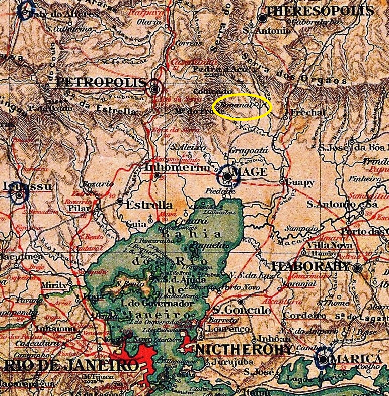
Bananal (Banana Grove) was a small settlement belonging to the Freguesia of Guapy-Mirim, located on the north bank of the Bananal River, just before it flows into the Soberbo in the Município of Magé, 75 km north of the capital Rio de Janeiro. This village may have been an important stop on the way to the imperial city of Teresópolis. Since December 1990, Bananal has been a district in the Município of Guapimirim.
According to the Directory of Imperial Post Offices (Tabella das Agencias do Correio do Imperio, Rio de Janeiro, 1885), there was a post office there from 1880. The postal route to Teresópolis is also confirmed by the Almanak Laemmert:

However, the agency was already closed in April 1905, as Paulo Novaes reports in agenciaspostais.com.br. Apparently, there was a new route to the north, away from the village. The 19th century postmark is BRJ-0111a (Coll. FM) a double circle with the inscription P. DO BANANAL at the top. The only one seen so far has a date from 1899 in the centre.
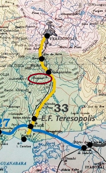
Bananal (Bananenhain) war eine kleine Siedlung, die zur Freguesia von Guapy-Mirim gehörte und am Nordufer des Flusses Bananal lag, kurz vor dessen Mündung in den Soberbo im Município von Magé, 75 km nördlich der Hauptstadt Rio de Janeiro. Diese Ortschaft war möglicherweise eine wichtige Station auf dem Weg zur Kaiserstadt Teresópolis. Seit Dezember 1990 ist Bananal ein Ortsteil im Município von Guapimirim.
Wie aus dem Verzeichnis der kaiserlichen Postämter (Tabella das Agencias do Correio do Imperio, Rio de Janeiro, 1885) hervorgeht, gab es dort ein Postamt ab 1880. Die Postroute nach Teresópolis wird auch durch den Almanak Laemmert bestätigt:

Allerdings wurde die Agentur bereits im April 1905 geschlossen, wie Paulo Novaes in agenciaspostais.com.br berichtet. Offenbar gab es eine neue Route nach Norden, die abseits des Orts lag. Der Poststempel im 19. Jahrhundert ist BRJ-0111a (Samml. FM) ein Doppelkreis mit der Inschrift P. DO BANANAL oben. Das bisher einzig gesichtete Exemplar hat ein Datum aus 1899 in der Mitte.
