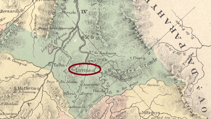
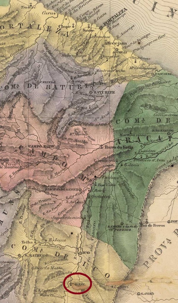
The Freguesia de São Vicente Ferrer das Lavras da Mangabeira on the west bank of the Rio Salgado, 420 kilometres south of the later provincial capital Fortaleza, had existed since August 1813 and belonged to the Vila de Icó. The village became a Vila in June 1816, which became the town of S. Vicente das Lavras in August 1884 and has been called Município de Lavras da Mangabeira since December 1943.
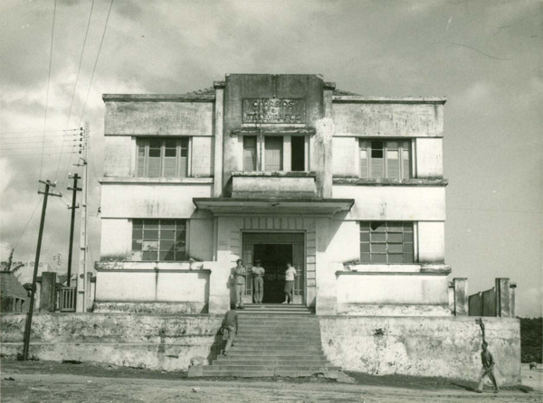
Lavras da Mangabeira post office, ca. 1950 (IBGE)
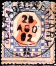
R. Koester writes in Carimbologia XXVI that there had been a post office there since September 1846. The only postmark in the 19th century to date, LCE-0190b (fig. Koester, op. cit.), shows the imperial seal:
LCE-0190b (RK)Villiers de l’Ile Adam: Carta (…) da Provincia do Ceará, 1849
Andere Namen: Lavras da Mangabeira (1943)
Seit August 1813 bestand die zur Vila de Icó gehörende Freguesia de São Vicente Ferrer das Lavras da Mangabeira am Westufer des Rio Salgado, 420 km südlich der späteren Provinzhauptstadt Fortaleza. Bereits im Juni 1816 wurde der Ort zur Vila, die im August 1884 zur Stadt S. Vicente das Lavras wurde und seit Dezember 1943 Município de Lavras da Mangabeira heißt.
Postamt Lavras da Mangabeira, ca. 1950 (IBGE)
R. Koester schreibt in Carimbologia XXVI, dass es dort seit September 1846 ein Postamt gab. Der bisher einzige Poststempel im 19. Jahrhundert LCE-0190b (Abb. Koester, op. cit.) zeigt den kaiserlichen Siegel:
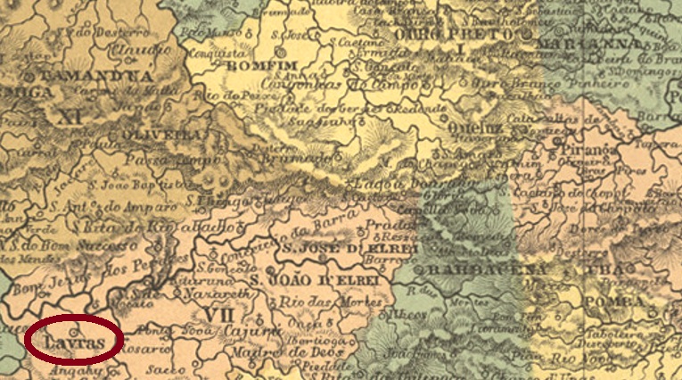
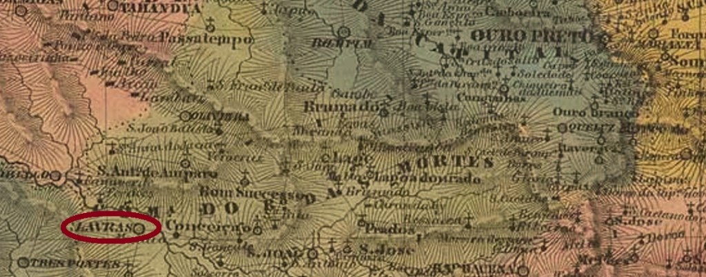
The parish of Sant’Anna de Lavras do Funil was established in July 1813 in the Município of Turvo, close to the south bank of the Rio Grande, about 250 km southwest of the former provincial capital of Ouro Preto. Funil means funnel, and this is still the name of a dam on the Rio Grande about 30 km away. The village rose to the status of Vila in October 1831 and has been a town since July 1868, when it was simply called Lavras.
Three years of origin have been found for the local post office. First in March 1829, as Nova Monteiro writes in Administrações e Agencias Postaes do Brasil Imperio (Brasil Filatelico/RJ, 1934-5; Reprint SPP 1994-1999). Then in October 1833, as can be read in both the Directory of Imperial Post Offices (Tabella das Agencias do Correio do Imperio, Rio de Janeiro, 1885) and the Postal Report (Relatorio Postal) for 1887. And finally in October 1853, as reported by Paula Sobrinho in História Postal de Minas Gerais (Belo Horizonte, 1997). However, this could be a transcription error.
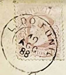
The oldest postmark is LMG-1490a, supposedly used as early as 1835 and presented by the RHM catalogue under P-MG-33:
LMG-1490a (RHM P-MG-33)
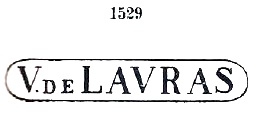
It was followed by VMG-3805a, which was in use between 1839 and at least 1866, also occurs in brown and green and is listed by Paulo Ayres in Catálogo de Carimbos Brasil-Império (S. Paulo, 1937, 1942) under no. 1529:
VMG-3805a (P.A. 1529, RHM P-MG-34)
This was followed by the double circle LMG-3370a (illustration from the Internet):
LMG-3370a (HiltonWA) 1879-1898
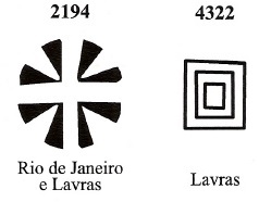
James Dingler and Klerman W. Lopes have listed two mute cancellations from Lavras in Mute Cancellations of the Brazil Empire / Carimbos Mudos do Brasil Império (Brazil Philatelic Association, Rio de Janeiro, 2000):
BPA 2194-4322Villiers de l’Ile Adam: Carta (…) da Provincia de Minas Geraes, 1849
Anderer Name: Lavras do Funil
Siehe auch Villa de Lavras (VMG-3805)
Die Pfarrei von Sant’Anna de Lavras do Funil wurde im Juli 1813 im Município von Turvo errichtet und lag nah am Südufer des Rio Grande, ca. 250 km südwestlich der ehemaligen Provinzhauptstadt Ouro Preto entfernt. Funil bedeutet Trichter, und so heißt bis heute ein ca. 30 km entfernter Staudamm des Rio Grande. Der Ort stieg im Oktober 1831 zur Vila auf und ist seit Juli 1868 eine Stadt, die lediglich Lavras heißt.
Fürs örtliche Postamt wurden drei Entstehungsjahre gefunden. Zunächst im März 1829, wie Nova Monteiro in Administrações e Agencias Postaes do Brasil Imperio, in (Brasil Filatelico/RJ, 1934-5; Reprint SPP 1994-1999) schreibt. Dann im Oktober 1833, wie sowohl im Verzeichnis der kaiserlichen Postämter (Tabella das Agencias do Correio do Imperio, Rio de Janeiro, 1885) als auch im Postbericht (Relatorio Postal) für 1887 zu lesen ist. Und schließlich im Oktober 1853, wie Paula Sobrinho in História Postal de Minas Gerais (Belo Horizonte, 1997) berichtet. Allerdings könnte es sich hier um ein Abschreibfehler handeln.
Der älteste Poststempel ist LMG-1490a, der angeblich bereits 1835 verwendet und durch den RHM-Katalog unter P-MG-33 vorgestellt wurde:
LMG-1490a (RHM P-MG-33)
Ihm folgte VMG-3805a, der zwischen 1839 und zumindest 1866 in Gebrauch war, auch in braun und grün vorkommt und durch Paulo Ayres in Catálogo de Carimbos Brasil-Império (S. Paulo, 1937, 1942) unter Nr. 1529 aufgelistet ist:
VMG-3805a (P.A. 1529, RHM P-MG-34)
Es folgte der Doppelkreis LMG-3370a (Abb. aus dem Internet):
LMG-3370a (HiltonWA) 1879-1898
James Dingler und Klerman W. Lopes haben zwei stumme Abstempelungen aus Lavras in Mute Cancellations of the Brazil Empire / Carimbos Mudos do Brasil Império (Brazil Philatelic Association, Rio de Janeiro, 2000) aufgeführt:
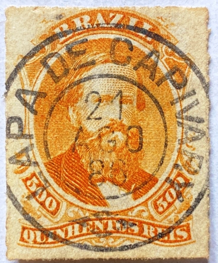
The village had been a distrito of the Vila de Leopoldina since October 1851 and was located on the north bank of the Pomba, 240 kilometres south-east of the provincial capital Ouro Preto. In February 1871 it became the Freguesia de N. Sra. da Conceição do Laranjal, which was subordinated to the Vila de Cataguazes in November 1875. Laranjal has been an independent município since December 1938.
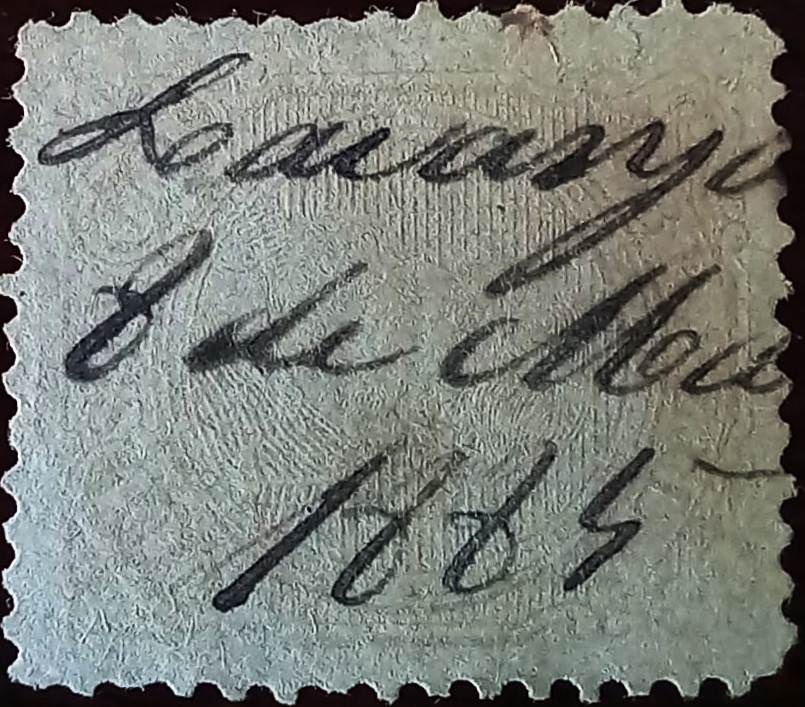
R. Koester (Carimbologia XXVI) and Paula Sobrinho (História Postal de Minas Gerais, Belo Horizonte, 1997) agree that there had been a post office there since November 1880. At first the stamps were cancelled by hand, as the illustration shows (collect. Fuad Ferreira Fo.):
1885 (FF)
The imperial postmark here is LMG-1485a (collect. Karlheinz Wittig), which also occurs in blue:
LMG-1485a (KW) 1885-1898Atlas do Imperio do Brasil, 1868
Der Ort war seit Oktober 1851 ein Distrito der Vila de Leopoldina und lag am Nordufer des Pomba, 240 km südöstlich der Provinzhauptstadt Ouro Preto. Im Februar 1871 wurde es zur Freguesia de N. Sra. da Conceição do Laranjal, die im November 1875 der Vila de Cataguazes unterstellt wurde. Seit Dezember 1938 ist Laranjal ein unabhängiges Município.
R. Koester (Carimbologia XXVI) und Paula Sobrinho (História Postal de Minas Gerais, Belo Horizonte, 1997) sind sich einig, dass es dort seit November 1880 ein Postamt gab. Zunächst wurden die Briefmarken noch von Hand entwertet, wie die Abbildung zeigt (Samml. Fuad Ferreira Fo.):
1885 (FF)
Der kaiserliche Poststempel ist hier LMG-1485a (Samml. Karlheinz Wittig), der auch in Blau vorkommt:
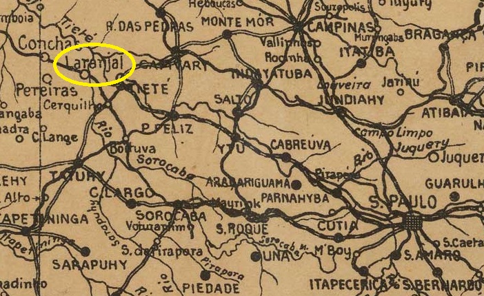
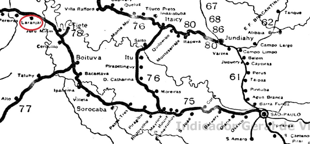
The place was originally a resting place (pouso) for cattle herders on the Ribeirão do Laranjal, Município de Tieté, 160 km north-west of the provincial capital of São Paulo. A railway station of the E.F. Sorocabana railway company (main line) was opened there in June 1886. The line went to the Cia. União Sorocabana e Ytuana in 1892, to the Sorocabana Railway in 1907, to the E.F. Sorocabana in 1919 and belonged to the FEPASA consortium from 1971 until it was closed in 1998 (estacoesferroviarias.com.br). The tracks are still there today, but the station building has been demolished.
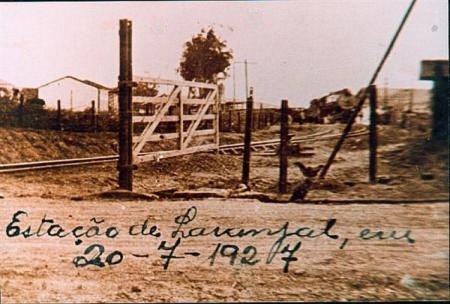
In 1927 (Photo: laranjalpaulista.sp.gov.br, on estacoesferroviarias.com.br)
The area around the railway station became a district in the Município de Tietê in November 1896. In October 1917, Laranjal became an independent Município de Laranjal, which has been called Laranjal Paulista since November 1944.
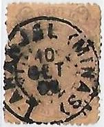
As R. Koester writes in Carimbologia XXVI, there had been a post office at the railway station since May 1886. The imperial postmark is LSP-0745a (illus. Claudio Coelho):
LSP-0745a (CC) 1889-1897Cia. Sorocabana e Ytuana, 1898 (IBGE)
Andere Namen: Laranjal Paulista (1944)
Der Ort war ursprünglich ein Rastplatz (Pouso) für Viehhirten am Ribeirão do Laranjal, Município de Tieté, 160 km nordwestlich der Provinzhauptstadt São Paulo. Dort wurde im Juni 1886 ein Bahnhof der Eisenbahngesellschaft E.F. Sorocabana (Hauptstrecke) eröffnet. Die Strecke ging 1892 an die Cia. União Sorocabana e Ytuana, 1907 an die Sorocabana Railway, 1919 an die E.F. Sorocabana und gehörte von 1971 bis zur Stilllegung 1998 dem Konsortium FEPASA (estacoesferroviarias.com.br). Heute sind die Gleise noch vorhanden, das Bahnhofsgebäude wurde abgerissen.
1927 (Foto: laranjalpaulista.sp.gov.br, auf estacoesferroviarias.com.br)
Das Gebiet um den Bahnhof wurde im November 1896 ein Distrito im Município de Tietê. Im Oktober 1917 wurde Laranjal ein unabhängiger Município de Laranjal, der seit November 1944 Laranjal Paulista heißt.
Wie R. Koester in Carimbologia XXVI schreibt, gab es am Bahnhof seit Mai 1886 ein Postamt. Der kaiserliche Poststempel ist LSP-0745a (Abb. Claudio Coelho):
Villiers de l’Ile Adam: Carta (…) das Provincias de Pernambuco, Alagoas e Sergipe, 1848
Other names: Porto de Larangeiras
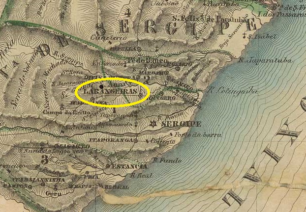
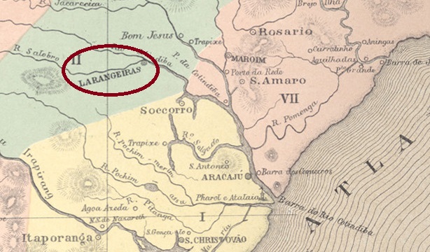
The settlement developed around a harbour on the south bank of the Cotinguiba (tributary of the Sergipe), 20 km northwest of the later provincial capital of Aracaju. From 1637 to 1645, Larangeiras was controlled by Dutch conquerors. It was not until long after the liberation, in August 1832, that it became a Vila and in February 1835 the Freguesia de Santissimo Coração de Jesus de Larangeiras. The following year, Larangeiras became the seat of the customs authority of the province of Sergipe. Since May 1848, Laranjeiras (as it is spelt today) has been a town.
Nova Monteiro writes in Administrações e Agencias Postaes do Brasil Imperio (Brasil Filatelico/RJ, 1934-5; reprint SPP 1994-1999) that there had been a post office there since March 1829. Further opening dates in 1844 and 1849 can be found in R. Koester (Carimbologia XXVI) and in the Directory of Imperial Post Offices (Tabella das Agencias do Correio do Imperio, Rio de Janeiro, 1885).
The oldest postmark to date is LSE-0110a (fig. Yuri Nobre):
LSE-0110a (YN) 1843ff-1844ff
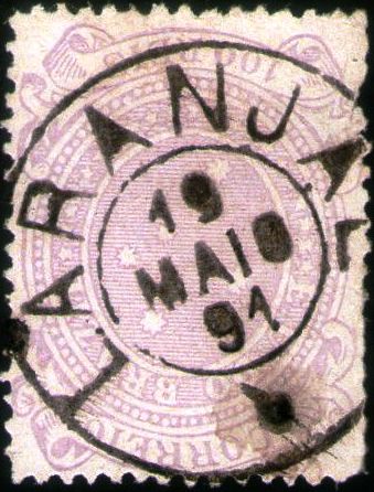
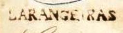
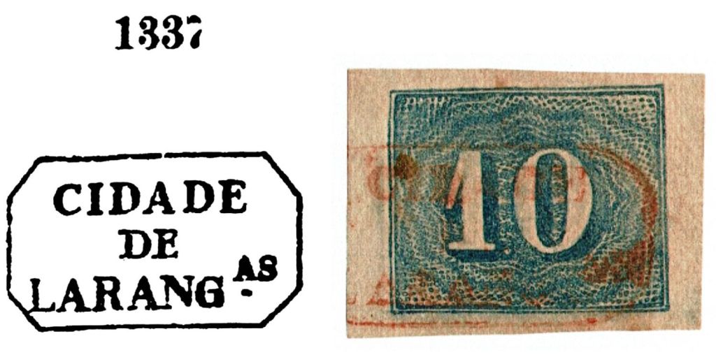
This was followed by LSE-0110b, which was given the no. 1337 in P. Ayres’ Catálogo de Carimbos Brasil-Império (S. Paulo, 1937, 1942), mostly in red, rarely in blue, here in an illustration by Cláudio Coelho:
LSE-0110b (P.A. 1337 – CC) 1843ff-1878ff
Then came the double circle LSE-0110c (illustration by Claudio Coelho):
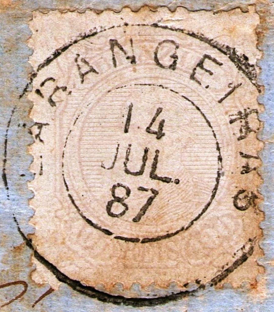
LSE-0110c (CC) 1881-1889
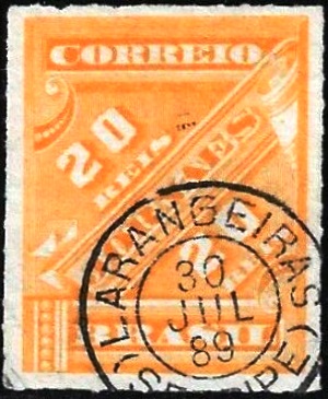
Towards the end of the century, LSE-0110d also appeared (illustration from the Internet):
LSE-0110d (EB) 1889-1899Atlas do Imperio do Brasil, 1868
Andere Namen: Porto de Larangeiras
Die Siedlung entstand um einen Hafen am Südufer des Cotinguiba (Nebenfluss des Sergipe), 20 km nordwestlich der späteren Provinzhauptstadt Aracaju. Von 1637 bis 1645 wurde Larangeiras von holländischen Eroberern kontrolliert. Erst lange nach der Befreiung, im August 1832, wurde es zur Vila und im Februar 1835 zur Freguesia de Santissimo Coração de Jesus de Larangeiras. Im folgenden Jahr wurde Larangeiras Sitz der Zollbehörde der Provinz Sergipe. Seit Mai 1848 ist Laranjeiras (wie es heute geschrieben wird) eine Stadt.
Nova Monteiro schreibt in Administrações e Agencias Postaes do Brasil Imperio (Brasil Filatelico/RJ, 1934-5; Reprint SPP 1994-1999), dass es dort seit März 1829 ein Postamt gab. Weitere Eröffnungsdaten in den Jahren 1844 und 1849 finden sich bei R. Koester (Carimbologia XXVI) und im Verzeichnis der Kaiserlichen Postämter (Tabella das Agencias do Correio do Imperio, Rio de Janeiro, 1885).
Der bisher älteste Poststempel ist LSE-0110a (Abb. Yuri Nobre):
LSE-0110a (YN) 1843ff-1844ff
Es folgte LSE-0110b, der im P. Ayres‘ Catálogo de Carimbos Brasil-Império (S. Paulo, 1937, 1942) die Nr. 1337 erhielt, meistens in rot, selten in blau vorkommend, hier in einer Abbildung von Cláudio Coelho:
LSE-0110b (P.A. 1337 – CC) 1843ff-1878ff
Danach kam der Doppelkreis LSE-0110c (Abb. Claudio Coelho):
LSE-0110c (CC) 1881-1889
Gegen Ende des Jahrhunderts erschien auch LSE-0110d (Abb. aus dem Internet):
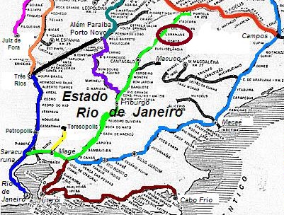
Larangeiras station was opened in 1881 by the Ramal Férreo de Cantagallo railway company and was located on the south bank of the Ribeirão das Areias in the municipality of Cantagallo, 260 km north-east of the capital Rio de Janeiro. The railway line was transferred to E.F. Macahe e Campos in 1888 and belonged to E.F. Leopoldina from 1890 until it was closed in 1967 (estacoesferroviarias.com.br). The tracks and station building have now disappeared.
Around 1950 (Photo: estacoesferroviarias.com.br)
From April 1891, the railway station was in the district of the same name in the Município de Itaocara, since December 1943 under the place name Laranjais. The original name Larangeiras, which like Laranjais means orange groves, referred to a sugar cane plantation in the region.
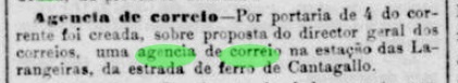
As the regional press reported, it was decided in March 1882 to create a post office at the railway station:
Jornal do Commercio, 07/03/1882
The directory of imperial post offices (Tabella das Agencias do Correio do Imperio, Rio de Janeiro, 1885) gives the year 1883 for the railway station post office, which could be the year it was opened. Paulo Novaes writes in agenciaspostais.com.br that the post office was closed in December 1943.
The oldest postmark here is LRJ-2460a (fig. R. Koester, in Carimbologia XXVI):
LRJ-2460a (RK) 1885
This was followed by LRJ-2460b, which was illustrated in P. Ayres’s Catálogo de Carimbos Brasil-Império (S. Paulo, 1937, 1942):
LRJ-2460b (P.A. p. 122) 1887-1889
LRJ-2460c also appeared towards the end of the century (illustration from the Internet):
LRJ-2460c (EB) 1890-1899
R. Koester also showed the postmark with the imperial seal LRJ-2460d in Carimbologia XXVI:
LRJ-2460d (RK)Estrada de Ferro Leopoldina
Andere Namen: Laranjais (1943)
Der Bahnhof Larangeiras wurde 1881 von der Eisenbahngesellschaft Ramal Férreo de Cantagallo eröffnet und lag am Südufer des Ribeirão das Areias im Munizip Cantagallo, 260 km nordöstlich der Hauptstadt Rio de Janeiro. Die Bahnlinie ging 1888 an die E.F. Macahe e Campos über und gehörte von 1890 bis zu ihrer Stilllegung 1967 der E.F. Leopoldina (estacoesferroviarias.com.br). Gleise und Bahnhofsgebäude sind heute verschwunden.
Um 1950 (Foto: estacoesferroviarias.com.br)
Seit April 1891 befand sich der Bahnhof im gleichnamigen Distrito im Município de Itaocara, seit Dezember 1943 unter dem Ortsnamen Laranjais. Der ursprüngliche Name Larangeiras, der wie Laranjais Orangenhaine bedeutet, bezog sich auf eine Zuckerrohrplantage in der Region.
Wie die regionale Presse berichtete, wurde im März 1882 beschlossen, am Bahnhof ein Postamt einzurichten:
Jornal do Commercio, 07.03.1882
Das Verzeichnis der kaiserlichen Postämter (Tabella das Agencias do Correio do Imperio, Rio de Janeiro, 1885) gibt für das Bahnhofspostamt das Jahr 1883 an, was das Jahr seiner Inbetriebnahme sein könnte. Paulo Novaes schreibt in agenciaspostais.com.br, dass das Postamt im Dezember 1943 geschlossen wurde.
Der älteste Poststempel hier ist LRJ-2460a (Abb. R. Koester, in Carimbologia XXVI):
LRJ-2460a (RK) 1885
Es folgte LRJ-2460b, der im P. Ayres’ Catálogo de Carimbos Brasil-Império (S. Paulo, 1937, 1942) abgebildet wurde:
LRJ-2460b (P.A. p./S. 122) 1887-1889
Gegen Ende des Jahrhunderts erschien auch LRJ-2460c (Abb. aus dem Internet):
LRJ-2460c (EB) 1890-1899
R. Koester zeigte in Carimbologia XXVI auch den Poststempel mit dem kaiserlichen Siegel LRJ-2460d:
See also Principe (R. Koester: Carimbologia XXXII)
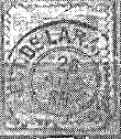
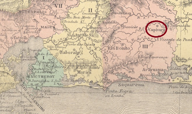
The Freguesia de Santo Antonio da Lapa had existed since June 1797. It belonged to the Vila de Curitiba, then still in the Capitania de S. Paulo, and was located 70 kilometres southwest of the later provincial capital Curitiba. In June 1806 it was elevated to Villa Nova do Principe and as such was incorporated into the province of Paraná in 1853. Since March 1872, it has been the city of Lapa.
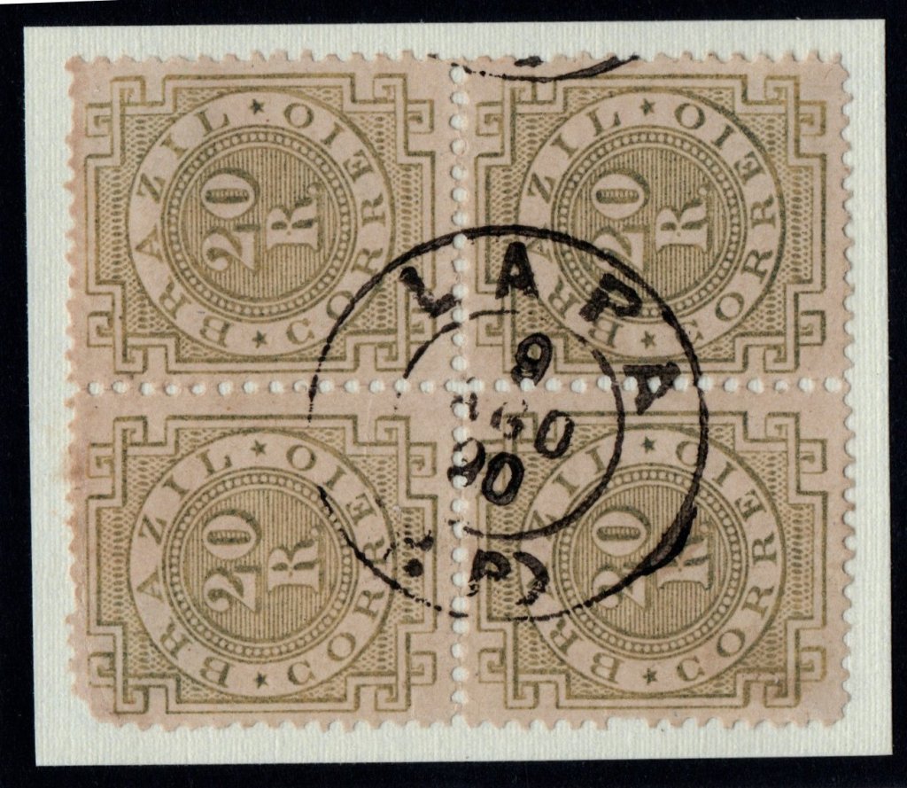
Nova Monteiro writes in Administrações e Agencias Postaes do Brasil Imperio (Brasil Filatelico/RJ, 1934-5; reprint SPP 1994-1999) that there has been a post office there since March 1836. The oldest postmark with the place name LAPA is LPR-0125a (collect. José A. Junges). Here the lower abbreviation P.P. is not clear; some read it as Porte Pago (fee paid), but Provincia do Paraná is more likely.
LPR-0125a (JJ) 1878ff-1890
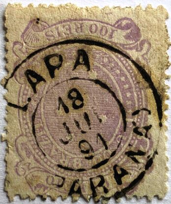
This was followed by LPR-0125b (fig. Roberto Assef Jr.), which also exists in purple:
LPR-0125b (RA) 1891-1898
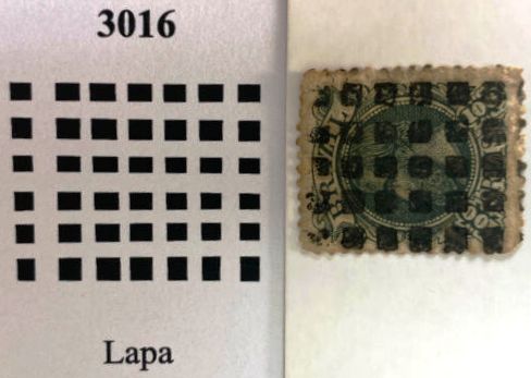
James Dingler and Klerman W. Lopes in Mute Cancellations of the Brazil Empire / Carimbos Mudos do Brasil Império (Brazil Philatelic Association, Rio de Janeiro, 2000) have also listed a mute cancellation for Lapa under no. 3016, here also in an example by R. Assef Jr:
BPA 3016 (P.A. 300-RA) 1882ff-1883
For postmarks with Principe see R. Koester’s Carimbologia XXXII.
Estado do Paraná, 1892
Andere Namen: Villa Nova do Principe, Principe
Siehe auch Principe (R. Koester: Carimbologia XXXII)
Die Freguesia de Santo Antonio da Lapa bestand seit Juni 1797. Sie gehörte zur Vila de Curitiba, damals noch in der Capitania de S. Paulo, und lag 70 km südwestlich der späteren Provinzhauptstadt Curitiba. Im Juni 1806 wurde sie zur Villa Nova do Principe erhoben und als solche 1853 in die Provinz Paraná eingegliedert. Seit März 1872 ist es die Stadt Lapa.
Nova Monteiro schreibt in Administrações e Agencias Postaes do Brasil Imperio (Brasil Filatelico/RJ, 1934-5; Reprint SPP 1994-1999), dass es dort seit März 1836 ein Postamt gab. Der älteste Poststempel mit der Ortsbezeichnung LAPA ist LPR-0125a (Samml. José A. Junges). Hier ist die untere Abkürzung P.P. nicht eindeutig; manche lesen sie als Porte Pago (Gebühr bezahlt), wahrscheinlicher ist aber Provincia do Paraná.
LPR-0125a (JJ) 1878ff-1890
Es folgte LPR-0125b (Abb. Roberto Assef Jr.), die es auch in violett gibt:
LPR-0125b (RA) 1891-1898
James Dingler und Klerman W. Lopes haben in Mute Cancellations of the Brazil Empire / Carimbos Mudos do Brasil Império (Brazil Philatelic Association, Rio de Janeiro, 2000) auch einen stummen Stempel für Lapa unter Nr. 3016 aufgeführt, hier auch in einem Beispiel von R. Assef Jr:
BPA 3016 (P.A. 300-RA) 1882ff-1883
Für Poststempel mit Principe siehe R. Koesters Carimbologia XXXII.
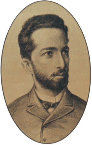
The Freguesia de N. Sra. da Lapa de Capivary was founded in January 1755, belonged to the Vila de Cabo Frio and was located on the south bank of the Capivary, 110 km east of the capital Rio de Janeiro. The place was elevated to Vila in May 1841 and to town in January 1890. Since December 1943, the município has borne the name Silva Jardim, in honour of Antônio da Silva Jardim (1860-1891). He was a lawyer, journalist and politician who strongly supported the Republic and the abolition of slavery. He died shortly before his 31st birthday in an accident on Mount Vesuvius:
Silva Jardim, self-portrait
Three dates have been found for the founding of the local post office. First around 1841, as shown in the 1842 report of the Imperial Ministry:
Relatorio do Ministerio do Imperio, 1842
The next two dates are close together, from February 1843: Paulo Novaes (agenciaspostais.com.br) writes 3 February, while Nova Monteiro (Administrações e Agencias Postaes do Brasil Imperio, in Brasil Filatelico/RJ, 1934-5; reprint SPP 1994-1999) gives a date 10 days later.
The oldest postmarks bear the place name CAPIVARY (see CRJ-0300). Paulo Novaes writes in agenciaspostais.com.br that the post office was renamed LAPA DE CAPIVARY in March 1881. The first postmark with the new place name is LRJ-0690a (fig. Felipe Piccinini):
LRJ-0690a (FP) 1885-1889
This was followed at the end of the century by LRJ-0690b (illustration from the Internet):
LRJ-0690b (EB) 1891-1900ffVilliers de l’Ile Adam: Carta (…) da Provincia do Rio de Janeiro, 1850
Andere Namen: Capivary, Silva Jardim (1943)
Die Freguesia de N. Sra. da Lapa de Capivary wurde im Januar 1755 gegründet, gehörte zur Vila de Cabo Frio und lag am Südufer des Capivary, 110 km östlich der Hauptstadt Rio de Janeiro. Der Ort wurde im Mai 1841 zur Vila und im Januar 1890 zur Stadt erhoben. Seit Dezember 1943 trägt der Município den Namen Silva Jardim, zu Ehren von Antônio da Silva Jardim (1860-1891). Dieser war Anwalt, Journalist und Politiker, der sich stark für die Republik und die Abschaffung der Sklaverei einsetzte. Er starb kurz vor seinem 31. Geburtstag bei einem Unfall auf dem Vesuv:
Silva Jardim, Selbstporträt
Für die Gründung des örtlichen Postamtes wurden drei Daten gefunden. Zuerst um 1841, wie aus dem Bericht des kaiserlichen Ministeriums von 1842 hervorgeht:
Relatorio do Ministerio do Imperio, 1842
Die nächsten beiden Daten sind nahe beieinander, aus dem Februar 1843: Paulo Novaes (agenciaspostais.com.br) schreibt den 3. Februar, während Nova Monteiro (Administrações e Agencias Postaes do Brasil Imperio, in Brasil Filatelico/RJ, 1934-5; Reprint SPP 1994-1999) ein um 10 Tage späteres Datum angibt.
Die ältesten Poststempel tragen die Ortsbezeichnung CAPIVARY (siehe CRJ-0300). Paulo Novaes schreibt in agenciaspostais.com.br, dass im März 1881 das Postamt zu LAPA DE CAPIVARY umbenannt wurde. Der erste Stempel mit der neuen Ortsbezeichnung ist LRJ-0690a (Abb. Felipe Piccinini):
LRJ-0690a (FP) 1885-1889
Am Ende des Jahrhunderts folgte LRJ-0690b (Abb. aus dem Internet):
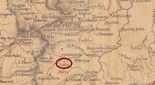
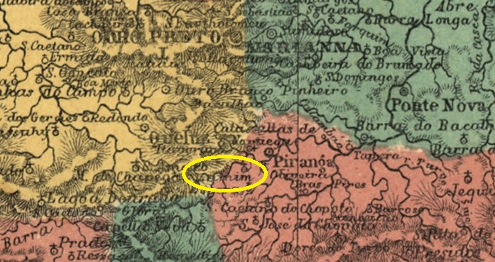
José Pires Lamim was the settler who had the first chapel built in July 1760, 65 kilometres south of the later provincial capital of Ouro Preto. The settlement was named after him and in 1840 became a district of Vila de Queluz (today: Conselheiro Lafaiete). In July 1859, it became the Freguesia de Espírito Santo do Lamim, which was subordinated to the Município de Rio Espera as a Distrito in December 1938. Lamim has been an independent município since December 1962.
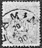
Paula Sobrinho (História Postal de Minas Gerais, Belo Horizonte, 1997) and R. Koester (Carimbologia XXVI) agree that there has been a post office there since May 1879. The oldest postmark to date is still handwritten (fig. Koester, op. cit.):
1883ff (RK)
The postmark LMG-1480b (Fig. Koester) was only added towards the end of the century:
LMG-1480b (RK) 1890Atlas do Imperio do Brasil, 1868
José Pires Lamim war der Siedler, der im Juli 1760 die erste Kapelle errichten ließ, 65 km südlich der späteren Provinzhauptstadt Ouro Preto. Die Siedlung wurde nach ihm benannt und 1840 zu einem Distrikt der Vila de Queluz (heute: Conselheiro Lafaiete). Im Juli 1859 wurde daraus die Freguesia de Espírito Santo do Lamim, die im Dezember 1938 als Distrito dem Município de Rio Espera unterstellt wurde. Seit Dezember 1962 ist Lamim ein unabhängiges Município.
Paula Sobrinho (História Postal de Minas Gerais, Belo Horizonte, 1997) und R. Koester (Carimbologia XXVI) sind sich einig, dass es dort seit Mai 1879 ein Postamt gab. Der bisher älteste Poststempel ist noch handschriftlich (Abb. Koester, op. cit.):
1883ff (RK)
Erst gegen Ende des Jahrhunderts kam der Poststempel LMG-1480b (Abb. Koester) hinzu:
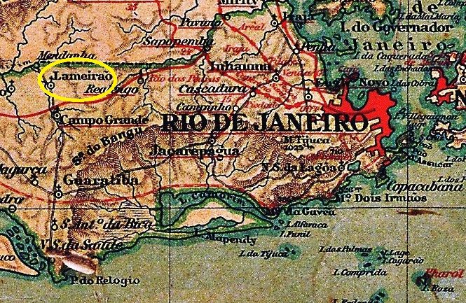
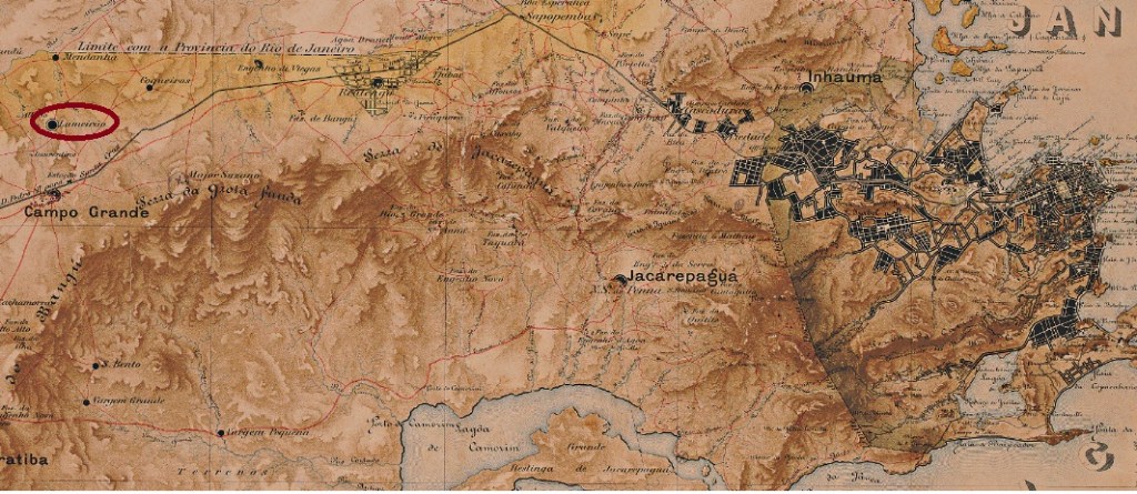
Lameirão was the name of an estate with sugar cane cultivation and processing (Engenho) in the Freguesia do Campo Grande, 50 kilometres west of the capital Rio de Janeiro, at the beginning of the 19th century. The settlement around the chapel of N. Sra. da Conceição do Lameirão grew slowly and became the Santíssimo neighbourhood in 1892. Since July 1981, it has belonged to the administrative district (Região Administrativa) of Campo Grande in the Município Rio de Janeiro.
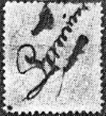
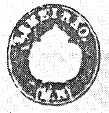
Paulo Novaes writes in agenciaspostais.com.br that there had been a post office there since April 1884. The only imperial postmark to date, LMN-0140a (fig. R. Koester, in Carimbologia XXVI), bears the imperial seal:
LMN-0140a (RK)Mappa do Municipio Neutro, 1880
Andere Namen: Santissimo (1892)
Lameirão war der Name eines Landgutes mit Zuckerrohranbau und -verarbeitung (Engenho), das zu Beginn des 19. Jahrhunderts in der Freguesia do Campo Grande, 50 km westlich der Hauptstadt Rio de Janeiro, lag. Die Siedlung um die Kapelle N. Sra. da Conceição do Lameirão wuchs langsam und wurde 1892 zum Stadtteil Santíssimo. Dieser gehört seit Juli 1981 zum Verwaltungsbezirk (Região Administrativa) Campo Grande im Município Rio de Janeiro.
Paulo Novaes schreibt in agenciaspostais.com.br, dass es dort seit April 1884 ein Postamt gab. Der bisher einzige kaiserliche Poststempel LMN-0140a (Abb. R. Koester, in Carimbologia XXVI) trägt den kaiserlichen Siegel: