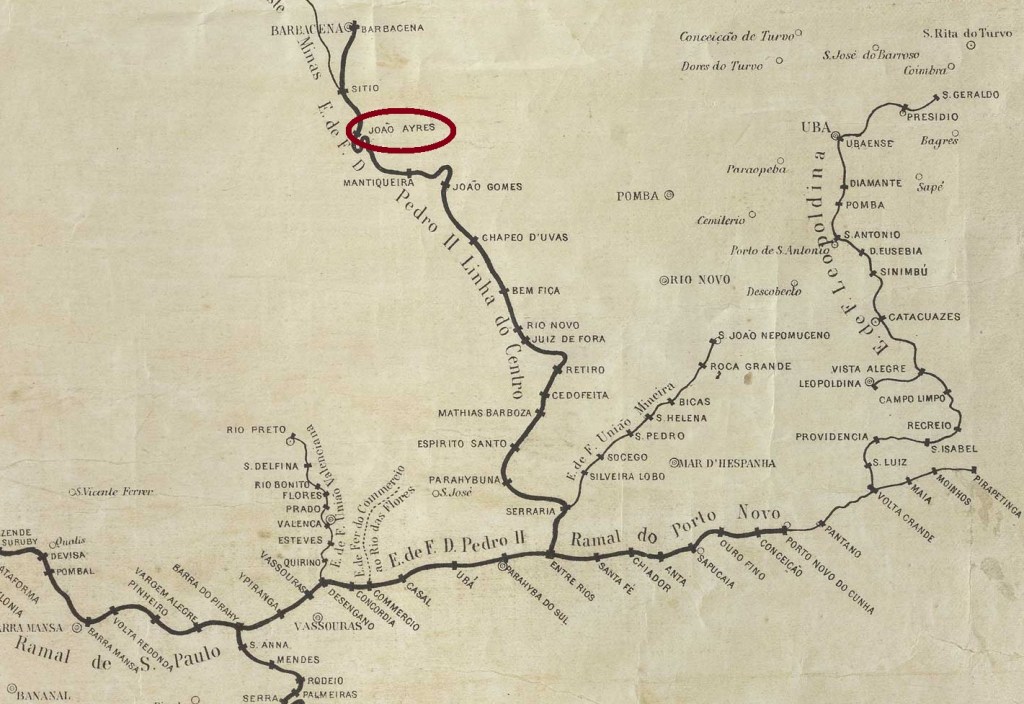
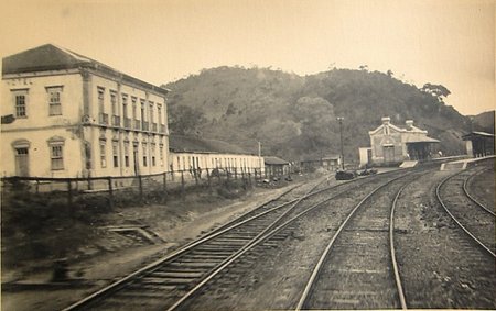
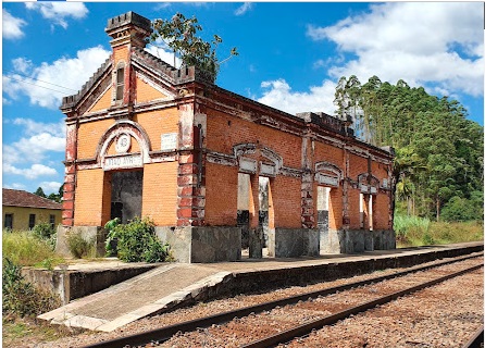
João Ayres station was opened in June 1878 by the railway company E.F.D. Pedro II (Center Line) in the Município de Barbacena, 150 km south of the provincial capital Ouro Preto. João Ayres Gomes was a major landowner in the region. The railway line was transferred to E.F. Central do Brasil in 1889 and belonged to Rede Ferroviária Federal S.A. (estacoesferroviarias.com.br) from 1975 until it was closed in 1996. Today the tracks are still there, the station building is an abandoned ruin.


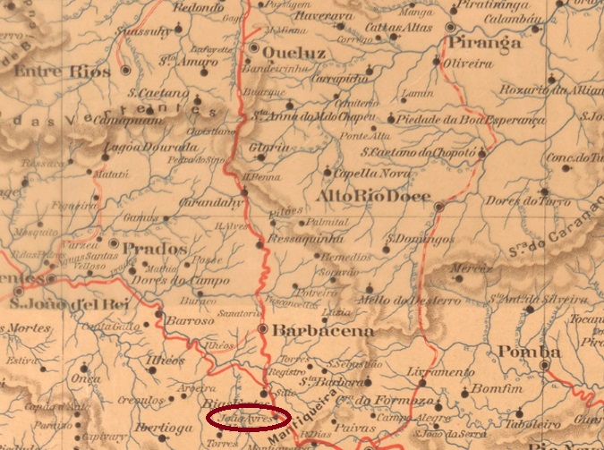
The station area belonged to the Distrito de Curral Novo from September 1891, 4 years later to the Distrito de Bias Fortes, from December 1938 to the Distrito de Sítio, and since December 1948 it has been part of the Município de Antonio Carlos.
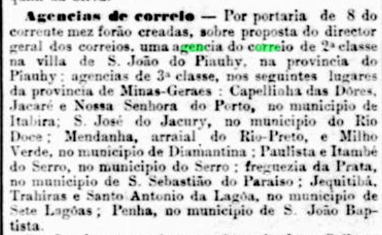
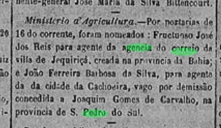
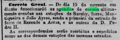
Two dates have been found for the foundation of the station post office. Both Paula Sobrinho (História Postal de Minas Gerais, Belo Horizonte, 1997) and R. Koester (Carimbologia XXV) write of July 1881, but the Rio press reported it as early as 1879:

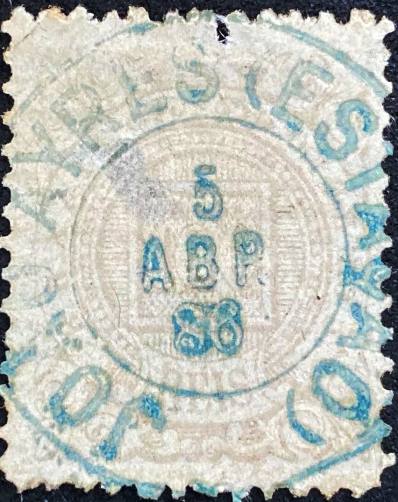
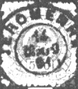
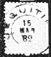
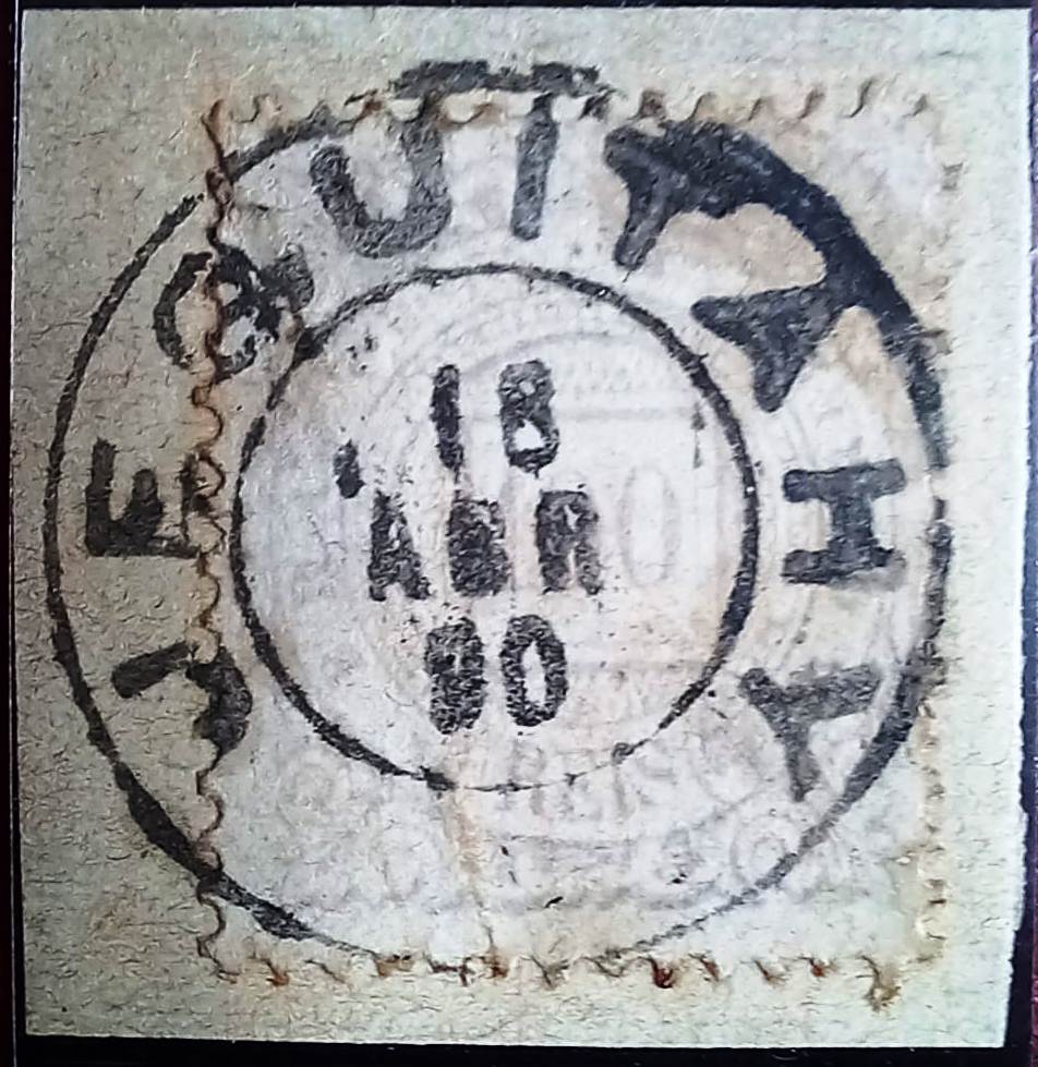
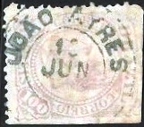
The later date presumably refers to the operation begin of the railway station post office. The oldest postmark to date is JMG-1440a (image from the Internet):
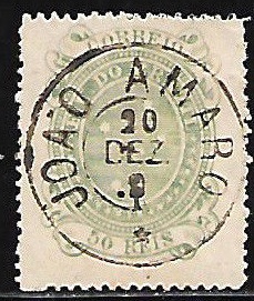
This was followed by JMG-1440b (ill. by Felipe Piccinini), which also occurs in turquoise blue:

Der Bahnhof João Ayres wurde im Juni 1878 von der Eisenbahngesellschaft E.F.D. Pedro II (Hauptlinie) eröffnet und lag im Município de Barbacena, 150 km südlich der Provinzhauptstadt Ouro Preto. João Ayres Gomes war Großgrundbesitzer in der Region. Die Bahnlinie ging 1889 an die E.F. Central do Brasil über und gehörte von 1975 bis zu ihrer Stilllegung 1996 der Rede Ferroviária Federal S.A. (estacoesferroviarias.com.br). Heute sind die Gleise noch vorhanden, das Bahnhofsgebäude ist eine verlassene Ruine.
Das Bahnhofsgelände gehörte ab September 1891 zum Distrito de Curral Novo, 4 Jahre später zum Distrito de Bias Fortes, ab Dezember 1938 zum Distrito de Sítio, seit Dezember 1948 liegt es im Município de Antonio Carlos.
Für die Gründung des Bahnhofspostamtes wurden zwei Daten gefunden. Sowohl Paula Sobrinho (História Postal de Minas Gerais, Belo Horizonte, 1997) als auch R. Koester (Carimbologia XXV) schreiben von Juli 1881. Die Presse von Rio berichtete jedoch bereits 1879 darüber:
Vermutlich handelt es sich bei dem späteren Datum um die Inbetriebnahme des Bahnhofspostamtes. Der bisher älteste Poststempel ist JMG-1440a (Abb. aus dem Internet):

Es folgte JMG-1440b (Abb. Felipe Piccinini), der auch in türkisblau vorkommt: