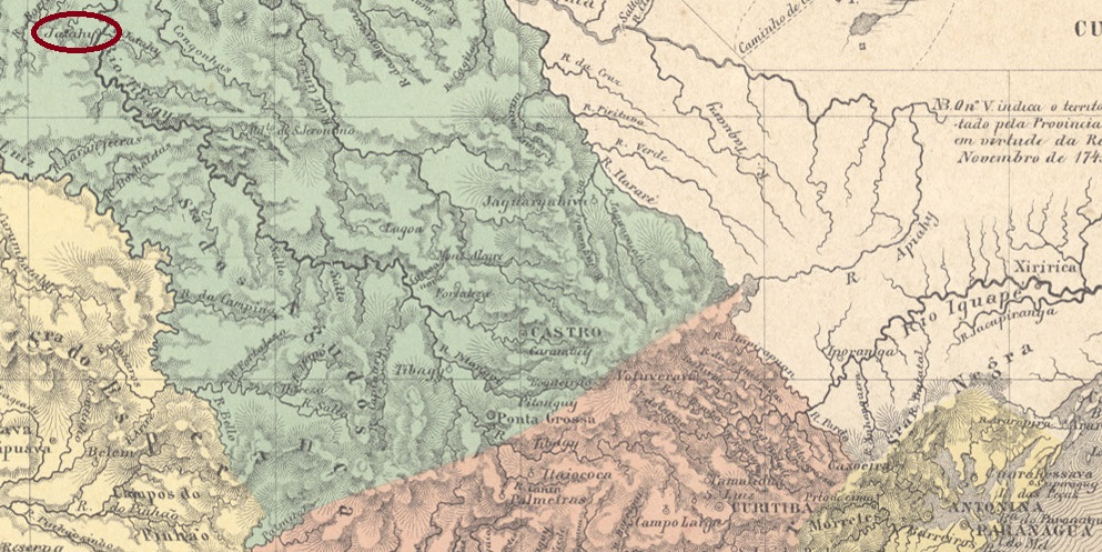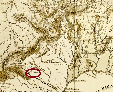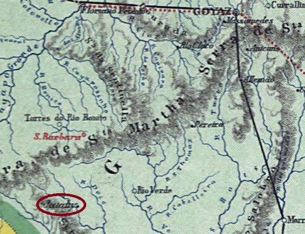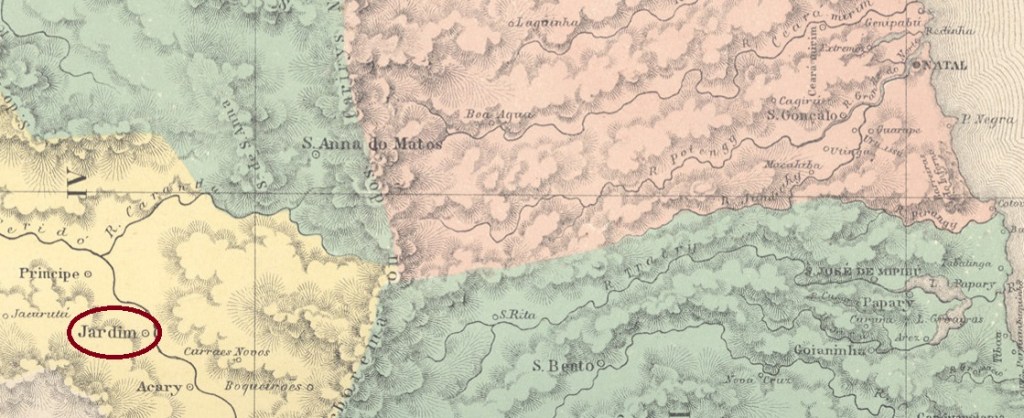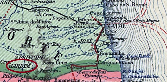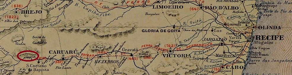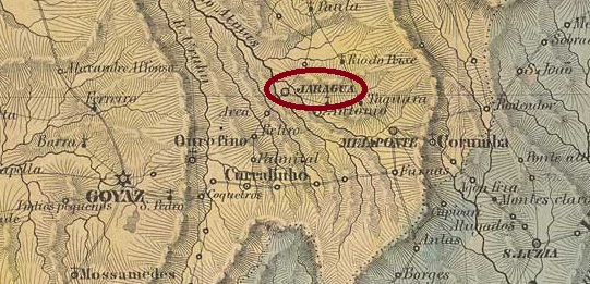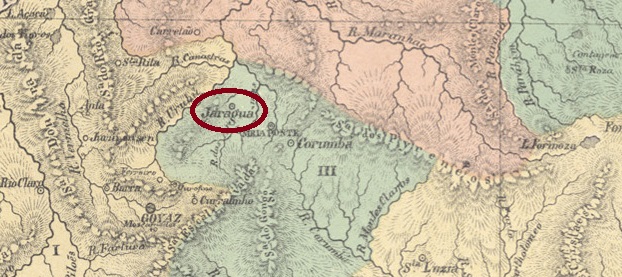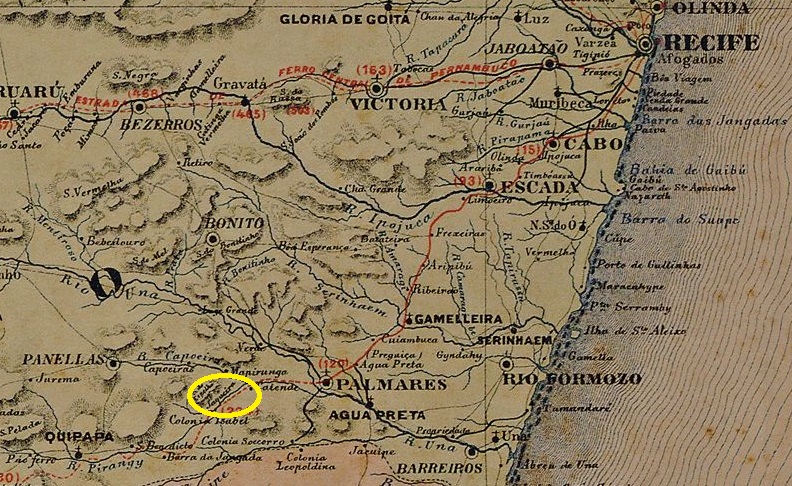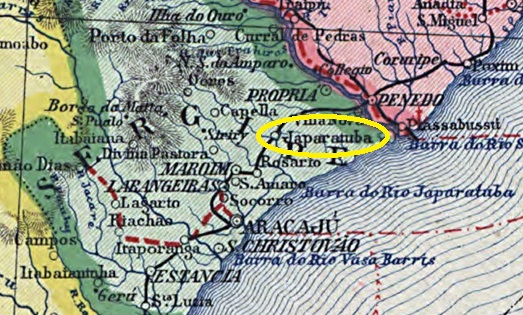
The settlement belonged to the Vila de Tacaratu and was located on the east bank of the São Francisco, 410 kilometres west of the provincial capital Recife. In May 1887 it became the seat of the Vila de Tacaratu and in July 1909 was elevated to the Cidade de Jatobá. In September 1928, it was downgraded to Distrito de Jatobá de Tacaratu in the reconstituted Município de Tacaratu. This was followed by two renamings: in December 1937 to Itaparica (which was declared a município a year later) and in December 1943 to Petrolândia. Today there is also a Município de Jatobá in the region, located 30 kilometres further south.
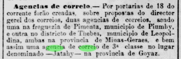
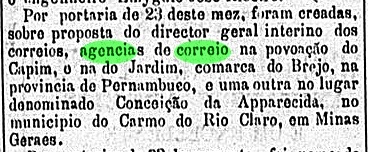
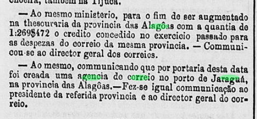
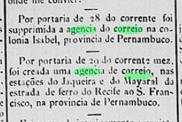
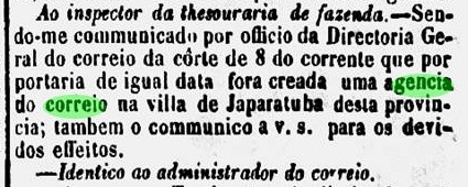
As can be read in the Rio press, there had been a post office since January 1885:

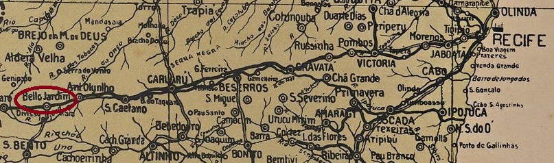
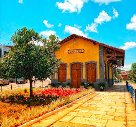
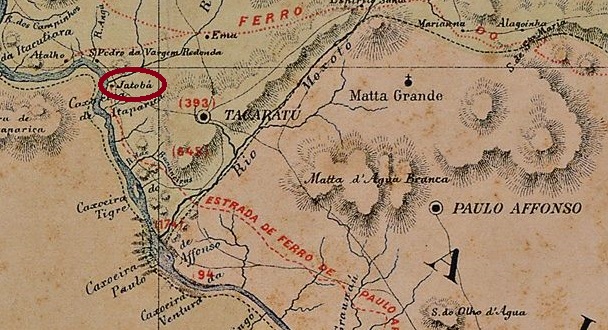
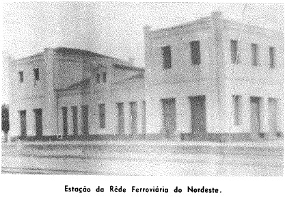
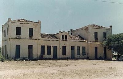
However, the directory of imperial post offices (Tabella das Agencias do Correio do Imperio, Rio de Janeiro, 1885) lists a Jatobá station post office, founded 1884. This is probably directly related to the opening of the railway station of the E.F. Paulo Afonso railway company in July 1883. The railway line was transferred to Great Western in 1903 and belonged to Rede Ferroviária do Nordeste (estacoesferroviarias.com.br) from 1950 until its closure in 1964. The tracks are still there today, but the station building has long since been demolished.


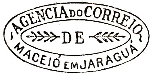
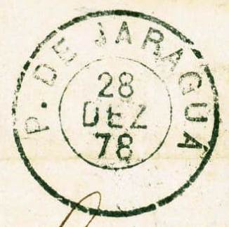
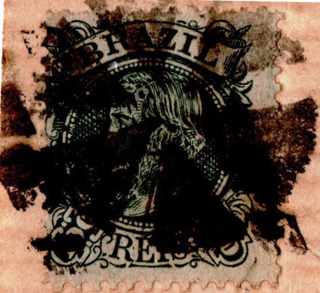
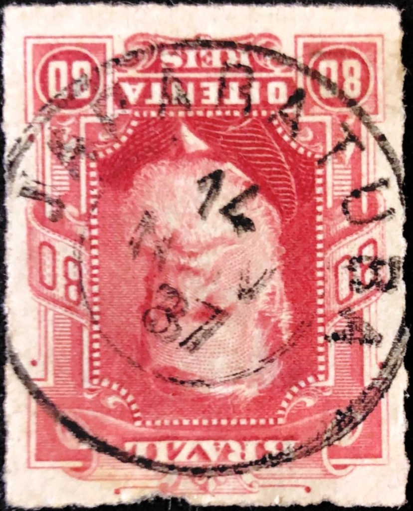
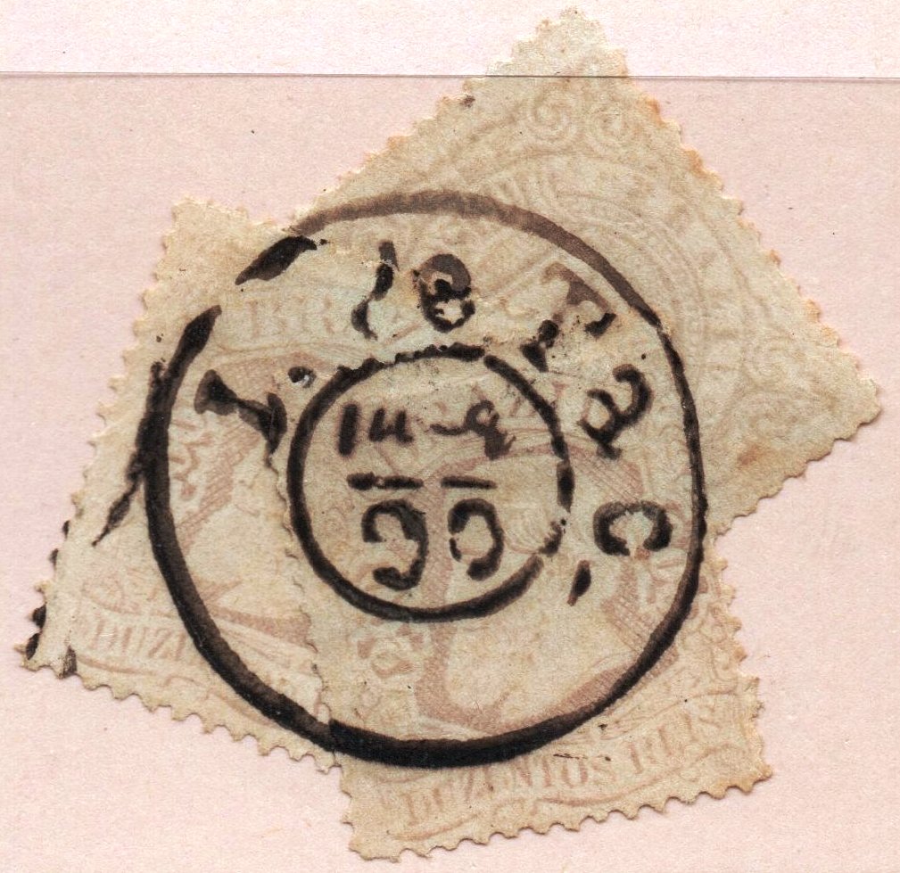
The oldest postmark is the archaic-looking JPE-0345a (José A. Junges collection):

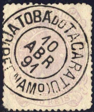
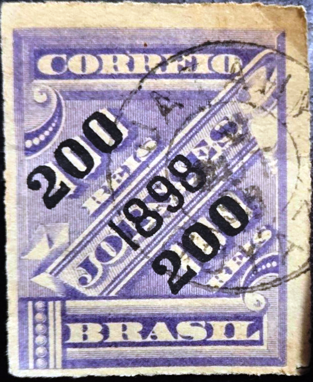
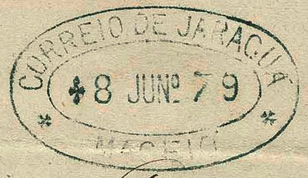
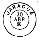
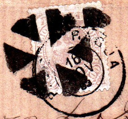
JPE-0345b (Dieter Kerkhoff collection) followed towards the end of the century:

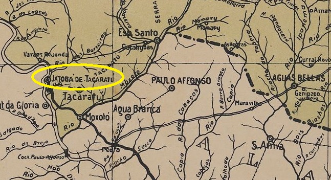
Die Siedlung gehörte zur Vila de Tacaratu und lag am Ostufer des São Francisco, 410 km westlich der Provinzhauptstadt Recife. Im Mai 1887 wurde sie Sitz der Vila de Tacaratu und im Juli 1909 zur Cidade de Jatobá erhoben. Im September 1928 erfolgte die Herabstufung zum Distrito de Jatobá de Tacaratu im wiederhergestellten Município de Tacaratu. Es folgten zwei Umbenennungen: im Dezember 1937 in Itaparica (das ein Jahr später zum Município erklärt wurde) und im Dezember 1943 in Petrolândia. Heute gibt es in der Region auch ein Município de Jatobá, dieses liegt 30 km weiter südlich.
Wie in der Presse von Rio zu lesen ist, gab es seit Januar 1885 ein Postamt:
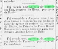
Im Verzeichnis der Kaiserlichen Postämter (Tabella das Agencias do Correio do Imperio, Rio de Janeiro, 1885) ist jedoch ein Bahnhofspostamt Jatobá mit dem Gründungsjahr 1884 aufgeführt. Dies dürfte in direktem Zusammenhang mit der Eröffnung des Bahnhofs der Eisenbahngesellschaft E.F. Paulo Afonso im Juli 1883 stehen. Die Bahnlinie ging 1903 an die Great Western über und gehörte von 1950 bis zu ihrer Schließung 1964 der Rede Ferroviária do Nordeste (estacoesferroviarias.com.br). Heute sind die Gleise noch vorhanden, das Bahnhofsgebäude ist längst abgerissen.
Der älteste Poststempel ist der archaisch anmutende JPE-0345a (Samml. José A. Junges):
Gegen Ende des Jahrhunderts folgte JPE-0345b (Sammlung Dieter Kerkhoff):