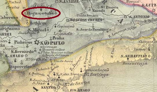
Villiers de l’Ile Adam: Carta (…) da Provincia de São Paulo, 1847
Other names: Itaquacetuba, Itaquecetuba
The Freguesia de N. Sta da Ajuda de Itaquaquecetuba, founded in February 1838, belonged to the Vila de Mogy das Cruzes and was located on the north bank of the Tietê, 40 kilometres east of the provincial capital of São Paulo. Itaquaquecetuba (or simply Itaquá, as it is known) has been an independent município since November 1953. The name comes from the Tupi-guarani and means a lot of cutting bamboo.
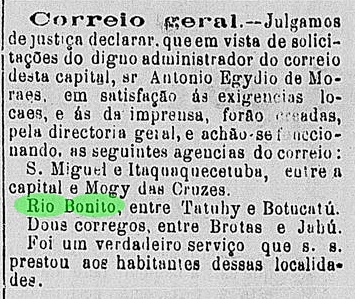
The local post office was opened following a decision at the beginning of 1872, as reported in the regional press:
Diario de São Paulo, 20/03/1872
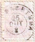
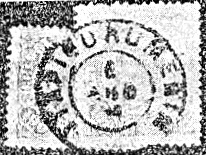
The only imperial postmark to date is ISP-0630a (image from the Internet):
ISP-0630a (EB) 1883ff-1887Atlas do Imperio do Brasil, 1868
Andere Namen: Itaquacetuba, Itaquecetuba
Die im Februar 1838 gegründete Freguesia de N. Sta da Ajuda de Itaquaquecetuba gehörte zur Vila de Mogy das Cruzes und lag am Nordufer des Tietê, 40 km östlich der Provinzhauptstadt São Paulo. Seit November 1953 ist Itaquaquecetuba (oder einfach Itaquá, wie der Ort genannt wird) ein eigenständiges Município. Der Name stammt aus dem Tupi-guarani und bedeutet viel schneidende Bambus.
Das örtliche Postamt wurde nach einem Beschluss Anfang 1872 eröffnet, wie die regionale Presse berichtete:
Diario de São Paulo, 20.03.1872
Der bisher einzige kaiserliche Poststempel ist ISP-0630a (Abbildung aus dem Internet):
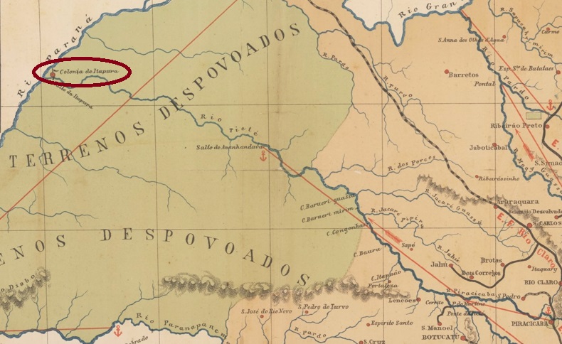
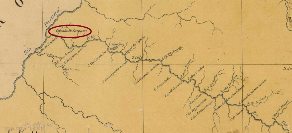
This military colony was founded in July 1858 on the north bank of the mouth of the Tietê into the Paraná, directly on the border with present-day Mato Grosso do Sul, 680 kilometres northwest of the provincial capital of São Paulo, and was intended to ensure the protection of Brazil’s western flank. When the Paraguay War broke out in 1864, the colony was probably not yet ready for operation. It was not until October 1909 that it became a district of the Município de S. José do Rio Preto and in December 1924 of the district of Novo Oriente, which now belonged to the Município de Monte Aprazível. In November 1938, the district was elevated to the Município de Pereira Barreto. The name commemorates Luiz Pereira Barreto (1840-1923), doctor, scientist and university professor, who is considered the discoverer of guaraná as a medicine, among other things.
Luiz P. Barreto (Photo: Militão A. De Azevedo, Museu Paulista da USP)
The municipal seat of Pereira Barreto was now a former fazenda of Japanese immigrants, located about 25 kilometres east of the former military colony of Itapura. Itapura was downgraded to a district in February 1959, as the Jupiá reservoir (Eng. Souza Dias hydroelectric power station) flooded the entire village the following year.
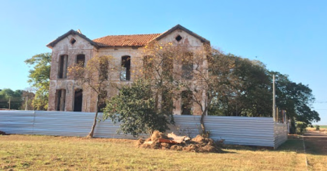
The old village of Itapura was moved to a higher location and five years later became the new Município de Itapura. The former administrative building of the military colony, the Palácio do Imperador (Imperial Palace), was extensively renovated from 2021 on:
Palácio do Imperador, in August 2020 (Photo: Vinicius D. B. de Oliveira, on Google Maps)
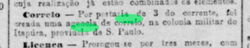
The local post office was created in August 1883, as recorded by the Rio press:
Jornal do Commercio/RJ, 05.08.1883
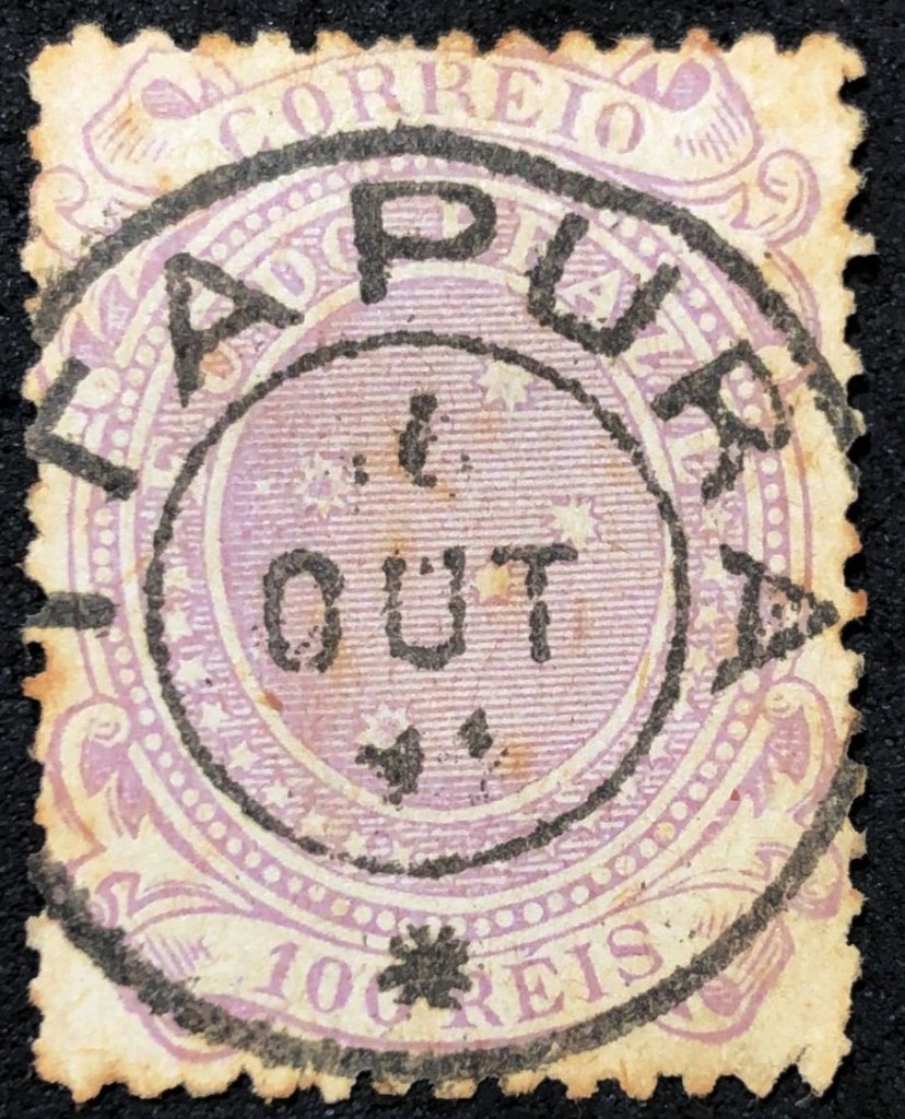
To date, the earliest postmark from Colonia de Itapura is ISP-0625a (Il. Felipe Piccinini):
ISP-0625a (FP) 1891J. M. Ribeiro Lisboa: Provincia de São Paulo, 1884
Andere Namen: Novo Oriente, Pereira Barreto
Diese Militärkolonie wurde im Juli 1858 am Nordufer der Mündung des Tietê in den Paraná, direkt an der Grenze zum heutigen Mato Grosso do Sul, 680 km nordwestlich der Provinzhauptstadt São Paulo, gegründet und sollte den Schutz der Westflanke Brasiliens sicherstellen. Als 1864 der Paraguay-Krieg ausbrach, war die Kolonie vermutlich noch nicht einsatzbereit. Erst im Oktober 1909 wurde sie ein Distrikt des Município de S. José do Rio Preto und im Dezember 1924 des Distrikts Novo Oriente, der nun zum Município de Monte Aprazível gehörte. Im November 1938 erfolgte die Erhebung zum Município de Pereira Barreto. Der Name erinnert an Luiz Pereira Barreto (1840-1923), Arzt, Wissenschaftler und Universitätsprofessor, der unter anderem als Entdecker des Guaraná als Medikament gilt.
Luiz P. Barreto (Foto: Militão A. De Azevedo, Museu Paulista da USP)
Der Gemeindesitz von Pereira Barreto war nun eine ehemalige Fazenda japanischer Einwanderer, etwa 25 km östlich der ehemaligen Militärkolonie Itapura gelegen. Itapura wurde im Februar 1959 zum Distrikt herabgestuft, da im folgenden Jahr der Stausee Jupiá (Wasserkraftwerk Eng. Souza Dias) den gesamten Ort überflutete.
Das alte Dorf Itapura wurde auf eine höhere Lage verlegt und wurde fünf Jahre später zum neuen Município de Itapura. Das ehemalige Verwaltungsgebäude der Militärkolonie, der Palácio do Imperador (Kaiserpalast), wurde ab 2021 aufwendig renoviert:
Palácio do Imperador, im August 2020 (Foto: Vinicius D. B. de Oliveira, auf Google Maps)
Die Einrichtung eines Postamts wurde im August 1883 beschlossen, wie die Presse aus Rio meldete:
Jornal do Commercio/RJ, 05.08.1883
Der bisher älteste Poststempel aus Colonia de Itapura ist ISP-0625a (Abb. Felipe Piccinini):
Other names: Itapocoranga, Itapiranga, Itaporanga d’Ajuda (1949)
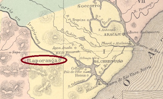
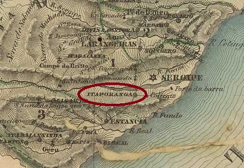
From 1575, Itaporanga was an Indian settlement looked after by Jesuits on the west bank of the Vaza-Barris, more than 30 kilometres west of the later provincial capital of Aracaju. In January 1845, it was elevated to the Freguesia de N. Sra. d’Ajuda de Itaporanga, which belonged to the Vila de S. Cristóvão, in May 1854 to an independent Vila and in March 1938 to a town. The name comes from the Tupi-guarani and means beautiful stone.
As other Itaporangas had been created in Paraíba and São Paulo in the meantime, the place name was changed twice more: in December 1943 to Irapiranga and in January 1949 to Município de Itaporanga d’Ajuda.
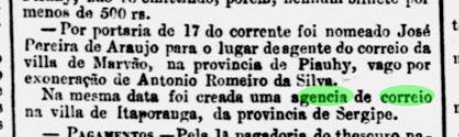
Nova Monteiro writes in Administrações e Agencias Postaes do Brasil Imperio (Brasil Filatelico/RJ, 1934-5; reprint SPP 1994-1999) that the local post office was created in July 1864. However, the establishment of a postal agency in Itaporanga had already been reported in the Rio press the previous month:
Jornal do Commercio/RJ, 20/06/1864
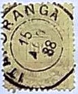
The only imperial postmark here so far is ISE-0095b (image from the Internet):
ISE-0095b (EB) 1887ff-1888Villiers de l’Ile Adam: Carta (…) das Provincias de Pernambuco, Alagoas e Sergipe, 1848
Andere Namen: Itapocoranga, Itapiranga, Itaporanga d’Ajuda (1949)
Seit 1575 war Itaporanga eine von Jesuiten betreute Indianersiedlung am Westufer des Vaza-Barris, mehr als 30 km westlich der späteren Provinzhauptstadt Aracaju. Im Januar 1845 wurde sie zur Freguesia de N. Sra. d’Ajuda de Itaporanga erhoben, die zur Vila de S. Cristóvão gehörte, im Mai 1854 zur eigenständigen Vila und im März 1938 zur Stadt. Der Name stammt aus dem Tupi-guarani und bedeutet schöner Stein.
Da in der Zwischenzeit weitere Itaporangas in Paraíba und São Paulo entstanden waren, wurde der Ortsname noch zweimal geändert: im Dezember 1943 in Irapiranga und im Januar 1949 in Município de Itaporanga d’Ajuda.
Nova Monteiro schreibt in Administrações e Agencias Postaes do Brasil Imperio (Brasil Filatelico/RJ, 1934-5; Reprint SPP 1994-1999), dass das örtliche Postamt im Juli 1864 eröffnet wurde. Allerdings wurde bereits im Vormonat in der Presse von Rio über die Einrichtung einer Postagentur in Itaporanga berichtet:
Jornal do Commercio/RJ, 20.06.1864
Der bisher einzige kaiserliche Poststempel hier ist ISE-0095b (Abbildung aus dem Internet):
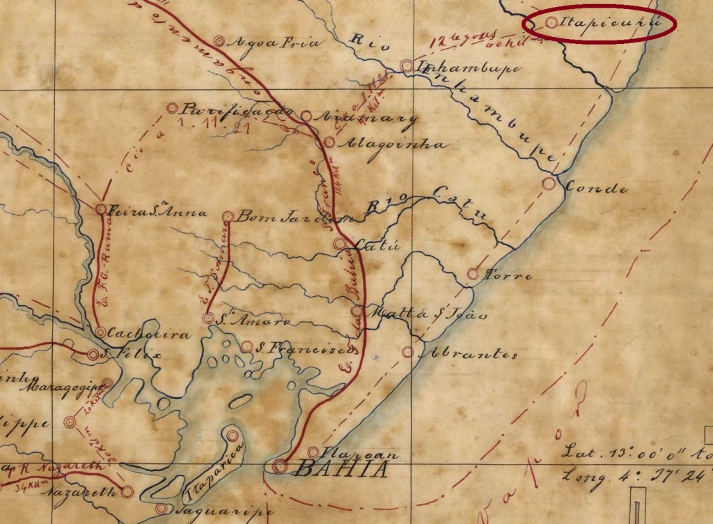
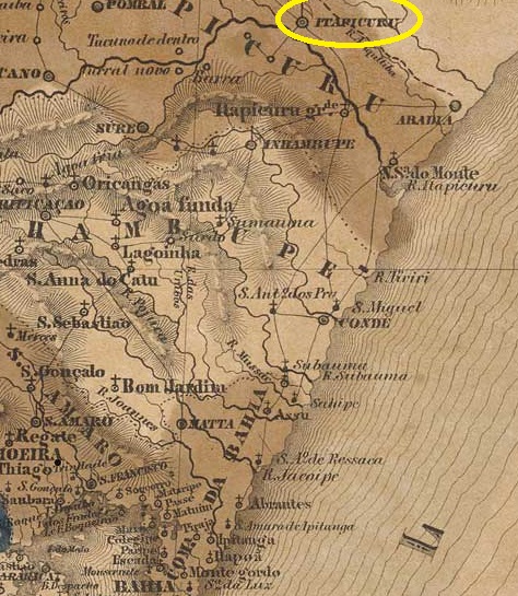
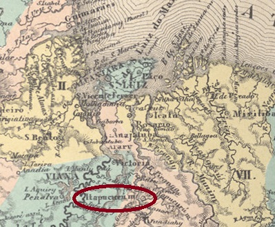
The Freguesia de N. Sra. de Nazareth do Itapicuru de Cima on the north bank of the Itapicuru, 230 kilometres north of the colonial capital Salvador da Bahia, had existed since 1698. In April 1728, Itapicuru was elevated to a Vila, but in June 1931 this Município was extinguished and its territory was assigned to the municipalities of Inhambupe and Rio Real. Itapicuru was declared an independent município again in May 1933. The name from the Tupi-Guarani means flat stone; there is also a tree of the Fabaceae family with this name:
Goniorrhachis marginata, Taub. (Photo Matt Levin, CC BY-SA)
The directory of imperial post offices (Tabella das Agencias do Correio do Imperio, Rio de Janeiro, 1885) shows that there has been a post office there since 1866. However, R. Koester (Carimbologia XXIV) gives September 1865 as the date.
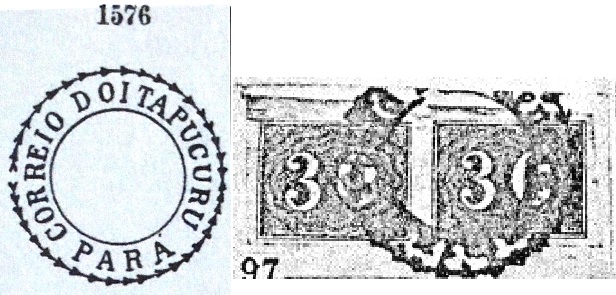
The only postmark of the Empire to date is also controversial. According to P. Ayres (Catálogo de Carimbos Brasil-Império, S. Paulo, 1937, 1942), the postmark with the no. 1576 is said to come from Itapucuru in the province of Pará, but R. Koester (op. cit.) is convinced that IBA-0410a comes from Itapucuru in Bahia:
IBA-0410a (P.A. 1576 – recte RK), also in brownVilliers de l’Ile Adam: Carta (..) da Provincia da Bahia, 1848
Andere Namen: Itapicuru de Cima, Itapucuru
Seit 1698 bestand die Freguesia de N. Sra. de Nazareth do Itapicuru de Cima am Nordufer des Itapicuru, 230 km nördlich der Kolonialhauptstadt Salvador da Bahia. Im April 1728 wurde Itapicuru zur Vila erhoben, aber im Juni 1931 wurde dieses Município aufgehoben und sein Gebiet den Gemeinden Inhambupe und Rio Real zugeschlagen. Erst im Mai 1933 wurde Itapicuru wieder zum eigenständiges Município erklärt. Der Name aus dem Tupi-Guarani bedeutet flacher Stein, es gibt auch einen Baum der Familie Fabaceae, der diesen Namen trägt:
Goniorrhachis marginata, Taub. (Foto Matt Levin, CC BY-SA)
Aus dem Verzeichnis der kaiserlichen Postämter (Tabella das Agencias do Correio do Imperio, Rio de Janeiro, 1885) geht hervor, dass es dort seit 1866 ein Postamt gab. R. Koester (Carimbologia XXIV) gibt dafür allerdings September 1865 an.
Auch der bisher einzige Poststempel des Kaiserreichs ist umstritten. Nach P. Ayres (Catálogo de Carimbos Brasil-Império, S. Paulo, 1937, 1942) soll der Stempel mit der Nr. 1576 aus Itapucuru in der Provinz Pará stammen, aber R. Koester (op. cit.) ist überzeugt, dass IBA-0410a aus Itapucuru in Bahia stammt:
Villiers de l’Ile Adam: Carta (…) da Provincia de São Paulo, 1847
Other names: Sant’Anna, Itapeva da Faxina
See also Faxina (FSP-0530)
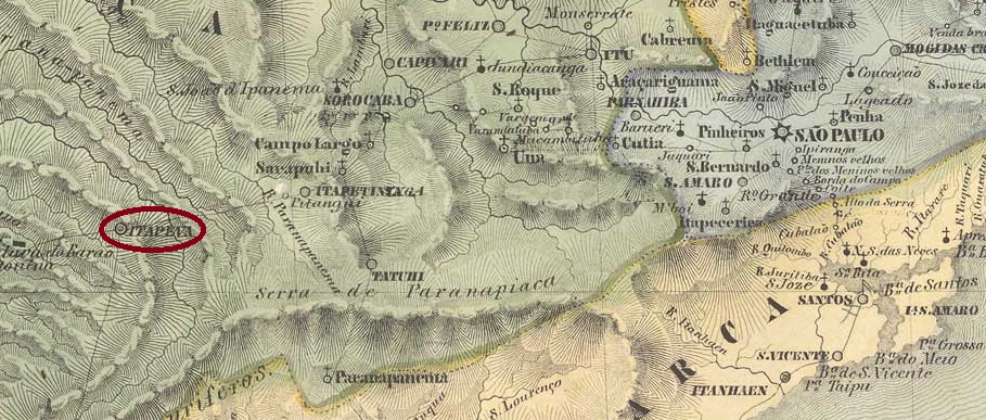
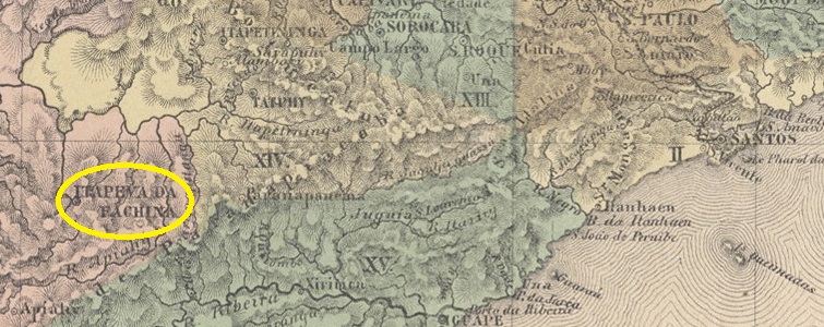
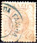
The beautiful Indian word Itapeva means yellow stone, while the less charming Faxina is traditionally translated as bundle of brushwood and is used in modern-day Brazil when there is a lot of cleaning and tidying up to do. However, the origin of the place probably goes back to a certain Facchina family, who are said to have run a resting place for drovers (tropeiros) here in the 18th century. In any case, the Freguesia de Itapeva de (or do) Faxina was founded in June 1766. It belonged to the Vila de Sorocaba and was located on the east bank of the Taquary, 290 kilometres west of the future provincial capital of São Paulo. Three years later it was elevated to Vila de Sant’Anna da Faxina, which was renamed Itapeva da Faxina in March 1838 and declared Cidade de Faxina in July 1861. The município has been called Itapeva again since November 1938.
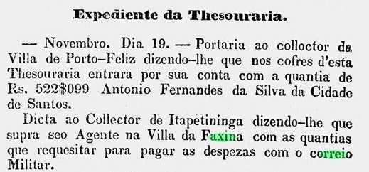
Two creation dates have been found for the local post office. Once in April 1828, as Nova Monteiro writes in Administrações e Agencias Postaes do Brasil Imperio (Brasil Filatelico/RJ, 1934-5; reprint SPP 1994-1999). Then again in 1844, as can be seen from the Directory of Imperial Post Offices (Tabella das Agencias do Correio do Imperio, Rio de Janeiro, 1885). Between the two periods of operation, a military postal courier was also active on the São Paulo-Curitiba route, as can be seen from the regional press:
A Phenix, 26/02/1840
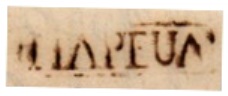
So far, seven Faxina or Itapeva postmarks have been found for the 19th century, starting with the pre-philatelic ISP-1665a (fig. Mário Celso Orsi Jr.), which is registered in the RHM catalogue under P-SP-14:
ISP-1665a (MO, RHM P-SP-14) 1833-1850ff
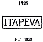
It was followed by ISP-1665b, known through P. Ayres’s Catálogo de Carimbos Brasil-Império (S. Paulo, 1937, 1942) under no. 1328:
ISP-1665b (P.A. 1328) 1850ff-1864
A later variant is ISP-1665c (illus. Mário Celso Orsi Jr.):
ISP-1665c (MO) 1866ff-1877ff
Later, the rare ISP-1715a also appeared (ill. Mario Celso Orsi Jr.):
ISP-1715a (MO) 1883ff
For Faxina cancels see FSP-0530.
Atlas do Imperio do Brasil, 1868
Andere Namen: Sant’Anna, Itapeva da Faxina
Siehe auch Faxina (FSP-0530)
Das schöne indianische Wort Itapeva bedeutet gelber Stein, während das weniger charmante Faxina traditionell mit Reisigbündel übersetzt wird und im heutigen Brasilien verwendet wird, wenn es viel zu putzen und aufzuräumen gibt. Der Ursprung des Ortes geht jedoch wahrscheinlich auf eine gewisse Familie Facchina zurück, die hier im 18. Jahrhundert eine Raststätte für Viehtreiber (Tropeiros) betrieben haben soll. Jedenfalls wurde im Juni 1766 die Freguesia de Itapeva de (oder do) Faxina gegründet. Sie gehörte zur Vila de Sorocaba und lag am Ostufer des Taquary, 290 km westlich der späteren Provinzhauptstadt São Paulo. Drei Jahre später erfolgte die Erhebung zur Vila de Sant’Anna da Faxina, die im März 1838 in Itapeva da Faxina umbenannt und im Juli 1861 zur Cidade de Faxina erklärt wurde. Seit November 1938 heißt der Município wieder Itapeva.
Für das örtliche Postamt wurden zwei Gründungsdaten gefunden. Einmal im April 1828, wie Nova Monteiro in Administrações e Agencias Postaes do Brasil Imperio (Brasil Filatelico/RJ, 1934-5; Reprint SPP 1994-1999) schreibt. Dann wieder 1844, wie aus dem Verzeichnis der kaiserlichen Postämter (Tabella das Agencias do Correio do Imperio, Rio de Janeiro, 1885) hervorgeht. Zwischen den beiden Betriebsperioden war auch ein militärischer Postkurier auf der Strecke São Paulo-Curitiba tätig, wie aus der regionalen Presse hervorgeht:
A Phenix, 26.02.1840
Bisher wurden sieben Faxina- bzw. Itapeva-Poststempel für das 19. Jahrhundert gefunden, beginnend mit dem vorphilatelistischen ISP-1665a (Abb. Mário Celso Orsi Jr.), der im RHM-Katalog unter P-SP-14 registriert ist:
ISP-1665a (MO, RHM P-SP-14) 1833-1850ff
Ihm folgte ISP-1665b, bekannt durch P. Ayres’ Catálogo de Carimbos Brasil-Império (S. Paulo, 1937, 1942) unter Nr. 1328:
ISP-1665b (P.A. 1328) 1850ff-1864
Eine spätere Variante ist ISP-1665c (Abb. Mário Celso Orsi Jr.):
ISP-1665c (MO) 1866ff-1877ff
Später tauchte auch der seltene ISP-1715a auf (Abb. Mario Celso Orsi Jr.):
Villiers de l’Ile Adam: Carta (…) da Provincia de São Paulo, 1847
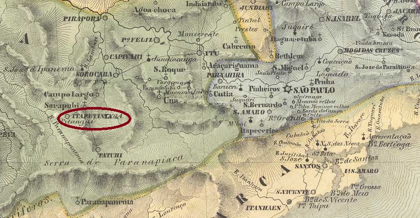
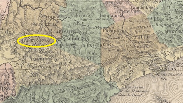
The Freguesia de N. Sra. dos Prazeres de Itapetininga (also spelt Itapeteninga), which belonged to the Vila de Sorocaba and was located 170 kilometres west of the later provincial capital of São Paulo, had existed since 1766 (other source: 1770). It became a vila in October 1770 (other source: January 1771) and was elevated to a town in March 1855. The name comes from the Tupi-Guarani and means place with dry stones.
Three foundation dates have been found for the local post office. First in April 1828, as Nova Monteiro writes in Administrações e Agencias Postaes do Brasil Imperio (Brasil Filatelico/RJ, 1934-5; reprint SPP 1994-1999). Then in 1840 according to the philatelist Mário Celso Orsi Jr. and finally in 1844 according to the Directory of Imperial Post Offices (Tabella das Agencias do Correio do Imperio, Rio de Janeiro, 1885). It follows from this that the agency was closed at least once in the meantime. It is certain that a postal route between Sorocaba and Curitiba via Itapetininga was active in February 1831:
O Farol Paulistano, 15/03/1831
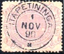
The oldest postmark to date is ISP-0620a (fig. Mário Celso Orsi Jr.):
ISP-0620a (MO) 1857-1868
This was followed by the double circle ISP-0620b, also in blue, illustrated by P. Ayres in Catálogo de Carimbos Brasil-Império (S. Paulo, 1937, 1942):
ISP-0620b (P.A. p. 121) 1877-1883
This was followed by the French type ISP-0620c (fig. Mário Orsi), also existent in blue:
ISP-0620c (MO) 1882-1890
Towards the end of the Empire, ISP-0620d (ill. from the internet) appeared, also in blue and violet:
ISP-0620d (EB) 1889-1897
Two mute cancellations are known from the imperial Itapetininga:
1876ff (illus. Mário Orsi)1882 (illustration from the Internet)Atlas do Imperio do Brasil, 1868
Seit 1766 (andere Quelle: 1770) bestand die Freguesia de N. Sra. dos Prazeres de Itapetininga (auch Itapeteninga geschrieben), die zur Vila de Sorocaba gehörte und 170 km westlich der späteren Provinzhauptstadt São Paulo lag. Sie wurde im Oktober 1770 (andere Quelle: Januar 1771) zur Vila und im März 1855 zur Stadt erhoben. Der Name stammt aus dem Tupi-Guarani und bedeutet Ort mit trockenen Steinen.
Für das örtliche Postamt wurden drei Gründungsdaten gefunden. Zuerst im April 1828, wie Nova Monteiro in Administrações e Agencias Postaes do Brasil Imperio (Brasil Filatelico/RJ, 1934-5; Nachdruck SPP 1994-1999) schreibt. Dann 1840 nach dem Philatelisten Mário Celso Orsi Jr. und schließlich 1844 nach dem Verzeichnis der kaiserlichen Postämter (Tabella das Agencias do Correio do Imperio, Rio de Janeiro, 1885). Daraus folgt, dass die Agentur zwischenzeitlich mindestens einmal geschlossen wurde. Sicher ist, dass im Februar 1831 eine Postroute zwischen Sorocaba und Curitiba über Itapetininga aktiv war:
O Farol Paulistano, 15.03.1831
Der bisher älteste Poststempel ist ISP-0620a (Abb. Mário Celso Orsi Jr.):
1882 (Abb. aus dem Internet)
Es folgte der Doppelkreis ISP-0620b, auch in blau, abgebildet von P. Ayres in Catálogo de Carimbos Brasil-Império (S. Paulo, 1937, 1942):
ISP-0620b (P.A. S. 121) 1877-1883
Danach kam der französische Typ ISP-0620c (Abb. Mário Orsi), auch in blau:
ISP-0620c (MO) 1882-1890
Gegen Ende des Kaiserreichs erschien auch ISP-0620d (Abb. aus dem Internet), den es auch in blau und violett gibt:
ISP-0620d (EB) 1889-1897
Vom kaiserlichen Itapetininga sind zwei stumme Stempel bekannt:
1876ff (Abb. Mário Orsi)1882 (Abb. aus dem Internet)
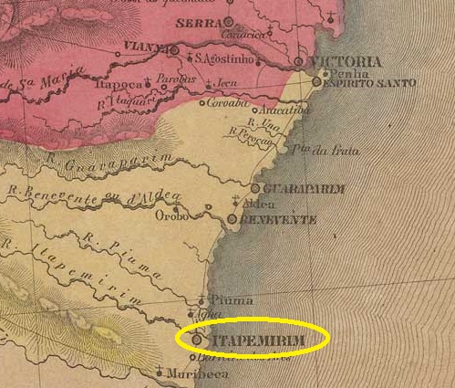
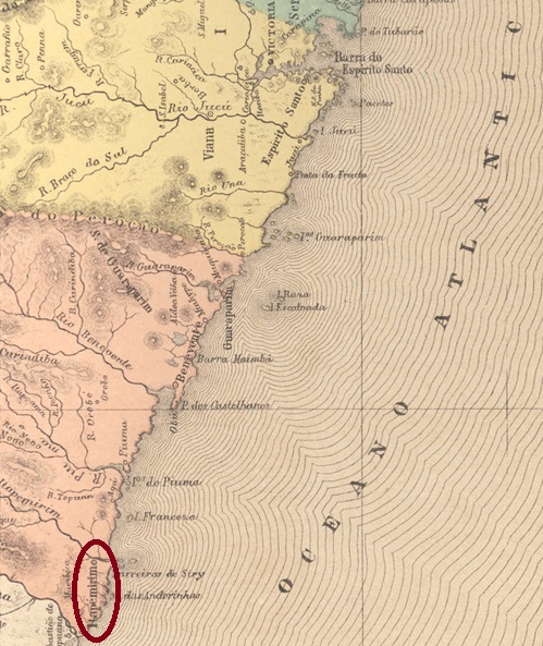
Villiers de l’Ile Adam: Carta (…) da Provincia do Espirito Santo, 1850
Other names: Itapemirim
The Freguesia de N. Sra. do Patrocínio, founded in 1771, belonged to the Vila de Guarapary and was located on the south bank of the Itapemirim estuary, 100 kilometres south of the later provincial capital Vitória. In July 1813 it became the Freguesia de N.Sra. do Amparo do Itapemerim (now spelt Itapemirim) and two years later a Vila.
As Nova Monteiro writes in Administrações e Agencias Postaes do Brasil Imperio (Brasil Filatelico/RJ, 1934-5; reprint SPP 1994-1999), there had already been a post office there since October 1831.
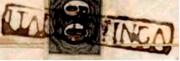
The oldest postmark to date is IES-0095a, which was given the no. P-ES-02 in the RHM catalogue. However, the illustration shows clear differences to the specimens found, as can be seen in the picture (Fig. Wady Vidal):
IES-0095a (RHM P-ES-02 – recte WV) 1843ff-1854
This was followed by IES-0095b (ill. Henrique B. Ferreira in Catálogo ilustrado dos carimbos sobre os olhos-de-boi, Porto Alegre, 2017)
IES-0095b (HBF) 1843ff-1866ff
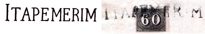
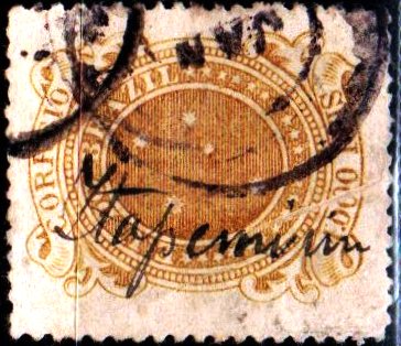
Then came IES-0095c, which was given the no. 1575 by P. Ayres in Catálogo de Carimbos Brasil-Império (S. Paulo, 1937, 1942), here in an illustration by Wady Vidal:
IES-0095c (P.A. 1575 – WV) 1850ff-1882
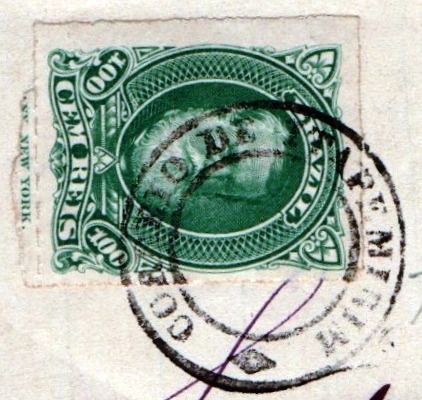
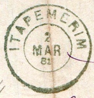
The last postmark of the imperial era is the double circle IES-0095d (illustration by Wady Vidal), which also exists in blue:
IES-0095d (WV) 1879-1896
Itapemerim also produced a mute cancellation in blue (fig. agenciaspostais.com.br):
1884 (PN)
Wady Vidal also shows a handwritten cancellation from the beginning of the Republic:
1890ff (WV)Atlas do Imperio do Brasil, 1868
Andere Namen: Itapemirim
Die 1771 gegründete Freguesia de N. Sra. do Patrocínio gehörte zur Vila de Guarapary und lag am Südufer der Mündung des Itapemirim, 100 km südlich der späteren Provinzhauptstadt Vitória. Im Juli 1813 wurde sie zur Freguesia de N.Sra. do Amparo do Itapemerim (heute Itapemirim geschrieben) und zwei Jahre später zur Vila.
Wie Nova Monteiro in Administrações e Agencias Postaes do Brasil Imperio (Brasil Filatelico/RJ, 1934-5; Reprint SPP 1994-1999) schreibt, gab es dort bereits seit Oktober 1831 ein Postamt.
Der bisher älteste Poststempel ist IES-0095a, der im RHM-Katalog die Nr. P-ES-02 erhielt. Die Abbildung zeigt jedoch deutliche Unterschiede zu den gefundenen Exemplaren, wie man auf dem Bild (Abb. Wady Vidal) erkennen kann:
IES-0095a (RHM P-ES-02 – recte WV) 1843ff-1854
Es folgte IES-0095b (Abb. Henrique B. Ferreira in Catálogo ilustrado dos carimbos sobre os olhos-de-boi, Porto Alegre, 2017)
IES-0095b (HBF) 1843ff-1866ff
Danach kam IES-0095c, der von P. Ayres in Catálogo de Carimbos Brasil-Império (S. Paulo, 1937, 1942) die Nr. 1575 erhielt, hier in einer Abbildung von Wady Vidal:
IES-0095c (P.A. 1575 – WV) 1850ff-1882
Der letzte Poststempel der Kaiserzeit ist der Doppelkreis IES-0095d (Abb. Wady Vidal), den es auch in blau gibt:
IES-0095d (WV) 1879-1896
Aus Itapemerim kommt auch ein stummer Stempel in blau (Abb. agenciaspostais.com.br):
1884 (PN)
Wady Vidal zeigt auch eine handschriftliche Entwertung vom Beginn der Republik:
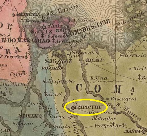
The Freguesia de N. Sra. das Dores do Itapecuru-Merim, formerly Itapucuru, sometimes also spelt Itapicuru, had existed since September 1801. At that time it belonged to Vila de S. Luis and was located 120 kilometres south of it on the east bank of the Itapecuru-Mirim. It became a vila in October 1818 and a town in July 1870. The name, now written Itapecuru Mirim, comes from the Tupi and means stone warehouse.
The local post office was opened at least twice. First in February 1820, as Nova Monteiro writes in Administrações e Agencias Postaes do Brasil Imperio (Brasil Filatelico/RJ, 1934-5; reprint SPP 1994-1999). Then again in December 1830, as can be seen from the postal report (Relatorio dos Correios) of 1886.
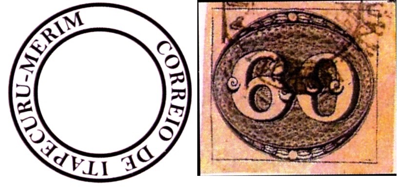
The oldest postmark to date, IMA-0310a, was found on Bull’s-eye issues from 1843 and appears to be similar to other earlier postmarks from this province, as the reconstruction by Henrique B. Ferreira’s Catálogo ilustrado dos carimbos sobre os olhos-de-boi (Porto Alegre, 2017) shows:
IMA-0310a (HBF) 1844
Then came IMA-0310b (ill. Walter Sonnenberg):
IMA-0310b (WS) 1850ff-1883
This was followed by the circle cancellation IMA-0310c (ill. R. Koester in Carimbologia XXIV):
IMA-0310c (RK) 1879-1883
Towards the end of the Empire, IMA-0310d also appeared (fig. Koester, op. cit.):
IMA-0310d (RK) 1889-1896Villiers de l’Ile Adam: Carta (…) da Provincia do Maranhão, 1850
Andere Namen: Itapicuru/Itapucuru-Mirim
Seit September 1801 bestand die Freguesia de N. Sra. das Dores do Itapecuru-Merim, früher Itapucuru, manchmal auch Itapicuru geschrieben. Sie gehörte damals zu Vila de S. Luis und lag 120 km südlich davon am Ostufer des Itapecuru-Mirim. Im Oktober 1818 wurde es zur Vila und im Juli 1870 zur Stadt erhoben. Der Name (heute Itapecuru Mirim geschrieben) stammt aus dem Tupi und bedeutet Steinlager.
Das örtliche Postamt wurde mindestens zweimal eröffnet. Zuerst im Februar 1820, wie Nova Monteiro in Administrações e Agencias Postaes do Brasil Imperio (Brasil Filatelico/RJ, 1934-5; Nachdruck SPP 1994-1999) schreibt. Dann wieder im Dezember 1830, wie aus dem Postbericht (Relatorio dos Correios) von 1886 hervorgeht.
Der bisher älteste Poststempel IMA-0310a wurde auf Ochsenaugen-Ausgaben von 1843 gefunden und scheint anderen früheren Stempeln aus dieser Provinz ähnlich zu sein, wie die Rekonstruktion von Henrique B. Ferreiras Catálogo ilustrado dos carimbos sobre os olhos-de-boi (Porto Alegre, 2017) zeigt:
IMA-0310a (HBF) 1844
Dann kam IMA-0310b (Abb. Walter Sonnenberg):
IMA-0310b (WS) 1850ff-1883
Es folgte der Kreisstempel IMA-0310c (Abb. R. Koester in Carimbologia XXIV):
IMA-0310c (RK) 1879-1883
Gegen Ende des Kaiserreichs erschien auch IMA-0310d (Abb. Koester, op. cit.):
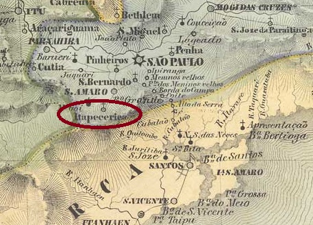
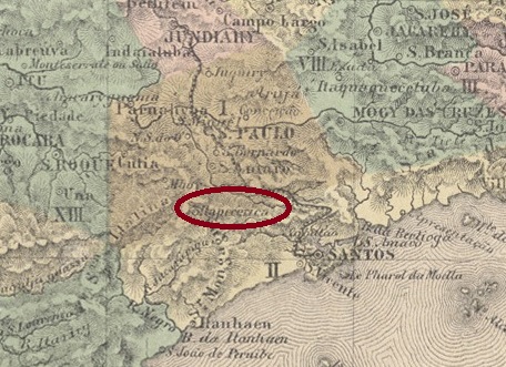
Villiers de l’Ile Adam: Carta (…) da Provincia de São Paulo, 1847
Other names: Itapecerica da Serra (1944)
The history of the village begins in November 1827, when a colony for German immigrants was founded by imperial decree 35 kilometres southwest of the provincial capital of São Paulo. In February 1841, it became the Freguesia de N. Sra. dos Prazeres de Itapecerica, which belonged to the Vila de Sto. Amaro. In May 1877 Itapecerica became a Vila and in December 1906 a town, which since November 1944 has borne the name Itapecerica da Serra (on the mountain), probably to avoid confusion with the town of the same name in Minas Gerais. The Tupi-guarani term means slippery stone.
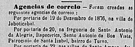
As reported in the regional press, there had been a post office there since December 1876:
Correio Paulistano, 05.01.1877
The postmark probably did not arrive in time, as the stamps were cancelled by hand, as shown in the illustration from the Fuad Ferreira Fo. collection:
1883ff (FF)
It was not until the 1880s that the French type ISP-0615a (Marcio Duarte collection) was used:
ISP-0615a (MD) 1885-1905Atlas do Imperio do Brasil, 1868
Andere Namen: Itapecerica da Serra (1944)
Die Geschichte des Ortes beginnt im November 1827, als auf kaiserlichen Erlass 35 km südwestlich der Provinzhauptstadt São Paulo eine Kolonie für deutsche Einwanderer gegründet wurde. Im Februar 1841 wurde daraus die Freguesia de N. Sra. dos Prazeres de Itapecerica, die zur Vila de Sto. Amaro gehörte. Im Mai 1877 wurde Itapecerica eine Vila und im Dezember 1906 eine Stadt, die seit November 1944 den Namen Itapecerica da Serra (am Berg) trägt, wahrscheinlich um Verwechslungen mit dem gleichnamigen Ort in Minas Gerais zu vermeiden. Der Begriff aus dem Tupi-guarani bedeutet rutschiger Stein.
Wie die regionale Presse berichtete, gab es dort seit Dezember 1876 ein Postamt:
Correio Paulistano, 05.01.1877
Vermutlich traf der Poststempel nicht rechtzeitig ein, denn die Marken wurden von Hand entwertet, wie die Abbildung aus der Sammlung Fuad Ferreira Fo.:
1883ff (FF)
Erst in den 1880er Jahren wurde der französische Typ ISP-0615a (Sammlung Marcio Duarte) verwendet:
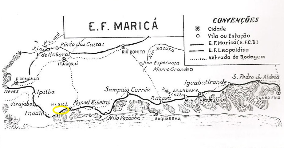
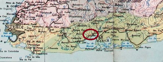
Itapeba station was opened in July 1889 by the railway company E.F. de Maricá (Cabo Frio branch line) and was located on the northern shore of the lake in the Município de Maricá, 50 km east of the capital Rio de Janeiro. The line was in operation until 1964, but today there are neither tracks nor a railway station. The name from the Tupi-guarani means flat stone.
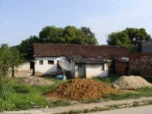
In October 2008 (Photo: Cleiton Pieruccini, on estacoesferroviarias.com.br)
According to the postal bulletin (Boletim Postal No. 7, November 1889), there had been a post office there since October 1889, which, according to Paulo Novaes (agenciaspostais.com.br), was closed in December 1896, reopened in January 1898 and finally closed around 1907.
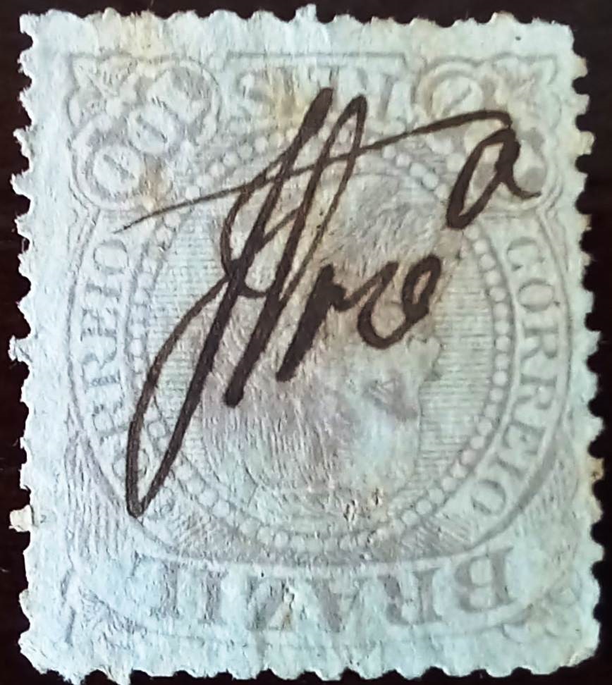
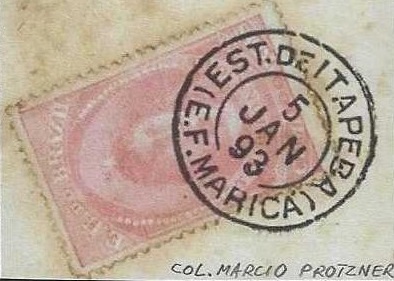
The oldest postmark is IRJ-2305a (collect. Márcio Protzner):
IRJ-2305a (MP) 1891-1895agenciaspostais.com.br
Der Bahnhof Itapeba wurde im Juli 1889 von der Eisenbahngesellschaft E.F. de Maricá (Zweigbahn Cabo Frio) eröffnet und lag am Nordufer des Sees im Município de Maricá, 50 km östlich der Hauptstadt Rio de Janeiro. Die Strecke war bis 1964 in Betrieb, heute gibt es weder Gleise noch einen Bahnhof. Der Name aus dem Tupi-guarani bedeutet flacher Stein.
Im Oktober 2008 (Foto: Cleiton Pieruccini, auf estacoesferroviarias.com.br)
Wie aus dem Postbulletin (Boletim Postal Nr. 7, November 1889) hervorgeht, gab es dort seit Oktober 1889 ein Postamt, das laut Paulo Novaes (agenciaspostais.com.br) im Dezember 1896 geschlossen, im Januar 1898 wiedereröffnet und um 1907 endgültig geschlossen wurde.
Der älteste Poststempel ist IRJ-2305a (Samml. Márcio Protzner):