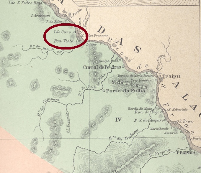
The old settlement of Boa Vista belonged to the Vila do Porto da Folha and was located on the south bank of the river São Francisco near the mouth of the river Capivara, 160 kilometres north of the provincial capital Aracaju. In March 1870, it became the seat of the Município with the name N. Sra. da Conceição da Ilha do Ouro. In April 1880, Ilha do Ouro lost this status and became first a freguesia and later a district of Porto da Folha.
The list of imperial post offices (Tabella das Agencias do Correio do Imperio, Rio de Janeiro, 1885) shows that there had been a post office in Porto da Folha since 1853. We do not know exactly when this agency adopted the new place name Ilha do Ouro, but it must have been before 1879, when the imperial postal guide (Guia Postal do Imperio) was published.
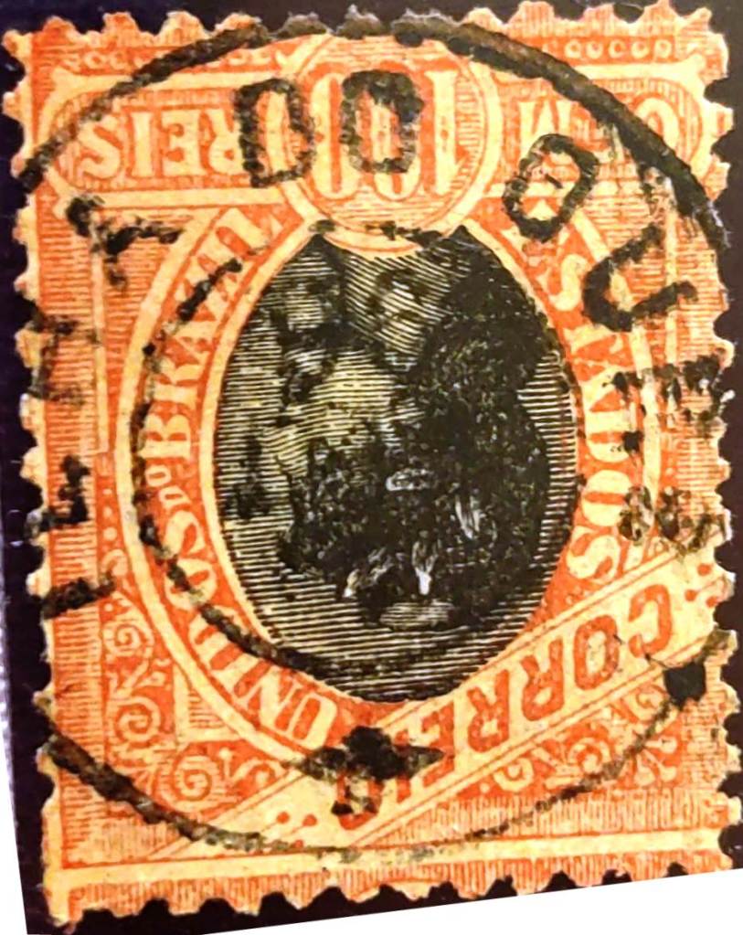
The only 19th century postmark from there so far is ISE-0080a (Jorge L. Pedreira collection):
ISE-0080a (JLP) 1896Arthur D. Ribeiro: Estado de Sergipe, 1924
Andere Namen: Boa Vista
Die alte Siedlung Boa Vista gehörte zur Vila do Porto da Folha und lag am Südufer des Flusses São Francisco nahe der Mündung des Flusses Capivara, 160 km nördlich der Provinzhauptstadt Aracaju. Im März 1870 wurde sie Sitz des Município mit dem Namen N. Sra. da Conceição da Ilha do Ouro. Im April 1880 verlor Ilha do Ouro diesen Status und wurde zunächst eine Freguesia und später ein Ortsteil von Porto da Folha.
Aus dem Verzeichnis der kaiserlichen Postämter (Tabella das Agencias do Correio do Imperio, Rio de Janeiro, 1885) geht hervor, dass es in Porto da Folha seit 1853 ein Postamt gab. Wir wissen nicht genau, wann diese Agentur den neuen Ortsnamen Ilha do Ouro annahm, aber es muss vor 1879 gewesen sein, als der kaiserliche Postführer (Guia Postal do Imperio) herausgegeben wurde.
Der bisher einzige Poststempel aus dem 19. Jahrhundert von dort ist ISE-0080a (Sammlung Jorge L. Pedreira):
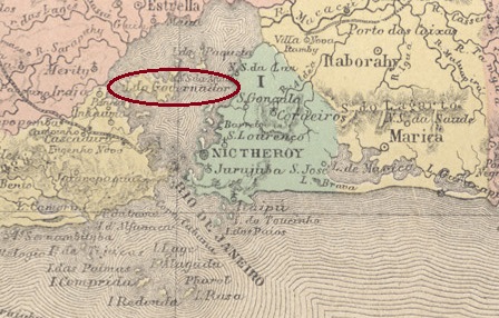
The Freguesia de N. Sra. da Ajuda da Ilha do Governador was founded in 1710 by royal decree (Alvará Real). Since July 1981, Ilha do Governador has been an administrative district (Região Administrativa) of the Município do Rio de Janeiro.
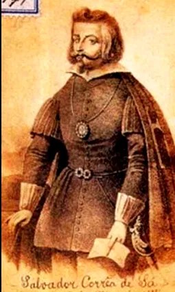
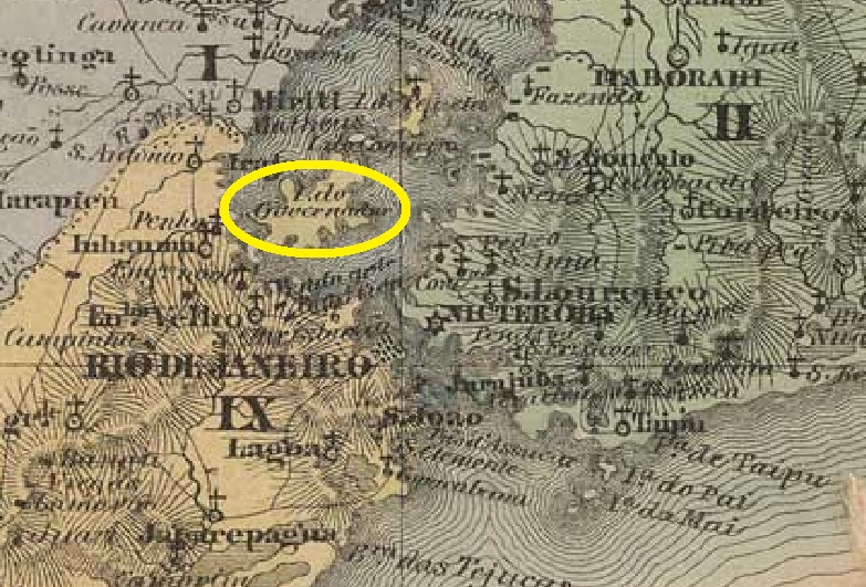
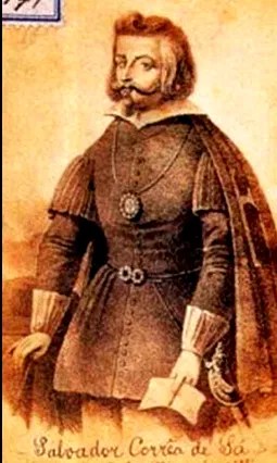
The island (Ilha) is located in Guanabara Bay, 20 km north of the city centre of Rio de Janeiro. The governor (governador) was the Portuguese Salvador Correia de Sá the Elder (approx. 1543-1631), who ruled Rio de Janeiro from 1578 to 1598. His grandson Salvador Correia de Sá e Benevides (1602-1688) was also governor of Rio.
Salvador Correia de Sá, the Elder (Wikipedia)
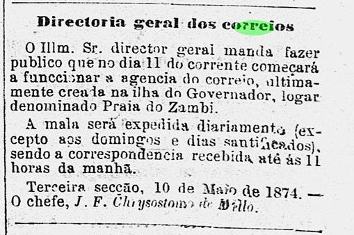
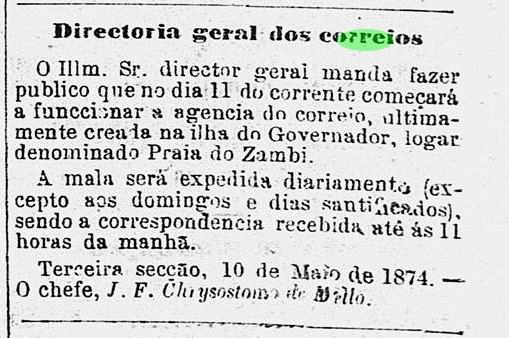
According to the Rio press, there had been a post office on the island since May 1874:
Diario do Rio de Janeiro, 11/05/1874
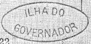
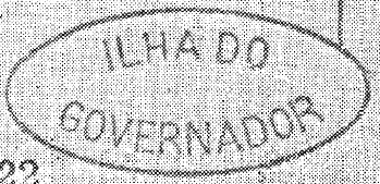
The oldest postmark IMN-0040a was shown by R. Koester (Carimbologia XXII):
IMN-0040a (RK) 1874ff
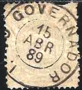
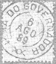
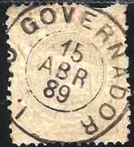
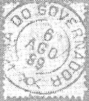
Towards the end of the Empire, two cancellations as double circles appeared, IMN-0040b (fig. agenciaspostais.com.br) and IMN-0040c (fig. Koester, op. cit.):
IMN-0040b (PN) 1889IMN-0040c (RK) 1889-1890Villiers de l’Ile Adam: Carta (…) da provincia do Rio de Janeiro, 1850
Siehe auch Freguezia (FMN-0100)
1710 wurde die Freguesia de N. Sra. da Ajuda da Ilha do Governador durch königliches Dekret (Alvará Real) gegründet. Seit Juli 1981 ist die Ilha do Governador ein Verwaltungsbezirk (Região Administrativa) des Município do Rio de Janeiro.
Die Insel (Ilha) liegt in der Guanabara-Bucht, 20 km nördlich des Stadtzentrums von Rio de Janeiro, Gouverneur (Governador) war der Portugiese Salvador Correia de Sá der Alte (ca. 1543-1631), der von 1578 bis 1598 in Rio de Janeiro regierte. Sein Enkel Salvador Correia de Sá e Benevides (1602-1688) war ebenfalls Gouverneur von Rio.
Salvador Correia de Sá, der Alte (Wikipedia)
Laut der Presse von Rio gab es seit Mai 1874 ein Postamt auf der Insel:
Diario do Rio de Janeiro, 11.05.1874
Der älteste Poststempel IMN-0040a wurde von R. Koester (Carimbologia XXII) gezeigt:
IMN-0040a (RK) 1874ff
Gegen Ende des Kaiserreichs erschienen zwei Stempel als Doppelkreise, IMN-0040b (Abb. agenciaspostais.com.br) und IMN-0040c (Abb. Koester, op. cit.):
Carta da Republica dos Estados Unidos do Brazil, 1892
Other names: Igatu, Aguatu
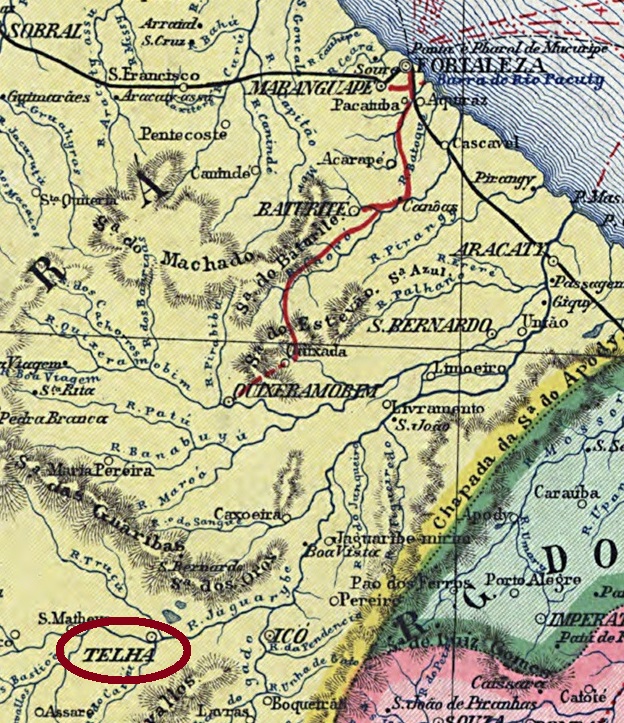
See also Telha (TCE-0370)
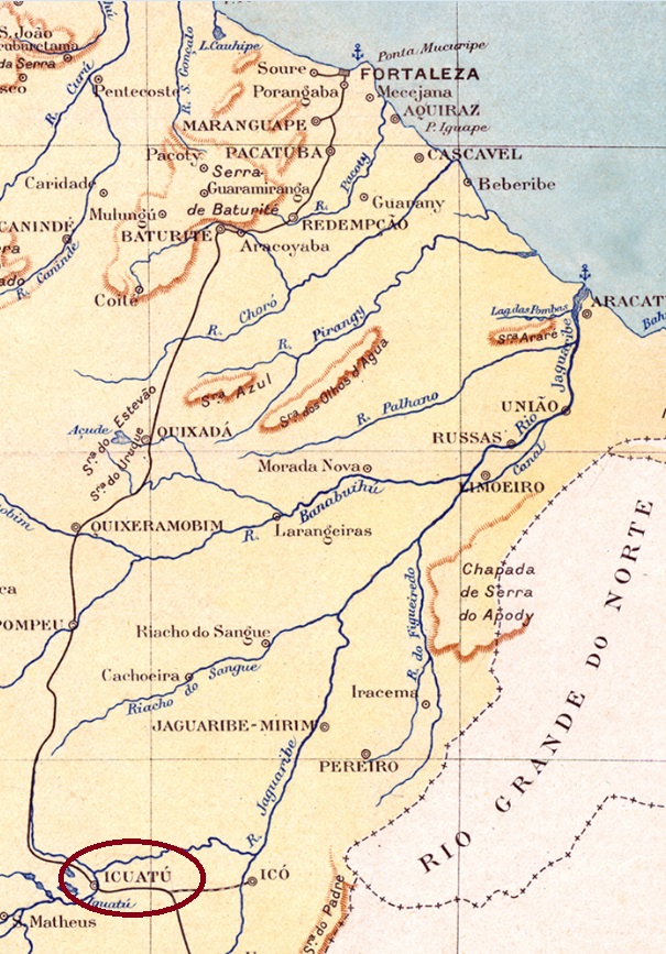
In October 1831, the Freguesia de Sant’Anna da Telha was founded by imperial decree. It belonged to the Vila de Icó and was located on the west bank of the Jaguaribe, 360 kilometres south of the provincial capital Fortaleza. In November 1851, it was elevated to a Vila and in August 1874 to a town, which has borne the name Iguatú since October 1883. The name comes from the Indian language and means good water.
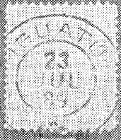
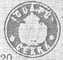
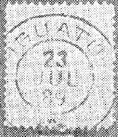
Nova Monteiro writes in Administrações e Agencias Postaes do Brasil Imperio (Brasil Filatelico/RJ, 1934-5; reprint SPP 1994-1999) that there has been a post office there since August 1866. R. Koester (Carimbologia XXII) shows two imperial postmarks with the place name Iguatu, current at least since 1883:
ICE-0160a (RK) 1889ICE-0160b (RK)Estado do Ceará, 1923
Andere Namen: Igatu, Aguatu
Siehe auch Telha (TCE-0370)
Im Oktober 1831 wurde durch kaiserliches Dekret die Freguesia de Sant’Anna da Telha gegründet, die zur Vila de Icó gehörte und am Westufer des Jaguaribe, 360 km südlich der Provinzhauptstadt Fortaleza, lag. Im November 1851 erfolgte die Erhebung zur Vila und im August 1874 zur Stadt, die seit Oktober 1883 den Namen Iguatú trägt. Der Name stammt aus der Indianersprache und bedeutet Gutes Wasser.
Nova Monteiro schreibt in Administrações e Agencias Postaes do Brasil Imperio (Brasil Filatelico/RJ, 1934-5; Reprint SPP 1994-1999), dass es dort seit August 1866 ein Postamt gab. R. Koester (Carimbologia XXII) zeigt zwei kaiserliche Poststempel mit dem mindestens seit 1883 gültigen Ortsnamen Iguatu:
Colton & Colton: Provincia do Rio de Janeiro, 1866
Other names: N. Sra. da Piedade do Caminho Velho, Aguassú, Piedade do Iguassú, Cava, José Bulhões
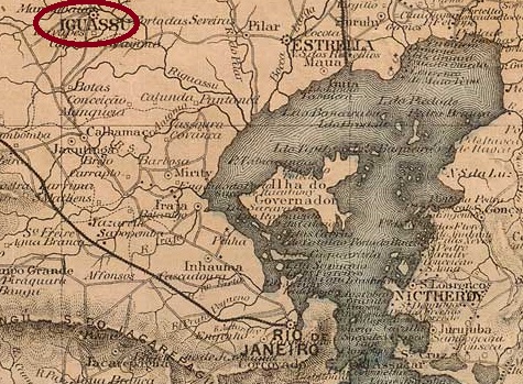
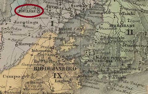
The village, which already had a chapel in 1669, became the Freguesia de N. Sra. da Piedade do Iguassú in 1719, 50 kilometres northwest of the capital Rio de Janeiro. It was elevated to a Vila in January 1833, two years later Piedade do Iguassú was downgraded to a Freguesia, but regained the status of a Vila in December 1836.
This was followed by a long period of decline, which had both economic and environmental causes. In May 1892, Piedade do Iguassú became a district of the then founded Município de Maxambomba, which was later given the name Nova Iguassú. Further name changes followed: around 1920 to Cava, in January 1924 to Estação José Bulhões, in 1939 back to Cava, and since 1997 it has also lost its status as a district: this rural suburb of Nova Iguaçu (as it is spelt today) is now called Vila de Cava.
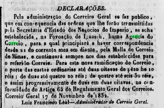
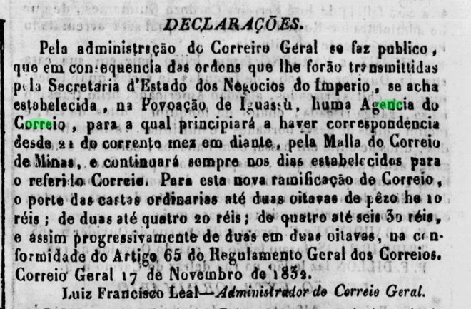
Nova Monteiro writes in Administrações e Agencias Postaes do Brasil Imperio (Brasil Filatelico/RJ, 1934-5; Reprint SPP 1994-1999), that there had been a post office there since October 1832. This is confirmed by the press in Rio:
Jornal do Commercio, 19/11/1832
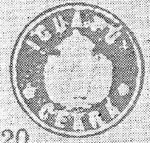
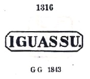
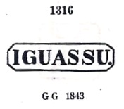
According to Paulo Novaes (agenciaspostais.com.br), the post office was closed in August 1931; the first postmark is IRJ-0600a, which was given the number 1316 by P. Ayres in his Catálogo de Carimbos Brasil-Império (S. Paulo, 1937, 1942):
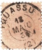
IRJ-0600a (P.A. 1316) 1832ff-1879
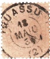
Then came IRJ-0600b (illus. Claudio Coelho), which also exists in blue:
IRJ-0600b (CC) 1883ff-1889
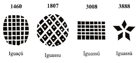
James Dingler and Klerman W. Lopes have listed four mute cancellations from Iguassú in Mute Cancellations of the Brazil Empire / Carimbos Mudos do Brasil Império (Brazil Philatelic Association, Rio de Janeiro, 2000):
BPA 1460 – 1807 – 3008 – 3888Viiers de l’Ie Adam: Carta (..) da Provincia do Rio de Janeiro, 1850
Andere Namen: N. Sra. da Piedade do Caminho Velho, Aguassú, Piedade do Iguassú, Cava, José Bulhões
Der Ort, der bereits 1669 eine Kapelle besaß, wurde 1719 zur Freguesia de N. Sra. da Piedade do Iguassú erhoben und liegt 50 km nordwestlich der Hauptstadt Rio de Janeiro. Die Erhebung zur Vila erfolgte im Januar 1833, zwei Jahre später wurde Piedade do Iguassú zur Freguesia herabgestuft, erhielt aber im Dezember 1836 wieder den Status einer Vila.
Es folgte eine lange Zeit des Niedergangs, der sowohl wirtschaftliche als auch ökologische Ursachen hatte. Im Mai 1892 wurde Piedade do Iguassú ein Distrikt des neu gegründeten Município de Maxambomba, das später den Namen Nova Iguassú erhielt. Danach folgten weitere Namensänderungen: um 1920 in Cava, im Januar 1924 in Estação José Bulhões, 1939 wieder in Cava, und seit 1997 ist auch der Status als Distrikt verloren: Vila de Cava heißt nun dieser ländliche Vorort von Nova Iguaçu, wie es heute geschrieben wird.
Nova Monteiro schreibt in Administrações e Agencias Postaes do Brasil Imperio (Brasil Filatelico/RJ, 1934-5; Reprint SPP 1994-1999), dass es dort seit Oktober 1832 ein Postamt gab. Dies wird von der Presse in Rio bestätigt:
Jornal do Commercio, 19.11.1832
Laut Paulo Novaes (agenciaspostais.com.br) wurde das Postamt im August 1931 geschlossen. Der erste Poststempel ist IRJ-0600a, der von P. Ayres im Catálogo de Carimbos Brasil-Império (S. Paulo, 1937, 1942) die Nr. 1316 erhielt:
IRJ-0600a (P.A. 1316) 1832ff-1879
Danach kam IRJ-0600b (Abb. Claudio Coelho), den es auch in blau gibt:
IRJ-0600b (CC) 1883ff-1889
James Dingler und Klerman W. Lopes haben in Mute Cancellations of the Brazil Empire / Carimbos Mudos do Brasil Império (Brazil Philatelic Association, Rio de Janeiro, 2000) vier stumme Abstempelungen aus Iguassú aufgeführt:
Other names: Assunguy, Tindiqüera, Araucária (1890)
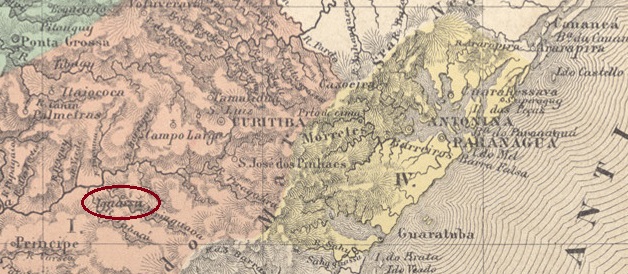
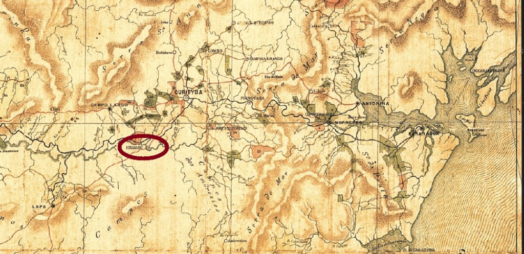
In 1837, the chapel of N. Sra. da Luz de Tindiqüera was built on the north bank of the Iguaçu, 30 kilometres southwest of the later provincial capital Curitiba. In February 1855, the settlement around the chapel became the Freguesia de N. Sra. dos Remédios de Iguassu. In 1868, the village moved from the Município de Curitiba to the municipality of S. José dos Pinhais, but returned 20 years later as the Freguesia de Curitiba. Araucária has been an independent município since February 1890.
R. Koester writes in Carimbologia XXII that there had been a post office there since 1874. So far, no imperial postmark could be assigned to this municipality with certainty.
Estado do Paraná, 1892
Andere Namen: Assunguy, Tindiqüera, Araucária (1890)
1837 wurde am Nordufer des Iguaçu, 30 km südwestlich der späteren Provinzhauptstadt Curitiba, die Kapelle N. Sra. da Luz de Tindiqüera errichtet. Im Februar 1855 wurde die Siedlung um die Kapelle zur Freguesia de N. Sra. dos Remédios de Iguassu. Im Jahr 1868 wechselte der Ort vom Município de Curitiba zur Gemeinde S. José dos Pinhais, kehrte aber 20 Jahre später als Freguesia de Curitiba zurück. Seit Februar 1890 ist Araucária ein selbständiges Município.
R. Koester schreibt in Carimbologia XXII, dass es dort seit 1874 ein Postamt gab. Bisher konnte kein kaiserlicher Poststempel mit Sicherheit dieser Gemeinde zugeordnet werden.
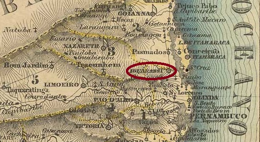
Villiers de l’Ile Adam: Carta (…) das Provincias de Pernambuco, Alagoas e Sergipe, 1848
Other names: Juarassú, Igarassú (1938)
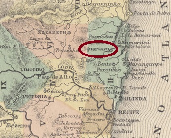
As early as September 1535, the Capela dos Santos Cosme e Damião was built around 30 kilometres north of the later provincial capital of Recife. Around 1564, it became the Vila de Santa Cruz de Santos Cosme e Damião de Iguarassú, which only became a freguesia in 1594. It has been a town since June 1895 and its name was changed to Igarassú in December 1938. The small difference in the place name has great significance: in the Indian language, Iguarassú means large water bird and Igarassú means large canoe.
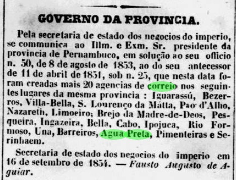
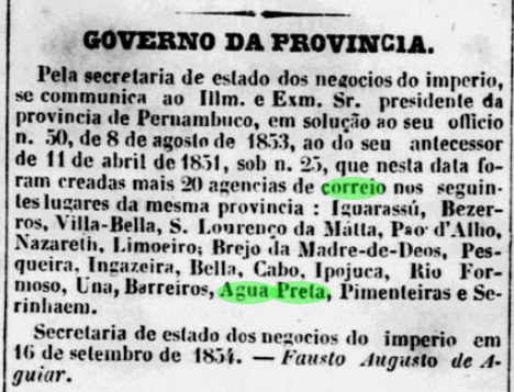
Nova Monteiro writes in Administrações e Agencias Postaes do Brasil Imperio (Brasil Filatelico/RJ, 1934-5; reprint SPP 1994-1999) that there has been a post office there since September 1854. This is confirmed by the regional press:
Diario de Pernambuco, 07/10/1854
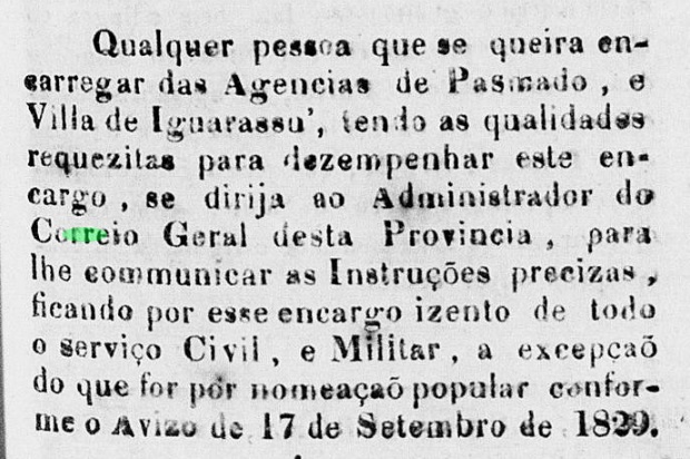
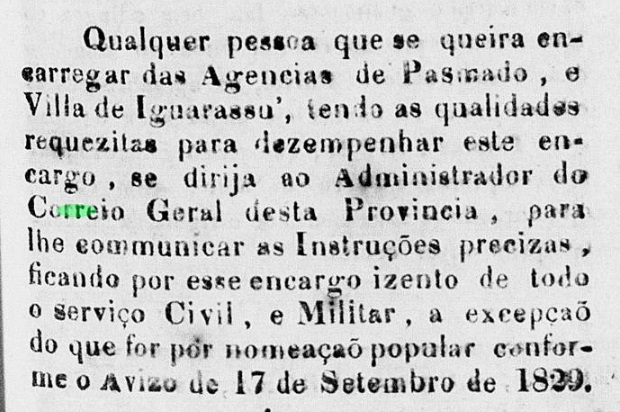
In addition, R. Koester mentions a date of January 1855 for the creation of the postal agency. These two dates could well be new openings, as the provincial postal administration was already looking for someone to run the Iguarassú post office in December 1830:
O Cruzeiro, 24/12/1830
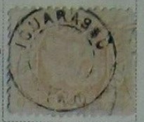
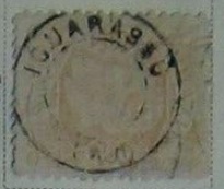
The only postmark from the imperial era to date is certainly not the oldest. The French type IPE-0305b (illustration from the Internet) was found with dates from the 1980s:
IPE-0305b (EB) 1882ff-1886Atlas do Imperio do Brasil, 1868
Andere Namen: Juarassú, Igarassú (1938)
Bereits im September 1535 wurde ca. 30 km nördlich der späteren Provinzhauptstadt Recife die Capela dos Santos Cosme e Damião errichtet. Um 1564 wurde daraus die Vila de Santa Cruz de Santos Cosme e Damião de Iguarassú, die erst 1594 zur Freguesia wurde. Seit Juni 1895 ist es eine Stadt, deren Name sich im Dezember 1938 in Igarassú änderte. Der kleine Unterschied im Ortsnamen hat eine große Bedeutung: In der indianischen Sprache bedeutet Iguarassú großer Wasservogel und Igarassú bedeutet großes Kanu.
Nova Monteiro schreibt in Administrações e Agencias Postaes do Brasil Imperio (Brasil Filatelico/RJ, 1934-5; Nachdruck SPP 1994-1999), dass es dort seit September 1854 ein Postamt gab. Dies wird von der regionalen Presse bestätigt:
Diario de Pernambuco, 07.10.1854
Darüber hinaus nennt R. Koester ein Datum vom Januar 1855 für die Gründung der Postagentur. Bei diesen beiden Daten könnte es sich durchaus um eine Neueröffnung handeln, denn bereits im Dezember 1830 suchte die Provinzialpostverwaltung nach einem Verantwortlichen für das Postamt Iguarassú:
O Cruzeiro, 24.12.1830
Der bisher einzige Poststempel aus der Kaiserzeit ist sicher nicht der älteste. Der französische Typ IPE-0305b (Abbildung aus dem Internet) wurde mit Daten aus den 80er Jahren gefunden:
Villiers de l’Ile Adam: Carta (…) da Provincia de São Paulo, 1847
Text update of March 9, 2025
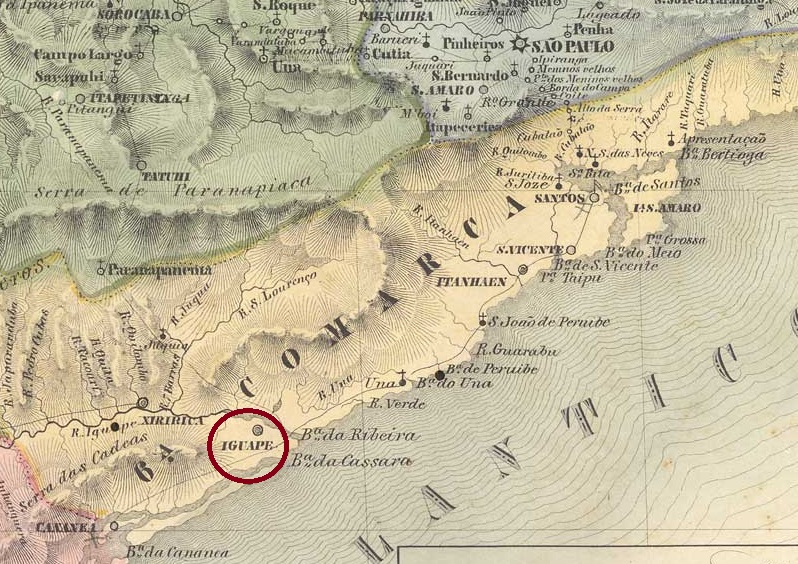
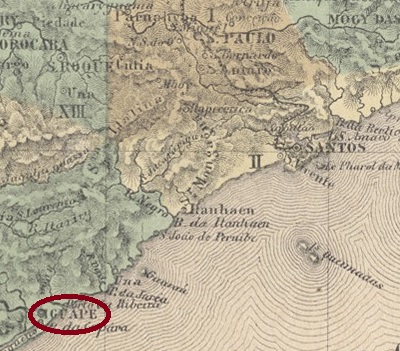
This settlement of Vila de Cananéia has existed since December 1538, at that time in the Capitania de São Vicente, at the mouth of the Ribeira de Iguape into the inland lake Mar Pequeno (‘Little Sea’), 200 km south-west of the later provincial capital of São Paulo. In 1577 it became the Freguesia de N. Sra. das Neves da Vila de Iguape and in April 1848 the town of Senhor Bom Jesus da Ribeira de Iguape.
R. Koester writes in Carimbologia XXII that a post office had been in operation there since 1844, but at the same time reports on postal traffic and postmarks of Iguape from 1829. Philatelist Mário Celso Orsi Jr. writes that the agency was also created in 1828 and 1840, unfortunately without citing any sources.
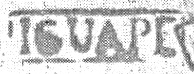
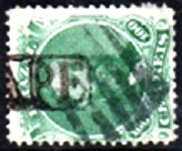
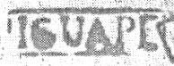
The oldest postmark is the pre-philatelic ISP-0585a (fig. R. Koester op. cit.).
ISP-0585a (RK) 1828-1843
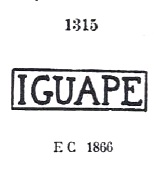
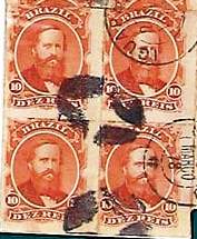
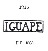
It was followed by a similar ISP-0585b, also existent in blue and green, which was given no. 1315 by P. Ayres in Catálogo de Carimbos Brasil-Império (S. Paulo, 1937, 1942):
ISP-0585b (P.A. 1315) 1866ff-1873
Its successor is the rare double circle ISP-0585c (Fig. Márcio Duarte), which also exists in blue:
ISP-0585c (MDu) 1878-1879
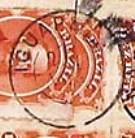
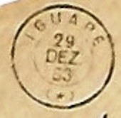
This was followed by the French type ISP-0585d (ill. José L. Fevereiro):
ISP-0585d (JLF) 1883-1903
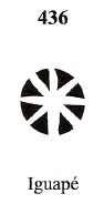
James Dingler and Klerman W. Lopes in Mute Cancellations of the Brazil Empire / Carimbos Mudos do Brasil Império (Brazil Philatelic Association, Rio de Janeiro, 2000) have also listed a mute cancellation from Iguape with no. 436:
BPA 436 (1883)
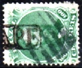
Another mute cancel was shown by Mário Celso Orsi Jr.
1866ff (MO)
Marcio Duarte has presented another mute postmark:
1878 (MDu)Atlas do Imperio do Brasil, 1868
Textaktualisierung vom 09.03.2025
Seit Dezember 1538 bestand diese Siedlung der Vila de Cananéia, damals in der Capitania de São Vicente, an der Mündung der Ribeira de Iguape in den Binnensee Mar Pequeno („Kleines Meer“), 200 km südwestlich der späteren Provinzhauptstadt São Paulo. 1577 wurde daraus die Freguesia de N. Sra. das Neves da Vila de Iguape und im April 1848 die Stadt Senhor Bom Jesus da Ribeira de Iguape.
R. Koester schreibt in Carimbologia XXII, dass dort seit 1844 ein Postamt in Betrieb war, berichtet aber gleichzeitig über Postverkehr und Poststempel von Iguape aus dem Jahre 1829. Der Philatelist Mário Celso Orsi Jr. schreibt, dass die Agentur auch in den Jahren 1828 und 1840 gegründet wurde, leider ohne Quellenangaben.
Der älteste Poststempel ist der vorphilatelistische ISP-0585a (Abb. R. Koester op. cit.).
ISP-0585a (RK) 1828-1843
Ihm folgte ein ähnlicher ISP-0585b, ebenfalls in blau und grün vorkommend, der von P. Ayres in Catálogo de Carimbos Brasil-Império (S. Paulo, 1937, 1942) die Nr. 1315 erhielt:
ISP-0585b (P.A. 1315) 1866ff-1873
Sein Nachfolger ist der seltene Doppelkreis ISP-0585c (Abb. Márcio Duarte), den es auch in blau gibt:
ISP-0585c (MDu) 1878-1879
Danach kam der französische Typ ISP-0585d (Abb. José L. Fevereiro):
ISP-0585d (JLF) 1883-1903
James Dingler und Klerman W. Lopes haben in Mute Cancellations of the Brazil Empire / Carimbos Mudos do Brasil Império (Brazil Philatelic Association, Rio de Janeiro, 2000) auch einen stummen Stempel aus Iguape mit Nr. 436 aufgeführt:
BPA 436 (1883)
Mário Calso Orsi Jr. zeigte einen anderen stummen Stempel:
1866ff (MO)
Ein weiterer stummer Poststempel zeigte Marcio Duarte:
Villiers de l’Ile Adam: Carta (…) da Provincia do Rio de Janeiro, 1850
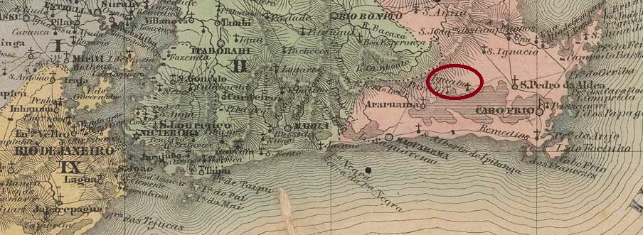
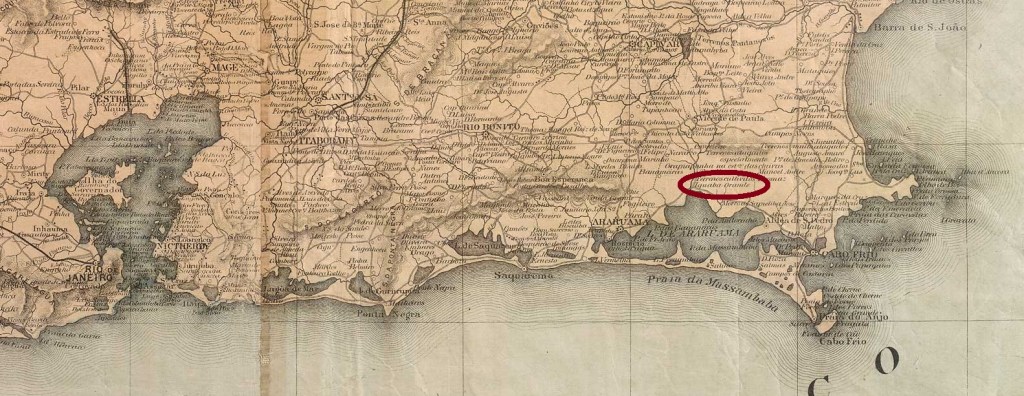
The settlement of N. Sra da Conceição da Iguaba Grande has existed since around 1795. It belonged to the Freguesia de S. Pedro da Aldeia in the Vila de Cabo Frio area and was located on the northern shore of Lake Araruama, 130 kilometres east of the capital Rio de Janeiro. In 1890, the village was incorporated into the newly founded Município de Sapiatiba and in June 1954 became a district of the Município de S. Pedro da Aldeia. Iguaba Grade has been an independent município since June 1995.
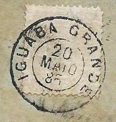
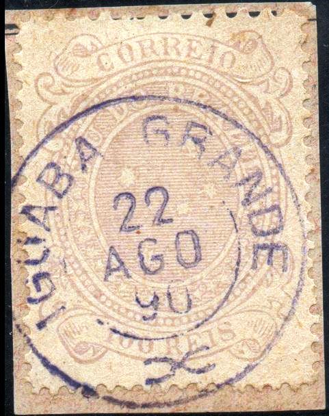
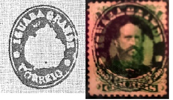
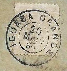
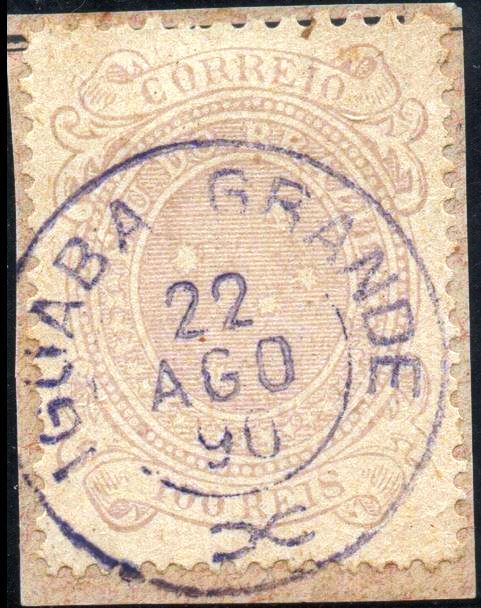
As Nova Monteiro writes in Administrações e Agencias Postaes do Brasil Imperio (Brasil Filatelico/RJ, 1934-5; reprint SPP 1994-1999), there was a post office there since July 1855. The first postmark is IRJ-1045a, which also exists in red and dark violet and which was given the no. 1314 by P. Ayres in Catálogo de Carimbos Brasil-Império (S. Paulo, 1937, 1942):
IRJ-1045a (P.A. 1314) 1855-1890ff
This was followed by IRJ-1045b (fig. agenciaspostais.com.br):
IRJ-1045b (PN) 1878-1885
It was followed by IRJ-1045c (illus. from the internet):
IRJ-1045c (EB) 1888-1890
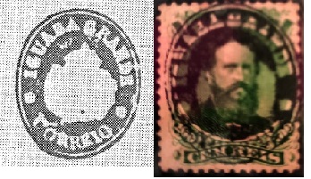
Two postmarks with the imperial seal were found from there. The first is IRJ-1045d (fig. R. Koester in Carimbologia XXII – Marcio Duarte)
IRJ-1045d (RK-MDu) 1866ff
The second is IRJ-1045e (fig. Koester):
IRJ-1045e (RK)
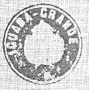
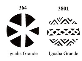
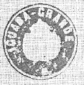
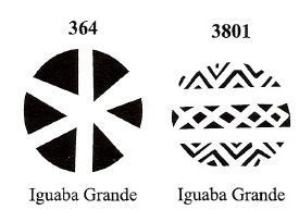
James Dingler and Klerman W. Lopes have included two mute cancellations from Iguaba Grande in Mute Cancellations of the Brazil Empire/ Carimbos Mudos do Brasil Império (Brazil Philatelic Association, Rio de Janeiro, 2000):
BPA 364 – 3871 (P.A. 671, 1866ff)Colton & Colton: Provincia do Rio de Janeiro, 1866
Die Siedlung N. Sra da Conceição da Iguaba Grande bestand seit ca. 1795. Sie gehörte zur Freguesia de S. Pedro da Aldeia im Gebiet der Vila de Cabo Frio und lag am Nordufer des Araruama-Sees, 130 km östlich der Hauptstadt Rio de Janeiro. Im Jahre 1890 wurde der Ort in das neu gegründete Município de Sapiatiba eingegliedert und im Juni 1954 ein Distrito des Município de S. Pedro da Aldeia. Seit Juni 1995 ist Iguaba Grade ein selbständiges Município.
Wie Nova Monteiro in Administrações e Agencias Postaes do Brasil Imperio (Brasil Filatelico/RJ, 1934-5; Reprint SPP 1994-1999) schreibt, gab es dort ein Postamt seit Juli 1855. Der erste Poststempel ist IRJ-1045a, den es auch in rot und dunkelviolett gibt und der von P. Ayres in Catálogo de Carimbos Brasil-Império (S. Paulo, 1937, 1942) die Nr. 1314 erhielt:
IRJ-1045a (P.A. 1314) 1855-1890ff
Es folgte IRJ-1045b (Abb. agenciaspostais.com.br):
IRJ-1045b (PN) 1878-1885
Ihm folgte IRJ-1045c (Abb. aus dem Internet):
IRJ-1045c (EB) 1888-1890
Zwei Poststempel mit dem kaiserlichen Siegel wurden von dort gefunden. Der erste ist IRJ-1045d (Abb. R. Koester in Carimbologia XXII – Marcio Duarte)
IRJ-1045d (RK-MDu) 1866ff
Der zweite ist IRJ-1045e (Abb. Koester):
IRJ-1045e (RK)
James Dingler und Klerman W. Lopes haben zwei stumme Abstempelungen aus Iguaba Grande in Mute Cancellations of the Brazil Empire/ Carimbos Mudos do Brasil Império (Brazil Philatelic Association, Rio de Janeiro, 2000) aufgenommen:
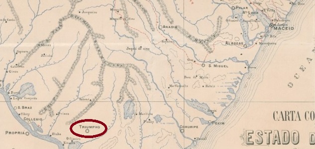
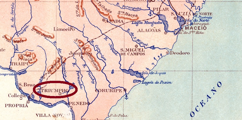
The Freguesia de Igreja Nova, which had existed since June 1880, belonged to the Vila de Agua Branca and was located on the north bank of the Riacho Boacica, 160 kilometres southwest of the provincial capital of Maceió. In June 1890 it was elevated to Vila de Triumpho, which became a town in May 1892. In July 1895, it was downgraded to a district of the Município de Penedo, before being elevated to a Município again in May 1897. The old name Igreja Nova returned in June 1928.
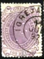
As Aldo Cardoso writes in Contribuição para a História dos Correios de Alagoas (Maceió, 1969), there had been a post office there since July 1868. The oldest postmark to date is IAL-0070b (image from the Internet):
IAL-0070b (Philasearch) 1887-1892Briguiet: Estado de Alagoas, 1923
Andere Namen: Oitiseiro, Triumpho (1890-1928)
Die seit Juni 1880 bestehende Freguesia de Igreja Nova gehörte zur Vila de Agua Branca und lag am Nordufer des Riacho Boacica, 160 km südwestlich der Provinzhauptstadt Maceió. Im Juni 1890 wurde es zur Vila de Triumpho erhoben, die im Mai 1892 zur Stadt wurde. Im Juli 1895 wurde es zum Distrikt des Município de Penedo herabgestuft, bevor es im Mai 1897 wieder zum Município erhoben wurde. Im Juni 1928 kehrte der alte Name Igreja Nova zurück.
Wie Aldo Cardoso in Contribuição para a História dos Correios de Alagoas (Maceió, 1969) schreibt, gab es dort seit Juli 1868 ein Postamt. Der bisher älteste Poststempel ist IAL-0070b (Abbildung aus dem Internet):
Villiers de l’Ile Adam: Carta (…) das Provincias do Gräo Pará e Alto Amazonas, 1850
Other names: Igarapé-Miri
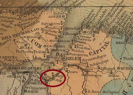
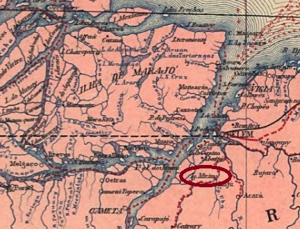
The Freguesia de Sant’Anna do Igarapé-Mery, in existence since 1758, belonged to the Vila de Belém do Pará and was located on the north bank of the Igarapé-Miri, 90 kilometres southwest of the later provincial capital Belém do Pará. In October 1843 it became a Vila and in May 1896 the town of Igarapé-Miri (current spelling).
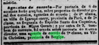
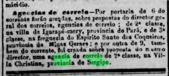
The list of imperial post offices (Tabella das Agencias do Correio do Imperio, Rio de Janeiro, 1885) shows that there had been a post office there since 1882. This was confirmed by the press in Rio:
Jornal do Commercio/RJ, 11/10/1882
No imperial postmarks have yet been found from Igarapé-Mery.
Carta da Republica dos Estados Unidos do Brazil, 1892
Andere Namen: Igarapé-Miri
Die seit 1758 bestehende Freguesia de Sant’Anna do Igarapé-Mery gehörte zur Vila de Belém do Pará und lag am Nordufer des Igarapé-Miri, 90 km südwestlich der späteren Provinzhauptstadt Belém do Pará. Im Oktober 1843 wurde es zur Vila und im Mai 1896 zur Stadt Igarapé-Miri (heutige Schreibweise) erhoben.
Aus dem Verzeichnis der kaiserlichen Postämter (Tabella das Agencias do Correio do Imperio, Rio de Janeiro, 1885) geht hervor, dass es dort seit 1882 ein Postamt gab. Dieses wurde von der Presse in Rio bestätigt:
Jornal do Commercio/RJ, 11.10.1882
Aus Igarapé-Mery sind bisher keine kaiserlichen Poststempel gefunden worden.







 Carimbologia