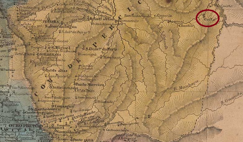
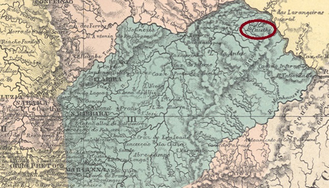
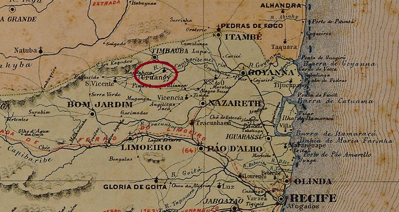
Other names: Borborema, Serra do Cuité, Cuité (1938)
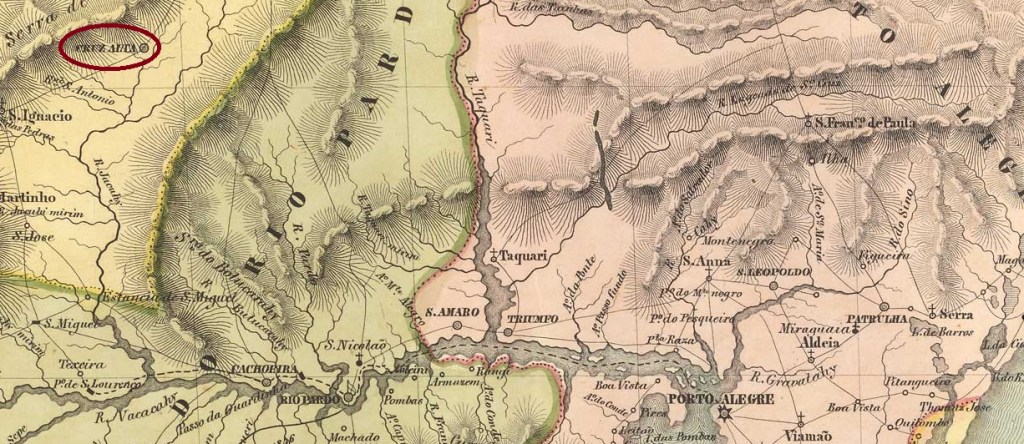
There are two versions of the origins of the Freguesia de N. Sra. das Mercês de Cuité. According to the first, it was founded in 1800, i.e. during the colonial period. The second date is later and more precise: 15 October 1827. Cuité was in any case 220 km north-west of the provincial capital Paraíba do Norte (today: João Pessoa). In May 1854, the first elevation to a Vila took place, followed by others in 1900 and in December 1936 (this time as Município de Serra do Cuité). In the meantime, Cuité was downgraded twice to a district of the Vila de Picuí: in 1891 and 1904. Since November 1938, the município has been called Cuité again.
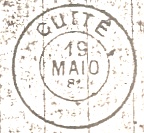
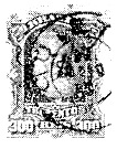
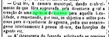
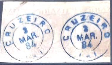
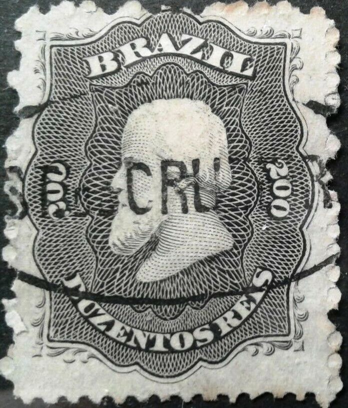
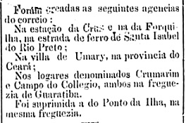
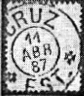
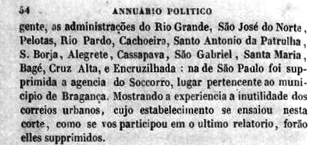
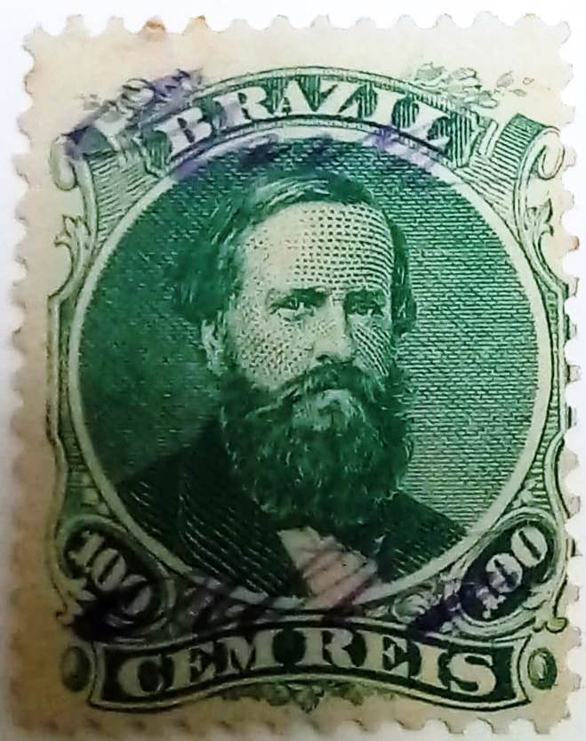
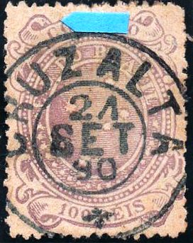
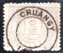
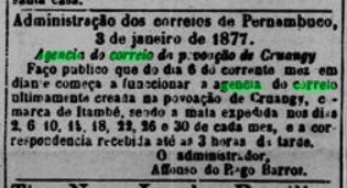
Nova Monteiro writes in Administrações e Agencias Postaes do Brasil Imperio (Brasil Filatelico/RJ, 1934-5; reprint SPP 1994-1999) that there had been a post office there since October 1858. This date is confirmed by the postal report (Relatório Postal) for 1887. The only imperial postmark to date is CPB-0125b (fig. Jorge L. Pedreira):

Andere Namen: Borborema, Serra do Cuité, Cuité (1938)
Über die Entstehung der Freguesia de N. Sra. das Mercês de Cuité gibt es zwei Versionen. Nach der ersten wurde sie im Jahre 1800 gegründet, also bereits in der Kolonialzeit. Das zweite Datum ist später und genauer: 15.10.1827. Cuité lag jedenfalls 220 km nordwestlich der Provinzhauptstadt Paraíba do Norte (heute: João Pessoa). Im Mai 1854 erfolgte die erste Erhebung zur Vila, weitere folgten 1900 und im Dezember 1936 (diesmal als Município de Serra do Cuité). In der Zwischenzeit wurde Cuité zweimal zum Distrikt der Vila de Picuí herabgestuft: 1891 und 1904. Seit November 1938 heißt der Município wieder Cuité.
Nova Monteiro schreibt in Administrações e Agencias Postaes do Brasil Imperio (Brasil Filatelico/RJ, 1934-5; Reprint SPP 1994-1999), dass es dort seit Oktober 1858 ein Postamt gab. Dieses Datum wird durch den Postbericht (Relatório Postal) für 1887 bestätigt. Der bisher einzige kaiserliche Poststempel ist CPB-0125b (Abb. Jorge L. Pedreira):