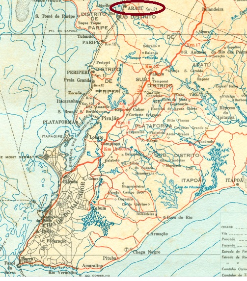
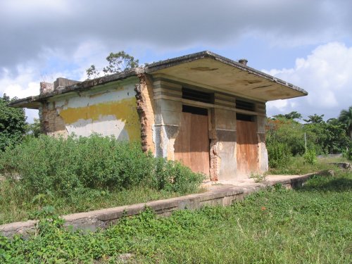
Aratu station was inaugurated in June 1860 on the main line of the E.F. da Bahia ao São Francisco railway company and was then located at the settlement of Água Comprida, 40 km north of the provincial capital Salvador da Bahia. The railway line went to the Cie. Chemins de Fer de l’Est Brésilien in 1925, to the V.F.F. Leste Brasileiro in 1935 and from 1975 to 1996 it belonged to Rede Ferroviária Federal S.A. (estacoesferroviarias.com.br). Since November 1961, the station has been in the Município of Simões Filho. Today, the rails are still there, but the station building is in ruins.
2005, Photo: Ralph Giesbrecht (estacoesferroviarias.com.br)
It is not certain whether there was a station post office at all, as no mention of it has been found in the press so far. But since R. Koester mentions this station in Carimbologia II, it remains here for the time being. In dubio pro reo. No postmark of the imperial period has been sighted so far either.
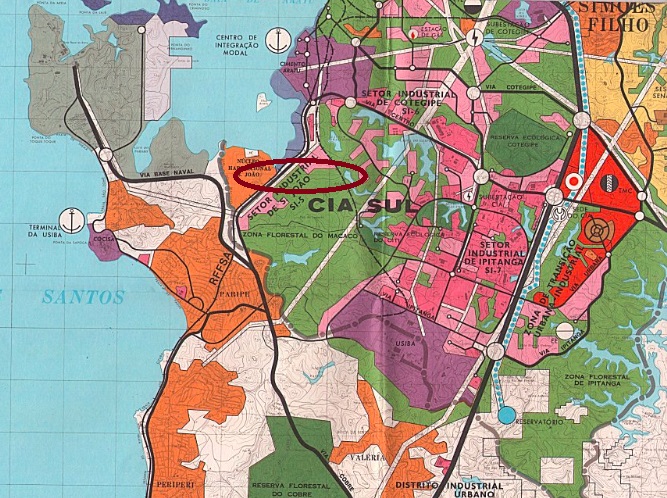
Mapa de Salvador, 1980 (estacoesferroviarias.com.br)
Siehe auch Água Cumprida (ABA-0020)
Der Bahnhof Aratu wurde im Juni 1860 auf der Hauptlinie der E.F. da Bahia ao São Francisco Bahngesellschaft eingeweiht und lag damals bei der Siedlung Água Comprida, 40 km nördlich der Provinzhauptstadt Salvador da Bahia entfernt. Die Bahnlinie ging 1925 zur Cie. Chemins de Fer de l’est Brésilien, 1935 zur V.F.F. Leste Brasileiro und von 1975 bis 1996 gehörte sie der Rede Ferroviária Federal S.A. (estacoesferroviarias.com.br). Seit November 1961 liegt der Bahnhof im Município von Simões Filho. Heute sind die Schienen zwar noch da, aber das Bahnhofsgebäude ist eine Ruine.
2005, Foto: Ralph Giesbrecht (estacoesferroviarias.com.br)
Es ist nicht sicher, ob es ein Bahnhofpostamt überhaupt gab, da bisher keine entsprechende Meldung in der Presse zu finden war. Aber da R. Koester diesen Bahnhof in Carimbologia II erwähnt, bleibt er zunächst auch hier. In dubio pro reo. Auch kein Poststempel der Kaiserzeit wurde bisher gesichtet.
Other names: Mercês, Calabar, Mercês de Diamantina, Senador Modestino Gonçalves (1962)
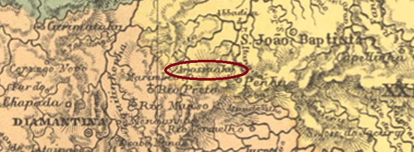
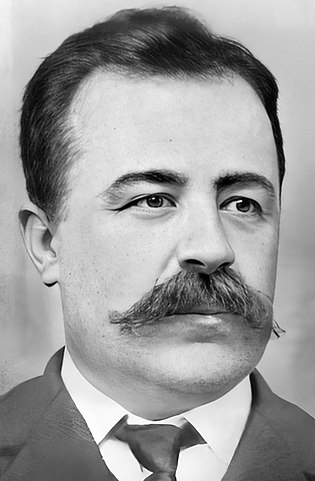
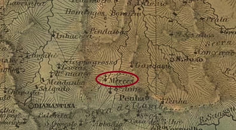
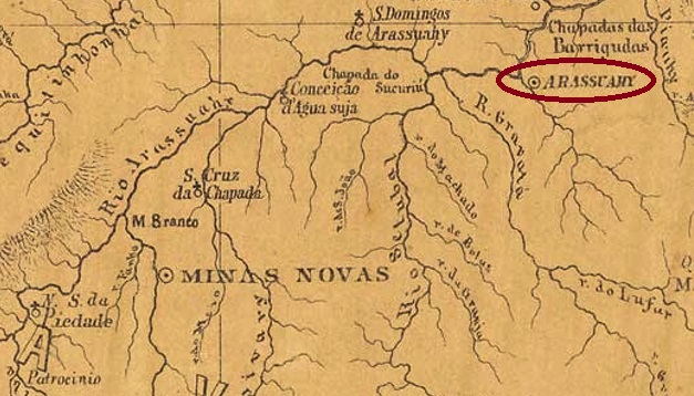
The smaller Arassuahy locality in the province of Minas Gerais was a settlement founded in 1744 on the east bank of the Arassuahy, 390 km north of the capital Ouro Preto. In September 1873, it became the Freguesia of N. Sra. das Mercês do Arassuahy, which belonged to Diamantina. After that, the place name changed three times: in September 1923 as the district of Calabar, in December 1938 to Mercês de Diamantina, and finally in December 1962 to Senador Modestino Gonçalves, when the place became an independent Município. The name is meant to commemorate Modestino Gonçalves Moreira (1861-1941), a Minas-born politician who became Prefeito of Santa Luzia and a provincial senator.
Modestino Gonçalves (Wikipedia)
The local post office dates from January 1881, as Paula Sobrinho writes in História Postal de Minas Gerais (Belo Horizonte, 1997). So far, no imperial-era postmark has been seen for this locality.
Villiers de l’Ile Adam: Carta (…) da Provincia de Minas Geraes, 1849
Andere Namen: Mercês, Calabar, Mercês de Diamantina, Senador Modestino Gonçalves (1962)
Die kleinere Arassuahy-Ortschaft in der Provinz Minas Gerais war eine 1744 gegründete Siedlung am Ostufer des Arassuahy, die 390 km nördlich der Hauptstadt Ouro Preto lag. Im September 1873 wurde daraus die Freguesia von N. Sra. das Mercês do Arassuahy, die bei Diamantina lag. Danach änderte sich der Ortsname dreimal: im September 1923 zum Distrikt von Calabar, im Dezember 1938 zu Mercês de Diamantina, und schließlich im Dezember 1962 zu Senador Modestino Gonçalves, als der Ort zum eigenständigen Município wurde. Der Name soll an Modestino Gonçalves Moreira (1861-1941) erinnern, der als Provinzpolitiker Prefeito von Santa Luzia und Landessenator wurde.
Modestino Gonçalves (Wikipedia)
Das örtliche Postamt datiert vom Januar 1881, wie Paula Sobrinho in História Postal de Minas Gerais (Belo Horizonte, 1997) schreibt. Bisher wurde kein Poststempel der Kaiserzeit aus dieser Ortschaft gesehen.
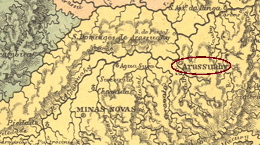
There were two places in the imperial province of Minas Gerais called Arassuahy, both located on the east bank of the river of the same name. The larger of these was originally called Calhau, a freguesia founded in June 1850 at the Município of Minas Novas, 570 km north of the capital Ouro Preto. It was declared a vila in July 1857 and a town in September 1871. In October 1885, the old place name Calhau returned – probably to avoid confusion with the other Arassuahy – but exactly two years later, the place name Arassuahy was restored.
Two dates of origin for the local post office were found. Nova Monteiro (Administrações e Agencias Postaes do Brasil Imperio, in Brasil Filatelico/RJ, 1934-5; Reprint SPP 1994-1999) and R. Koester (Carimbologia II) give January 1859, while Paula Sobrinho and the postal report (Relatorio dos Correios) for 1887 indicate May of that year for it. It is possible that both dates are correct, the first would be that of the legal order (Portaria), the second that of the commissioning of the agency. Two imperial postmarks are also to be reported, but probably not the oldest among them. The first one is AMG-0115b, which has already been shown by R. Koester (op. cit.). This postmark also exists in green and has dates between 1879 and 1886:
AMG-0115b (RK)
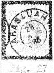
It was followed by AMG-0115c (Coll. Claudio Coelho): a double circle with the inscriptions ARASSUAHY above and (CIDADE) below. The dates in the middle so far go from 1887 to 1903. Could this mean that there was no town stamp with CALHAU?
Provincia de Minas Geraes, 1873
Anderer Name: Calhau
Es gab in der kaiserlichen Provinz Minas Gerais zwei Ortschaften, die Arassuahy hießen, beide am Ostufer des gleichnamigen Flusses gelegen. Die größere davon hieß ursprünglich Calhau und war eine im Juni 1850 beim Município von Minas Novas gegründete Freguesia, die 570 km nördlich der Hauptstadt Ouro Preto entfernt lag. Sie wurde im Juli 1857 zur Vila und im September 1871 zur Stadt erklärt. Im Oktober 1885 kehrte der alte Ortsname Calhau zurück – wohl um Verwechslungen mit dem anderen Arassuahy zu vermeiden – aber genau zwei Jahre später wurde der Ortsname Arassuahy wieder hergestellt.
Zwei Entstehungsdaten fürs örtliche Postamt wurden gefunden. Nova Monteiro (Administrações e Agencias Postaes do Brasil Imperio, in Brasil Filatelico/RJ, 1934-5; Reprint SPP 1994-1999) und R. Koester (Carimbologia II) schreiben dafür den Januar 1859, während Paula Sobrinho und der Postbericht (Relatorio dos Correios) für 1887 geben hierfür den Mai des Jahres an. Möglicherweise sind beide Angaben korrekt, die erste wäre die der gesetzlichen Anordnung (Portaria), die zweite die der Inbetriebnahme der Agentur. Auch zwei kaiserliche Poststempel sind zu melden, wohl aber nicht der älteste darunter. Erstens AMG-0115b, der uns durch R. Koester (op. cit.) bereits bekannt gemacht wurde. Dieser Poststempel gibt es auch in grün und trägt Daten zwischen 1879 und 1886:
AMG-0115b (RK)
Ihm folgte AMG-0115c (Samml. Claudio Coelho): ein Doppelkreis mit den Inschriften ARASSUAHY oben und (CIDADE) unten. Die Daten in der Mitte gehen bisher von 1887 bis 1903. Könnte das bedeuten, dass es keinen Ortsstempel mit CALHAU gab?
Villiers de l’Ile Adam: Carta (…) da Provincia do Maranhão, 1850
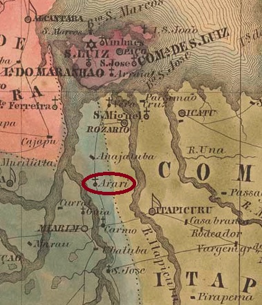
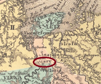
The Freguesia of N. Sra. da Graça do Arary was created in May 1858, located on the east bank of the Mearim River and belonging to the Vila of Victoria do Baixo Mearim, 160 km south of the provincial capital São Luís do Maranhão. The place became a vila in June 1864 and is today the Município of Arari, in the current spelling.
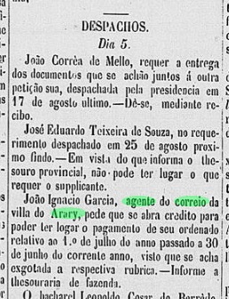
As the Postal Report (Relatoriodos Correios) for 1887 states, there had been a post office there since May 1881, but this date would have to be a reopening. For firstly, the agency was listed in the Imperial Postal Guide (Guia Postal do Império) for 1880. Secondly, the regional press had already reported a postal clerk there in September 1874:
Publicador Maranhense, 11.09.1874
Seen in this light, the only 19th century postmark from this locality so far is probably not the oldest. AMA-0020b (Coll. FM) is a double circle with the inscription ARARY above and (MARANHÃO) below. The date in the centre shows the year 1892.
Atlas do Imperio do Brasil, 1868
Die Freguesia von N. Sra. da Graça do Arary entstand im Mai 1858 und lag am Ostufer des Flusses Mearim bei der Vila von Victoria do Baixo Mearim, 160 km südlich der Provinzhauptstadt São Luís do Maranhão entfernt. Der Ort wurde im Juni 1864 zur Vila und heute ist er der Município von Arari, in der aktuellen Schreibweise.
Wie im Postbericht (Relatorio dos Correios) für 1887 zu lesen ist, gab es dort ein Postamt seit Mai 1881. Dieser Zeitpunkt müsste aber eine Wiedereröffnung sein, denn erstens war die Agentur im Kaiserlichen Postführer (Guia Postal do Império) für 1880 aufgelistet, und zweitens hatte die Regionalpresse bereits im September 1874 über einen Postangestellter vor Ort berichtet:
Publicador Maranhense, 11.09.1874
So gesehen, ist der bisher einzige Poststempel im 19. Jahrhundert aus dieser Ortschaft wohl nicht der älteste. AMA-0020b (Samml. FM) ist ein Doppelkreis mit der Inschrift ARARY oben und (MARANHÃO) unten. Das Datum in der Mitte zeigt das Jahr 1892.
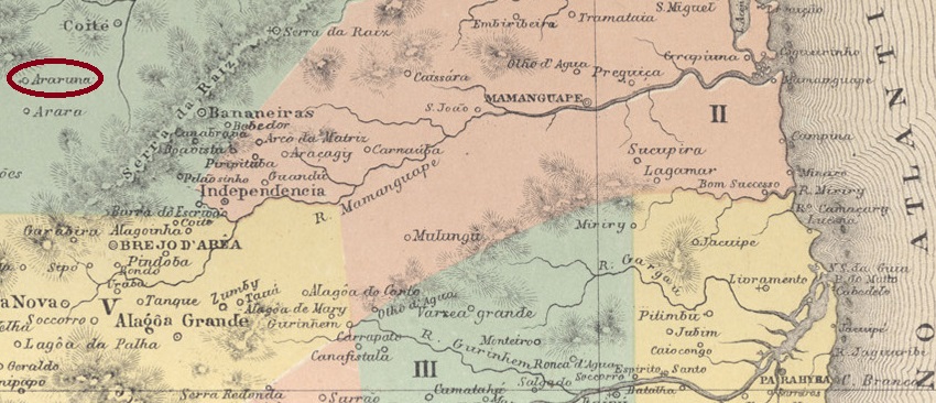
The settlement called N. Sra. da Conceição de Araruna originated around 1845 in the Município of Bananeiras and became a parish in July 1854, located 150 km northwest of the provincial capital Parahyba do Norte (today: João Pessoa). The place was declared a vila in July 1876 and has been a town since November 1938. The name comes from the Tupi-Guarani and means Black Macaw.
There was a post office there since April 1878, as can be read in the postal report (Relatorio dos Correios) for 1887. The oldest postmark so far, APB-0030a, has already been illustrated by R. Koester in Carimbologia II:
APB-0030a (RK) 1886
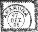
It was followed by APB-0030b (image from the internet): In this double circle the outer circle seems to be doubled. At the top one reads ARARUNA and at the bottom is an ornament in lozenge, formed by four small lozenges. The only specimen so far bears a date from 1908 in the centre.
Google Maps
Die Siedlung mit Namen N. Sra. da Conceição de Araruna entstand um 1845 im Município von Bananeiras und wurde eine Pfarrei im Juli 1854, die 150 km nordwestlich der Provinzhauptstadt Parahyba do Norte (heute: João Pessoa) lag. Der Ort wurde im Juli 1876 zur Vila ernannt und ist eine Stadt seit November 1938. Der Name kommt aus dem Tupi-Guarani und bedeutet Schwarzer Ara.
Dort gab es ein Postamt seit April 1878, wie im Postbericht (Relatorio dos Correios) für 1887 zu lesen ist. Der bisher älteste Poststempel APB-0030a wurde bereits durch R. Koester in Carimbologia II abgebildet:
APB-0030a (RK) 1886
Ihm folgte APB-0030b (Abb. aus dem Internet): In diesem Doppelkreis scheint der äußere Kreis verdoppelt zu sein. Oben liest man ARARUNA und unten ist ein Ornament in Raute, das aus vier kleinen Rauten gebildet wird. Das bisher einzige Exemplar trägt ein Datum aus 1908 in der Mitte.
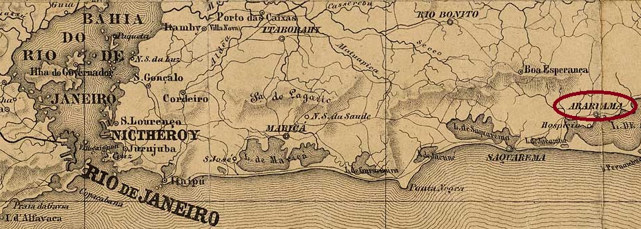
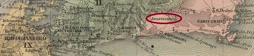
The Freguesia of S. Sebastião de Araruama was created in January 1799, belonged to the Vila of Cabo Frio and was located on the northern shore of Lake Araruama, 120 km east of the capital Rio de Janeiro. The name came from the Tupi-Guarani language and means land of the many macaws. The locality became a vila in February 1859 and has been a town since January 1890.
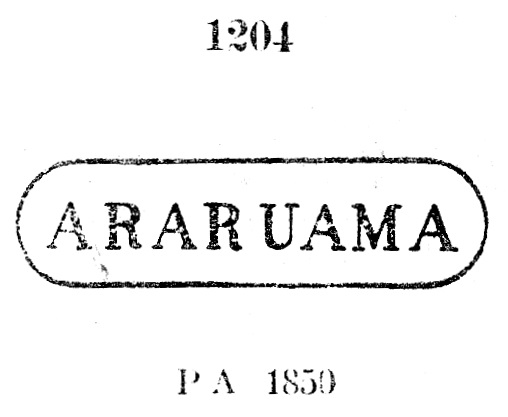
The local post office was established in January 1841, as noted by Nova Monteiro in Administrações e Agencias Postaes do Brasil Imperio (Brasil Filatelico/RJ, 1934-5; Reprint SPP 1994-1999). The first postmark is ARJ-0050a. It was demonstrably used between 1843 and 1857, exists also in blue, and has already been made known by Paulo Ayres (Catálogo de Carimbos Brasil-Império, S. Paulo, 1937, 1942) under Nr. 1204:
ARJ-0050a (P.A. 1204)
It was followed by ARJ-0050b, which also exists in red. This cancel was in use from about 1850 to at least 1877 and was also introduced by P. Ayres (op. cit.), now under no. 1205:
ARJ-0050b (P.A. 1205, MPT 370)
We also know the third imperial postmark ARJ-0050c through P. Ayres:
ARJ-0050c (P.A. p. 144)
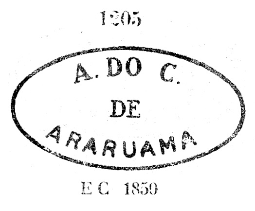
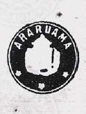
The following ARJ-0050d is a plain double circle with the inscription ARARUAMA at the top, found so far with date 1877 in the middle. At the end of the 19th century its successor ARJ-0050e was also found (fig. from the internet). In this double circle, which also exists in blue, an additional lower ornament appears, consisting of three small circles lined up. The dates in the middle so far go from 1890 to 1901.
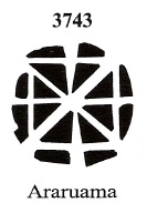
A mute cancellation from Araruama is also recorded in Mute Cancellations of the Brazil Empire/ Carimbos Mudos do Brasil Império, (Brazil Philatelic Association, Rio de Janeiro, 2000) by J. Dingler and K.W. Lopes with no. 3743:
BPA 3743Villiers de l’Ile Adam: Carta (…) da Provincia do Rio de Janeiro, 1850
Die Freguesia von S. Sebastião de Araruama entstand im Januar 1799, gehörte der Vila von Cabo Frio und lag am Nordufer des Araruama-Sees, 120 km östlich der Hauptstadt Rio de Janeiro. Der Name kam aus der Tupi-Guarani-Sprache und bedeutet Land der vielen Aras. Die Ortschaft wurde im Februar 1859 eine Vila und ist eine Stadt seit Januar 1890.
Das örtliche Postamt wurde im Januar 1841 ins Leben gerufen, wie Nova Monteiro in Administrações e Agencias Postaes do Brasil Imperio (Brasil Filatelico/RJ, 1934-5; Reprint SPP 1994-1999) vermerkte. Der erste Poststempel ist ARJ-0050a. Er wurde nachweislich zwischen 1843 und 1857 verwendet, auch in Blau, und ist bereits durch Paulo Ayres (Catálogo de Carimbos Brasil-Império, S. Paulo, 1937, 1942) als Nr. 1204 bekannt gemacht:
ARJ-0050a (P.A. 1204)
Ihm folgte ARJ-0050b, den es auch in Rot gibt. Dieser Stempel war von ca. 1850 bis mindestens 1877 in Gebrauch und wurde ebenfalls durch P. Ayres (op. cit.) unter Nr. 1205 vorgestellt:
ARJ-0050b (P.A. 1205, MPT 370)
Auch den dritten kaiserlichen Poststempel ARJ-0050c kennen wir durch P. Ayres:
ARJ-0050c (P.A. S. 144)
Der folgende ARJ-0050d ist ein schlichter Doppelkreis mit der Inschrift ARARUAMA oben, gefunden bisher mit Datum 1877 in der Mitte. Am Ende des 19. Jahrhunderts fand sich auch sein Nachfolger ARJ-0050e (Abb. aus dem Internet). In diesem Doppelkreis, den es auch in Blau gibt, erscheint zusätzlich noch ein unteres Ornament, das aus drei aneinander gereihten kleinen Kreisen besteht. Die Daten in der Mitte gehen bisher von 1890 bis 1901.
Eine stumme Abstempelung aus Araruama wird auch in Mute Cancellations of the Brazil Empire / Carimbos Mudos do Brasil Império, (Brazil Philatelic Association, Rio de Janeiro, 2000) von J. Dingler und K.W. Lopes mit Nr. 3743 registriert:
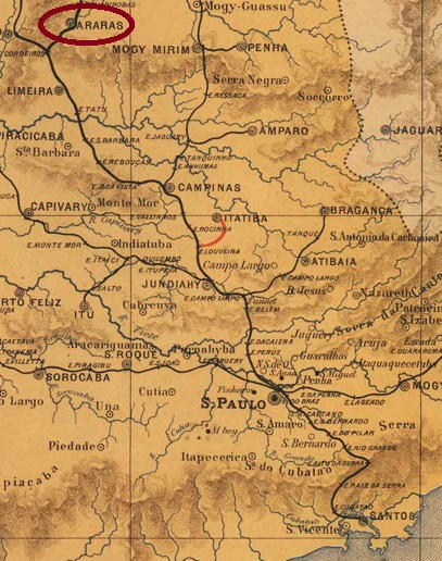
The chapel of N. Sra. do Patrocínio das Araras was built in August 1862 near the vila of Limeira, 170 km north of the provincial capital of São Paulo. The locality became a freguesia in July 1869, a vila in March 1871, and since April 1879 Araras has been a town whose name clearly evokes the beautiful colourful birds that used to be common there:
Photo: Brian Ralphs (CC-BY SA 2-0)
As can be read in the Directory of Imperial Post Offices (Tabella das Agencias do Correio do Imperio, Rio de Janeiro, 1885), there was a post office there since 1873, which started operations in November of that year:
Correio Paulistano, 28.11.1873
The oldest postmark so far is PSP-0055a, which was already presented by R. Koester in Carimbologia II:
PSP-0055a (RK) 1878
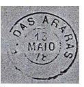
It was followed by two postmarks as double circles: ASP-0055b (Fig. Mario Celso Orsi Jr.) has only the inscription ARARAS on top and no ornaments else, the only specimen so far seen was used in 1887. ASP-0055b (Fig. Mário Celso Orsi Jr.) is a French type, with the inscription ARARAS above and the star between brackets below. The copies bear dates from 1890 inside.
Provincia de S. Paulo, 1886
Anderer Name: Patrocínio das Araras
Die Kapelle von N. Sra. do Patrocínio das Araras wurde im August 1862 bei der Vila von Limeira errichtet und lag 170 km nördlich der Provinzhauptstadt São Paulo entfernt. Die Ortschaft wurde im Juli 1869 zu einer Freguesia, im März 1871 zu einer Vila, und seit April 1879 ist Araras eine Stadt, deren Name eindeutig an die schönen bunten Vögel erinnert, die früher dort häufig zu sehen waren:
Foto: Brian Ralphs (CC-BY SA 2-0)
Wie im Verzeichnis der kaiserlichen Postämter (Tabella das Agencias do Correio do Imperio, Rio de Janeiro, 1885) zu lesen ist, gab es dort ein Postamt seit 1873, das im November d.Js. den Betrieb aufgenommen hat:
Correio Paulistano, 28.11.1873
Der bisher älteste Poststempel ist PSP-0055a, der bereits durch R. Koester in Carimbologia II vorgestellt wurde:
PSP-0055a (RK) 1878
Ihm folgten zwei Stempel als Doppelkreise: ASP-0055b (Abb. Mario Celso Orsi Jr.) hat lediglich die Inschrift ARARAS oben und sonst keine Ornamente, das bisher einzige Exemplar wurde 1887 verwendet. ASP-0055b (Abb. Mário Celso Orsi Jr.) ist ein Französischer Typus, mit der Inschrift ARARAS oben und dem Stern zwischen Klammern unten. Die bisherigen Exemplaren tragen Daten aus 1890 im Inneren.
Villiers de l’Ile Adam: Carta (…) da Provincia de São Paulo, 1847
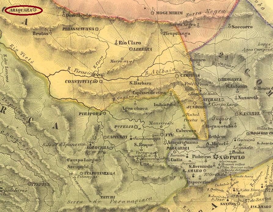
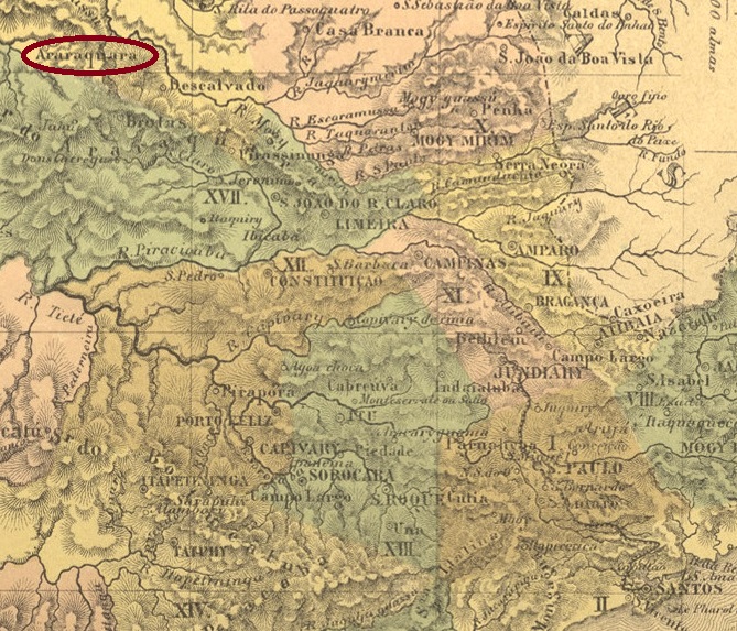
The Freguesia of S. Bento de Araraquara was created in October 1817 and at that time belonged to the Vila of Piracicaba. Araraquara became a vila in August 1832 and has been a town since February 1889.
Three different creation dates have been found for the local post office. First in March 1833, as Nova Monteiro writes in Administrações e Agencias Postaes do Brasil Imperio (Brasil Filatelico/RJ, 1934-5; Reprint SPP 1994-1999). Then in 1844, as shown in the Directory of Imperial Post Offices (Tabella das Agencias do Correio do Imperio, Rio de Janeiro, 1885). And lastly in April 1864, as reported by philatelist Mário Celso Orsi Jr.
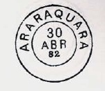
The first postmark is probably ASP-0050a, which also occurs in red, was in circulation between c. 1843 and at least 1876, and was already presented by Paulo Ayres in Catálogo de Carimbos Brasil-Império (S. Paulo, 1937, 1942) under no. 1126. However, R. Koester noted in Carimbologia II some discrepancies between Ayres’ illustration and his own:
ASP-0050a (P.A. 1126, RK recte)
This was followed by ASP-0050b, which was in circulation between 1882 and 1898. This postmark also exists in blue and was also shown by P. Ayres (op. cit.), now on p. 120:
ASP-0050b (P.A. p 120)
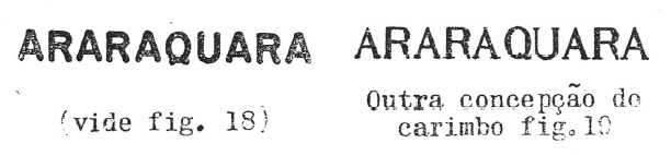
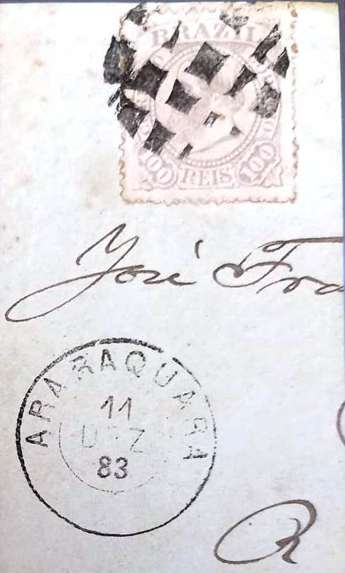
At the end of the Empire there also came the French type ASP-0050c (Image: Luis C. Fritzen): above one reads ARARAQUARA, below is the typical star between brackets. The only specimen so far bears a date from 1889 in the centre.
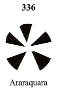
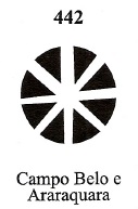
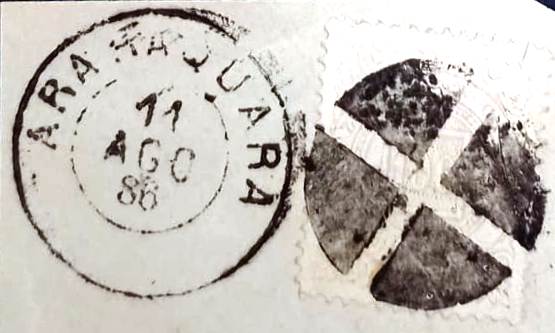
Five mute cancellations from the imperial Araraquara have appeared so far. Two of these have been registered by P. Ayres as Nos. 26 and 61a. These were adopted in Mute Cancellations of the Brazil Empire / Carimbos Mudos do Brasil Império (Brazil Philatelic Association, Rio de Janeiro, 2000) by J. Dingler and Klerman W. Lopes under nos. 336 and 442 respectively:
P.A. 26/BPA 336, 1878ff-1882P.A. 61a / BPA 442, 1885, also occurring in blue
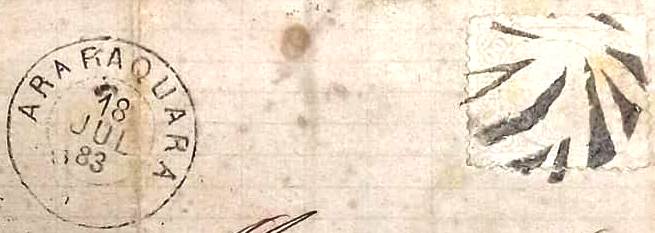
The other three mute cancels come from the Fuad Ferreira Fo. collection:
1883 (FF)1883 (FF)1886 (FF)
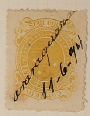
Finally, there was also a handwritten cancellation from there in the early Republic (image from the internet):
1894 (Philasearch)Atlas do Imperio do Brasil, 1868
Die Freguesia von S. Bento de Araraquara entstand im Oktober 1817 und gehörte damals der Vila von Piracicaba. Araraquara wurde eine Vila im August 1832 und ist eine Stadt seit Februar 1889.
Drei verschiedene Gründungsdaten wurden fürs örtliche Postamt gefunden. Zuerst im März 1833, wie Nova Monteiro in Administrações e Agencias Postaes do Brasil Imperio (Brasil Filatelico/RJ, 1934-5; Reprint SPP 1994-1999) schreibt. Dann 1844, wie aus dem Verzeichnis der kaiserlichen Postämter (Tabella das Agencias do Correio do Imperio, Rio de Janeiro, 1885) hervorgeht. Und zuletzt im April 1864, wie durch den Philatelisten Mário Celso Orsi Jr. vermerkt.
Der erste Poststempel ist wohl ASP-0050a, der auch in rot vorkommt, zwischen ca. 1843 und zumindest 1876 im Umlauf war, und bereits durch Paulo Ayres in Catálogo de Carimbos Brasil-Império (S. Paulo, 1937, 1942) unter Nr. 1126 vorgestellt wurde. Allerdings bemerkte R. Koester in Carimbologia II einige Abweichungen zwischen Ayres’ Abbildung und seinen eigenen Exemplaren:
ASP-0050a (P.A. 1126, RK recte)
Es folgte ASP-0050b, der zwischen 1882 und 1898 im Umlauf war. Diesen Poststempel gibt es auch in Blau und wurde ebenfalls durch P. Ayres (op. cit.) gezeigt, diesmal auf S. 120:
ASP-0050b (P.A. S. 120)
Am Ende des Kaiserreichs kam auch der Französischer Typus ASP-0050c (Abb. Luis C. Fritzen): oben liest man ARARAQUARA, unten ist der typische Stern zwischen Klammern. Das bisher einzige Exemplar trägt ein Datum aus 1889 in der Mitte.
Aus dem kaiserlichen Araraquara sind bisher fünf stumme Abstempelungen aufgetaucht. Zwei davon wurden von P. Ayres unter Nr. 26 und 61a registriert. Diese wurden im Mute Cancellations of the Brazil Empire / Carimbos Mudos do Brasil Império, (Brazil Philatelic Association, Rio de Janeiro, 2000) von J. Dingler und Klerman W. Lopes unter Nr. 336 bzw. 442 übernommen:
P.A. 26/BPA 336, 1878ff-1882P.A. 61a / BPA 442, 1885, auch in Blau
Die anderen drei stummen Entwertungen kommen aus der Sammlung Fuad Ferreira Fo.:
1883 (FF)1883 (FF)1886 (FF)
Schließlich gab es in der frühen Republik auch eine handschriftliche Entwertung von dort (Abb. aus dem Internet):
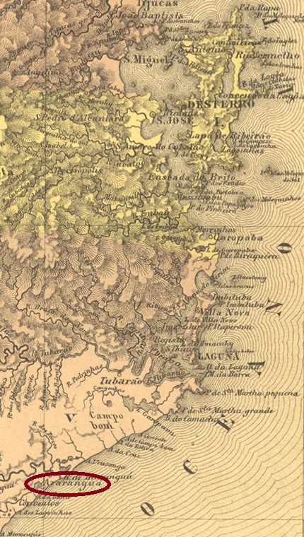
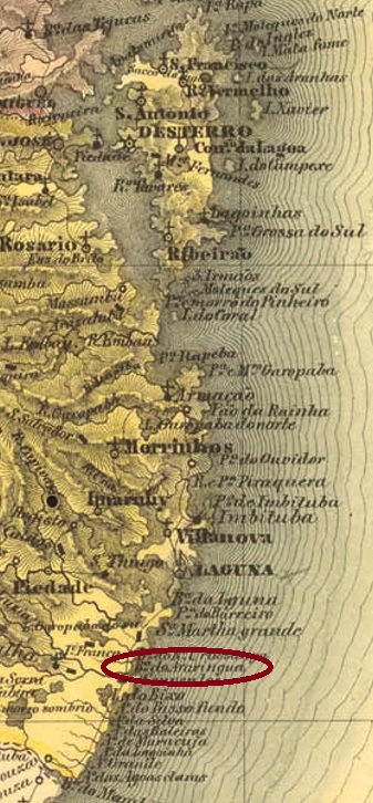
The Freguesia of N. Sra. da Mãe dos Homens de Araranguá was founded in May 1848 and was located on the south bank of the Araranguá River near Laguna, 220 km south of the provincial capital Desterro (today: Florianópolis). In March 1864, the place name changed to Campinas, but when it became a vila in April 1880, the old name Araranguá returned.
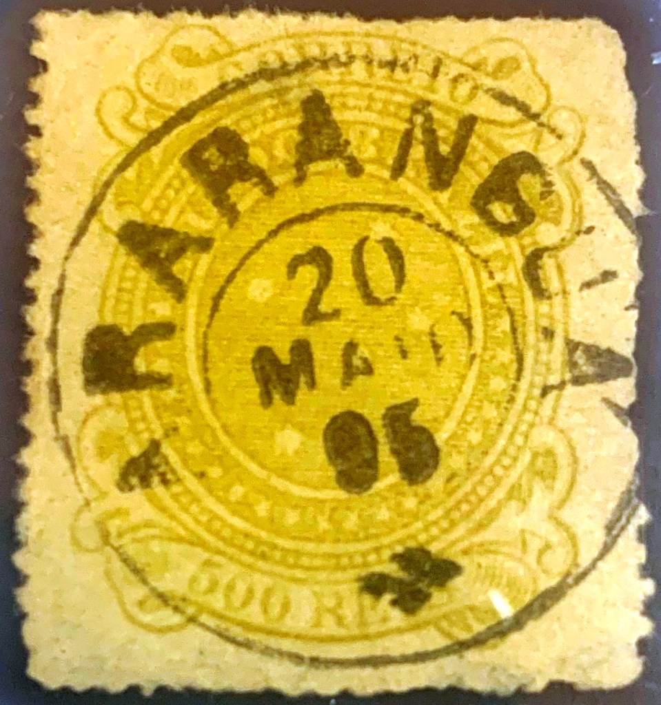
As can be read in the Directory of Imperial Post Offices (Tabella das Agencias do Correio do Imperio, Rio de Janeiro, 1885), there was a post office there from 1877, which means there may have been postmarks still under Campinas.
In the meantime, a 19th century postmark has been found from this locality, the double circle ASC-0005a (Coll. Alexandre Andrade):
ASC-0005a (AA) 1895Villiers de l’Ile Adam: Carta (…) da Provincia de Santa Catharina, 1848
Textaktualisierung am 9. März 2024
Die Freguesia von N. Sra. da Mãe dos Homens de Araranguá wurde im Mai 1848 gegründet und lag am Südufer des Flusses Araranguá bei Laguna, 220 km südlich der Provinzhauptstadt Desterro (heute: Florianópolis) entfernt. Im März 1864 wechselte der Ortsnamen zu Campinas, aber bei dem Aufstieg zur Vila im April 1880 kehrte der alte Name Araranguá zurück.
Wie im Verzeichnis der kaiserlichen Postämter (Tabella das Agencias do Correio do Imperio, Rio de Janeiro, 1885) zu lesen ist, gab es dort ein Postamt ab 1877. Das bedeutet, möglicherweise gab es Poststempel noch unter Campinas. Inzwischen wurde ein Poststempel im 19. Jahrhundert aus dieser Ortschaft gefunden, der Doppelkreis ASC-0005a (Samml. Alexandre Andrade):
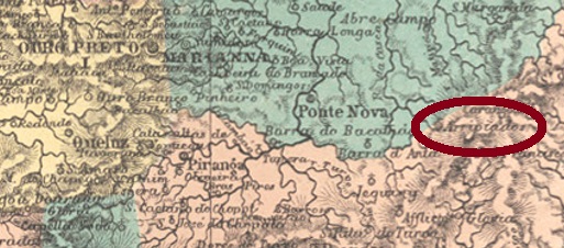
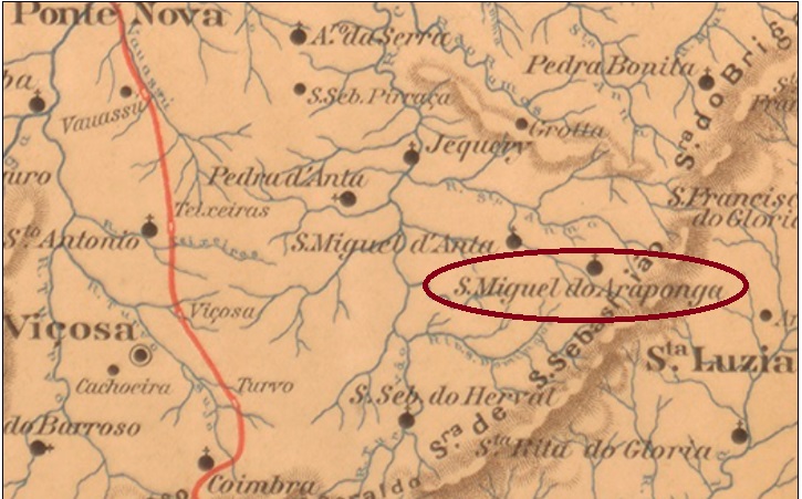
Other names: São Miguel e Almas dos Arrepiados, São Miguel do Araponga
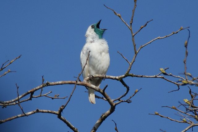
Since November 1826, this village was a district of Santa Rita do Turvo (today: Viçosa), which was called the São Miguel e Almas dos Arripiados (= St. Michael and Souls of the Feared) and was located about 170 km east of the provincial capital Ouro Preto. Since the name sounded very bizarre even for Brazilian conditions, it was changed to S. Miguel do Araponga in July 1886. Araponga is the name of three different neo-tropical bellbirds of the Family Cotingidae of South America:
Procnias Nudicollis (Photo: Ben Taverner, CC BY 2.0)
In December 1938, the place’s name was simplified to Araponga, and in December 1962 it became a municipality.
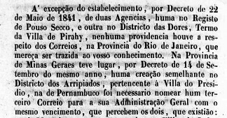
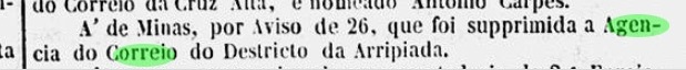
As Paula Sobrinho reports in Historia Postal de Minas Gerais (Belo Horizonte, 1997), there has been a post office there since September 1880. Nevertheless, new research has revealed that a post office was established there as early as September 1841, as confirmed by a ministerial report of that year:
Relatório do Ministério do Império, 1841
The post office was not closed until November 1846, as the capital’s press reported at the time:
Gazeta Official, 10.12.1846
This means there could still be postmarks from Arripiados on Bull’s-eyes.
The first postmark with the place name Araponga is AMG-0110a (Coll. J.L. Fevereiro): a double circle with the inscriptions ARAPONGA above and (MINAS) below. The only specimen so far bears a date from 1889 in the centre. For stamps with earlier place names, see São Miguel de Arripiados (SMG-2518).
Estado de Minas Geraes, 1910
Textaktualisierung vom 9. Dezember 2022
Andere Namen: São Miguel e Almas dos Arrepiados, São Miguel do Araponga
Diese Ortschaft war seit November 1826 ein Distrikt von Santa Rita do Turvo (heute: Viçosa), der São Miguel e Almas dos Arripiados (= Skt. Michael und Seelen der Gefürchteten) hieß und ca. 170 km östlich der Provinzhauptstadt Ouro Preto lag. Da der Name sogar für brasilianische Verhältnisse sehr skurril klang, wurde er im Juli 1886 zu S. Miguel do Araponga geändert. Araponga ist der Name von drei verschiedenen Glockenvögeln Sudamerikas der Familie Cotingidae, Gattung Procnias:
Procnias Nudicollis (Foto: Ben Taverner, CC BY 2.0)
Im Dezember 1938 wurde der Ortsname zu Araponga vereinfacht, und im Dezember 1962 stieg der Ort zum Município auf.
Wie Paula Sobrinho in História Postal de Minas Gerais (Belo Horizonte, 1997) berichtet, gab es dort ein Postamt seit September 1880. Neue Recherchen haben dennoch ergeben, dass bereits im September 1841 ein Postamt dort ins Leben gerufen wurde, wie ein Ministerialbericht des Jahres bestätigt:
Relatório do Ministério do Império, 1841
Das Postamt wurde erst im November 1846 geschlossen wie damals die Hauptstadtpresse meldete:
Gazeta Official, 10.12.1846
Das bedeutet, es könnten noch Poststempel aus Arripiados auf Ochsenaugen geben. Der erste Poststempel mit dem Ortsnamen Arapongas ist AMG-0110a (Samml. J.L. Fevereiro): ein Doppelkreis mit den Inschriften ARAPONGA oben und (MINAS) unten. Das bisher einzige Exemplar trägt ein Datum aus 1889 in der Mitte. Für Stempel mit früheren Ortsnamen siehe São Miguel de Arripiados (SMG-2518).